
Mori Atlas logo
Nature reserveEbenauer Köpfe und Wisch

A canyon-like protected valley defined by Muschelkalk limestone cliffs and rare calcareous ecosystems

Ebenauer Köpfe und Wisch Nature Reserve: Mapped Landscapes and Geological Geography in Wartburgkreis

(Naturschutzgebiet Ebenauer Köpfe und Wisch)

Ebenauer Köpfe und Wisch preserves a striking stretch of the Werra river valley in the Wartburgkreis district. The landscape features deep meanders carved into Muschelkalk massifs, creating vertical cliffs that rise over 110 metres above the river. This protected area connects a mosaic of juniper heaths, dry grasslands, and near-natural forests that support significant orchid populations and critical bat maternity roosts.

nature reserveMuschelkalk cliffsWerra valleycalcareous dry grasslandsjuniper heathrock communities
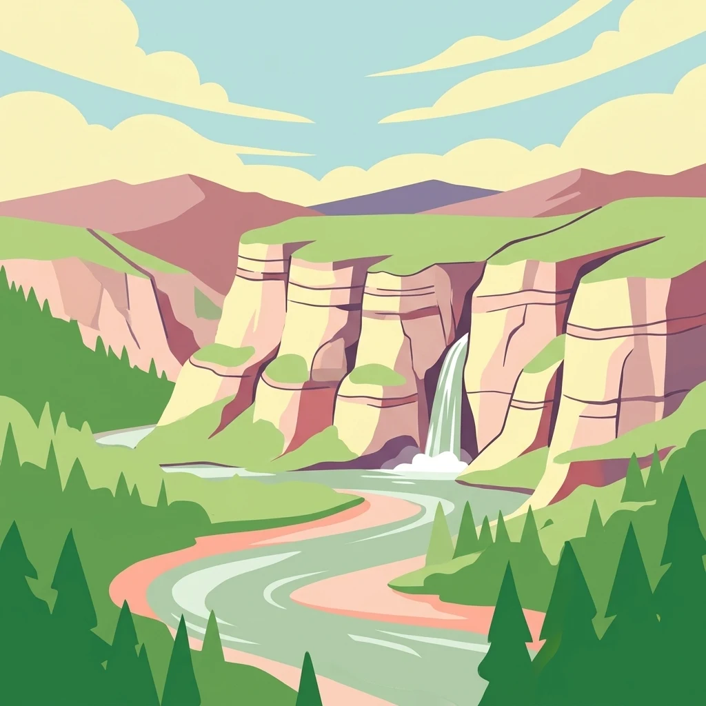
A flat-style digital illustration showing a winding river flowing past steep rock cliffs with a waterfall, surrounded by evergreen trees under a light blue sky.

Ebenauer Köpfe und Wisch

Nature reserve

Park overview

Structured park overview, official facts, and landscape profile for Ebenauer Köpfe und Wisch

Ebenauer Köpfe und Wisch park facts, protected area profile, and essential visitor context

Review the core facts for Ebenauer Köpfe und Wisch, including designation, size, terrain, visitor scale, habitats, and operating context in one park-focused overview.

About Ebenauer Köpfe und Wisch

Ebenauer Köpfe und Wisch lies along the middle reaches of the Werra in the northwestern corner of Thuringia's Wartburgkreis, close to the border with northern Hesse. The reserve stretches from the town of Creuzburg along the river toward the village of Ebenau, following the dramatic Muschelkalk cliffs that rise above the meandering Werra. Its location within the Werra valley landscape links a chain of protected sites that together form one of central Germany's most concentrated corridors of calcareous habitats.

The defining feature of the area is the Creuzburg Werra breakthrough, a deep gorge where the river has carved into the Muschelkalk plateau. Over millions of years, water and weathering have produced vertical rock faces, rock ledges, gullies, and block slopes, while the upper slopes grade into gentler terrain formed from Middle Muschelkalk and loess-influenced soils. This sharp contrast between steep rocky walls and more level plateau has created strongly varying microclimates, ranging from sun-baked, extremely dry south-facing slopes to cooler, more humid north-facing woodland.

Ecologically, the reserve is a textbook example of a calcareous habitat mosaic. Rock communities, pioneer vegetation on bare stone, nutrient-poor dry grasslands, juniper heaths, and near-natural forests of pine, beech, sessile oak, and hornbeam intertwine in complex patterns. Many of these habitats depend on traditional land use such as sheep grazing or extensive orchard management, and conservationists emphasise that without ongoing care they would gradually succeed into dry woodland and lose their character.

From a European perspective, the reserve is part of the Creuzburger Werratal-Hänge FFH area, which Thuringia's environment ministry proposed in 2000 and which was formally integrated into the Natura 2000 network through the Thuringian Natura 2000 conservation objectives ordinance of 2008. The site qualifies for several priority habitat types under the Habitats Directive, including calcareous dry grasslands with remarkable orchids, rupicolous pioneer grasslands, and mixed slope forests, giving it both national and cross-border conservation significance.

Quick facts and research context for Ebenauer Köpfe und Wisch

Ebenauer Köpfe und Wisch is a Thuringian nature reserve on the steep Muschelkalk slopes of the middle Werra valley between Creuzburg and Mihla. Designated in 1996 and expanded to roughly 80 hectares in 2017, the reserve lies within the Wartburgkreis and is administered by the lower nature conservation authority in Bad Salzungen. It is also part of the Natura 2000 FFH area Creuzburger Werratal-Hänge, carrying IUCN Category IV status as a habitat and species management area.

Geologically, the site is defined by the Creuzburg Werra breakthrough, where the river carved a canyon-like valley 150 to 170 metres deep into Upper and Lower Muschelkalk formations. The slopes rise over 110 metres above the river with gradients of 30 to 40 degrees, exposing wave limestone strata and sheltering an exceptional combination of dry grasslands, juniper heaths, rock communities, pine forests, and orchid-rich beech woods.

Protection and recognition

Terrestrial protected area metrics, management scope, and international recognition facts

Ebenauer Köpfe und Wisch Protection Status and Official Designation Data

Ebenauer Köpfe und Wisch maintains a documented terrestrial protection status with structured records covering management scope and baseline geographic data. Conservation analysts examine these verified records to understand official designation frameworks and international database listings.

Protection details

Protection scope
Terrestrial
Transboundary protection
No
WDPA ID
162830
Park context

Deeper park guide and search-rich context for Ebenauer Köpfe und Wisch

Ebenauer Köpfe und Wisch history, landscape, wildlife, and travel context

Explore Ebenauer Köpfe und Wisch through its history, landscape character, ecosystems, wildlife, conservation priorities, cultural context, and seasonal travel timing in a structured park guide built for atlas discovery and search intent.

Why Ebenauer Köpfe und Wisch stands out

The reserve is best known for its towering Muschelkalk cliffs and the unusually rich mosaic of calcareous dry habitats that have developed on the Werra's steep slopes. Its dry meadows and juniper heaths host some of Thuringia's most important orchid populations, including the only natural occurrence of the Small Spider Orchid in the state. It is also recognised as a nationally significant site for the Greater Mouse-eared Bat and a critical refuge for the rare Lesser Horseshoe Bat, whose largest German population lives in Thuringia.
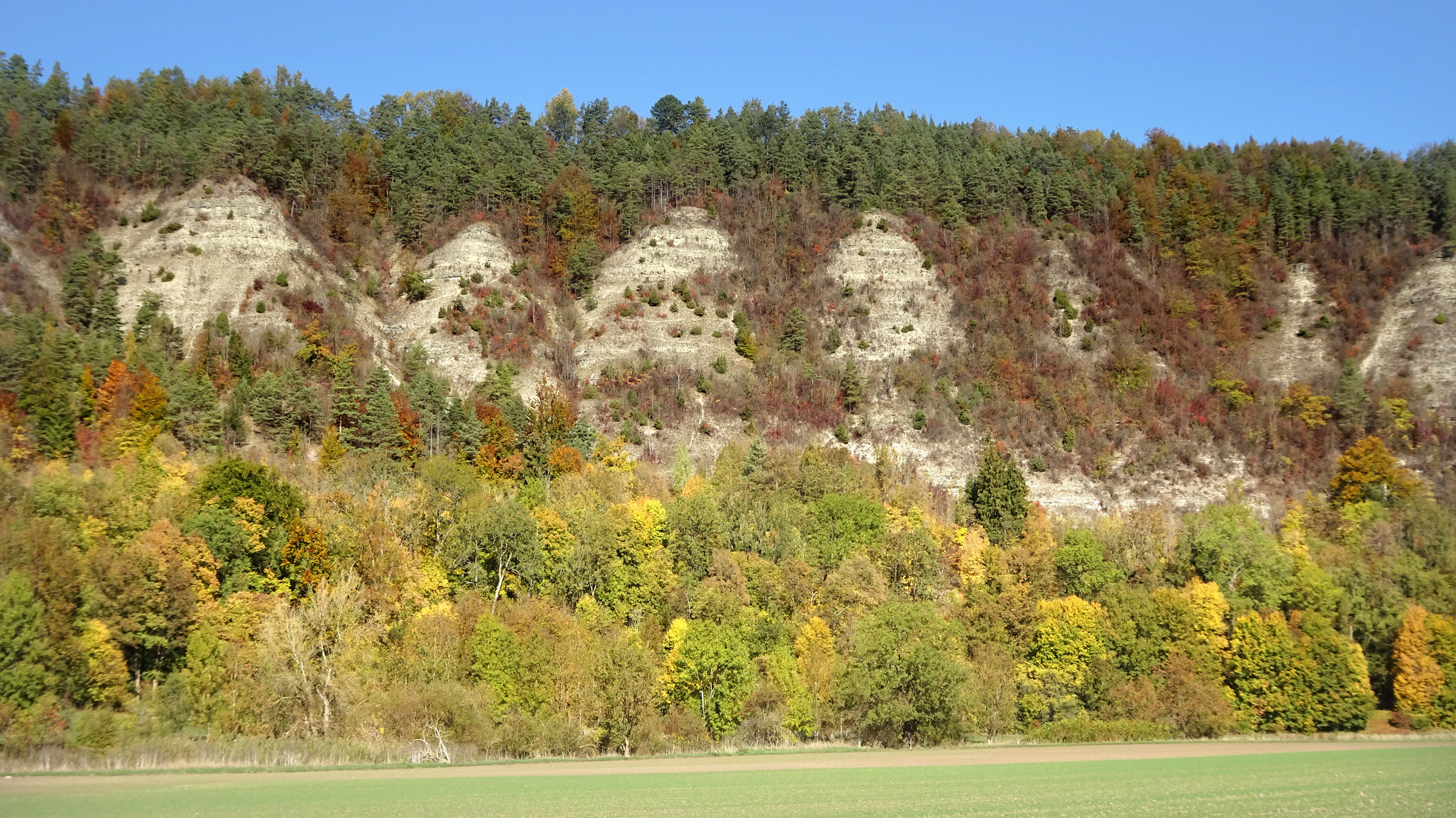
A wide, eye-level view of steep, light-colored limestone cliffs featuring exposed rock faces interspersed with autumn-colored deciduous forest, set against a clear blue sky.
The Ebenauer Köpfe rock formations rise above the autumn foliage in the Wartburgkreis region.

Ebenauer Köpfe und Wisch history and protected-area timeline

The conservation history of Ebenauer Köpfe und Wisch begins in 1990, when the steep Muschelkalk slopes were placed under provisional protection. After a five-year interim safeguarding phase, the Thuringian State Administrative Office formally declared the area a nature reserve on 12 April 1996, securing roughly 46 hectares of calcareous dry habitat considered nationally important for orchids, bats, and insects.

In September 2000, the Thuringian Environment Ministry proposed the reserve, together with the adjacent Klosterholz und Nordmannssteine and Lienig protected areas, as part of a Fauna-Flora-Habitat site called Creuzburger Werratal-Hänge. After federal transmission and European confirmation, the sites were integrated into the Natura 2000 network with the Thuringian Natura 2000 conservation objectives ordinance of 29 May 2008, under the European site number 4927-303.

A significant expansion came in 2017. Following a draft ordinance in November 2016, public consultation, and the weighing of objections, a revised ordinance of 13 November 2017 enlarged the reserve to about 80 hectares by adding the slopes of the Wisch and Hahn areas, which feature additional dry limestone grasslands, warm-loving plant communities, and near-natural mixed forests. The expanded area became known as Naturschutzgebiet Ebenauer Köpfe und Wisch, with the Thuringian designation number 64 and the WDPA code 162830. Management planning for the FFH area was completed with a 2017 report on the Creuzburger Werratal-Hänge habitats.

Ebenauer Köpfe und Wisch landscape and geographic character

The landscape of Ebenauer Köpfe und Wisch is shaped almost entirely by the geology of the Creuzburg Werra breakthrough. Here the Werra has driven a canyon-like trench 150 to 170 metres deep into the surrounding Muschelkalk massif, producing tightly curved meanders flanked by steep, rocky cut banks on the outside of each bend and gentler slip-off slopes on the inside.

The protected cliffs rise over 110 metres above the river at gradients of 30 to 40 degrees, often in near-vertical form. Wave limestone strata of the Lower Muschelkalk form the basis of these walls, with harder beds standing out as parallel ledges that have been etched out by weathering. Below the cliffs lie narrow boulder fields, while the upper slopes are smoother, resting on Middle Muschelkalk with loamy, slightly loess-influenced soils. In the northwestern part of the reserve, small patches of the dolomite horizon between the Muschelkalk and Lower Keuper form a distinctive geological detail.

Above the steep slopes, the Wisch plateau, at roughly 363 metres elevation, offers broad panoramic views toward the northwestern Thuringian Forest and the river's winding course. The Hausberg hill above Creuzburg, topped by a hiking hut and benches, lies next to the protected area, providing an accessible overlook without being part of the formally protected zone. Together, the cliffs, valley meanders, and plateaus define one of the most visually distinctive stretches of the central Werra valley.
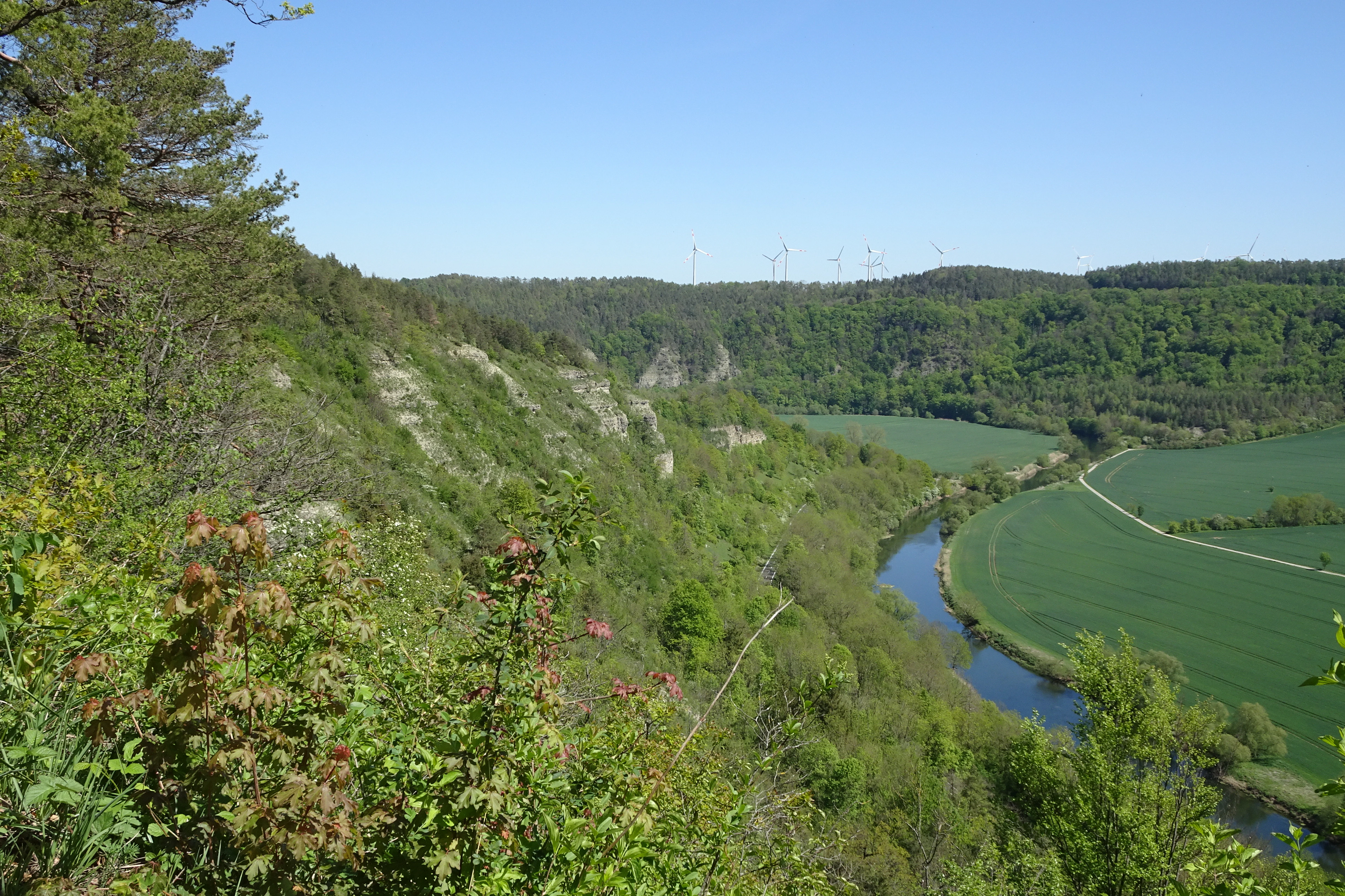
A wide, high-angle landscape shot showing steep wooded cliffs on the left overlooking a winding river and lush green fields in the valley below under a clear blue sky.
A scenic view of the Ebenauer Köpfe cliffs and the winding Werra river valley in the Wartburgkreis region.

Ebenauer Köpfe und Wisch ecosystems, habitats, and plant life

The reserve's nature is defined by an unusually dense mosaic of calcareous biotopes that follow the elevation and exposure of the Muschelkalk slopes. Botanists classify the vegetation into several characteristic plant communities: the Berglauch-Wimperperlgras community, the Fiederzwenken-Graslilien semi-dry grassland, the Blutstorchschnabel-Hirschwurz fringe community, and the Enzian-Schillergras grassland. Large areas are covered by an open Fiederzwenken pine forest, beneath which a dense shrub layer has sometimes developed.

The openland character of the upper slopes is striking. Rock communities, dry grasslands, and ruderal vegetation form a shifting mosaic that is not stable, but gradually succeeds toward pioneer woodland or dry forest. Habitats that historically depended on orchards, vineyards, or sheep droveways can maintain their diversity only through continued extensive management, a core principle of the reserve's conservation work.

Microclimate plays a defining role. South-facing rock walls are extremely dry and sun-exposed, supporting thermophilic species, while north-facing woodlands are cooler and more humid. This contrast produces a remarkable breadth of bryophytes, more than fifty lichen species, two lichens-dependent fungi, and a particularly rich orchid flora, including rare species such as the Green-flowered Helleborine and the only natural Thuringian population of the Small Spider Orchid. The site is also characterised by a capsule moss (Hypnum vaucheri) known in western Thuringia only from this reserve, along with typically Mediterranean bryophytes that grow in the rock crevices.
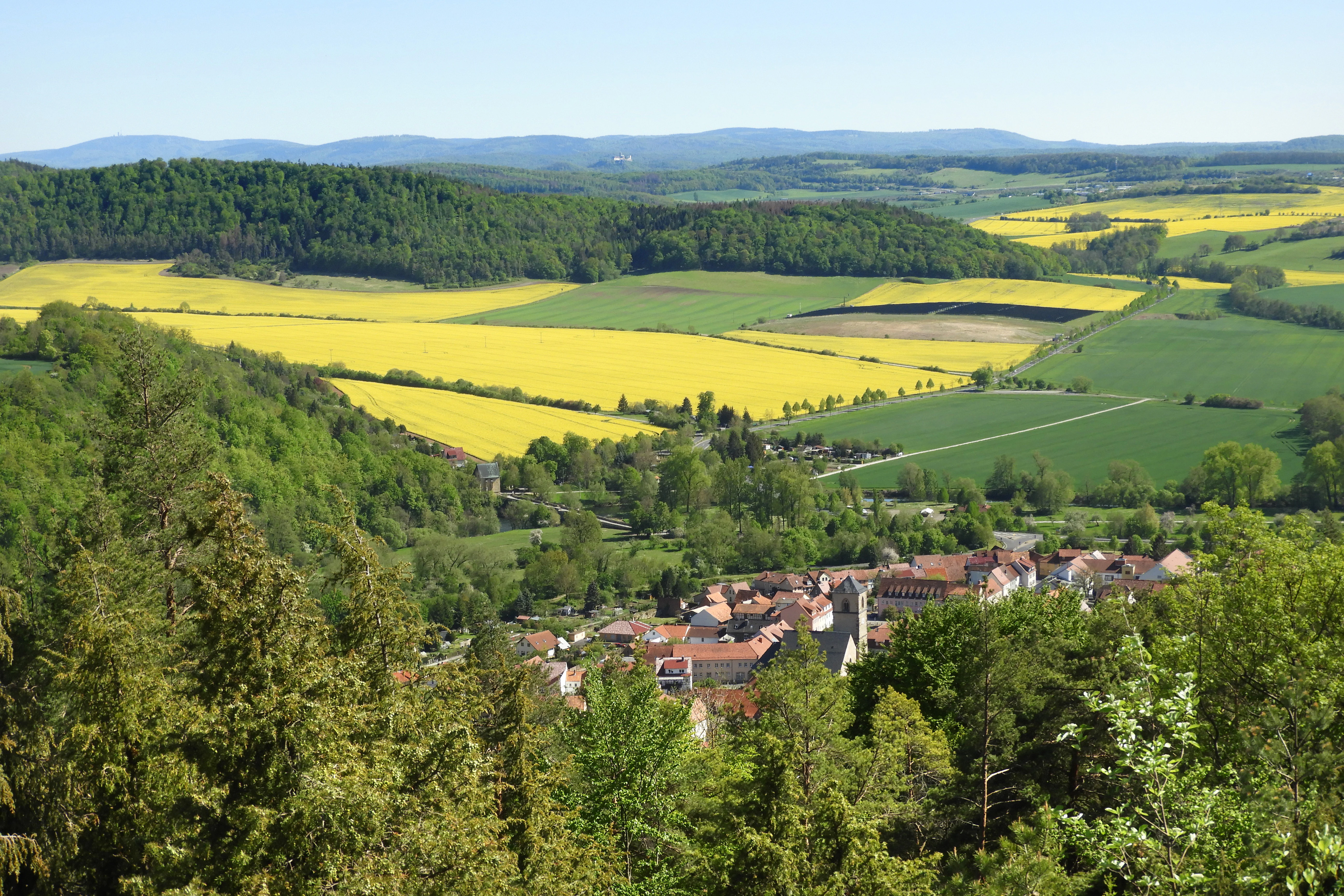
A high-angle view looking over a small town nestled in a valley, surrounded by bright yellow rapeseed fields, green forests, and rolling hills in the distance.
Panoramic view from the Wisch lookout over the Werratal landscape in Thuringia.

Ebenauer Köpfe und Wisch wildlife and species highlights

Wildlife at Ebenauer Köpfe und Wisch reflects the combination of warm, dry rock habitats, varied forest stands, and old quarries and caves. Two strictly protected bat species are particularly significant: the Greater Mouse-eared Bat, the largest native bat species, which here holds one of its most important populations in Germany, and the Lesser Horseshoe Bat, whose presence was only confirmed in the 2000s through a maternity roost in one of the natural caves. Thuringia supports roughly two thousand Lesser Horseshoe Bats, the largest population in Germany, placing the regional conservation task for this species at the Ebenauer cliffs at the centre of national responsibility.

The reserve's butterfly fauna is rich as well. The 1992 conservation assessment recorded thirty-five butterfly species, including Red List species such as the Thyme Blue, the Woodland Brown, the Black Hairstreak, and the Essex Skipper. Night-active moths are also abundant: more than one hundred owlet moths, more than one hundred geometer moths, around fifty hawk moths and silk moths, and roughly thirty micro-moths have been recorded, including five snout moths found for the first time in Thuringia. Grasshoppers, crickets, and the longhorn beetle known as the White-striped Thistle Longhorn Beetle add to the insect diversity.

Birds are tied closely to the rocky terrain. Eagle Owl and Red Kite, both listed as endangered on the German Red List, breed or forage in the cliff area, which provides ideal nesting habitat for the largest native owl. The neighbouring Werra river, meanwhile, supports fish species such as brook lamprey and bullhead, amphibians such as the yellow-bellied toad and the northern crested newt, and mammals such as the European otter, all within the broader Natura 2000 context linked to the reserve.
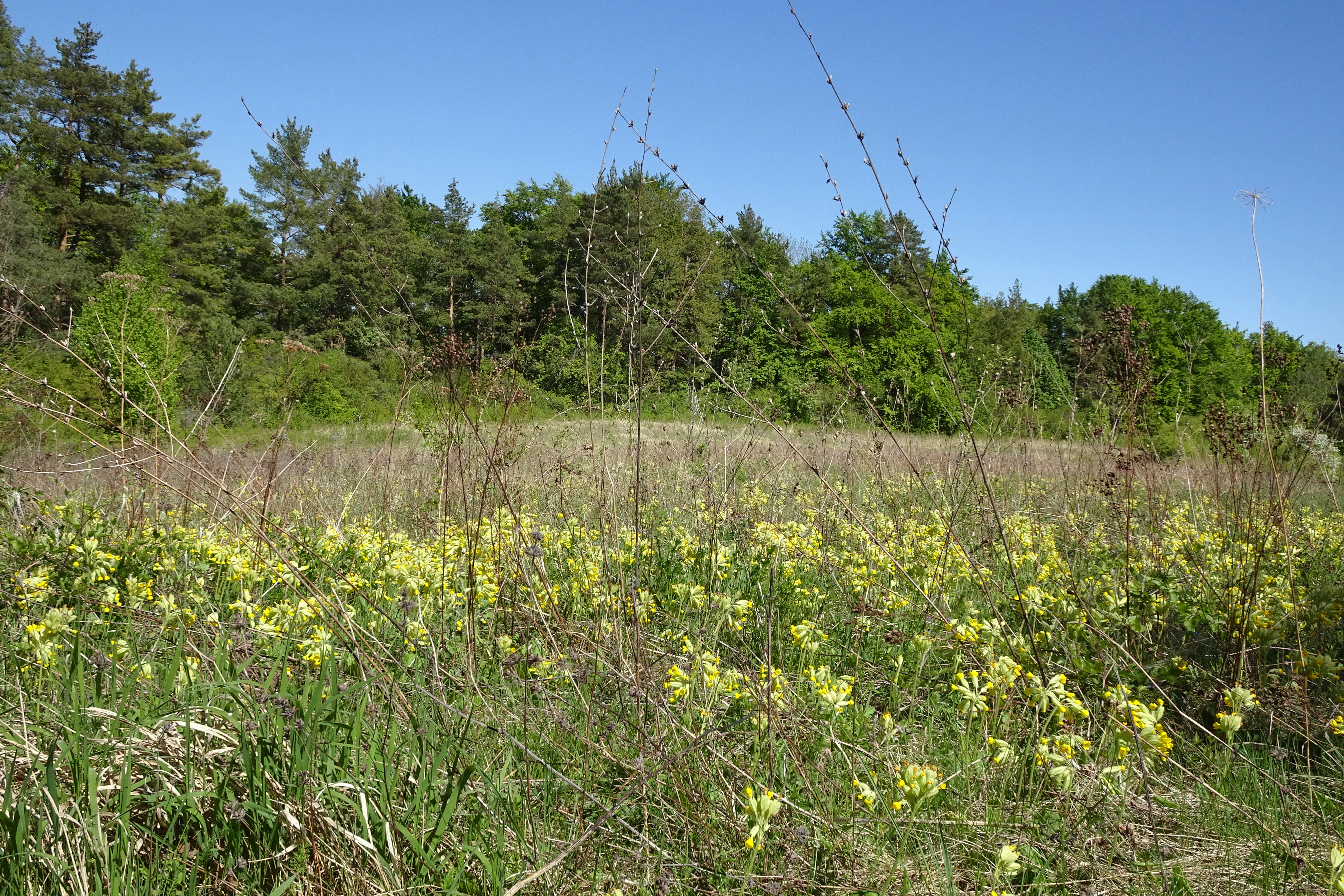
A sunny, grassy meadow filled with yellow primrose flowers in the foreground, backed by a dense green forest under a clear blue sky.
A meadow of blooming primroses within the Ebenauer Köpfe und Wisch nature reserve.

Ebenauer Köpfe und Wisch conservation status and protection priorities

Ebenauer Köpfe und Wisch is important to conservation at multiple scales. Its IUCN Category IV status as a Habitat and Species Management Area reflects its role in actively safeguarding particular species and habitat types rather than leaving ecosystems entirely to natural processes. At the European level, it lies within the Creuzburger Werratal-Hänge FFH area, where it qualifies for several priority habitat types under the Habitats Directive, including orchid-rich calcareous dry grasslands, rupicolous pioneer grasslands, and mixed slope forests. These priority classifications carry especially strict protection requirements.

The reserve's core conservation value lies in the rare combination of calcareous rock communities, semi-dry grasslands, juniper heaths, and near-natural forests on Muschelkalk substrate. Such habitats have become extremely scarce in central Germany, and the Ebenauer slopes support some of the largest remaining orchid-rich grasslands in Thuringia, along with nationally significant populations of orchid, bat, and butterfly species. The site functions as a key connecting element in the Werra valley's biotope network, linking protected sites upstream and downstream.

Long-term conservation depends on active management. Without ongoing measures such as shepherding, controlled grazing, and selective clearing, the open habitats risk being lost to succession into dry forest. The management plan completed in 2017 for FFH area 35 and the coordination with surrounding reserves, including Klosterholz und Nordmannssteine and Lienig, are designed to preserve habitat diversity through targeted, low-intensity land use combined with strict protective rules on the cliffs and rock faces themselves.

Ebenauer Köpfe und Wisch cultural meaning and human context

The reserve and its surroundings hold a layered cultural context rooted in centuries of human-landscape interaction. Historical land uses, including orchards, vineyards, and sheep droveways along the dry slopes, have shaped the open habitats that now form the reserve's ecological backbone. Maintaining the park's character therefore depends on continuing some of these traditional forms of land use, particularly extensive grazing, in cooperation with local farmers and conservation managers.

The towns of Creuzburg and Mihla anchor the cultural scene, with regional importance for pilgrimage, hiking, and Luther-related heritage routes. The Lutherweg passes through the area on its Creuzburg to Scherbda stage, while the long-distance Leine-Werra nature park trail and the Hainichlandweg circle bring walkers through the reserve's periphery. The Gottesackerkirche above Creuzburg, housing an exhibition on the Eichsfeld-Hainich-Werratal Nature Park since 2017, brings visitors and nature interpretation together at the edge of the protected cliffs, linking the cultural landscape with the geological and ecological story of the Werra valley.

Top sights and standout views in Ebenauer Köpfe und Wisch

The highlights of Ebenauer Köpfe und Wisch combine dramatic Muschelkalk scenery with some of the richest calcareous habitats in Thuringia. Standout features include the sheer Werra cut-bank cliffs rising more than 110 metres above the river, the mosaic of dry grasslands, juniper heaths, and pioneer vegetation on the slopes, and the orchid-rich beech and oak forests of the upper plateau. Botanically, the site is famous for orchid populations and the only Thuringian occurrence of the Small Spider Orchid, while zoologically it stands out for its nationally important Greater Mouse-eared Bat colony and a significant Lesser Horseshoe Bat maternity roost.

Equally important is the reserve's role within the broader Werra valley network. As part of the Creuzburger Werratal-Hänge FFH area and the Eichsfeld-Hainich-Werratal Nature Park, it links upstream and downstream protected sites, supports priority habitat types under the EU Habitats Directive, and provides interpretive trails such as the Muschelkalkhänge nature trail at Creuzburg. The combination of geological drama, ecological rarity, and accessible hiking routes makes the site a focal point of conservation and quiet exploration in the central Werra region.

Best time to visit Ebenauer Köpfe und Wisch

Late spring into early summer is generally the most rewarding period for visiting Ebenauer Köpfe und Wisch, when the orchids and other calcareous grassland plants are in bloom across the plateau and slopes. This season brings out the dry meadow flora, including the characteristic Fiederzwenken-Graslilien grasslands, and supports the most active butterfly and insect life on the warm rock faces.

Early autumn is a quieter alternative, offering clearer visibility across the Werra valley from the Wisch viewpoint and cleaner light on the Muschelkalk cliffs in cooler, less humid conditions. Winter visits are less common but can showcase the stark cliff scenery and the meandering course of the Werra in low, unobstructed views. Throughout the year, microclimate differences between sun-baked south-facing walls and cooler north-facing woods shape both the hike experience and what visitors are likely to see, so clothing and timing should reflect the cool, drafty conditions often found near the cliffs.

Monthly climate preview

Long-term monthly temperature averages and precipitation patterns measured across the coordinate sample

Ebenauer Köpfe und Wisch Climate Normals, Annual Temperature and Precipitation Rhythm

Representative coordinate measurements reveal measured monthly fluctuations in average temperature and precipitation across Ebenauer Köpfe und Wisch from nineteen ninety-one to twenty twenty. Detailed monthly climate records and complete twelve-month normals provide deeper analytical context for the protected terrain.
Annual mean8 °C
-1 °C18 °C
Jan-1°
Feb
Mar
Apr
May12°
Jun16°
Jul18°
Aug18°
Sep14°
Oct
Nov
Dec
Warmest month
July

18.3 °C

Coolest month
January

-1.1 °C

Wettest month
July

2.6 mm/day

Driest month
April

1.4 mm/day

Park location guide

Geography guide, regional context, and park location map for Ebenauer Köpfe und Wisch

Ebenauer Köpfe und Wisch park geography, regions, and map view in Germany

Understand where Ebenauer Köpfe und Wisch sits in Germany through a broader geographic reading of the surrounding landscape, nearby location context, and its mapped position within the national park landscape.

How Ebenauer Köpfe und Wisch fits into Germany

Germany is a federal republic in Western and Central Europe with a population of over 83 million across sixteen constituent states. It is Europe's largest economy by nominal GDP and a major global exporter and importer. The capital is Berlin, and the country borders Denmark, Poland, Czech Republic, Austria, Switzerland, France, Luxembourg, Belgium, and the Netherlands.

Wider geography shaping Ebenauer Köpfe und Wisch in Germany

Germany is located in Western and Central Europe, spanning 357,022 km². It borders Denmark to the north, Poland and the Czech Republic to the east, Austria and Switzerland to the south, and France, Luxembourg, Belgium, and the Netherlands to the west. The country has coastlines on the Baltic Sea and North Sea to the north, with the Alps located in the southern region.

Map view of Ebenauer Köpfe und Wisch

Use this park location map to pinpoint Ebenauer Köpfe und Wisch in Germany, understand its exact geographic position, and read its mapped placement within the surrounding landscape more clearly.

Pigeon | © OpenStreetMap contributors

Location context for Ebenauer Köpfe und Wisch

Wartburgkreis

Visualizing the steep Muschelkalk cliffs and calcareous habitats of the Werra valley

Ebenauer Köpfe und Wisch Photos and Landscape Scenery

Visual records capture the dramatic limestone canyons, sheer rock faces, and rare orchid habitats that define the protected landscape. Examining these field photographs reveals the rugged terrain and geological character of the central Werra river valley.

A wide, eye-level view of steep, light-colored limestone cliffs featuring exposed rock faces interspersed with autumn-colored deciduous forest, set against a clear blue sky.

A steep, layered limestone cliff face rising above a lush green forest, showing distinct horizontal rock strata and sparse vegetation clinging to the cliffside under a partially cloudy blue sky.

A wide, high-angle landscape shot showing steep wooded cliffs on the left overlooking a winding river and lush green fields in the valley below under a clear blue sky.

A high-angle view looking over a small town nestled in a valley, surrounded by bright yellow rapeseed fields, green forests, and rolling hills in the distance.

A sunny, grassy meadow filled with yellow primrose flowers in the foreground, backed by a dense green forest under a clear blue sky.

Park atlas

Compare adjacent limestone cliffs, river valleys, and connected conservation networks

Parks Near Ebenauer Köpfe und Wisch and Protected Landscapes in the Surrounding Region

Browsing parks near Ebenauer Köpfe und Wisch reveals shared geological traits across the central Werra valley and neighbouring calcareous terrain. Comparing these adjacent protected areas provides wider geographic context for regional limestone formations and valley habitats.
A horizontal watercolor illustration showing a landscape with rolling, misty purple hills in the background and a line of stylized green and pink trees in the foreground, with a meandering river winding through the scene.
Nature reserveThuringia
Mapped location lies within the park boundary#1 closest

East

Creuzburger Werratal-Hänge Nature Reserve: Geography and Protected Landscape Analysis

Muschelkalk cliffs and calcareous dry grasslands in Thuringia

Located in western Thuringia, the Creuzburger Werratal-Hänge nature reserve features an intricate mosaic of cliff faces, ravine forests, and nutrient-poor dry grasslands. This protected area stands out for its high density of orchid species and mosses, all sculpted by the erosional force of the river Werra through the regional limestone bedrock.

Area
1.47 km²
Established
2000
IUCN
IV
Relief
Mountain
A soft watercolor painting of a river landscape with rolling green hills and gentle slopes.
Nature reserveWartburgkreis
About 0 km away#2 closest

North

Lienig Nature Reserve: Protected Karst Forest Landscapes in the Wartburgkreis Region

A study of steep forested slopes and limestone gullies

Lienig acts as a crucial protected sanctuary for deciduous forest communities situated on the steep, north-facing slopes of the Werra valley. The terrain presents a complex geological profile defined by shell limestone bedrock, small-scale karst features, and deeply incised erosion ravines that support a rare assembly of spring geophytes and old-growth forest characteristics.

Area
0.225 km²
Established
1961
IUCN
IV
Relief
Upland
Nature reserveThuringia
About 0.3 km away#3 closest

Northeast

Werra bis Treffurt mit Zuflüssen: Protected River and Floodplain Network in Thuringia

Mapping an extensive 191 kilometer Natura 2000 river corridor.

The Werra bis Treffurt mit Zuflüssen protected area serves as a vital ecological corridor in Thuringia. This site encompasses a complex mosaic of fast-flowing highland brooks, expansive floodplain meadows, inland salt sites, and rare dissolution lakes. Its geography bridges high-altitude source regions with lower river valleys, creating a distinctive landscape transect that supports essential freshwater habitats and rare aquatic species across the state.

Area
22.6 km²
Established
2008
IUCN
IV
Relief
Mixed relief
Watercolor illustration of a lush river valley with gently rolling hills and trees under a soft, light sky.
Nature reserveWartburgkreis
About 1.7 km away#4 closest

Southeast

Klosterholz und Nordmannssteine: Geography and Protected Area Landscape Context

Essential nature reserve mapping in the Wartburgkreis district

Klosterholz und Nordmannssteine is a significant nature reserve situated along the Werra river. This protected area features a striking vertical profile defined by exposed shell-limestone cliffs, diverse ravine forests, and remnants of industrial activity. It serves as a key site for calcareous flora and avian conservation within the broader ecological network of the Eichsfeld-Hainich-Werratal nature park region.

Area
1.395 km²
Established
1961
IUCN
IV
Nature reserveThuringia
About 1.8 km away#5 closest

Northeast

Werra-Aue zwischen Breitungen und Creuzburg: Protected Floodplain and River Geography

Nature reserve sanctuary in western Thuringia

Spanning over 33 kilometers of the Werra river, this protected floodplain is defined by its distinctive geological sinkholes, seasonal wetlands, and diverse bird habitats. Discover the layered conservation status and riparian terrain that mark this significant Thuringian nature reserve as a crucial node for European ecological connectivity.

Area
25.78 km²
Established
2007
IUCN
IV
Relief
Lowland
Nature reserveThuringia
About 2.5 km away#6 closest

Southwest

Wilhelmsglücksbrunn Nature Reserve and Werra Valley Protected Landscape Geography

A mapped overview of inland saline springs in Thuringia

The Wilhelmsglücksbrunn nature reserve preserves a rare inland saline ecosystem within the flat Werra floodplain of western Thuringia. This site sustains a complex landscape of reed beds, wet meadows, and brine-fed habitats that connect to the broader Green Band ecological corridor, providing essential staging grounds for diverse migratory bird populations.

Area
0.773 km²
Established
2000
IUCN
IV
Relief
Lowland
Nature reserveThuringia
About 4.3 km away#7 closest

North

Werrahänge von Frankenroda bis Falken: A Deep Dive into Thuringian Protected Landscapes

Mapping limestone river canyons and unique forest habitats in Wartburgkreis.

This protected area captures a distinct geomorphological intersection of river-cut canyons and plateau ridges in Thuringia. The site preserves an intense mosaic of juniper heath, dry grasslands, and ancient beech forests, functioning as a vital link for species conservation. Examine the mapped boundaries, karst features, and the sculptural topography formed by the Werra river as it winds through the Muschelkalk rim of the Thuringian Basin.

Area
5.69 km²
Established
1999
IUCN
IV
Relief
Upland
Watercolor painting of a rolling green landscape with a winding trail leading toward purple mountains under a soft light.
Nature reserveWartburgkreis
About 5.6 km away#8 closest

Southwest

Mertelstal - Heldrastein: Protected Nature Reserve and Forested Limestone Geography in Wartburgkreis

Mapping the natural relief and ecological boundaries of a central German nature reserve.

Mertelstal - Heldrastein stands as a protected natural landmark in the Wartburgkreis district, defined by its dramatic limestone cliffs and ancient beech forest canopy. The reserve features a unique vertical relief above the Werra river valley, housing rare orchid communities and specialized bryophytes. This entry maps the structural geography and conservation value of the site, highlighting its dual identity as both a Natura 2000 protected habitat and a place of deep historical resonance across the former inner-German border landscape.

Area
2.525 km²
Established
1997
IUCN
IV
Relief
Mountain

Common questions about visiting, size, designation, and location context for Ebenauer Köpfe und Wisch

Ebenauer Köpfe und Wisch FAQs for park facts, access, geography, and protected area context

Find quick answers about Ebenauer Köpfe und Wisch, including protected-area facts, park geography, trail and visitor context, and how the park fits into its surrounding country and regional landscape.
MoriAtlas Explorer

Continue Your Protected Areas Search Across the Global Atlas

Deepen your exploration by continuing the structured search for national parks and protected areas worldwide. Utilize the comprehensive filtering capabilities to compare different conservation landscapes and refine your understanding of global park geography. Discover more about the distribution and characteristics of protected natural areas.

Global natural geography