
Mori Atlas logo
Protected landscapeParque natural y área de manejo integrado El Cardón

High-altitude cactus reserves and puna ecosystems within the department of Tarija, Bolivia.

Parque natural y área de manejo integrado El Cardón: Andean Geography and Protected Landscapes

Parque natural y área de manejo integrado El Cardón protects 30,000 hectares of rugged Andean terrain across the municipalities of El Puente and Yunchará. Rising between 3,100 and 4,300 meters, this high-altitude landscape serves as a vital cactus reserve and habitat for wild vicuñas. The region encompasses diverse puna and pre-puna ecological belts, offering a unique mosaic of rocky slopes and plateaus that support significant botanical diversity and pre-Columbian cultural heritage.

cactus reservehigh Andespunapre-punavicuña habitatwildlife refuge
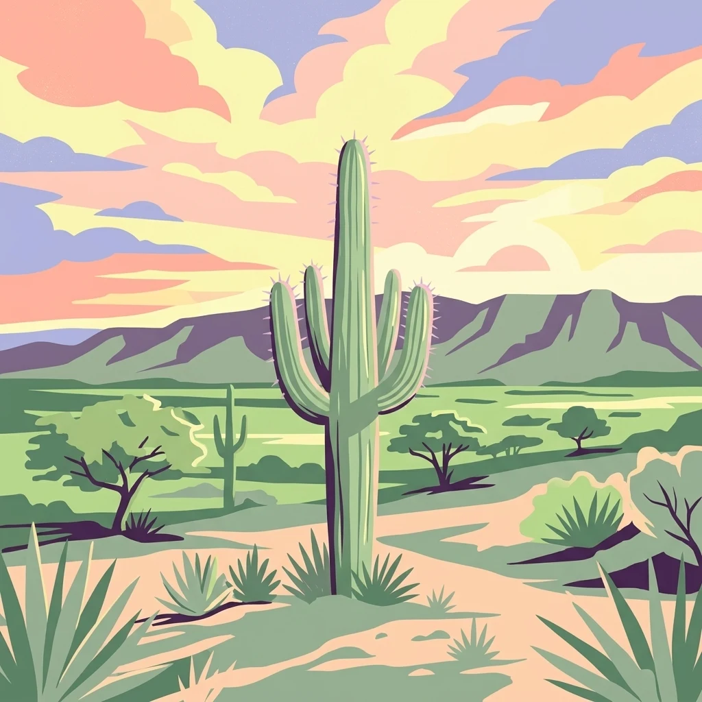
A digital illustration of a desert scene with a tall cactus in the center, sparse vegetation, and mountains under a colorful pastel sky.

Parque natural y área de manejo integrado El Cardón

Protected landscape

Park overview

Structured park overview, official facts, and landscape profile for El Cardón Natural Park and Integrated Management Natural Area

El Cardón Natural Park and Integrated Management Natural Area park facts, protected area profile, and essential visitor context

Review the core facts for El Cardón Natural Park and Integrated Management Natural Area, including designation, size, terrain, visitor scale, habitats, and operating context in one park-focused overview.

About El Cardón Natural Park and Integrated Management Natural Area

El Cardón Natural Park and Integrated Management Natural Area is a protected landscape of approximately 30,000 hectares in the department of Tarija, southern Bolivia. Established by Law No. 2465 on 2 May 2003, the area combines strict conservation of its cactus-rich high-Andean ecosystems with an integrated management approach that recognizes the presence and needs of surrounding rural communities, including Huarmachi, Cóndor Huasy, Curqui, and Colpayito.

Geographically, the park lies about 72 kilometers from the city of Tarija, across the municipalities of El Puente and Yunchará, and extends through puna and pre-puna environments between roughly 3,100 and 4,300 meters above sea level. It functions as a buffer zone for the neighboring Reserva Biológica de la Cordillera de Sama, and since 2023 it has been administered by Bolivia's Servicio Nacional de Áreas Protegidas, SERNAP. This administrative shift has strengthened protection, monitoring, and research activities inside the park.

Ecologically, El Cardón stands out for its extraordinary cactus diversity. Around fifteen cactus species, some of them endemic, grow across its rugged terrain, including species that reach six meters in height and others that grow close to the ground. For this reason, the area is regarded as the second largest cactus reserve in Latin America, after the Tehuacán-Cuicatlán Biosphere Reserve in Mexico. The high plateaus also support wild vicuñas, with the first formal census registering 322 individuals in 2024, and preserve pre-Columbian archaeological evidence of ancient Chichas presence in the form of arrowheads, ceramics, engravings, and chullpas.

The park is also a place where conservation and community life meet. Local families have long used cardón wood to craft furniture, doors, and objects, and community-based ecotourism initiatives are now helping link the park with other attractions of the Tarija region, including the Tajzara lagoons and the dunes of Yunchará.

Quick facts and research context for El Cardón Natural Park and Integrated Management Natural Area

El Cardón Natural Park and Integrated Management Natural Area is a Bolivian protected area of approximately 30,000 hectares, located in the department of Tarija about 72 kilometers from the city of Tarija. It lies in the high Andes, spanning puna and pre-puna zones between roughly 3,100 and 4,300 meters of elevation, and was established by Law No. 2465 on 2 May 2003. Since 2023 the park has been administered by Bolivia's Servicio Nacional de Áreas Protegidas and serves as a buffer area for the nearby Reserva Biológica de la Cordillera de Sama.

Protection and recognition

Documented terrestrial protection scope and international recognition data

Parque natural y área de manejo integrado El Cardón Protection Status

Parque natural y área de manejo integrado El Cardón maintains a documented terrestrial protection scope within the global conservation database framework. Official records outline management designations and international recognition sources associated with the protected area.

Protection details

Protection scope
Terrestrial
Transboundary protection
No
Park context

Deeper park guide and search-rich context for El Cardón Natural Park and Integrated Management Natural Area

El Cardón Natural Park and Integrated Management Natural Area history, landscape, wildlife, and travel context

Explore El Cardón Natural Park and Integrated Management Natural Area through its history, landscape character, ecosystems, wildlife, conservation priorities, cultural context, and seasonal travel timing in a structured park guide built for atlas discovery and search intent.

Why El Cardón Natural Park and Integrated Management Natural Area stands out

El Cardón is best known for its extraordinary diversity of columnar and globular cacti, often described as the second largest cactus reserve in Latin America after Mexico's Tehuacán-Cuicatlán Biosphere Reserve. Around fifteen cactus varieties, several of them endemic to the region, grow in the puna and pre-puna highlands of southern Bolivia between roughly 3,100 and 4,300 meters in elevation. The park has also become recognized for its growing population of wild vicuñas, whose first formal census in May 2024 recorded 322 individuals within the protected area. Together, the cactus landscapes, high-Andean wildlife, and the cultural heritage of nearby rural communities give the park a distinctive identity within Bolivia's Tarija department.
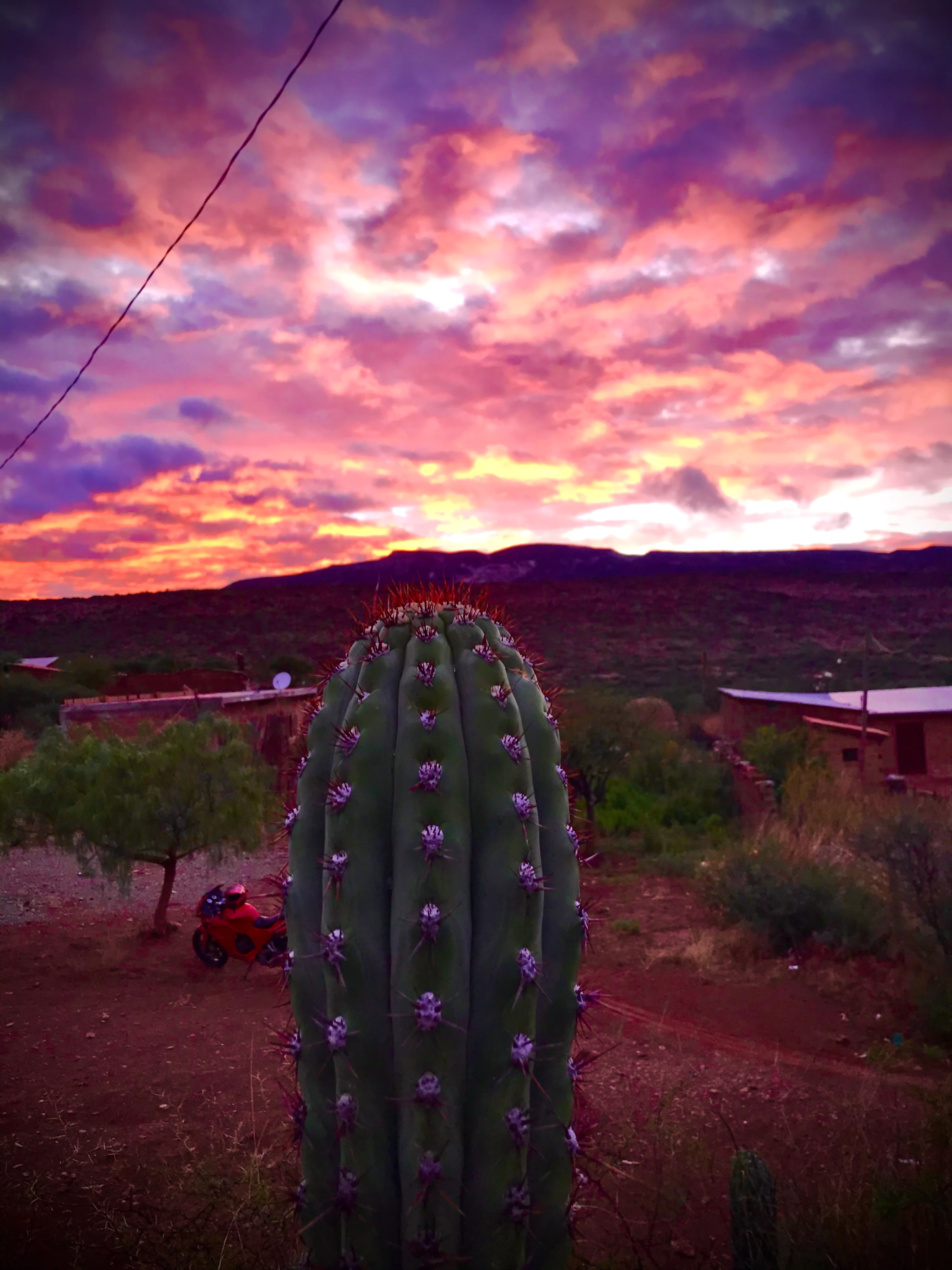
A close up view of a large columnar cactus with purple flowers in the foreground, set against a dark landscape and a brilliant pink and orange sunset in the background.
A giant cactus silhouetted against a vibrant, fiery sunset at El Cardón.

El Cardón Natural Park and Integrated Management Natural Area history and protected-area timeline

El Cardón was established as a Natural Park and Integrated Management Natural Area on 2 May 2003 under Bolivia's Law No. 2465. From its creation, the area was conceived not only as a conservation zone but also as a buffer area reinforcing the nearby Reserva Biológica de la Cordillera de Sama, and personnel from the Sama reserve carried out sporadic surveillance and control activities within El Cardón for many years.

A major institutional shift occurred in 2023, when El Cardón was formally incorporated into Bolivia's Servicio Nacional de Áreas Protegidas, SERNAP. This change expanded the management capacity of the area and enabled new actions including fauna monitoring, archaeological surveys, tourism assessments, and protection activities. That same period also brought the first formal vicuña census in the park and increased inventories of cactus species and archaeological sites.

El Cardón Natural Park and Integrated Management Natural Area landscape and geographic character

The park lies within the rugged topography of the southern Bolivian Andes, where steep terrain, deep valleys, and broad high-altitude plateaus shape an environment that is both visually dramatic and ecologically demanding. Elevations range from about 3,100 meters up to around 4,300 meters above sea level, placing the area within the puna and pre-puna ecological belts characteristic of the Central Andes.

This altitudinal gradient produces a mosaic of arid and semi-arid landscapes, with exposed rocky slopes, sparse grasslands, and open high plateaus that together support the cactus-dominated vegetation for which El Cardón is famous. The combination of rugged relief and native vegetation also makes the area attractive for nature-based and adventure tourism, including hiking through varied terrain and exploring panoramic Andean vistas.
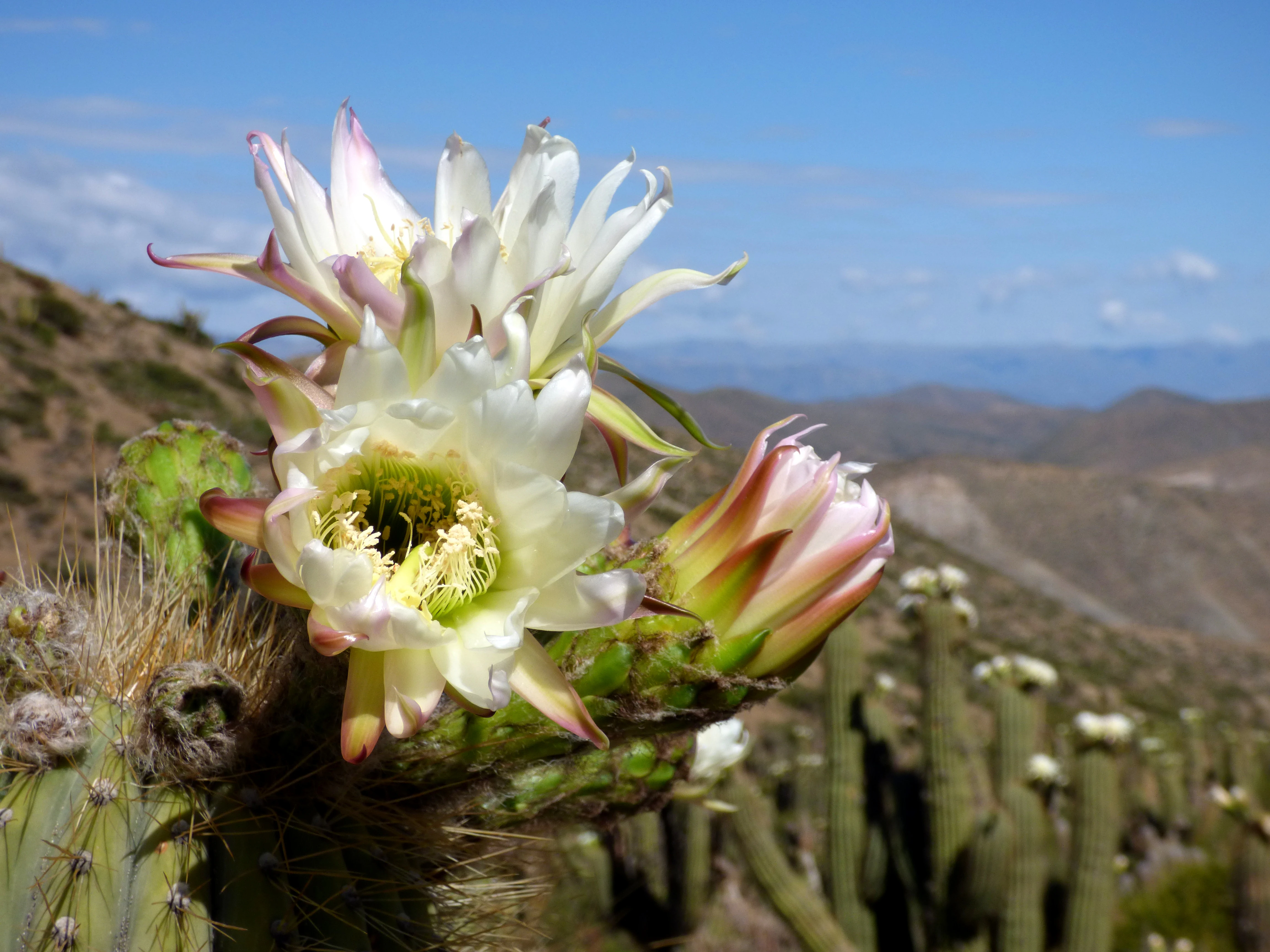
A close-up view of several large, white cactus flowers in bloom, with a blurred hillside of additional cactus plants in the background under a blue sky.
White flowers blooming on a cardon cactus, characteristic of the El Cardon Natural Park landscape.

El Cardón Natural Park and Integrated Management Natural Area ecosystems, habitats, and plant life

Vegetation in El Cardón is dominated by cacti and other drought-adapted species that thrive in the cool, dry conditions of the high Andes. The park hosts around fifteen cactus varieties, several of them endemic to the region, with growth forms ranging from tall columnar species reaching up to six meters high to low-growing, creeping forms that hug the rocky ground. Flowering generally occurs between January and March, and depending on the species and conditions, individual plants may flower for the first time anywhere from three to ten years of age.

Beyond the iconic cacti, the protected area preserves expanses of native Andean vegetation that maintain ecological connectivity within the broader Tarija highland system. The combination of native flora, varied topography, and the influence of the Cordillera de Sama Biological Reserve to the north reinforces the ecological importance of El Cardón as a refuge for high-Andean plant communities.

El Cardón Natural Park and Integrated Management Natural Area wildlife and species highlights

Wildlife in El Cardón reflects the character of Bolivia's high-Andean puna ecosystems. The park's most emblematic mammal is the vicuña, a wild camelid whose graceful presence has become a hallmark of conservation interest in the area. The first formal vicuña census inside the park, carried out in May 2024 by park rangers and supported by conservation organizations, recorded 322 individuals, confirming El Cardón as a significant area for the species in southern Bolivia.

In addition to vicuñas, the protected area supports broader high-Andean fauna associated with grasslands, rocky slopes, and cactus habitats. Ongoing fauna monitoring carried out under SERNAP has expanded knowledge of the species present and has helped strengthen patrolling and conservation actions within the park's boundaries.

El Cardón Natural Park and Integrated Management Natural Area cultural meaning and human context

Around two hundred families live in roughly ten communities around the park, including Huarmachi, Cóndor Huasy, Curqui, and Colpayito, and their daily life is closely tied to the surrounding landscape. Local residents have long used the woody skeleton of dead cardón cacti to make doors, furniture, construction elements, and household objects, and this traditional raw material has given rise to a small craft economy producing vases, pots, bottle holders, toys, and items that combine cactus wood with traditional weaving.

Some cactus species are also used as food or for personal hygiene, while the fruits of the pasacana cactus are distilled into a regional alcoholic beverage linked to local social traditions. Archaeological findings, including arrowheads, ceramic fragments, engraved stones, and chullpas attributed to ancient Chichas populations, have inspired proposals to create a community museum. Local development plans also envision a tourism route connecting Tarija city with El Cardón, the Tajzara lagoons, and the dunes of Yunchará, linking biodiversity, cultural expressions, and artisanal production.

Top sights and standout views in El Cardón Natural Park and Integrated Management Natural Area

El Cardón's highlights include its high-altitude cactus ecosystems, an outstanding population of wild vicuñas roaming the puna grasslands, dramatic Andean topography suited to adventure tourism, and a deeply rooted rural culture that has long used cardón wood for furniture, doors, and crafts. Pre-Columbian archaeological sites, including lithic arrowheads, ceramics, petroglyphs, and chullpas linked to ancient Chichas populations, add an important cultural dimension to the visit experience.
Monthly climate preview

Long term temperature and precipitation normals across twelve representative months

Parque natural y área de manejo integrado El Cardón Climate and Weather by Month

Representative coordinate records show sustained annual temperature swings and distinct precipitation rhythms across monthly intervals. Examining the full twelve month climate profile reveals complete statistical distributions for regional analysis.
Annual mean11 °C
7 °C14 °C
Jan14°
Feb14°
Mar13°
Apr12°
May
Jun
Jul
Aug
Sep11°
Oct13°
Nov14°
Dec14°
Warmest month
December

14.5 °C

Coolest month
July

7.2 °C

Wettest month
January

5.1 mm/day

Driest month
July

0.4 mm/day

Park location guide

Geography guide, regional context, and park location map for El Cardón Natural Park and Integrated Management Natural Area

El Cardón Natural Park and Integrated Management Natural Area park geography, regions, and map view in Bolivia

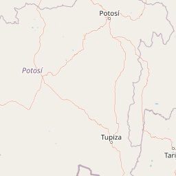
Understand where El Cardón Natural Park and Integrated Management Natural Area sits in Bolivia through a broader geographic reading of the surrounding landscape, nearby location context, and its mapped position within the national park landscape.

How El Cardón Natural Park and Integrated Management Natural Area fits into Bolivia

Bolivia, officially the Plurinational State of Bolivia, is a landlocked country in central South America. It features diverse geography including the Andean mountain range, Amazonian plains, Gran Chaco, and the Pantanal wetland. The country has a population of approximately 11.4 million and is administratively divided into nine departments, with La Paz as the seat of government and Sucre as the constitutional capital.

Wider geography shaping El Cardón Natural Park and Integrated Management Natural Area in Bolivia

Bolivia is located in central South America, bordered by Brazil to the north and east, Paraguay to the southeast, Argentina to the south, Chile to the southwest, and Peru to the west. The country is divided between a western Andean region and tropical lowlands to the east and north. It includes the Amazonian plain, Gran Chaco, temperate valleys, the high-altitude Altiplano plateau, and part of the Pantanal wetland along its eastern border.

Map view of El Cardón Natural Park and Integrated Management Natural Area

Use this park location map to pinpoint El Cardón Natural Park and Integrated Management Natural Area in Bolivia, understand its exact geographic position, and read its mapped placement within the surrounding landscape more clearly.

Pigeon | © OpenStreetMap contributors

Location context for El Cardón Natural Park and Integrated Management Natural Area

Tarija
Recorded earthquake history

Examine Recorded Seismic Activity Near Parque natural y área de manejo integrado El Cardón

Consult the MoriAtlas collection of historical earthquake records associated with the geography of Parque natural y área de manejo integrado El Cardón. Explore documented seismic events by date, depth, and magnitude to better understand the regional context of these Andean highlands.

El Cardón Earthquake History

Catalogued events

5 events

Strongest magnitude

Magnitude 5.1

Most recent event

Oct 3, 2018

This history includes earthquakes recorded inside the park or within 50 km of its borders

Visual reference of high-altitude cactus reserves and Andean protected terrain

Parque natural y área de manejo integrado El Cardón Photos and Landscapes

Examine authentic photographs capturing the rugged terrain, high-altitude cactus reserves, and native wildlife habitats of Parque natural y área de manejo integrado El Cardón. Visual exploration reveals the distinct Andean scenery and environmental character defining this southern Bolivian protected area.

A close up view of a large columnar cactus with purple flowers in the foreground, set against a dark landscape and a brilliant pink and orange sunset in the background.

A close-up view of a blooming cactus with cream-colored flowers and spiny buds against a clear blue sky.

A close-up view of several large, white cactus flowers in bloom, with a blurred hillside of additional cactus plants in the background under a blue sky.

Park atlas

Compare adjacent Andean reserves, high-altitude puna landscapes, and connected wildlife habitats

Parks Near Parque natural y área de manejo integrado El Cardón and Regional Protected Areas

Browsing other protected areas near Parque natural y área de manejo integrado El Cardón reveals the broader ecological patterns of the southern Bolivian Andes. Expanding the geographic comparison helps trace neighboring high-altitude terrain, regional park boundaries, and connected conservation zones.
Wildlife reserveTarija Department
About 11 km away#1 closest

South

Tajzara Wildlife Reserve: Geographic and Landscape Overview of the Tarija Basin

High-altitude wetlands and saline lagoons in the Bolivian Andes

Tajzara Wildlife Reserve stands as a critical high-altitude wetland complex within the Tarija Department. This protected landscape sustains life across saline lake beds, seasonal pools, and marshy margins, functioning as a vital refuge for migratory waders and flamingo populations in the harsh, arid climate of the Bolivian Altiplano.

Area
13 km²
Established
1999
Relief
Highland
Climate
Alpine
Watercolor illustration showing a pale green rural landscape with rolling hills, scattered trees, a winding path or stream, and small buildings in the distance
Biosphere reserveBolivia
About 15 km away#2 closest

Southeast

Reserva Biológica de la Cordillera de Sama: Protected Mountain Landscapes of Southern Bolivia

High-Andean biosphere reserve featuring lagoons, dunes, and ancient pathways.

Reserva Biológica de la Cordillera de Sama encompasses a vast elevation range from dry inter-Andean valleys to the 4,700-meter peaks of the Cordillera Oriental. This reserve protects the endorheic Tajzara basin, where seasonal lagoons and sand dunes contrast with relict forests and steep mountain ravines. Its geography offers a complex mosaic of ecosystems, providing essential water sources and specialized habitat for endemic fauna within the southern Bolivian highlands.

Area
1,085 km²
Established
1991
Relief
Mountain
Climate
Alpine
A soft watercolor painting depicting gentle, rolling hills and plains in muted shades of green, yellow, and violet.
Natural monumentSud Chichas
About 61 km away#3 closest

West

Área protegida municipal Ecoparque Encantado: Geographic Atlas and Natural Monument Overview

Mapped canyon landscapes and dry valley geography in the Sud Chichas province.

Analyze the topographic features of Área protegida municipal Ecoparque Encantado, a protected municipal monument in southern Bolivia. This area captures the dramatic transition between high-altitude puna grasslands and warm inter-Andean dry valleys. Learn about the geological history of the Tupiza Formation, the preservation of endemic vegetation, and the specific terrain dynamics that define this unique canyon-rich protected landscape.

Area
38.2 km²
Established
2015
IUCN
III
Relief
Mountain
Protected areaPotosí
About 63 km away#4 closest

Southwest

Pampa Tholar de las Vicuñas: Protected Andean Puna Landscapes and Geographic Overview

Integrated management area and high-altitude habitat in Potosí, Bolivia.

Pampa Tholar de las Vicuñas covers nearly 60,000 hectares of arid puna in the municipality of Villazón, representing a key intersection of biodiversity and local pastoral traditions. The area features a complex mosaic of piedmont slopes, rolling foothills, and seasonal water networks that provide essential habitat for the Andean condor and large vicuña populations. This protected landscape offers a unique look at high-altitude land management in the transitional zone between the Altiplano and the Eastern Cordillera.

Area
584.8 km²
Established
2018
Relief
Highland
Climate
Arid
A soft watercolor illustration of a river flowing through a lush landscape with gentle green hills in the distance.
Wildlife reserveTarija
About 86 km away#5 closest

Southeast

Reserva nacional de flora y fauna de Tariquía: Atlas and Geographic Protected Area Overview

Montane cloud forest and subandean river valleys in Tarija

This wildlife reserve preserves the most intact stands of Yungas Tucumano-Boliviano forest in Bolivia. Featuring a dramatic vertical zonation from foothill selva to high-elevation pine woodlands, the area serves as a primary hub for ecological research and conservation in the rugged landscapes of Tarija near the Argentine border.

Area
2,468.7 km²
Established
1989
Relief
Mountain
Climate
Subtropical
National parkArgentina
95 km away#6 closest

South

Baritú National Park National Park: Mapped Protected Landscapes in Argentina's Geography

Understand the natural terrain and geographic setting of this Argentinian park.

Baritú National Park represents a distinct national park entity within Argentina, crucial for understanding the country's protected landscapes and regional geography. This page provides specific atlas-level detail on its mapped boundaries and the surrounding natural terrain. Explore Baritú National Park as a key geographic feature contributing to the broader understanding of conservation areas across South America, grounded in factual, map-oriented discovery.

Area
720 km²
Established
1974
IUCN
II
Relief
Mountain
Protected areaGran Chaco Province
About 146 km away#7 closest

East

Aguaragüe National Park and Integrated Management Natural Area: Bolivia's Easternmost Sub-Andean Protected Landscape

Explore its mapped mountain geography and ecological diversity.

Aguaragüe National Park and Integrated Management Natural Area is a crucial protected area in Bolivia's Gran Chaco Province, defined by the Serranía del Aguaragüe mountain range. This landscape offers a unique opportunity to explore a geographic transition zone where Southern Andean Yungas montane forests converge with Dry Chaco ecosystems. The park's protected boundaries encompass a rugged mountain backbone rising from the lowlands, representing a vital segment of Bolivia's Sub-Andean geography and protected natural areas.

Area
1,083.07 km²
Established
2000
IUCN
II
Relief
Mountain
Natural monumentSanta Cruz
About 205 km away#8 closest

Northeast

Monumento natural municipal Muela del Diablo: Protected Area Geography and Landscape Context

Regional mapping of the Chaco plain and serranías.

The Muela del Diablo natural monument serves as an essential ecological landmark, protecting key aquifer recharge zones within the Santa Cruz department. This summary focuses on the topography of the peak and its function within the Gran Chaco ecoregion, offering a detailed perspective on the site's environmental geography and historical landscape significance.

Area
50.99 km²
Established
2009
Relief
Mountain
Climate
Subtropical

Common questions about visiting, size, designation, and location context for El Cardón Natural Park and Integrated Management Natural Area

El Cardón Natural Park and Integrated Management Natural Area FAQs for park facts, access, geography, and protected area context

Find quick answers about El Cardón Natural Park and Integrated Management Natural Area, including protected-area facts, park geography, trail and visitor context, and how the park fits into its surrounding country and regional landscape.
MoriAtlas Explorer

Continue Your Protected Areas Search Across the Global Atlas

Deepen your exploration by continuing the structured search for national parks and protected areas worldwide. Utilize the comprehensive filtering capabilities to compare different conservation landscapes and refine your understanding of global park geography. Discover more about the distribution and characteristics of protected natural areas.

Global natural geography