
Why Emigrant Wilderness stands out
Emigrant Wilderness is best known for its glaciated high Sierra landscape, where hundreds of lakes and meadows fill basins between sparsely vegetated granite ridges and a distinctive cluster of volcanic peaks in the northeast. It is also recognized as one of the historic emigrant crossing corridors of the mid nineteenth century, with names such as Relief Valley and Emigrant Pass preserving the memory of those early overland journeys. The wilderness draws hikers and equestrians for its dense network of trails, scenic destinations like Granite Dome, Emigrant Lake, Huckleberry Lake, and Lake Lertora, and its position along a particularly scenic stretch of the Pacific Crest Trail.
Emigrant Wilderness history and protected-area timeline
The high country that is now Emigrant Wilderness was inhabited for thousands of years before Euro-American arrival. Native peoples occupied the area for at least 10,000 years, spending the summer and early autumn hunting in the high elevations and trading with groups from the eastern side of the Sierra Nevada. The most recent of these communities were the Sierra Miwok, who lived along the western slope, and the Northern Paiute (referred to historically as Piute) of the Great Basin.
The discovery of gold in 1848 brought a rapid influx of miners and settlers to the Sierra, and native populations in and around the Emigrant area declined quickly under the pressures of displacement, disease, and conflict. In the early 1850s, overland emigrant parties began searching for viable routes across the central Sierra. In September and October of 1852, the Clark-Skidmore party became the first emigrant group to travel the West Walker route over Emigrant Pass, continuing through a portion of what is now the wilderness. Officials from Sonora encouraged additional parties to use the route in 1853, but the passage proved harsh and difficult, and it was soon abandoned. The names Relief Valley and Relief Reservoir survive today because local Sonora residents provided assistance to struggling emigrants in that area.
In 1931, the U.S. Forest Service recognized the area's wild character by designating it the Emigrant Basin Primitive Area, subjecting it to a more restrictive management regime than the surrounding national forest land. On January 4, 1975, the primitive area was redesignated as Emigrant Wilderness under the National Wilderness Preservation System, giving it the stronger legal protections and standardized wilderness status that it retains today. Since that time, the wilderness has also been at the center of an unresolved debate over 18 small angler-built dams constructed from stacked stones and boulders, with conflicting interpretations of the Wilderness Act shaping policy on whether these structures should be maintained or allowed to deteriorate naturally.
Emigrant Wilderness landscape and geographic character
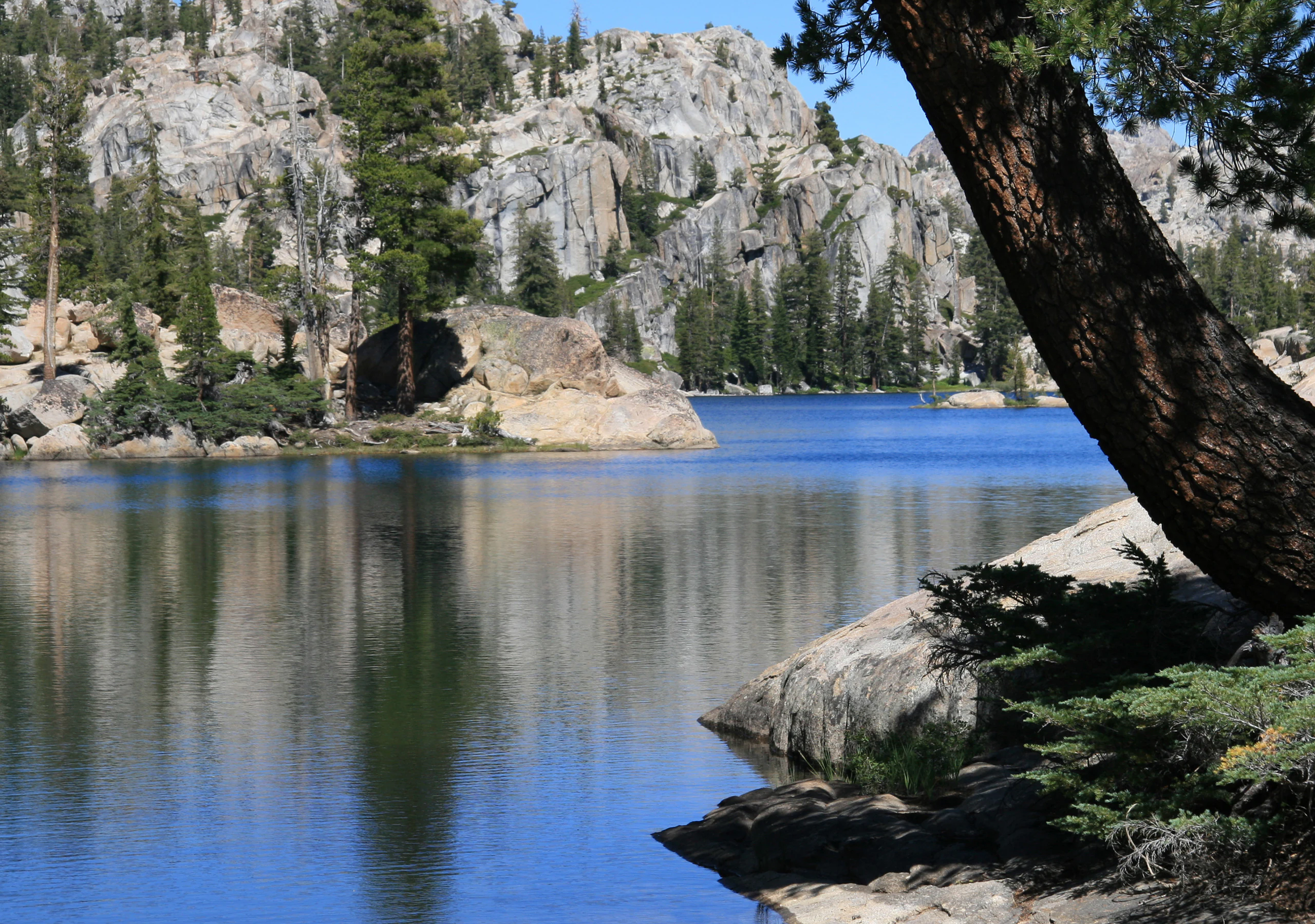
Emigrant Wilderness is defined by a glaciated Sierra Nevada landscape that combines vast expanses of granite with a distinct volcanic sector in the northeast. The southern and western portions are dominated by lightly vegetated granitic ridges, broad domes, and rounded uplands where ice age glaciers planed and reshaped the bedrock into the sweeping basins, benches, and cirques typical of the central Sierra. Scattered across this granite terrain are hundreds of lakes and wet meadows, concentrated especially between 7,500 and 9,000 feet, that give the wilderness its distinctive dotted, blue-and-green appearance from above.
In contrast, the northeastern third of Emigrant Wilderness is built from older volcanic flows that hardened into darker, more jagged ridges and peaks. These volcanic highlands rise above the surrounding basins and create a rougher skyline than the smoother granite country to the southwest. The boundary between the two geological provinces is one of the visible hallmarks of the area, with transitions sometimes occurring over relatively short distances within a single drainage.
Elevations span nearly 6,500 vertical feet across the wilderness. The lowest terrain lies below 5,000 feet near Cherry Reservoir in the western portions, while the highest summit, Leavitt Peak, reaches 11,570 feet along the eastern ridge paralleling the Pacific Crest Trail. Between these extremes, much of the popular hiking and riding terrain lies in the 7,500 to 9,000 foot band, where the combination of lake basins, forest patches, and open ridges makes travel relatively varied and rewarding. Drainages from across the wilderness feed the Stanislaus River on one side and the Tuolumne River on the other, making the landscape a significant headwaters zone for both of these Sierra Nevada river systems.
Emigrant Wilderness ecosystems, habitats, and plant life
Ecologically, Emigrant Wilderness occupies the classic mid-to-high elevation bands of the central Sierra Nevada, with vegetation patterns closely tied to elevation, slope, and substrate. Lower elevations around Cherry Reservoir and the western fringes support mixed conifer forests, while middle elevations give way to true fir and lodgepole pine stands that intermingle with broad, sometimes grassy meadows. Above the forest line, especially on the volcanic ridges in the northeast and around the higher summits, the cover thins to open alpine terrain with hardy shrubs, scattered whitebark pine, and exposed rocky ground.
The many lake and meadow basins scattered across the wilderness form a network of wet habitats that are central to the area's ecological character. These basins hold water through the spring and early summer from the melting of heavy winter snowpacks, which on average deliver around 50 inches of precipitation per year, with the great majority falling as snow. The gradual release of this stored moisture sustains downstream flows in both the Stanislaus and Tuolumne watersheds and supports a rich seasonal ecology of wet meadows, riparian margins, and aquatic systems. Snowpacks commonly linger into June and can persist later into the summer following especially wet winters.
Because the wilderness sits between Yosemite National Park and the Hoover Wilderness, it also serves as a connective landscape within a much larger protected matrix of Sierra Nevada ecosystems. This positioning enhances habitat continuity for wide-ranging species and helps preserve ecological processes tied to elevation gradients and seasonal snowmelt that extend beyond Emigrant's boundaries.
Emigrant Wilderness wildlife and species highlights
The wildlife of Emigrant Wilderness reflects the broader patterns of the central Sierra, with species composition shifting alongside elevation and habitat type. Lower forest bands host deer, black bear, and a variety of small mammals associated with mixed conifer and chaparral communities, while higher basins and meadows are important summer range for mule deer and other ungulates that move upslope as the snow retreats. The combination of lakes, streams, and surrounding wetlands makes the wilderness a notable area for both resident and seasonal birdlife.
Wet meadows, lake margins, and willow thickets support breeding and migratory bird communities typical of Sierra high country, including waterfowl and a range of songbirds that depend on wet habitat edges. Raptors patrol the open ridges and meadows, and the wilderness's position along the Pacific Crest Trail corridor places it within a broader landscape used by species moving across the Sierra crest. Carnivores such as mountain lions and various mustelids are also part of the fauna, though their presence is typically more elusive.
Emigrant Wilderness conservation status and protection priorities
Emigrant Wilderness plays a meaningful conservation role as part of the National Wilderness Preservation System, providing strong statutory protection to a representative slice of the central Sierra Nevada's granite and volcanic high country. Its roughly 113,000 acres buffer and connect other major protected landscapes, linking Yosemite National Park to the south with the Hoover Wilderness and Toiyabe National Forest to the east. Together, these areas form one of the largest contiguous blocks of protected terrain in the Sierra, supporting ecological processes that depend on large, unbroken landscapes.
The wilderness functions as a critical headwaters area for both the Stanislaus and Tuolumne River systems. By keeping watersheds under wilderness management, it helps safeguard the natural hydrology of basins that supply water well beyond the protected boundary. Heavy winter snow accumulation, averaging around 50 inches per year and predominantly as snow, drives a snowmelt dominated hydrology that sustains downstream flows, lake levels, and meadow ecosystems through the dry Sierra summer.
Beyond ecological protection, Emigrant's designation as wilderness also preserves the area's historic and cultural landscape. Routes used by mid nineteenth century emigrants, including Emigrant Pass, the West Walker route, and Relief Valley, are integral to the area's identity and remain part of the wilderness's protected heritage. The ongoing debates over 18 small angler-built rock dams, begun after the 1975 wilderness designation, illustrate the broader tensions involved in interpreting the Wilderness Act and managing human modifications within a wilderness setting, and the area continues to be a touchstone for discussions about how to maintain ecological integrity while accommodating historical recreational uses.
Emigrant Wilderness cultural meaning and human context
Human history in the Emigrant Wilderness extends back at least 10,000 years, when native peoples used the high country seasonally for hunting and trading with groups from the eastern Sierra and the Great Basin. The most recently documented indigenous communities associated with the area were the Sierra Miwok of the western slope and the Northern Paiute of the Great Basin, both of whom had ties to the broader cultural landscape of the central Sierra.
The mid nineteenth century brought a different kind of cultural imprint: the overland emigrant experience. The Clark-Skidmore party of 1852 was the first recorded emigrant group to cross the Sierra via Emigrant Pass and the West Walker route, passing through what is now the wilderness. Relief Valley and Relief Reservoir take their names from aid provided by residents of Sonora to struggling emigrants along this difficult route. Although the trail was abandoned after only a short period of use, the names of these features, and the broader legend of the emigrant crossings, remain woven into the modern identity of the place.
Top sights and standout views in Emigrant Wilderness
Among Emigrant Wilderness's most distinctive features are its hundreds of high country lakes and meadows, its sharp transition from glaciated granite to volcanic terrain in the northeast, and the scenic stretch of the Pacific Crest Trail that traces its eastern boundary past Leavitt Peak. Notable destinations include Granite Dome's cliff-lined landscape, Emigrant Lake, Huckleberry Lake, and Lake Lertora, as well as the broad meadow systems around Leavitt Meadow on the east and Kennedy Meadow on the west. Layered over these natural features is the area's emigrant heritage, preserved in the names of passes, valleys, and reservoirs across the wilderness.
Best time to visit Emigrant Wilderness
Emigrant Wilderness is most accessible from late spring through early autumn, when snow has melted sufficiently to open higher trails and passes. Deep winter snowpacks, which can linger into June and even later after wet winters, limit access at elevation, and summer is the primary season for backpacking, lake-hopping itineraries, and riding along the Pacific Crest Trail. Summers are generally dry and mild, but afternoon thunderstorms are a recurring feature and nighttime temperatures can dip below freezing at any time, even in midseason. The months when trails are mostly clear of snow, lakes are fullest from meltwater, and the risk of serious winter conditions has passed tend to offer the most rewarding conditions for exploring the full range of the wilderness.