
Mori Atlas logo
Protected areaEU-Vogelschutzgebiet Westlicher Düppeler Forst

Map-based exploration of forest, riparian corridors, and avian habitats in the southwest of Berlin

EU-Vogelschutzgebiet Westlicher Düppeler Forst: A Protected Landscape and Bird Sanctuary in Berlin

EU-Vogelschutzgebiet Westlicher Düppeler Forst represents a significant ecological territory within the Natura 2000 network, spanning nearly 9.44 square kilometres in southwestern Berlin. This protected landscape integrates near-natural forest stands of the western Düppeler Forst with the complex lakeshore systems of the Havel river. The area serves as a critical habitat for migratory birds and breeding populations, characterized by old-growth trees, lowland moors, and structurally rich shoreline environments that intersect with cultural landmarks.

bird sanctuaryNatura 2000Special Protection AreaSPAold-growth forestdeadwood habitat
A flat, stylized illustration of a mountain valley with a waterfall cascading down cliffs, surrounded by a pine forest and a winding river.

EU-Vogelschutzgebiet Westlicher Düppeler Forst

Protected area

Park overview

Structured park overview, official facts, and landscape profile for EU-Vogelschutzgebiet Westlicher Düppeler Forst

EU-Vogelschutzgebiet Westlicher Düppeler Forst park facts, protected area profile, and essential visitor context

Review the core facts for EU-Vogelschutzgebiet Westlicher Düppeler Forst, including designation, size, terrain, visitor scale, habitats, and operating context in one park-focused overview.

About EU-Vogelschutzgebiet Westlicher Düppeler Forst

The EU-Vogelschutzgebiet Westlicher Düppeler Forst occupies a distinctive position in the southwest of Berlin, where the city's urban boundary meets the lake landscape of the Havel river system. Designated in June 2003 under the European Union's Birds Directive (2009/147/EC) and connected to the broader Natura 2000 framework through the Habitats Directive (92/43/EEC), the SPA reflects Berlin's integration into Europe's continent-wide ecological network.

At its core, the area blends a near-natural forest landscape with dramatic lakeshore scenery and a rich cultural environment. The western segment of the Düppeler Forst provides extensive stands of older woodland with abundant deadwood, a habitat feature crucial for cavity-nesting birds and a defining ecological element of the area. The Pfaueninsel, an island in the Havel, combines a protected Natura 2000 lakeshore with a Romantic-era royal domain including Schloss Pfaueninsel. To the east, the English landscape garden of Park Klein-Glienicke extends the ecological mosaic into a designed cultural landscape, complete with the Böttcherberg and proximity to Schloss Glienicke.

Bordering water bodies shape much of the site's geographic identity. To the west lies the Jungfernsee, to the east the Großer Wannsee, and to the south the Griebnitzsee (through which the Teltowkanal passes). The Königstraße crosses the area from west to east, while local landmarks include the Krughorn, the Moorlake, the Russian-inspired colony of Nikolskoe with its St. Peter and Paul Church, and the Schäferberg, the fourth-highest natural elevation in Berlin, topped by the Fernmeldeturm Berlin-Schäferberg telecommunications tower.

The Wannseeweg, designated as Route 11 of Berlin's 20 Green Main Routes, threads through the lakeside section of the area between the Glienicke Bridge and Heckeshorn, illustrating how the SPA is woven into the regional outdoor recreation network. Because of its location on the city fringe and its overlap with well-known attractions such as the Glienicke Bridge, Pfaueninsel, and Park Klein-Glienicke, the protected area functions simultaneously as a refuge for sensitive birds and as an easily accessible escape for residents of Berlin, Potsdam, and Potsdam-Mittelmark.

Quick facts and research context for EU-Vogelschutzgebiet Westlicher Düppeler Forst

The Westlicher Düppeler Forst is a Special Protection Area (SPA) under the EU Birds Directive and a component site of the Natura 2000 network in Germany. It was formally designated in June 2003 by the Berlin Senate Administration for Urban Development and is registered under the Natura 2000 site code DE3544306 and World Database on Protected Areas ID 555537446.

The site covers approximately 9.44 square kilometres in the Wannsee district of Berlin's Steglitz-Zehlendorf borough and includes the Pfaueninsel, Park Klein-Glienicke, the western part of the Düppeler Forst, and associated sections of the Havel shoreline. Earlier, in 1961, the territory had already been declared a landscape protection area by the West Berlin Senate, giving it a layered history of conservation designation before its current EU-level status.

Protection and recognition

Review documented protected area designation data and international records for EU-Vogelschutzgebiet Westlicher Düppeler Forst

EU-Vogelschutzgebiet Westlicher Düppeler Forst Protection Status and International Recognition Records

Examine official conservation status records and verified international protection data compiled for EU-Vogelschutzgebiet Westlicher Düppeler Forst. Access structured administrative details and recognized designation frameworks associated with this protected natural area.

Protection details

WDPA ID
555537446
Park context

Deeper park guide and search-rich context for EU-Vogelschutzgebiet Westlicher Düppeler Forst

EU-Vogelschutzgebiet Westlicher Düppeler Forst history, landscape, wildlife, and travel context

Explore EU-Vogelschutzgebiet Westlicher Düppeler Forst through its history, landscape character, ecosystems, wildlife, conservation priorities, cultural context, and seasonal travel timing in a structured park guide built for atlas discovery and search intent.

Why EU-Vogelschutzgebiet Westlicher Düppeler Forst stands out

The area is especially known as a breeding and migratory bird habitat embedded in the southwestern lakescape of Berlin. It hosts breeding populations of several protected and threatened species, including the middle spotted woodpecker (with multiple dozen territories representing a regional focal point in the Berlin-Brandenburg area), black woodpecker, red and black kites, honey buzzard, kingfisher, woodlark, red-backed shrike, barred warbler, and red-breasted flycatcher. Beyond its birdlife, the site is known for combining cultural landscape heritage with ecologically valuable natural habitats. Old trees and deadwood, lowland moors, dynamic successional areas on former use sites, and the varied shoreline of the Havel all contribute to its profile as a compact but ecologically diverse urban-edge sanctuary.
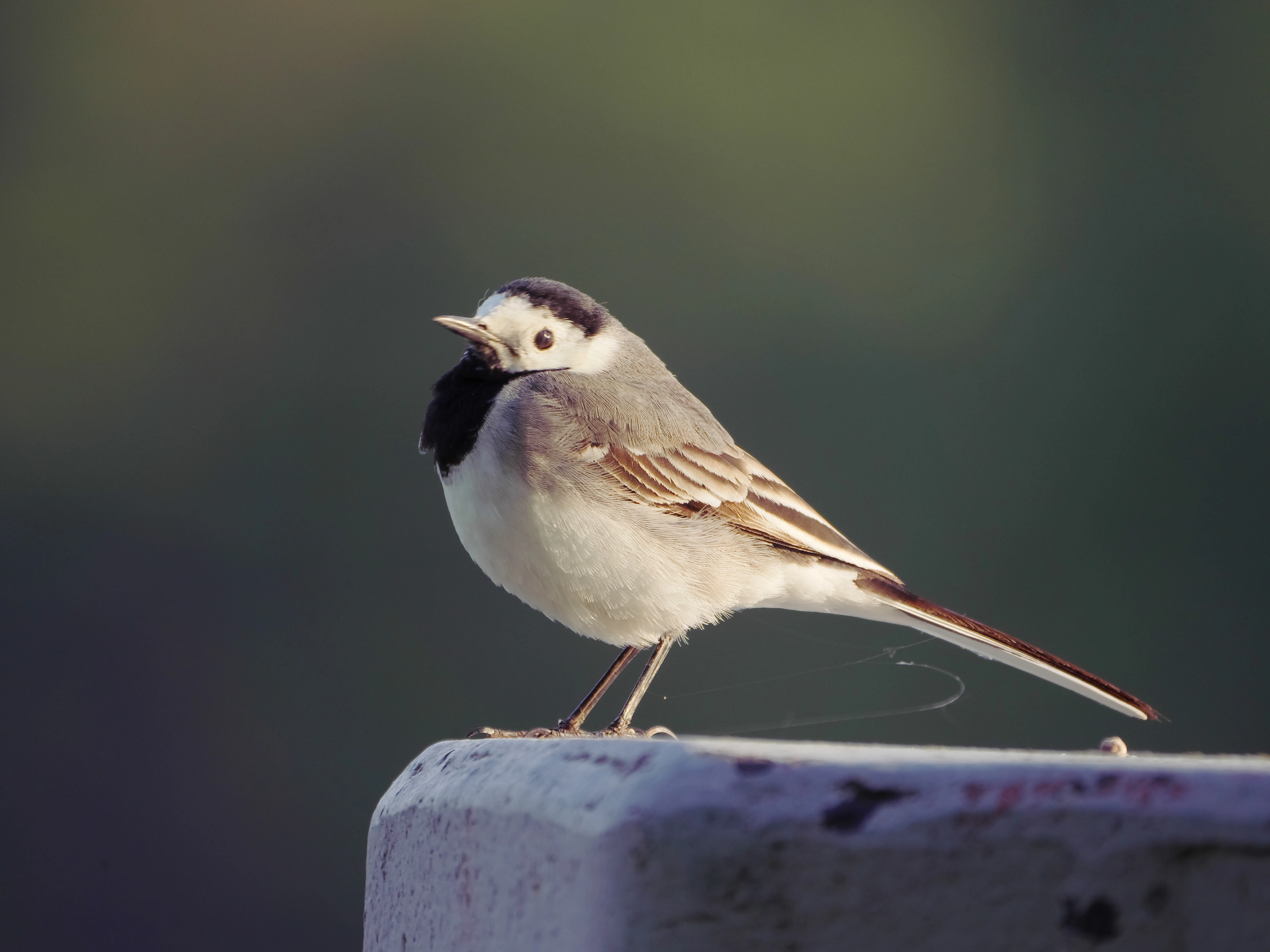
A side-profile shot of a small white wagtail bird with black, white, and grey plumage perched on a grey post against a blurred dark green background.
A white wagtail perched at the Krughorn site within the Westlicher Düppeler Forst bird sanctuary.

EU-Vogelschutzgebiet Westlicher Düppeler Forst history and protected-area timeline

The conservation history of the Westlicher Düppeler Forst spans more than half a century and reflects both local and European-level efforts to protect a distinctive corner of southwestern Berlin. In 1961, the West Berlin Senate declared the area a landscape protection area (Landschaftsschutzgebiet), giving it its first formal status as territory warranting conservation attention at a time when much of West Berlin's southwestern lakeshore was under development pressure.

In June 2003, the Berlin Senate Administration for Urban Development formally designated the area as a Special Protection Area (SPA) under the European Union's Birds Directive, building on the parallel obligations of the EU Habitats Directive from 1992. This designation integrated the site into the Natura 2000 network under the site code DE3544306, while it is catalogued internationally with the World Database on Protected Areas ID 555537446.

Administrative responsibility for management lies with Berlin's highest nature protection authority, with oversight by the Federal Agency for Nature Conservation (Bundesamt für Naturschutz). Environmental organisations such as the Bund für Umwelt und Naturschutz Deutschland and the Berlin Senate Administration have publicly criticised the chronic underfunding of the site's management, highlighting how implementation has struggled to keep pace with the ecological demands of the area's protected habitats.

EU-Vogelschutzgebiet Westlicher Düppeler Forst landscape and geographic character

The protected area sits at the intersection of forested uplands and a mosaic of lakes, channels, and embayments of the Havel river system near the southwestern edge of Berlin. The eastern and central portions of the site are dominated by the near-natural woodland of the western Düppeler Forst, characterised by old-growth tree stands and abundant deadwood that contribute to a structurally varied canopy.

Lakeshore environments form a defining visual and ecological element of the area. To the east lies the Großer Wannsee, to the south the Griebnitzsee (used by the Teltowkanal), and to the west the Jungfernsee, each contributing long stretches of riparian and aquatic habitat. Inland water bodies such as the Moorlake and small shoreline irregularities around the Krughorn peninsula add finer-scale variation, while lowland moors in the forest belt introduce wetland features uncommon in the urban context.

Within the surrounding cultural landscape, the Pfaueninsel rises as a low island in the Havel, and the Böttcherberg within Park Klein-Glienicke introduces structured designed terrain. The Schäferberg, the fourth-highest natural elevation in Berlin, adds modest but significant relief and forms a recognisable landmark visible from much of the area, even with its telecommunications tower altering the modern silhouette.
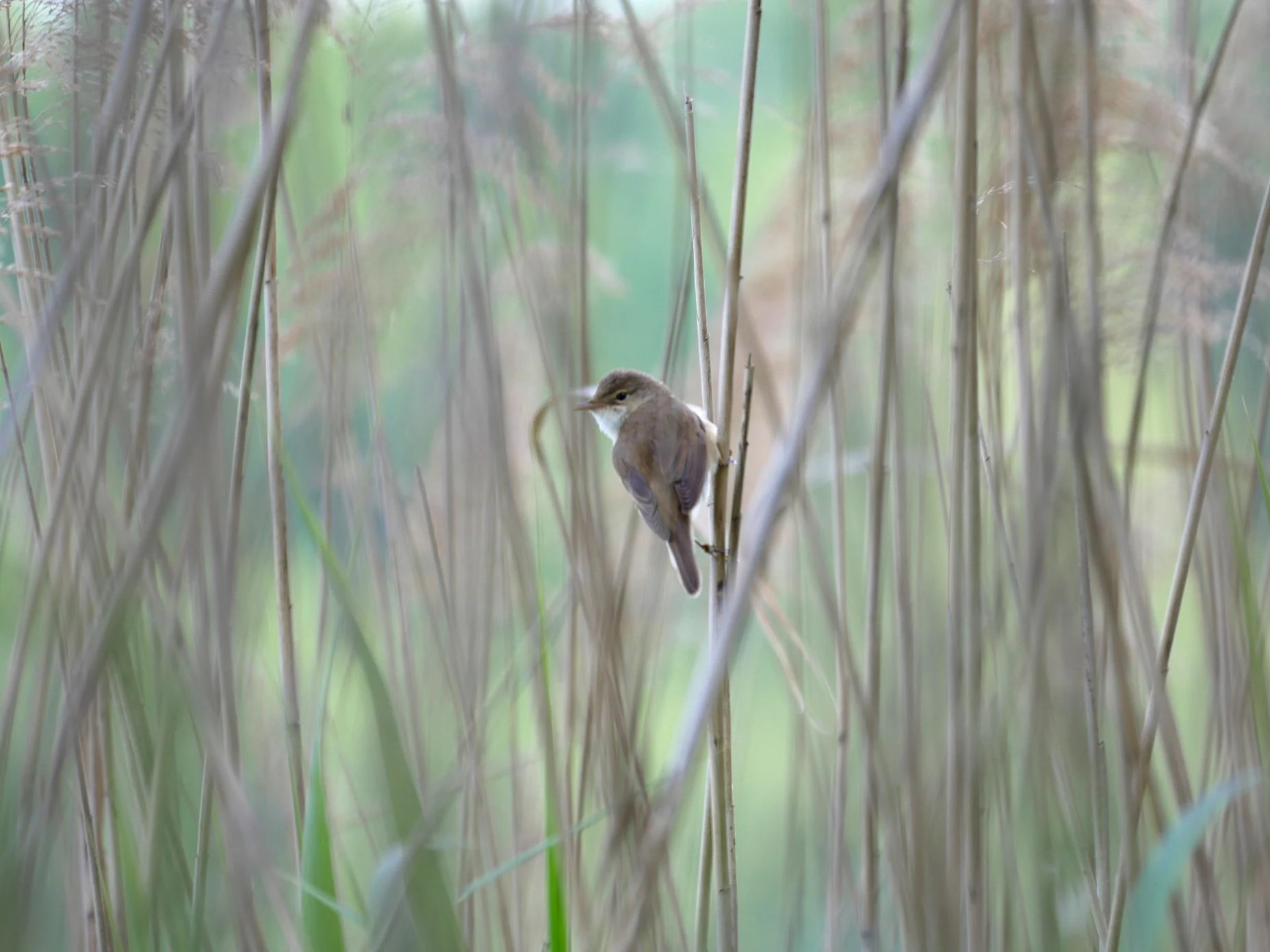
A small brownish bird, identified as a Eurasian reed warbler, perched on a thin vertical reed stalk surrounded by tall, out of focus marsh vegetation.
A Eurasian reed warbler perched on a reed stem in the Westlicher Düppeler Forst bird sanctuary.

EU-Vogelschutzgebiet Westlicher Düppeler Forst ecosystems, habitats, and plant life

Ecologically, the Westlicher Düppeler Forst is defined by the interplay of ancient woodland, shoreline, wetland, and successional habitats in close proximity. Old trees and substantial volumes of standing and fallen deadwood create vertical and horizontal structure in the forest, providing nesting cavities, foraging substrate, and perches essential to woodpeckers, cavity-nesting songbirds, and a wide array of invertebrates.

Lowland moors and small wetland pockets such as those near the Moorlake bring a distinct ecological character to an otherwise forested landscape. Their waterlogged conditions and specialised vegetation contrast with the dryness of elevated forest patches and offer different food bases for bird species throughout the year. The varied banks of the Havel and its connected lakes, shaped by reed belts, overhanging trees, and shallow water zones, then extend these wetland conditions along the entire perimeter of much of the site.

Successional areas on former use sites add a dynamic, open-land habitat layer. These younger, more open stretches often support different breeding and feeding bird communities than the closed-canopy forest, increasing overall biodiversity within the protected area.
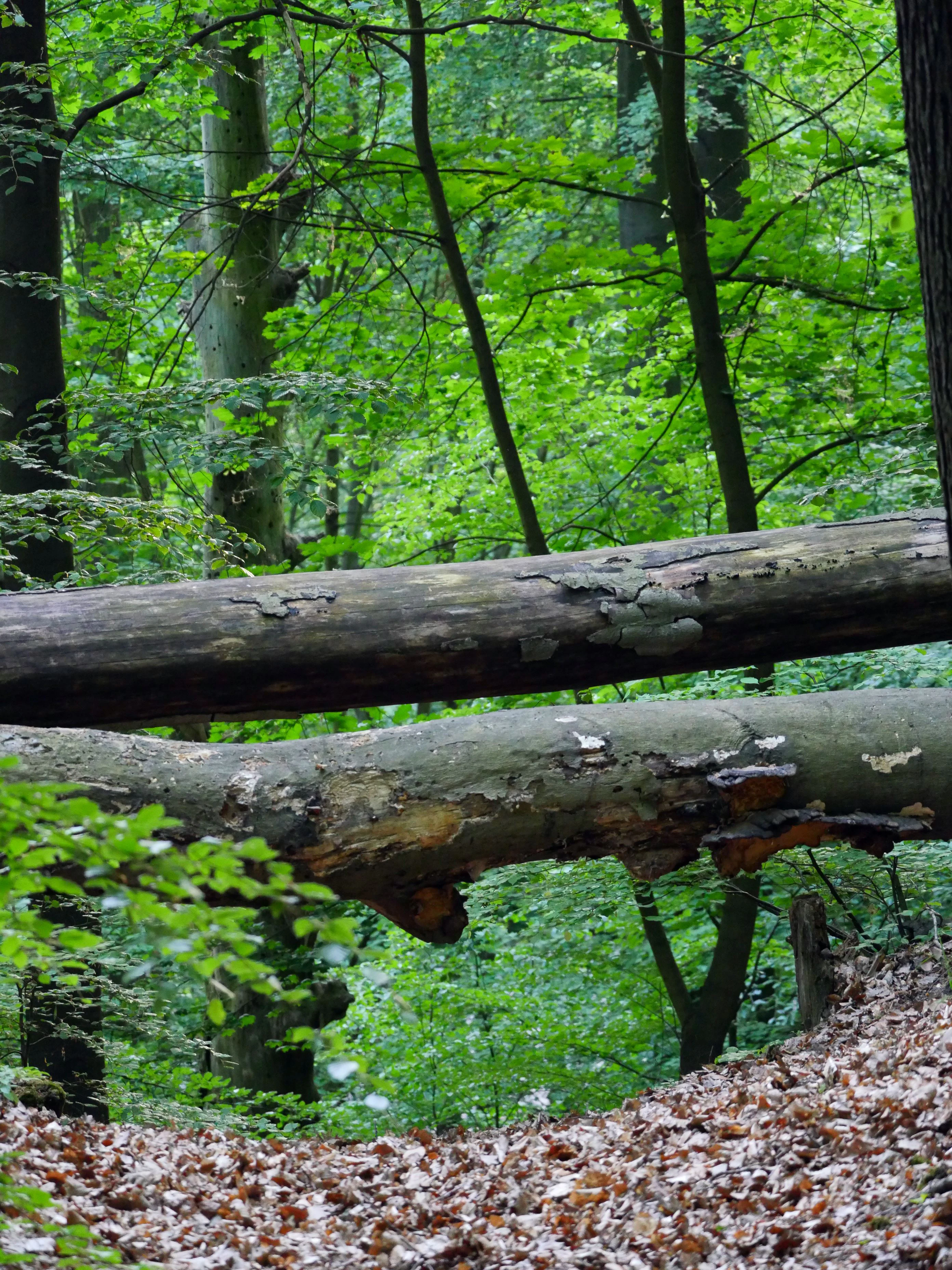
Two large fallen tree trunks lying horizontally across a dense forest floor covered in fallen brown leaves.
Deadwood resting within the lush forest environment of the Westlicher Düppeler Forst area.

EU-Vogelschutzgebiet Westlicher Düppeler Forst wildlife and species highlights

The site's primary wildlife significance is its bird community, which is the explicit focus of its SPA designation. It supports breeding populations of several specially protected or threatened species beyond the typical urban Berlin avifauna, including the kingfisher, woodlark, middle spotted woodpecker, red-backed shrike, red kite, black kite, black woodpecker, white-tailed eagle, barred warbler, honey buzzard, and red-breasted flycatcher.

Among these, the middle spotted woodpecker stands out. With multiple dozen recorded territories as of 2006, the area forms a documented regional stronghold for the species within the Berlin-Brandenburg region, making the SPA an important focal point for the conservation of a habitat specialist of broadleaf woodland.

A further set of Berlin Red List breeding birds is documented within the site, including the great spotted woodpecker, tree sparrow, garden warbler, melodious warbler, stock dove, and golden oriole. Additional strictly protected species such as the green woodpecker, lesser spotted woodpecker, and common buzzard also breed in the area. The site's role as a migratory passage area is illustrated by recurring records of the great reed warbler, while common everyday species such as the blackbird, white wagtail, chaffinch, grey heron, great cormorant, common starling, and Eurasian reed warbler are also regularly observed in the protected area.
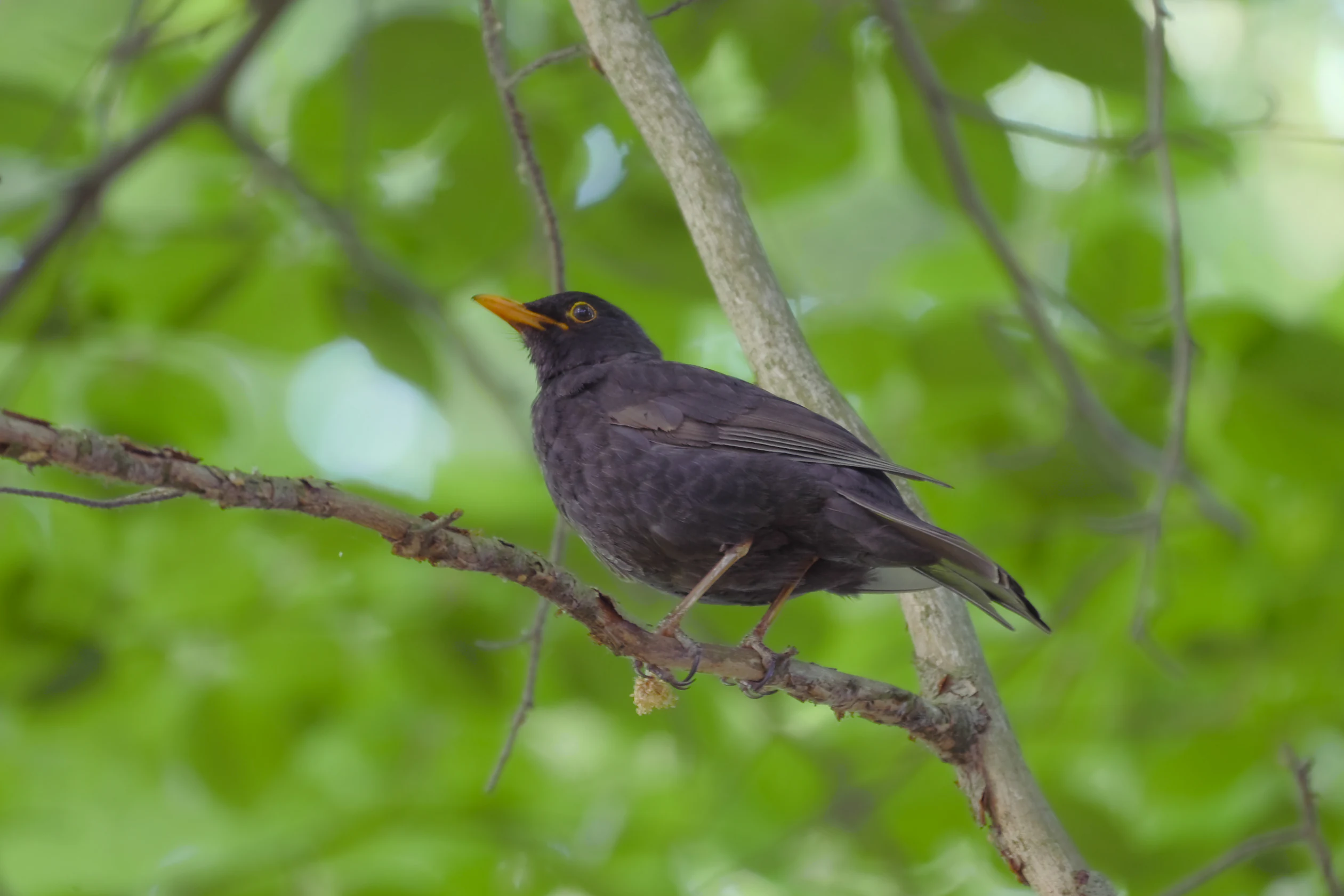
A blackbird with dark feathers and an orange-yellow beak perched on a thin tree branch, surrounded by blurred green leaves.
A common blackbird perched on a branch within the lush forest canopy.

EU-Vogelschutzgebiet Westlicher Düppeler Forst conservation status and protection priorities

Conservation significance at the Westlicher Düppeler Forst operates on multiple nested levels. Nationally, it has held landscape protection area status since 1961 and remains under the management of Berlin's highest nature protection authority. At the European level, its 2003 designation under the Birds Directive and integration into the Natura 2000 network bind it to one of the world's largest coordinated networks of protected areas, anchored to site code DE3544306.

The combination of old-growth broadleaf and mixed forest with significant deadwood, shoreline ecosystems along several Havel-connected lakes, lowland moors, and successional habitats gives the protected area disproportionate ecological value relative to its modest size. It is particularly valuable for species that depend on old trees and deadwood, including multiple woodpecker species and cavity-nesting songbirds, and for water-associated and wetland species in the lake fringe.

Conservation implementation has, however, faced resource challenges. The Bund für Umwelt und Naturschutz Deutschland and the Berlin Senate Administration for Urban Development and the Environment have publicly criticised the chronic underfunding of the site's management, suggesting that long-term ecological monitoring, habitat care, and visitor infrastructure have struggled to match the requirements of its multiple overlapping designations.

EU-Vogelschutzgebiet Westlicher Düppeler Forst cultural meaning and human context

The Westlicher Düppeler Forst is embedded in a richly layered cultural landscape. The Pfaueninsel, with its romantic Schloss Pfaueninsel, was developed as a royal retreat in the late 18th and early 19th centuries and remains a national cultural landmark, despite its ecologically sensitive status. Park Klein-Glienicke, designed as an English landscape garden and including the Böttcherberg and the adjoining Schloss Glienicke, represents the broader 19th-century Prussian landscape of palaces and gardens that extends into nearby Potsdam.

Within the protected area itself, the colony of Nikolskoe and its Orthodox church of St. Peter und Paul reflect 19th-century Russian cultural settlement patterns connected to Prussian royal ties. The nearby Glienicke Bridge, famous historically as a Cold War crossing point, anchors the area in 20th-century memory, while the Wannseeweg connecting the bridge area to Heckeshorn connects these cultural references into Berlin's contemporary network of green routes.
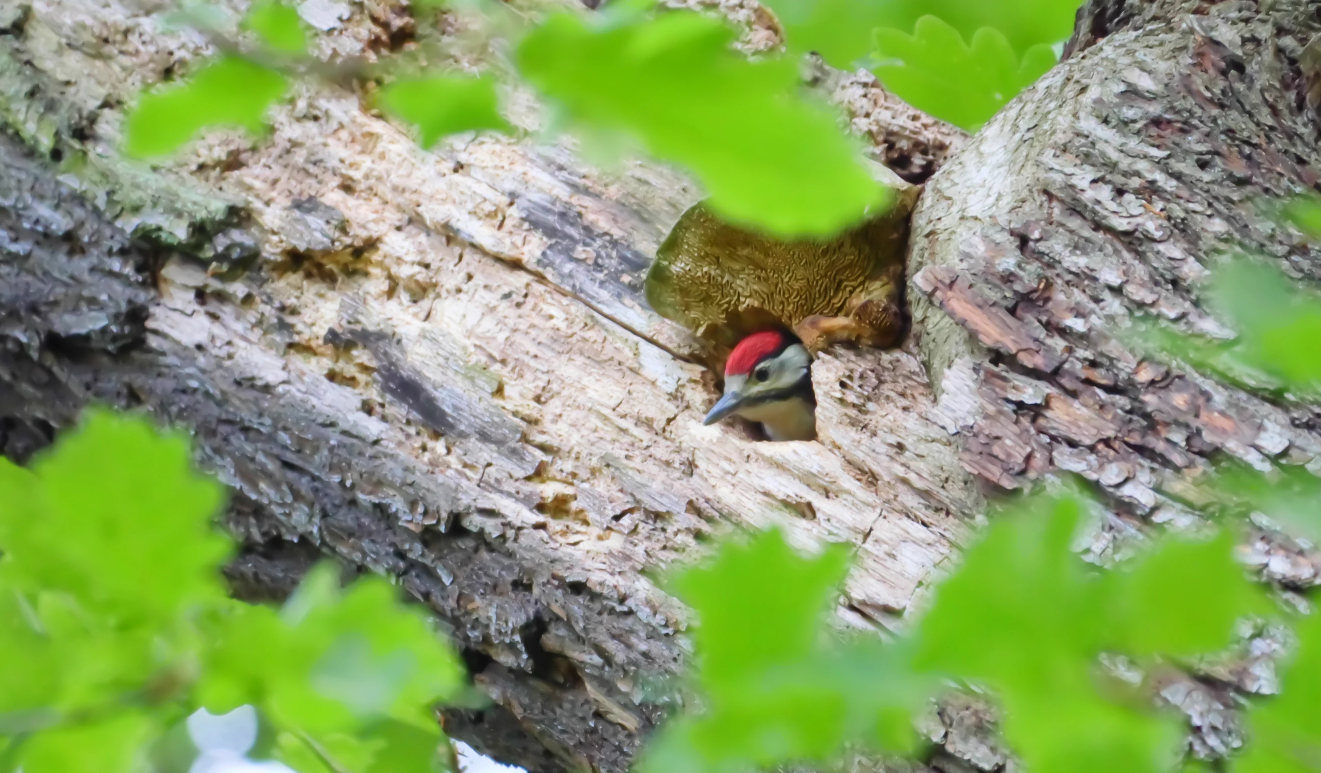
A Great Spotted Woodpecker with a distinctive red patch on its head looks out from a hole in a tree trunk, partially obscured by green leaves.
A Great Spotted Woodpecker peeking from its nest within a tree hollow in the protected forest area.

Top sights and standout views in EU-Vogelschutzgebiet Westlicher Düppeler Forst

The protected area's profile rests on a tight spatial overlap of cultural landscape icons and ecologically rich habitat types. Within a single continuous jurisdiction it brings together a Romantic-era royal island, an English landscape garden, an old-growth forest with abundant deadwood, multiple connected lake bodies of the Havel system, and a Berlin-distinctive hill crowned by a telecommunications tower.

For bird-focused conservation, the area's highlights are the regionally significant population of middle spotted woodpeckers, stable occurrences of white-tailed eagle, red and black kites, honey buzzard, black woodpecker, and red-breasted flycatcher, and a documented array of Berlin Red List species breeding amid the urban-adjacent forest and shore landscape.
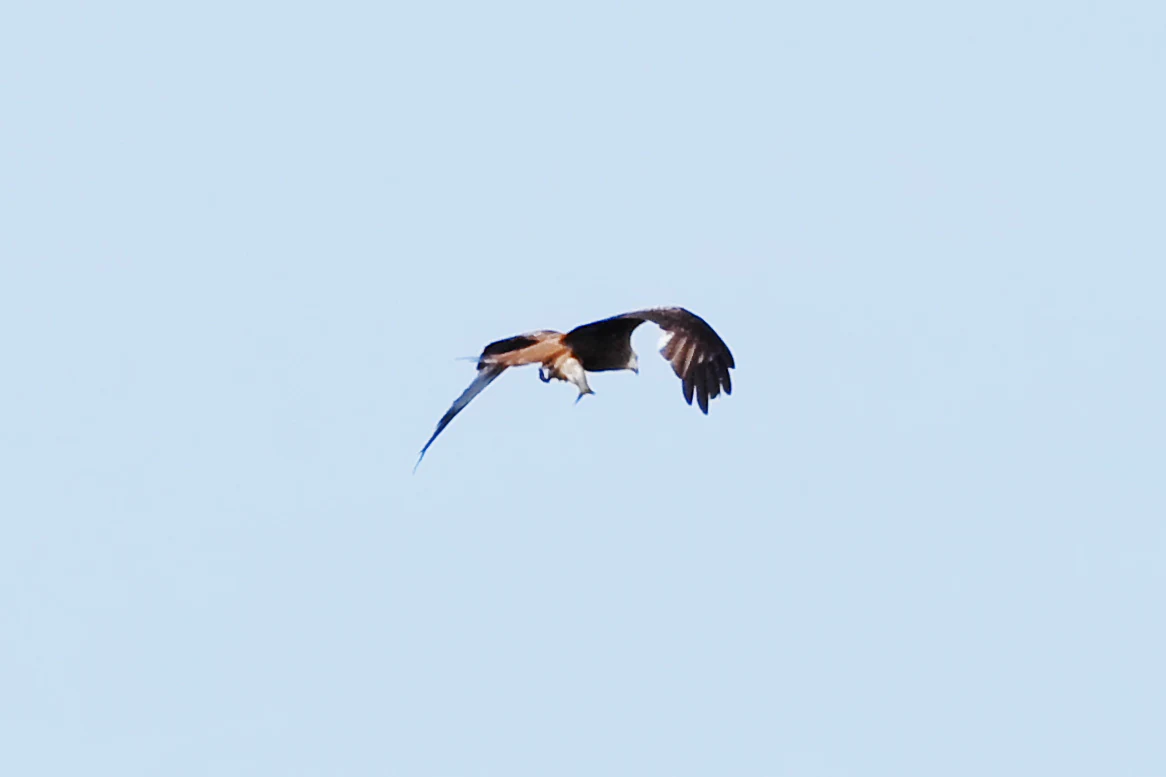
A red kite bird flying against a clear, pale blue sky, carrying a small fish in its talons.
A red kite in flight, carrying a fish in its talons.

Best time to visit EU-Vogelschutzgebiet Westlicher Düppeler Forst

Spring and early summer are the most rewarding periods for experiencing the breeding bird activity for which the area is designated, as territorial song, courtship, and nesting behaviour peak across the woodland, wetland, and lakeshore habitats. Migratory passage is also most visible in these seasons, particularly along the Havel shorelines and at locations such as the Krughorn and the Moorlake.

Autumn brings quieter conditions, with reduced breeding activity but persistent raptor presence and milder temperatures that suit longer walking routes such as the Wannseeweg along the Havel shore. Winter visits offer a more contemplative experience, with bare trees opening up views across the lakes and toward landmarks such as the Schäferberg, though the ecological focus on breeding and migratory seasons means that spring generally offers the richest wildlife experience.

Monthly climate preview

Long term representative coordinate measurements tracing monthly weather patterns and climate rhythms

Annual Temperature and Precipitation Normals for EU-Vogelschutzgebiet Westlicher Düppeler Forst

Representative coordinate data reveals a measured annual temperature range from sub-zero winter minimums to warm summer maximums alongside stable precipitation patterns. Detailed monthly climate normals provide deeper insight into long term temperature averages and precipitation totals across the protected area.
Annual mean9 °C
-1 °C20 °C
Jan-1°
Feb
Mar
Apr
May14°
Jun18°
Jul20°
Aug20°
Sep15°
Oct
Nov
Dec
Warmest month
July

20.3 °C

Coolest month
January

-0.7 °C

Wettest month
July

2.4 mm/day

Driest month
April

1 mm/day

Park location guide

Geography guide, regional context, and park location map for EU-Vogelschutzgebiet Westlicher Düppeler Forst

EU-Vogelschutzgebiet Westlicher Düppeler Forst park geography, regions, and map view in Germany

Understand where EU-Vogelschutzgebiet Westlicher Düppeler Forst sits in Germany through a broader geographic reading of the surrounding landscape, nearby location context, and its mapped position within the national park landscape.

How EU-Vogelschutzgebiet Westlicher Düppeler Forst fits into Germany

Germany is a federal republic in Western and Central Europe with a population of over 83 million across sixteen constituent states. It is Europe's largest economy by nominal GDP and a major global exporter and importer. The capital is Berlin, and the country borders Denmark, Poland, Czech Republic, Austria, Switzerland, France, Luxembourg, Belgium, and the Netherlands.

Wider geography shaping EU-Vogelschutzgebiet Westlicher Düppeler Forst in Germany

Germany is located in Western and Central Europe, spanning 357,022 km². It borders Denmark to the north, Poland and the Czech Republic to the east, Austria and Switzerland to the south, and France, Luxembourg, Belgium, and the Netherlands to the west. The country has coastlines on the Baltic Sea and North Sea to the north, with the Alps located in the southern region.

Map view of EU-Vogelschutzgebiet Westlicher Düppeler Forst

Use this park location map to pinpoint EU-Vogelschutzgebiet Westlicher Düppeler Forst in Germany, understand its exact geographic position, and read its mapped placement within the surrounding landscape more clearly.

Pigeon | © OpenStreetMap contributors

Location context for EU-Vogelschutzgebiet Westlicher Düppeler Forst

Berlin

Visual exploration of habitats, Havel shorelines, and protected forest terrain

EU-Vogelschutzgebiet Westlicher Düppeler Forst Photos and Landscapes

Visual records capture the old-growth woodlands, lowland moors, and connected lake systems defining EU-Vogelschutzgebiet Westlicher Düppeler Forst. Photographic documentation reveals the complex interplay between avian habitats and cultural landscape features across the protected area.

A side-profile shot of a small white wagtail bird with black, white, and grey plumage perched on a grey post against a blurred dark green background.

A grey heron flying with wings fully extended against a clear blue sky.

A small brownish bird, identified as a Eurasian reed warbler, perched on a thin vertical reed stalk surrounded by tall, out of focus marsh vegetation.

Two large fallen tree trunks lying horizontally across a dense forest floor covered in fallen brown leaves.

A blackbird with dark feathers and an orange-yellow beak perched on a thin tree branch, surrounded by blurred green leaves.

A small black bird, likely a starling, perched on a dark tree branch surrounded by out-of-focus green leaves.

A Great Spotted Woodpecker with a distinctive red patch on its head looks out from a hole in a tree trunk, partially obscured by green leaves.

A red kite bird flying against a clear, pale blue sky, carrying a small fish in its talons.

A large fallen tree trunk lying on the forest floor, featuring several shelf-like mushrooms growing on its bark and moss patches.

Four cormorants flying in a loose formation against a clear pale blue sky.

A view of dense green and dark foliage in a forest setting during the morning.

A small bird, likely a chaffinch, partially obscured by bright green leaves on a tree branch.

Park atlas

Compare surrounding regional park geography and connected conservation landscapes.

Parks Near EU-Vogelschutzgebiet Westlicher Düppeler Forst and Related Protected Areas

Browse other parks near EU-Vogelschutzgebiet Westlicher Düppeler Forst to examine adjacent forested uplands and connected lakeshore habitats. Continued exploration reveals how surrounding regional protected areas share similar ecological characteristics and riverine terrain.
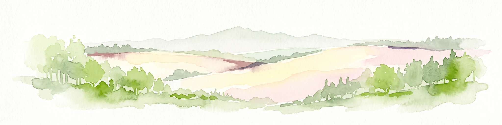
Watercolor painting of a green wetland area with soft, blurred rolling hills in the background.
Nature reserveBerlin
About 2.1 km away#1 closest

Southeast

Großes Fenn Nature Reserve: Protected Peatland and Kettle Bog Geography in Berlin

A study of post-glacial landforms and mire environments.

Großes Fenn represents a rare urban kettle bog formed during the last glacial period, now protected within the Berlin region. This reserve showcases the historical peat-forming processes and the fragile ecological balance of small depressions in the Düppeler Forest, offering a compact site for understanding glacial landscape legacies.

Area
0.064 km²
Established
1986
IUCN
IV
A soft watercolor painting showing rolling green hills, patches of open land, and trees against a pale sky background.
Nature reserveHavelland
About 6.6 km away#2 closest

Northwest

Döberitzer Heide Nature Reserve: Geographic Atlas and Protected Landscape Mapping

Glacial sand flats and heathlands in the Havelland region

Döberitzer Heide occupies a unique position on the southeastern Nauener Platte, providing a study of dry heath, grassland, and wetland habitats. Once a restricted military training ground, the area now functions as a vital protected landscape where European bison and wild horses maintain open terrains. This atlas entry focuses on the regional geography and the structural components of this nature reserve situated near the urban centers of Berlin and Potsdam.

Area
34.15 km²
Established
1997
Relief
Upland
Climate
Temperate
Nature reserveBerlin
About 8.4 km away#3 closest

Northeast

Windmühlenberg Nature Reserve: Glacial Terrain and Steppe Flora in Berlin

Protected sand-dry grasslands on the Nauen Plateau edge

Windmühlenberg preserves a rare ecological landscape in western Berlin. This glacial hill and nature reserve functions as a protected habitat for steppe-relict flora and specialized insects, serving as a critical point of interest for understanding the geomorphology and sand-based grassland environments of the Havel river valley.

Area
0.051 km²
Established
2002
Relief
Upland
Climate
Temperate
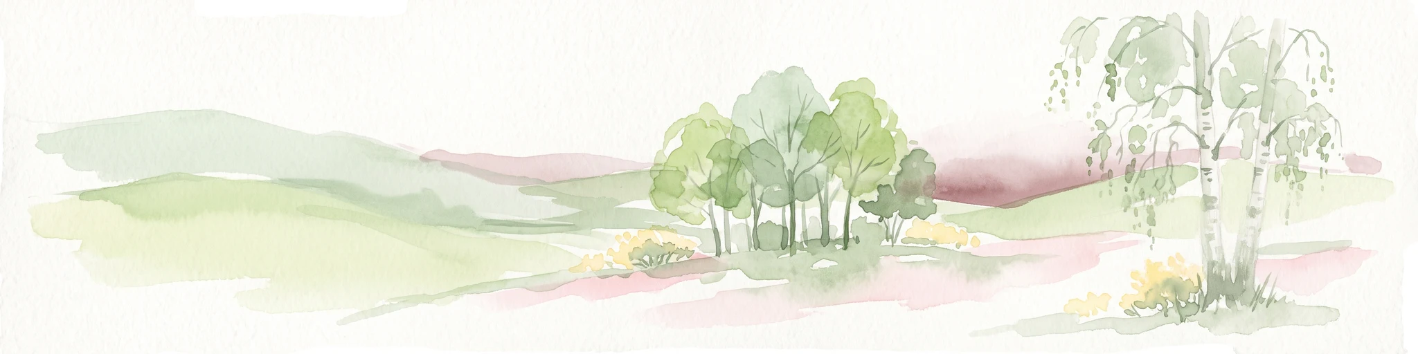
A soft watercolor illustration of a rolling green landscape with a small cluster of trees and birch trees in the foreground, against a pale background.
Nature reserveBrandenburg
About 8.8 km away#4 closest

Northwest

Ferbitzer Bruch Nature Reserve: Exploring Brandenburg Protected Landscape Boundaries

A lowland mosaic of sandy habitat in the Havelland region

Ferbitzer Bruch provides a focused look at the sandy lowland ecosystems characteristic of western Brandenburg. This nature reserve, anchored between the Havel Canal and the Döberitzer Heide, preserves a distinct mosaic of open heath, scrub, and woodland habitats that define this segment of the German landscape.

Area
11.564 km²
Established
1996
IUCN
IV
Nature reserveBerlin
About 9 km away#5 closest

Northeast

Riemeisterfenn Nature Reserve and Protected Peatland Landscape in Berlin

A rare bog ecosystem within the city glacial lake chain

Riemeisterfenn is a distinct nature reserve in Berlin, characterized by its marshy lowlands, reed beds, and alder carr vegetation. This site offers an essential look at a preserved peatland habitat and the Fennkanal hydrology that connects these protected areas to the wider Grunewald forest ecosystem.

Area
0.072 km²
Established
1987
Relief
Lowland
Climate
Temperate
A horizontal watercolor painting showing a wetland landscape with calm water, marshy vegetation, and a background of soft rolling hills and mixed forest trees.
Nature reserveBerlin
About 9.8 km away#6 closest

Northeast

Langes Luch / Dachsheide: Nature Reserve and Glacial Wetland Geography in Berlin

Protected mosaic of bog, forest, and inland dune habitats

Langes Luch / Dachsheide encompasses a rare urban protected area in Berlin, defined by the interplay between low-lying swampy depressions and elevated sandy heath. The site features complex glacial meltwater channels, open transitional mires, and historical terrain modifications, forming an essential study area for local conservation and regional landscape ecology.

Area
0.324 km²
Established
1960
IUCN
IV
Relief
Lowland
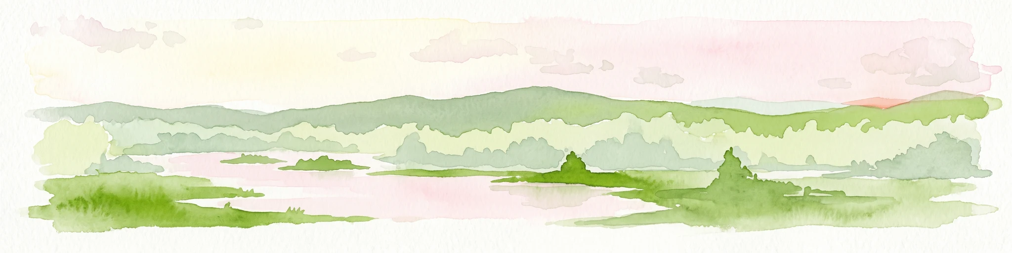
Watercolor illustration of a serene wetland scene with soft green hills and a light pink sky.
Nature reserveBerlin
About 11 km away#7 closest

Northeast

Sandgrube im Jagen 86 Nature Reserve: Mapped Geography and Protected Area Context

A unique habitat mosaic within the Berlin forest region

Sandgrube im Jagen 86 functions as a protected nature reserve in Berlin, characterized by a bowl-shaped terrain of glacial sands. The area provides a critical habitat for specialized wildlife by balancing nutrient-poor grasslands with open water bodies and sun-exposed slopes, illustrating an effective example of managed conservation within an urban forest.

Area
0.135 km²
Established
1992
IUCN
IV
Relief
Lowland
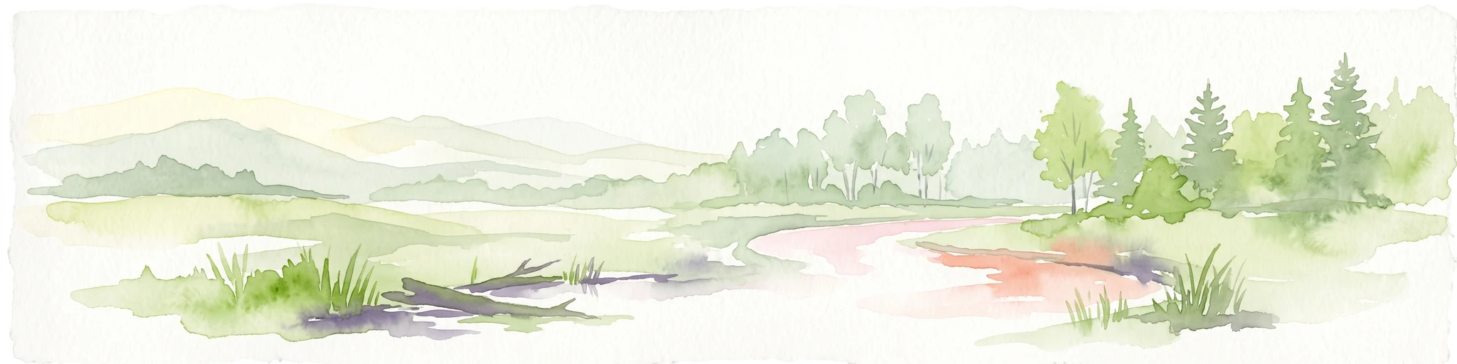
A watercolor painting showing a soft green marshy landscape with low hills in the background and a winding stream in the foreground.
Nature reserveBerlin
About 11 km away#8 closest

Northeast

Hundekehlefenn Nature Reserve: Geography and Protected Wetland Landscapes in Berlin

Glacial meltwater channel and moorland in Grunewald

Hundekehlefenn represents one of the last surviving pieces of original Berlin vegetation, preserved as a nature reserve within the city limits. This compact protected area showcases a glacial meltwater channel geography, featuring marshy depressions, mesotrophic bog remnants, and alder swamp forests. It serves as an essential ecological link within the Grunewaldseenkette lake chain, providing a window into the natural terrain history of the region.

Area
0.1 km²
Established
1987
Relief
Lowland
Climate
Temperate

Common questions about visiting, size, designation, and location context for EU-Vogelschutzgebiet Westlicher Düppeler Forst

EU-Vogelschutzgebiet Westlicher Düppeler Forst FAQs for park facts, access, geography, and protected area context

Find quick answers about EU-Vogelschutzgebiet Westlicher Düppeler Forst, including protected-area facts, park geography, trail and visitor context, and how the park fits into its surrounding country and regional landscape.
MoriAtlas Explorer

Continue Your Protected Areas Search Across the Global Atlas

Deepen your exploration by continuing the structured search for national parks and protected areas worldwide. Utilize the comprehensive filtering capabilities to compare different conservation landscapes and refine your understanding of global park geography. Discover more about the distribution and characteristics of protected natural areas.

Global natural geography