
Mori Atlas logo
Nature reserveFalkenrehder Wublitz

Mapping the ecological connectivity and riparian floodplain terrain of this essential Brandenburg nature reserve.

Falkenrehder Wublitz Nature Reserve: A Protected Wetland Landscape in the Havel Valley of Brandenburg

(Naturschutzgebiet Falkenrehder Wublitz)

Falkenrehder Wublitz represents a vital protected area within the Havel lowland landscape of Brandenburg. This nature reserve conserves a complex mosaic of wetland habitats, including riparian alder forests, reedbeds, and aquatic vegetation along the Wublitz side arm. By securing this stretch of the Havel floodplain, the site functions as a key node in a regional network of protected biotopes that support diverse water-dependent species.

wetlandsriverine landscapelowlandHavel valleynature reservewaterfowl
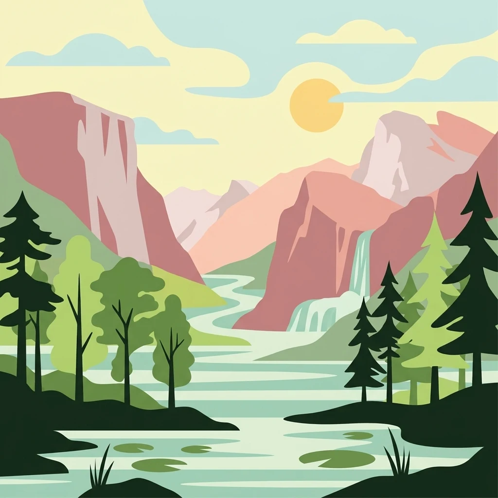
Stylized vector illustration showing a winding river flowing through a mountain valley, featuring pine trees, a waterfall, and a warm sky.

Falkenrehder Wublitz

Nature reserve

Park overview

Structured park overview, official facts, and landscape profile for Falkenrehder Wublitz

Falkenrehder Wublitz park facts, protected area profile, and essential visitor context

Review the core facts for Falkenrehder Wublitz, including designation, size, terrain, visitor scale, habitats, and operating context in one park-focused overview.

About Falkenrehder Wublitz

Falkenrehder Wublitz is a dedicated nature reserve (Naturschutzgebiet) situated in the Havelland district of Brandenburg, in northeastern Germany. The protected area covers roughly 97 hectares of floodplain terrain along the Havel Canal, close to the village of Falkenrehde, part of the municipality of Ketzin/Havel. Its name combines the locality with the Wublitz, the Havel side arm that defines much of the landscape within the reserve.

The reserve belongs to the broader landscape of the Havel lowlands, a low-lying, historically wetland-rich corridor shaped by the slow meandering waters of the Havel River and its branches. Within this setting, the area protected at Falkenrehder Wublitz combines open water, marginal aquatic vegetation, wet meadows, and flooded forest types, producing a habitat mosaic that is typical of the region but increasingly rare as surrounding land has been drained or converted for agriculture and infrastructure.

Conservation planning around the reserve recognises it both as a stand-alone refuge for vulnerable wetland species and as a connecting piece in a larger biotope network of moist habitats across the Havel valley. This dual role reflects the typical logic of Brandenburg's small nature reserves: individually modest in size, but ecologically meaningful when considered as part of an intact network of lowland wetlands. The reserve's designation in the early 2000s placed it within this long-term framework of habitat preservation and landscape water management for the Havel floodplain.

Quick facts and research context for Falkenrehder Wublitz

Falkenrehder Wublitz is a nature reserve (Naturschutzgebiet) in the Havelland district of Brandenburg, Germany, designated on 8 April 2002. It is identified by code 1504 and recorded in the World Database on Protected Areas under WDPA ID 318381. The reserve lies north of the settlement of Uetz-Paaren, straddling both banks of the Havel Canal, close to the Wublitz, a side arm of the Havel River.

The reserve is classified as an IUCN Category IV area, a habitat and species management area, reflecting its role in conserving particular wetland communities. It is part of a wider network of protected sites in the Havel lowlands, sitting adjacent to the larger Ferbitzer Bruch reserve and bordered by the A10 motorway to the east.

Protection and recognition

Documented conservation status and official protected area records for Falkenrehder Wublitz

Falkenrehder Wublitz Protection Status and International Recognition Data

Falkenrehder Wublitz brings together verified protection status records and international database entries within a structured conservation overview. Documented management scope and official designation facts provide clear context for geographic and environmental research.

Protection details

WDPA ID
318381
Park context

Deeper park guide and search-rich context for Falkenrehder Wublitz

Falkenrehder Wublitz history, landscape, wildlife, and travel context

Explore Falkenrehder Wublitz through its history, landscape character, ecosystems, wildlife, conservation priorities, cultural context, and seasonal travel timing in a structured park guide built for atlas discovery and search intent.

Why Falkenrehder Wublitz stands out

Falkenrehder Wublitz is best known for conserving a characteristic slice of the Havel lowland landscape, with particular emphasis on its mosaic of aquatic and wetland habitats. The reserve is recognized for protecting floating leaf communities, reedbeds, wet meadows, and alder swamp forests around the Wublitz side arm of the Havel. It is also valued as a refuge for water-associated wildlife, including breeding and feeding birds, amphibians, and the European otter. Its role as a node within a larger chain of Havel valley wetlands gives it importance beyond its modest size.

A wide view of a calm, dark river bordered by a dense line of green trees and bushes under a cloudy sky.
The Havel Canal passing through the lush vegetation of the Falkenrehder Wublitz nature reserve.

Falkenrehder Wublitz history and protected-area timeline

Falkenrehder Wublitz was formally placed under nature protection by legal ordinance on 8 April 2002, although related sources also reference an establishment date of 5 June 2002. The designation brought a 97-hectare tract of Havel lowland habitat under the status of a Naturschutzgebiet within the Havelland district of Brandenburg.

The reserve was created with the explicit purpose of preserving and developing the area as a representative section of the Havelniederung, or Havel lowlands, and as a habitat for threatened plant and animal species. Its establishment also reflected a wider recognition of the need to maintain a connected chain of wetland biotopes across the region and to support the functioning of the broader landscape water cycle, rather than treating the site as an isolated patch.

Falkenrehder Wublitz landscape and geographic character

The landscape of Falkenrehder Wublitz is shaped by its position within the Havel lowlands, a flat, water-defined terrain typical of the middle Havel valley in Brandenburg. The protected area straddles both sides of the Havel Canal, a regulated waterway that runs through the Havel floodplain, and centres on the Wublitz, a quieter side arm of the main Havel River that gives the reserve much of its character.

Surrounding terrain is dominated by low, level ground historically shaped by flooding and river dynamics. To the east of the reserve runs the A10, the Berlin orbital motorway, while to the west lie the Landesstraßen L 2014 and L 862. Beyond these boundaries the protected area is flanked by the much larger Ferbitzer Bruch nature reserve to the east, illustrating how the smaller reserve acts within a wider patchwork of wetland sites along the Havel.

Falkenrehder Wublitz ecosystems, habitats, and plant life

Ecologically, Falkenrehder Wublitz is a wetland reserve defined by the gradual transitions between open water, marshy margins, wet grassland, and waterlogged forest. Within its compact boundaries it preserves several habitat types that together represent the biodiversity profile of the Havelniederung.

Aquatic and semi-aquatic vegetation is a defining feature of the area. Floating leaf communities (Schwimmblattgesellschaften) cover stretches of the slower-moving waters, while dense reedbeds (Röhrichte) fringe the channels and the Wublitz itself. Beyond the immediate water margins, wet meadows (Feuchtwiesen) and alder swamp forests (Erlenbruchwälder) extend across the flats, reinforcing the wet, lowland character of the reserve.

The site is also ecologically significant as part of the broader Havel floodplain system. It functions as a refuge for wetland-dependent flora and fauna, supports the natural water balance of the surrounding landscape, and contributes to a connected network of moist habitats that allow species to move and persist across the region.

Falkenrehder Wublitz wildlife and species highlights

The wildlife value of Falkenrehder Wublitz comes primarily from the richness of bird, amphibian, reptile, and mammal life associated with its wetland habitats. The reserve serves as a breeding and feeding ground for several notable bird species, including kingfishers, teal, spotted crakes, Eurasian hobbies, quails, and red-backed shrikes.

Reptiles such as sand lizards, amphibians including the red-bellied toad, and a range of butterflies (Tagfalter) use the area for feeding and reproduction. The reserve is also an important retreat for water-bound mammals, most notably the Eurasian otter, which depends on quiet, fish-rich waters like the Wublitz and on connected wetland corridors to survive. Together, these communities reflect the conservation importance of even small Havel valley wetlands for maintaining regional biodiversity.

Falkenrehder Wublitz conservation status and protection priorities

Falkenrehder Wublitz is classified as an IUCN Category IV area, recognising it as a habitat and species management area where active conservation of particular habitats and species is the primary goal. The reserve is registered in the World Database on Protected Areas under WDPA ID 318381 and identified in the German federal-state system with site code 1504.

Its conservation significance lies in preserving a representative sample of the Havelniederung, providing refuge for threatened wetland plants and animals, and supporting the regional landscape water balance. By linking with neighbouring reserves such as Ferbitzer Bruch and other wetland sites along the Havel, it also contributes to the ecological coherence of a larger biotope network of moist habitats that helps maintain biodiversity across the Havel valley.

Top sights and standout views in Falkenrehder Wublitz

Falkenrehder Wublitz stands out for its compact but ecologically rich representation of Brandenburg's Havel lowland wetlands. Its combination of floating leaf vegetation, reedbeds, wet meadows, and alder swamp forest gives it habitat diversity unusual for a reserve of its size.

The reserve is also notable for its role within a network of protected wetland sites along the Havel, linking it to larger areas such as Ferbitzer Bruch and contributing to regional conservation efforts for water-dependent species including otters, kingfishers, and amphibians. Its position next to the Havel Canal and within easy horizon view of the A10 motorway underscores the broader story of how small wetland reserves persist within a heavily managed lowland landscape.

Monthly climate preview

Long term monthly temperature averages and precipitation measurements for Brandenburg

Falkenrehder Wublitz Climate Normals and Annual Temperature Rhythm

Falkenrehder Wublitz records long term monthly temperature values ranging from sub-zero winter minimums to warm summer maximums alongside consistent daily precipitation. Examining the complete twelve month profile provides detailed numerical context for regional temperature and precipitation patterns.
Annual mean9 °C
-1 °C20 °C
Jan-1°
Feb
Mar
Apr
May14°
Jun18°
Jul20°
Aug20°
Sep15°
Oct
Nov
Dec
Warmest month
July

20.3 °C

Coolest month
January

-0.7 °C

Wettest month
July

2.4 mm/day

Driest month
April

1 mm/day

Park location guide

Geography guide, regional context, and park location map for Falkenrehder Wublitz

Falkenrehder Wublitz park geography, regions, and map view in Germany

Understand where Falkenrehder Wublitz sits in Germany through a broader geographic reading of the surrounding landscape, nearby location context, and its mapped position within the national park landscape.

How Falkenrehder Wublitz fits into Germany

Germany is a federal republic in Western and Central Europe with a population of over 83 million across sixteen constituent states. It is Europe's largest economy by nominal GDP and a major global exporter and importer. The capital is Berlin, and the country borders Denmark, Poland, Czech Republic, Austria, Switzerland, France, Luxembourg, Belgium, and the Netherlands.

Wider geography shaping Falkenrehder Wublitz in Germany

Germany is located in Western and Central Europe, spanning 357,022 km². It borders Denmark to the north, Poland and the Czech Republic to the east, Austria and Switzerland to the south, and France, Luxembourg, Belgium, and the Netherlands to the west. The country has coastlines on the Baltic Sea and North Sea to the north, with the Alps located in the southern region.

Map view of Falkenrehder Wublitz

Use this park location map to pinpoint Falkenrehder Wublitz in Germany, understand its exact geographic position, and read its mapped placement within the surrounding landscape more clearly.

Pigeon | © OpenStreetMap contributors

Location context for Falkenrehder Wublitz

BrandenburgLandkreis Havelland

Explore protected area photography, wetland terrain, and riparian scenery across the reserve.

Falkenrehder Wublitz Landscapes and Scenery: Visualizing Havel Lowland Habitats

Visual documentation captures the unique wetland habitats, aquatic vegetation, and floodplain terrain defining Falkenrehder Wublitz. Examining protected area photography reveals the ecological character of its protected waters and surrounding riparian environments.

A wide view of a calm, dark river bordered by a dense line of green trees and bushes under a cloudy sky.

Park atlas

Compare adjacent lowland landscapes and linked protected habitats

Parks near Falkenrehder Wublitz and Connected Regional Wetland Reserves

Visitors exploring Falkenrehder Wublitz can browse neighbouring lowland nature reserves and connected wetland biotopes across the surrounding region. Extending the geographic review provides deeper context on regional floodplain preservation and aquatic habitat networks.
A soft watercolor painting showing rolling green hills, patches of open land, and trees against a pale sky background.
Nature reserveHavelland
About 2.6 km away#1 closest

East

Döberitzer Heide Nature Reserve: Geographic Atlas and Protected Landscape Mapping

Glacial sand flats and heathlands in the Havelland region

Döberitzer Heide occupies a unique position on the southeastern Nauener Platte, providing a study of dry heath, grassland, and wetland habitats. Once a restricted military training ground, the area now functions as a vital protected landscape where European bison and wild horses maintain open terrains. This atlas entry focuses on the regional geography and the structural components of this nature reserve situated near the urban centers of Berlin and Potsdam.

Area
34.15 km²
Established
1997
Relief
Upland
Climate
Temperate
A soft watercolor illustration of a rolling green landscape with a small cluster of trees and birch trees in the foreground, against a pale background.
Nature reserveBrandenburg
About 2.8 km away#2 closest

East

Ferbitzer Bruch Nature Reserve: Exploring Brandenburg Protected Landscape Boundaries

A lowland mosaic of sandy habitat in the Havelland region

Ferbitzer Bruch provides a focused look at the sandy lowland ecosystems characteristic of western Brandenburg. This nature reserve, anchored between the Havel Canal and the Döberitzer Heide, preserves a distinct mosaic of open heath, scrub, and woodland habitats that define this segment of the German landscape.

Area
11.564 km²
Established
1996
IUCN
IV
Nature reserveBrandenburg
About 11 km away#3 closest

Southwest

Naturschutzgebiet Krielower See: Protected Nature Reserve and Glacial Wetland Geography

Located in Brandenburg, this reserve protects a complex, silted-up lake basin and wetland network.

Naturschutzgebiet Krielower See protects a distinct glacial landscape near the Havel river. This 155-hectare nature reserve preserves a network of alder carr, reed beds, and wet meadows, providing an essential refuge for diverse species within the broader Havelland natural region. Explore the mapped topography and conservation context of this integral Brandenburg wetland habitat.

Area
1.55 km²
Established
2004
Relief
Lowland
Climate
Temperate
Watercolor painting of a lush, flat landscape with low green hills in the distance and wetland vegetation in the foreground.
Protected landscapeBrandenburg
About 15 km away#4 closest

Southwest

Landschaftsschutzgebiet Brandenburger Osthavelniederung: Protected Landscape and Regional Geography

Mapped Havel River floodplain and glacial moraine terrain in Brandenburg.

Covering over 9,000 hectares, this protected landscape serves as a prime example of the Brandenburg Havel region. The area integrates a network of canals, dikes, and backwater lakes with isolated moraine ridges, creating a diverse geographic mosaic of river-managed lowlands and forested glacial remnants.

Area
93.81 km²
Established
1998
Relief
Lowland
Climate
Temperate
A horizontal watercolor illustration depicting a calm lake surrounded by soft green forest and distant hazy hills.
Protected areaBerlin
About 16 km away#5 closest

Southeast

EU-Vogelschutzgebiet Westlicher Düppeler Forst: Protected Area and Regional Geography

Ecological sanctuary and Havel lakeshore landscape in Berlin

Located in the Steglitz-Zehlendorf district, this protected area spans nearly 10 square kilometres of diverse woodland and aquatic terrain. The site combines historical cultural landmarks with essential breeding grounds for migratory birds, including significant woodpecker populations and varied riparian corridors throughout the southwestern Berlin borderlands.

Area
9.44 km²
Established
2003
A soft watercolor illustration showing rolling green hills, a small stream winding through the foreground, and distant purple-toned peaks against a white background.
Nature reserveBrandenburg
About 16 km away#6 closest

South

Glindower Alpen: Protected Nature Reserve and Clay Mining Geography in Brandenburg

A striking post-industrial landscape and nature reserve

Glindower Alpen is a 120-hectare nature reserve near Werder, Germany, characterized by an atypical terrain of deep ravines and ridges resulting from historical clay mining. This protected area stands out as an island of mixed deciduous forests and dry grasslands amidst the broader flat geography of the Brandenburg region.

Area
1.19 km²
Established
1995
Relief
Upland
Climate
Temperate
Nature reserveBerlin
About 16 km away#7 closest

East

Windmühlenberg Nature Reserve: Glacial Terrain and Steppe Flora in Berlin

Protected sand-dry grasslands on the Nauen Plateau edge

Windmühlenberg preserves a rare ecological landscape in western Berlin. This glacial hill and nature reserve functions as a protected habitat for steppe-relict flora and specialized insects, serving as a critical point of interest for understanding the geomorphology and sand-based grassland environments of the Havel river valley.

Area
0.051 km²
Established
2002
Relief
Upland
Climate
Temperate
Watercolor painting of a green wetland area with soft, blurred rolling hills in the background.
Nature reserveBerlin
About 18 km away#8 closest

Southeast

Großes Fenn Nature Reserve: Protected Peatland and Kettle Bog Geography in Berlin

A study of post-glacial landforms and mire environments.

Großes Fenn represents a rare urban kettle bog formed during the last glacial period, now protected within the Berlin region. This reserve showcases the historical peat-forming processes and the fragile ecological balance of small depressions in the Düppeler Forest, offering a compact site for understanding glacial landscape legacies.

Area
0.064 km²
Established
1986
IUCN
IV

Common questions about visiting, size, designation, and location context for Falkenrehder Wublitz

Falkenrehder Wublitz FAQs for park facts, access, geography, and protected area context

Find quick answers about Falkenrehder Wublitz, including protected-area facts, park geography, trail and visitor context, and how the park fits into its surrounding country and regional landscape.
MoriAtlas Explorer

Continue Your Protected Areas Search Across the Global Atlas

Deepen your exploration by continuing the structured search for national parks and protected areas worldwide. Utilize the comprehensive filtering capabilities to compare different conservation landscapes and refine your understanding of global park geography. Discover more about the distribution and characteristics of protected natural areas.

Global natural geography