
Mori Atlas logo
Nature reserveFeuchtwiesen bei Lüderbach

Discover the contrasting habitats within this tectonic valley and calcareous grassland system

Feuchtwiesen bei Lüderbach Nature Reserve: Mapped Protected Landscapes and Regional Geography

(Naturschutzgebiet Feuchtwiesen bei Lüderbach)

Feuchtwiesen bei Lüderbach is a significant 40-hectare nature reserve situated within the Netra-Ifta valley of northern Hesse, Germany. This protected area showcases a striking ecological transition from lowland wet meadows and black alder swamp woodlands to the elevated dry calcareous grasslands of the Weinberg hill. As part of the broader Natura 2000 network, the reserve provides essential geographic context for studying tectonic graben formations and local wetland conservation patterns within the Ringgau plateau.

wet meadownature reservecalcareous grasslandalluvial forestbeech forestwetland mosaic
A digital illustration of a sunlit rural landscape featuring rolling green meadows, diverse tree clusters, and a distant forest under a bright sky.

Feuchtwiesen bei Lüderbach

Nature reserve

Park overview

Structured park overview, official facts, and landscape profile for Feuchtwiesen bei Lüderbach

Feuchtwiesen bei Lüderbach park facts, protected area profile, and essential visitor context

Review the core facts for Feuchtwiesen bei Lüderbach, including designation, size, terrain, visitor scale, habitats, and operating context in one park-focused overview.

About Feuchtwiesen bei Lüderbach

Feuchtwiesen bei Lüderbach is a modestly sized but ecologically focused nature reserve in the Ringgau area of the Werra-Meißner-Kreis, in northern Hesse. Its character is defined by the sharp contrast between a damp valley floor and the drier, elevated slopes around it. The valley bottom supports a wetland complex of wet meadows, sedge marsh, reedbeds, ponds, and wet woodland, while the surrounding slopes carry historically grazed calcareous semi-dry grassland and beech forest that has long been shaped by low-intensity human use.

The reserve was created in 1995 specifically to preserve and develop the habitat of rare plant and animal species through extensive grassland management and near-natural forestry. Conservation organizations, in particular the Hessische Gesellschaft für Ornithologie und Naturschutz, played a central role in acquiring and securing key parcels before the official designation, and in reintroducing wetter conditions by halting the routine clearing of drainage ditches.

In 2008 the area was incorporated into the larger FFH site "Wald südöstlich von Netra," connecting this local reserve with surrounding forests, meadows, and calcareous grassland within the European Natura 2000 framework. This broader designation reinforces Feuchtwiesen bei Lüderbach's role as a refuge for habitat types such as priority alluvial forests with black alder and ash, natural eutrophic lakes, submediterranean semi-dry grassland, and woodruff beech forest.

Quick facts and research context for Feuchtwiesen bei Lüderbach

Feuchtwiesen bei Lüderbach is a Hessian nature reserve covering about 40 hectares in the Werra-Meißner-Kreis, between the villages of Rittmannshausen and Lüderbach in the Ringgau municipality. It was designated by the Regierungspräsidium Kassel on 19 June 1995, has the national identifier 1636027, and carries the World Database on Protected Areas code 163082.

The reserve sits in the Netra-Ifta valley, a tectonic graben cutting through the Muschelkalk and Keuper geology of the Ringgau plateau, with elevations ranging from roughly 280 meters near the Kreisstraße 17 in the southeast to 348.6 meters at the summit of the Weinberg. Since 2008 it has been integrated into the 185-hectare Natura 2000 FFH site "Wald südöstlich von Netra," and is classified as an IUCN Category IV Habitat/Species Management Area.

Protection and recognition

Documented terrestrial protection scope, registry identifiers, and international recognition data

Feuchtwiesen bei Lüderbach Protection Status and Designation Records

Feuchtwiesen bei Lüderbach holds a recorded terrestrial protection status backed by official registry documentation and administrative tracking identifiers. Complete designation parameters outline the established management scope and verified international conservation context for the protected area.

Protection details

Protection scope
Terrestrial
Transboundary protection
No
WDPA ID
163082
Park context

Deeper park guide and search-rich context for Feuchtwiesen bei Lüderbach

Feuchtwiesen bei Lüderbach history, landscape, wildlife, and travel context

Explore Feuchtwiesen bei Lüderbach through its history, landscape character, ecosystems, wildlife, conservation priorities, cultural context, and seasonal travel timing in a structured park guide built for atlas discovery and search intent.

Why Feuchtwiesen bei Lüderbach stands out

The reserve is best known for its compact but ecologically rich mosaic of contrasting habitats: species-rich wet meadows, sedge and reed marsh, small eutrophic ponds, priority black alder and ash floodplain woodland in the valley bottom, and submediterranean calcareous semi-dry grassland on the dry woodland slopes of the Weinberg hill. It is also recognized for its connection to the broader Natura 2000 network through the "Wald südöstlich von Netra" FFH site, and for the conservation work carried out by the Hessische Gesellschaft für Ornithologie und Naturschutz, which secured the wetland parcels even before formal protection was granted.
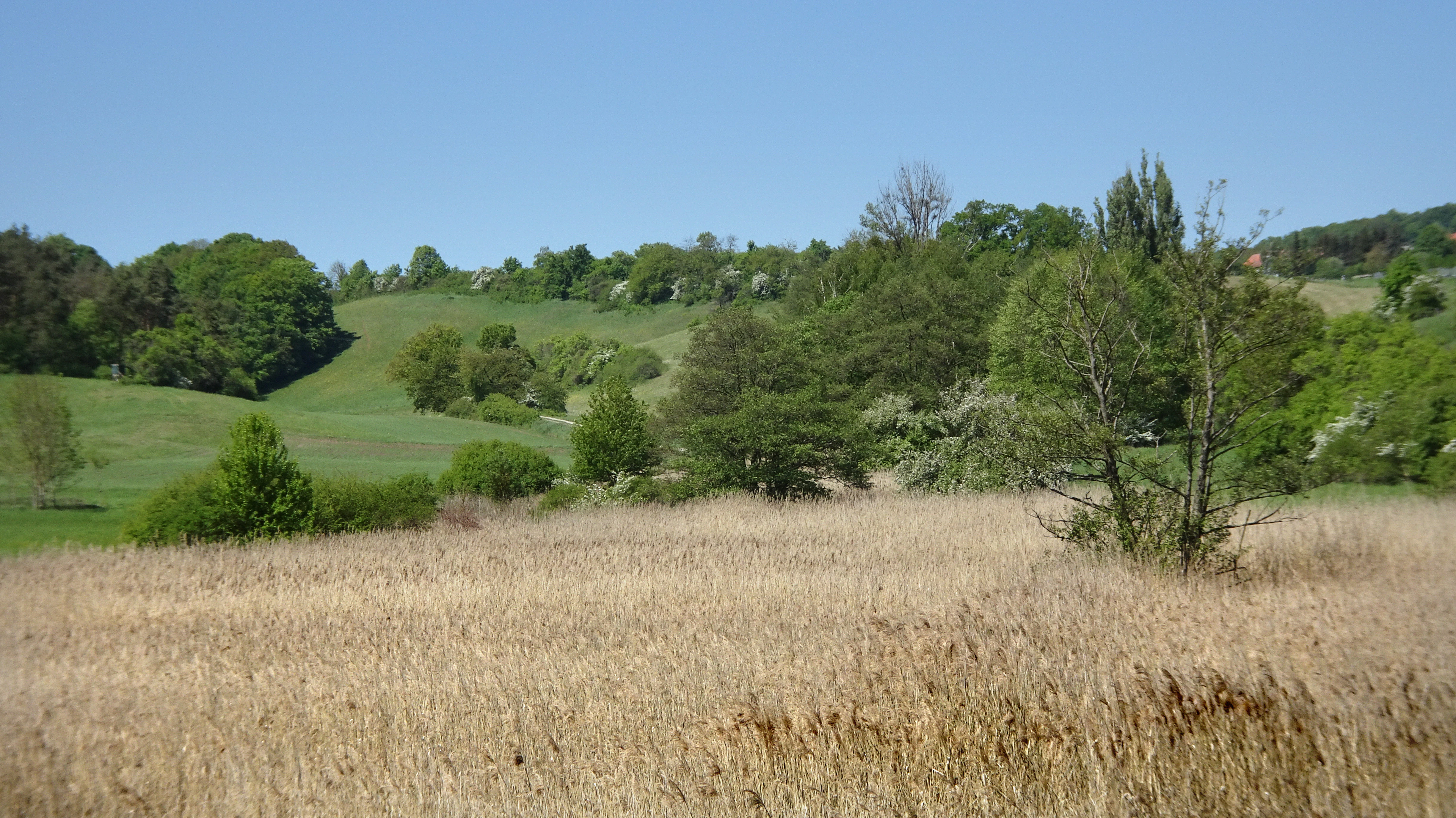
A wide, eye-level landscape view of a light-brown, grassy meadow in the foreground transitioning to green rolling hills and scattered trees under a clear blue sky.
A view of the moist meadows and surrounding forested slopes of the Feuchtwiesen bei Lüderbach nature reserve.

Feuchtwiesen bei Lüderbach history and protected-area timeline

Before its formal protection, the wetland area that would become Feuchtwiesen bei Lüderbach was already a focus of conservation interest. The Hessische Gesellschaft für Ornithologie und Naturschutz (HGON) leased the central sedge and reed parcels in advance, securing them for nature and species protection and ensuring that the drainage ditches were no longer cleared, allowing gradual rewetting of the area.

HGON also initiated the formal designation process, which culminated on 19 June 1995 when the Regierungspräsidium Kassel issued a regulation declaring the reed-fringed wet meadows, the small stream with its pond system, and the surrounding agricultural and forested land a Naturschutzgebiet, or nature reserve. The stated purpose was to preserve and develop the habitat of rare plant and animal species through extensive, near-natural land management.

A second major step came in 2008, when the reserve was integrated into the 185.04-hectare Fauna-Flora-Habitat site "Wald südöstlich von Netra" under number 4926-304, embedding the local protection effort within the larger European Natura 2000 network.

Feuchtwiesen bei Lüderbach landscape and geographic character

The Feuchtwiesen bei Lüderbach reserve lies in the Netra-Ifta valley, a long tectonic graben that cleaves the Ringgau plateau and separates it into a northern and a southern section. Geologically, the area is shaped by the Muschelkalk limestone of the plateau and by Keuper sediments, giving rise to both calcareous soils on the slopes and more moisture-retaining substrates in the valley bottom.

The lowest part of the reserve, at roughly 280 meters, lies in the southeast near the Kreisstraße 17, where water collects in former pond basins and along the small intermittent stream known locally as the Sommerbach. The highest point is the 348.6-meter summit of the Weinberg hill, whose dry slopes host both semi-dry grassland and beech forest. Erosion features on the eastern flank of the Weinberg are part of the visible terrain character of the protected area.

The valley floor and the Weinberg slopes together create a striking landscape contrast within a small area: open wet meadows, reedbeds, ponds, and wet woodland below; sun-exposed dry grasslands and deciduous forest above.
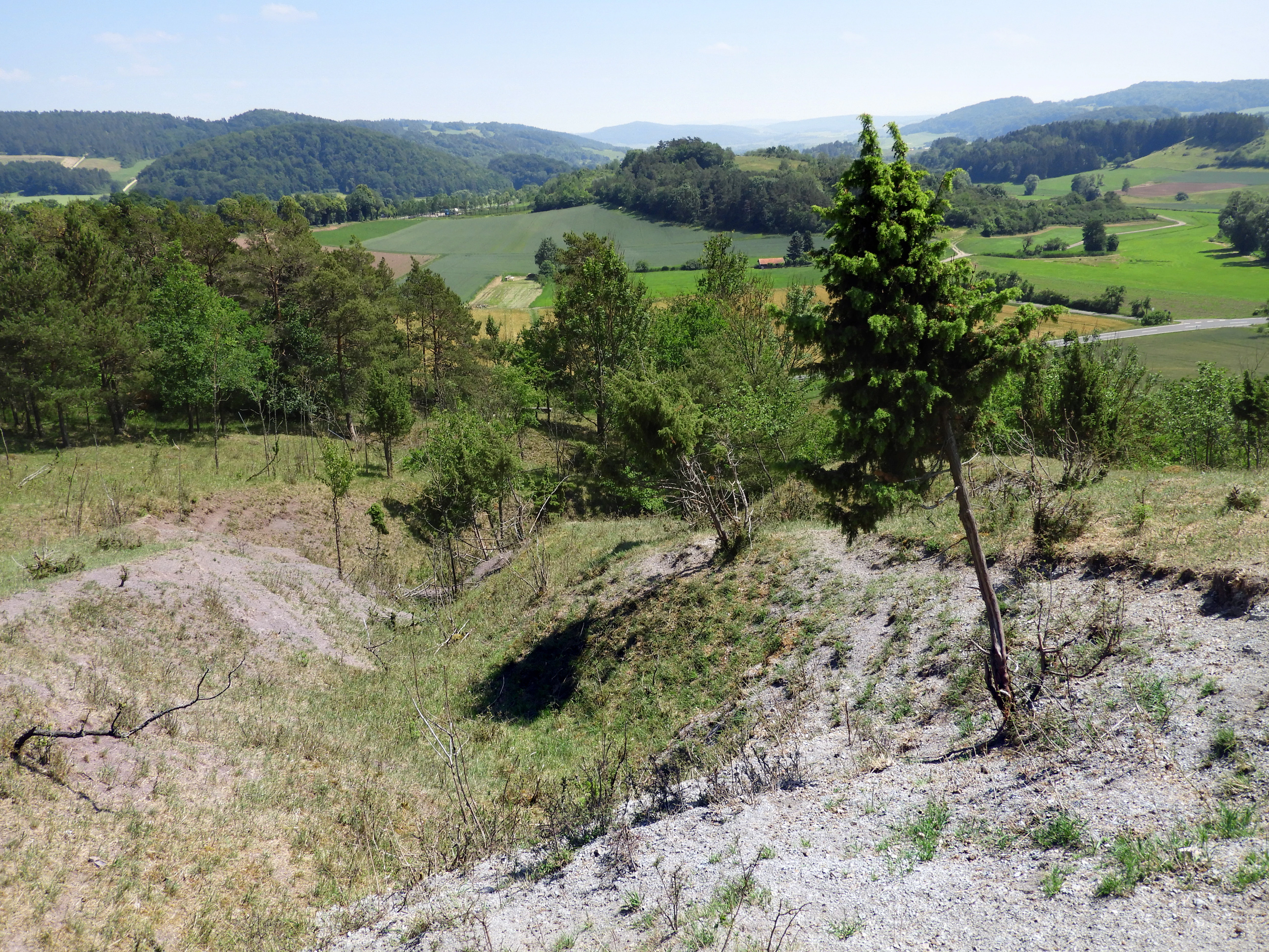
A downward sloping erosion gully with sparse vegetation and sandy soil in the foreground, overlooking a green valley with meadows and distant forested hills.
An erosion gully on the eastern side of the Weinberg in the Feuchtwiesen bei Lüderbach nature reserve.

Feuchtwiesen bei Lüderbach ecosystems, habitats, and plant life

Ecologically, Feuchtwiesen bei Lüderbach is defined by a small-scale mosaic of habitats that are unusual to find in such close proximity. In the valley bottom, a priority habitat type of alluvial forests with black alder and ash (LRT 91E0) occurs alongside the natural eutrophic lake habitat type (LRT 3150), reflecting the presence of former pond basins, some of which still hold open water while others have become damp depressions.

Wet meadows, large sedge stands (sedge marsh), and reedbeds dominate the damp central area, with reed canary grass, swamp sedge, and willows along the edges of the wetter zones. The site also supports a small stream that usually only carries water after prolonged rainfall, further shaping the seasonal hydrology of the wetland complex.

The drier Weinberg slopes carry the near-natural calcareous semi-dry grassland habitat type (LRT 6210), including the Submediterranean subtype (LRT 6212), grazed in past centuries by livestock and now gradually affected by grass encroachment and scrub overgrowth. The woodland on the same hill belongs to the woodruff beech forest habitat type (LRT 9130), with an unusual local presence of common pinesap, an indicator of long ecological continuity.

Feuchtwiesen bei Lüderbach wildlife and species highlights

The reserve's wildlife interest is closely tied to its wetland complex. The surviving pond in the floodplain area is considered important for amphibians and dragonflies, even though it faces long-term threat from natural silting-up. Wetland habitat here supports the kind of amphibian breeding and dragonfly hunting environment that has become scarce in the wider agricultural landscape of the Werra-Meißner-Kreis.

The calcareous semi-dry grasslands on the Weinberg increase the conservation value of the site for butterflies (day-flying Lepidoptera) and for grasshopper species, both of which are highlighted as particularly species-rich components of the habitat mosaic. The mosaic of meadows, sedge beds, reedbeds, and adjacent woodland also provides nesting and feeding habitat for breeding birds typical of structured wetland and edge habitats.

Although exact species lists are not the main emphasis of the source material, the reserve is understood to harbor a community of rare plants and animals associated with calcareous fens, wet meadows, alluvial forests, and dry grasslands, and is regularly monitored under the EU Habitats Directive reporting obligation to the European Commission.

Feuchtwiesen bei Lüderbach conservation status and protection priorities

Feuchtwiesen bei Lüderbach is managed first and foremost as a Hessian Naturschutzgebiet under IUCN Category IV, defined as a Habitat/Species Management Area. Protection is justified by the concentration here of several Habitats Directive habitat types, including the priority alluvial forest type with black alder and ash and the calcareous semi-dry grassland type with its submediterranean subform.

The main conservation aims are to preserve and develop rare plant and animal communities through extensive grassland use, near-natural forestry, and the maintenance or restoration of wet conditions in the valley bottom. Allowing drainage ditches to silt up and water levels to rise again has been a deliberate strategy to counteract ongoing drying of the site, which has already reduced the formerly three ponds to a single viable one with two damp remnants.

Integration in 2008 into the FFH site "Wald südöstlich von Netra" extended the reserve's significance, tying it into a 185.04-hectare Natura 2000 area characterized by species-rich deciduous woodland, extensively used grassland, and calcareous grassland. A 2008 baseline habitat survey commissioned by the Obere Naturschutzbehörde at the Regierungspräsidium Kassel confirmed both the special conservation value of the reserve and the urgency of addressing its hydrological decline.

Feuchtwiesen bei Lüderbach cultural meaning and human context

The cultural dimension of the reserve is closely bound up with centuries of low-intensity human land use. The semi-dry grasslands on the Weinberg originated as grazing land maintained by livestock, and the surrounding beech forests show the imprint of long-standing coppice-with-standards and coppice woodland management going back at least to the medieval period.

The two small villages of Rittmannshausen and Lüderbach, in the Ringgau municipality, frame the protected area, and a small parking area near the sports ground in Lüderbach, along with footpaths, benches, and information panels, invite visitors to engage with the landscape. The combination of working agricultural villages, traditional land-use history, and a tightly protected ecological core gives the reserve a quiet but tangible cultural-ecological identity within the broader Ringgau region.

Top sights and standout views in Feuchtwiesen bei Lüderbach

Feuchtwiesen bei Lüderbach offers an unusually compact combination of contrasting habitats: priority black alder and ash floodplain woodland, eutrophic ponds, sedge and reed marsh, wet meadows, submediterranean calcareous grassland, and woodruff beech forest, all within a single nature reserve of about 40 hectares.

It is also notable for the integration of a local Hessian protection effort into the European Natura 2000 network through the FFH site "Wald südöstlich von Netra," and for the long conservation history led by the Hessische Gesellschaft für Ornithologie und Naturschutz, which secured and rewetted the wetland before official designation in 1995.

Best time to visit Feuchtwiesen bei Lüderbach

Spring and early summer are particularly rewarding, when wet meadows, sedge beds, and calcareous grasslands are most florally expressive and amphibians and dragonflies are most active around the surviving pond. Late spring to early summer also brings the highest diversity of butterflies and grasshoppers on the warmer, sun-exposed Weinberg slopes.

In summer and early autumn the wetland character is most apparent, but visitors should be aware that the small Sommerbach stream only flows after extended rainfall, and that pond and groundwater levels vary with the seasons. Access is straightforward year-round via field paths from Rittmannshausen, Lüderbach, and the Kreisstraße 17, though muddy ground in the valley after wet periods can make the wet meadow tracks more demanding.

Monthly climate preview

Long-term representative temperature and precipitation normals by month

Feuchtwiesen bei Lüderbach Climate Normals and Annual Weather Patterns

Representative coordinates record measured monthly temperature swings and precipitation averages across the protected site. Detailed historical climatology normals provide full monthly comparison tables for analytical research.
Annual mean8 °C
-1 °C18 °C
Jan-1°
Feb
Mar
Apr
May12°
Jun16°
Jul18°
Aug18°
Sep14°
Oct
Nov
Dec
Warmest month
July

18.3 °C

Coolest month
January

-1.1 °C

Wettest month
July

2.6 mm/day

Driest month
April

1.4 mm/day

Park location guide

Geography guide, regional context, and park location map for Feuchtwiesen bei Lüderbach

Feuchtwiesen bei Lüderbach park geography, regions, and map view in Germany

Understand where Feuchtwiesen bei Lüderbach sits in Germany through a broader geographic reading of the surrounding landscape, nearby location context, and its mapped position within the national park landscape.

How Feuchtwiesen bei Lüderbach fits into Germany

Germany is a federal republic in Western and Central Europe with a population of over 83 million across sixteen constituent states. It is Europe's largest economy by nominal GDP and a major global exporter and importer. The capital is Berlin, and the country borders Denmark, Poland, Czech Republic, Austria, Switzerland, France, Luxembourg, Belgium, and the Netherlands.

Wider geography shaping Feuchtwiesen bei Lüderbach in Germany

Germany is located in Western and Central Europe, spanning 357,022 km². It borders Denmark to the north, Poland and the Czech Republic to the east, Austria and Switzerland to the south, and France, Luxembourg, Belgium, and the Netherlands to the west. The country has coastlines on the Baltic Sea and North Sea to the north, with the Alps located in the southern region.

Map view of Feuchtwiesen bei Lüderbach

Use this park location map to pinpoint Feuchtwiesen bei Lüderbach in Germany, understand its exact geographic position, and read its mapped placement within the surrounding landscape more clearly.

Pigeon | © OpenStreetMap contributors

Explore protected habitat imagery, wetland terrain, and valley scenery across the nature reserve.

Feuchtwiesen bei Lüderbach Photos and Landscape Scenery Visual Guide

Visual records reveal the diverse protected habitats and valley terrain defining Feuchtwiesen bei Lüderbach through detailed field photography. Photographic documentation captures the striking contrast between wet meadows, floodplain woodland, and dry limestone slopes within the reserve.

A wide, eye-level landscape view of a light-brown, grassy meadow in the foreground transitioning to green rolling hills and scattered trees under a clear blue sky.

A green meadow with scattered trees and shrubs leading into a denser forest with rolling hills in the background under a clear sky.

A downward sloping erosion gully with sparse vegetation and sandy soil in the foreground, overlooking a green valley with meadows and distant forested hills.

Park atlas

Discover related reserves and regional protected landscapes across northern Hesse

Exploring Parks Near Feuchtwiesen bei Lüderbach and Surrounding Protected Areas

Continue comparing natural reserves and protected areas near Feuchtwiesen bei Lüderbach to study regional valley terrain and wetland habitats. Expanding the geographic scope helps trace connected conservation networks throughout the surrounding Ringgau plateau.
Watercolor painting of a green landscape featuring rolling hills and sparse trees.
Nature reserveWerra-Meißner-Kreis
About 2.5 km away#1 closest

Northeast

Dreiherrenstein-Eschenberg-Kreutzerberg Nature Reserve and Border Landscape Geography

Protected calcareous forests and limestone ridges in Werra-Meißner-Kreis

Spanning 206 hectares of the Ringgau escarpment, this reserve features ancient beech forests, steep limestone cliffs, and rare steppe-heath grasslands. It sits at a cultural and ecological intersection, preserving Cold War-era boundary markers alongside post-glacial biological relicts within the broader Hessian protected-area network.

Area
2.063 km²
Established
1998
IUCN
IV
Relief
Mountain
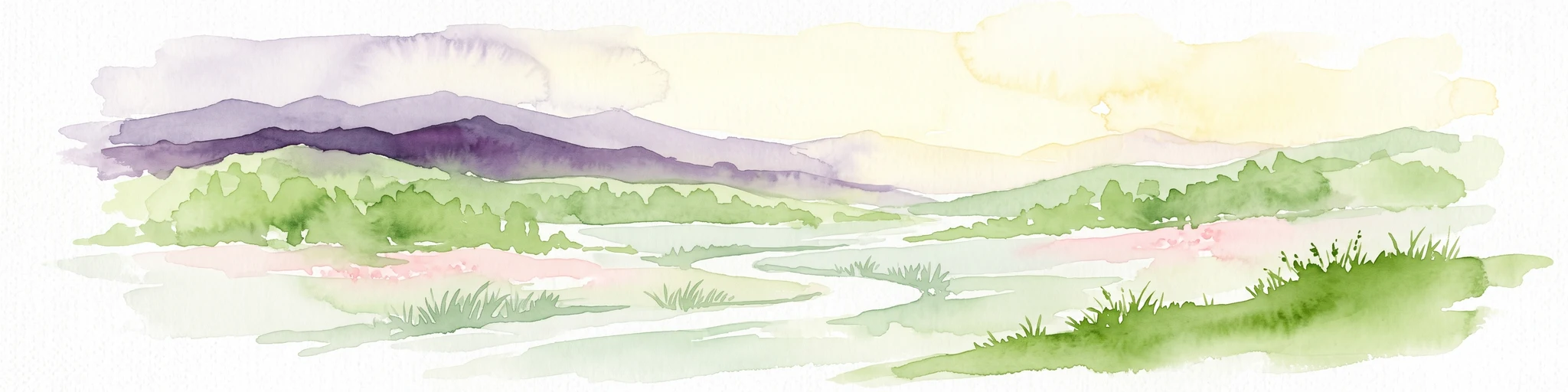
Watercolor painting of a rolling green landscape with a winding trail leading toward purple mountains under a soft light.
Nature reserveWartburgkreis
About 3.3 km away#2 closest

South

Mertelstal - Heldrastein: Protected Nature Reserve and Forested Limestone Geography in Wartburgkreis

Mapping the natural relief and ecological boundaries of a central German nature reserve.

Mertelstal - Heldrastein stands as a protected natural landmark in the Wartburgkreis district, defined by its dramatic limestone cliffs and ancient beech forest canopy. The reserve features a unique vertical relief above the Werra river valley, housing rare orchid communities and specialized bryophytes. This entry maps the structural geography and conservation value of the site, highlighting its dual identity as both a Natura 2000 protected habitat and a place of deep historical resonance across the former inner-German border landscape.

Area
2.525 km²
Established
1997
IUCN
IV
Relief
Mountain
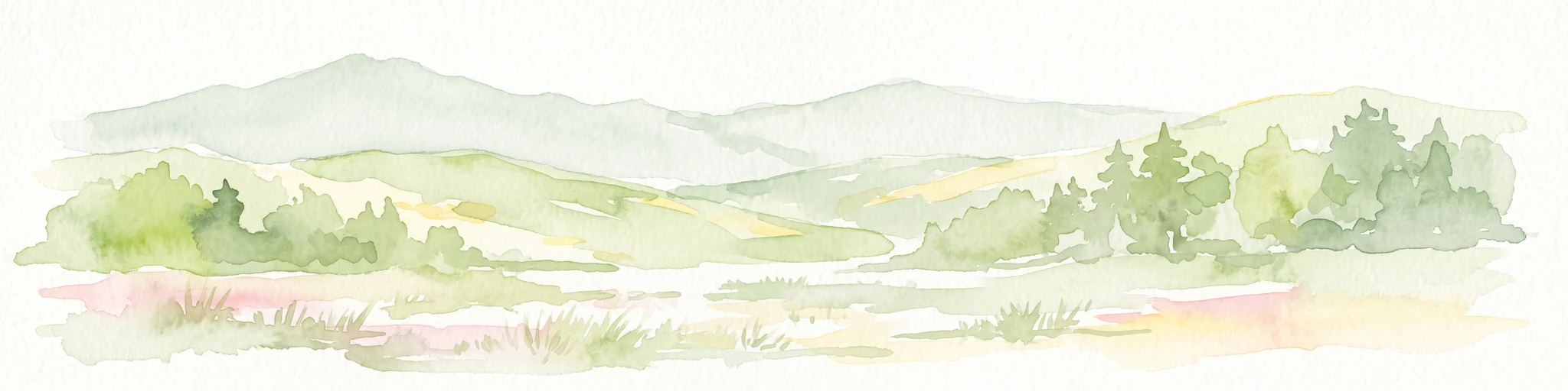
Watercolor illustration showing a wide landscape with green trees, rolling hills, and distant mountains under a pale sky.
Nature reserveHessen
About 3.9 km away#3 closest

Northwest

Graburg Nature Reserve and Protected Shell-Limestone Massif in Northern Hessen

Mapped protected areas and botanical landscape geography

Graburg is a compact shell-limestone plateau located in the Ringgau range of northern Hessen. This nature reserve is characterized by its high conservation value, featuring ancient calcareous beech forests, dramatic rock faces, and extensive historic landslide zones that support one of the most botanically diverse habitats in central Germany.

Area
3.41 km²
Established
1965
IUCN
IV
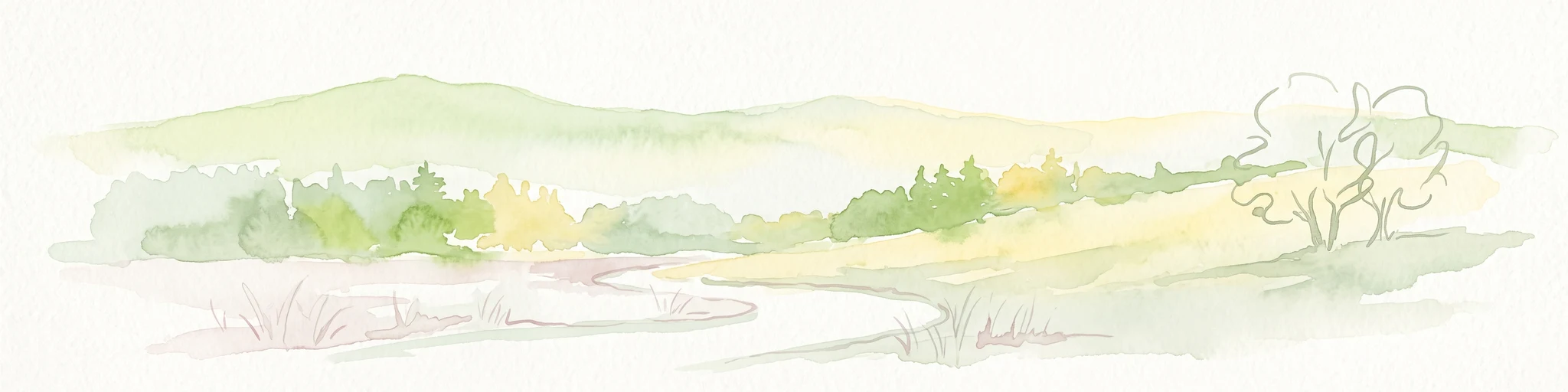
A minimalist watercolor illustration depicting a soft, rolling landscape with gentle hills, a winding path, and sparse trees in light green, yellow, and muted tones.
Nature reserveHesse
About 4.3 km away#4 closest

South

Iberg bei Markershausen: Nature Reserve and Geological Landmark in Hesse, Germany

Calcareous forests and limestone cliff landscapes within the Ringgau plateau

Iberg bei Markershausen is a protected nature reserve in northern Hesse recognized for its complex Muschelkalk terrain. The reserve encompasses a 180-meter limestone cliff, rare relict yew populations, and a dense forest floor featuring spring geophytes and diverse orchid species. This site serves as a vital anchor for regional biodiversity, linking steep rockfall remnants with open dry grassland habitats.

Area
0.32 km²
Established
1988
IUCN
IV
Relief
Upland
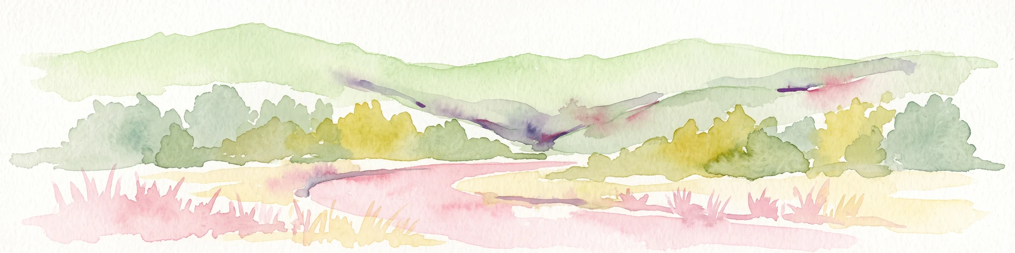
Watercolor illustration showing a wide landscape with green rolling hills in the background, a line of trees in the midground, and a pinkish meadow with grasses in the foreground
Nature reserveHesse
About 6.8 km away#5 closest

Northeast

Frankenloch bei Heldra Nature Reserve: Mapped Protected Landscapes in Hesse, Germany

A rare, near-natural Werra river oxbow and wetland floodplain sanctuary.

Discover the geographic layout of Frankenloch bei Heldra, a protected nature reserve located along the River Werra. This site offers insight into floodplain dynamics, reed-bed ecology, and the restoration of natural river channels within the Werra-Meissner-Kreis district of Hesse, Germany.

Area
0.089 km²
Established
1995
Relief
Lowland
Climate
Temperate
Nature reserveThuringia
About 6.9 km away#6 closest

East

Werra-Aue zwischen Breitungen und Creuzburg: Protected Floodplain and River Geography

Nature reserve sanctuary in western Thuringia

Spanning over 33 kilometers of the Werra river, this protected floodplain is defined by its distinctive geological sinkholes, seasonal wetlands, and diverse bird habitats. Discover the layered conservation status and riparian terrain that mark this significant Thuringian nature reserve as a crucial node for European ecological connectivity.

Area
25.78 km²
Established
2007
IUCN
IV
Relief
Lowland
Nature reserveThuringia
About 7 km away#7 closest

East

Werra bis Treffurt mit Zuflüssen: Protected River and Floodplain Network in Thuringia

Mapping an extensive 191 kilometer Natura 2000 river corridor.

The Werra bis Treffurt mit Zuflüssen protected area serves as a vital ecological corridor in Thuringia. This site encompasses a complex mosaic of fast-flowing highland brooks, expansive floodplain meadows, inland salt sites, and rare dissolution lakes. Its geography bridges high-altitude source regions with lower river valleys, creating a distinctive landscape transect that supports essential freshwater habitats and rare aquatic species across the state.

Area
22.6 km²
Established
2008
IUCN
IV
Relief
Mixed relief
A horizontal watercolor painting showing layers of soft green hills and forests against a pale yellow sky.
Nature reserveHessen
About 7 km away#8 closest

West

Boyneburg und Schickeberg bei Breitau: Protected Nature Reserve and Geological Landmark

Geology, forest habitats, and medieval history in the Ringgau plateau of Hesse.

This nature reserve serves as a critical protected area showcasing the largest active mass-movement zone in Hesse. The landscape features striking Muschelkalk cliffs, diverse orchid-rich beech forests, and cave systems that provide essential habitat for protected bat populations and breeding raptors.

Area
2.115 km²
Established
1988
IUCN
IV
Relief
Upland

Common questions about visiting, size, designation, and location context for Feuchtwiesen bei Lüderbach

Feuchtwiesen bei Lüderbach FAQs for park facts, access, geography, and protected area context

Find quick answers about Feuchtwiesen bei Lüderbach, including protected-area facts, park geography, trail and visitor context, and how the park fits into its surrounding country and regional landscape.
MoriAtlas Explorer

Continue Your Protected Areas Search Across the Global Atlas

Deepen your exploration by continuing the structured search for national parks and protected areas worldwide. Utilize the comprehensive filtering capabilities to compare different conservation landscapes and refine your understanding of global park geography. Discover more about the distribution and characteristics of protected natural areas.

Global natural geography