
Mori Atlas logo
Nature reserveFilfla

A study of vertical Mediterranean terrain at the southernmost point of the Maltese archipelago

Filfla Nature Reserve: Mapping the Protected Limestone Plateau and Sea Cliffs of Malta

Filfla stands as a stark, flat-topped limestone plateau rising from the Mediterranean Sea, forming a critical protected nature reserve south of the Maltese coast. This isolated islet features sheer 60-metre sea cliffs and a barren interior that serves as an essential sanctuary for European storm petrels and endemic species. Through this atlas entry, observe the rugged geological structure and ecological significance of a landscape shaped by centuries of natural erosion and complex human history.

uninhabited isletlimestone plateausea cliffsImportant Bird Areaseabird colonystorm petrel
Stylized digital illustration of a waterfall flowing between mountain cliffs into a river, framed by coniferous trees under a soft-colored sky with a sun.

Filfla

Nature reserve

Park overview

Structured park overview, official facts, and landscape profile for Filfla

Filfla park facts, protected area profile, and essential visitor context

Review the core facts for Filfla, including designation, size, terrain, visitor scale, habitats, and operating context in one park-focused overview.

About Filfla

Filfla occupies the southern fringe of the Maltese archipelago, sitting as a lonely limestone punctuation mark in the Mediterranean roughly 4.5 kilometres beyond the southern coast of Malta. From the Dingli Cliffs on the mainland the islet and its smaller companion Filfoletta appear as low, steep-sided slabs on the horizon, hinting at the dramatic cliff scenery that defines the island up close.

The physical character of Filfla is dominated by its geology. It is essentially a crumbling, flat-topped limestone plateau, only a few hectares across but with cliffs that rise about 60 metres from the sea. The island's surface is largely barren rock, yet within this austere setting a surprising amount of specialised life clings to the slopes and cliff ledges. The combination of isolation, vertical habitat, and freedom from human disturbance has allowed several species to thrive here in numbers that would be impossible on the populated main island.

Filfla is administered as part of the territory of Siġġiewi and is uninhabited, with no permanent residents and no regular access. Permission from Malta's Environment and Resources Authority is required even to land, and only for educational or scientific purposes. This protected status reflects the island's importance as one of the Mediterranean's more significant small-island seabird stations, and as the only home of species found nowhere else on Earth.

Beyond its natural profile, Filfla carries a remarkable cultural and historical layering. The Neolithic people who built the great temples of Ħaġar Qim and Mnajdra may have regarded the island as sacred, orienting their monumental architecture toward it across the water. A chapel was cut into a cave on Filfla in 1343, only to be destroyed by an earthquake in 1856 that also sank part of the island. In the twentieth century the islet was used for bombardment practice by the Royal Navy and Royal Air Force, a legacy still visible in spent cartridges lingering on the surface. Today Filfla functions primarily as a nature reserve, a case study in international maritime boundary disputes, and one of Malta's most distinctive landmarks, animated less by human presence than by birdsong, salt spray, and stone.

Quick facts and research context for Filfla

Filfla is a small uninhabited islet of roughly 3.7 hectares, part of the Maltese islands and administered under Siġġiewi. It lies south of Malta in the central Mediterranean and forms the southernmost land of the Maltese archipelago when combined with the nearby rocky islet of Filfoletta.

The terrain is a flat-topped limestone plateau ringed by cliffs rising about 60 metres above the sea. Despite its small size, Filfla is an Important Bird Area, hosts endemic reptile and snail species, and is subject to a national nature reserve act that restricts access and fishing in its surrounding waters.

Protection and recognition

Examine the recorded protection scope and establishment year for this protected area.

Filfla Protection Status and Designated Area Recognition History

Filfla maintains a documented protection scope established through official designation in 1980. Records compile the verified protection history and designation framework without relying on external international recognition sources.

Protection details

Protection scope
Mixed
Designated year
1980
Transboundary protection
No
Park context

Deeper park guide and search-rich context for Filfla

Filfla history, landscape, wildlife, and travel context

Explore Filfla through its history, landscape character, ecosystems, wildlife, conservation priorities, cultural context, and seasonal travel timing in a structured park guide built for atlas discovery and search intent.

Why Filfla stands out

Filfla is best known for its role as a seabird sanctuary, particularly for the sizeable breeding colony of European storm petrels that nest on its cliffs and plateau. BirdLife International has designated the islet an Important Bird Area chiefly for this reason, with Cory's shearwater and yellow-legged gull also breeding there. The island is equally notable for its two genuinely endemic species: a subspecies of the Maltese wall lizard and a local form of door snail, both found nowhere else. Its stark limestone profile, visible from the Dingli Cliffs on mainland Malta, and its layered human history, from Neolithic sacred landscape to military bombing range to protected reserve, give Filfla an identity out of proportion to its tiny footprint.
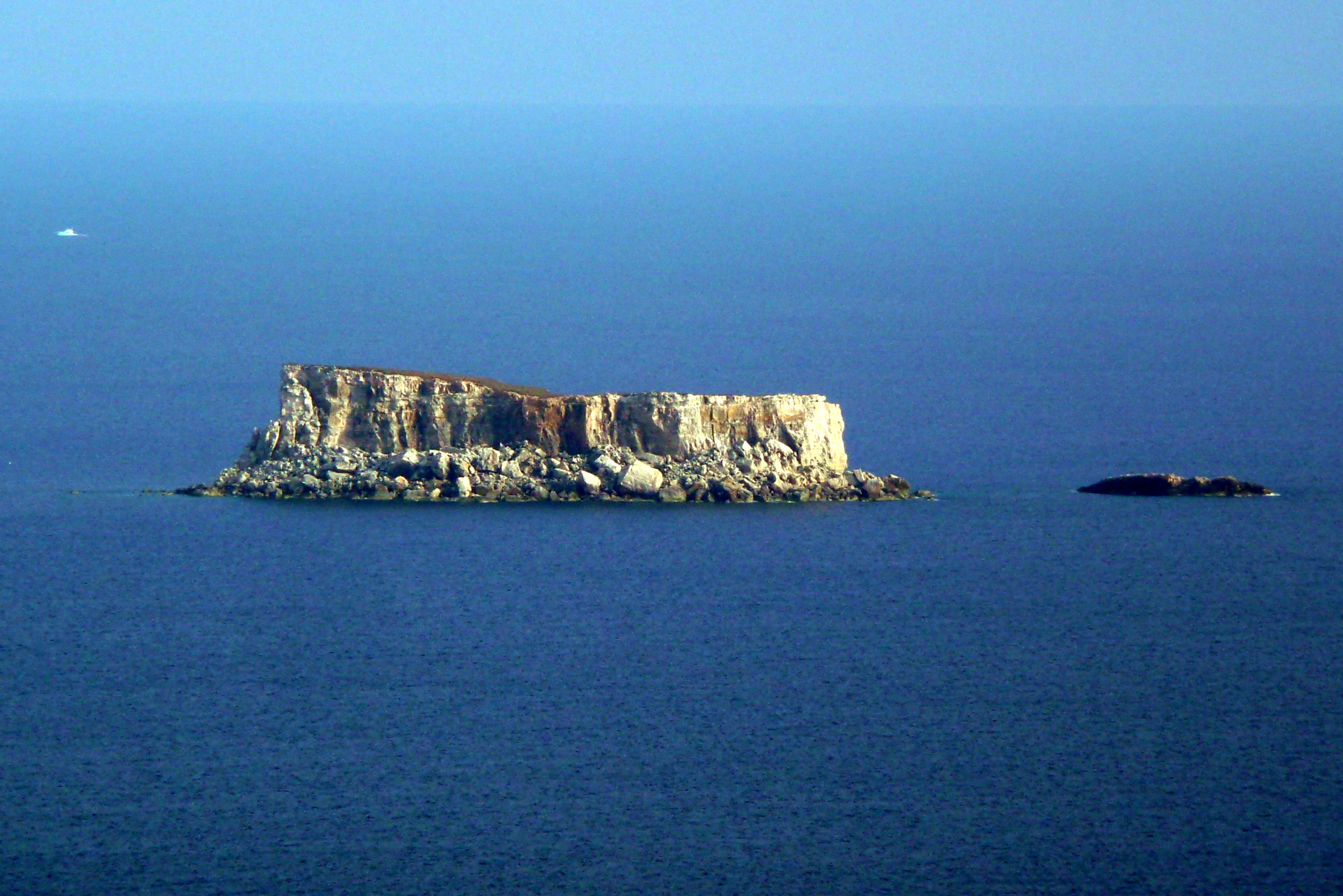
A distant, eye level view of the small, flat topped limestone islet of Filfla, surrounded by deep blue water, with a smaller rock formation visible to its right.
The uninhabited limestone islet of Filfla viewed from the Mediterranean Sea.

Filfla history and protected-area timeline

Filfla's documented human story begins long before written records. The Neolithic temple complexes of Ħaġar Qim and Mnajdra face the islet from the Maltese coast, and the alignment of these massive structures suggests that the people who built them regarded Filfla, sometimes called Lone Island, as a sacred landmark standing opposite their rituals.

The only known permanent structure on the island itself was a chapel excavated inside a cave in 1343. This tiny place of worship survived for over five centuries before an earthquake in 1856 destroyed it and simultaneously sank part of the island, reshaping its outline forever. An older 1798 map of Malta records a fort, a lighthouse, and a monastery with a chapel on Filfla, hinting at a more built-up past that has since been erased by time and seismic activity.

During the twentieth century Filfla took on a very different role. From the British military presence until 1971, the Royal Navy and Royal Air Force used the islet as a target range, and spent cartridges from those bombardments can still be found scattered across the rock. In 1980 Filfla was declared a bird reserve, and in 1988 the Filfla Natural Reserve Act formalised its protected status, restricting landing access, and originally prohibiting fishing within a one nautical mile radius because of the danger from unexploded ordnance. Fishing was later permitted again within that zone under Government notice 173 of 1990.

Filfla also entered the wider geopolitical stage. In 1985 the International Court of Justice adjudicated a continental shelf dispute between Libya and Malta, ruling in a way that essentially set the tiny islet aside from its territorial calculations. In January 2026 Storm Harry eroded a substantial portion of the island, raising fresh concerns about damage to seabird breeding habitat.

Filfla landscape and geographic character

Filfla is a study in compressed verticality. Although the islet measures only a few hectares across, it is essentially a flat-topped limestone plateau piled above the sea, ringed by cliffs that rise roughly 60 metres from the waterline. The rock face is bare and crumbling, fragmented by erosion, and there is no safe harbour or gradual slope.

The coastline, only about 988 metres long in total, drops sharply into deep Mediterranean water, and the island's interior consists of exposed limestone pavement with very thin soil. Vegetation is sparse and patchy, with a wild leek capable of reaching nearly two metres in height among the few plants that have adapted to the windy, salt-sprayed conditions.

Together, Filfla and the smaller rocky islet of Filfoletta, lying some 101 metres to the southwest, form the southernmost geological expression of the Maltese archipelago. The combination of steep cliffs, barren plateau, and surrounding open sea creates a setting that feels closer to a sea stack than to a habitable island.

Filfla ecosystems, habitats, and plant life

The ecological identity of Filfla is shaped by the absence of people and the presence of cliffs. With no residents, no grazing animals, and very limited access, the islet offers a refuge for seabirds and small invertebrates that cannot survive disturbance on the main Maltese islands.

Three seabird species breed on Filfla: the European storm petrel, Cory's shearwater, and yellow-legged gull. The storm petrel colony alone is estimated at several thousand pairs, making Filfla one of the most important sites for this species in the central Mediterranean. The bird colonies, in turn, fertilise small patches of the otherwise barren rock, allowing a marginal but distinctive plant community to take hold, including the remarkable wild leeks that can tower well above head height.

The island is also significant for invertebrates and reptiles. A subspecies of the Maltese wall lizard, Podarcis filfolensis filfolensis, and a local form of door snail, Lampedusa imitatrix gattoi, are both endemic to Filfla, found nowhere else. This combination of seabird abundance and endemic terrestrial fauna gives a tiny islet disproportionate biological importance, which is precisely why BirdLife International has recognised Filfla as an Important Bird Area.

Filfla wildlife and species highlights

Filfla's wildlife story is dominated by birds. The European storm petrel is the headline species, with an estimated 5,000 to 8,000 pairs estimated to breed among the island's crevices and boulder fields. Cory's shearwater adds another roughly 200 pairs, while yellow-legged gulls maintain around 130 pairs, creating a layered seabird community perched on the limestone plateau.

Beyond the birds, Filfla is most biologically distinctive for what lives at ground level. The endemic Maltese wall lizard subspecies Podarcis filfolensis filfolensis basks on the sun-warmed rock, while the door snail Lampedusa imitatrix gattoi inhabits the damp crevices. Both are narrowly endemic to this single islet, which gives them an outsized conservation profile despite their modest size.

The surrounding marine waters were once part of a regulated fishing zone within one nautical mile of Filfla, originally to protect against unexploded ordnance and still relevant for the broader marine ecology surrounding the island. The interplay between seabird life above and the small but specialised fauna on the rock is what makes Filfla ecologically interesting far beyond its physical scale.

Filfla conservation status and protection priorities

Filfla's conservation story began in earnest in 1980, when the islet was declared a bird reserve. This recognition was formalised through the Filfla Natural Reserve Act of 1988, which placed strict conditions on landing and use of the island. Access today is only permitted for educational or scientific purposes, with prior authorisation from Malta's Environment and Resources Authority.

Recognition at the international level followed with BirdLife International's designation of Filfla as an Important Bird Area. The principal driver of that designation is the European storm petrel colony, which is one of the densest of its kind in the Mediterranean and would be immediately vulnerable to introduced predators or human disturbance.

Conservation management on Filfla also grapples with a layered legacy. The islet still carries the remnants of twentieth-century military bombardment, with unexploded ordnance historically preventing safe fishing in surrounding waters and ongoing concerns about how erosion and storms, including the recent Storm Harry, may further degrade seabird habitat. The combination of strict access rules, endemic species protection, and active monitoring means Filfla now functions less as a remote outpost than as a tightly managed natural reserve.

Filfla cultural meaning and human context

Filfla has long occupied a place in Maltese imagination disproportionate to its size. The Neolithic communities that constructed the great temples of Ħaġar Qim and Mnajdra appear to have aligned these monuments with the islet visible on the southern horizon, treating it as a sacred focal point across the water.

In more recent centuries the island acquired a Christian presence in the form of a chapel carved into a cave in 1343, which gave the rock a small but durable spiritual identity until a nineteenth-century earthquake brought it down. The 1798 map record of a fort, a lighthouse, and a monastery suggests that, at moments in its history, Filfla was more intensively used than its barren appearance today implies.

Filfla is also embedded in Maltese legend. Local tradition links the creation of the islet to the story of Il-Maqluba, describing how a fragment of a sinful, sunken hamlet was cast into the sea by angels to form Filfla. More lightheartedly, the islet served as the on-screen Scab Island in the 1980 film Popeye, embedding Filfla briefly into international popular culture.

Top sights and standout views in Filfla

Filfla's standout qualities begin with its geography: a flat-topped limestone plateau ringed by 60-metre cliffs, marking the most southerly point of the Maltese archipelago. Even at a few hectares in size it carries bold vertical relief and an unmistakable silhouette against the open Mediterranean.

Ecologically, the islet punches well above its weight. It hosts one of the densest European storm petrel colonies in the region, supports two species endemic to Filfla alone, and is formally recognised as an Important Bird Area by BirdLife International. These distinctions turn a barren rock into a reference site for seabird conservation in the central Mediterranean.

The remaining layers of meaning, from Neolithic sacred landscape to medieval chapel cave, from twentieth-century bombardment range to international maritime boundary dispute, give Filfla a uniquely layered identity among small Mediterranean islands.

Best time to visit Filfla

Because Filfla is closed to general visitors and only accessible for educational or scientific purposes with advance permission from the Environment and Resources Authority, conventional seasonality advice has limited relevance. Day-to-day weather conditions and Mediterranean sea state usually govern whether a landing is feasible at all, with calmer spring and early autumn days generally offering more workable conditions for authorised visits.

For anyone interested in observing Filfla from the mainland, the Dingli Cliffs on Malta's southern coast provide the classic vantage point. Visibility tends to be best on clear, calm days in late spring and early summer, when the light is bright and the air is less hazy, and again in early autumn after the worst of the summer heat has passed. Watching from the cliffs, rather than attempting a landing, is the most realistic way to appreciate the island for the vast majority of people.

Monthly climate preview

Long-term representative point measurements tracking monthly temperature and precipitation rhythm

Filfla Climate Normals, Annual Temperature and Monthly Precipitation Patterns

Representative coordinate records show measured annual temperature and precipitation cycles spanning long-term historical observation periods for Filfla. Reviewing the complete monthly profile provides detailed historical climate context across every recorded period.
Annual mean20 °C
14 °C27 °C
Jan15°
Feb14°
Mar15°
Apr16°
May19°
Jun22°
Jul25°
Aug27°
Sep25°
Oct23°
Nov19°
Dec16°
Warmest month
August

26.6 °C

Coolest month
February

13.9 °C

Wettest month
November

3 mm/day

Driest month
July

0.1 mm/day

Park location guide

Geography guide, regional context, and park location map for Filfla

Filfla park geography, regions, and map view in Malta

Understand where Filfla sits in Malta through a broader geographic reading of the surrounding landscape, nearby location context, and its mapped position within the national park landscape.

How Filfla fits into Malta

Malta is a small island nation in the Mediterranean, located between Italy, Tunisia, and Libya. With a population of about 520,000 spread over 316 km², it is one of the world's most densely populated countries. The country has a long history of foreign rule and is known for its strategic position, historic sites, and membership in the EU, Commonwealth, and UN.

Wider geography shaping Filfla in Malta

Malta is located in the Mediterranean Sea between Sicily and North Africa, approximately 80 km south of Italy, 284 km east of Tunisia, and 333 km north of Libya. The archipelago sits at coordinates 35°54′N 14°31′E.

Map view of Filfla

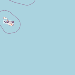
Use this park location map to pinpoint Filfla in Malta, understand its exact geographic position, and read its mapped placement within the surrounding landscape more clearly.

Pigeon | © OpenStreetMap contributors

Explore high-resolution park imagery capturing the stark sea cliffs, barren terrain, and protected island environment.

Filfla Photos and Landscapes: Visualizing the Limestone Plateau and Seabird Sanctuary

Visual documentation of Filfla reveals the stark limestone plateau, sheer vertical sea cliffs, and specialized habitats that define this protected Mediterranean seabird sanctuary. Examining detailed park photography provides essential geographic context for understanding the unique terrain and ecological significance of the Maltese archipelago.

A distant, eye level view of the small, flat topped limestone islet of Filfla, surrounded by deep blue water, with a smaller rock formation visible to its right.

Park atlas

Continue comparing coastal nature reserves and regional marine habitats

Exploring Parks Near Filfla and Related Mediterranean Protected Landscapes

Browsing parks near Filfla opens wider comparative perspectives across surrounding Mediterranean island habitats and marine reserves. Examining adjacent protected areas provides deeper geographic context for isolated limestone plateaus and regional seabird sanctuaries.
A soft, pastel-toned watercolor painting of a rolling green landscape with a small body of water in the foreground and a silhouette of a building on a hill in the distance.
Wildlife reserveMalta
About 8.3 km away#1 closest

North

Buskett Gardens Wildlife Reserve: Geography and Protected Landscape Map of Malta

A rare sheltered woodland valley in the central Mediterranean

Buskett Gardens serves as a critical protected woodland in the heart of the Maltese islands. Nestled in the fertile Wied il-Luq valley, the site offers an unusually green, shaded environment of broadleaved trees and conifers. This reserve functions as an Important Bird Area and a historic cultural landscape, providing a lush contrast to the exposed limestone plateau of rural Malta.

Area
0.47 km²
Relief
Upland
Scope
Terrestrial
Water
Minor water
National parkMalta
About 12 km away#2 closest

North

Ta' Qali National Park: Malta's Largest Urban Protected Landscape and Recreation Hub

Mapped Gardens, Event Venues, and Recreational Zones

Ta' Qali National Park serves as a vital green lung in central Malta, showcasing a landscape transformed from a wartime airfield into a modern urban protected area. This national park is recognized for its extensive recreational zones, meticulously designed formal gardens, and a prominent open-air concert venue that hosts major cultural events. Its relatively flat terrain and planned infrastructure offer a distinct map-based perspective on urban parkland, highlighting its significance as a major public amenity and a key feature of Malta's landscape.

Area
0.35 km²
IUCN
V
Relief
Lowland
Climate
Mediterranean
A horizontal watercolor illustration showing soft, blended washes of green, yellow, and pale pink depicting an abstract rolling landscape or horizon line against a white background.
Natural monumentMalta
About 12 km away#3 closest

Northeast

Għar Dalam Natural Monument: A Protected Maltese Cave and Paleontological Landmark

Geological and prehistoric landscape context in southeastern Malta

Għar Dalam is a protected natural monument in Malta that preserves a complex phreatic cave passage and essential fossil records of extinct dwarf species. This cave site acts as a major cornerstone for understanding the prehistoric Mediterranean, documenting the arrival of early Neolithic cultures and the long-term evolution of island-bound animal life through stratified sediment analysis.

Established
1933
Relief
Lowland
Climate
Mediterranean
Access
Easy access
A watercolor painting showing a soft landscape with green rolling hills, low vegetation, and a calm water surface against a pastel sky.
Nature reserveSouth Eastern Region
About 14 km away#4 closest

Northeast

Il-Ballut ta' Marsaxlokk Nature Reserve: Geography and Protected Wetland Landscapes

Essential salt marsh habitat in Malta's South Eastern Region

Il-Ballut ta' Marsaxlokk serves as a critical protected area, preserving a rare salt marsh landscape within the coastal environment of Malta. This reserve features a compact mosaic of muddy canals, halophytic vegetation, and Mediterranean coastal terrain. Its inclusion in the Natura 2000 network highlights its regional importance as a refuge for migratory birds and a focal point for environmental conservation in the South Eastern Region.

Area
0.23 km²
Established
2018
IUCN
IV
Relief
Lowland
A horizontal watercolor painting depicting a soft-toned, abstract coastal landscape with gentle green hills, grassy foreground patches, and a calm, pale pool of water against a white background.
Marine protected areaMalta
About 15 km away#5 closest

Northwest

Ras ir-Raħeb Marine Protected Area: Geographic Profile and Mapped Coastal Landscape

Coastal cliffs and protected marine zones in north western Malta.

Ras ir-Raħeb serves as a pivotal marine protected area along the Malta coastline, where high limestone cliffs meet complex underwater habitats. This site links historical archaeological remnants with modern ecological conservation, offering a unique geographic snapshot of the Rabat plateau edge. Its mapped boundaries encompass both the terrestrial promontory and the essential seagrass meadows beneath the surface, providing a critical reference point for Mediterranean coastal geography and protected land status.

Established
2005
Relief
Upland
Climate
Mediterranean
Access
Moderate access
Nature reserveMarsaxlokk
About 16 km away#6 closest

Northeast

Xrobb l-Għaġin Nature Park: Protected Coastal Landscape in Marsaxlokk, Malta

A compact peninsula of protected cliffs and historic archaeological sites

Xrobb l-Għaġin Nature Park spans a low-lying coastal peninsula near Marsaxlokk, combining rocky Mediterranean shoreline with significant prehistoric temple remains. This protected area serves as a focal point for environmental education and coastal terrain analysis, showcasing the integration of natural heritage and historical coastal defense within a compact geographic boundary.

Area
0.155 km²
Relief
Lowland
Scope
Terrestrial
Water
Minor water
A pale, minimalist watercolor painting depicting St Paul's Island in Malta, showing green rolling landforms and a hint of a structure against a light background.
Protected areaMalta
About 20 km away#7 closest

North

St Paul's Island Protected Landscape and Maltese Coastal Geography Overview

Uninhabited Mediterranean island and heritage landmark

St Paul's Island represents a unique Mediterranean limestone islet featuring maritime garigue habitat and historic ruins. Located near the Mellieħa coastline, this protected area provides a compact example of Maltese coastal geography, defined by exposed cliffs and an enduring connection to local maritime history.

Area
0.101 km²
Relief
Lowland
Scope
Mixed
Water
Water-dominated
A horizontal watercolor painting showing soft green hills, grassy marshland, and a calm water channel under a light, hazy sky.
Nature reserveGozo
About 26 km away#8 closest

North

Comino Nature Reserve: Geography, Protected Marine Areas, and Karst Terrain in Gozo

Island ecology and coastal landscape mapping

Examine the protected geography of Comino, an island nature reserve near Gozo defined by limestone plateaus and sheltered bays. This overview covers the ecological boundaries of the Natura 2000 marine area, the distribution of coastal sea caves, and the topographic patterns of this Important Bird Area.

Area
3.5 km²
Relief
Lowland
Climate
Mediterranean
Access
Moderate access

Common questions about visiting, size, designation, and location context for Filfla

Filfla FAQs for park facts, access, geography, and protected area context

Find quick answers about Filfla, including protected-area facts, park geography, trail and visitor context, and how the park fits into its surrounding country and regional landscape.
MoriAtlas Explorer

Continue Your Protected Areas Search Across the Global Atlas

Deepen your exploration by continuing the structured search for national parks and protected areas worldwide. Utilize the comprehensive filtering capabilities to compare different conservation landscapes and refine your understanding of global park geography. Discover more about the distribution and characteristics of protected natural areas.

Global natural geography