Mori Atlas logo
Nature reserveFließwiese Ruhleben

Understanding the ecological boundaries and ice age topography of a significant urban protected area

Fließwiese Ruhleben Nature Reserve: Mapped Landscapes and Glacial Terrain in Berlin

(Naturschutz- und Natura-2000-Gebiet Fließwiese Ruhleben)

Fließwiese Ruhleben sits as a protected nature reserve within the urban fabric of Berlin, representing a rare, surviving fragment of a glacial meltwater channel. This terrestrializing marsh, known as a Verlandungsmoor, offers a unique opportunity to study the intersection of ice age geography and modern conservation boundaries. The basin features a complex mosaic of reed beds, alder swamp forests, and peat meadows that serve as critical breeding grounds for protected amphibian populations.

wetlandVerlandungsmoorpeat marshnature reserveNaturschutzgebietNatura 2000

Fließwiese Ruhleben

Nature reserve

Park overview

Structured park overview, official facts, and landscape profile for Fließwiese Ruhleben

Fließwiese Ruhleben park facts, protected area profile, and essential visitor context

Review the core facts for Fließwiese Ruhleben, including designation, size, terrain, visitor scale, habitats, and operating context in one park-focused overview.

About Fließwiese Ruhleben

Fließwiese Ruhleben occupies a narrow, elongated depression in the western Berlin landscape, lying between the gentle hills of the Murellenberge to the west and the edge of the Teltow plateau, with the historic Ruhleben settlement to the east and the Olympic grounds and Waldbühne amphitheater to the south. Despite its compact size, the site carries an unusual concentration of ecological and geological significance within a densely urban setting.

The reserve is fundamentally a product of the last ice age. Its basin is a meltwater channel that was cut by glacial outwash during the Weichselian glaciation. Over thousands of years, the open lake that originally filled the depression silted up, with sedges and peat mosses transforming it into a Verlandungsmoor, a peaty terrestrializing marsh, where organic material slowly accumulates as standing water disappears. Today the surface consists of peat-rich soils whose vegetation shifts dramatically depending on whether the basin is dry, moist, or deeply flooded.

The ecological importance of the site stretches well beyond its modest area. As one of Berlin's recognized Naturschutzgebiete since 1959 and a Natura 2000 site under the EU Habitats Directive, it has institutional recognition at both city and European levels. Its amphibian assemblages, especially its population of the Northern Crested Newt and the presence of the Garlic Toad and Moor Frog, make it functionally important for species that have declined across much of central Europe. Mosaics of Common Reed, cattail, sedge marsh, and alder swamp forest provide habitat structure, while surrounding pine and oak woodland on the slopes adds terrestrial complement. Within Berlin's mosaic of nature reserves, the Fließwiese functions as a small but unusually rich fragment of the city's inherited glacial landscape.

Quick facts and research context for Fließwiese Ruhleben

Fließwiese Ruhleben is a protected wetland in Berlin-Charlottenburg-Wilmersdorf, near the Murellenberge and the Olympiapark. It is a Verlandungsmoor, a former lake that has gradually filled in to become a peat-forming marsh, and occupies a meltwater channel carved during the Weichselian glaciation.

The site has been a Berliner Naturschutzgebiet since 1959 and is part of the European Natura 2000 network, classified under the Fauna-Flora-Habitat directive for its amphibian fauna and threatened habitat types. Its official combined designation is Naturschutz- und Natura-2000-Gebiet Fließwiese Ruhleben.

Protection and recognition

Documented terrestrial protection scope and official international conservation designations.

Fließwiese Ruhleben Protection Status and Natura 2000 Recognition Details

Fließwiese Ruhleben maintains documented terrestrial protection status supported by official Natura 2000 recognition records. Structured conservation data outlines the established management scope and international framework details for this protected area.

International recognition

Protection details

Protection scope
Terrestrial
Transboundary protection
No
Park context

Deeper park guide and search-rich context for Fließwiese Ruhleben

Fließwiese Ruhleben history, landscape, wildlife, and travel context

Explore Fließwiese Ruhleben through its history, landscape character, ecosystems, wildlife, conservation priorities, cultural context, and seasonal travel timing in a structured park guide built for atlas discovery and search intent.

Why Fließwiese Ruhleben stands out

Fließwiese Ruhleben is best known for its role as one of Berlin's most important amphibian breeding sites, particularly for the strictly protected Northern Crested Newt (Triturus cristatus), whose significant population here helped justify its inclusion in the Natura 2000 network. It is also valued as a rare surviving example of an urban Verlandungsmoor, a peat-forming terrestrializing marsh within an inner-city landscape. The interplay of fluctuating water levels, relict glacial meltwater topography, and a mosaic of reedbeds, alder swamp forest, and damp meadows gives the site a strongly distinctive ecological identity for such a small reserve.
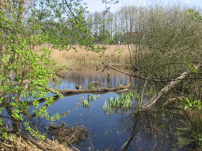
A tranquil pond surrounded by lush spring vegetation, featuring fallen logs in the water and a background of reeds and trees in the Fließwiese Ruhleben nature reserve.
A view of the central northern section of the Fließwiese Ruhleben, a nature reserve characterized by its wetlands and glacial meltwater terrain.

Fließwiese Ruhleben history and protected-area timeline

Fließwiese Ruhleben's history as a managed landscape goes back to the nineteenth century, when the basin's peat-forming vegetation was beginning to be shaped by drainage and agricultural use. A central longitudinal ditch was cut through the marsh during nineteenth-century land improvement works, linking the wetland to the Elsgraben, an 1832 canal that was navigable until 1886. The Elsgraben was designed to divert Spree floodwater toward the Havel, protecting the city of Spandau. At that time, the lower, southern portion of the wetland was already wooded as alder swamp forest, while the higher northern part functioned as a wet meadow.

Local residents continued to use the area during the early twentieth century: farmers grew vegetables, kept livestock, and harvested hay, while goat herders collected fodder and neighbors cut alder wood for fuel. A small farmstead with fruit trees, vegetable plots, and pasture occupied the northeastern corner, surrounded by extensive flat marsh with closed reed and cattail stands ringed by alder carr.

The site's long-term ecology shifted abruptly in the twentieth century. When the Elsgraben was filled in and the Hempelsteig embankment was raised in 1936 using spoil from the construction of the Waldbühne amphitheater, the historic drainage link was broken. The wetland's importance for nature conservation was recognized in 1959, when Berlin declared it protected as Naturschutzgebiet number 05. During the 1960s and 1970s, management focused on preventing the area from drying out; almost all woody growth was cleared by 1984 and the meadow was mown annually until 1994.

A significant hydrological change occurred when the Tiefwerder waterworks reduced groundwater extraction in 1994, allowing the upper aquifers to refill. Water levels rose dramatically, peaking about a meter above the ground in the late 1980s. Since 1994, the reed area has been almost continuously inundated. This shift greatly reduced the need for active mowing but created new management challenges, especially maintaining open vegetation along the woodland edge and within the reedbeds.

Fließwiese Ruhleben landscape and geographic character

The defining landscape feature of Fließwiese Ruhleben is a long, narrow, shallow depression that arcs gently from southwest to northeast, widening from a narrow tip near the Waldbühne amphitheater to about two hundred fifty meters across in the center before narrowing again toward the north. The basin is roughly one kilometer long, and for most of its perimeter is fenced off as a protected reserve.

Geologically, the depression is a relic of the Weichselian glaciation. It originated as a meltwater channel and was later carved further as a dead-ice valley by a remnant glacial block. Today it forms the northern continuation of the dry valley of the Murellenschlucht, cutting up to thirty meters into the surrounding hummocky landscape. Around it, the Murellenberge rise in a strongly contoured push-moraine and end-moraine topography formed where the inland ice thrust up glacial outwash sands during an earlier advance phase. In the wider regional context, this terrain belongs to the northern edge of the Teltow plateau, which drops off westward into the Havel lowlands and northward into the Berlin Urstromtal, the broad glacial spillway now occupied by the Spree.
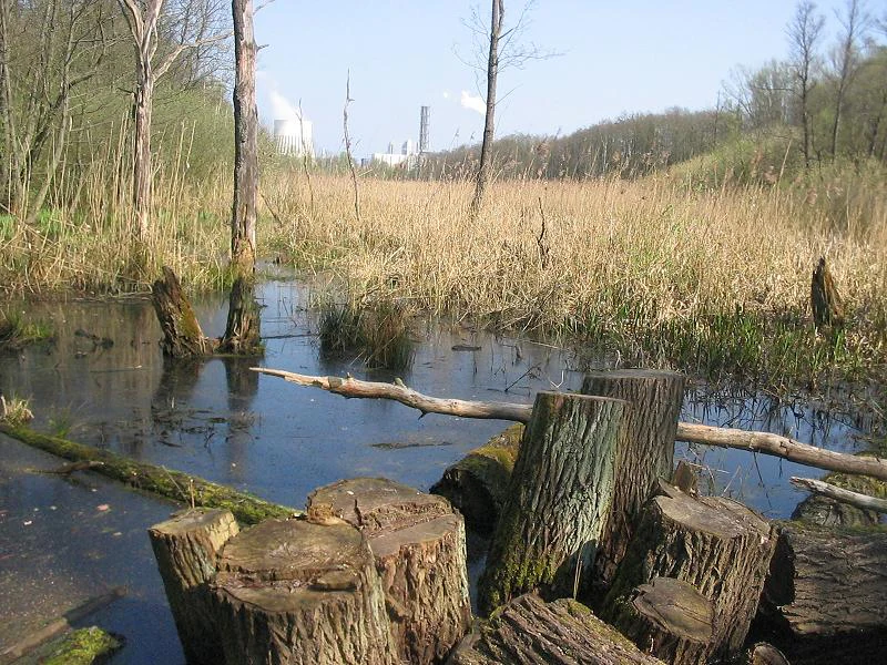
A wetland area with standing water, dead tree stumps in the foreground, and tall dry grass in the background with a power plant chimney visible in the distance.
A view of the wetland habitat at Fliesswiese Ruhleben nature reserve.

Fließwiese Ruhleben ecosystems, habitats, and plant life

Fließwiese Ruhleben belongs to the natural region known as the Brandenburg-Potsdam Havel area, part of the broader Central Brandenburg plateaus and lowlands of the East German Plain. Despite being surrounded by dense urban development, it preserves a sequence of rare wetland habitat types that flourish in the wet peat basin and along the slopes.

The northern central area, covering roughly four-fifths of the reserve, is dominated by extensive reedbeds. Common Reed forms the main mass, with patches of Broad-leaved Cattail, Floating Sweet-grass, and various sedges. Reed is encircled by a varying band of Black Alder swamp forest, with smaller additions of grey willow scrub, reed, and wetland sedges toward the shore. The southern portion is a more compact mosaic of Black Alder and Common Ash swamp forest, the latter a threatened biotope type that retains its protected status in part because of its rarity in Berlin. Where the forest meets shoreline, a tall herb layer includes Giant Fescue, Marsh Poa, Tufted Hair-grass, Marsh Hedge-nettle, Hop, and Stinging Nettle.

The edges of the basin connect the wetland to dry woodland on the surrounding slopes, where pine and oak, including oaks that are roughly three hundred years old, close the canopy. In a few warmer patches near the Ruhleben cemetery, rare Berlin dry grassland communities add an unexpected contrast to the otherwise wet environment. The Natura 2000 classification characterizes the site as a subneutral, mesotrophic to eutrophic terrestrializing moor of high amphibian importance, and as terrestrial habitat for moisture-dependent species.

Fließwiese Ruhleben wildlife and species highlights

Fließwiese Ruhleben is recognized above all as a breeding site for amphibians, with seven species of frogs, toads, and newts using its shallow, fish-free waters and surrounding woodland. The Northern Crested Newt is the site's most important faunal feature: in a 2000 supplementary proposal that supported the area's Natura 2000 designation, Berlin conservation groups estimated about five hundred adult Northern Crested Newts here, contributing roughly thirty-eight percent of the city's total population together with the Falkenberger Rieselfelder and Spandauer Forst.

The strictly nocturnal Garlic Toad also uses the reserve extensively. In spring it migrates in large numbers from the sandy end-moraine slopes of the Teltow down into the wetland to breed, and the dry, sandy high ground around the Murellenberge gives it crucial daytime refuge and overwintering habitat. The bog-loving Moor Frog lives year-round in the basin, using the seasonal flooding, the alder swamp, and the sedge-rich wet meadow for both spawning cover and hibernation. A handful of other amphibian species complete the fauna.

Beyond amphibians, the site is known for the Large White-faced Darter, a medium-sized dragonfly strictly protected under both German federal nature conservation law and the EU Habitats Directive. Birdlife includes breeding Greylag Geese and roughly four breeding pairs of Common Moorhens, while Common Cranes have become increasingly regular spring and summer visitors since around 2000. The surrounding forests hold typical songbirds, and the damp woods and meadows support small mammal populations including the Common Shrew, which reaches high densities in such habitats. Larger mammals such as Wild Boar, abundant in the nearby Grunewald forest, only rarely enter the reserve.

Fließwiese Ruhleben conservation status and protection priorities

Fließwiese Ruhleben has been legally protected as a Berliner Naturschutzgebiet since 21 May 1959, originally under number 04 and now listed as number 05. After being notified to the European network it also became part of the Natura 2000 system under the EU Fauna-Flora-Habitat directive, bearing the combined designation Naturschutz- und Natura 2000-Gebiet Fließwiese Ruhleben.

From a conservation perspective, the reserve concentrates significant value into a very small urban footprint. Its combination of peat-forming marsh, alder swamp forest, and rare amphibian breeding habitat makes it disproportionately important for biodiversity conservation in Berlin. The site's inclusion in Natura 2000 was specifically triggered by its Northern Crested Newt population, and the reserve remains classified for its amphibian fauna and moisture-dependent terrestrial species.

Modern management focuses on keeping the wetland open and lightly shaded: the reedbeds and the transition between reed and woodland mantle are periodically cleared of encroaching shrubs, while previously necessary mowing and roding have largely ceased since the groundwater rebound of 1994. The 1994 Berlin landscape and species protection programme explicitly identified the Fließwiese, along with the nearby Tiefwerder Wiesen and Schönower Wiesen, as extensive wet meadows to be preserved and expanded, with continuous green corridors planned along waterways to link similar habitats.

Fließwiese Ruhleben cultural meaning and human context

Although mostly a natural history subject, the Fließwiese carries modest cultural traces rooted in human use of the wetland. Historically, the meadow supported small-scale farming: a farmstead with fruit trees, vegetable plots, and pasture stood at the northeastern corner, while goat herders harvested hay and grass and neighbors took alder wood for fuel. The Murellenberge landscape that surrounds the reserve also holds heavier historical weight, including the nearby execution site commemorated by the memorial markers of the Denkzeichenweg along the Murellenberg, which passes directly above the southern tip of the Fließwiese.

In the broader German cultural landscape of traditional medicinal and useful wetland plants, the reserve still harbors surviving reminders of older rural plant knowledge. Three species in its herb layer have documented histories as medicinal plants: Pennywort once grown in medieval cottage gardens as a cough remedy, Water Mint historically used against stitch, and Shore Wolfstrap, whose above-ground parts are still used today in finished preparations for symptoms associated with overactive thyroid.

Top sights and standout views in Fließwiese Ruhleben

Among Berlin's protected areas, Fließwiese Ruhleben stands out for packing an ice-age landscape, an amphibian-rich peat marsh, and Natura 2000 protections into a single compact urban reserve. Its defining moments include the dramatic seasonal rise of groundwater that turns the basin into a shallow lake in spring and the persistence of threatened biotope types like Black Alder and Common Ash swamp forest.

The Northern Crested Newt, the Garlic Toad, and the Large White-faced Darter together give the site a disproportionately rich faunal profile, while the surrounding Murellenberge add a striking morphological contrast between steeply contoured push-moraine ridges and a low, water-filled peat basin. The reserve is one of the most visible examples of how a glacial landscape can survive within a dense modern city.

Best time to visit Fließwiese Ruhleben

Spring is the most striking time to experience Fließwiese Ruhleben, both for the visual impact of the flooded peat basin and for peak amphibian activity. By April the groundwater-recharged meadow often stands under roughly a meter of water, and newts, frogs, and toads are concentrated in and around the shallow pools for breeding. Summer and autumn, by contrast, typically show a drying mosaic with smaller flooded patches in the north and exposed reed and meadow vegetation, useful for observing the site's structural variety rather than its amphibian drama.

Because the reserve is fenced and primarily designated for ecological protection rather than recreation, any visit should be approached as a quiet appreciation from the surrounding paths, including the Brombeerweg and the commemorative Denkzeichenweg above the southern tip. Cool, damp days tend to bring more visible wildlife activity in a wetland of this type.

Monthly climate preview

Long-term representative monthly temperature ranges and precipitation rhythm for Fließwiese Ruhleben

Fließwiese Ruhleben Climate Normals, Annual Temperature and Precipitation Patterns

Representative coordinate measurements reveal how monthly mean temperatures transition from sub-zero winter lows to warm summer maximums alongside steady daily precipitation amounts. Detailed examination of the full twelve-month statistical record provides complete insight into long-term climate normals across the protected area.
Annual mean9 °C
-1 °C20 °C
Jan-1°
Feb
Mar
Apr
May14°
Jun18°
Jul20°
Aug20°
Sep15°
Oct
Nov
Dec
Warmest month
July

20.3 °C

Coolest month
January

-0.7 °C

Wettest month
July

2.4 mm/day

Driest month
April

1 mm/day

Park location guide

Geography guide, regional context, and park location map for Fließwiese Ruhleben

Fließwiese Ruhleben park geography, regions, and map view in Germany

Understand where Fließwiese Ruhleben sits in Germany through a broader geographic reading of the surrounding landscape, nearby location context, and its mapped position within the national park landscape.

How Fließwiese Ruhleben fits into Germany

Germany is a federal republic in Western and Central Europe with a population of over 83 million across sixteen constituent states. It is Europe's largest economy by nominal GDP and a major global exporter and importer. The capital is Berlin, and the country borders Denmark, Poland, Czech Republic, Austria, Switzerland, France, Luxembourg, Belgium, and the Netherlands.

Wider geography shaping Fließwiese Ruhleben in Germany

Germany is located in Western and Central Europe, spanning 357,022 km². It borders Denmark to the north, Poland and the Czech Republic to the east, Austria and Switzerland to the south, and France, Luxembourg, Belgium, and the Netherlands to the west. The country has coastlines on the Baltic Sea and North Sea to the north, with the Alps located in the southern region.

Map view of Fließwiese Ruhleben

Use this park location map to pinpoint Fließwiese Ruhleben in Germany, understand its exact geographic position, and read its mapped placement within the surrounding landscape more clearly.

Pigeon | © OpenStreetMap contributors

Location context for Fließwiese Ruhleben

Berlin

Explore protected area photography capturing peat marsh habitats, reed beds, and ice-age terrain.

Fließwiese Ruhleben Photos and Landscape Scenery: Visualizing the Glacial Wetland Reserve

Visual documentation reveals the distinct topography and seasonal flooding cycles shaping the protected wetland ecosystem of Fließwiese Ruhleben. Examining these field photographs provides deeper insight into the rare glacial meltwater basin, alder swamp forests, and urban nature reserve habitats.

A tranquil pond surrounded by lush spring vegetation, featuring fallen logs in the water and a background of reeds and trees in the Fließwiese Ruhleben nature reserve.

A swampy woodland area with thin, dark tree trunks rising from a green, mossy water surface reflecting the spring light.

A wetland area with standing water, dead tree stumps in the foreground, and tall dry grass in the background with a power plant chimney visible in the distance.

Park atlas

Discover adjacent wetland reserves and connected glacial landscapes in the regional park network.

Explore Parks Near Fließwiese Ruhleben And Surrounding Protected Areas

Compare Fließwiese Ruhleben with other protected areas across the surrounding urban and glacial terrain. Regional park exploration reveals linked wetland habitats and diverse ecological reserves throughout the wider district.
Protected landscapeBerlin
About 1.6 km away#1 closest

Southwest

Tiefwerder-Wiesen Protected Landscape: Berlin Riverine Geography and Floodplain Map

Mapping the historic Havel river floodplains and wetland habitats.

Tiefwerder-Wiesen serves as an important ecological corridor in Berlin, safeguarding the last functional pike spawning grounds within the city. This protected landscape contains a dense network of river arms, ditches, and sedge meadows that illustrate the historical and ongoing geomorphological processes of the Havel river valley.

Area
0.667 km²
Established
1960
Relief
Lowland
Climate
Temperate
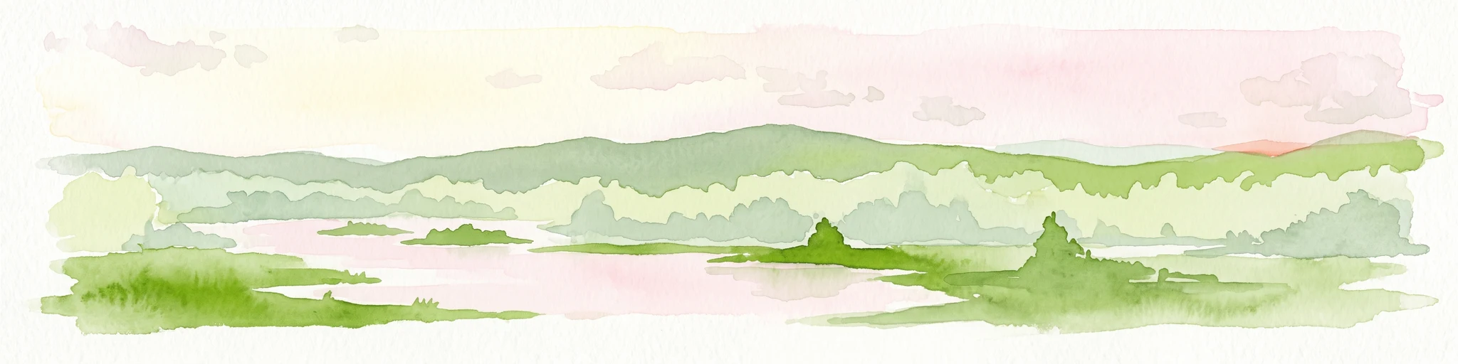
Watercolor illustration of a serene wetland scene with soft green hills and a light pink sky.
Nature reserveBerlin
About 3.3 km away#2 closest

South

Sandgrube im Jagen 86 Nature Reserve: Mapped Geography and Protected Area Context

A unique habitat mosaic within the Berlin forest region

Sandgrube im Jagen 86 functions as a protected nature reserve in Berlin, characterized by a bowl-shaped terrain of glacial sands. The area provides a critical habitat for specialized wildlife by balancing nutrient-poor grasslands with open water bodies and sun-exposed slopes, illustrating an effective example of managed conservation within an urban forest.

Area
0.135 km²
Established
1992
IUCN
IV
Relief
Lowland
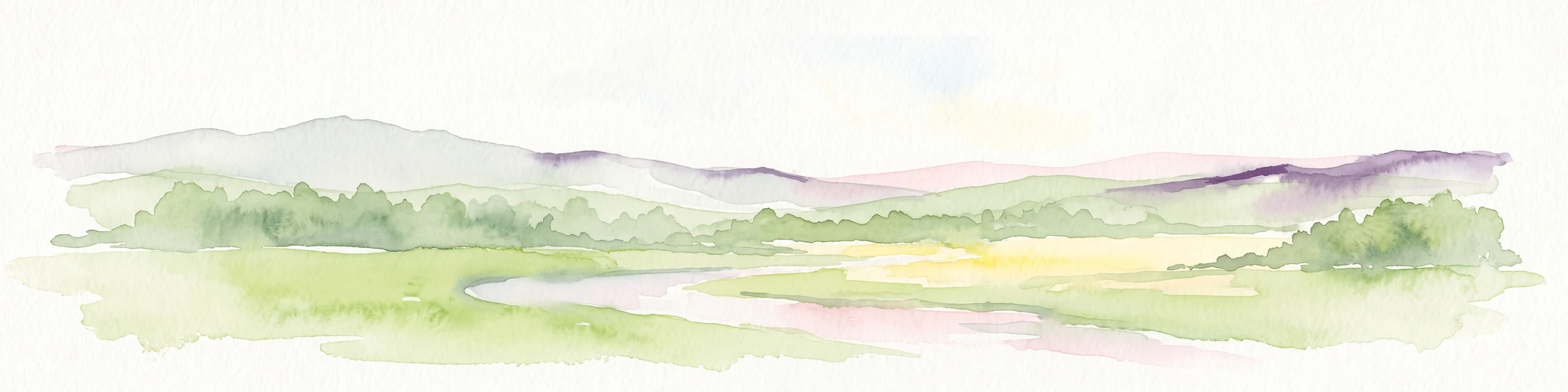
A watercolor painting showing a soft green marshy landscape with low hills in the background and a winding stream in the foreground.
Nature reserveBerlin
About 5 km away#3 closest

South

Hundekehlefenn Nature Reserve: Geography and Protected Wetland Landscapes in Berlin

Glacial meltwater channel and moorland in Grunewald

Hundekehlefenn represents one of the last surviving pieces of original Berlin vegetation, preserved as a nature reserve within the city limits. This compact protected area showcases a glacial meltwater channel geography, featuring marshy depressions, mesotrophic bog remnants, and alder swamp forests. It serves as an essential ecological link within the Grunewaldseenkette lake chain, providing a window into the natural terrain history of the region.

Area
0.1 km²
Established
1987
Relief
Lowland
Climate
Temperate
Nature reserveBerlin
About 5 km away#4 closest

Southwest

Windmühlenberg Nature Reserve: Glacial Terrain and Steppe Flora in Berlin

Protected sand-dry grasslands on the Nauen Plateau edge

Windmühlenberg preserves a rare ecological landscape in western Berlin. This glacial hill and nature reserve functions as a protected habitat for steppe-relict flora and specialized insects, serving as a critical point of interest for understanding the geomorphology and sand-based grassland environments of the Havel river valley.

Area
0.051 km²
Established
2002
Relief
Upland
Climate
Temperate
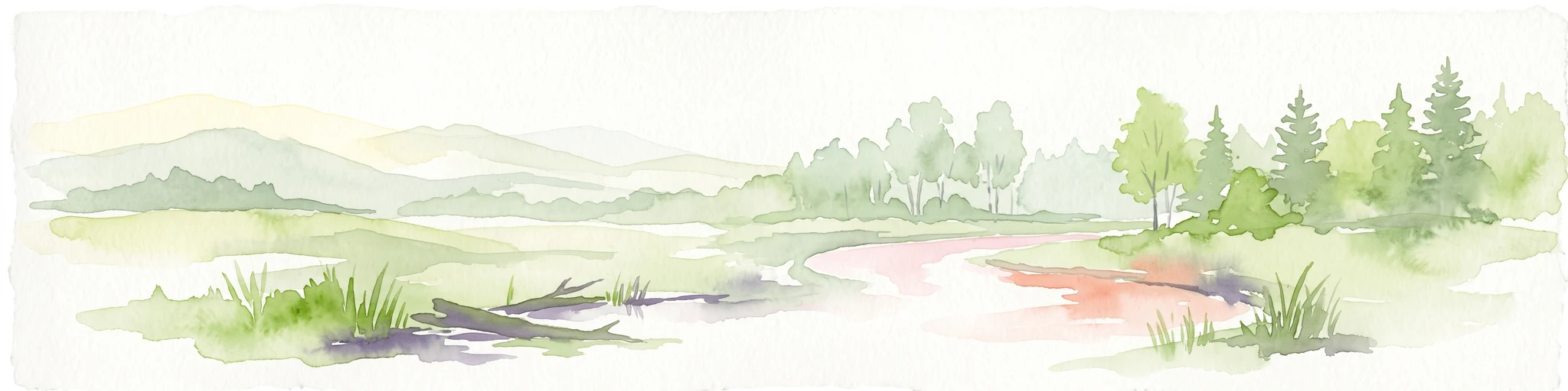
A horizontal watercolor painting showing a wetland landscape with calm water, marshy vegetation, and a background of soft rolling hills and mixed forest trees.
Nature reserveBerlin
About 6.4 km away#5 closest

South

Langes Luch / Dachsheide: Nature Reserve and Glacial Wetland Geography in Berlin

Protected mosaic of bog, forest, and inland dune habitats

Langes Luch / Dachsheide encompasses a rare urban protected area in Berlin, defined by the interplay between low-lying swampy depressions and elevated sandy heath. The site features complex glacial meltwater channels, open transitional mires, and historical terrain modifications, forming an essential study area for local conservation and regional landscape ecology.

Area
0.324 km²
Established
1960
IUCN
IV
Relief
Lowland
Nature reserveBerlin
About 7 km away#6 closest

South

Riemeisterfenn Nature Reserve and Protected Peatland Landscape in Berlin

A rare bog ecosystem within the city glacial lake chain

Riemeisterfenn is a distinct nature reserve in Berlin, characterized by its marshy lowlands, reed beds, and alder carr vegetation. This site offers an essential look at a preserved peatland habitat and the Fennkanal hydrology that connects these protected areas to the wider Grunewald forest ecosystem.

Area
0.072 km²
Established
1987
Relief
Lowland
Climate
Temperate
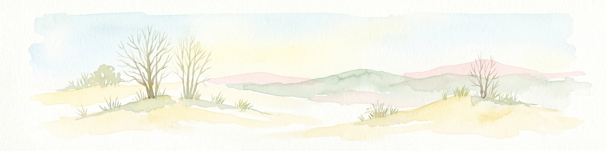
A pale, soft watercolor illustration showing rolling hills, sparse trees, and gentle inland dune slopes under a light sky.
Protected landscapeBerlin
7.8 km away#7 closest

North

Baumberge Protected Landscape: Mapping Berlin's Glacial Sand Dunes and Rare Grassland Habitats

A vital protected ecosystem within the Tegeler Forst region

The Baumberge stand as one of the last remaining open inland dune sites in Berlin, encompassing a fragile 47 hectare mosaic of sand heath and dry grassland. These parabolic dunes provide a critical refuge for warmth-loving invertebrate species and rare flora, anchored by glacial sand deposits dating back to the last ice age. The area offers a significant window into the historical landscape evolution of the northern Berlin glacial valley.

Area
0.47 km²
Relief
Lowland
Climate
Temperate
Access
Easy access
A soft watercolor painting showing rolling green hills, patches of open land, and trees against a pale sky background.
Nature reserveHavelland
8.8 km away#8 closest

West

Döberitzer Heide Nature Reserve: Geographic Atlas and Protected Landscape Mapping

Glacial sand flats and heathlands in the Havelland region

Döberitzer Heide occupies a unique position on the southeastern Nauener Platte, providing a study of dry heath, grassland, and wetland habitats. Once a restricted military training ground, the area now functions as a vital protected landscape where European bison and wild horses maintain open terrains. This atlas entry focuses on the regional geography and the structural components of this nature reserve situated near the urban centers of Berlin and Potsdam.

Area
34.15 km²
Established
1997
Relief
Upland
Climate
Temperate

Common questions about visiting, size, designation, and location context for Fließwiese Ruhleben

Fließwiese Ruhleben FAQs for park facts, access, geography, and protected area context

Find quick answers about Fließwiese Ruhleben, including protected-area facts, park geography, trail and visitor context, and how the park fits into its surrounding country and regional landscape.
MoriAtlas Explorer

Continue Your Protected Areas Search Across the Global Atlas

Deepen your exploration by continuing the structured search for national parks and protected areas worldwide. Utilize the comprehensive filtering capabilities to compare different conservation landscapes and refine your understanding of global park geography. Discover more about the distribution and characteristics of protected natural areas.

Global natural geography