
Mori Atlas logo
Protected areaForêt classée de Kakimbo

Examining the ecological boundaries and hydrogeological features of a critical peri-urban woodland reserve.

Forêt classée de Kakimbo: A Mapped Analysis of Conakry Coastal Forest Landscapes and Protected Terrain

Forêt classée de Kakimbo serves as a vital protected area on the northeastern outskirts of Conakry, functioning as a dense canopy refuge within the rapidly expanding urban landscape of the Ratoma commune. This detailed atlas entry examines the reserve's unique karst cave systems, groundwater boreholes, and mature coastal woodlands that define its physical character. Understanding its geographic placement and historic protection status provides context for its role as the green lung of Guinea's capital city.

classified forestperi-urban forestcoastal woodlandcavesurban green spacebiodiversity refuge
An artistic, flat-style illustration of a waterfall flowing between steep canyon walls, framed by silhouetted pine trees in the foreground, with a warm-toned sun setting in the background.

Forêt classée de Kakimbo

Protected area

Park overview

Structured park overview, official facts, and landscape profile for Forêt classée de Kakimbo

Forêt classée de Kakimbo park facts, protected area profile, and essential visitor context

Review the core facts for Forêt classée de Kakimbo, including designation, size, terrain, visitor scale, habitats, and operating context in one park-focused overview.

About Forêt classée de Kakimbo

Forêt classée de Kakimbo is a small but ecologically and socially significant classified forest reserve on the northeastern edge of Conakry, Guinea's coastal capital. It occupies a place quite unlike Guinea's larger, more remote national parks such as the Fouta Djallon highlands or the Mount Nimba massif; instead, Kakimbo is an urban and peri-urban forest, threaded between residential neighborhoods, roads, and infrastructure in one of West Africa's most densely populated capital cities.

The reserve falls within the commune of Ratoma, beyond the Kipé neighborhood on the route that leads toward Taouyah. Although its original extent is reported to have been around 117 hectares, decades of urban expansion and pressure have reduced the standing forest to a much smaller core area, estimated at only about 15 hectares in more recent accounts. Despite this dramatic shrinkage, the surviving woodland continues to play an outsized role in the local environment.

Kakimbo's protected status has a layered history. The forest was originally placed under protection in 1945, during the colonial administration, with a focus on its contribution to greenhouse gas storage. Protection was reaffirmed in 1983 during the first republic under President Ahmed Sékou Touré, embedding the site within Guinea's broader framework of classified forests. Today, the reserve is valued not only for its carbon-storage role but also for the shade, biodiversity, groundwater, and scenic diversity that it provides to Conakry's residents.

Among the physical features that distinguish Kakimbo are four caves, collectively referred to as the Grotte de Kakimbo, which add a subterranean dimension to the otherwise wooded reserve. The site also hosts a series of boreholes operated by the Société des Eaux de Guinée (SEG), reflecting the forest's central role in supplying drinking water to surrounding neighborhoods. Together these characteristics: forest, caves, and water infrastructure, give Kakimbo a multi-functional identity that few other classified forests in West African capital cities can match.

Quick facts and research context for Forêt classée de Kakimbo

Forêt classée de Kakimbo is a classified forest located in the commune of Ratoma, in the northeastern coastal part of Conakry, Guinea. It was first given protected status in 1945 during the French colonial period, and was reclassified as a protected area in 1983 under the government of Ahmed Sékou Touré. The site is recognized for its greenhouse gas storage function, its tall trees, and the presence of four notable caves within its boundaries.

Park context

Deeper park guide and search-rich context for Forêt classée de Kakimbo

Forêt classée de Kakimbo history, landscape, wildlife, and travel context

Explore Forêt classée de Kakimbo through its history, landscape character, ecosystems, wildlife, conservation priorities, cultural context, and seasonal travel timing in a structured park guide built for atlas discovery and search intent.

Why Forêt classée de Kakimbo stands out

Kakimbo is best known for serving as the "green lung" of Conakry, a peri-urban classified forest with tall trees, a network of caves (the Grotte de Kakimbo), and boreholes that supply drinking water to parts of the capital. Its identification with carbon storage and local biodiversity in an otherwise densely built coastal urban setting gives it a distinct identity among Guinea's protected forest reserves.
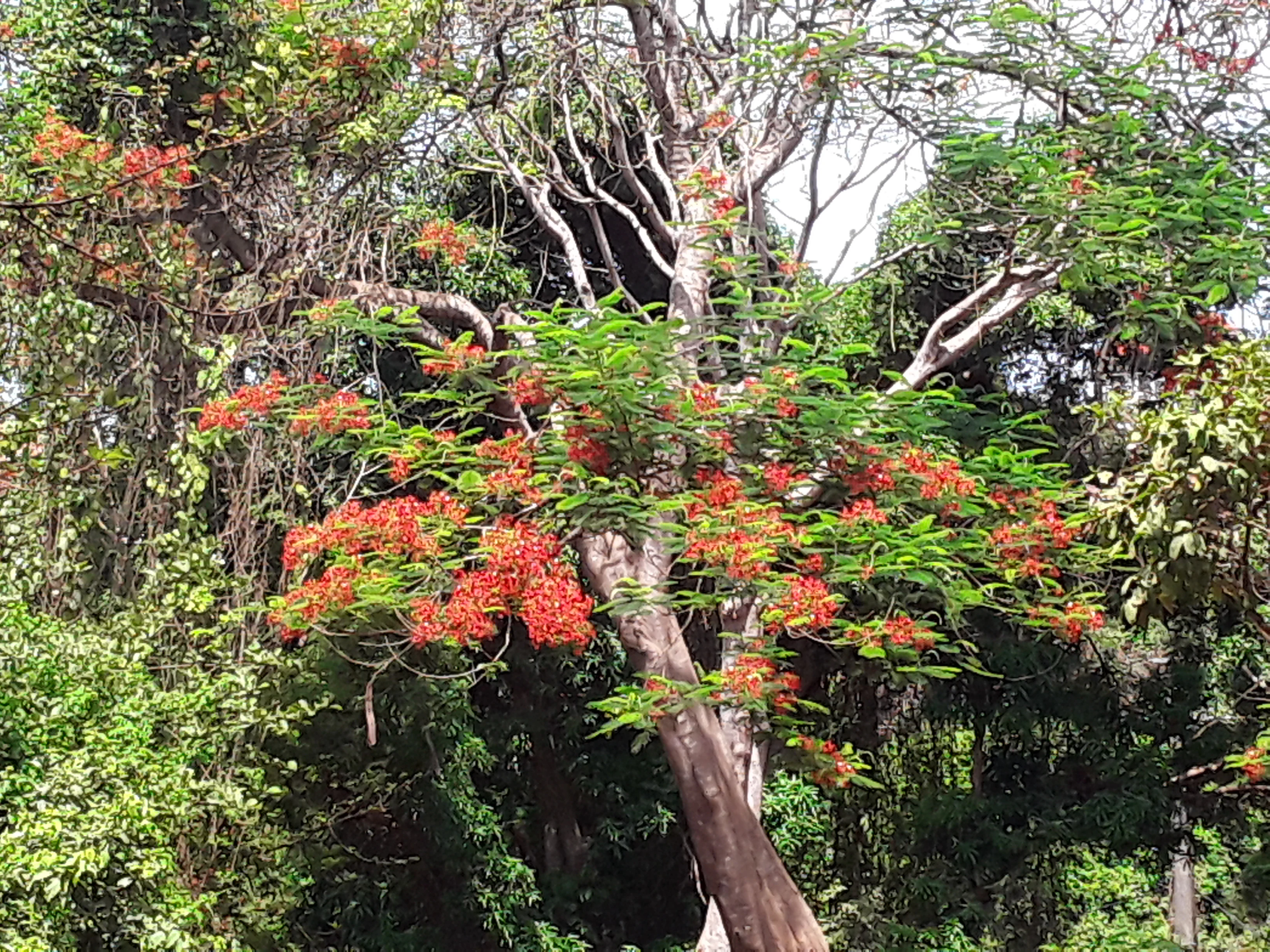
A medium shot of a tree with vibrant orange-red flowers and green foliage standing in a dense tropical forest.
A flowering tree within the Kakimbo Classified Forest in Guinea.

Forêt classée de Kakimbo history and protected-area timeline

Forêt classée de Kakimbo was first placed under formal protection in 1945, during the period of French colonial administration in Guinea, with its designation explicitly tied to the storage of greenhouse gases and the carbon sequestration value of mature coastal woodland. This early classification reflects the colonial-era recognition of forested landscapes as both ecological reserves and atmospheric buffers.

Protection was reaffirmed in 1983 under the first republic of independent Guinea, during the presidency of Ahmed Sékou Touré. The reclassification under the post-independence government integrated Kakimbo into the national network of forêts classées, ensuring continuity of legal protection across the colonial-to-republican transition.

Beyond these formal milestones, the reserve has experienced a steady contraction of its actual forested area. Originally reported at around 117 hectares, the standing forest has shrunk to roughly 15 hectares, an outcome widely attributed to urban growth, land conversion, and development pressure in the expanding periphery of Conakry. This history of reduction parallels the broader story of peri-urban forest loss across many West African capitals.

Forêt classée de Kakimbo landscape and geographic character

Kakimbo's landscape is defined less by grand relief than by contrast: a patch of dense, tall-canopy forest set against the sprawling built-up neighborhoods of northeastern Conakry. The terrain is part of the low-lying Atlantic coastal plain of Guinea, with the reserve sitting beyond the Kipé neighborhood on the route toward Taouyah in the commune of Ratoma.

The vegetation profile is dominated by high-canopy trees typical of Guinean coastal woodlands, with mature individuals forming a relatively continuous shaded canopy over the surviving forest core. Among the most visually distinctive features of the site are its four caves, known collectively as the Grotte de Kakimbo, which introduce karst-like subterranean elements into an otherwise flat coastal setting.

The reserve's hydrogeology is equally important to its landscape character. Kakimbo hosts seven boreholes operated by the Société des Eaux de Guinée (SEG), reflecting an aquifer system that has been productive enough to justify extraction infrastructure. The combination of dense woodland, caves, and accessible groundwater gives the site a layered physical identity that operates at multiple levels: canopy, ground, and subsurface.
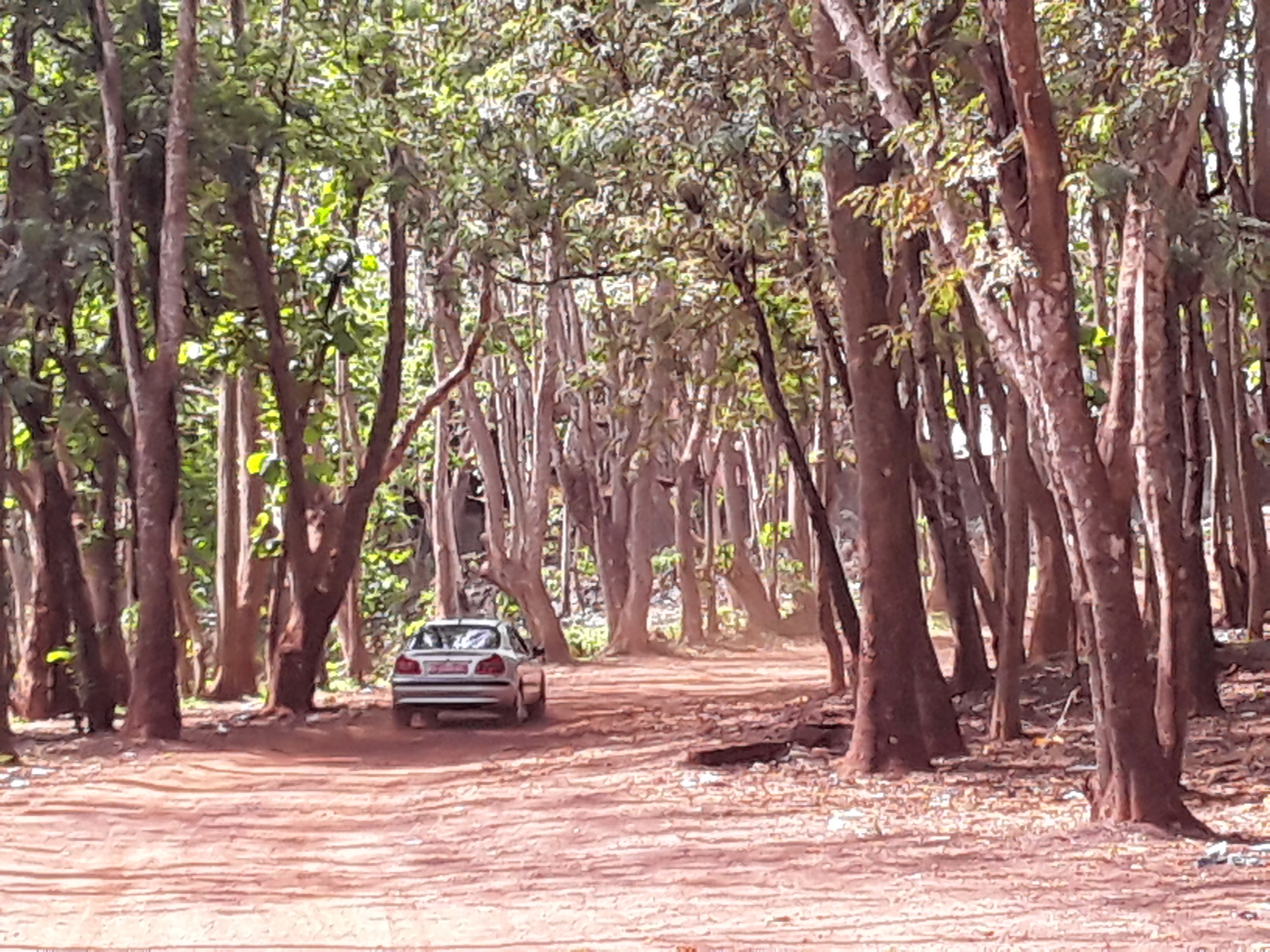
A silver car driving on a reddish dirt road surrounded by tall, slender trees in a forested area.
A dirt road winding through the dense trees of the Forêt classée de Kakimbo.

Forêt classée de Kakimbo ecosystems, habitats, and plant life

Ecologically, Forêt classée de Kakimbo functions as a refugium of Guinean coastal woodland within an urban matrix. Its tall trees and closed canopy create microclimates that contrast strongly with the surrounding built environment, supporting shade-tolerant understory plants and providing habitat for the reptiles, small mammals, and birdlife typical of the West African coastal forest belt.

The remaining forest is small in absolute terms following decades of contraction, but its ecological value is amplified by proximity to dense human settlement. Kakimbo offers an unusually accessible window into the structure and composition of what the region's natural vegetation once looked like before urban expansion. Cave systems within the reserve further diversify habitat conditions, supporting cave-adapted fauna and adding a subterranean component to the site's biodiversity profile.

The boreholes within the reserve are not only infrastructural assets but also ecological indicators, signaling the presence of a productive shallow aquifer beneath the wooded area. This water resource supports both the forest vegetation and the surrounding human population, linking ecological function with urban water supply in a way that few small reserves do.
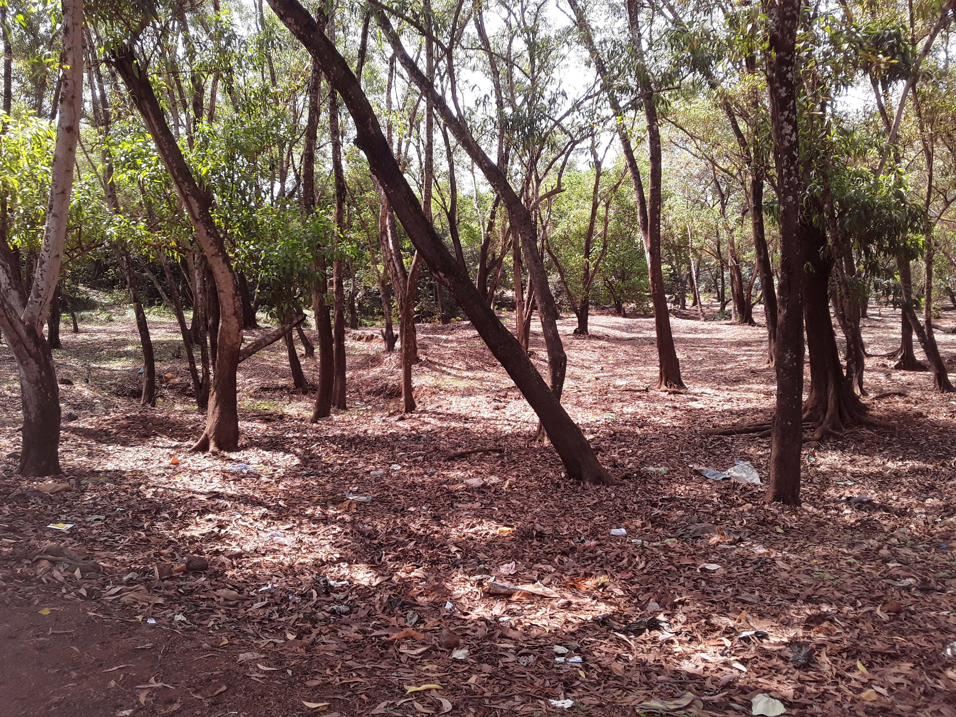
A grove of slender trees with a ground covered in dry brown leaves in the Kakimbo Classified Forest.
A view of the woodland landscape within the Forêt classée de Kakimbo.

Forêt classée de Kakimbo wildlife and species highlights

Wildlife at Forêt classée de Kakimbo reflects the character of a small but ecologically functional patch of coastal Guinean woodland. The reserve is documented as harboring reptiles, with children and visitors occasionally encountering small reptile species, and the local fauna is broadly consistent with that of West African urban-adjacent forests, including small mammals and a community of resident and seasonal birds drawn to the closed canopy.

The cave systems of the Grotte de Kakimbo provide additional habitat for cave-associated fauna such as bats and other crevice-dwelling species, enriching the reserve's animal life beyond what the surface forest alone would support. Although the small size of the remnant forest limits the population sizes that can be sustained, the site's role as a biodiversity refugium within Conakry remains important.
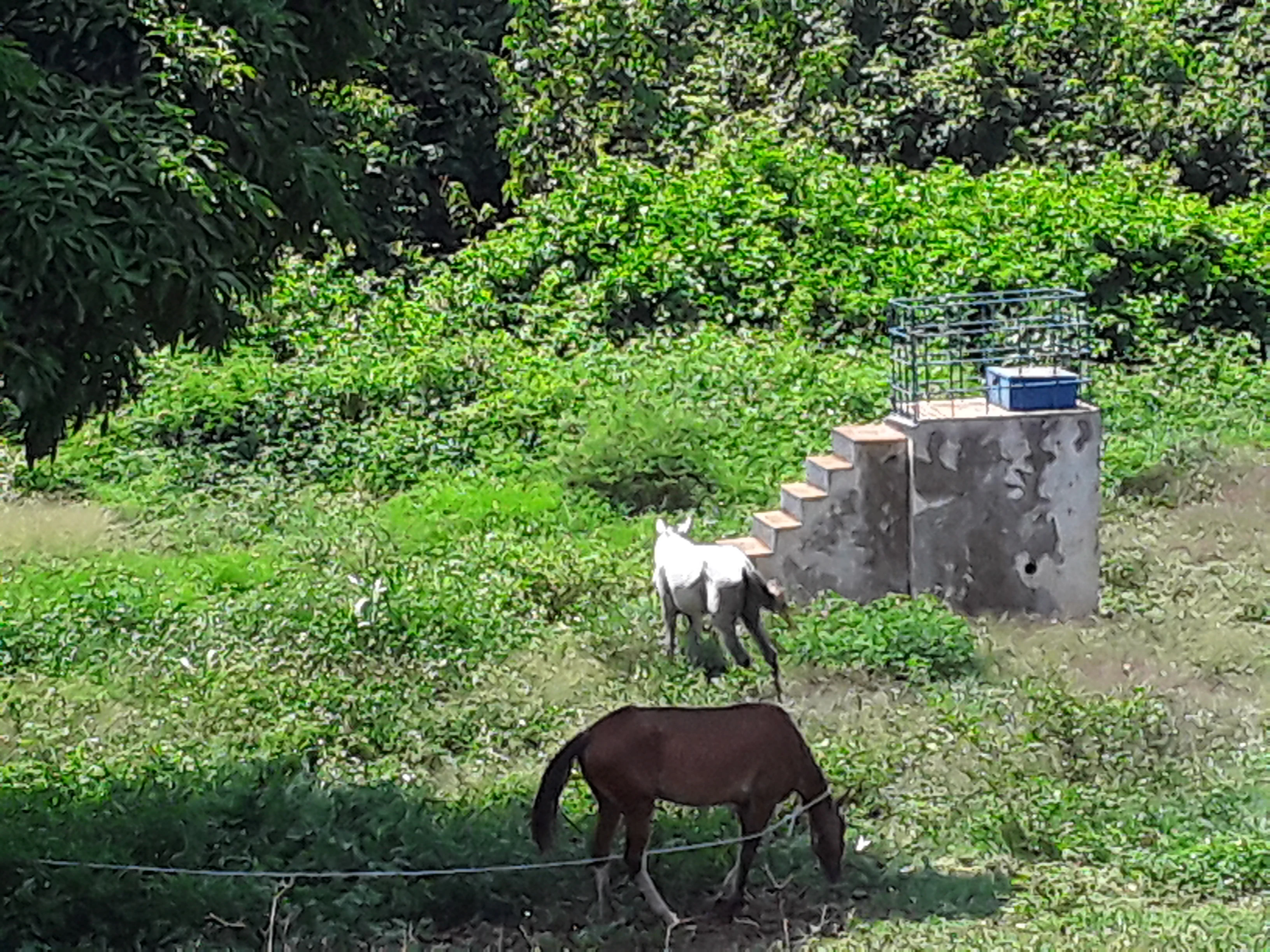
Two horses grazing in a grassy field in front of a small concrete structure and dense green foliage.
Horses grazing in a cleared area of the Kakimbo Classified Forest.

Forêt classée de Kakimbo conservation status and protection priorities

Conservation significance at Kakimbo is twofold. First, the reserve is one of the older formally protected classified forest areas in Guinea, with legal protection dating back to 1945 during the colonial period and reaffirmed in 1983 under the first republic. Its original designation explicitly cited greenhouse gas storage, embedding carbon sequestration into the rationale for its protection at a time when this framing was unusual.

Second, Kakimbo represents a critical case of peri-urban forest conservation. Originally around 117 hectares, the area of standing forest has contracted dramatically, with only around 15 hectares reported in more recent assessments. This pattern of loss mirrors the broader trajectory of urban forest reserves across the region, making Kakimbo a high-priority site for retention, restoration, and continued legal protection.

The reserve also contributes to functional ecosystem services, most notably through its boreholes feeding into the municipal water supply via the Société des Eaux de Guinée (SEG). The combination of carbon storage, biodiversity refuge status, and groundwater provisioning gives Kakimbo a multi-layered conservation profile that extends well beyond a simple designation on paper.

Forêt classée de Kakimbo cultural meaning and human context

Kakimbo has a strong identity as the "green lung" of Conakry, a phrase that captures the cultural significance Guineans attach to the forested reserve within their densely settled capital. For residents of the commune of Ratoma and surrounding neighborhoods, the forest functions as a place for shade, recreation, encounters with nature, and a tangible symbol of the city's natural heritage.

The reserve's role in supplying drinking water through the Société des Eaux de Guinée (SEG) adds a utilitarian cultural layer: Kakimbo is not only admired but also depended upon as part of everyday urban life. Horses are among the animals that have been documented within the forest, suggesting traditional uses of the reserve that include grazing and informal passage alongside modern urban activity.

The caves of Kakimbo, collectively known as the Grotte de Kakimbo, contribute their own local lore and sense of place, distinguishing the site from surrounding green areas and reinforcing its standing as a memorable landmark within the neighborhood landscape of northeast Conakry.

Top sights and standout views in Forêt classée de Kakimbo

Forêt classée de Kakimbo stands out for its combination of ecological and infrastructural functions within a single small reserve. Among its most distinctive attributes are its tall coastal-canopy trees, its set of four caves (the Grotte de Kakimbo), its network of SEG boreholes supplying drinking water to the capital, and its long-standing legal protection dating to 1945 and reaffirmed in 1983.

Best time to visit Forêt classée de Kakimbo

Kakimbo's character as a peri-urban coastal forest means that visits are shaped more by Guinea's broader coastal climate than by dramatic seasonal shifts. The wet season, generally associated with the West African monsoon pattern, tends to bring lusher vegetation and more active wildlife, while the drier season offers more comfortable ground conditions and clearer access along the reserve's unpaved routes. Because the site lies close to the Atlantic, temperatures remain relatively warm year-round, and early morning or late afternoon hours typically offer the most pleasant conditions for walking beneath the canopy.

Monthly climate preview

Long-term representative measurements of temperature and precipitation rhythms

Annual Climate Normals and Weather by Month for Forêt classée de Kakimbo

Representative coordinates reveal recorded monthly temperature variations and precipitation averages across the protected area. Examining the complete twelve-month profile provides deeper insight into the local climate normals.
Annual mean27 °C
26 °C28 °C
Jan27°
Feb27°
Mar27°
Apr27°
May27°
Jun27°
Jul26°
Aug26°
Sep26°
Oct27°
Nov27°
Dec28°
Warmest month
December

27.6 °C

Coolest month
August

25.8 °C

Wettest month
August

28.4 mm/day

Driest month
January

0 mm/day

Park location guide

Geography guide, regional context, and park location map for Forêt classée de Kakimbo

Forêt classée de Kakimbo park geography, regions, and map view in Guinea

Understand where Forêt classée de Kakimbo sits in Guinea through a broader geographic reading of the surrounding landscape, nearby location context, and its mapped position within the national park landscape.

How Forêt classée de Kakimbo fits into Guinea

Guinea is a West African country with a population of approximately 14 million people. The country achieved independence from France in 1958 and is known for its diverse geography ranging from coastal lowlands to highland plateaus. Conakry serves as both the capital and largest city. Guinea is a member of the United Nations, ECOWAS, the African Union, and La Francophonie.

Wider geography shaping Forêt classée de Kakimbo in Guinea

Guinea is located on the West African Atlantic coast, bordered by Guinea-Bissau to the northwest, Senegal to the north, Mali to the northeast, Ivory Coast to the southeast, and Sierra Leone and Liberia to the south. The country is divided into four geographic regions: Maritime Guinea along the Atlantic coast, the Fouta Djallon highlands in Middle Guinea, the Upper Guinea savanna in the northeast, and the forested Guinea region in the southeast.

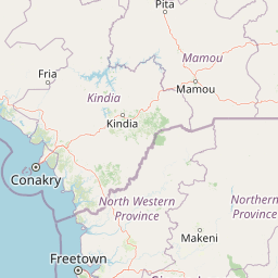
Map view of Forêt classée de Kakimbo

Use this park location map to pinpoint Forêt classée de Kakimbo in Guinea, understand its exact geographic position, and read its mapped placement within the surrounding landscape more clearly.

Pigeon | © OpenStreetMap contributors

Location context for Forêt classée de Kakimbo

Conakry Region

Visual exploration of coastal woodland habitats and subterranean cave formations

Forêt classée de Kakimbo Photos and Landscape Scenery

Visual records document the dense high-canopy woodlands and subterranean karst formations that define Forêt classée de Kakimbo. Field photography illustrates the physical terrain and protected habitat features of this coastal forest reserve.

A medium shot of a tree with vibrant orange-red flowers and green foliage standing in a dense tropical forest.

A slightly backlit view inside a forest with numerous thin tree trunks and a canopy allowing light to filter down to the dry, leaf-covered ground.

A silver car driving on a reddish dirt road surrounded by tall, slender trees in a forested area.

A grove of slender trees with a ground covered in dry brown leaves in the Kakimbo Classified Forest.

Two horses grazing in a grassy field in front of a small concrete structure and dense green foliage.

A young boy in a dark blue shirt holds a small lizard by its tail near a forest stream, with other children standing nearby.

Park atlas

Compare regional park geography and connected protected landscapes.

Other Parks Near Forêt classée de Kakimbo and Surrounding Protected Areas

Browse nearby national parks and protected areas sharing similar coastal woodland and regional geography. Expanding the search helps compare protected landscapes across the surrounding region.
Protected areaGuinea
About 53 km away#1 closest

Northwest

Rio Pongo: A Protected Estuarine Wetland Landscape in Coastal Guinea

Mapping mangrove forests, tidal mudflats, and coastal ecology

Rio Pongo is a prominent protected area in Guinea, characterized by a complex network of brackish tidal channels and dense mangrove forests. The site serves as a crucial habitat for waterbirds and aquatic mammals, while its position at the edge of the Atlantic Ocean defines a dynamic, low-lying coastal terrain that remains vital for regional conservation and ecological research.

Area
300 km²
Established
1992
Water
Water-dominated
Nature reserveBoke Region
About 138 km away#2 closest

Northwest

Rio Kapatchez Managed Nature Reserve: Coastal Estuarine Mapping and Protected Area Overview

Tidal wetland geography within the Boke region of Guinea

Examine the protected coastal landscapes of Rio Kapatchez Managed Nature Reserve, a significant wetland system where freshwater river flow merges with Atlantic tidal influences. This reserve provides an essential geographic look at mangrove-rich estuarine environments and the sediment-driven topography of the western Guinean coastline.

Area
200 km²
Established
1992
Relief
Lowland
Scope
Mixed
National parkSierra Leone
About 149 km away#3 closest

South

Western Area Peninsula National Park: Sierra Leone Protected Coastal Rainforest Atlas

Mapped terrain, forest boundaries, and regional watershed geography

Discover the geographic identity of Western Area Peninsula National Park, a key protected area situated along the coast of Sierra Leone. This record details the park's dense tropical forest canopy, steep slopes, and vital role in watershed management across the peninsula, offering a clear view of its natural boundaries.

IUCN
II
National parkSierra Leone
About 149 km away#4 closest

South

Western Area Peninsula National Park: Mapped Forest Landscape and Geographic Context

Sierra Leone protected area and forest ecosystem map

Western Area Peninsula National Park encompasses 18,337 hectares of rolling terrain and semi-deciduous forest. This atlas entry examines the park boundaries and its role as a key conservation refuge in Sierra Leone, home to the Tacugama Chimpanzee Sanctuary and significant avian habitats within a coastal-influenced climate.

Area
183.37 km²
Established
2012
IUCN
II
Relief
Lowland
National parkKarene District
About 180 km away#5 closest

East

Outamba-Kilimi National Park: Sierra Leone National Park and Protected Landscape Atlas

Mapped natural terrain within Karene District.

Investigate Outamba-Kilimi National Park as a protected area, examining its geographic footprint and significance within Sierra Leone's natural landscapes. This detailed entry provides context on the park's mapped boundaries and its contribution to regional geography, serving as a key point for atlas-based exploration of conservation lands in the Karene District.

Area
1,109 km²
Established
1986
IUCN
II
Relief
Lowland
A wide watercolor illustration showing green hills and trees along a pale river valley with a soft sky.
Protected areaMamou Region
About 214 km away#6 closest

Northeast

Bafing-Source Protected Area: A Highland Wetland Landscape in the Mamou Region

Tracing the headwaters and plateau geography of the Bafing River basin

The Bafing-Source protected area serves as a significant hydrological anchor within the Fouta Djallon highlands of Guinea. This expansive site protects critical wetland catchments and plateau terrain that feed into the broader Senegal River system, demonstrating the vital link between highland ecosystems and downstream water security.

Area
3,172 km²
Established
2007
Relief
Highland
Climate
Tropical
Watercolor painting of a soft, layered landscape featuring green trees and gentle hills against a pale, warm sky.
Nature reserveIvory Coast
About 226 km away#7 closest

East

Forêt classée de Pinselly: Protected Area Geography and Landscape Mapping

Nature reserve analysis and regional atlas context

Examine the formal boundaries and landscape character of Forêt classée de Pinselly. This atlas entry focuses on the geographic structure and environmental positioning of this nature reserve in Ivory Coast, offering a clear view of its role as a protected landscape.

Established
1945
Relief
Mountain
Climate
Tropical
Access
Moderate access
National parkGuinea-Bissau
About 239 km away#8 closest

Northwest

Cantanhez Forests National Park: A Protected Landscape within Guinea-Bissau's Geography

Explore mapped boundaries and regional landscape context.

Cantanhez Forests National Park stands as a notable protected area, providing a specific lens through which to understand the natural geography of Guinea-Bissau. This entry facilitates an atlas-style examination of the park's identity, focusing on its landscape character and its position within the regional geographic framework of West Africa. Delve into the structured information to appreciate the unique protected-area context that Cantanhez Forests National Park contributes to the country's mapped natural heritage.

IUCN
II
Scope
Terrestrial

Common questions about visiting, size, designation, and location context for Forêt classée de Kakimbo

Forêt classée de Kakimbo FAQs for park facts, access, geography, and protected area context

Find quick answers about Forêt classée de Kakimbo, including protected-area facts, park geography, trail and visitor context, and how the park fits into its surrounding country and regional landscape.
MoriAtlas Explorer

Continue Your Protected Areas Search Across the Global Atlas

Deepen your exploration by continuing the structured search for national parks and protected areas worldwide. Utilize the comprehensive filtering capabilities to compare different conservation landscapes and refine your understanding of global park geography. Discover more about the distribution and characteristics of protected natural areas.

Global natural geography