Why Forêt classée de N'Dali stands out
The Forêt classée de N'Dali is best known for its savanna-woodland mosaic, a typical vegetation pattern of northern Benin formed by open woodland, tree savanna, shrub savanna, and ribbon-like gallery forests along watercourses. It is also recognized as one of the forêts classées whose management was modernized through participatory planning in the late 1990s, alongside the larger Ouémé supérieur classified forest.
Forêt classée de N'Dali history and protected-area timeline
The Forêt classée de N'Dali was originally established as a classified forest under arrêté N° 366 SE of 30 January 1942, when the area was part of the Cercle de Parakou under French colonial administration. This early classification laid the foundation for nearly a century of state-recognized protection for the woodland surrounding the town of N'Dali in northern Benin.
The legal framework governing the reserve was modernized with the adoption of Benin's forest law, Loi N° 93-009 of 2 July 1993, which established the contemporary regime des forêts of the Republic of Benin. This law provided the basis under which subsequent management planning was developed, including for Forêt classée de N'Dali and the larger Ouémé supérieur classified forest.
In 1997, a vegetation inventory of Forêt classée de N'Dali was carried out, mirroring the work being done for the Ouémé supérieur classified forest. The inventory documented the mosaic structure of the reserve, including open woodland, tree savanna, shrub savanna, and gallery forest components. Following the inventory, a participatory management plan covering both N'Dali and the Ouémé supérieur forests was proposed by the Minister of Rural Development and formally approved by the Council of Ministers on 2 June 1999. The plan became legally effective through Décret N° 99-295 of 11 June 1999, marking the official adoption of participatory management planning for these classified forests in the modern Beninese state.
Forêt classée de N'Dali landscape and geographic character
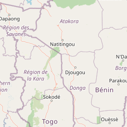
The landscape of Forêt classée de N'Dali reflects the broader topographic character of northern Borgou, a region of gently undulating terrain between the Atacora chain to the west and the broader Sudano-Sahelian plains to the north and east. Elevations are relatively low and the relief is subdued, producing a landscape in which subtle variations in soil and drainage strongly control vegetation patterns.
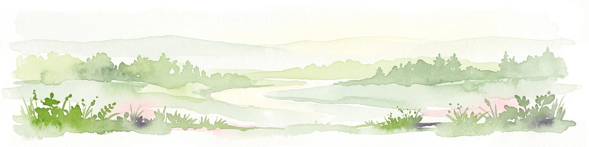
The defining landscape feature of the reserve is its vegetation mosaic. Open areas of tree and shrub savanna dominate much of the area, interrupted by patches of open woodland where tree cover becomes denser. Gallery forests, narrow strips of taller and more closed vegetation, follow the seasonal drainage lines and watercourses that cross the reserve. Together these elements produce a patchwork landscape typical of Benin's northern woodland belt, rather than a single uniform forest type.
The original extent of the classified forest was approximately 4,721 hectares, with a slightly larger managed zone of about 4,829 hectares under subsequent planning. The boundary of the reserve encompasses the mosaic of savannas and woodlands that surround N'Dali, anchoring the surrounding rural landscape in a defined protected area.
Forêt classée de N'Dali ecosystems, habitats, and plant life
Ecologically, the Forêt classée de N'Dali belongs to the Sudano-Sahelian transition zone of West Africa, where plant communities reflect an interplay between more humid southern woodland influences and drier Sahelian conditions to the north. This transitional character is central to the reserve's ecological identity and is reflected in the diversity of vegetation types found within its boundaries.
The 1997 vegetation inventory of the reserve documented four principal vegetation components. Open woodland, locally referred to as forêt claire, forms the most tree-dominated component, with canopies that are light but continuous, typically dominated by deciduous species adapted to seasonal drought. Tree savanna is a more open formation in which scattered trees stand above a grassy layer, while shrub savanna consists primarily of low woody vegetation over ground cover. Gallery forests, the fourth component, occupy moister sites along watercourses and represent the most humid habitat type within the reserve.
This mosaic has important ecological value because it preserves a range of habitat conditions within a single protected area, including different levels of canopy cover, soil moisture, and disturbance regimes. Such mosaics are increasingly rare in West Africa's farming landscapes, where agricultural expansion tends to simplify vegetation structure. The classification of N'Dali as a forêt classée is intended to maintain this complexity over the long term.
Forêt classée de N'Dali wildlife and species highlights
The source material for Forêt classée de N'Dali does not provide detailed species inventories of the reserve's fauna, so a precise account of its wildlife cannot be given. The reserve's vegetation mosaic, comprising open woodland, tree savanna, shrub savanna, and gallery forest, is nonetheless characteristic of habitat capable of supporting the typical fauna of Benin's northern Sudano-Sahelian woodlands.
Such mosaic landscapes generally host a community of savanna-adapted mammals, a wide variety of resident and migratory birds associated with both woodland and open-country habitats, reptiles in drier savanna areas, and amphibian species concentrated in gallery forest and watercourse environments. The combined presence of denser woodland patches and open savannas within a single reserve typically supports a richer overall species mix than uniform habitats alone.
Forêt classée de N'Dali conservation status and protection priorities
The conservation significance of Forêt classée de N'Dali lies primarily in the long-term preservation of a representative Sudano-Sahelian vegetation mosaic in a region where woodland loss and agricultural conversion are ongoing pressures. By maintaining open woodland alongside tree savanna, shrub savanna, and gallery forest within a single protected area, the reserve sustains habitat heterogeneity that is increasingly scarce in northern Benin.
As a forêt classée, the reserve is part of the foundational network of state-protected forests that has underpinned Beninese forest conservation since the colonial period. Its legal history illustrates this continuity: early classification in 1942, a transition to the modern forest law of 1993, and the 1999 participatory management plan that brought the reserve into line with more contemporary approaches to working with surrounding communities.
The 1999 participatory planning, adopted jointly for N'Dali and Ouémé supérieur, also reflects an evolving understanding of conservation in Benin, in which the maintenance of classified forests is seen as inseparable from the rural livelihoods and land-use decisions of neighboring populations. The reserve thus serves both as a refuge for woodland and savanna habitats and as a focal point for community-oriented forest management in Borgou.
Forêt classée de N'Dali cultural meaning and human context
Although the source material does not detail the cultural dimension of the area directly, the location of Forêt classée de N'Dali within the commune of N'Dali places it in a region of long-established rural communities whose livelihoods are closely tied to the surrounding woodland and savanna landscapes. Forest resources, including fuelwood, nontimber forest products, and areas used for seasonal grazing and agriculture, have historically been important to local populations in Borgou.
The shift toward participatory management planning in the late 1990s reflects a broader recognition of these cultural and economic ties. By formally integrating local stakeholder involvement into the management framework, the reserve's planning approach acknowledges the dependence of nearby communities on the forest mosaic and the importance of aligning conservation objectives with rural land use.
Top sights and standout views in Forêt classée de N'Dali
The reserve's principal highlight is its savanna-woodland mosaic, an interwoven pattern of open woodland, tree savanna, shrub savanna, and gallery forest that captures the ecological character of northern Benin in a single protected area. Equally notable is its long legal history as one of the forêts classées of Borgou, with documented classification in 1942 and a modernized participatory management plan adopted in 1999 alongside the Ouémé supérieur classified forest.
The reserve also stands out for its governance significance. Its planning process exemplifies the transition of Benin's classified forests from purely state-administered reserves toward more participatory frameworks that take into account the relationship between the forest and surrounding rural communities.
Best time to visit Forêt classée de N'Dali
The source material does not include detailed seasonal visitor guidance for Forêt classée de N'Dali. In the broader Sudano-Sahelian context of northern Benin, the landscape is shaped by a strongly seasonal climate, with a wet season that promotes greener vegetation and active growing conditions followed by a dry season in which savannas become more golden and open. The wet season tends to favor denser foliage and more active birdlife, while the dry season offers clearer views across open savanna and woodland margins. Without further source support, no more specific seasonal recommendations can be confidently given.