Why Forêt classée de Niégré stands out
Niégré is best known as a former stronghold of Guinean moist evergreen forest in southwestern Ivory Coast, and as one of the most studied cases of how cocoa-driven smallholder expansion can hollow out a classified forest from within. It is also known internationally for the 2013 eviction operation that displaced a large rural population living inside the reserve, and for being listed among the Ivorian protected areas that have lost their forest elephant populations entirely. In broader conservation literature, the forest is used as an example of a classified tropical forest whose protected legal status never prevented it from being extensively converted into agricultural land, and whose restoration has become a recurring target of SODEFOR and partner-led reforestation programs.
Forêt classée de Niégré history and protected-area timeline
The legal history of the Forêt classée de Niégré begins with the colonial arrêté n° 837 S.E. of March 1937, which formally placed roughly 91,793 hectares under classified-forest protection in what was then French West Africa. The reserve was conceived in the same era as many other tropical forest reserves, with a focus on safeguarding commercially important timber resources rather than on strict ecological preservation.
From the late 1940s onward, the perimeter began to shrink in response to local agricultural demands. In 1948, villagers from Dakpadou, whose lands lay surrounded by the Niégré forest to the west and the Bolo forest to the east, requested a partial declassification. Their petition was granted in 1956 by arrêté n° 3141 of the government general of French West Africa, removing about 5,000 hectares from the classified area. Similar petitions from the Godié villagers of Kokolopozo in 1958, from seventy-four Néyo planters of Gaoulou in 1960, and from Baoulé leader Yao Appéla in 1964 produced further piecemeal reductions. A smaller declassification of 500 hectares for a private individual followed in 1986 by arrêté n° 86-379.
From the 1970s onward, the forest entered a new phase. Selective loggers arrived first, followed more decisively by rural migrants establishing cocoa and coffee farms inside the classified perimeter. Successive Ivorian governments adopted a largely tolerant posture in this period. A 1992 study recorded around 1,630 farm operations and a population of roughly 13,000 people within the limits of the classified forest, and 1993 saw SODEFOR draft a remembrement plan to reorganize agricultural occupation inside the massif.
The most dramatic chapter came in June 2013, when SODEFOR, jointly with the Ivorian army, carried out a large-scale eviction operation inside Niégré as part of a national policy to rebuild national forest cover. According to Human Rights Watch, the operation forced more than 20,000 people into neighboring villages or makeshift camps and led to the bulldozing of Baléko-Niégré, the largest settlement in the massif, along with its houses, shops, school, church, and market. The Ivorian authorities framed the action as the clearance of around 10,000 clandestine cocoa and coffee planters.
The site has since been drawn into wider forest-policy reforms. A new forest code adopted in July 2014 set a national target of restoring forest cover to at least 20% of the territory, followed by an updated forest code in 2019 and, in September 2021, a decree establishing a framework for concession-based management of classified forests by private operators. In 2021, SODEFOR, the Forestry Investment Program, and a partnership with Nestlé launched reforestation work in the Niégré Sud sector to gradually reconvert agricultural plots to forest.
Forêt classée de Niégré landscape and geographic character
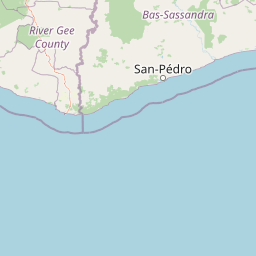
The landscape of Niégré belongs to the sub-equatorial coastal belt of southwestern Ivory Coast, a region of relatively flat to gently broken terrain lying inland of the Gulf of Guinea but west of the more rugged southwestern escarpments. The massif is not a mountainous or dramatic physical environment; instead, it is a broad forested plain whose ecological character is defined primarily by humidity, soil, and vegetation rather than by relief.
In its original state, the landscape was characterized by the dense, multi-layered canopy typical of West African moist evergreen forest, with emergent trees rising above a continuous green cover, closed interior shade, and a humid microclimate near the forest floor. Boundaries between different forest types are gradual rather than sharp: the western, more coastal portions of the massif passed into ombrophile formations adapted to higher humidity, while eastern and more inland portions shifted toward mesophile formations with a more seasonal character.
The contemporary landscape is a mosaic rather than a continuous forest. Intact canopy persists in scattered patches, but large portions of the massif have been transformed into cocoa and coffee smallholdings, secondary regrowth, and zones of rural settlement, with the former village of Baléko-Niégré once forming a substantial agricultural node before its destruction in 2013. The visual impression of the reserve today is therefore not that of a closed tropical forest but of an interrupted, partially fragmented green matrix in which agricultural clearings dominate the broader view.
Forêt classée de Niégré ecosystems, habitats, and plant life
Ecologically, Niégré belongs to the dense humid Guinean forest domain, one of the major tropical phytogeographic regions of West Africa. The massif sits at a transition between ombrophile formations along the more humid coastal side and mesophile formations under a slightly more seasonal climatic regime further inland, which gave the original vegetation both structural complexity and a notable timber value.
In its undisturbed form, the forest was characterized by a tall, closed canopy dominated by ligneous species of commercial interest, a moist understory, and high overall botanical diversity. This structural richness was paired with a significant fauna, as documented by IRD and other researchers in the 1990s, when the site still hosted substantial populations of large mammals and other wildlife typical of the southwestern Ivorian forest belt.
Over the following decades, the ecological character of Niégré was profoundly altered. Logging followed by agricultural colonization, the progressive abandonment of strict protection, and the near-complete conversion of much of the perimeter into cultivated land have together degraded the once-rich Guinean forest into a much more impoverished mosaic. By the time of more recent regional surveys, the massif was classified among those Ivorian protected areas whose ecological integrity had largely collapsed, with corresponding losses of large-mammal populations and a general retreat of the characteristic West African forest biodiversity.
Forêt classée de Niégré wildlife and species highlights
In the 1990s, Niégré was still described by researchers, including teams from IRD, as a forest of significant ecological richness, harboring a wide range of plant and animal species, including threatened ones, and as a meaningful refuge for southwestern Ivorian wildlife. The fauna profile would have aligned with that of other forests in the Taï-Gbôklè region, including forest elephants, several species of primates typical of West African moist forest, duikers, and a varied bird community associated with dense canopy.
That original profile has largely faded. A regional survey covering twenty-five Ivorian protected areas conducted between 2011 and 2017 used elephant dung counts to assess the status of forest elephants, and placed Niégré among the sites that had lost their entire elephant population. The same study placed the massif in a group of southwestern classified forests that had been almost entirely converted to agriculture and human settlement, alongside other reserves such as Bolo-Ouest, Monogaga, Rapides-Grah, Haute-Bolo, and Okroumodou. The broader fauna has followed the same trajectory as elsewhere in Côte d'Ivoire's most pressured protected forests, with primates and other forest-dependent species affected by the same cocoa-driven deforestation identified by environmental organizations as a key driver of wildlife decline.
Forêt classée de Niégré conservation status and protection priorities
The conservation story of Niégré is unusual in that the site has long been formally protected yet has steadily lost much of what made it ecologically valuable. Classified as a forest reserve in 1937, it then suffered repeated partial declassifications through the second half of the twentieth century, and from the 1970s onward both informal logging and cocoa and coffee colonization progressively hollowed out its natural cover. The 2013 eviction operation, which the authorities described as aimed at restoring forest cover and which displaced a large settled population, marked an escalation of the conflict between conservation objectives and agrarian realities on the ground.
Niégré has since been drawn into a wider national strategy. Ivory Coast's 2014 forest code set a target of restoring forest cover to at least 20% of the national territory, the 2019 forest code and the 2021 concession decree restructured how classified forests can be managed by private operators, and national policy targets 20% forest cover by 2030. Within that framework, SODEFOR has led reforestation work in the Niégré Sud sector, including through a partnership with the Forestry Investment Program and Nestlé, and the site continues to be referenced in discussions of how to reconcile forest restoration with the rights and livelihoods of the rural populations who had settled inside the classified perimeter.
Forêt classée de Niégré cultural meaning and human context
Niégré carries significant human and cultural context that has shaped its history almost as much as its ecology. The massif lies in a region traditionally home to the Godié and Néyo peoples, communities historically associated with the Sassandra area, and the forest has long been an arena of interaction between these autochthonous populations and successive waves of migrants. From the 1960s onward, Baoulé planters in particular established themselves in the area, joined later by other rural migrants attracted by cocoa and coffee.
Beyond its importance as an agricultural frontier, the forest also became a space of organized rural life before 2013. The village of Baléko-Niégré functioned as the principal settlement inside the reserve, with the social infrastructure, schools, churches, and markets typical of a small Ivorian rural community. Its destruction during the 2013 eviction operation transformed the forest from a place of habitual residence into a symbol of the tensions between conservation policy and rural livelihoods in Côte d'Ivoire, a tension that Human Rights Watch and other organizations have documented across other classified forests such as Goin-Débé and Cavally.
Top sights and standout views in Forêt classée de Niégré
Niégré stands out for the contrast between its original ecological promise and its present condition: a legally protected block of Guinean moist evergreen forest in a globally important biodiversity region, transformed within a few decades into a mostly agricultural and human-occupied landscape. It anchors the southwestern Ivorian forest mosaic in tandem with Taï National Park, and remains a key reference case for the dynamics of classified-forest loss in West Africa.
It is also notable because it became a nationwide test of how Côte d'Ivoire chooses to recover forest cover, including through the 2013 eviction, the 2014 and 2019 forest codes, the 2021 concession decree, and ongoing SODEFOR-led reforestation partnerships. As such, the forest functions less as a tourism destination than as a strategic landscape for forest policy, agrarian livelihoods, and biodiversity restoration in the West African coastal belt.
Best time to visit Forêt classée de Niégré
Niégré falls within the sub-equatorial climatic regime of southwestern Ivory Coast, with two rainy seasons and two dry seasons distributed through the year. For visitors interested in observing the forest under its most photogenic green canopy and in the most active bird and primate activity, the wetter stretches of the year tend to bring out the closed, humid character of Guinean forest, while drier intervals make internal access and visibility slightly easier. As with the broader southwestern Ivorian region, the climate remains warm and humid throughout the year, and conditions are more relevant for the character of a visit than for seasonal opening or closing of the site itself.