
Mori Atlas logo
Nature reserveFuldatal bei Konnefeld

Mapping the ecological sanctuary of the Fulda river basin through protected meadow and forest zones

Fuldatal bei Konnefeld Nature Reserve and Protected Floodplain Landscapes in Schwalm-Eder-Kreis

(Naturschutzgebiet Fuldatal bei Konnefeld)

Fuldatal bei Konnefeld represents a vital floodplain refuge located along the middle course of the Fulda River. The protected area features a unique combination of partially silted historic oxbows, artificial wetlands, and extensive softwood forests. Our mapping captures the structural composition of these habitats within the Schwalm-Eder-Kreis region, providing context for its role as a crucial stepping-stone for rare bird species and amphibian communities.

floodplainFulda Riverriver valleyoxbowstill water habitatsoftwood floodplain forest
A flat, vector-style illustration of a river flowing through a valley between hills with a waterfall, pine trees, and a sun in the sky.

Fuldatal bei Konnefeld

Nature reserve

Park overview

Structured park overview, official facts, and landscape profile for Fuldatal bei Konnefeld

Fuldatal bei Konnefeld park facts, protected area profile, and essential visitor context

Review the core facts for Fuldatal bei Konnefeld, including designation, size, terrain, visitor scale, habitats, and operating context in one park-focused overview.

About Fuldatal bei Konnefeld

Fuldatal bei Konnefeld sits within the natural region known as the Fulda-Werra-Bergland in the eastern Hessian highlands, specifically in the Rotenburger Fuldatal sub-unit, transitioning downstream toward the Melsunger Fuldatal. The reserve lies in a culturally significant river-settlement landscape shaped over centuries by human activity, floodplain agriculture, and gradual modification of the Fulda's former meandering course.

The protected area encompasses a stretch of floodplain approximately one kilometer long adjacent to the Fulda, featuring two still water bodies and the surrounding vegetation that has largely been left to natural succession. The eastern component is a silted former course of the Fulda, while the western component is an artificially created oxbow-like water body developed as a compensatory measure for a new Deutsche Bahn railway line.

Surrounding these water bodies, scattered remnants of floodplain forest dominated by crack willow and shrub willows are interspersed with black alder and ash specimens. Extensive tall-herb communities fringe the waters, and the broader grassland belt is managed through the Hessian contract nature conservation scheme without fertilizer to encourage the regeneration of species-rich, lowland hay meadows.

The site is embedded in a layered protection framework that makes it simultaneously a Naturschutzgebiet, a Landschaftsschutzgebiet within the Auenverbund Fulda, and a FFH-Gebiet under the EU Habitats Directive. This combination of statuses reflects the high ecological density of the area and the strong dependence of its habitat quality on the broader hydrological dynamics of the Fulda floodplain.

Quick facts and research context for Fuldatal bei Konnefeld

Fuldatal bei Konnefeld is a small floodplain nature reserve in the Regierungsbezirk Kassel in northern Hesse, stretching roughly one kilometer along the Fulda River between Melsungen and Rotenburg an der Fulda. The core nature reserve covers about 16.87 hectares, largely identical in extent to the associated 16.85-hectare FFH site, and is buffered by a 65.48-hectare landscape protection area that forms part of the larger Auenverbund Fulda.

The reserve combines an old, partially silted oxbow, a second still water body, floodplain woodland of willows, black alder, and ash, and meadows managed without fertilizer under the Hessian landscape stewardship program. It is classified as IUCN Category IV (Habitat/Species Management Area), carries national identifier 1634019, and was additionally designated as a Natura 2000 site in 2008.

Protection and recognition

Explore documented terrestrial boundaries and Natura 2000 recognition records.

Fuldatal bei Konnefeld Protection Status and International Recognition Data

Fuldatal bei Konnefeld holds documented terrestrial protection status supported by official Natura 2000 boundary records. Review the verified conservation framework, designation details, and international recognition sources for this protected area.

International recognition

Protection details

Protection scope
Terrestrial
Transboundary protection
No
WDPA ID
163174
Buffer area
0.66 km²
Park context

Deeper park guide and search-rich context for Fuldatal bei Konnefeld

Fuldatal bei Konnefeld history, landscape, wildlife, and travel context

Explore Fuldatal bei Konnefeld through its history, landscape character, ecosystems, wildlife, conservation priorities, cultural context, and seasonal travel timing in a structured park guide built for atlas discovery and search intent.

Why Fuldatal bei Konnefeld stands out

Fuldatal bei Konnefeld is best known as a compact, multi-layered floodplain refuge that protects a partially silted oxbow, an artificially created oxbow-like water body, and adjacent softwood floodplain forest along the middle Fulda. The reserve hosts Annex I bird species such as kingfisher, red kite, and white stork that use the area for foraging, and its amphibian and dragonfly communities are notable on a regional scale. Equally distinctive is the area's role as a stepping-stone within the wider Fulda floodplain biotope network, linking habitat patches across central Hesse. The combination of protected habitat types, including natural eutrophic still waters, moist tall-herb communities, and priority alder-ash softwood floodplain forest, gives the site an outsized conservation significance relative to its small surface area.
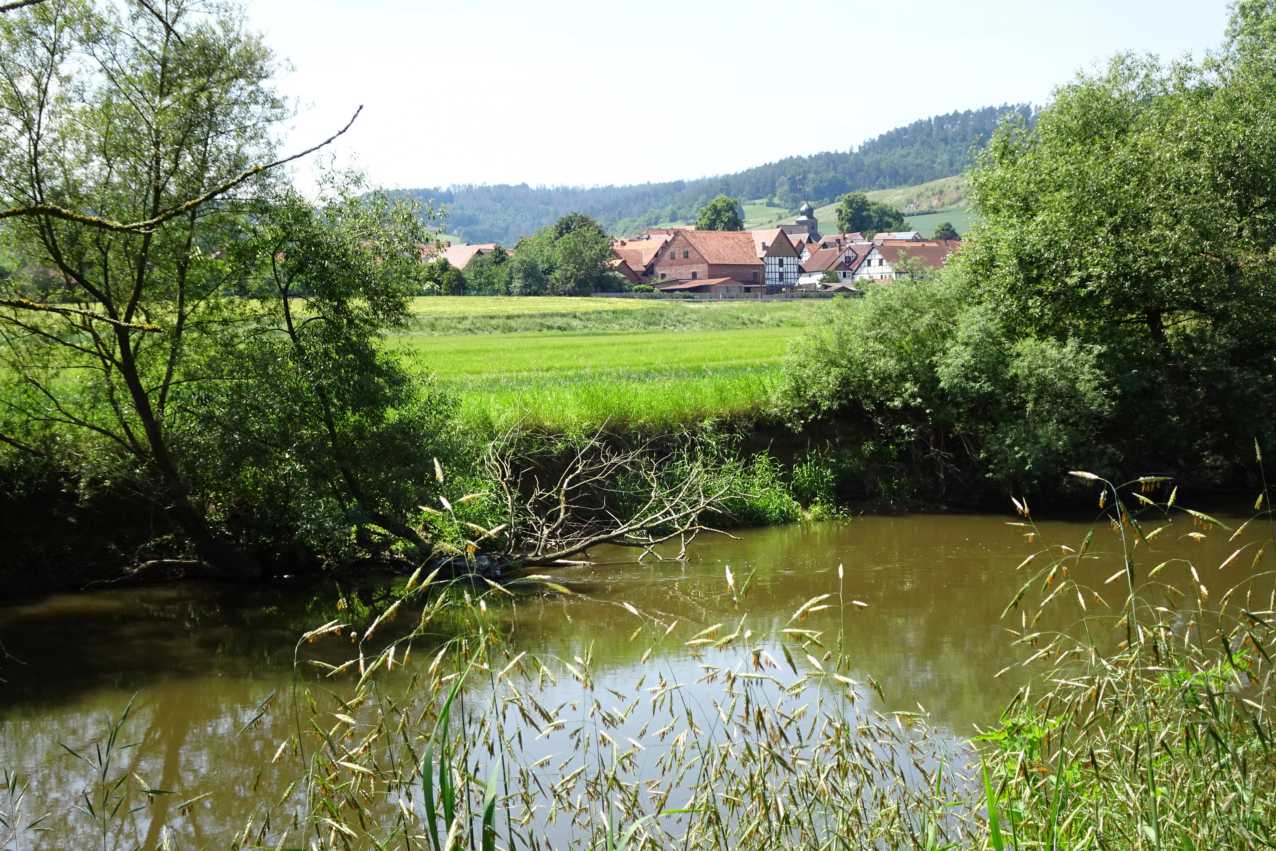
A peaceful river flows in the foreground with lush green meadows and trees behind it, leading to a small village with traditional buildings nestled at the base of a forested hill under a clear sky.
The tranquil Fulda river flowing through the floodplain ecosystem of the Fuldatal bei Konnefeld nature reserve.

Fuldatal bei Konnefeld history and protected-area timeline

The present-day character of the Fuldatal bei Konnefeld reflects an extended history of human influence on the floodplain. From the early Middle Ages onward, settlement, population growth, and the expansion of cultivated land gradually reshaped the floodplain, with raw gravel and sand soils overlaid by thick layers of floodplain loam deposited through slope erosion. By the late High Middle Ages, the cultural landscape had reached an extent in the floodplain that has largely remained stable since.

The oxbow that defines the protected area most likely originated in the nineteenth century when a straightening of the Fulda severed the former meander; it is already shown as cut-off standing water on an 1858 map. Earlier water-engineering interventions, begun in the Middle Ages to improve navigability downstream of Hersfeld, had already shortened and straightened the river's winding course, intensifying incision, lowering groundwater levels, and slowly drying out the floodplain.

The decisive conservation step came on 19 October 1989, when the Regierungspräsidium Kassel issued an ordinance declaring parts of the floodplain a Naturschutzgebiet and surrounding areas a Landschaftsschutzgebiet. The purpose of the designation was to preserve and improve the oxbow and existing water surfaces as habitats for rare bird and amphibian species and to protect the connected meadows and flood channels of the floodplain.

A further transformation occurred when Deutsche Bahn acquired a 3.72-hectare portion of former intensively used hay meadows as compensatory mitigation for landscape impacts from a new railway line. The railway, working with the conservation authorities, replaced removed features such as field hedgerows by creating a fish- and bird-oriented wetland, reshaping existing flood channels into floodplain-typical still waters of varying depths and shoreline character, and planting a thorny shrub embankment as a buffer against an adjacent farm track.

In November 2004, the state of Hesse notified the European Commission that the Naturschutzgebiet Fuldatal bei Konnefeld should be included in the transboundary Natura 2000 network. Formal protection under Hessian Natura 2000 legislation followed in January 2008, with the designated FFH-Gebiet closely mirroring the boundaries and area of the original nature reserve.

Fuldatal bei Konnefeld landscape and geographic character

The protected landscape of Fuldatal bei Konnefeld is a classic, though small, lowland river floodplain set between roughly 175 and 180 meters above sea level. The terrain is flat and quiet, defined by the slow-moving dynamics of an old river landscape: still water bodies, soft alluvial soils, and levee-edge transitions between open water, willow thickets, and meadows.

The hydrological foundation of the site is an old, partially silted oxbow of the Fulda in the eastern part of the reserve, accompanied by a second, artificially created oxbow-like water body in the western part. The two waters differ slightly in character, but both are integrated into the active floodplain through open ditches that remain connected with the Fulda, allowing exchange of water and nutrients.

A defining visual feature is the dense fringe of willows along the still waters, dominated by crack willow and shrub willows, which shades the water surfaces strongly and creates a tunnel-like gallery over the channels. Black alder and ash are scattered through these softwood stands, while the broader meadows around the waters form an open, lightly rolling green frame to the wooded watercourses.

Historically, the dynamic flooding and groundwater variation that built these features has been weakened by centuries of river straightening and incision, and the present-day landscape retains only traces of its original flooding rhythm. The protected area's management aims in part to maintain and, where possible, revive the structural variety of this floodplain landscape.
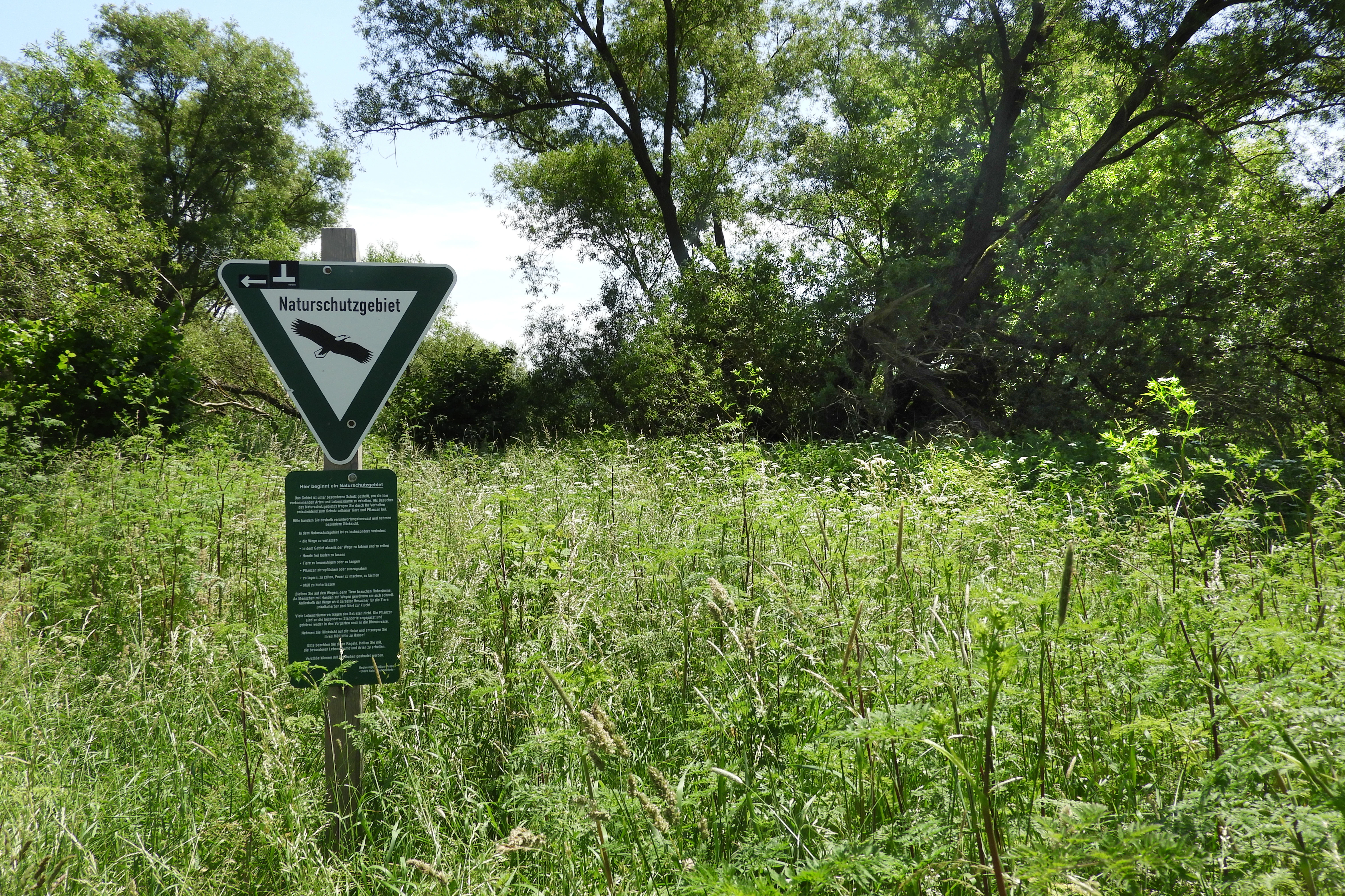
A triangular Naturschutzgebiet sign with a black eagle silhouette, mounted on a wooden post in a grassy field with trees in the background.
A nature reserve sign marking the protected area of Fuldatal bei Konnefeld.

Fuldatal bei Konnefeld ecosystems, habitats, and plant life

Ecologically, Fuldatal bei Konnefeld is built around three core, interlinked habitat types: natural eutrophic still waters, moist tall-herb communities, and softwood floodplain forests of alder, ash, and willows. The protected still waters, classified under EU habitat type 3150, form the heart of the reserve, while the tall-herb fringes (habitat type 6431) and the priority softwood floodplain forest (\*91E0) extend the habitat mosaic outward into the floodplain.

The two water bodies differ subtly in their aquatic communities. The eastern, more shaded oxbow carries a dense closed cover of small duckweed (Kleine Wasserlinse), while the more open western water body additionally hosts rough hornwort and small pondweed. Surveys carried out for the FFH baseline data collection recorded twelve dragonfly species across the two waters, including the small red-eyed damselfly (Kleines Granatauge), which is listed as endangered on the Hessian Red List of dragonflies.

Vegetation along the waters shows a layered mix of near-natural floodplain forest relics and more disturbed tall-herb stands. Crack willow and shrub willows dominate the wooded shores, with black alder and ash adding structural variety. Tall-herb fringes are widespread but in many places are composed of nitrogen-tolerant species such as stinging nettle, reed canary grass, and the neophyte Himalayan balsam, signaling the legacy of nutrient enrichment.

The surrounding meadows are managed extensively under the Hessian contract nature conservation scheme, without fertilizer use, with the explicit goal of regenerating species-rich, lowland hay meadows. Early signs of this recovery are visible in the reappearance of indicator species such as lady's bedstraw and the spread of butterflies associated with extensively managed grassland, including the golden eight and the brown hairstreak.
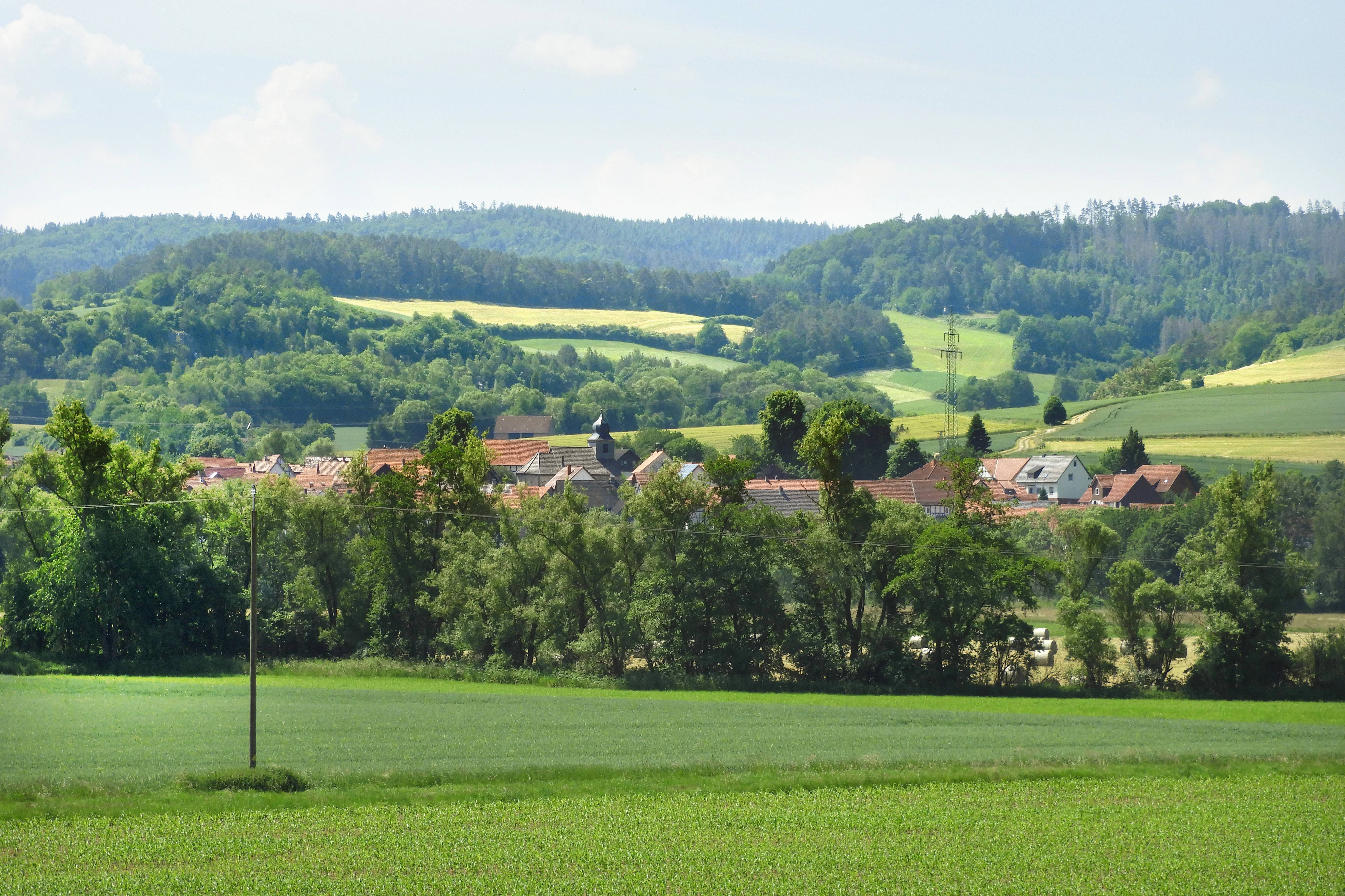
A wide view of a green valley and hillside in Germany featuring a small village partially hidden by trees in the middle distance.
The agricultural landscape and rolling hills surrounding the Fuldatal near Konnefeld.

Fuldatal bei Konnefeld wildlife and species highlights

The wildlife significance of Fuldatal bei Konnefeld lies less in the diversity of large mammals typical of more expansive protected areas and more in the concentration of habitat specialists tied to floodplain wetlands, still waters, and species-rich meadows. The reserve functions as an important refuge for rare birds and amphibians, as stated explicitly in its original 1989 protection ordinance.

Three bird species protected under Annex I of the EU Birds Directive regularly use the area for foraging: the kingfisher, the red kite, and the white stork. Their presence reflects the combination of clean, fish-rich water bodies, open meadow hunting grounds, and a wider landscape mosaic that includes neighboring floodplain reaches of the Fulda.

Amphibians are represented by a small but ecologically meaningful population of water frogs from the green frog complex around the still waters, along with scattered common frogs recorded in the immediate vicinity of the pools. Reptiles and ground-dwelling fauna are not a focus of the conservation documentation, but the mosaic of wet woodland, tall herbs, and meadows supports a range of typical floodplain invertebrates.

The high invertebrate interest of the site is illustrated by its dragonfly fauna. Surveys for the FFH baseline recorded twelve species across the two still waters, including the small red-eyed damselfly, a species of conservation concern in Hesse. Butterflies tied to extensively managed, species-rich meadows, such as the golden eight and the brown hairstreak, are increasingly present as meadow regeneration progresses, marking the early success of habitat recovery efforts.
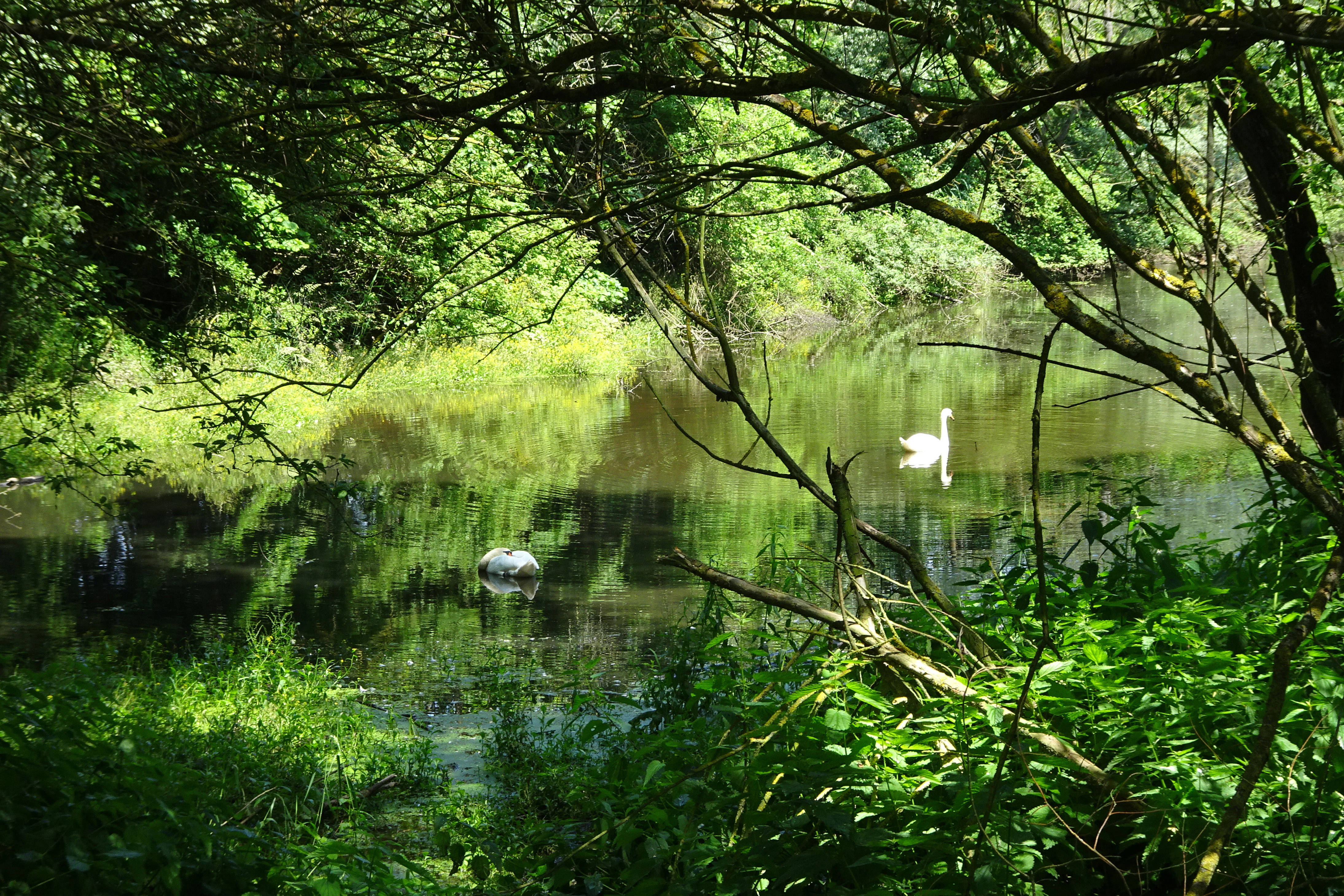
A white swan swimming on a calm river framed by overhanging tree branches and lush green vegetation.
A swan swimming in the Fulda river within the Fuldatal bei Konnefeld nature reserve.

Fuldatal bei Konnefeld conservation status and protection priorities

Fuldatal bei Konnefeld is protected under a layered conservation regime that recognizes both its local ecological value and its importance within broader European biodiversity networks. Its IUCN management category of IV, Habitat/Species Management Area, signals an active management approach aimed at maintaining particular habitats and species rather than strict preservation.

The core 16.87-hectare Naturschutzgebiet and the 65.48-hectare surrounding Landschaftsschutzgebiet together form a tightly coupled buffer system. The surrounding landscape protection area is itself embedded within the much larger Auenverbund Fulda, a roughly 9,500-hectare landscape protection area stretching across multiple counties that aims to secure the Fulda, its tributaries, and their characteristic flood-dependent biological communities.

Within the EU Natura 2000 network, the site is designated as the Flora-Fauna-Habitat-Gebiet 4923-301, covering approximately the same 16.85-hectare footprint as the national nature reserve. The binding conservation objectives include maintaining the functional connectivity of floodplain contact habitats, preserving near-natural and structurally rich floodplain forests with characteristic tree species in varied age stages, and safeguarding the habitat-defining water quality, aquatic vegetation, and siltation zones of the still waters.

Management of the meadows is delivered through the Hessian contract nature conservation framework, under which landholders commit to extensive, fertilizer-free use of grasslands in exchange for compensation. This combination of regulatory protection, contractual management, and habitat-creation through compensatory mitigation linked to infrastructure development has shaped the reserve since the early railway-related interventions in the western section.

Fuldatal bei Konnefeld cultural meaning and human context

The cultural dimension of Fuldatal bei Konnefeld is inseparable from the long history of human modification of the Fulda floodplain that gave the area its present form. The site sits within a floodplain settlement landscape that has been cultivated and partly engineered since the early Middle Ages, with the river's meandering course, floodplain soils, and water levels successively reshaped by agriculture, settlement expansion, and water engineering.

Medieval efforts to make the Fulda navigable below Hersfeld initiated straightening and shortening of the river course, a process that continued into modern times and contributed to today's gradually drier floodplain conditions. The current oxbow that defines the reserve is itself likely a product of nineteenth-century river straightening, with the cut-off already recorded on an 1858 map.

Modern cultural ties to the landscape are expressed through the contract nature conservation partnership with farmers and through the involvement of Deutsche Bahn in creating the western wetland as mitigation for a new railway line. These elements combine traditional agricultural stewardship of the meadows with the kind of engineered habitat restoration that has become typical of floodplain conservation in densely settled parts of central Germany.

Top sights and standout views in Fuldatal bei Konnefeld

Standout features of Fuldatal bei Konnefeld include a partially silted historic oxbow of the Fulda and an adjacent, deliberately constructed oxbow-like wetland, together forming the hydrological heart of the reserve. Softwood floodplain forest of crack willow, shrub willow, black alder, and ash rims the waters, while extensively managed meadows under the Hessian contract conservation scheme provide an increasingly flower-rich matrix.

The reserve's integration into three overlapping protection frameworks, national nature reserve, surrounding landscape protection area, and EU Natura 2000 FFH site, gives it significance well beyond its modest size. The presence of Annex I bird species such as kingfisher, red kite, and white stork, the documentation of twelve dragonfly species including the endangered small red-eyed damselfly, and the recovering populations of meadow-indicator butterflies together define its ecological identity.

Best time to visit Fuldatal bei Konnefeld

Fuldatal bei Konnefeld is a habitat-driven rather than a tourism-driven site, and seasonal timing is best considered in ecological terms. Spring and early summer bring the most active amphibian movement, dragonfly emergence, and meadow flowering, while late spring to midsummer tends to be the most rewarding period for observing wetland vegetation, breeding bird activity around the still waters, and the developing flower richness of the regenerating meadows.

Late summer and autumn emphasize the structural character of the floodplain itself, with tall herbs at peak height and the willow gallery casting heavy shade over the still waters. Because the floodplain lies at relatively low elevation and the water bodies are shallow, very high summer or winter conditions can substantially alter accessibility of wet ground and visibility of wildlife, but the area's small size and open meadow setting generally allow quiet low-impact visits across much of the frost-free season.


Monthly climate preview

Long-term representative coordinate measurements for Fuldatal bei Konnefeld across twelve months

Fuldatal bei Konnefeld Climate Normals, Annual Temperature and Precipitation Rhythm

Fuldatal bei Konnefeld records multi-year average temperatures ranging from negative winter minimums to warm summer maximums alongside consistent daily precipitation. Reviewing the complete monthly climate record provides deeper insight into long-term environmental patterns at this representative coordinate.
Annual mean9 °C
-1 °C19 °C
Jan-1°
Feb
Mar
Apr
May12°
Jun16°
Jul19°
Aug18°
Sep14°
Oct
Nov
Dec
Warmest month
July

18.6 °C

Coolest month
January

-0.8 °C

Wettest month
July

2.5 mm/day

Driest month
April

1.4 mm/day

Park location guide

Geography guide, regional context, and park location map for Fuldatal bei Konnefeld

Fuldatal bei Konnefeld park geography, regions, and map view in Germany

Understand where Fuldatal bei Konnefeld sits in Germany through a broader geographic reading of the surrounding landscape, nearby location context, and its mapped position within the national park landscape.

How Fuldatal bei Konnefeld fits into Germany

Germany is a federal republic in Western and Central Europe with a population of over 83 million across sixteen constituent states. It is Europe's largest economy by nominal GDP and a major global exporter and importer. The capital is Berlin, and the country borders Denmark, Poland, Czech Republic, Austria, Switzerland, France, Luxembourg, Belgium, and the Netherlands.

Wider geography shaping Fuldatal bei Konnefeld in Germany

Germany is located in Western and Central Europe, spanning 357,022 km². It borders Denmark to the north, Poland and the Czech Republic to the east, Austria and Switzerland to the south, and France, Luxembourg, Belgium, and the Netherlands to the west. The country has coastlines on the Baltic Sea and North Sea to the north, with the Alps located in the southern region.

Map view of Fuldatal bei Konnefeld

Use this park location map to pinpoint Fuldatal bei Konnefeld in Germany, understand its exact geographic position, and read its mapped placement within the surrounding landscape more clearly.

Pigeon | © OpenStreetMap contributors

Location context for Fuldatal bei Konnefeld

Landkreis Hersfeld-RotenburgSchwalm-Eder-Kreis
Recorded earthquake history

Review Recorded Earthquake History near Fuldatal bei Konnefeld

Examine the historical catalogue of seismic events recorded in the regional surroundings of Fuldatal bei Konnefeld. MoriAtlas provides distance-calculated epicentre records for this protected landscape, offering a clear and factual perspective on regional seismic activity.

Fuldatal bei Konnefeld Earthquake History

Catalogued events

2 events

Strongest magnitude

Magnitude 3.4

Most recent event

Sep 22, 2005

This history includes earthquakes recorded inside the park or within 50 km of its borders

Protected floodplain terrain, oxbow waters, and river valley habitats

Fuldatal bei Konnefeld Photos and Landscape Scenery Visual Exploration

Visual documentation of Fuldatal bei Konnefeld reveals the intricate river floodplain terrain, oxbow water bodies, and softwood forest edges that define this protected area. Examining park imagery provides concrete insight into the lowland habitats, willow galleries, and ecological structure shaping the middle Fulda valley.

A peaceful river flows in the foreground with lush green meadows and trees behind it, leading to a small village with traditional buildings nestled at the base of a forested hill under a clear sky.

A wide view of a rural landscape with numerous round hay bales scattered across a harvested field, with a line of trees and low rolling hills in the background under a light blue sky.

A triangular Naturschutzgebiet sign with a black eagle silhouette, mounted on a wooden post in a grassy field with trees in the background.

A wide view of a green valley and hillside in Germany featuring a small village partially hidden by trees in the middle distance.

A white swan swimming on a calm river framed by overhanging tree branches and lush green vegetation.

Park atlas

Compare surrounding river valleys, lowland floodplains, and regional habitats

Exploring Other Parks and Protected Areas Near Fuldatal bei Konnefeld

Visitors exploring Fuldatal bei Konnefeld can continue browsing nearby protected areas and river valley reserves across northern Hesse. Comparing adjacent lowland habitats and connected biotope networks provides a broader geographical understanding of regional conservation landscapes.
A watercolor illustration showing a winding river flowing through a grassy field, with a cluster of green trees on the right and soft pink and gray hills in the background.
Nature reserveGermany
About 2.4 km away#1 closest

Southeast

Kiesgrube bei Baumbach Nature Reserve: River Meander and Wetland Geography in Germany

A preserved riparian landscape and bird habitat in northern Hesse

Located along the middle Fulda, this nature reserve represents an engineered success story where a former quarry transformed into a vital wetland ecosystem. Its shallow lake margins, willow thickets, and floodplain forests create a critical protected area for local waterbird populations, serving as an essential node within the Auenverbund Fulda floodplain conservation network.

Area
0.23 km²
Established
1995
Relief
Lowland
Climate
Temperate
A pale, panoramic watercolor painting of a wetland landscape with a row of trees on the right side and low hills in the distance.
Nature reserveLandkreis Hersfeld-Rotenburg
About 6.3 km away#2 closest

Southeast

Im Sand bei Rotenburg Nature Reserve: Mapping the Fulda River Floodplain and Wetland Mosaic

A structured floodplain refuge in Landkreis Hersfeld Rotenburg

Located in the low-lying reaches of the Fulda River, Im Sand bei Rotenburg represents a significant shift from industrial land use to a protected, structurally rich riverine mosaic. The area features a complex of water-filled pits, reedbeds, and alluvial forest patches that serve as a crucial migratory stopover for diverse waterbird populations in northeastern Hesse.

Area
0.102 km²
Established
1997
IUCN
IV
Relief
Lowland
A horizontal watercolor painting of a serene lake bordered by a shoreline with trees and distant rolling hills against a soft background.
Nature reserveSchwalm-Eder-Kreis
About 11 km away#3 closest

West

Goldbergsee Nature Reserve and Mapped Protected Landscapes in Schwalm-Eder-Kreis

Ecological transition and inland water-body geography.

Goldbergsee stands as a prime case study of industrial renaturalization in northern Hesse. This protected nature reserve, characterized by its clear spring-fed water and successional woodland habitat, offers a window into how former open-cast mining sites evolve into ecologically balanced water bodies within the Schwalm-Eder-Kreis mountain foothills.

Established
1991
A horizontal watercolor painting depicting a soft-toned, rolling landscape with green meadows, distant tree lines, and a light-filled sky.
Nature reserveHesse
11 km away#4 closest

Southwest

Roßbachtal bei Völkershain Nature Reserve: Geography and Protected Valley Landscapes

Stream-fed meadow and forest habitats in Hesse

Located in the Schwalm-Eder-Kreis, Roßbachtal bei Völkershain encompasses a linear valley environment within the Knüllgebirge. The reserve tracks the Roßbach stream as it moves toward the Breitenbach, featuring a protected alignment of meadows and slopes that serves as a focused habitat management area in central Germany.

Area
1.141 km²
Established
1988
IUCN
IV
A soft, painterly watercolor landscape showing a green grassy meadow beside a calm lake with a stand of trees and rolling hills in the background.
Nature reserveLandkreis Hersfeld-Rotenburg
11 km away#5 closest

Southeast

Forbachsee bei Bebra Nature Reserve: Mapped Protected Landscape in Landkreis Hersfeld-Rotenburg

River-connected gravel-pit lake and floodplain geography

Analyze the protected boundaries of Forbachsee bei Bebra, a nature reserve defined by its active connection to the River Fulda. The site features an evolving shoreline of gravel banks and softwood forest, showcasing how industrial extraction areas mature into essential refuges for migratory waterbirds within the larger regional valley system.

Area
0.219 km²
Established
1985
IUCN
IV
Relief
Lowland
A watercolor painting showing a soft, stylized landscape of green hills, a winding stream, and coniferous forest sections under a pale sky.
Nature reserveHesse
About 13 km away#6 closest

West

Eichelskopf Nature Reserve: Protected Geological and Historical Landscapes in Hesse

Regional conservation profile and mapped boundaries in Schwalm-Eder.

Examine the conservation history of Eichelskopf, a key nature reserve in the Schwalm-Eder district of Hesse. Established in 1927, this site remains a vital point of interest for understanding the evolution of species protection and geological heritage management in central Germany.

Area
0.027 km²
Established
1927
Scope
Terrestrial
A wide watercolor illustration showing a pale sky above a line of green trees and a foreground of pink and green grassy meadows.
Nature reserveSchwalm-Eder-Kreis
13 km away#7 closest

West

Mosenberg bei Homberg Nature Reserve: Mapped Protected Landscape and Regional Geography

Nature reserve terrain in the Schwalm-Eder-Kreis district of northern Hesse

Spanning 64 hectares, Mosenberg bei Homberg preserves a diverse mixture of traditional agricultural landscapes including open grasslands and wood-pastures. The area provides a critical habitat for specialized birds, defined by its steep basalt scree and proximity to the Klingelbach stream. This site offers a clear example of how historic coppice woodland systems maintain significant biodiversity across the northern Hesse region.

Area
0.646 km²
Established
1986
Relief
Upland
Climate
Temperate
Watercolor illustration showing rolling green hills, small clusters of trees, and tall grasses in the foreground against a soft white background.
Nature reserveWerra-Meißner-Kreis
15 km away#8 closest

Northeast

Reichenbacher Kalkberge Nature Reserve: Geographic and Protected Landscape Analysis

Muschelkalk limestone hills and orchid-rich grassland habitats

An essential look at the Reichenbacher Kalkberge protected area, where limestone-based forest stands meet rare semi-dry meadows. Gain geographic insight into the terrain, the medieval castle ruin surroundings, and the protected habitat mosaic that defines this distinctive part of the Geo-Naturpark Frau-Holle-Land.

Area
1.503 km²
Established
1996
IUCN
IV
Relief
Mountain

Common questions about visiting, size, designation, and location context for Fuldatal bei Konnefeld

Fuldatal bei Konnefeld FAQs for park facts, access, geography, and protected area context

Find quick answers about Fuldatal bei Konnefeld, including protected-area facts, park geography, trail and visitor context, and how the park fits into its surrounding country and regional landscape.
MoriAtlas Explorer

Continue Your Protected Areas Search Across the Global Atlas

Deepen your exploration by continuing the structured search for national parks and protected areas worldwide. Utilize the comprehensive filtering capabilities to compare different conservation landscapes and refine your understanding of global park geography. Discover more about the distribution and characteristics of protected natural areas.

Global natural geography