
Mori Atlas logo
State or regional parkGaribaldi Provincial Park

Mapping the dramatic terrain, protected boundaries, and diverse alpine ecosystems of the Garibaldi Volcanic Belt

Garibaldi Provincial Park: A Comprehensive Geographic Atlas of Glacial and Volcanic Landscapes

Garibaldi Provincial Park serves as a centerpiece of wilderness conservation in the mountains of southwestern British Columbia. This expansive protected area showcases a rare intersection of active volcanic geology and massive glacial icefields, spanning from rugged high-altitude peaks to dense coastal rainforests. Explore the mapped boundaries of this iconic region, including its distinctive stratovolcanoes and glacier-fed lake systems that define the character of the Garibaldi Range.

wilderness parkalpine parkvolcanic landscapeglacial landscapemountain parkalpine lakes

Garibaldi Provincial Park

State or regional park

Park overview

Structured park overview, official facts, and landscape profile for Garibaldi Provincial Park

Garibaldi Provincial Park park facts, protected area profile, and essential visitor context

Review the core facts for Garibaldi Provincial Park, including designation, size, terrain, visitor scale, habitats, and operating context in one park-focused overview.

About Garibaldi Provincial Park

Garibaldi Provincial Park is one of the defining protected landscapes of coastal British Columbia, stretching across the heart of the Garibaldi Range between the Sea to Sky Corridor and the more remote eastern slopes. Its landscape is the product of two powerful geological forces: Quaternary continental and alpine glaciation that carved the rugged terrain and continues to feed the park's rivers and lakes today, and volcanism associated with the Garibaldi Volcanic Belt that produced the stratovolcanoes, cinder cones, and lava dams defining much of the scenery.

The centerpiece of the park is the Garibaldi Lake area, where a turquoise glacial lake is impounded by a natural lava dam known as The Barrier. Around it rise iconic peaks including Mount Garibaldi, The Black Tusk, Mount Price, and The Table, alongside expansive icefields such as the Garibaldi Névé and the Mamquam Icefield. Wedge Mountain, the highest point in the park at nearly 2,900 metres, anchors the more remote northern and eastern wilderness. Together, these features create a layered scene of jagged summits, deep alpine basins, and glacier-fed lakes that has become emblematic of British Columbia's interior-coastal mountain country.

Garibaldi Park is also culturally significant. The mountains and valleys within its boundaries are tied to the traditional territories and oral histories of the Squamish and Lil'wat peoples, for whom peaks such as Mount Garibaldi and The Black Tusk are important landmarks with deep mythological meaning. Today, the park balances its role as a wilderness protector with its identity as one of British Columbia's premier hiking destinations, offering everything from short lake walks to demanding alpine ridges, mountaineering routes, and multi-day backcountry journeys.

Quick facts and research context for Garibaldi Provincial Park

Garibaldi Provincial Park is a Class A Provincial Park in British Columbia, established as a park reserve in 1920 and formally designated in 1927. It is managed by BC Parks and covers an area of roughly 1,950 square kilometres, encompassing most of the Garibaldi Range between Squamish, Whistler, and Pemberton. The park reaches from the relatively accessible western valleys along the Sea to Sky Highway to more remote eastern wilderness near the Lillooet River watershed.

Protection and recognition

Documented terrestrial protection scope, designation year, and management context.

Garibaldi Provincial Park Protection Status and Designation History

Garibaldi Provincial Park maintains a documented terrestrial protection status established in 1927. Systematic records compile its designation history and management scope for environmental analysis.

Protection details

Protection scope
Terrestrial
Designated year
1927
Transboundary protection
No
Park context

Deeper park guide and search-rich context for Garibaldi Provincial Park

Garibaldi Provincial Park history, landscape, wildlife, and travel context

Explore Garibaldi Provincial Park through its history, landscape character, ecosystems, wildlife, conservation priorities, cultural context, and seasonal travel timing in a structured park guide built for atlas discovery and search intent.

Why Garibaldi Provincial Park stands out

Garibaldi Provincial Park is best known for its dramatic convergence of glacial and volcanic scenery within the Garibaldi Volcanic Belt. Iconic landmarks include the turquoise waters of Garibaldi Lake, the jagged volcanic spire of The Black Tusk, the broad stratovolcano profile of Mount Garibaldi, and the high-altitude viewpoints of Panorama Ridge. The park is also widely recognized for its extensive system of alpine lakes, including Elfin Lakes, Cheakamus Lake, and Wedgemount Lake, each surrounded by rugged mountain terrain and accessed through popular hiking trails.
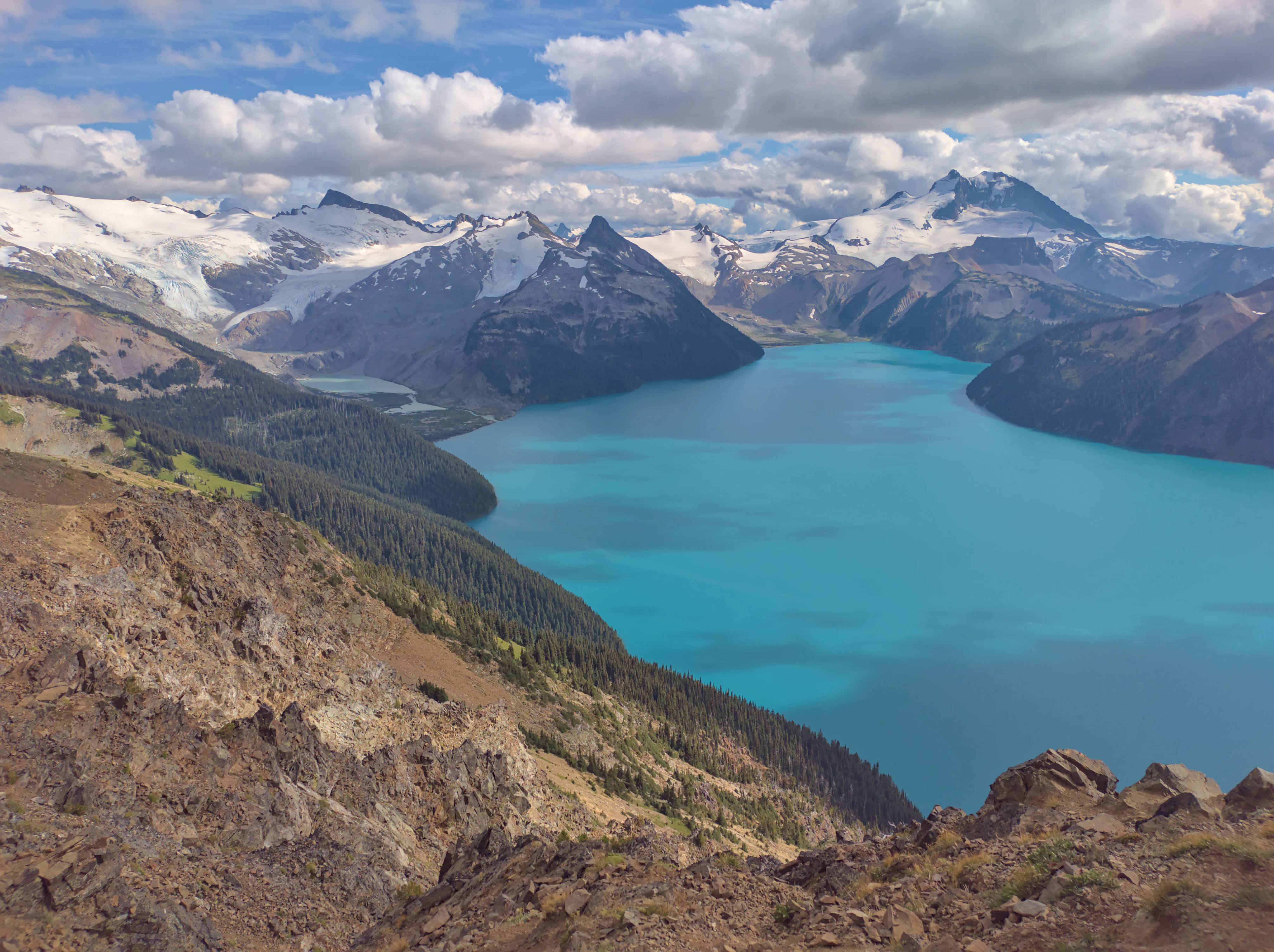
Garibaldi Lake from Panorama Ridge
View of Garibaldi Lake and Sphinx Glacier from the Panorama Ridge trail.

Garibaldi Provincial Park history and protected-area timeline

Garibaldi Provincial Park takes its name from Mount Garibaldi, which was itself named by Captain George Henry Richards during a hydrographic survey of Howe Sound in 1860, honouring the Italian general Giuseppe Garibaldi. The naming reflected the era of European exploration along the British Columbia coast, while the mountain and surrounding landscape had long carried significance for Indigenous peoples of the region.

For the Squamish people, Mount Garibaldi is known as Nch'ḵay̓, meaning "Dirty Place" or "Grimy One" in reference to the muddy waters of the Cheekye River. The peak is associated with traditional hunting, foraging, and obsidian collection, and features prominently in Squamish flood mythology. The Black Tusk carries similar cultural weight, known to the Squamish as the Landing Place of the Thunderbird and to the Lil'wat as the Place Where the Thunder Rests.

European-era recreational history of the area began in earnest in 1907, when Vancouver mountaineers completed the first ascent of Mount Garibaldi. Their enthusiasm inspired summer climbing camps at Garibaldi Lake, which brought together members of the early British Columbia Mountaineering Club and led to the first ascent of The Black Tusk in 1912. These climbing activities ultimately drove the campaign for formal protection, and the area was legislated as a park reserve on April 29, 1920. In 1927, it was designated a Class A Provincial Park of British Columbia.

The park's boundaries have evolved over time. In 1967, its southern section was separated to form Golden Ears Provincial Park around the Pitt Lake and Stave River basins. Over the following decades, Garibaldi Park transitioned from a specialized mountaineering destination into a broadly popular wilderness park, and between the early 2010s and late 2010s the number of overnight campers and day users rose sharply, prompting changes such as mandatory online advance bookings for backcountry sites in 2016.

Garibaldi Provincial Park landscape and geographic character

The landscape of Garibaldi Provincial Park is defined by a striking mix of glaciated mountain terrain and volcanic landforms. Steep, rugged peaks of the Garibaldi Range dominate the skyline, while broad U-shaped valleys, alpine basins, and cirques reflect the heavy sculpting of Quaternary continental and alpine glaciation. The park contains more than 150 glaciers, including substantial icefield complexes such as the Garibaldi Névé and the Mamquam Icefield, which continue to feed its lakes and streams.

Volcanic scenery is woven through the heart of the park. Mount Garibaldi, Mount Price, and The Black Tusk are stratovolcanoes rooted in the Garibaldi Volcanic Belt, while the Opal Cone is a cinder cone and The Table is a distinctive flat-topped andesite tuya. The most famous individual landform is The Barrier, a lava dam that holds back the turquoise waters of Garibaldi Lake and remains an actively unstable geological feature.

Between these high points lie the park's signature alpine lakes. Garibaldi Lake, Elfin Lakes, Cheakamus Lake, Mamquam Lake, and Wedgemount Lake each occupy their own distinct settings, from glacier-scoured basins to forest-rimmed subalpine valleys. Lower elevations transition into dense coastal forest, giving the park a vertical zonation that ranges from coastal rainforest to high alpine rock and ice.
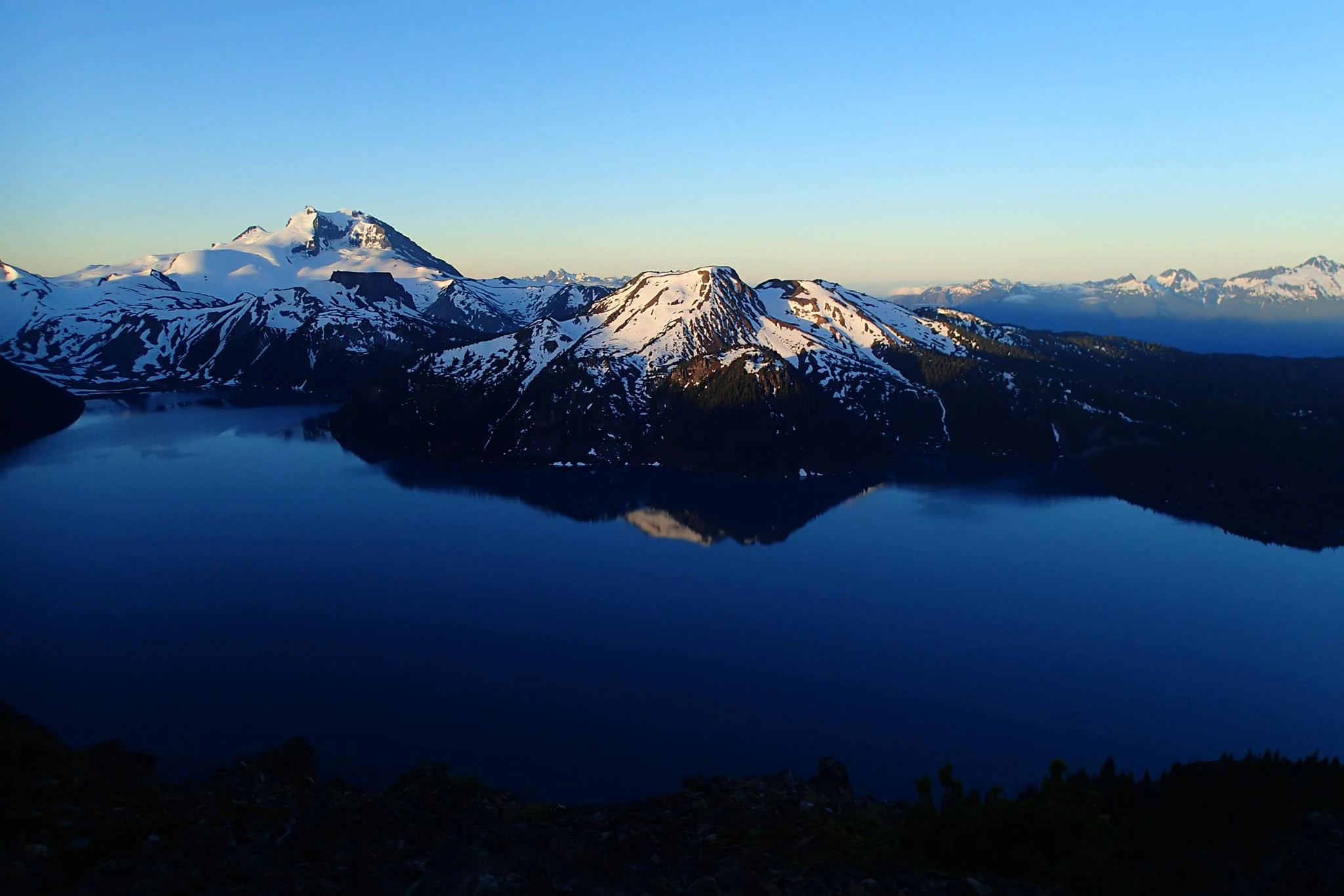
Garibaldi Lake from Panorama Ridge at dawn
A view of Garibaldi Lake at dawn from Panorama Ridge, featuring Mount Garibaldi and The Table in the background.

Garibaldi Provincial Park ecosystems, habitats, and plant life

Garibaldi's ecosystems reflect the strong elevational gradient between its coastal lowlands and its high alpine summits. The lowest forested slopes, roughly between 1,000 and 1,700 metres, support dense stands of Douglas fir, western red cedar, and western hemlock, characteristic of the lush coastal forests of southwestern British Columbia.

Higher elevations shift toward mountain hemlock, yellow cedar, alpine fir, and whitebark pine, with trees becoming progressively more stunted as the environment gives way to classic subalpine parkland. Among the most ecologically distinctive zones are the park's alpine meadows, which during the short growing season burst into flower with heather, western anemone, lupine, arnica, Indian paintbrush, and avalanche lily. August is the most colourful period for wildflower viewing.

The high country is shaped as much by ice as by vegetation. Despite measurable glacial recession over the past century, the park still holds extensive perennial snow and ice, sustaining cold, clear alpine lakes that influence the entire park watershed. This combination of cool, wet coastal forest, dry subalpine parkland, and glaciated peaks gives Garibaldi an unusually varied ecological character within a single protected area.

Elfin Lakes panorama
Panoramic view of Elfin Lakes looking north in Garibaldi Provincial Park

Garibaldi Provincial Park wildlife and species highlights

Garibaldi Provincial Park supports a diverse community of mountain and forest wildlife typical of British Columbia's south coast ranges. Mammals present in the park include grizzly bears, black bears, mountain goats, deer, marmots, and pikas, with marmots and pikas especially associated with the rocky alpine slopes and meadows. Mountain goats are a particular focus of conservation monitoring, especially around the Spearhead area, where surveys have shown a relatively stable population of roughly fifty to seventy animals.

Birdlife in the park includes American three-toed woodpeckers, common ravens, Canada jays, and ptarmigans, with Canada jays being a frequent and familiar sight on the trails and at higher elevations. The mix of forested valleys, subalpine parkland, and rocky alpine terrain allows these birds, along with smaller migratory and resident songbirds, to occupy distinct habitats across the park's elevation range.

The overall wildlife character of the park is shaped by the contrast between the lush coastal forest at lower elevations and the harsh, open alpine zone above. Species such as bears and deer are typically associated with forested and meadow environments, while mountain goats, marmots, pikas, and ptarmigans are tied more closely to the rugged, exposed upper slopes and ridgelines.
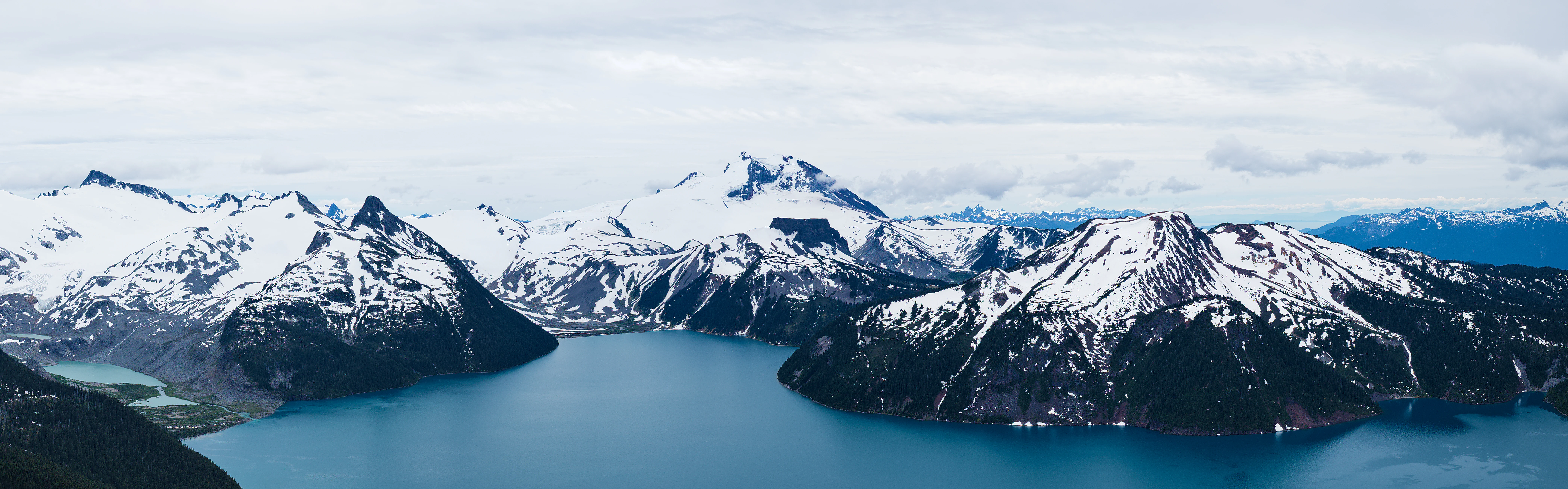
View of Garibaldi Lake from Panorama Ridge
Panoramic view of Garibaldi Lake captured from Panorama Ridge in Garibaldi Provincial Park, British Columbia.

Garibaldi Provincial Park conservation status and protection priorities

Garibaldi Provincial Park plays a significant role in protecting a continuous block of undisturbed mountain, forest, and alpine habitat along British Columbia's south coast. Because it encompasses much of the Garibaldi Range and a substantial portion of the Garibaldi Volcanic Belt, the park safeguards rare combinations of volcanic landforms, glacier systems, alpine lakes, and coastal rainforest within a single protected boundary. Its designation as a Class A Provincial Park reflects a high level of protection, and its management is the responsibility of BC Parks.

A long-running conservation concern within the park is The Barrier, the unstable lava dam impounding Garibaldi Lake. After part of the dam collapsed catastrophically in the winter of 1855–56, producing a massive landslide downstream, the structure was eventually recognized as unstable, leading in 1981 to the declaration of unsafe conditions in the area below and the evacuation of the village of Garibaldi. The land beneath The Barrier is now designated as the Barrier Civil Defence Zone, where visitors are explicitly warned not to camp, stop, or linger.

Wider conservation attention has focused on glacial recession. Studies by Simon Fraser University's Department of Earth Sciences have documented substantial loss of glacier coverage in the park since the early eighteenth century, with glacier extent by 2005 reduced to roughly half of its historical area. The park also supports targeted wildlife monitoring, including assessments of mountain goat populations designed to maintain healthy, viable numbers and prevent the species from entering at-risk status under provincial frameworks.

Garibaldi Provincial Park cultural meaning and human context

Garibaldi Provincial Park lies within the traditional territories of the Squamish and Lil'wat peoples, and the landscape carries deep cultural meaning independent of its later European-era naming. The Squamish name for Mount Garibaldi, Nch'ḵay̓, references the muddy waters of the Cheekye River and is tied to traditional uses of the area for hunting, foraging, and the collection of obsidian. In Squamish flood mythology, the mountain is the peak to which the people tied their canoes to ride out the Great Flood.

The Black Tusk is another culturally prominent landmark within the park. To the Squamish it is known as t'aḵ't'aḵ mu'yin tl'a in7in'a'xe7en, the Landing Place of the Thunderbird, said to have been crushed into its present jagged profile by the talons of the Thunderbird. The Lil'wat refer to the same peak as Q̓elqámtensa ti Skenknápa, or Place Where the Thunder Rests, reflecting the broader regional importance of the mountain range as part of Indigenous cosmological and territorial identity.

In the early twentieth century, the area also became a focal point of British Columbia's emerging mountaineering culture. Climbs such as the first ascent of Mount Garibaldi in 1907 and of The Black Tusk in 1912 helped define a recognizable recreation identity for the region and contributed directly to the campaign that led to formal park protection in 1920.
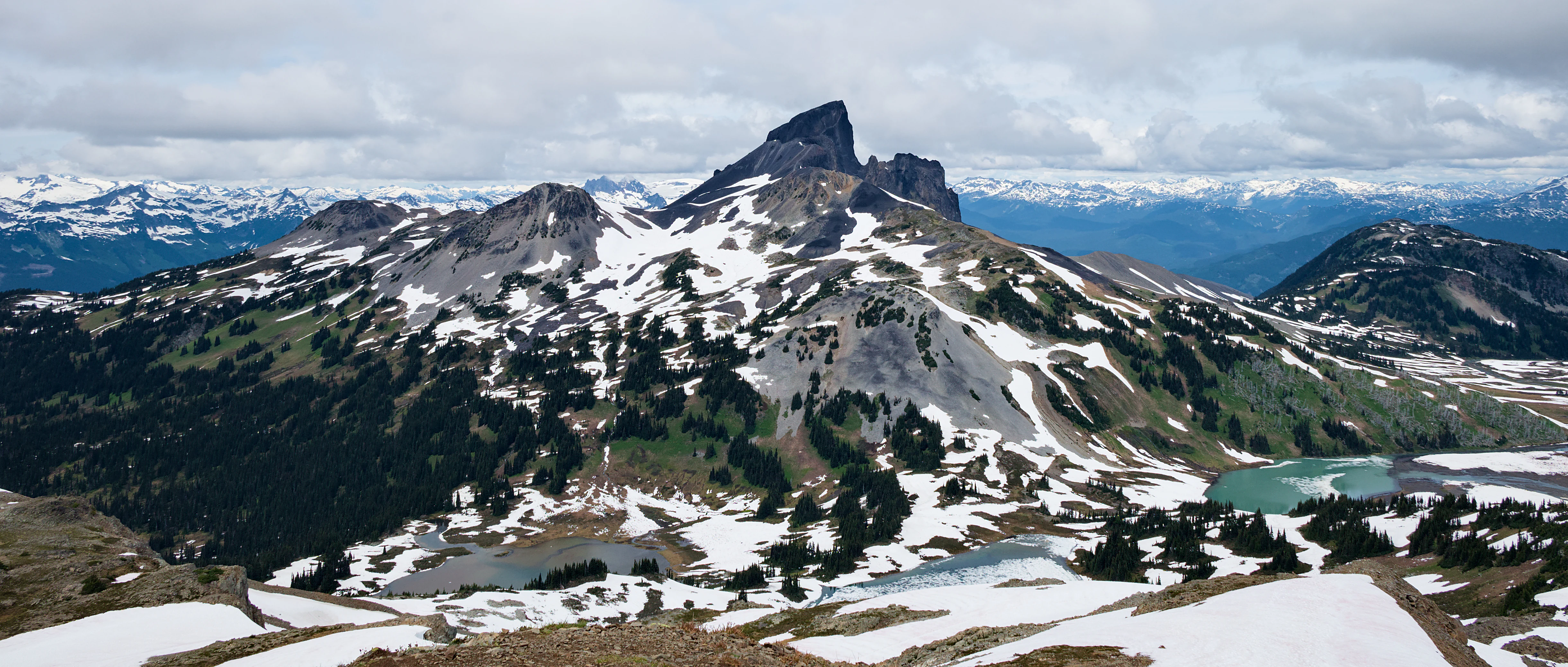
Black Tusk from Panorama Ridge Trail
View of Black Tusk peak from the Panorama Ridge Trail in Garibaldi Provincial Park, British Columbia

Top sights and standout views in Garibaldi Provincial Park

Garibaldi Provincial Park's most distinctive highlights include the turquoise expanse of Garibaldi Lake framed by volcanic peaks, the dramatic viewpoint from Panorama Ridge, and the unmistakable silhouette of The Black Tusk, considered one of the most recognizable volcanic features in the Garibaldi Volcanic Belt. The park's collection of subalpine lakes, including Elfin Lakes, Cheakamus Lake, and Wedgemount Lake, offers a remarkable variety of accessible yet deeply scenic destinations within a single protected boundary.

The park is also remarkable for its geological diversity, combining classic glacial landforms with active volcanic features. Visitors encounter stratovolcanoes, cinder cones, lava dams, and extensive icefields in close proximity, a combination that is rare among protected areas. The interplay of cultural significance for the Squamish and Lil'wat peoples, a century of mountaineering history, and ongoing conservation concerns such as glacial recession and the instability of The Barrier adds further depth to the park's identity as one of British Columbia's most important wilderness reserves.
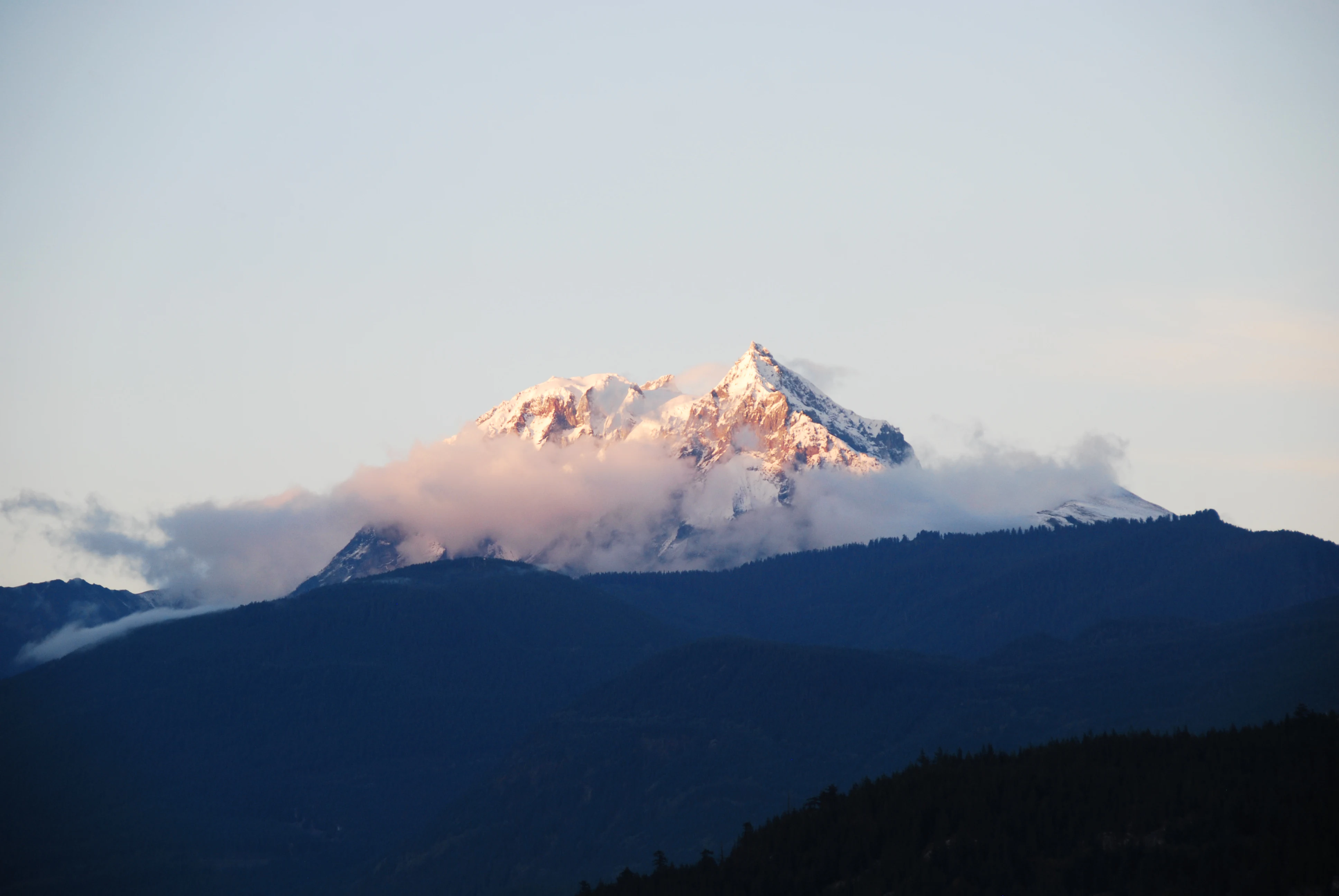
Mount Garibaldi viewed from Squamish
View of Mount Garibaldi, a potentially active stratovolcano in British Columbia, from the town of Squamish.

Best time to visit Garibaldi Provincial Park

Garibaldi Provincial Park's character shifts strongly with the seasons, and timing has a major effect on what visitors can experience. Summer, particularly July and August, is the most popular and accessible period, when most trails are snow-free, the alpine meadows at mid and upper elevations are at peak wildflower bloom, and facilities such as walk-in campgrounds and the Elfin Lakes Shelter operate in full summer mode. Day lengths are long, and the lakes, though glacier-cold, can be visited comfortably.

Winter offers a markedly different experience. Many of the same trails remain accessible for ski touring and snowshoeing, with quieter conditions, snow-covered alpine scenery, and a small number of facilities such as Red Heather Meadows operating primarily for winter use. Visitors should expect significantly more challenging conditions, shorter daylight, and the need for winter travel skills, but in exchange gain a quieter and more austerely beautiful perspective on the park's volcanic ridges and icefields.
Park guides

Essential planning documentation for alpine terrain and volcanic landscapes

Garibaldi Provincial Park Focused Guides and Resource Library

Selected thematic resources help visitors examine specific alpine planning questions for Garibaldi Provincial Park. The curated preview covers seasonal timing criteria and high altitude weather factors.
Monthly climate preview

Long-term representative monthly temperature and precipitation data for Garibaldi Provincial Park

Garibaldi Provincial Park Climate Normals and Annual Temperature Patterns

Garibaldi Provincial Park records measured monthly temperature and precipitation averages derived from historical coordinate sampling at elevation. Examining the complete twelve-month climatology profile reveals structured long-term environmental patterns across the protected landscape.
Annual mean2 °C
-7 °C13 °C
Jan-7°
Feb-6°
Mar-4°
Apr-1°
May
Jun
Jul13°
Aug13°
Sep
Oct
Nov-4°
Dec-7°
Warmest month
July

12.9 °C

Coolest month
December

-7.5 °C

Wettest month
November

7.5 mm/day

Driest month
July

1.8 mm/day

Park location guide

Geography guide, regional context, and park location map for Garibaldi Provincial Park

Garibaldi Provincial Park park geography, regions, and map view in Canada

Understand where Garibaldi Provincial Park sits in Canada through a broader geographic reading of the surrounding landscape, nearby location context, and its mapped position within the national park landscape.

How Garibaldi Provincial Park fits into Canada

Canada is a federal parliamentary constitutional monarchy spanning North America from the Atlantic to the Pacific and Arctic Oceans. With a population of over 41 million, it is officially bilingual in English and French at the federal level. The country gained independence from the United Kingdom through a gradual process culminating in 1982.

Wider geography shaping Garibaldi Provincial Park in Canada

Canada occupies the northern portion of North America, sharing its longest international border with the United States. The country extends from the Atlantic Ocean to the Pacific Ocean and northward into the Arctic Ocean, giving it the longest coastline of any nation.

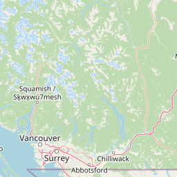
Map view of Garibaldi Provincial Park

Use this park location map to pinpoint Garibaldi Provincial Park in Canada, understand its exact geographic position, and read its mapped placement within the surrounding landscape more clearly.

Pigeon | © OpenStreetMap contributors

Location context for Garibaldi Provincial Park

British Columbia
Recorded earthquake history

Explore Historical Earthquake Records Near Garibaldi Provincial Park

Review documented seismic events through a structured history of epicentres located within the vicinity of the park. This MoriAtlas collection provides a reliable overview of past activity, offering insight into regional seismic history through indexed data points and geographic mapping.

Garibaldi Provincial Park Earthquake History

Catalogued events

9 events

Strongest magnitude

Magnitude 4.8

Most recent event

Feb 21, 2025

This history includes earthquakes recorded inside the park or within 50 km of its borders

Explore high-resolution photography capturing rugged peaks, alpine lakes, and icefields across the protected reserve.

Garibaldi Provincial Park Photos and Landscapes: Visualizing Glacial Terrain and Volcanic Scenery

Visual documentation reveals the striking interplay of ancient icefields, volcanic landforms, and dense coastal forests within Garibaldi Provincial Park. Examining photographic records helps researchers and visitors interpret the complex topography, glacial recession, and ecological zones defining the protected landscape.

Garibaldi Lake from Panorama Ridge

Wedgemount Lake and Whistler Mountain

Garibaldi Lake from Panorama Ridge at dawn

Elfin Lakes panorama

View of Garibaldi Lake from Panorama Ridge

Cheakamus Lake

Black Tusk from Panorama Ridge Trail

Mount Garibaldi viewed from Squamish

Cinder Flats

The Barrier Rockslide

Two Grey Jays at Garibaldi Lake

Park atlas

Compare regional mountain terrain, alpine lakes, and connected protected landscapes.

Explore Other Parks Near Garibaldi Provincial Park and Surrounding Protected Areas

Continue browsing other parks near Garibaldi Provincial Park to compare regional mountain terrain and protected landscapes. Evaluating adjacent wilderness areas provides broader geographic context for the volcanic and glacial geography of British Columbia.
State or regional parkBritish Columbia
Park boundaries overlap#1 closest

Southeast

Golden Ears Provincial Park: Geographic Atlas and Protected Landscape Overview

Coast Mountains terrain and protected wilderness boundaries

Golden Ears Provincial Park is a major protected wilderness in British Columbia, defined by the twin peaks of the Golden Ears massif and vast glacial lake systems like Alouette and Pitt. This site serves as a vital ecological corridor where lowland forests meet high subalpine ridges. Explore the park through its mapped boundaries and diverse ecological zones within the Pacific Northwest mountain landscape.

Area
609 km²
Established
1967
IUCN
II
Visitors
956.5K annual
State or regional parkBritish Columbia
Park boundaries overlap#2 closest

South

Pinecone Burke Provincial Park: Coast Mountain Wilderness and Protected Terrain Geography

Mapping a vast ecological corridor in British Columbia

Spanning over 38,000 hectares, Pinecone Burke Provincial Park represents a dramatic transition from the urban proximity of Coquitlam to the remote interiors of the southern Coast Mountains. The landscape is defined by its rugged relief, featuring subalpine meadows, deep freshwater systems, and historically significant forested slopes. This park provides a critical look at the complex topography of the Pacific Northwest, serving as a sanctuary for wildlife and a foundational piece of regional conservation.

Area
380 km²
Established
1995
IUCN
II
Relief
Mountain
State or regional parkBritish Columbia
About 14 km away#3 closest

North

Joffre Lakes Provincial Park: Geographic Atlas of Southwestern British Columbia Mountains

Glacial valleys and alpine wilderness protected areas

Joffre Lakes Provincial Park serves as a benchmark for alpine geography in British Columbia, showcasing a compact amphitheater of polished bedrock, moraines, and intense turquoise lakes. This protected area offers a focused look at the intersection of glacial hydrography and high-mountain terrain within the Coast Mountains, illustrating how meltwater and high-altitude peaks define this regional ecosystem.

Area
14.87 km²
Established
1996
Relief
Mountain
Climate
Alpine
State or regional parkBritish Columbia
24 km away#4 closest

Southwest

Porteau Cove Provincial Park: Mapping Coastal Protected Landscapes in British Columbia

Geography of Howe Sound shorelines and marine habitats

Porteau Cove Provincial Park offers a unique geographic vantage point at the meeting of granite-sloped mountains and the Pacific waters of Howe Sound. This park detail covers the coastal landscape, including protected intertidal zones, artificial reef structures, and the surrounding terrain that characterizes this segment of the British Columbia coastline.

Area
0.5 km²
Established
1981
IUCN
II
Visitors
611.8K annual
State or regional parkBritish Columbia
About 48 km away#5 closest

Southwest

Plumper Cove Marine Provincial Park: Protected Marine Geography and Coastal Landscapes in Howe Sound

Exploring the forested trails and sheltered marine anchorages of Keats Island.

Plumper Cove Marine Provincial Park represents a vital protected landscape on the coast of British Columbia, defined by its blend of upland coastal forest and intimate, boat-accessed marine anchorages. This geography-focused profile traces the park's terrain, including its rocky shorelines, forest-covered bluffs, and the trail networks that connect visitors to the broader Howe Sound maritime environment.

Area
0.66 km²
Established
1960
IUCN
II
Relief
Upland
State or regional parkBritish Columbia
About 50 km away#6 closest

Southeast

Davis Lake Provincial Park: Protected Forest and Lake Geography in British Columbia

Regional protected area with old-growth forest and waterfalls

Davis Lake Provincial Park represents a significant protected area in the Fraser Valley, characterized by its undisturbed Western Hemlock forest and the scenic descent of Murdo Creek into McDonald Falls. The park provides an essential look at the regional geography of southwestern British Columbia, balancing dense coniferous canopy with accessible lake-based terrain in a quiet, natural setting.

Area
0.75 km²
Established
1963
IUCN
II
Relief
Upland
State or regional parkFraser Valley Regional District
About 55 km away#7 closest

South

Rolley Lake Provincial Park: An Atlas of Protected Landscapes and Regional Geography

Lakeshore forest terrain and protected park geography

Delve into the geographic identity of Rolley Lake Provincial Park, a state-protected landscape in the Fraser Valley Regional District. This documentation traces the park's internal map, including its central freshwater lake, loop trail connectivity, and surrounding second-growth forest topography, providing essential context for understanding this localized wilderness zone.

Area
1.15 km²
Established
1961
IUCN
II
State or regional parkBritish Columbia
About 63 km away#8 closest

Southeast

Kilby Provincial Park: Protected Riverfront Geography and Historic Sites in BC

A unique riparian landscape along the Harrison River

Kilby Provincial Park offers an intimate look at the flood plain geography of the Harrison River. The site features an elevated, boardwalk-linked heritage environment integrated with sandy riverfronts and seasonal wildlife corridors. This protected area stands out for its combination of historical pioneer preservation and river-based ecosystem monitoring within the Upper Fraser Valley region of British Columbia.

Area
0.03 km²
Established
1973
IUCN
II
Relief
Lowland

Common questions about visiting, size, designation, and location context for Garibaldi Provincial Park

Garibaldi Provincial Park FAQs for park facts, access, geography, and protected area context

Find quick answers about Garibaldi Provincial Park, including protected-area facts, park geography, trail and visitor context, and how the park fits into its surrounding country and regional landscape.
MoriAtlas Explorer

Continue Your Protected Areas Search Across the Global Atlas

Deepen your exploration by continuing the structured search for national parks and protected areas worldwide. Utilize the comprehensive filtering capabilities to compare different conservation landscapes and refine your understanding of global park geography. Discover more about the distribution and characteristics of protected natural areas.

Global natural geography