
Mori Atlas logo
Protected landscapeGateway National Recreation Area

Tracing the barrier beaches, tidal estuaries, and historic maritime defense zones

Gateway National Recreation Area: Mapping a Vast Coastal Protected Landscape in New York

Gateway National Recreation Area forms a distinctive ring around the entrance to New York Harbor, preserving vital coastal ecosystems that bridge the urban environment and the Atlantic shore. This protected landscape encompasses a diverse range of natural terrain, including expansive salt marshes, dune systems, maritime forests, and barrier peninsulas that reflect the original coastline of the region. Through integrated map exploration, visitors and researchers can trace the connection between preserved wildlife refuges, historic coastal defense forts, and the complex hydrology of the Jamaica Bay estuary and Sandy Hook peninsula.

national recreation areaurban parkcoastal parkbeachbarrier islandocean swimming
A stylized flat vector illustration of a suspension bridge extending over a river, with green hills, evergreen trees, and rocky cliffs in the foreground under a pale sky.

Gateway National Recreation Area

Protected landscape

Park overview

Structured park overview, official facts, and landscape profile for Gateway National Recreation Area

Gateway National Recreation Area park facts, protected area profile, and essential visitor context

Review the core facts for Gateway National Recreation Area, including designation, size, terrain, visitor scale, habitats, and operating context in one park-focused overview.

About Gateway National Recreation Area

Gateway National Recreation Area occupies a distinctive position in the U.S. National Park System. It was created in 1972 to preserve natural, cultural, and recreational resources near the heart of the New York metropolitan area, and it remains one of the few federally administered park landscapes that are easily reached by mass transit and car from a population of millions. The recreation area's geography frames the harbor entrance, with Jamaica Bay and the western Rockaway Peninsula on one side and the Sandy Hook barrier peninsula on the other. Between them lie the harbor's Narrows, a stretch of water that has shaped the region's maritime history and now also defines the geography of this park.

The park's three units each carry a strong identity. The Jamaica Bay Unit, the largest, includes the Jamaica Bay Wildlife Refuge, the only federally named wildlife refuge within the National Park System, as well as Floyd Bennett Field, Shirley Chisholm State Park, Fort Tilden, Breezy Point Tip, Jacob Riis Park, and Canarsie Pier. Floyd Bennett Field is a decommissioned airfield that once served as New York City's municipal airport and now includes the Ryan Visitor Center, the Historic Aircraft Restoration Project, and the only public campground within New York City limits. Fort Tilden combines natural coastal features with the ruins of a 20th-century coastal defense installation, while Jacob Riis Park retains an art deco bathhouse built under New York planner Robert Moses.

The Staten Island Unit centers on Fort Wadsworth, one of the oldest military sites in the country, with origins dating back to 1663, and includes structures such as Fort Tompkins and Battery Weed. Miller Field preserves another historic airfield now used for sport and picnicking, while Great Kills Park offers a marina, beach, and osprey nesting habitat. Offshore, Hoffman and Swinburne Islands, both off-limits to the public, originated as immigrant quarantine stations in the late 19th century and now primarily serve nesting birds and, in winter, hauled-out harbor seals.

Across the harbor, the Sandy Hook Unit covers roughly 1,665 acres of barrier peninsula in Monmouth County, New Jersey. It includes seven ocean beaches along Sandy Hook Bay, the historic Sandy Hook Lighthouse, salt marshes, and the Fort Hancock complex with its 100 historic buildings. The Maritime Holly Forest at Sandy Hook is the largest holly forest in the northeastern United States. A seasonal ferry from Manhattan connects visitors to this New Jersey portion of the park, completing a recreation area that ties together two states and multiple boroughs under a single National Park Service umbrella.

Throughout its units, Gateway presents recreational opportunities that would otherwise be unavailable within a dense urban environment. Activities include ocean swimming, surfing, boating, kayaking, fishing, hiking, biking, birdwatching, camping, kite flying, and touring historic forts and aircraft hangars. This breadth of use, combined with its ecological and historic content, makes Gateway an unusually multifaceted park experience for residents and visitors to the New York region.

Quick facts and research context for Gateway National Recreation Area

Gateway National Recreation Area was established on October 27, 1972, by an act of the U.S. Congress. It covers about 26,607 acres spread across three main units and 11 park sites, straddling New York City and northern New Jersey. The area is administered by the National Park Service under IUCN Category V, recognizing it as a protected landscape and seascape.

The recreation area includes about 800 historic buildings, structures, and sites. It conserves significant stretches of ocean beach, salt marsh, dunes, and barrier island habitat, including the largest maritime holly forest in the northeastern United States. It is also notable for being the only National Park Service-maintained public campground located within the limits of an American city.

Protection and recognition

Examine documented conservation scope and formal designation records.

Gateway National Recreation Area Protection Status and International Recognition

Gateway National Recreation Area maintains a mixed protection scope governed by established administrative frameworks and management guidelines. Review official designation records, administrative history, and international recognition details compiled for this protected area.

Protection details

Protection scope
Mixed
Transboundary protection
No
Park context

Deeper park guide and search-rich context for Gateway National Recreation Area

Gateway National Recreation Area history, landscape, wildlife, and travel context

Explore Gateway National Recreation Area through its history, landscape character, ecosystems, wildlife, conservation priorities, cultural context, and seasonal travel timing in a structured park guide built for atlas discovery and search intent.

Why Gateway National Recreation Area stands out

Gateway is best known for being a major coastal park embedded inside one of the world's largest metropolitan areas. Its beaches at Sandy Hook, Jacob Riis Park, and Great Kills Park are signature destinations, while the Jamaica Bay Wildlife Refuge and Breezy Point Tip are recognized for their importance to shorebirds and other coastal wildlife. The recreation area is also widely associated with historic coastal defense installations such as Fort Tilden, Fort Wadsworth, and Fort Hancock, which anchor its regional identity as a place where military history meets surviving natural shoreline. Beyond individual sites, Gateway stands out for the role it plays in regional conservation. It preserves remnants of the original New York and New Jersey coastline, including tidal estuary, dune, and barrier beach ecosystems that have largely disappeared elsewhere in the region. Its sheer visitor numbers make it one of the most important entry points for urban residents to experience coastal national parklands, and it has become a benchmark example of how a major urban area can sustain relatively intact natural systems within its borders.
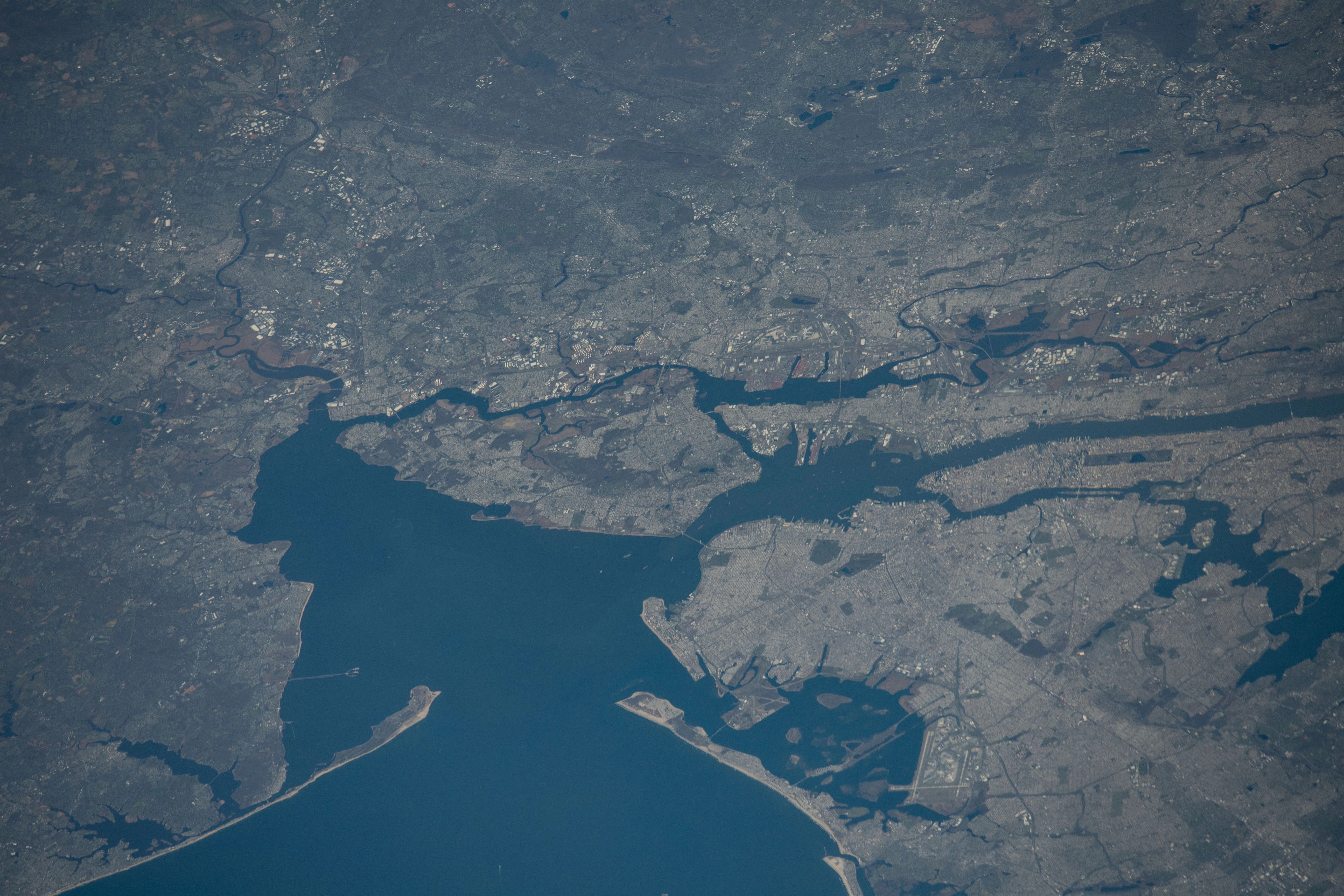
Satellite-style aerial view showing the intricate shoreline, bays, and urban-integrated coastal landscapes of the Gateway National Recreation Area.
An aerial view of the Gateway National Recreation Area as seen from the International Space Station.

Gateway National Recreation Area history and protected-area timeline

The idea for Gateway National Recreation Area emerged from regional planning concerns in the late 1960s. In 1969, the Regional Plan Association proposed a new national seashore in the New York metropolitan area, to be administered by the U.S. Department of the Interior. President Richard Nixon endorsed a closely related proposal in 1970 but substituted a different designation: instead of a "seashore," the protected area would have the broader scope of a "national park." Nixon began the process of seeking Congressional approval for the new unit in May of that year.

The U.S. House of Representatives approved the creation of Gateway National Recreation Area in September 1972, and most of the land was transferred to the National Park Service for inclusion in the new unit. In the same vote, the House rejected a state provision that would have allowed housing development at Floyd Bennett Field, keeping that historic airfield within the park. Gateway National Recreation Area was officially created on October 27, 1972, alongside Golden Gate National Recreation Area in San Francisco, and initially included over 26,000 acres of land. Some areas proposed by the Regional Plan Association, including the Coney Island shore, were ultimately not included.

The recreation area absorbed military and industrial lands with rich prior histories. At Sandy Hook, Fort Hancock had served as part of the harbor's coastal defense system from 1895 until 1974 and brought with it approximately 100 historic buildings and fortifications. Fort Wadsworth on Staten Island, whose origins reach back to 1663, was under U.S. Army control when Gateway was established in 1972, transferred to the U.S. Navy in 1979, ended operations as a military base in 1993, and was placed under National Park Service jurisdiction in 1995. Floyd Bennett Field, the decommissioned New York City municipal airport, carried its own aviation heritage into the new park. Meanwhile, Hoffman and Swinburne Islands, originally constructed in the late 19th century as quarantine stations for immigrants arriving via Ellis Island, became part of the Staten Island Unit as largely undisturbed wildlife sites.

Later developments added new dimensions to the park. The Jamaica Bay Wildlife Refuge was created and managed initially by New York City; the term "wildlife refuge" was preserved when the area was incorporated into Gateway, making it the only site in the National Park System officially called a wildlife refuge. In more recent decades, Shirley Chisholm State Park was constructed on top of the former Pennsylvania Avenue landfill along the Belt Parkway, representing an innovative landfill remediation project; its first phase opened in July 2019 and the remainder was completed in 2021. The park has also faced modern environmental challenges, including the discovery of radioactive contamination at Great Kills Park in 2005, which has triggered ongoing clean-up efforts under CERCLA authority.

Gateway National Recreation Area landscape and geographic character

Gateway's landscape is defined by the coastal geography of the New York Bight and the lower Hudson estuary region. It is a patchwork of ocean beach, barrier peninsula, tidal estuary, salt marsh, coastal dune, maritime forest, and small offshore islands, all set within an intensely urban region. The Jamaica Bay estuary forms the heart of the largest unit, with dozens of small islands, brackish ponds, and open water bounded by the western Rockaway Peninsula. Sandy Hook stretches as a long, narrow barrier peninsula into the Atlantic, with oceanfront beach on one side and the calmer waters of Sandy Hook Bay on the other.

Several sites within the park are noted for their specific physical character. Fort Tilden on the Rockaway peninsula combines some of the city's most secluded ocean beaches with a successional maritime forest, a coastal dune system, and a freshwater pond. Breezy Point Tip, at the western end of the Rockaways, holds 200 acres of oceanfront beach, bay shoreline, dunes, marshes, and coastal grasslands. Floyd Bennett Field contains large open grasslands that reflect its history as an airfield, while Canarsie Pier extends recreational access onto the bay.

The Staten Island Unit occupies a varied southeastern shoreline facing Lower New York Bay. Fort Wadsworth sits on high ground overlooking the Narrows, with views back toward Manhattan and the Verrazzano-Narrows Bridge, while Miller Field preserves open athletic and picnic spaces on a former airfield and Great Kills Park adds beach and marina landscapes. Offshore, Hoffman and Swinburne Islands are small, largely unmodified landforms that play a disproportionate ecological role relative to their size.

A unique feature of the Sandy Hook Unit is the Maritime Holly Forest, the largest holly forest in the northeastern United States. This unusual plant community is part of the broader system of dune, pond, and woodland habitats that the Fort Hancock area has protected for more than a century. The combination of barrier beach, salt marsh, and maritime forest makes Sandy Hook both ecologically distinctive and visually striking within the regional landscape.
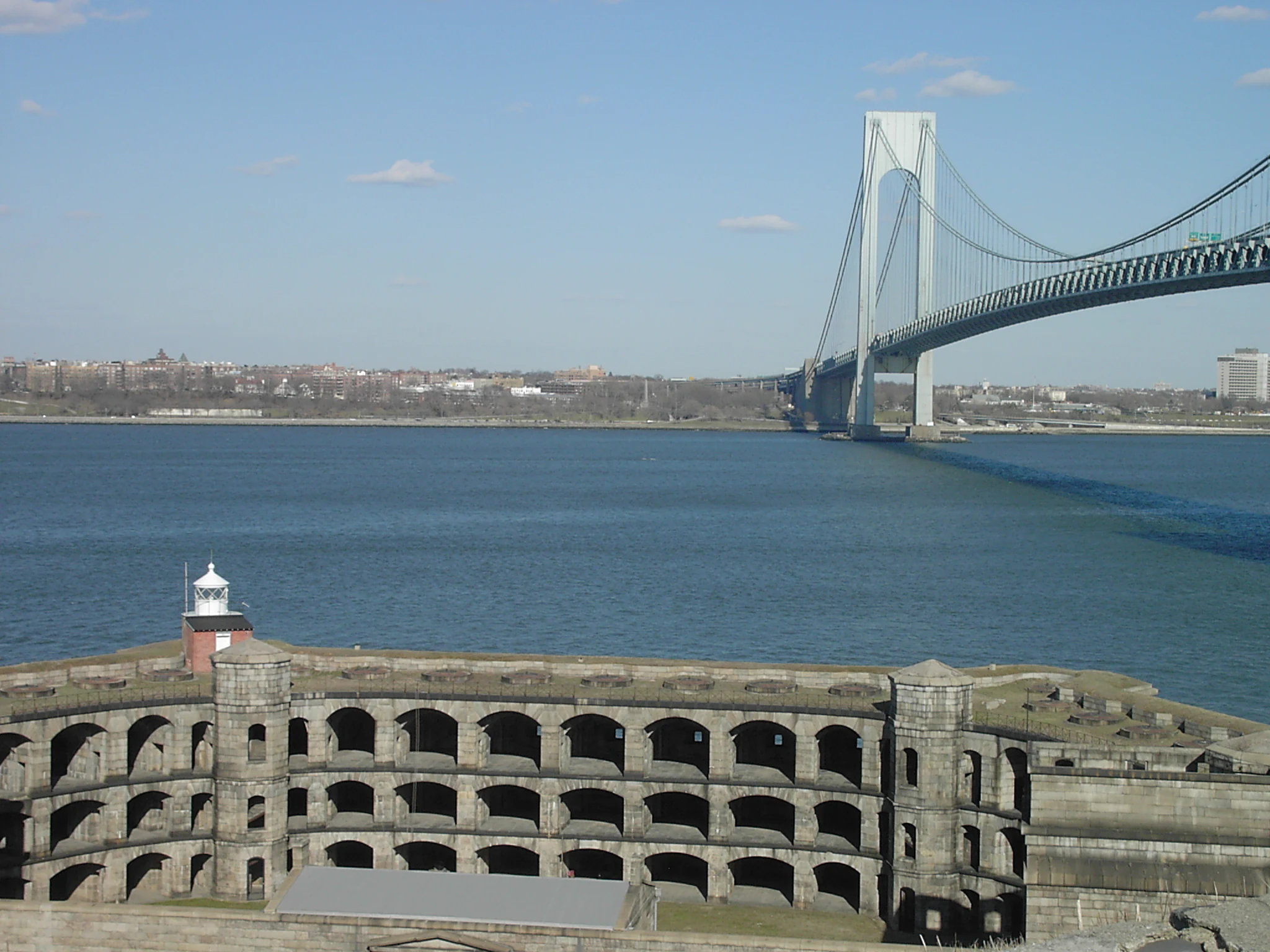
A wide shot of the semicircular masonry walls of Fort Wadsworth in the foreground, with the massive Verrazano-Narrows Bridge spanning a large body of water in the background.
The historic Fort Wadsworth overlooking the Verrazano-Narrows Bridge at Gateway National Recreation Area.

Gateway National Recreation Area ecosystems, habitats, and plant life

Gateway preserves a rare concentration of coastal ecosystems in a region where urbanization has long since replaced most natural shoreline. Salt marshes, tidal mudflats, brackish ponds, dunes, barrier beaches, successional maritime forest, and small estuarine islands are all represented within the recreation area. The Jamaica Bay estuary is the ecological centerpiece of the largest unit, supporting extensive marsh habitat along with open water used seasonally by large numbers of migratory birds. The western Rockaway Peninsula's dune and beach systems, including those at Breezy Point Tip and Fort Tilden, add further ecological variety to the same unit.

The Sandy Hook Unit contains a hierarchically rich assembly of barrier-beach habitats. Its maritime holly forest, dune systems, ponds, and salt marshes together support exceptional bird and plant diversity, including sites the National Park Service has identified among the most valuable bird habitats in New Jersey. The two offshore islands in the Staten Island Unit, Hoffman and Swinburne Islands, are unusual closed habitats where bird nesting dominates and human access is restricted, leaving natural dynamics to prevail over much of the year.

The park's ecological character is shaped as much by human history as by underlying geology. Much of Gateway's land was modified in the early and mid-20th century through the use of artificial fill to create usable parkland from former marshes and tidal areas. Jamaica Bay soils in particular contain extensive artificial fill, which has affected infiltration patterns and even the persistence of hardened trails. Restoration work within the park now aims to recover native vegetation and more natural marsh processes, including invasive species removal, native plantings, and the reintroduction of historically appropriate plant communities at sites such as Crooke's Point.
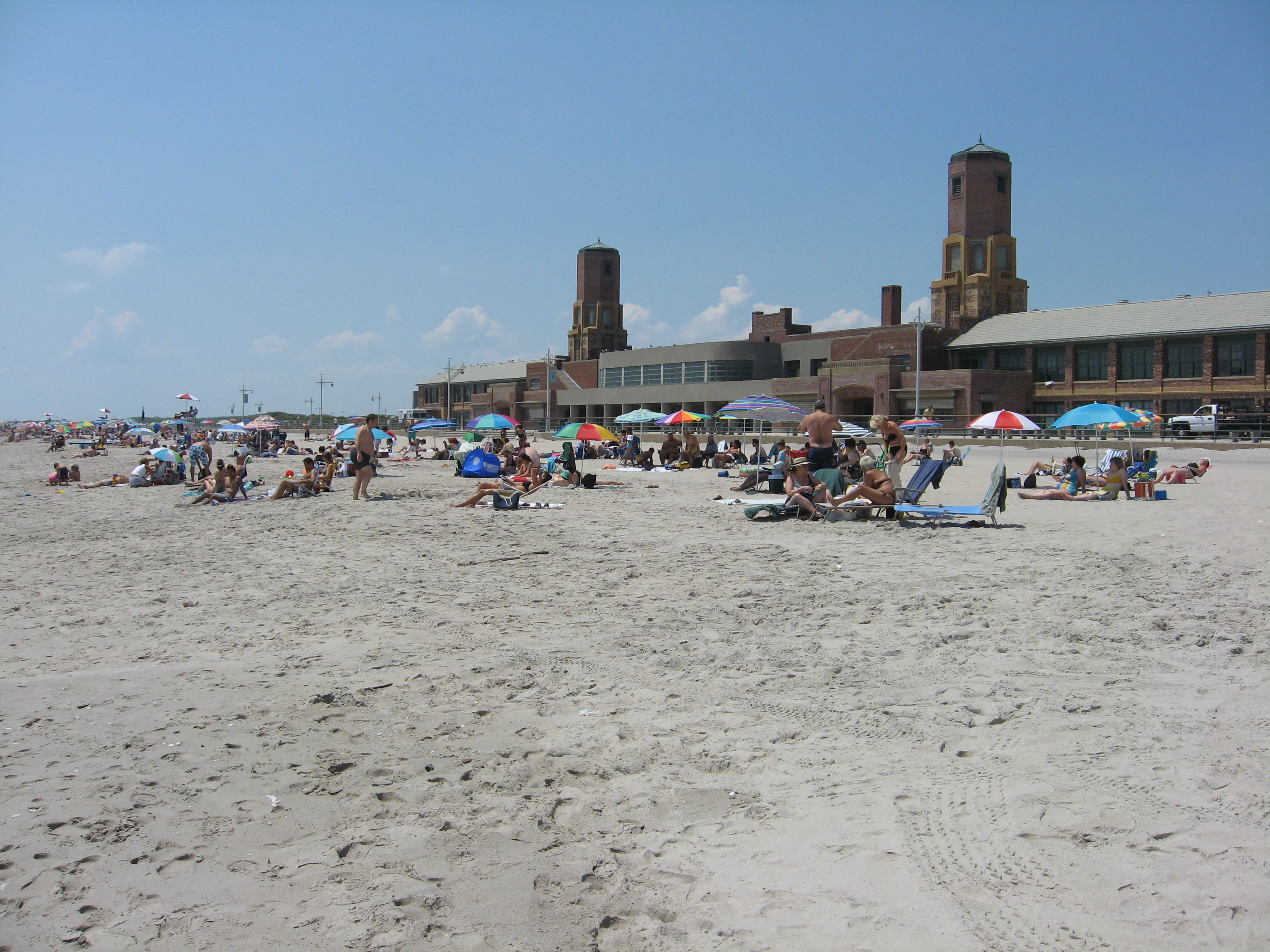
Wide view of a sandy beach with people lounging under colorful umbrellas, featuring a large brick historic bathhouse building with two towers in the background.
A sunny day at the beach at Jacob Riis Park, part of the Jamaica Bay Unit of Gateway National Recreation Area.

Gateway National Recreation Area wildlife and species highlights

Despite its urban location, Gateway is recognized as one of the most important bird-related sites in the New York region. More than 325 bird species have been recorded across the recreation area, and the Jamaica Bay Wildlife Refuge in particular attracts large numbers of birdwatchers. The refuge and adjacent habitats support migratory shorebirds, songbirds, raptors, and beach-nesting species, and Fort Tilden is widely regarded as one of the best places on New York Harbor to observe hawks during fall migration. The Jamaica Bay Unit is also a strong location for viewing nesting activity of diamondback terrapins and the seasonal mating and egg-laying of horseshoe crabs.

Beach-nesting birds are a recurring signature of the park. Piping plovers, listed as threatened, nest at Breezy Point Tip, and American oystercatchers, killdeer, and tree swallows are among the other bird species commonly observed across the recreation area. The Staten Island Unit's Hoffman and Swinburne Islands are major nesting sites for colonial seabirds and other avian species, while Great Kills Park supports nesting osprey. Sandy Hook's varied barrier-beach habitats also draw nesting and migratory activity from many bird species, complementing the wildlife picture across the bay.

Beyond birds, Gateway supports a wide range of other wildlife adapted to the region's coastal and urban environments. Mammals include foxes, raccoons, white-tailed deer (most notably in the Staten Island Unit), muskrats, and harbor seals, the latter occasionally hauling out on Hoffman and Swinburne Islands during winter months. Reptiles include diamondback terrapins, eastern box turtles, painted turtles, and snapping turtles, while amphibian records include the eastern gray tree frog. Monarch butterflies and eastern tent caterpillars represent some of the more visible insect species, and Atlantic horseshoe crabs are a notable component of the bay ecosystem.
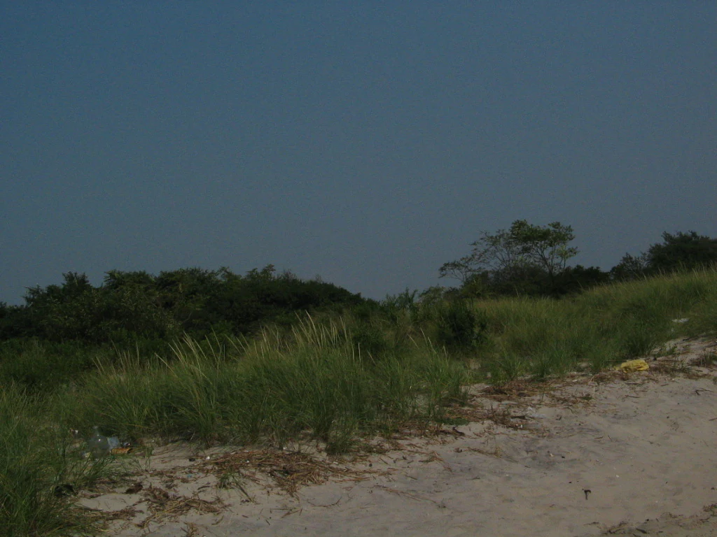
A view of tall beach grasses and low-lying shrubs growing behind a sandy beach under a clear sky.
Coastal vegetation along the sandy shoreline of Gateway National Recreation Area.

Gateway National Recreation Area conservation status and protection priorities

Gateway's conservation role begins with preserving rare coastal remnants within a heavily populated region. The lands and waters within the recreation area represent some of the last fragments of the original shoreline of the New York area, and the park's salt marshes, dunes, barrier beaches, and estuarine islands carry regional significance for migratory birds and coastal biodiversity. Its location ensures that its conservation value is not just about the acreage protected but about the ecological function it performs for one of the most heavily developed estuaries in North America.

The National Park Service has implemented a range of habitat restoration and pollution response programs at Gateway. Marsh restoration projects have sought to repair damage caused by erosion and decades of artificial fill, while the Crooke's Point restoration targeted invasive species and the reintroduction of native Atlantic coastal flora. The park also runs ongoing invasive species removal and native plant plantings across multiple sites to support biodiversity and stabilize ecological function.

The recreation area faces distinctive environmental challenges that derive directly from its urban setting. The National Park Service conducts annual air quality surveys monitoring overall air quality, visibility, and ground ozone levels. Wildlife interacts constantly with the surrounding built environment, requiring visitors to be cautious about white-tailed deer near roads, particularly during dawn, dusk, and the autumn mating season. The discovery of radioactive contamination at Great Kills Park in 2005 has restricted access to affected areas and prompted clean-up work under CERCLA authority. Hydrological changes from deep dredging and engineering modifications, as well as fill-related soil issues across sites such as Jamaica Bay, add further long-term management considerations that influence ongoing conservation planning.

Gateway National Recreation Area cultural meaning and human context

Gateway reflects layers of human history layered onto a coastal landscape once inhabited by the Lenape and other Indigenous peoples of the New York region. The most visible strand of cultural context is military history. Fort Wadsworth, with fortifications dating to 1663, is among the oldest continuously used military sites in the United States, and structures such as Fort Tompkins and Battery Weed remain as prominent landmarks along the Narrows. Sandy Hook's Fort Hancock, used for harbor defense from 1895 to 1974, retains around 100 historic buildings and forts, and Fort Tilden similarly carries the remains of 20th-century coastal defense and Nike antiaircraft missile installations. Together, these forts frame the harbor's entrance and form a major part of Gateway's interpretive identity.

The park also preserves a more recent layer of maritime immigration history. Hoffman and Swinburne Islands, off Staten Island, were constructed in the late 19th century as quarantine stations for immigrants arriving via Ellis Island who were suspected of carrying disease, marking a tangible link to the broader story of immigration into New York Harbor. Floyd Bennett Field represents New York City's early aviation heritage and was championed as a park addition by Congressman William Fitts Ryan, who was also a key supporter of Gateway's creation, with the site's visitor center named in his honor. Jacob Riis Park, an art deco bathhouse beach, was built by New York planner Robert Moses and named for the journalist and reformer Jacob Riis.

A final cultural element is the recreational and community role the park has played since 1972. Its beaches, camping facilities, and historic sites are intensively used by residents of Brooklyn, Queens, Staten Island, and the broader New York and New Jersey region. Gateway has thus become not only a conservation site but also an integral part of regional everyday life, blending ecological protection with military, immigration, and aviation heritage into a single accessible cultural landscape.
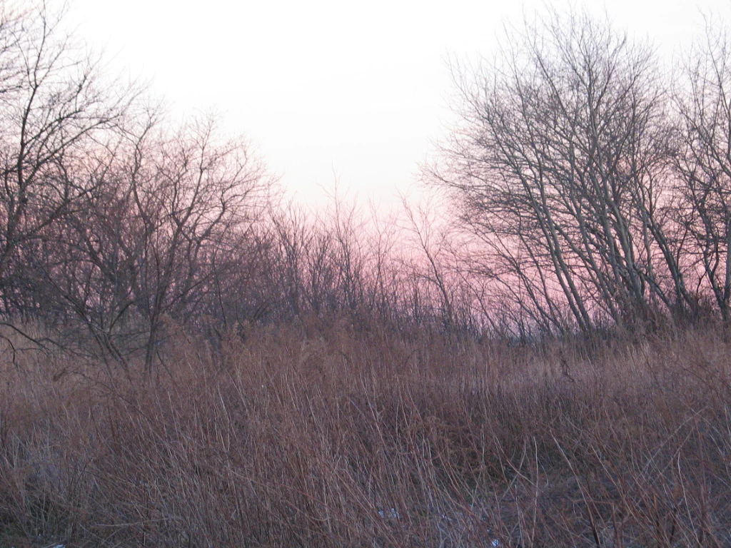
Bare deciduous trees and dry golden grasses in a field at twilight.
Winter vegetation at Jamaica Bay, Gateway National Recreation Area.

Top sights and standout views in Gateway National Recreation Area

Among Gateway's strongest distinguishing features is its location: a fully developed national park landscape reachable from one of the largest metropolitan areas in the world, a quality rare within the National Park System. Its scenery includes ocean beaches at Sandy Hook, Jacob Riis Park, Fort Tilden, and Great Kills, combined with calm bay shorelines at Jamaica Bay and Sandy Hook Bay. The mixing of barrier beach, dune, salt marsh, and maritime forest in a single park system gives visitors a compressed experience of the regional coastal environment within short distances of mass transit.

Equally distinctive is the park's historic military architecture. Fort Hancock's 100 buildings at Sandy Hook, Fort Wadsworth's centuries-old fortifications on the Narrows, and the coastal defense remnants at Fort Tilden link Gateway directly to the long history of harbor defense. The recreation area's array of converted airfields, including Floyd Bennett Field and Miller Field, adds an aviation heritage dimension unusual for a coastal park. Wildlife-rich sites such as the Jamaica Bay Wildlife Refuge and Breezy Point Tip complement these historic and scenic highlights with significant bird and habitat experiences.

Finally, Gateway offers recreational opportunities uncommon in a major city. Ocean swimming, surfing, kayaking, camping, fishing, boating, hiking, biking, and kite flying are all available within the recreation area, while sites such as Canarsie Pier and Great Kills marina bring water activity to the heart of the boroughs. Shirley Chisholm State Park adds a newer model of landfill-to-parkland transformation, and seasonal ferries from Manhattan to Sandy Hook make even the New Jersey portion of the park accessible without a private vehicle.
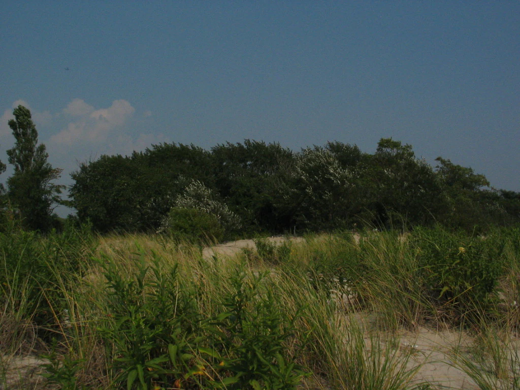
A view of low coastal dunes covered in tall grasses and shrubs under a clear blue sky, with a dark line of trees in the background.
A coastal landscape view at Gateway National Recreation Area.

Best time to visit Gateway National Recreation Area

Gateway is best experienced in mild seasons when both wildlife and beach activities are at their peak. Spring through early fall offers the warmest conditions for ocean swimming, surfing, and use of beaches such as Gunnison Beach, Jacob Riis Park, and the beaches of Great Kills Park, with lifeguards typically on duty during the summer months. This window also supports active reptile viewing and the activity period for insects like the monarch butterfly.

Migration seasons offer some of the richest wildlife experiences. Spring and fall bird migrations bring large numbers of species through the Jamaica Bay Wildlife Refuge, the Rockaway Peninsula, and Sandy Hook, with Fort Tilden identified as a particularly strong hawk migration viewpoint in autumn. Horseshoe crab mating and egg-laying on bay beaches, along with diamondback terrapin nesting, are more visible during warmer months, while winter offers occasional harbor seal sightings around Hoffman and Swinburne Islands.

Winter visits bring quieter conditions and a different atmosphere. Off-season travel reveals dune, marsh, and maritime forest landscapes with fewer crowds, though some facilities and beach lifeguards are reduced. Visitors planning around wildlife and weather can generally favor late spring through early fall for warm-weather recreation, spring and fall peaks for bird migration, and quieter off-season periods for contemplative exploration of historic forts and natural shoreline.
Monthly climate preview

Long-term representative monthly temperature and precipitation rhythm

Gateway National Recreation Area Climate Normals and Annual Weather Patterns

Gateway National Recreation Area exhibits a measured annual temperature range from negative averages in winter months up to thirty degrees Celsius in peak periods, alongside steady daily precipitation normals across the entire coordinate cycle. Examining the complete twelve-month temperature and precipitation record provides deeper context into long-term environmental patterns for this protected location.
Annual mean12 °C
1 °C24 °C
Jan
Feb
Mar
Apr
May14°
Jun20°
Jul24°
Aug23°
Sep20°
Oct15°
Nov
Dec
Warmest month
July

23.5 °C

Coolest month
January

1.1 °C

Wettest month
December

3.9 mm/day

Driest month
February

3.1 mm/day

Park location guide

Geography guide, regional context, and park location map for Gateway National Recreation Area

Gateway National Recreation Area park geography, regions, and map view in United States of America

Understand where Gateway National Recreation Area sits in United States of America through a broader geographic reading of the surrounding landscape, nearby location context, and its mapped position within the national park landscape.

How Gateway National Recreation Area fits into United States of America

The United States of America is a federal presidential republic and one of the world's largest countries by area and population. It consists of 50 states across a vast territory spanning multiple time zones, with its capital in Washington, D.C. and largest city in New York City. The nation has a diverse economy, influential political system, and significant cultural and military presence globally.

Wider geography shaping Gateway National Recreation Area in United States of America

The United States occupies a vast territory in North America, bordered by Canada to the north and Mexico to the south. The 48 contiguous states stretch from the Atlantic to the Pacific Ocean, while Alaska occupies the northwestern region and Hawaii is an archipelago in the Pacific. The country encompasses diverse terrain including the Rocky Mountains, Appalachian Mountains, Great Plains, and extensive river systems.

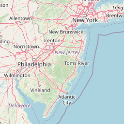
Map view of Gateway National Recreation Area

Use this park location map to pinpoint Gateway National Recreation Area in United States of America, understand its exact geographic position, and read its mapped placement within the surrounding landscape more clearly.

Pigeon | © OpenStreetMap contributors

Location context for Gateway National Recreation Area

New JerseyNew York
Recorded earthquake history

Explore Recorded Seismic History near Gateway National Recreation Area

Review the curated list of historical earthquakes associated by location with the diverse coastal environments of Gateway National Recreation Area. Use these records to analyze past regional seismic activity and its geographic relationship to this major national recreation landscape.

Gateway National Recreation Area Earthquake History

Catalogued events

7 events

Strongest magnitude

Magnitude 3.6

Most recent event

Aug 3, 2025

This history includes earthquakes recorded inside the park or within 50 km of its borders

Visualizing barrier beaches, salt marshes, and maritime forests across the harbor

Gateway National Recreation Area Photos and Coastal Landscape Scenery

Examine authentic photographs of Gateway National Recreation Area to understand its diverse coastal terrain, including ocean beaches, tidal estuaries, and historic fortifications. Visual documentation reveals the distinct protected habitats and natural shoreline environments preserved within a major metropolitan setting.

Satellite-style aerial view showing the intricate shoreline, bays, and urban-integrated coastal landscapes of the Gateway National Recreation Area.

A piping plover, a small pale shorebird with orange legs and a thin black collar, stands on sandy ground.

A wide shot of the semicircular masonry walls of Fort Wadsworth in the foreground, with the massive Verrazano-Narrows Bridge spanning a large body of water in the background.

Wide view of a sandy beach with people lounging under colorful umbrellas, featuring a large brick historic bathhouse building with two towers in the background.

A view of tall beach grasses and low-lying shrubs growing behind a sandy beach under a clear sky.

A wide, eye-level view of a calm bay with a brown, grassy shoreline in the foreground and a small, simple wooden shelter standing near the water's edge.

Bare deciduous trees and dry golden grasses in a field at twilight.

A view of low coastal dunes covered in tall grasses and shrubs under a clear blue sky, with a dark line of trees in the background.

Park atlas

Compare surrounding regional coastal geography and connected protected natural areas

Parks Near Gateway National Recreation Area and Related Protected Landscapes

Browsing parks near Gateway National Recreation Area reveals broader coastal geography, barrier beach ecosystems, and estuarine habitats across the surrounding region. Extending the geographic comparison helps trace similar protected landscapes and regional conservation areas beyond the immediate harbor gateway.
Protected landscapeNew York
46 km away#1 closest

East

Fire Island National Seashore: Geography and Protected Area Exploration

Barrier island ecosystems and coastal wilderness in New York

Fire Island National Seashore spans a narrow, thirty-mile barrier island corridor, protecting a mosaic of maritime pine forest, expansive Atlantic beaches, and quiet bay-side salt marshes. This protected landscape includes the Otis Pike Fire Island High Dune Wilderness and the maritime holly canopy of the Sunken Forest, offering an essential reference for exploring coastal geography in New York.

Area
79.23 km²
Established
1964
IUCN
V
Visitors
393.7K annual
Watercolor illustration depicting a cascading waterfall nestled between rolling green hills and a gentle body of water.
Protected landscapeUnited States of America
88 km away#2 closest

Northwest

Delaware Water Gap National Recreation Area: Regional Geography and Mapped Protected Landscapes

Appalachian river corridors and mountain pass geography.

Delaware Water Gap National Recreation Area serves as a major protected unit in the United States, centered on the dramatic geological pass where the Delaware River cuts through Kittatinny Mountain and Blue Mountain. This expansive landscape preserves critical riverine habitats, forested ridges, and historic corridors that provide a deep look into the regional geography of the mid-Atlantic Appalachians.

Area
270.09 km²
Established
1965
Visitors
4.2M annual
Relief
Mountain
Nature reserveNew Jersey
About 97 km away#3 closest

South

Jacques Cousteau National Estuarine Research Reserve: New Jersey Coastal Protected Area

Inland-to-ocean ecological gradient map and landscape overview.

Located in southeastern New Jersey, the Jacques Cousteau National Estuarine Research Reserve provides a rare, contiguous protected footprint covering the Mullica River and Great Bay. This landscape includes freshwater swamps, salt marshes, and barrier island dunes, offering a benchmark site for scientific research on estuarine and coastal processes along the Atlantic coast.

Area
470 km²
Established
1997
Relief
Lowland
Climate
Temperate
Nature reserveDelaware
About 193 km away#4 closest

Southwest

Delaware National Estuarine Research Reserve: Coastal Estuary and Wetland Protected Landscape

A paired nature reserve system in Delaware

Delaware National Estuarine Research Reserve preserves a significant coastal gradient across two distinct units in Kent County. From the freshwater wetlands and forests of Blackbird Creek to the tidal salt marshes of the St. Jones River, this protected area serves as a primary hub for estuarine research, monitoring aquatic conditions, and safeguarding biodiversity within the Delaware Bay ecological corridor.

Established
1937
IUCN
IV
Relief
Lowland
Climate
Temperate
Marine protected areaRhode Island
About 230 km away#5 closest

Northeast

Narragansett Bay National Estuarine Research Reserve: Island and Marine Protected Area Overview

A coastal research landscape in Rhode Island

Discover the geographic composition of the Narragansett Bay National Estuarine Research Reserve. This marine protected area spans the terrestrial and aquatic zones of three major islands within the Narragansett Bay system, providing a deep look at estuarine habitat conservation and regional island geography.

Area
15.9 km²
Established
1980
Relief
Lowland
Climate
Temperate
Watercolor painting of a lush green landscape featuring rolling hills in the distance, a meandering stream in the midground, and wetlands with cattails in the foreground.
Protected landscapeVermont
239 km away#6 closest

North

Green Mountain National Forest: Mapped Geography and Protected Landscape Analysis

Examining the wilderness backbone of Vermont's mountainous terrain

Gain insight into the expansive boundaries of Green Mountain National Forest, an essential protected area spanning the Green Mountains of Vermont. This profile details the forest's composition, ranging from high-elevation spruce-fir zones to mixed hardwood slopes and extensive federal wilderness corridors, providing a foundational geographic understanding of this vital northeastern landscape.

Area
1,615.31 km²
Established
1932
Relief
Mountain
Climate
Temperate
Wildlife reserveBennington County
251 km away#7 closest

North

George D. Aiken Wilderness: Protected Forest Landscapes and Ridgelines in Vermont

Detailed geographic overview of a Green Mountain wilderness reserve

Spanning over 4,800 acres in Bennington County, the George D. Aiken Wilderness stands as a significant protected area within the southern Green Mountains. The terrain features narrow ridgelines, steep valleys, and a dense canopy of northern hardwoods that remain unmanaged to maintain wilderness standards. This area serves as a primary geographic anchor for Eastern wilderness preservation efforts in the United States.

Area
19 km²
Established
1984
IUCN
Ib
Relief
Mountain
A minimalist watercolor painting depicting a soft green and pastel landscape with rolling hills and a central pond or marshy area on a white background.
Protected landscapeMaryland
252 km away#8 closest

South

Assateague Island National Seashore: Geographic Atlas and Protected Landscape Overview

Dynamic barrier island terrain in the Maryland region

Assateague Island National Seashore preserves one of the most naturally functioning barrier island ecosystems in the Mid-Atlantic. This protected stretch of coastline showcases the interaction between sediment movement, storm-driven overwash, and salt marsh development, offering a clear view of how barrier systems respond to environmental forces.

Area
167.2 km²
Established
1965
IUCN
V
Visitors
2.3M annual

Common questions about visiting, size, designation, and location context for Gateway National Recreation Area

Gateway National Recreation Area FAQs for park facts, access, geography, and protected area context

Find quick answers about Gateway National Recreation Area, including protected-area facts, park geography, trail and visitor context, and how the park fits into its surrounding country and regional landscape.
MoriAtlas Explorer

Continue Your Protected Areas Search Across the Global Atlas

Deepen your exploration by continuing the structured search for national parks and protected areas worldwide. Utilize the comprehensive filtering capabilities to compare different conservation landscapes and refine your understanding of global park geography. Discover more about the distribution and characteristics of protected natural areas.

Global natural geography