
Streams
Park geography
Explore recorded boundary dimensions, topographical elevation, and landscape classifications
Detailed Geographic Profile and Mapped Terrain Analysis for Glacier National Park in Montana
Analyze the structured geographic framework of Glacier National Park, covering the 4100.77 square kilometer area and its significant mountain terrain. This resource details the park extent, encompassing regional administrative divisions, diverse habitat zones, and a vast collection of peaks including Blackfoot Mountain and Ahern Peak.
Related tags
Rocky MountainsGlacial LandscapeWorld Heritage SiteInternational Peace ParkAlpine Environment
Montana's crown of the continent wilderness
Glacier National Park
Glacier National Park is a national park of the United States located in northwestern Montana, on the Canada United States border. The park encompasses more than one million acres and includes parts of two mountain ranges sub ranges of the Rocky Mountains, more than 130 named lakes, more than 1,000 different species of plants, and hundreds of species of animals. This vast pristine ecosystem is the centerpiece of what has been referred to as the Crown of the Continent Ecosystem, a region of protected land encompassing 16,000 square miles. The park is bordered by Waterton Lakes National Park in Canada to the north, and together the two parks form the Waterton Glacier International Peace Park, the world's first International Peace Park, designated in 1932. Both parks were designated as UNESCO Biosphere Reserves in 1976 and World Heritage Sites in 1995. The park is also recognized as an International Dark Sky Park, receiving a provisional Gold Tier designation in 2017. Glacier National Park's mountains began forming 170 million years ago when ancient rocks were forced eastward up and over much younger rock strata through a phenomenon known as the Lewis Overthrust. These sedimentary rocks contain some of the finest examples of early life fossils on Earth and are among the best preserved Proterozoic sedimentary rocks in the world.
- Location
- United States of America
- Park type
- National park
- Established
- 1910
- Area
- 4,100.8 km²
- Highest point
- 3,190 m
Location overview
Mapped regional placements and transboundary status in Montana
Geographic Atlas and Regional Placement of Glacier National Park
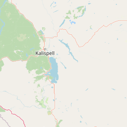
Glacier National Park lies in the United States of America, spanning Montana, Glacier County, and Flathead County. Mapping profiles define these regional boundaries alongside its recorded transboundary status.
- Countries
- United States of America
- Regions
- Flathead County, Glacier County, Montana
- Primary location
- Montana
- Geographic setting
- Transboundary · Inland
Boundary and coordinates
Spatial extent and geographic reach spanning over 4,100 square kilometers
Glacier National Park Boundary Map and Geographic Footprint
The interactive boundary map traces the geographic limits and shape of the protected wilderness. Structured geographic details compile key dimensions like calculated total area, spatial span, and coordinate center.
- Boundary area
- 4,078.9 km²
- Boundary perimeter
- 337.9 km
- Northernmost point
- 49.0011° N
- Southernmost point
- 48.2337° N
- Easternmost point
- 113.2416° W
- Westernmost point
- 114.4755° W
- Geographic centre
- 48.6834° N, 113.8005° W
- North–south span
- 85.3 km
- East–west span
- 91 km
Elevation and terrain
Recorded peaks, cliffs, and vertical relief metrics
Glacier National Park Terrain and Mountain Elevation Profile
Glacier National Park features a recorded maximum elevation summary reaching thirty-one ninety meters across its mountain terrain. Individual feature cards list names, types, and spatial relationships for peaks located within the protected boundary.
- Maximum elevation
- 3,190 m
- Highest point
- 3,190 m
Selected named natural features
Peaks
Parke Peak
2,725 m
Rivers
Redgap Creek
Lakes
Bowman Lake
1,228.3 m
Glaciers
Carter Glaciers
2,318 m
Waterfalls
Feather Plume Falls
1,955 m
Environmental setting
Boreal climate zones, montane forest habitats, and major water systems
Glacier National Park Environmental Classifications and Physical Setting
Recorded landscape features and habitat types frame the complex physical setting of the protected area. Structured categories connect recorded classifications to relevant atlas destinations.
- Relief
- Mountain
- Climate
- Boreal
- Water
- Major water bodies
- Forest cover
- Mostly forested
- Seasonality
- Seasonal
Landscape features
Mountains · Valleys · Lakes · Rivers · Waterfalls · Glacier · Forest · Cliffs
Habitat types
Temperate coniferous forest · Boreal forest · Montane forest · Alpine meadow · Grassland · Wetland · Riverine habitat · Lacustrine habitat · Tundra habitat
Park atlas
Compare mountain terrain and protected landscapes around Glacier National Park, tracing regional conservation efforts.
Explore Other National Parks and Protected Areas Near Glacier National Park
Explore national parks and protected areas geographically near Glacier National Park, encompassing neighboring mountain ranges and the wider Crown of the Continent Ecosystem. This comparative view allows you to trace the spread of protected landscapes, understand regional conservation patterns, and continue your atlas-based discovery of significant natural sites.

Protected landscapeMontana
Park boundaries overlap#1 closest
Southeast

Helena-Lewis and Clark National Forest: Geographic Overview and Protected Area Map
Montana wilderness spanning the Continental Divide
Spanning from the rolling eastern plains to the crest of the Northern Rockies, Helena-Lewis and Clark National Forest serves as a massive protected landscape in central Montana. This forest system protects eight unique mountain ranges and critical wilderness corridors, offering a comprehensive look at the ecological transition zones of the American Mountain West.
- Area
- 11,000 km²
- Established
- 1897
- Relief
- Mountain
- Climate
- Temperate
National parkAlberta
Park boundaries overlap#2 closest
North

Waterton Lakes National Park: Alberta's Protected Landscape and Geographic Atlas
Explore mapped boundaries and regional terrain context.
Waterton Lakes National Park represents a vital protected area situated within the province of Alberta. This atlas view focuses on its mapped boundaries and the characteristic natural terrain, providing essential geographic context for understanding its significance. Discover its role as a national park and its placement within the regional geography of Western Canada, ideal for users seeking structured data on protected lands and landscape features.
- Area
- 505 km²
- Established
- 1895
- IUCN
- II
- Visitors
- 475.8K annual
Protected landscapeMontana
16 km away#3 closest
Southwest
Kootenai National Forest: Geography and Protected Land Map for Northwestern Montana
Northern Rockies mountain ranges and watershed analysis.
Spanning over two million acres, Kootenai National Forest represents a critical protected landscape in the Northern Rockies. This atlas entry details the interplay between the Cabinet Mountains, regional river systems like the Kootenai and Clark Fork, and the dense conifer forests that define this uniquely wet corner of Montana.
- Area
- 8,900 km²
- Established
- 1907
- Relief
- Mountain
- Climate
- Temperate
Wildlife reserveMontana
65 km away#4 closest
South
Mission Mountains Wilderness: A Rugged Protected Area in the Montana Rocky Mountains
Glacial topography and high elevation alpine ecosystems
Mission Mountains Wilderness is a defining landmark in northwestern Montana, characterized by a steep and narrow mountain spine that rises abruptly above the Flathead Valley. The area protects a full spectrum of ecosystems, from dense coniferous forests to exposed talus slopes and alpine tundra. With its glacially carved cirques and deep U shaped valleys, this wilderness functions as a key component of a larger, jointly managed regional conservation landscape in the United States.
- Area
- 298.97 km²
- Established
- 1975
- IUCN
- Ib
- Relief
- Mountain
Protected areaMontana
76 km away#5 closest
South
Lolo National Forest: An Atlas of Protected Lands and Mountainous Terrain in Montana
Ecological transition zone of the northern Rocky Mountains
This protected area covers two million acres of diverse northern Rocky Mountain geography. Known for its massive western red cedars and transitional ecology, the forest features a complex network of ridgelines, glacial lake basins, and river corridors that serve as vital habitat across the Montana landscape.
- Area
- 8,894.85 km²
- Established
- 1906
- Relief
- Mountain
- Climate
- Temperate
Wildlife reserveMontana
128 km away#6 closest
South
Rattlesnake Wilderness: Exploring the Protected Landscapes and Geography of Montana
Rugged alpine terrain and roadless mountain wilderness in the Northern Rockies.
Located in the Lolo National Forest of western Montana, Rattlesnake Wilderness protects an essential network of forested slopes, alpine ridges, and drainage headwaters. This roadless wildlife reserve provides an ecologically intact landscape that serves as a core component of the northern Rockies wilderness system, offering a clear view into the rugged relief of the Rattlesnake Mountains and their significant influence on local watersheds.
- Area
- 133.45 km²
- Established
- 1980
- IUCN
- Ib
- Relief
- Mountain
Protected landscapeMontana
About 145 km away#7 closest
South
Rattlesnake National Recreation Area: Geography and Protected Landscape Analysis
A mapped Northern Rockies gateway in western Montana
The recreation area encompasses 28,000 acres of forested mountain terrain, montane wetlands, and creek-carved valleys located just north of Missoula. This protected landscape is defined by its diverse trail network and significant ecological systems, including the rare Sphagnum bogs of Shoo Fly Meadows. The area provides essential habitat for grizzly bears, elk, and bull trout while framing a transition zone into the remote backcountry of the surrounding national forest.
- Area
- 110 km²
- Established
- 1980
- Relief
- Mountain
- Scope
- Terrestrial
Protected landscapeIdaho
About 178 km away#8 closest
Southwest
Idaho Panhandle National Forests: Mapping the Inland Pacific Northwest Protected Landscapes
Geographic analysis of mountain ranges and river valley ecosystems
Spanning over 2.5 million acres, the Idaho Panhandle National Forests comprise a massive, interconnected network of mountain ranges, pristine lakes, and river corridors. This detailed look at the geography examines the structural backbone of the Selkirk, Cabinet, and Bitterroot ranges, highlighting the diverse ecological gradients and protected wilderness areas that characterize this significant portion of the inland Northwest.
- Area
- 13,000 km²
- Established
- 1912
- Relief
- Mountain
- Climate
- Temperate
MoriAtlas Explorer
Continue Exploring Glacier National Park's Protected Landscape and Geographic Context
Delve deeper into the geographic structure and mapped boundaries of Glacier National Park. Understanding its role as a national park within Montana enhances your atlas exploration of protected lands. This detailed view provides essential context for appreciating its natural terrain and its position in the broader geographic landscape, fostering a richer comprehension of conservation areas.
Browse next
Global natural geography
Explore related park routes
Explore MoriAtlas Global ParksBrowse All MoriAtlas ParksGlobal Park Map DiscoveryMoriAtlas: Browse All CountriesBrowse All MoriAtlas ContinentsNational Park Environment AtlasGrand Canyon National Park AtlasYellowstone National Park AtlasYosemite National Park Atlas and GeographySerengeti National Park AtlasGalápagos National Park Protected LandscapeBanff National Park Geography and AtlasKruger National Park Atlas EntryUluṟu-Kata Tjuṯa National Park AtlasExplore Uluru-Kata Tjuta National Park GeographyPlitvice Lakes National Park AtlasFiordland National Park Protected LandscapeGreat Smoky Mountains National Park AtlasAfghanistan National Parks and Protected AreasAlbania National Parks and Protected AreasAlgeria National Parks and Protected AreasAmerican Samoa National Parks and Protected AreasAndorra National Parks and Protected AreasAngola National Parks and Protected AreasAntarctica National Parks and Protected AreasAntigua and Barbuda Park List