
Mori Atlas logo
Nature reserveGoldie Bush

Tracing the protected landscape, volcanic terrain, and cultural history of the Mokoroa Stream valley

Goldie Bush Scenic Reserve: A Deeply Forested Valley in the Waitākere Ranges of New Zealand

(Goldie Bush Scenic Reserve)

Goldie Bush Scenic Reserve stands as a significant protected area within the lush foothills of West Auckland, New Zealand. This forested catchment features the iconic Mokoroa Falls and represents a complex intersection of regenerating native bush, Māori history, and early logging heritage. The reserve offers a distinct look into the ecological recovery of the region, where kauri and other native trees reclaim the slopes above the stream valley.

native forestscenic reservewaterfallregenerating bushkauri forestWest Auckland bush
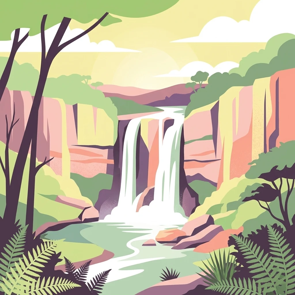
Digital vector-style illustration of a waterfall cascading down between two rocky cliffs into a pool, framed by trees and ferns.

Goldie Bush

Nature reserve

Park overview

Structured park overview, official facts, and landscape profile for Goldie Bush Scenic Reserve

Goldie Bush Scenic Reserve park facts, protected area profile, and essential visitor context

Review the core facts for Goldie Bush Scenic Reserve, including designation, size, terrain, visitor scale, habitats, and operating context in one park-focused overview.

About Goldie Bush Scenic Reserve

Goldie Bush Scenic Reserve is a forested protected area within the Auckland Region of New Zealand, set into the hilly terrain of West Auckland between the coastal settlement of Muriwai and the larger Waitākere Ranges. The reserve occupies much of the catchment of the Mokoroa Stream, which flows generally southwest through the valley before joining the broader Waitākere River system near Te Henga / Bethells Beach. Most of the reserve sits within the Waitākere Ranges local board area, while the northwestern sections cross into the Rodney local board area.

The landscape is dominated by native forest that has regrown after decades of milling pressure and grazing, producing a mosaic of mature remnants and younger regenerating stands. Kānuka and mamangi form much of the visible canopy, while in deeper and more sheltered pockets, kauri have slowly re-established themselves alongside other characteristic West Auckland bush species. The valley setting creates a sheltered, humid microclimate, and the underlying terrain produces small gorges and stream-side slopes typical of the broader Waitākere foothills.

The reserve's key scenic attraction is Mokoroa Falls, a striking cascade that drops into a deep plunge pool. Around this waterfall has gathered a rich body of local Māori tradition, including the story of Te Mokoroa, a taniwha believed to inhabit the base pool, and the broader associations with the Te Kawerau ā Maki ancestor Taiaoroa. These cultural layers sit alongside the more recent industrial history of the valley, which was once worked as a private timber estate by David Goldie and later by the Kauri Timber Company. After the bush had been extensively milled, the land was returned to public ownership and converted into a scenic reserve, forming the core of what visitors experience today.

In contemporary terms, the reserve has become as much an ecological management site as a recreational destination. The forest represents a significant example of West Auckland bush recovery on formerly logged land, and it is also a frontline site in efforts to combat kauri dieback. Changes to visitor infrastructure, track design, and access reflect the reserve's ongoing role in balancing public enjoyment with the protection of vulnerable native forest ecosystems.

Quick facts and research context for Goldie Bush Scenic Reserve

Goldie Bush Scenic Reserve is a 249 hectare forested reserve administered by the Auckland Council system within the wider Waitākere Ranges landscape. It lies in West Auckland, south-east of Muriwai beach and north of the main Waitākere Ranges block, and forms much of the Mokoroa Stream catchment that flows toward the Waitākere River near Te Henga / Bethells Beach.

The reserve protects regenerating native forest dominated by kānuka and mamangi, with re-establishing kauri, and features the Mokoroa Falls as its most prominent landmark. It falls within the traditional rohe of Te Kawerau ā Maki, was once logged by the Kauri Timber Company, and has been managed for conservation since being gifted to Auckland City Council following the death of former mayor David Goldie in 1926.

Protection and recognition

Examining documented protected area designation and management scope details.

Goldie Bush Protection Status and Terrestrial Conservation Scope

Goldie Bush maintains a documented terrestrial protection scope within the regional conservation framework. Official records compile available designation details and management boundaries without external international recognition sources.

Protection details

Protection scope
Terrestrial
Transboundary protection
No
Park context

Deeper park guide and search-rich context for Goldie Bush Scenic Reserve

Goldie Bush Scenic Reserve history, landscape, wildlife, and travel context

Explore Goldie Bush Scenic Reserve through its history, landscape character, ecosystems, wildlife, conservation priorities, cultural context, and seasonal travel timing in a structured park guide built for atlas discovery and search intent.

Why Goldie Bush Scenic Reserve stands out

Goldie Bush Scenic Reserve is best known for its combination of forested valley scenery, the Mokoroa Falls with its associated taniwha mythology, and its deep connections to the West Auckland timber history. The reserve has come to represent a small but characteristic piece of the Waitākere Ranges fringe, where regenerating bush meets a landscape shaped by both Māori settlement and early-twentieth-century milling. The reserve is also notable for being a place of active ecological recovery. The forest here was almost entirely stripped of valuable timber in the early 1900s, yet it has since supported the return of native tree cover, including the slow re-establishment of kauri. This layered story, from original bush, to intensive logging, to scenic reserve, to ongoing forest health management, gives the park a distinctive sense of place in the Auckland region.
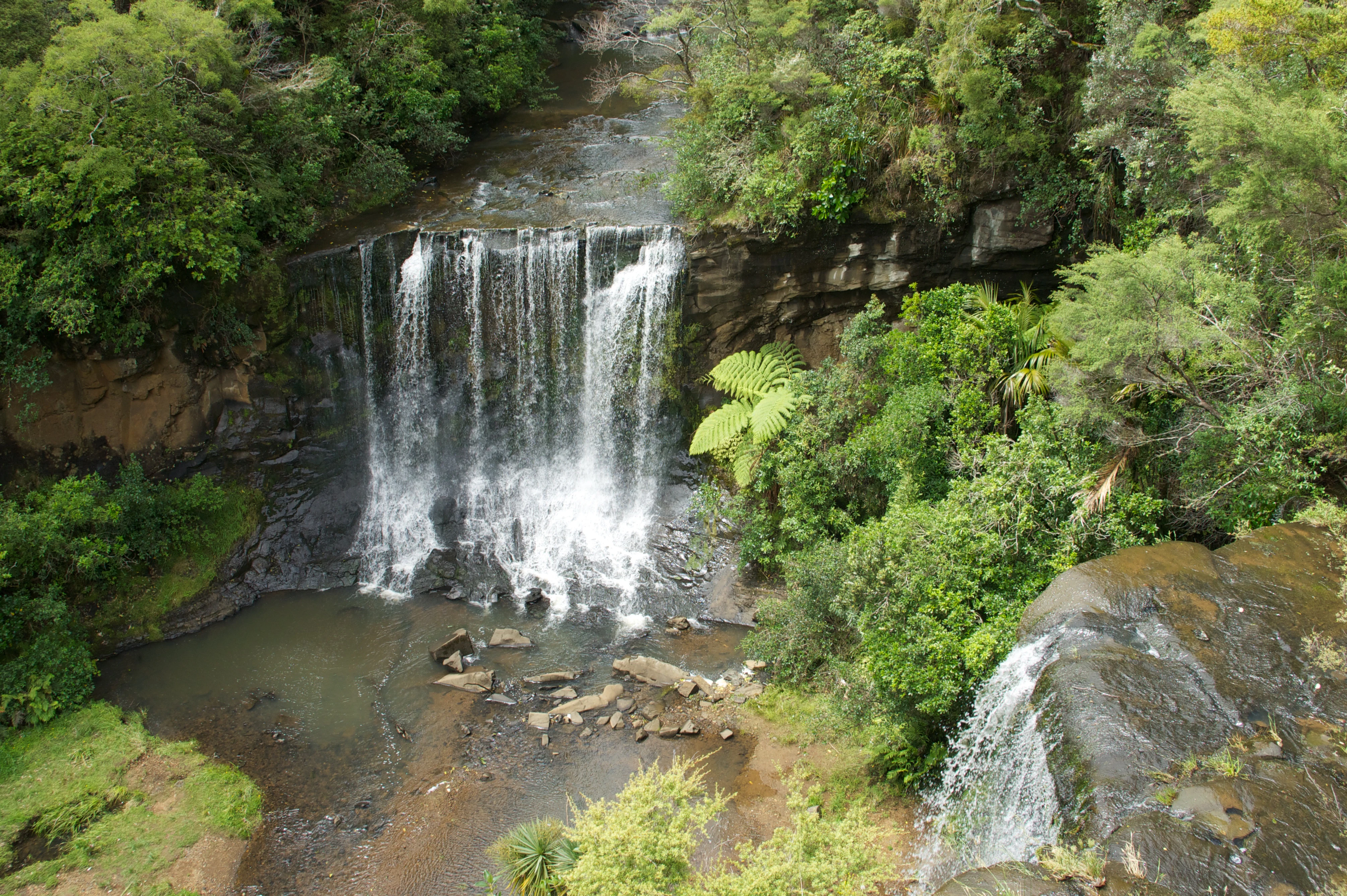
A high-angle view of a two-tiered waterfall cascading into a rocky pool, surrounded by dense temperate rainforest.
Mokoroa Falls viewed from above within the Goldie Bush Scenic Reserve.

Goldie Bush Scenic Reserve history and protected-area timeline

The cultural history of Goldie Bush Scenic Reserve runs much deeper than its formal establishment as a protected area. Within the landscape is Te Taiapa, a fortified pā associated with Te Kawerau ā Maki and named for its wooden palisade (taiapa) defenses rather than the more typical ditch system. The wider area is also known as Te Patunga ō Te Mokoroa, a name recalling the traditional story of Taiaoroa and the defeat of Te Mokoroa, a taniwha said to have lived at the base of Mokoroa Falls.

The forested era of intensive settlement and industry began near the turn of the twentieth century, when David Goldie, who served as mayor of Auckland, acquired land in the area and established a timber mill on the property. The operation was later moved closer to the falls, and by 1920 cutting rights had passed to the Kauri Timber Company. The company dammed parts of the Mokoroa River catchments so that logs could be driven downstream toward the Waitākere River and Te Henga / Bethells Beach, where a tramway carried them onward to the Waitakere railway station. By the time Goldie died in 1926, virtually all of the original kauri had been removed from the property.

Following his death, the land was gifted to Auckland City Council, which transformed the area into a scenic reserve. The protection of the land allowed the native bush to recover over subsequent decades, with kauri becoming re-established alongside dominant kānuka and mamangi cover. The modern history of the reserve is closely tied to the emergence of kauri dieback as a major ecological concern. In 2018 the reserve was closed in order to limit the spread of the disease between trees via soil carried on footwear, and as recent planning has progressed, the reserve has remained closed while upgraded walking tracks are developed to mitigate further contamination.

Goldie Bush Scenic Reserve landscape and geographic character

Goldie Bush Scenic Reserve occupies a steep, forested catchment valley within the foothills of the wider Waitākere Ranges. The terrain is shaped by the Mokoroa Stream and its tributaries, which cut through the hills before flowing southwest toward the Waitākere River near Te Henga / Bethells Beach. This valley configuration gives the reserve a sense of enclosure, with elevated ridges framing the lowland forest interior and creating the shaded, humid conditions typical of West Auckland bush.

The most dramatic single feature of the landscape is Mokoroa Falls, a cascade that drops into a deep plunge pool in the upper Mokoroa catchment. Around the falls the topography becomes more rugged, with rocky outcrops, small gorges, and deeply incised channels cutting back into the surrounding slopes. Away from the falls, the land continues as a network of ridge and valley systems marked by numerous small streams, old track alignments, and pockets of deeper forest. The reserve's location on the fringe of the broader Waitākere Ranges means it shares the geological character of that larger system, including its mix of volcanic and sedimentary terrain, while being relatively contained compared to the wider ranges.

Goldie Bush Scenic Reserve ecosystems, habitats, and plant life

The ecological character of the reserve is defined by regenerating native bush growing on land that was once subjected to intense timber extraction. Today, much of the visible forest is dominated by kānuka, a hardy pioneer species that thrives in post-disturbance landscapes, alongside mamangi and other native broadleaves that add structure and diversity to the canopy. In more sheltered and less disturbed pockets, kauri have also re-established themselves, although many of these trees remain relatively young compared to the grand kauri that once dominated the area.

The combination of kānuka-dominated recovery forest and reappearing kauri gives the reserve a layered ecological profile. The understorey, stream margins, and gullies support moisture-loving native plants, while the ridges and more exposed slopes carry a tougher, drought-tolerant mix of species. The catchment setting means that the reserve has a strong freshwater dimension as well, with the Mokoroa Stream and its tributaries forming the ecological connective tissue of the bush. This combination of regenerating forest, mature remnants, stream environments, and steep topography gives the reserve significant habitat value at a regional scale.

Goldie Bush Scenic Reserve wildlife and species highlights

Because the reserve's habitats are typical of West Auckland lowland and foothill native forest, the area supports a community of birds, insects, and other fauna characteristic of the broader Waitākere Ranges. Native forest birds generally associated with kānuka and regenerating bush are typically present, alongside freshwater life associated with the Mokoroa Stream catchment. Smaller native fauna benefit from the dense understorey created by kānuka and mamangi, while stream life in the Mokoroa system forms an important part of the local ecosystem.

The reserve's forest recovery has direct implications for wildlife, since the gradual thickening of canopy and diversification of the understorey provides more habitat complexity than the open, post-logging land that once occupied the valley. The reappearance of kauri, although vulnerable to disease, also adds long-term habitat structure for species that rely on mature forest conditions.

Goldie Bush Scenic Reserve conservation status and protection priorities

The conservation significance of Goldie Bush Scenic Reserve lies in its representation of bush recovery on formerly logged land and its position within the broader Waitākere Ranges ecological network. As a scenic reserve, it is held primarily for the protection of native vegetation, landscape values, and public enjoyment, and it forms a small but meaningful node in a wider system of protected lands in West Auckland.

Kauri dieback has emerged as the central conservation issue shaping the reserve's management. The disease spreads through soil movement and poses a serious threat to kauri forests across northern New Zealand. In 2018 the reserve was closed as a precautionary step, and planning efforts have emphasized redesigned walking tracks and hygiene infrastructure aimed at slowing the disease's spread when the reserve eventually reopens. This combination of ecological recovery, native biodiversity protection, and active disease management gives the reserve an important role in regional conservation work focused on the future health of West Auckland's kauri forests.

Goldie Bush Scenic Reserve cultural meaning and human context

The reserve has strong cultural significance for Te Kawerau ā Maki, whose traditional rohe encompasses the wider West Auckland coastline and the inland ranges. The name Te Taiapa reflects a Māori defensive tradition centered on wooden palisades rather than ditches and links the site to an earlier fortified settlement overlooking the Mokoroa Stream. Combined with the Te Patunga ō Te Mokoroa name and the taniwha story associated with the waterfall, the area carries a rich set of place-based narratives that continue to be part of Māori identity in the region.

The early-twentieth-century milling era, led by David Goldie and later by the Kauri Timber Company, also forms part of the area's cultural story, reflecting a period when bush-covered ranges around Auckland were rapidly logged to meet demand for timber. The transition from private estate to scenic reserve, and later to a managed conservation site, represents a shift in how the landscape is valued, from a resource to be harvested to a place held in trust for ecological, recreational, and cultural purposes.

Top sights and standout views in Goldie Bush Scenic Reserve

Among the reserve's strongest features, Mokoroa Falls stands out as both an aesthetic highlight and a focal point for local mythology. The waterfall is set within a steep, sheltered catchment that captures much of the reserve's scenic appeal. The surrounding forest, dominated by kānuka and mamangi with re-emerging kauri, offers a representative example of West Auckland regenerating bush.

The layered cultural history also gives the reserve a distinctive identity, with Te Taiapa fortifications, taniwha stories, early logging heritage, and the David Goldie legacy all woven into the place. The reserve's contemporary role in managing kauri dieback, especially through closed access and planned track upgrades, adds further significance, showcasing modern on-the-ground conservation practice in one of Auckland's most ecologically important regions.

Best time to visit Goldie Bush Scenic Reserve

Because the reserve has been closed for an extended period due to kauri dieback concerns, seasonal visitation guidance is necessarily limited and should be checked against current Auckland Council information before any planned visit. In general terms, West Auckland bush reserves tend to be most atmospheric in the cooler and wetter months, when the forest is green, streams are flowing strongly, and water flow over the falls is typically at its best. Spring can also be rewarding, as the understorey becomes more active and native birds are more vocal. Summer visits are usually drier, with firmer tracks but lower water levels, though conditions can still be pleasant for those familiar with bush walking.

Monthly climate preview

Measured monthly weather patterns and representative climatology for New Zealand

Goldie Bush Climate Normals: Long Term Temperature and Precipitation Rhythm

Goldie Bush exhibits a measured annual temperature and precipitation rhythm spanning long-term averages from NASA Power coordinate sampling. Accessing the complete monthly profile reveals detailed temperature ranges and precipitation rates across all twelve periods.
Annual mean16 °C
13 °C20 °C
Jan20°
Feb20°
Mar19°
Apr18°
May16°
Jun14°
Jul13°
Aug13°
Sep13°
Oct14°
Nov16°
Dec18°
Warmest month
February

20.3 °C

Coolest month
August

12.7 °C

Wettest month
July

4.2 mm/day

Driest month
January

2.2 mm/day

Park location guide

Geography guide, regional context, and park location map for Goldie Bush Scenic Reserve

Goldie Bush Scenic Reserve park geography, regions, and map view in New Zealand

Understand where Goldie Bush Scenic Reserve sits in New Zealand through a broader geographic reading of the surrounding landscape, nearby location context, and its mapped position within the national park landscape.

How Goldie Bush Scenic Reserve fits into New Zealand

New Zealand is an island nation in the southwestern Pacific Ocean comprising two main islands and numerous smaller islands. Located east of Australia across the Tasman Sea, it features varied topography with the Southern Alps running along the South Island and volcanic terrain on the North Island. The country was settled by Maori people between 1280 and 1350, followed by European exploration beginning in 1642, and became a Dominion in 1907 before gaining full independence in 1947.

Wider geography shaping Goldie Bush Scenic Reserve in New Zealand

New Zealand lies in the southwestern Pacific Ocean, east of Australia across the Tasman Sea. The country consists of two main islands, the North Island and South Island, plus over 600 smaller islands. The North Island features volcanic plateaus and hills while the South Island is dominated by the Southern Alps mountain range. The country has a long coastline and is surrounded by the Pacific Ocean.

Map view of Goldie Bush Scenic Reserve

Use this park location map to pinpoint Goldie Bush Scenic Reserve in New Zealand, understand its exact geographic position, and read its mapped placement within the surrounding landscape more clearly.

Pigeon | © OpenStreetMap contributors

Explore detailed imagery of forest terrain, stream valleys, and waterfalls.

Goldie Bush Photos and Landscape Scenery: Visualising the Protected Area

Visual documentation captures the forested catchment valleys, native regeneration zones, and dramatic waterfalls defining Goldie Bush. Examining these protected area environments provides clear insight into the topography, plant communities, and ecological character of the reserve.

A high-angle view of a two-tiered waterfall cascading into a rocky pool, surrounded by dense temperate rainforest.

Park atlas

Compare regional valley terrain, regenerating native forest, and nearby conservation areas.

Explore Other Parks Near Goldie Bush and Surrounding Protected Landscapes

Continue exploring protected areas near Goldie Bush by examining adjacent stream valleys, forested ridges, and regional reserves across the wider West Auckland foothills. Comparing these connected landscapes reveals shared ecological patterns, native forest recovery, and distinct topographical features within the surrounding terrain.
Regional parkAuckland Region
About 14 km away#1 closest

South

Waitākere Ranges Regional Park: Geographic Mapping of Auckland's Protected Coastal Forest

Volcanic terrain and expansive coastal wilderness boundaries

Examine the rugged geography of the Waitākere Ranges, spanning from sheer western sea cliffs to lush, regenerating forest valleys. This overview details the protected land, including volcanic rock formations, black sand surf beaches, and the inland reservoirs serving the Auckland region, highlighting its status as an ecologically critical heritage area.

Area
277.2 km²
Established
1895
Relief
Mountain
Climate
Subtropical
A pale, minimalist watercolor painting showing a grassy island or shoreline with a small cluster of trees, set against a quiet body of water and soft, distant rolling hills.
Protected areaAuckland Region
About 18 km away#2 closest

East

Motumānawa / Pollen Island: Protected Marine Reserve and Scientific Landscape in Auckland

A coastal shellbank island refuge within the Waitematā Harbour.

Motumānawa / Pollen Island is an essential protected area near the Rosebank Peninsula, serving as a sanctuary for native bird populations and estuarine vegetation. Its status as both a scientific and marine reserve highlights the importance of small-scale coastal conservation within a major metropolitan harbour landscape in New Zealand.

Established
2006
Relief
Lowland
Scope
Marine
Water
Water-dominated
A flat-style digital illustration showing a winding river through a valley with pine trees, steep rock cliffs, and a waterfall under a soft sun.
Nature reserveAuckland
About 38 km away#3 closest

Southeast

Puhinui Reserve: Protected Nature Reserve and Volcanic Geography in Auckland, New Zealand

Coastal wetlands, maar craters, and working agricultural lands

Explore the physical geography of Puhinui Reserve, a protected nature reserve in South Auckland. This site encompasses rare saltmarsh habitat, active volcanic maar features, and estuarine environments situated on the shores of the Manukau Harbour. Gain insight into the volcanic ash, alluvium, and peat soil structures that define this unique transitional landscape.

Area
1.99 km²
Established
1991
Relief
Lowland
Climate
Temperate
Regional parkAuckland Region
About 40 km away#4 closest

Northeast

Wenderholm Regional Park: Coastal Forest and Estuary Geography in the Auckland Region

Mapped protected landscapes of a coastal New Zealand peninsula

Situated on a narrow peninsula north of Auckland, Wenderholm Regional Park offers a compact study in diverse coastal terrain. The park encompasses the forested Maungatauhoro headland, the tidal Puhoi sandspit, and riverine boundaries that create a distinct protected environment. Since its 1965 founding, the area has become a haven for native bird restoration and coastal vegetation, providing a unique vantage point across the Hauraki Gulf.

Area
1.35 km²
Established
1965
Relief
Mixed relief
Climate
Temperate
Regional parkAuckland Region
About 41 km away#5 closest

Northeast

Te Muri Regional Park: Mapped Coastal Peninsula and Estuarine Geography in Auckland

Protected native forest and tidal estuary landscapes

Te Muri Regional Park presents a unique peninsular landscape situated between the Puhoi River and Te Muri O Tarariki Stream in Auckland. This protected area showcases a complex interface between native coastal forest and tidal ecosystems, offering clear mapped boundaries that connect to the wider Hauraki Gulf coastal belt. Explore the topographical transition from sea level estuaries to rolling hill country.

Area
4.44 km²
Established
2010
Relief
Upland
Scope
Terrestrial
A horizontal watercolor painting of a coastal island landscape with rolling green hills, pale distant mountains, and coastal greenery.
Wildlife reserveAuckland
About 43 km away#6 closest

East

Motuihe Island Wildlife Reserve: Protected Landscapes and Hauraki Gulf Geography

Ecological restoration and coastal island history near Auckland

Motuihe Island represents a significant case study in island conservation, featuring intensive native forest regeneration and successful wildlife reintroduction. The mapped landscape details an elongated island geography defined by coastal beaches, sandstone terrain, and rich archaeological layers, serving as a prominent protected reserve for the Auckland region.

Area
1.79 km²
Relief
Lowland
Climate
Subtropical
Access
Moderate access
Regional parkAuckland Region
About 43 km away#7 closest

Northwest

Te Rau Pūriri Regional Park: Geography and Protected Land Overview for Auckland Region

Coastal harbour landscape and native forest recovery zones

Te Rau Pūriri Regional Park occupies a strategic position on the South Kaipara Head, serving as a protected corridor between agricultural land and the expansive Kaipara Harbour. The park serves as an atlas-worthy example of ecological transition, featuring sandy bays, eucalyptus stands, and native pūriri forests that provide habitat stability within the wider Auckland coastal geography.

Area
2.49 km²
Established
2006
Relief
Lowland
Climate
Temperate
A soft watercolor illustration showing the low-lying shape of Motuora Island surrounded by calm water, with a distant hilly coastline in the background.
Nature reserveNorth Island
About 48 km away#8 closest

Northeast

Motuora Nature Reserve: Protected Coastal Island Geography and Restoration Map

Predator-free ecological sanctuary in the Hauraki Gulf

Motuora occupies a key position in the Hauraki Gulf, offering a well-mapped look at coastal island restoration in New Zealand. This protected area features a regenerated forest interior and cliff-edged terrain, serving as an important mainland-island site for avian conservation, including kiwi and petrel colonies.

Area
0.8 km²
Established
1965
Relief
Lowland
Climate
Subtropical

Common questions about visiting, size, designation, and location context for Goldie Bush Scenic Reserve

Goldie Bush Scenic Reserve FAQs for park facts, access, geography, and protected area context

Find quick answers about Goldie Bush Scenic Reserve, including protected-area facts, park geography, trail and visitor context, and how the park fits into its surrounding country and regional landscape.
MoriAtlas Explorer

Continue Your Protected Areas Search Across the Global Atlas

Deepen your exploration by continuing the structured search for national parks and protected areas worldwide. Utilize the comprehensive filtering capabilities to compare different conservation landscapes and refine your understanding of global park geography. Discover more about the distribution and characteristics of protected natural areas.

Global natural geography