
Mori Atlas logo
National parkPark Narodowy Gór Stołowych

Mapping the dramatic plateaus, rock labyrinths, and forest corridors of the Polish Sudetes

Park Narodowy Gór Stołowych: A Comprehensive Geographic Atlas of Poland's Sandstone Table Mountains

Park Narodowy Gór Stołowych protects one of the most singular highland landscapes in Poland, featuring a compact range of flat-topped sandstone plateaus situated in the Dolnośląskie region. This protected area reveals a complex sedimentary history through its stepped summit terraces, deep valley notches, and eroded rock formations like Szczeliniec Wielki and Błędne Skały. Explore the geographical structure of these table mountains, ranging from expansive spruce and beech forests to rare granodiorite formations along the park's southwestern margins.

national parksandstone plateautable mountainsSudetesLower Silesiarock labyrinth
A flat-style digital illustration depicting a prominent, multi-tiered sandstone rock formation rising above a lush forest, with a bright sun in the sky and green foreground hills.

Park Narodowy Gór Stołowych

National park

Park overview

Structured park overview, official facts, and landscape profile for Góry Stołowe National Park

Góry Stołowe National Park park facts, protected area profile, and essential visitor context

Review the core facts for Góry Stołowe National Park, including designation, size, terrain, visitor scale, habitats, and operating context in one park-focused overview.

About Góry Stołowe National Park

Góry Stołowe National Park is one of 23 national parks in Poland and one of the most visited, yet it remains defined by an unusual geological premise. Its mountains are not built of folded crystalline rocks like much of the Sudetes, but of almost horizontal layers of Upper Cretaceous sandstone that once lay on the floor of an ancient sea. Erosion over tens of millions of years cut this sedimentary plate into broad ledge-like levels separated by steep cliff faces, producing the firm's characteristic "table" profile of level summits rising from vertical walls.

The park occupies the higher northern and central part of that sandstone plate within Poland, on the northwestern edge of the Land of Kłodzko. It sits between the Karkonosze Mountains to the northwest and the Bystrzyckie and Orlickie Mountains to the southeast, in a landscape that continues across the border as the protected Broumovská vrchovina in the Czech Republic. The protection of the park's surrounding "otulina", or buffer zone, includes the famous spa towns of Polanica-Zdrój, Duszniki-Zdrój, Lewin Kłodzki, and Kudowa-Zdrój.

Ecologically, the park covers extensive forest complexes dominated by spruce, with patches of beech and mixed stands, and rocky terrain that has its own specialized fauna, particularly bats roosting in the sandstone clefts. Despite its modest size, the park has become a focal point of Polish nature conservation because its scenic plateaus, rock labyrinths, and forest mosaics are unusually concentrated within a short travel distance from major urban centers, drawing what is now well over a million visitors in recent years.

Quick facts and research context for Góry Stołowe National Park

Góry Stołowe National Park lies in the Central Sudetes of southwestern Poland, in the Lower Silesian Voivodeship, close to the Czech border and surrounded by well-known spa towns of the Kłodzko region. It was established on 16 September 1993 and has its seat at Kudowa-Zdrój.

The park protects the upper plateau portion of the Stołowe Mountains, with its two highest summits, Szczeliniec Wielki and Skalniak, rising just above 900 meters. It belongs to a broader sandstone table landscape that continues as the protected Broumovská vrchovina on the Czech side.

Protection and recognition

Analysis of terrestrial protected area boundaries and management recognition status

Park Narodowy Gór Stołowych Protection Status and Documented Designations

Park Narodowy Gór Stołowych maintains a documented terrestrial protection scope within the regional conservation framework. Official records outline the established conservation status, management parameters, and available recognition data for this protected area.

Protection details

Protection scope
Terrestrial
Transboundary protection
No
Buffer area
105.15 km²
Park context

Deeper park guide and search-rich context for Góry Stołowe National Park

Góry Stołowe National Park history, landscape, wildlife, and travel context

Explore Góry Stołowe National Park through its history, landscape character, ecosystems, wildlife, conservation priorities, cultural context, and seasonal travel timing in a structured park guide built for atlas discovery and search intent.

Why Góry Stołowe National Park stands out

The park is best known for the distinctive flat-topped sandstone plateaus and the maze-like rock formations sculpted from them: the stepped summit of Szczeliniec Wielki, the Błędne Skały labyrinth, and a wider catalog of clefts, crags, and isolated rock towers that make the Stołowe Mountains one of the most unusual ranges in the Polish Sudetes. It is also recognized for combining this dramatic, easily readable geological scenery with extensive spruce and mixed forests, peatland fragments, and small stream valleys, all within a relatively compact protected area close to traditional spa resorts.
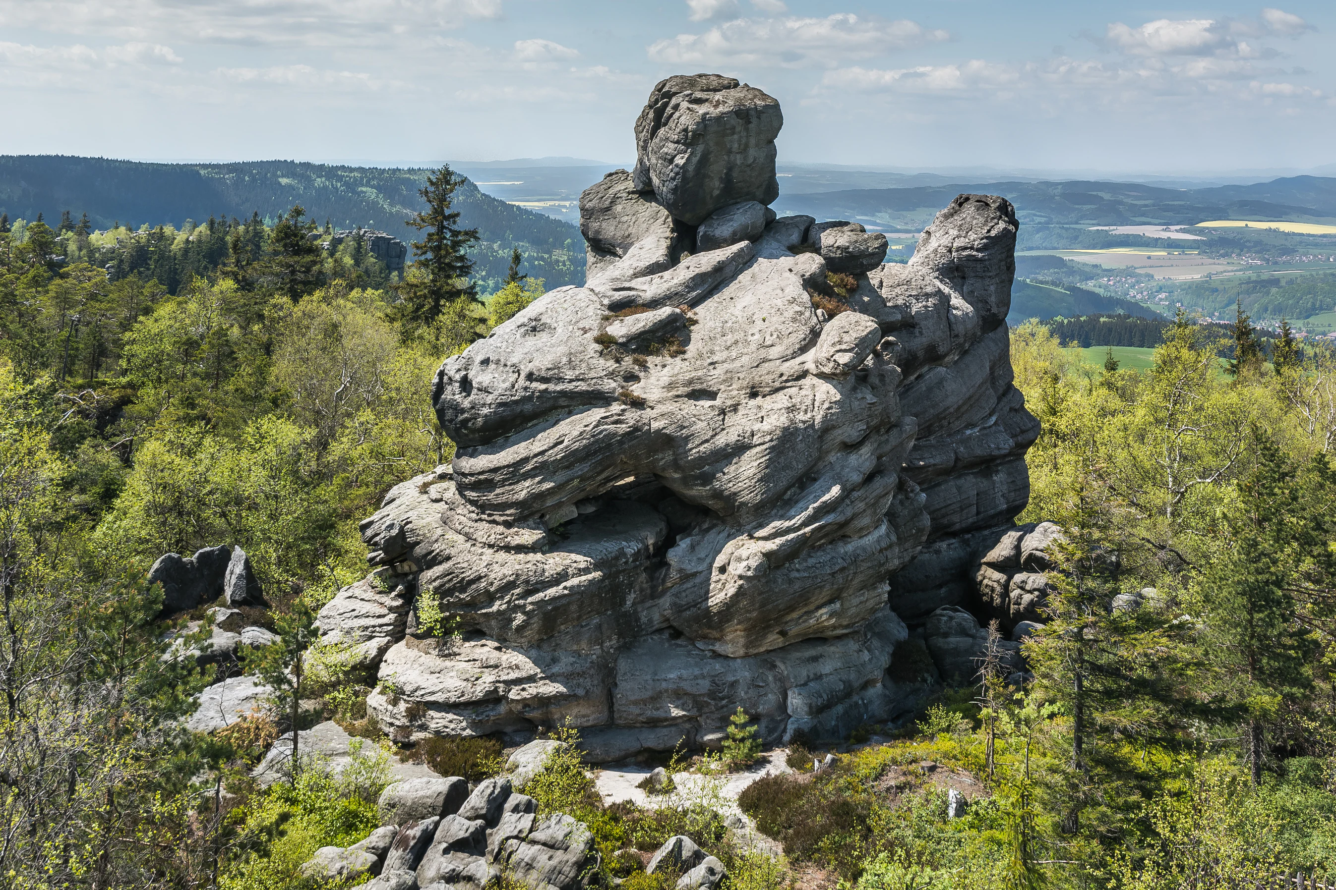
A large, weathered sandstone rock formation with distinct layered horizontal strata surrounded by a green forest and distant valley views.
Sandstone rock formations atop Szczeliniec Wielki in Góry Stołowe National Park.

Góry Stołowe National Park history and protected-area timeline

The movement to protect the Stołowe Mountains began soon after the creation of the Stołowogórski Landscape Park, when conservationists recognized that the landscape park status alone could not shield the range's unique features from growing pressure, especially the urbanization of nearby spas such as Duszniki-Zdrój and Kudowa-Zdrój, and the rapid rise of mass tourism.

In September 1983 a scientific session held in Radków, organized by the regional government, the Provincial Committee for Nature Protection, and the local League for Nature Conservation, concluded that the area merited full national park status. A second session in 1984 in Radków refined the proposal, recommending a park area of around 6,000 hectares that would absorb the existing strict nature reserves of Szczeliniec Wielki, Błędne Skały, and Wielkie Torfowisko Batorowskie, along with reserves then being planned, such as Skałki Łężyckie, Rogowa Kopa, Wrota Pośny, and Buczyna nad Wambierzycami.

The years of analysis that followed culminated on 16 September 1993, when the Council of Ministers formally established Park Narodowy Gór Stołowych, including the upper plateau portion of the range crowned by Szczeliniec Wielki and Skalniak, and a small granodiorite section in the southwest around Krucza Kopa. Continued pressure on surrounding areas has kept plans to expand the park onto further ecologically valuable grounds near Jakubowice, Gołaczów, Łężyce, and Szczytna under active discussion.

Góry Stołowe National Park landscape and geographic character

The landscape of Góry Stołowe National Park is essentially a sculpted plateau, and the mountains' name describes it directly: broad, level summits sit on top of eroded sandstone layers, while the cliff faces beneath them drop into irregular, broken slopes. The effect is a series of oversized "tables" rising above the surrounding countryside, often separated by deep clefts, valley notches, and corridors of rock debris.

This scenery is shaped almost entirely by the horizontal construction of the underlying rock. During the Late Cretaceous, the area lay beneath a shallow sea, where rivers draining nearby land deposited thick beds of sand that later hardened into sandstone. Three main sandstone levels are separated by thinner marl layers. The youngest rocks in the southwestern part of the range include a substantial body of marl that has also shaped local relief. Because the sandstone beds lie nearly flat and are divided by numerous vertical joints, the forces of the Alpine orogeny lifted them as a coherent plate whose edges have since been cut back, leaving an unusually well-preserved and unusually legible sedimentary landscape.

Inside the park, this translates into named landmarks such as Szczeliniec Wielki with its terraced summit, Błędne Skały with its winding rock labyrinth, Skalniak as a second near-900-meter neighbor, and long cliff belts studded with isolated tors. The southwestern margin of the park, around Krucza Kopa, switches character because it is built from harder igneous rocks, especially granodiorite, offering a noticeable contrast to the dominant sandstone architecture.
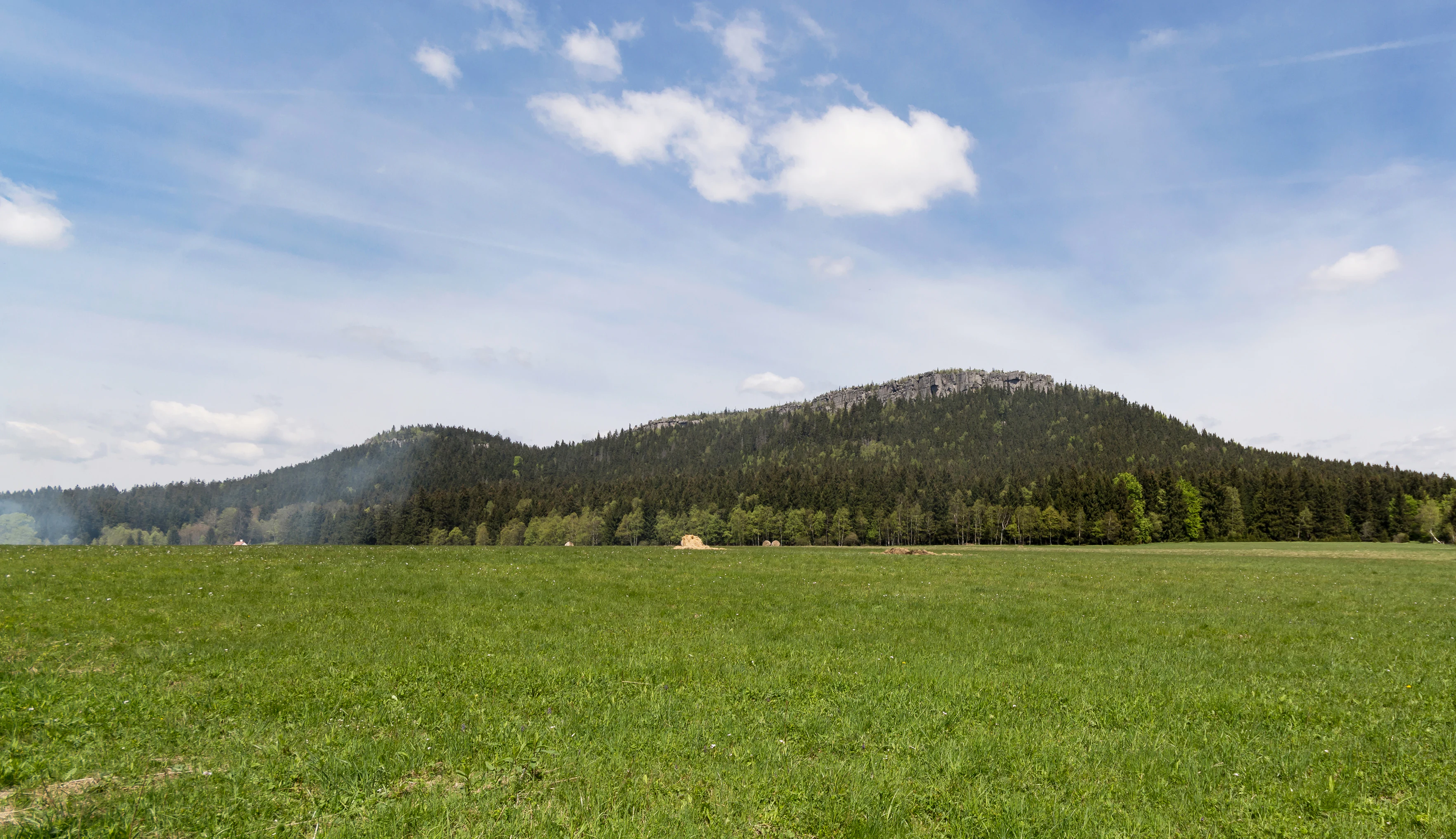
A wide shot of a green grassy field in the foreground leading to a forested table mountain range under a blue sky with light clouds.
A wide view of Szczeliniec Wielki, the highest peak in the Stołowe Mountains.

Góry Stołowe National Park ecosystems, habitats, and plant life

Ecologically, Góry Stołowe National Park reflects its mountainous and rocky character rather than any single dominant forest type. The larger part of the protected area is forested, with extensive spruce-dominated stands on the higher plateaus and slopes, intermixed with beech and mixed deciduous patches on more sheltered ground, and with distinctive fragments of older forest that have been incorporated into the park from earlier strict reserves.

Between the forests the sandstone plateaus create their own specialized environments. Thin, sandy soils over rock, rock fields strewn with boulders, narrow clefts, exposed cliff faces, and small peatland fragments each support different plant and animal communities. Peatland relict habitat is preserved especially around the Batorowice area, where the park inherited the older Wielkie Torfowisko Batorowskie reserve. Near mountain streams and flushes, more humidity-loving vegetation appears, while the upper, exposed slabs carry a sparser, more drought-resistant flora.

The park's character is therefore best understood as a contiguous mosaic: spruce forest on the plateaus, mixed forest and beech in the valleys, peatland on poorly drained sites, and a network of rocky habitats whose microclimates differ markedly from the surrounding forest interior.
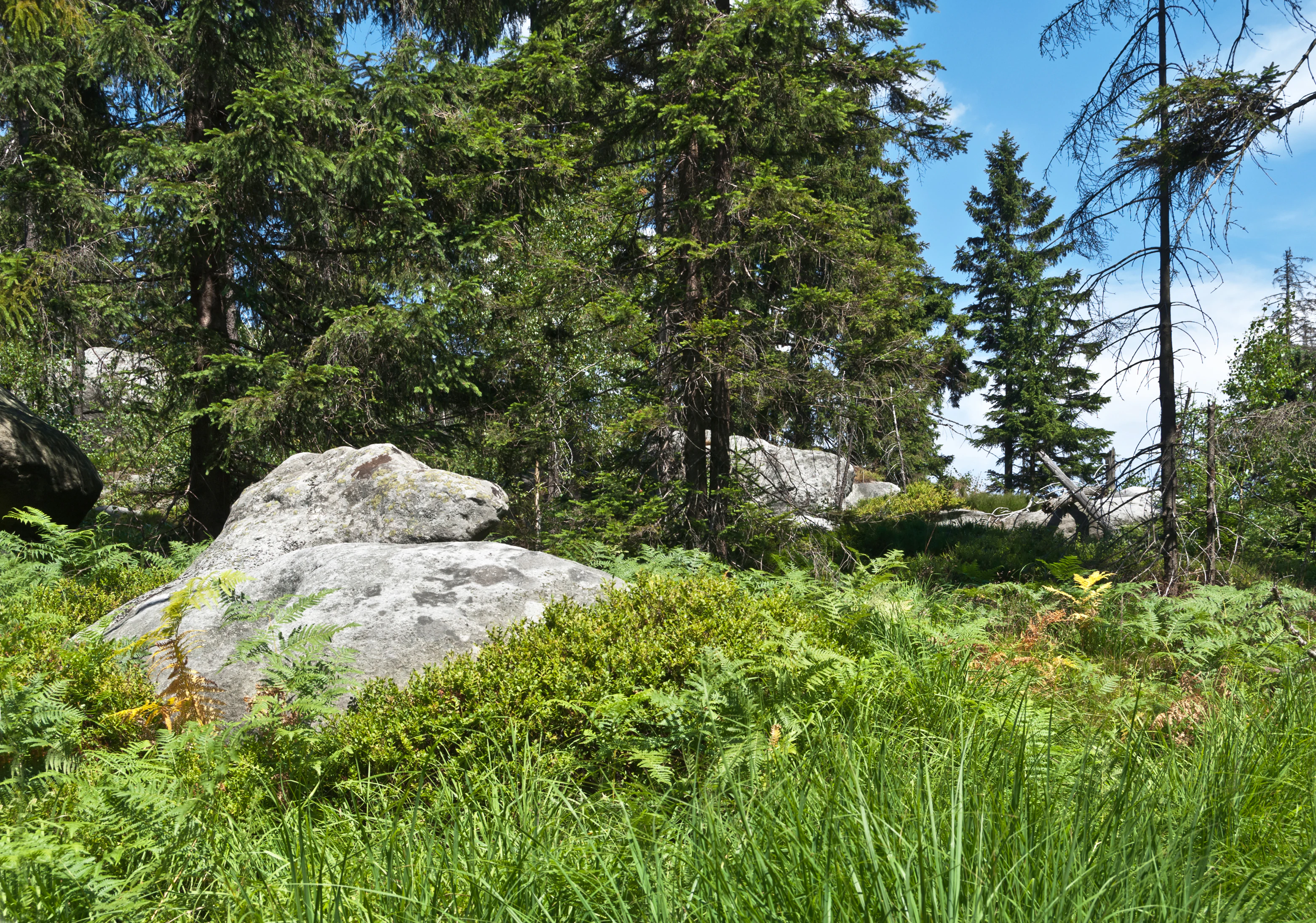
A sunny, forested scene in a mountain park, featuring large, weathered sandstone rocks partially obscured by green ferns and tall grass, with tall coniferous trees in the background under a blue sky.
A forested area with large sandstone boulders characteristic of the Stolowe Mountains.

Góry Stołowe National Park wildlife and species highlights

The fauna of Góry Stołowe National Park mirrors the mix of forest, rock, and running water that defines the protected area. Native fish life in the small mountain streams is naturally limited. Brook trout is the most widespread indigenous species, while the streambed sculpins, the bearded bullhead and the European bullhead, and the brook lamprey are rare and largely relegated to the park's buffer zone outside the strict core. The reservoir on the Czerwona Woda stream holds additional introduced species, including Prussian carp, tench, European perch, and roach.

In the larger, unbroken forest tracts, typical European woodland mammals are well established: red deer, wild boar, roe deer, red fox, and red and black-phase squirrels, together with numerous small rodents. Largely nocturnal mustelids, such as European badger, pine marten, European polecat, least weasel, and ermine, share the same forests but are seen more rarely. Among insectivores, the hedgehog is common, while the Eurasian pygmy shrew is scarce and the alpine shrew is a characteristically mountain-dwelling species.

The park's sandstone labyrinths and rock clefts are particularly important for bats, which use them as roosts and shelter. The park also harbors a valuable group of small, nocturnal, arboreal rodents tied to older deciduous and mixed forest: the hazel dormouse, the rare fat dormouse, and the forest dormouse. Near the Polish-Czech border, mouflon descended from Corsican stock introduced into the Sudetes many decades ago also find refuge, adding a distinctive large mammal to the local scene.

Góry Stołowe National Park conservation status and protection priorities

Conservation significance in Góry Stołowe National Park centers on a landscape that is unusual in Poland: a flat-lying sandstone plateau with unusually well-exposed stratigraphy, dense rock labyrinths, and intact forest cover across an entire mountain range. The park protects both individual geological features of high natural value, including Szczeliniec Wielki, Błędne Skały, and the inherited peatland of Wielkie Torfowisko Batorowskie, and the broader forest and rock mosaic that connects them.

The park uses a graduated protection regime: a strict core covering around 771 hectares, an active protection zone of roughly 4,944 hectares, and a landscape protection zone of about 624 hectares. These zones reflect an effort to safeguard the most sensitive sites while accommodating the level of public use that comes with the park's location near major spa towns and cities.

There is also ongoing recognition that the original boundaries, designed to capture the upper plateau, leave out adjacent areas of high natural value, including the most southeastern part of the Stołowe Mountains and two enclaves around Karłów and the Radków sandstone quarry. Active proposals exist to expand the park into ecologically valuable grounds around Jakubowice, Gołaczów, Łężyce, and parts of the Szczytna commune, which would strengthen ecological connectivity and reduce fragmentation of the protected area.

Góry Stołowe National Park cultural meaning and human context

The park is closely tied to the cultural landscape of the Land of Kłodzko and the long spa tradition of the surrounding valleys. The buffer zone contains several historically important health resorts: Polanica-Zdrój, Duszniki-Zdrój, Lewin Kłodzki, and Kudowa-Zdrój, which have shaped regional identity and a tourism economy that long predates the park itself.

The range has been protected in stages, first as the Stołowogórski Landscape Park, then through individual reserves before the full national park designation in 1993. Several villages, including Pasterka and Karłów, lie within or adjacent to the park and form part of the visitor experience, providing trailheads and traditional mountain settlement context for an area that has long been known to hikers.

Top sights and standout views in Góry Stołowe National Park

Szczeliniec Wielki, with its terraced summit and dramatic cliff scenery, is the park's signature landmark and one of the most visited natural sites in Poland. Błędne Skały offers a sandstone labyrinth that translates the park's geological character into a directly walkable maze. Skalniak stands nearby as the second highest summit and a quieter counterpoint to Szczeliniec's crowds.

Beyond these headline features, the park's broader plateau landscape, its beech and spruce forests, the inherited Wielkie Torfowisko Batorowskie peatland, the rarer granodiorite scenery around Krucza Kopa, and the protected rock habitats used by bats and dormice together make the park a compact, layered example of Sudeten geology, ecology, and human use.

Best time to visit Góry Stołowe National Park

Spring through early autumn is broadly the most rewarding window for landscape-oriented visits: warmer months open up long ridge walks and the network of trails across the plateaus, while late spring and early summer bring fresh forest green and active birdlife.

Winter gives the table mountains a strongly different character, with snowy plateaus, frosted rock labyrinths, and quieter trails around Szczeliniec Wielki and Błędne Skały, though conditions on exposed rock can be markedly harsher than in the surrounding spa towns of the buffer zone. Shoulder seasons are also when visitor numbers drop relative to the midsummer peak, which matches the park's status as one of Poland's most heavily visited national parks.

Monthly climate preview

Long-term representative temperature and precipitation patterns across twelve recorded intervals

Park Narodowy Gór Stołowych Climate Normals and Annual Temperature Rhythm

Park Narodowy Gór Stołowych exhibits a measured annual cycle of monthly temperatures and precipitation rates derived from multi-year observation points. Accessing the complete monthly profile provides deeper analytical context for long-term climate normals across the protected area.
Annual mean7 °C
-4 °C18 °C
Jan-4°
Feb-3°
Mar
Apr
May12°
Jun16°
Jul18°
Aug18°
Sep13°
Oct
Nov
Dec-3°
Warmest month
July

17.9 °C

Coolest month
January

-4 °C

Wettest month
July

3.1 mm/day

Driest month
April

1.5 mm/day

Park location guide

Geography guide, regional context, and park location map for Góry Stołowe National Park

Góry Stołowe National Park park geography, regions, and map view in Poland

Understand where Góry Stołowe National Park sits in Poland through a broader geographic reading of the surrounding landscape, nearby location context, and its mapped position within the national park landscape.

How Góry Stołowe National Park fits into Poland

Poland, officially the Republic of Poland, is a Central European country spanning from the Baltic Sea in the north to the Carpathian Mountains in the south. It borders Germany, Czech Republic, Slovakia, Ukraine, Belarus, Lithuania, and Kaliningrad Oblast. The country has a temperate climate, diverse landscapes, and is known for its rich history, cultural heritage, and strong economic position within the EU.

Wider geography shaping Góry Stołowe National Park in Poland

Poland occupies 312,696 km2 in Central Europe, extending from the Baltic Sea coast in the north to the Sudetes and Carpathian Mountains in the south. It borders Germany to the west, Czech Republic and Slovakia to the south, Ukraine and Belarus to the east, and Lithuania and Kaliningrad Oblast to the northeast. The landscape includes lowland plains, uplands, and mountain ranges.

Map view of Góry Stołowe National Park

Use this park location map to pinpoint Góry Stołowe National Park in Poland, understand its exact geographic position, and read its mapped placement within the surrounding landscape more clearly.

Pigeon | © OpenStreetMap contributors

Location context for Góry Stołowe National Park

Dolnośląskie
Natural feature types

Explore the Named Natural Features of Park Narodowy Gór Stołowych

Investigate the detailed geography of Park Narodowy Gór Stołowych through its collection of named natural features. Use this MoriAtlas index to trace the spatial relationships between the range's sandstone labyrinths, plateau summits, and forested valleys. Deepen your understanding of this unique Sudeten landscape through targeted geographic browsing.
Recorded earthquake history

Examine Historical Seismic Data for Park Narodowy Gór Stołowych

Access a detailed, structured catalogue of recorded seismic events associated with Park Narodowy Gór Stołowych. This data provides a clear historical perspective on regional activity by mapping documented epicentres, magnitudes, and depths relative to the park landscape.

Park Narodowy Gór Stołowych Earthquake History

Catalogued events

13 events

Strongest magnitude

Magnitude 4

Most recent event

Oct 25, 2005

This history includes earthquakes recorded inside the park or within 50 km of its borders

Visual exploration of sandstone plateaus and rock labyrinths in the Sudetes

Park Narodowy Gór Stołowych Landscape Photos and Scenery

Examine detailed photographs capturing the flat-topped sandstone plateaus, dramatic rock labyrinths, and forest environments of Park Narodowy Gór Stołowych. Visual records reveal the distinct geological formations and rugged terrain characterizing this protected upland range in Lower Silesia.

A large, weathered sandstone rock formation with distinct layered horizontal strata surrounded by a green forest and distant valley views.

A wide shot of a forested mountain slope topped with a jagged sandstone cliff face under a blue sky.

A wide shot of a green grassy field in the foreground leading to a forested table mountain range under a blue sky with light clouds.

A sunny, forested scene in a mountain park, featuring large, weathered sandstone rocks partially obscured by green ferns and tall grass, with tall coniferous trees in the background under a blue sky.

Park atlas

Explore nearby national parks and regional geological reserves across the Sudetes border.

Parks near Park Narodowy Gór Stołowych: Compare Surrounding Protected Landscapes

Browsing other protected areas near Park Narodowy Gór Stołowych reveals connected highland terrain, sandstone plateaus, and forested mountain ranges. Comparing these neighboring reserves provides deeper geographic context for regional ecology and regional landforms.
Watercolor artwork depicting a landscape with green hills, distant mountains, and pastel sky
National parkLower Silesian Voivodeship
Park boundaries overlap#1 closest

Southwest

Stołowe Mountains National Park: Explore Poland's Sandstone Rock Cities and Protected Terrain

National Park in Lower Silesian Voivodeship: Geological Wonders.

Stołowe Mountains National Park is a protected national park in Poland celebrated for its unparalleled sandstone geological features. Within the Lower Silesian Voivodeship, the park showcases a dramatic landscape dominated by flat-topped rock plateaus, natural labyrinths, and vertical sandstone formations that create a visually stunning and geologically significant environment. Its protected status ensures the preservation of these unique landforms and the rare ecosystems, such as raised peat bogs, offering extensive opportunities for atlas exploration and understanding the region's distinct natural context.

Area
63.39 km²
Established
1993
IUCN
II
Visitors
1.3M annual
Natural monumentKrálovéhradecký kraj
About 12 km away#2 closest

South

Velká louka Natural Monument: Geographic Profile of an Orlické hory Wetland Habitat

Protected peat meadow terrain in the Královéhradecký kraj region.

Velká louka represents a focused protected landscape in the Czech Republic, known for its rare botanical composition and wetland-dependent amphibian pools. The site highlights the importance of small-scale conservation efforts within the mountainous Orlické hory region, offering a clear example of specialized meadow ecology in a submontane climate.

Area
0.023 km²
Established
1982
IUCN
IV
Relief
Upland
A minimalist, flat-design vector illustration showing a tall waterfall flowing down a rocky canyon flanked by pine trees and layers of cliffs.
Protected landscapeLower Silesian Voivodeship
17 km away#3 closest

North

Park Krajobrazowy Sudetów Wałbrzyskich: Protected Mountain Landscape Map

Geographic overview of forested ridges and rock formations

Gain insight into the topography of Park Krajobrazowy Sudetów Wałbrzyskich, where elevations reach 936 meters. This atlas entry details the forested Central Sudetes landscape, highlighting protected geological monuments like Małpia Skała and the unique hydrology of the Rybna river capture.

Area
64.93 km²
Established
1998
Relief
Mountain
Climate
Temperate
Protected landscapeDolnośląskie
24 km away#4 closest

Southeast

Śnieżnicki Park Krajobrazowy: Protected Landscape and Mountain Geography Atlas

Eastern Sudetes protected area in Dolnoslaskie, Poland

Located in the Dolnoslaskie region, Śnieżnicki Park Krajobrazowy protects a striking mosaic of primeval forest and varied mountain relief. This entry maps its core components, from the high peak of Śnieżnik to the intricate karst landforms and deep river valleys that define its regional geographic character.

Area
288 km²
Established
1981
Relief
Mountain
Climate
Alpine
Watercolor painting showing green forests, a valley, and distant mountains under a soft sky
National parkLiberec Region
30 km away#5 closest

Northwest

Krkonoše National Park: Central European Alpine Protected Area and Map Context

Discover glacial landforms and unique ecosystems in the Giant Mountains.

Krkonoše National Park, situated in the Liberec Region, is a premier example of a protected alpine landscape in Central Europe. This page facilitates exploration of its significant glacial geography, including distinct cirques, rockfields, and valleys, providing vital context for understanding its protected area status. Engage with the mapped terrain and discover the unique ecological features that make this national park a cornerstone of conservation and geographic study within the Czech Republic.

Area
363.52 km²
Established
1963
IUCN
II
Visitors
12.1M annual
Natural monumentKrálovéhradecký kraj
33 km away#6 closest

Southwest

Vražba Natural Monument: Botanical Geography and Protected Lands in Královéhradecký Kraj

A rare habitat for critically endangered Central European flora.

Vražba is a specialized protected area located in the Královéhradecký region, designated primarily to stabilize populations of the critically endangered ladybells. Its landscape consists of managed woodland edges and semi-open grassland patches, creating a highly specific environment for rare botanical communities. This site stands as a prime example of targeted habitat management within the broader Czech protected-area network.

Area
0.078 km²
Established
2011
IUCN
III
A horizontal watercolor illustration showing rolling green hills, a small pond, and trees under a soft, light sky.
Protected landscapeTrutnov District
About 34 km away#7 closest

West

Přírodní park Hrádeček: Protected Landscape Geography and Mapped Regional Terrain

A forested hill-country protected area in Trutnov District

Přírodní park Hrádeček is a regional protected landscape characterized by a compact cluster of forested summits and traditional Bohemian countryside. Located in the Trutnov District, this area features a distinctive bowl-shaped topography anchored by the ruins of Břecštejn castle, offering a clear example of protected hill-forest and rural mosaic environments within the eastern Giant Mountains foothills.

Established
2000
Relief
Upland
Climate
Temperate
Access
Easy access
A soft watercolor painting of gentle rolling green hills and meadows with patches of trees, set against a background of distant mountains.
Natural monumentKrálovéhradecký kraj
About 34 km away#8 closest

Northwest

Sklenářovické údolí Natural Monument: Geography, Terrain, and Protected Land Features

Meadow-rich valley ecosystems in the Krkonoše foothills

Sklenářovické údolí stands as a significant protected natural monument in the Královéhradecký kraj region. Its geography consists of a deeply carved stream valley that shelters an unusually high concentration of rare orchid species and sensitive wetland habitats. The area provides a clear look at historical land-use restoration, where meadow and forest boundaries are maintained to protect diverse raptor nesting grounds and fragile montane flora within the broader Czech landscape network.

Area
1.806 km²
Established
2009
IUCN
III
Relief
Mountain

Common questions about visiting, size, designation, and location context for Góry Stołowe National Park

Góry Stołowe National Park FAQs for park facts, access, geography, and protected area context

Find quick answers about Góry Stołowe National Park, including protected-area facts, park geography, trail and visitor context, and how the park fits into its surrounding country and regional landscape.
MoriAtlas Explorer

Continue Your Protected Areas Search Across the Global Atlas

Deepen your exploration by continuing the structured search for national parks and protected areas worldwide. Utilize the comprehensive filtering capabilities to compare different conservation landscapes and refine your understanding of global park geography. Discover more about the distribution and characteristics of protected natural areas.

Global natural geography