
Mori Atlas logo
Nature reserveGraburg

A mapped overview of shell-limestone plateaus, forested mountain stocks, and rare botanical habitats

Graburg Nature Reserve and Protected Calcareous Upland Landscapes of Northern Hessen

(Naturschutzgebiet Graburg)

The Graburg nature reserve represents a significant shell-limestone upland within the Ringgau range of northern Hessen, Germany. This protected landscape encompasses a complex mosaic of near-natural calcareous beech forests, exposed limestone cliffs, and large-scale historic landslides. Its distinct geography shelters rare orchid species and the largest native yew population in the region, serving as a critical habitat within the broader Natura 2000 network.

shell-limestone plateaucalcareous beech forestorchid-rich grasslandlimestone dry grasslandjuniper scrublandslides
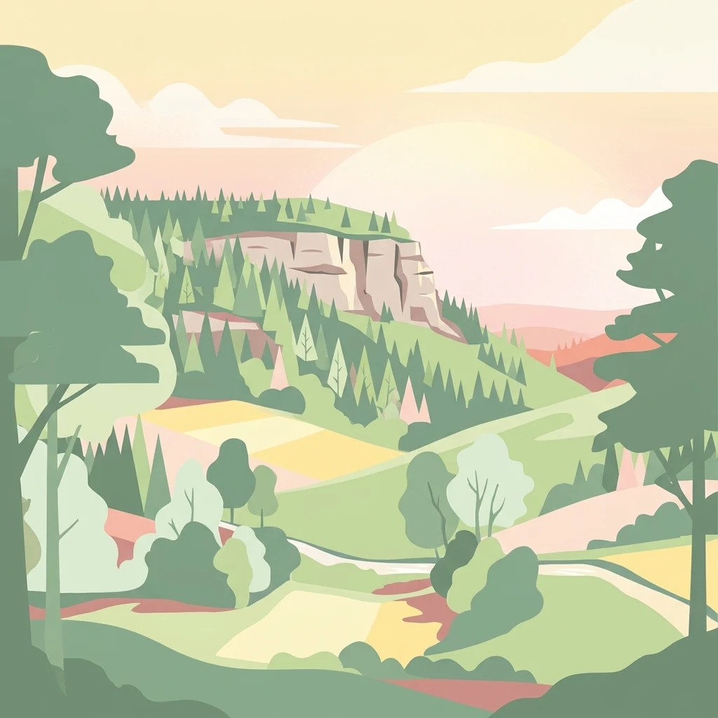
A stylized vector illustration showing a green forested ridge with rocky cliffs, rolling hills, fields, and trees under a soft pastel sky.

Graburg

Nature reserve

Park overview

Structured park overview, official facts, and landscape profile for Graburg

Graburg park facts, protected area profile, and essential visitor context

Review the core facts for Graburg, including designation, size, terrain, visitor scale, habitats, and operating context in one park-focused overview.

About Graburg

The Graburg is a compact but ecologically intense protected upland in the northern Ringgau, one of the westernmost shell-limestone plateaus of the Thuringian Basin. Its protected area encompasses the high plateau between the Rabenkuppe and the Schäferburg together with the steep forested slopes and the Königental valley below. The reserve is recognized at both state and federal level as one of the most important protected landscapes in Hesse for calcareous flora, and forms the central section of the broader Natura 2000 site "Kalkberge bei Röhrda und Weißenborn."

The landscape is shaped by Upper and Lower Wellenkalk limestone, laid down in a shallow Mesozoic sea more than two hundred million years ago and now resting on a softer base of red marl and sandstone. Where rainwater penetrates the limestone and reaches the swelling clay of the underlying Röt formation, large blocks of rock periodically break loose and slide downslope, producing the spectacular landslides for which the Graburg is famous. The most recent major slide occurred at the Manrod in May 1895, when thunderstorm rain loosened a vast mass of rock from the slope.

Ecologically, the reserve is defined by the interplay between closed forest and open habitat. Near-natural calcareous beech forest, dominated by the woodruff-beech community on rich limestone soils, covers most of the plateau and slopes. Below the rock walls, remnants of open grazing land survive as orchid-rich limestone dry grasslands, fescue communities, and Juniper stands that recall centuries of pastoral use. Relics of former coppice-with-standards and coppice forest management are still visible on the plateau, alongside residual old Scots pines from early-twentieth-century afforestation of former grazing land. Since 1988 these habitats have been managed to favor natural woodland development, and a network of core forest areas has been excluded from timber harvesting to benefit species dependent on old-growth and deadwood conditions.

Quick facts and research context for Graburg

The Graburg is a 341-hectare nature reserve located in the Werra-Meißner-Kreis of Hesse, within the municipalities of Weißenborn and Ringgau. It lies in the Geo-Naturpark Frau-Holle-Land and belongs to the northern edge of the Ringgau plateau, the westernmost extension of the shell-limestone scarps that frame the Thuringian Basin. The reserve was first declared a natural monument in 1915 and was formally designated as a Naturschutzgebiet in 1965, with its present boundaries established in 1988.

Together with neighboring protected areas, it forms the Natura 2000 site "Kalkberge bei Röhrda und Weißenborn," in which thirteen habitat types of community interest are recorded, three of them prioritized. The area is managed by Hessen-Forst and is recognized as one of the most important protected landscapes in Hesse for rare plant species, particularly orchids and yew trees. A network of designated core forest areas has been set aside from timber use to support old-growth and deadwood-dependent species.

Protection and recognition

Examine official records, international recognition sources, and management frameworks for Graburg.

Graburg Protection Status and Protected Area Designation Details

Examine official protection records and international designation data compiled for Graburg within the global conservation database. Access structured administrative facts that outline the established management scope and documented status of this protected area.

Protection details

WDPA ID
6970
Park context

Deeper park guide and search-rich context for Graburg

Graburg history, landscape, wildlife, and travel context

Explore Graburg through its history, landscape character, ecosystems, wildlife, conservation priorities, cultural context, and seasonal travel timing in a structured park guide built for atlas discovery and search intent.

Why Graburg stands out

The Graburg is especially known for its exceptional botanical richness on limestone substrate, particularly its orchid-rich calcareous dry grasslands and the largest naturally occurring yew population in Hesse. Its calcareous beech forests, dramatic rock faces, and numerous pre-historic and historic landslides form a compact landscape mosaic of unusually high conservation value. The reserve also stands out for harboring habitat types and species that qualify it as part of the Natura 2000 network. Caves in the rock bands serve as hibernation sites for rare bats, including the Lesser Horseshoe Bat, and orchids such as the Lady's Slipper grow in the open limestone grasslands. The combination of geological drama, ancient woodland, and species-rich open habitat makes the Graburg a reference site for calcareous landscape conservation in central Germany.
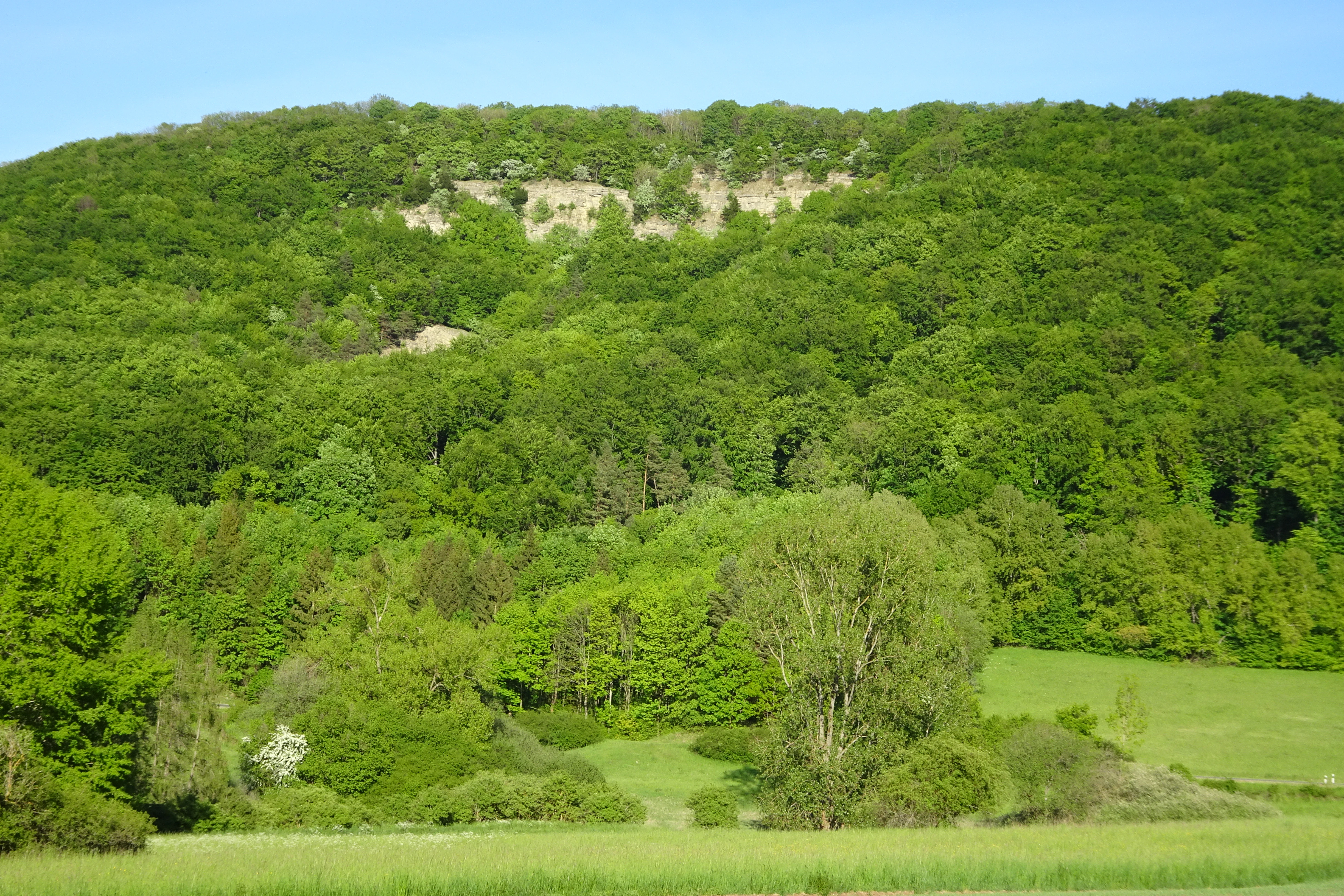
A lush green forested hill with a rocky limestone outcrop near the summit, rising above a grassy field under a clear blue sky.
The Rabenkuppe hill in the Graburg nature reserve, featuring dense beech forests and a prominent limestone rock formation.

Graburg history and protected-area timeline

The Graburg has been recognized as a landscape of exceptional value since the early years of state-organized nature conservation in Germany. In 1915, during the period of the Prussian province of Hessen-Nassau, an order of the royal government placed the shell-limestone plateau and its rock faces under protection as a natural monument, shielding it from destructive interventions. By 1924, larger sections of the Graburg had been withdrawn from forestry use, and in 1937 the third supplementary ordinance for the protection of natural monuments in the Kreis Eschwege formally entered the area in the natural monument register, affirming protection for its alder, beech, and maple stands and for its inaccessible cliffs and old-growth trees.

In 1965, an ordinance of the higher nature conservation authority at the Regierungspräsidium in Kassel designated approximately 180 hectares of the Graburg as a formal nature reserve under the still-operative Reich Nature Conservation Law of 1935. In November 1988, the protected area was substantially enlarged to its present extent of 341 hectares, encompassing the high plateau from the Rabenkuppe to the Schäferburg, the southern Königental, and the 475-meter-high Manrod. The enlarged designation was intended to protect calcareous dry grasslands, rock communities, mixed deciduous forests, alder-ash galleries along watercourses, and species-rich meadows, as well as two landslides of differing age that were regarded as scientifically significant landforms.

Since 2008, the Graburg has formed the core of the larger Natura 2000 site "Kalkberge bei Röhrda und Weißenborn," established under Hessian regulations to conserve thirteen habitat types of community interest together with bat and orchid species listed in Annex II of the Habitats Directive. In the 2010s, 39.2 hectares within the broader Graburg-Schieferstein area were set aside as core nature conservation areas under the Hessian biodiversity strategy, with additional state forest closures of roughly 230 hectares planned to meet the strategy's eight-percent wilderness target. These closures have been welcomed by conservation organizations but have also generated local resistance over forest use and management goals.

The cultural history of the plateau extends back much further. The narrow, steeply falling rocky ridge of the Schäferburg is believed to have served as an Iron Age refuge fortification, and ceramic fragments suggest a high medieval castle site. The chronicler Georg Landau referred in 1858 to the "Kraburg" as a thirteenth-century fortification, while later archaeological work by Sippel in 1991 interpreted the site as a lost spur castle separated from the plateau by a neck ditch known as the "Wartelücke."

Graburg landscape and geographic character

The Graburg is a compact shell-limestone massif set within the Ringgau, itself the westernmost promontory of the limestone scarps that wrap around the Thuringian Basin. Erosion by the Werra once separated the Ringgau from its parent plateau, leaving it as an isolated mesa-like remnant, and a long tectonic rift, the Netra-Ifta depression, divides the range into a northern and a southern half. The Graburg forms the central section of the northern half, a rough rectangle of high plateau roughly one and a half kilometers long and seven hundred meters wide, bordered by dramatic rock bands and forested slopes.

The two principal summits are the Rabenkuppe in the west, at about 515 meters, and the Schäferburg in the east, at about 490 meters. Between them runs a high plateau of open woodland and coppice relicts at elevations typically between four hundred and five hundred meters. Below the upper rim of the plateau, distinctive limestone cliff bands wrap around the hill, marking the level at which the harder limestone rests on the softer red marl below it. In many places, landslides and rockfalls have left chaotic boulder fields and scree slopes, and the entire area is recognized as one of the most landslide-rich sections of the western rim of the Thuringian Basin.

The slopes themselves are unusually varied. Bracken-rich woodland, marshy alder stands along seeps, dry juniper scrub on former pasture, and exposed rock ledges with bluegrass swards all occur within short horizontal distances. The southern face descends into the elongated Königental, while to the north the hill connects with the broader Schlierbachswald of the Fulda-Werra uplands. The contrast between the sheltered, moister north side of the plateau and the drier, sun-exposed southern rock faces strongly shapes the habitat mosaic of the reserve.
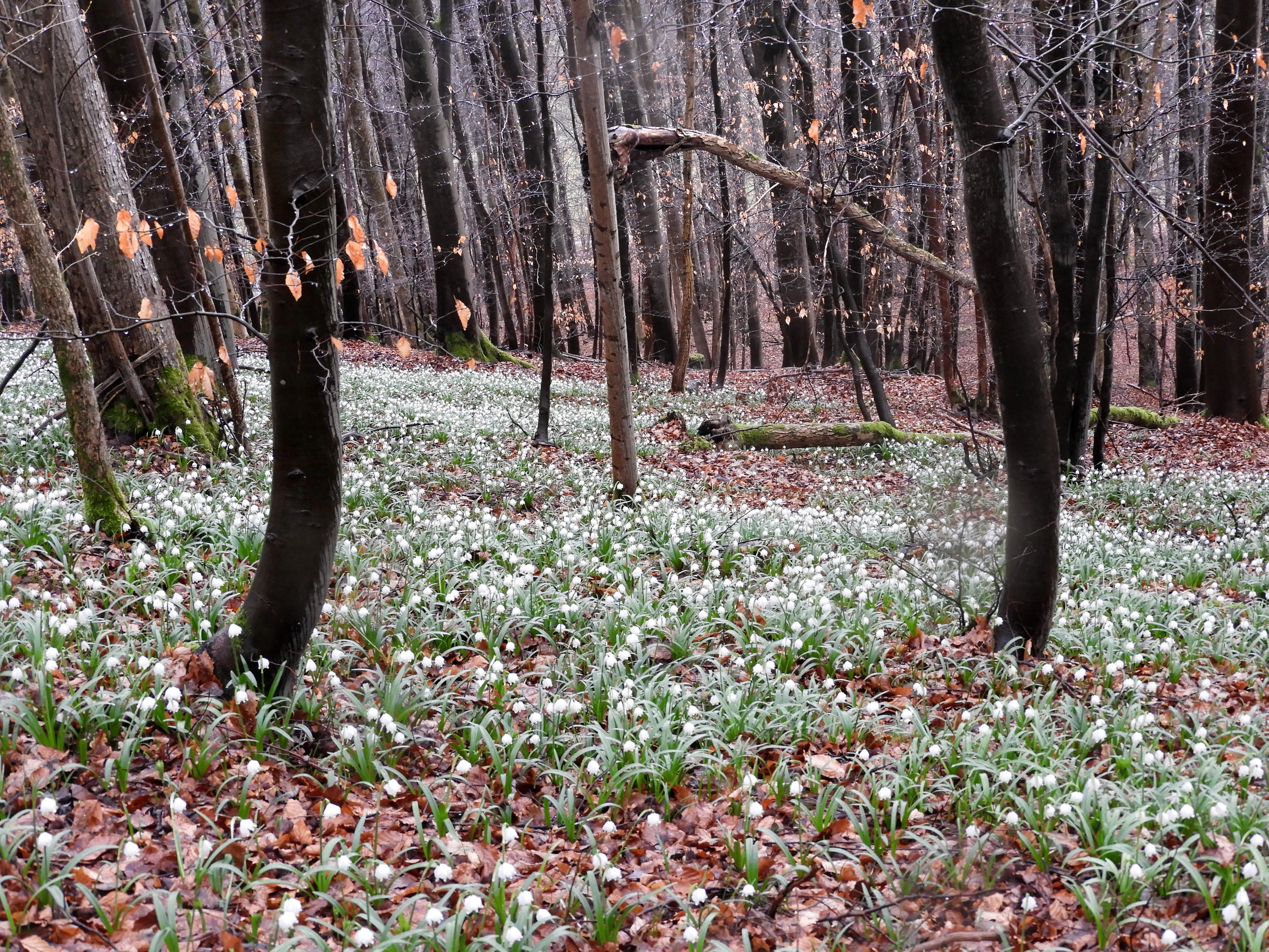
A forest floor densely covered with small white flowers and brown fallen leaves, surrounded by numerous bare tree trunks.
A carpet of white snowdrops covering the forest floor of the Graburg nature reserve in early spring.

Graburg ecosystems, habitats, and plant life

Ecologically, the Graburg is dominated by near-natural calcareous beech forest, with the woodruff-beech community as the prevailing woodland type on the rich limestone soils. Smaller areas of pure limestone beech forest and gorge-like ravine forest occupy the steepest and most sheltered sites, and the woodland is layered into a submontane beech-mixed forest belt on the slopes and a montane beech zone across the plateau. Relics of former coppice and coppice-with-standards management are visible on the Rabenkuppe, where old stools with mossy bases and regrowth stems still bear witness to centuries of traditional forest use.

Among the open habitats, the orchid-rich limestone dry grasslands and the bluegrass swards on scree slopes stand out ecologically. These communities contain a striking mix of sub-Mediterranean, continental, and dealpine species, including elements considered Ice Age relicts. Spring on the plateau brings extensive carpets of snowflake and white butterbur in the herb layer, while the rock bands and their adjoining tall-herb fringes support plants such as the bloody crane's-bill community with abundant flowers, fruits, and seeds.

The reserve is also notable for its yew population. The steep, rocky slopes of the Schäferburg and the northern scarp harbor the largest natural concentration of European yew in Hesse, with more than a thousand older trees and an additional six hundred or so younger individuals that have been deliberately fenced against browsing deer by the responsible forestry office. Juniper stands south of the Schäferburg preserve additional traces of centuries of pastoral land use, and patches of old Scots Pine from early-twentieth-century afforestation still survive within the present woodland mosaic.
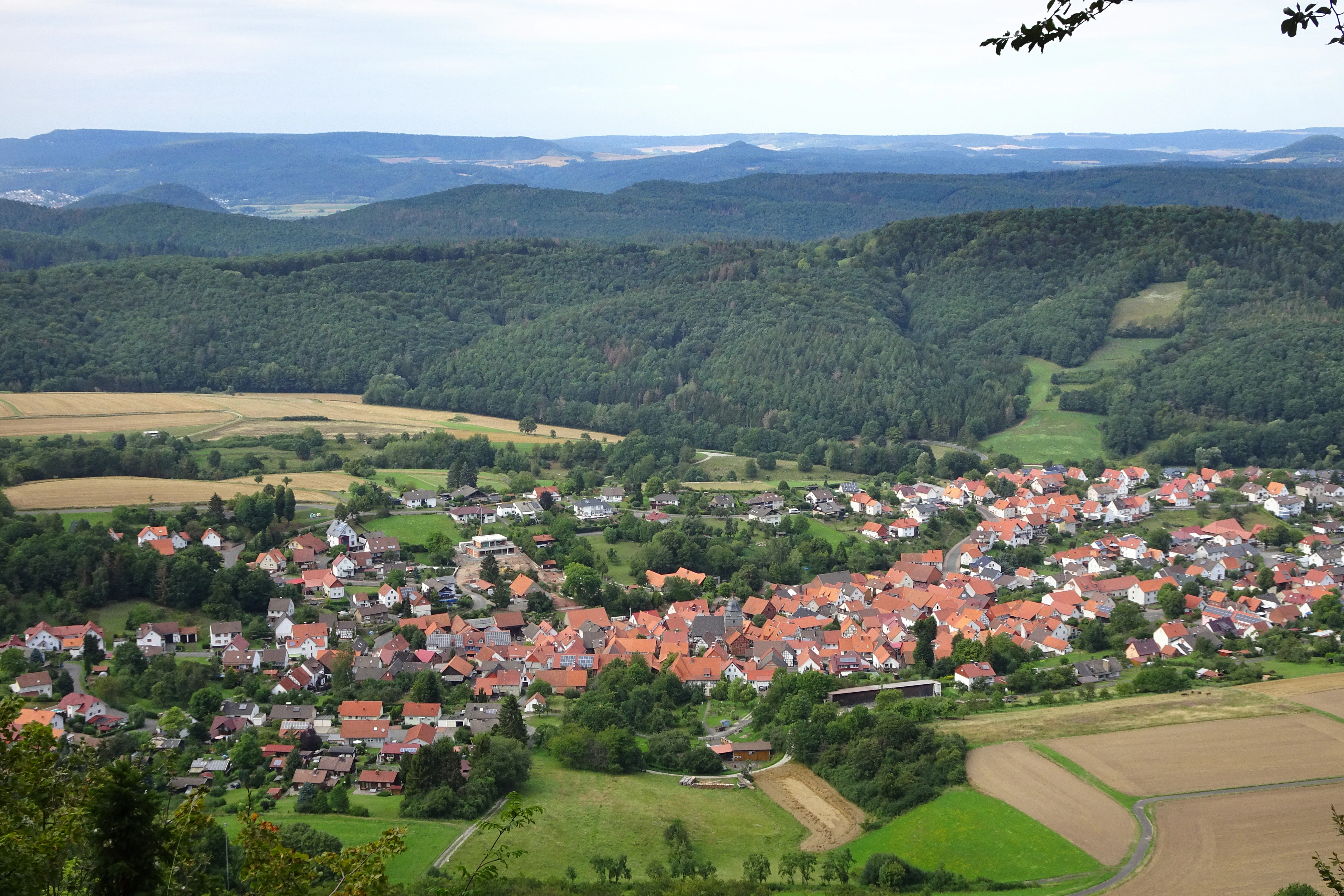
A high-angle landscape photograph showing a village with red-roofed houses in a valley, surrounded by green forests, agricultural fields, and rolling hills in the background.
A wide landscape view of a village nestled in a valley surrounded by forested hills and agricultural fields near the Graburg nature reserve.

Graburg wildlife and species highlights

The caves and crevices in the rock bands of the Graburg are the wildlife feature that has given the area its strongest formal recognition. The Lesser Horseshoe Bat, which by 1995 was considered lost from Hesse and remains threatened with extinction in Germany, has been documented hibernating in one of these caves. The reserve also supports the Common Noctule and other bat species that depend on the mosaic of old forest, rock, and sheltered cave sites.

The woodland and cliff mosaic supports a rich community of breeding birds. Eight species protected under the European Birds Directive are documented in the area, including the Eagle Owl, Black Woodpecker, Middle Spotted Woodpecker, Grey-headed Woodpecker, Red Kite, Tengmalm's Owl, Black Stork, and Honey Buzzard. Stock Dove, Tawny Owl, Long-eared Owl, Woodcock, and Common Raven are also recorded as characteristic species. The undisturbed core forest areas are regarded as particularly important refuges for disturbance-sensitive species such as the Black Stork and forest bats.

The exposed rock faces and adjoining woodland edges also hold a notable butterfly fauna. Threatened day-flying butterflies and burnet moths recorded in the area include the Large Tortoiseshell, Lesser Purple Emperor, Scarce Fritillary varieties, White Admiral, Swallowtail, and several burnet moth species that depend on warm, flower-rich limestone swards.
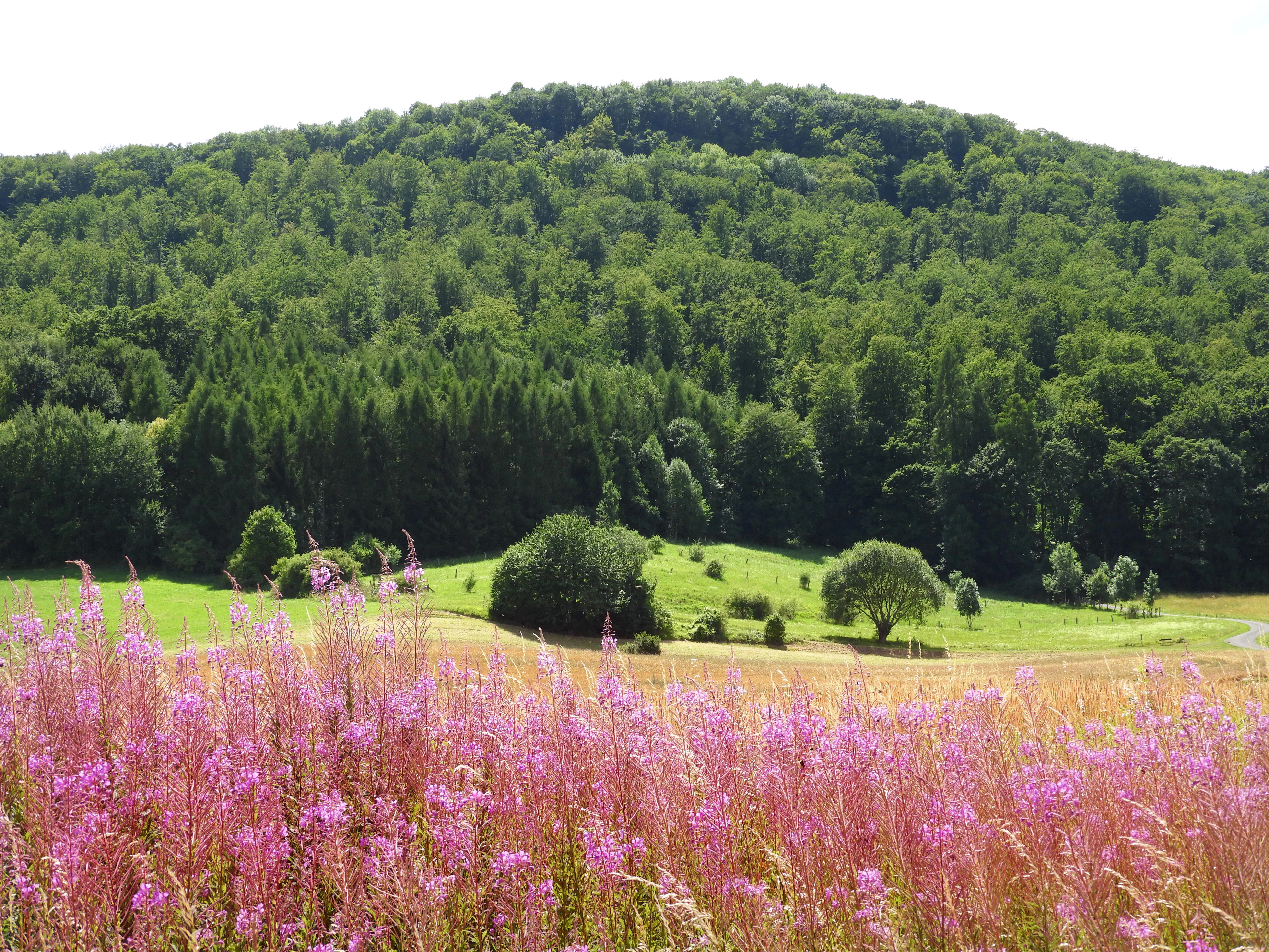
A forested hill rising behind a green meadow, with a field of tall pink wildflowers in the foreground.
View of the forested Graburg mountain ridge with blooming rosebay willowherb in the foreground.

Graburg conservation status and protection priorities

The conservation significance of the Graburg rests on the unusually dense concentration of priority habitats and species within a relatively small area. It is recognized as a nationally important calcareous landscape and is one of the most highly valued nature reserves in Hesse for plant conservation. Its protected status has accumulated over more than a century: a natural monument declaration in 1915, formal reserve status in 1965, an enlarged designation in 1988, and statutory recognition as part of the Natura 2000 network since 2008.

Within the Natura 2000 site "Kalkberge bei Röhrda und Weißenborn," thirteen habitat types of community interest are present, three of them classified as priority habitat types of particular conservation responsibility. The reserve is also one of the key Hessian strongholds for the European yew and for orchids such as the Lady's Slipper, both protected under the Habitats Directive. Bats recorded here, including the Lesser Horseshoe Bat and the Greater Mouse-eared Bat, have been among the decisive species for the site's European designation.

Conservation management combines traditional and modern approaches. Large areas have been managed under close-to-nature forestry by the Hessian state forest service for decades, with selective harvesting limited to larger trees, while about 39 hectares of core forest area have been excluded from timber use altogether to allow natural development. Planned extensions of these core areas would add roughly 230 hectares of state forest to the set-aside network, contributing to Hesse's strategy for old-growth and deadwood habitat. Landslide zones, cliff bands, and a 25-meter protective strip around key features are excluded from forestry under the reserve ordinance.

Graburg cultural meaning and human context

The cultural landscape of the Graburg reflects centuries of human interaction with a demanding limestone terrain. The plateau and slopes were historically managed as coppice-with-standards and coppice forest, while oak-rich areas supported extensive grazing and litter harvesting, practices whose relicts are still visible today. Sheep and goat pasturing shaped the open dry grasslands and juniper stands south of the Schäferburg, leaving a cultural landscape element that is now itself a conservation focus.

The Schäferburg ridge itself carries a layered human history. Iron Age communities appear to have used the narrow, defensible rocky crest as a refuge fortification, and ceramic finds indicate a high medieval castle site that may correspond to historical references to a thirteenth-century fortification in the Werra region. The historian Georg Landau described the "Kraburg" in 1858 as a thirteenth-century fortification that was soon destroyed, while later archaeological work has reinterpreted the site as a lost spur castle on the eastern edge of the plateau.

In the present day, the area is part of the Geo-Naturpark Frau-Holle-Land, and a hiking culture has grown around it that links nature conservation, art, and regional identity. The community of Weißenborn operates a volunteer "Graburg-Scout" service for visitors and was recognized by the GrimmHeimat NordHessen tourism initiative for this concept. A premium hiking trail, the P15 Graburg, circles Weißenborn and crosses several long-distance paths, including the Barbarossa Path X8, which also hosts part of the "Ars Natura" artistic trail installation.
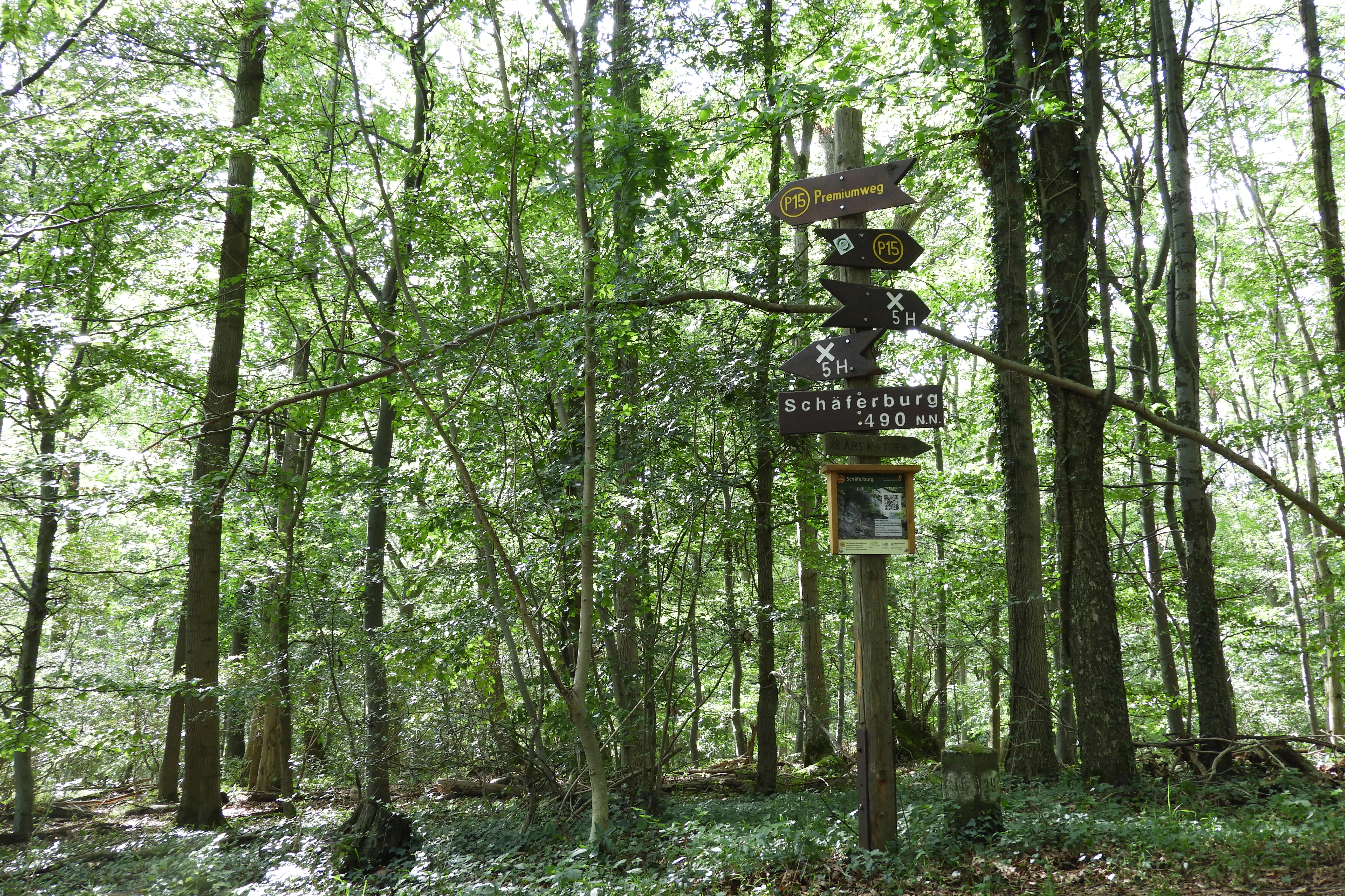
A wooden post with multiple directional hiking signs stands in a green forest with tall trees and a leafy ground cover.
A wooden trail signpost stands in a dense beech forest, pointing towards the Sandsteinfelsen.

Top sights and standout views in Graburg

The Graburg's strongest single highlight is its exceptionally rich calcareous flora, including more than twenty orchid species and the largest native yew population in Hesse, set within near-natural calcareous beech forest on a dramatic shell-limestone plateau. Equally distinctive are the large historic landslides that descend from the rock bands over the swelling red marl below, a phenomenon for which the western edge of the Thuringian Basin is famous.

From a conservation perspective, the reserve stands out as one of Hesse's most botanically important protected areas, a Natura 2000 site harboring priority habitat types and rare bat and orchid species. The combination of caves, cliffs, ancient woodland, and orchid-rich open grassland within a landscape of less than four square kilometers makes the Graburg a compact but unusually complete example of a central European calcareous upland ecosystem.
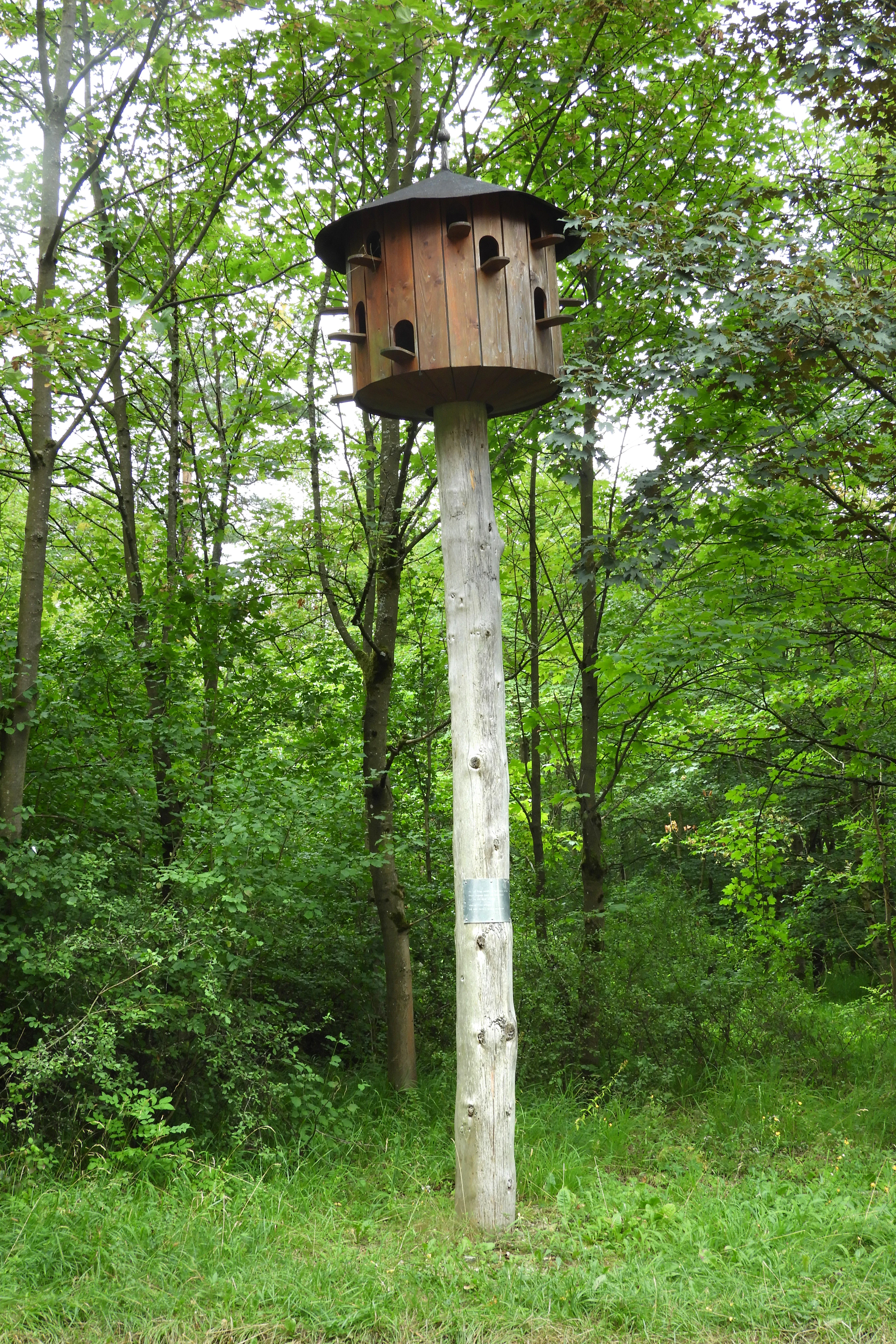
A tall wooden pole supporting a large, multi-compartment wooden birdhouse with a dark roof, standing in a green forest clearing.
A large wooden birdhouse mounted on a tall pole in the forest, part of the Ars Natura art trail on the Graburg.

Best time to visit Graburg

The Graburg has a weak sub-Atlantic climate, with annual precipitation around 700 millimeters and mean annual temperatures between about 6.5 and 7.5 degrees Celsius. Spring is the most striking season for visitors, when the forest floor of the plateau, especially around the Rabenkuppe, is transformed by extensive snowflake and white butterbur blooms that turn the woodland understorey green-and-white. The exposed rock swards and orchid-rich dry grasslands are at their most colorful in late spring and early summer, when orchid species are in flower and the fescue and bluegrass swards are fully active.

Late summer and autumn are well suited to appreciating the broader landscape structure and wildlife of the area, when visibility from the rock bands and viewpoints such as the Anger is at its best and bat activity around the caves can be observed over longer evenings. Winters are generally mild for central Germany but can be demanding on the exposed cliff and scree communities, when freeze-thaw cycles and heavy rainfall may occasionally trigger fresh rock movement on the slopes.

Monthly climate preview

Long-term monthly temperature averages and precipitation trends measured at representative coordinates in Hessen.

Graburg Climate Normals, Annual Temperature and Precipitation Rhythm

Historical data records monthly temperature swings from sub-zero winter lows to warm summer maximums alongside consistent daily precipitation patterns across the protected landscape. Examining the full twelve-month profile provides complete context for long-term climatological variations across the representative coordinate.
Annual mean8 °C
-1 °C18 °C
Jan-1°
Feb
Mar
Apr
May12°
Jun16°
Jul18°
Aug18°
Sep14°
Oct
Nov
Dec
Warmest month
July

18.3 °C

Coolest month
January

-1.1 °C

Wettest month
July

2.6 mm/day

Driest month
April

1.4 mm/day

Park location guide

Geography guide, regional context, and park location map for Graburg

Graburg park geography, regions, and map view in Germany

Understand where Graburg sits in Germany through a broader geographic reading of the surrounding landscape, nearby location context, and its mapped position within the national park landscape.

How Graburg fits into Germany

Germany is a federal republic in Western and Central Europe with a population of over 83 million across sixteen constituent states. It is Europe's largest economy by nominal GDP and a major global exporter and importer. The capital is Berlin, and the country borders Denmark, Poland, Czech Republic, Austria, Switzerland, France, Luxembourg, Belgium, and the Netherlands.

Wider geography shaping Graburg in Germany

Germany is located in Western and Central Europe, spanning 357,022 km². It borders Denmark to the north, Poland and the Czech Republic to the east, Austria and Switzerland to the south, and France, Luxembourg, Belgium, and the Netherlands to the west. The country has coastlines on the Baltic Sea and North Sea to the north, with the Alps located in the southern region.

Map view of Graburg

Use this park location map to pinpoint Graburg in Germany, understand its exact geographic position, and read its mapped placement within the surrounding landscape more clearly.

Pigeon | © OpenStreetMap contributors

Location context for Graburg

Hessen

Explore protected area imagery highlighting calcareous beech forests, rock cliffs, and rare orchid habitats.

Graburg Photos and Landscapes, Visualizing the Shell Limestone Upland

Visual documentation of Graburg reveals the rugged topography of its shell limestone plateau, ancient beech woodlands, and exposed rock faces. Examining these protected habitats provides clear insight into the complex geological formations and diverse botanical communities of the reserve.

A lush green forested hill with a rocky limestone outcrop near the summit, rising above a grassy field under a clear blue sky.

A view of the lower trunks and roots of several trees covered in green moss, standing on a forest floor scattered with dry leaves and twigs.

A forest floor densely covered with small white flowers and brown fallen leaves, surrounded by numerous bare tree trunks.

A high-angle landscape photograph showing a village with red-roofed houses in a valley, surrounded by green forests, agricultural fields, and rolling hills in the background.

A forested hill rising behind a green meadow, with a field of tall pink wildflowers in the foreground.

A large wooden sculpture resembling a split seed pod stands on a forest floor surrounded by green trees and undergrowth.

A wooden post with multiple directional hiking signs stands in a green forest with tall trees and a leafy ground cover.

A tall wooden pole supporting a large, multi-compartment wooden birdhouse with a dark roof, standing in a green forest clearing.

A tall, dark, slender sculpture of a human-like figure stands in a grassy clearing surrounded by green trees and a blue sky.

Park atlas

Compare surrounding limestone uplands, forest reserves, and protected natural landscapes.

Explore Other Protected Areas and Nearby Regional Parks Around Graburg

Continue geographic discovery by browsing other protected areas and reserves located near the Graburg limestone massif. Comparing adjacent upland habitats reveals the broader ecological patterns and varied terrain defining the surrounding region.
Watercolor painting of a green landscape featuring rolling hills and sparse trees.
Nature reserveWerra-Meißner-Kreis
About 3 km away#1 closest

Southeast

Dreiherrenstein-Eschenberg-Kreutzerberg Nature Reserve and Border Landscape Geography

Protected calcareous forests and limestone ridges in Werra-Meißner-Kreis

Spanning 206 hectares of the Ringgau escarpment, this reserve features ancient beech forests, steep limestone cliffs, and rare steppe-heath grasslands. It sits at a cultural and ecological intersection, preserving Cold War-era boundary markers alongside post-glacial biological relicts within the broader Hessian protected-area network.

Area
2.063 km²
Established
1998
IUCN
IV
Relief
Mountain
A watercolor painting depicting a soft, green meadow landscape with gentle rolling hills in the background and scattered trees.
Nature reserveGermany
About 3.9 km away#2 closest

Southeast

Feuchtwiesen bei Lüderbach Nature Reserve: Regional Geography and Protected Landscape Atlas

A diverse wetland and grassland reserve in northern Hesse, Germany

Spanning 40 hectares in the Werra-Meißner-Kreis district, Feuchtwiesen bei Lüderbach protects a complex mosaic of reedbeds, eutrophic ponds, and floodplain forests. This nature reserve serves as an important ecological link in the Netra-Ifta valley, bridging valley-bottom wetlands with the limestone-rich slopes of the Weinberg hill to create a distinct and valuable natural terrain in the German landscape.

Area
0.41 km²
Established
1995
Relief
Upland
Climate
Temperate
Watercolor painting of a rolling green landscape with a winding trail leading toward purple mountains under a soft light.
Nature reserveWartburgkreis
About 4.1 km away#3 closest

South

Mertelstal - Heldrastein: Protected Nature Reserve and Forested Limestone Geography in Wartburgkreis

Mapping the natural relief and ecological boundaries of a central German nature reserve.

Mertelstal - Heldrastein stands as a protected natural landmark in the Wartburgkreis district, defined by its dramatic limestone cliffs and ancient beech forest canopy. The reserve features a unique vertical relief above the Werra river valley, housing rare orchid communities and specialized bryophytes. This entry maps the structural geography and conservation value of the site, highlighting its dual identity as both a Natura 2000 protected habitat and a place of deep historical resonance across the former inner-German border landscape.

Area
2.525 km²
Established
1997
IUCN
IV
Relief
Mountain
A horizontal watercolor painting showing layers of soft green hills and forests against a pale yellow sky.
Nature reserveHessen
About 5.2 km away#4 closest

Southwest

Boyneburg und Schickeberg bei Breitau: Protected Nature Reserve and Geological Landmark

Geology, forest habitats, and medieval history in the Ringgau plateau of Hesse.

This nature reserve serves as a critical protected area showcasing the largest active mass-movement zone in Hesse. The landscape features striking Muschelkalk cliffs, diverse orchid-rich beech forests, and cave systems that provide essential habitat for protected bat populations and breeding raptors.

Area
2.115 km²
Established
1988
IUCN
IV
Relief
Upland
Watercolor illustration showing a wide landscape with green rolling hills in the background, a line of trees in the midground, and a pinkish meadow with grasses in the foreground
Nature reserveHesse
About 6.5 km away#5 closest

East

Frankenloch bei Heldra Nature Reserve: Mapped Protected Landscapes in Hesse, Germany

A rare, near-natural Werra river oxbow and wetland floodplain sanctuary.

Discover the geographic layout of Frankenloch bei Heldra, a protected nature reserve located along the River Werra. This site offers insight into floodplain dynamics, reed-bed ecology, and the restoration of natural river channels within the Werra-Meissner-Kreis district of Hesse, Germany.

Area
0.089 km²
Established
1995
Relief
Lowland
Climate
Temperate
Nature reserveThuringia
About 6.8 km away#6 closest

East

Werra bis Treffurt mit Zuflüssen: Protected River and Floodplain Network in Thuringia

Mapping an extensive 191 kilometer Natura 2000 river corridor.

The Werra bis Treffurt mit Zuflüssen protected area serves as a vital ecological corridor in Thuringia. This site encompasses a complex mosaic of fast-flowing highland brooks, expansive floodplain meadows, inland salt sites, and rare dissolution lakes. Its geography bridges high-altitude source regions with lower river valleys, creating a distinctive landscape transect that supports essential freshwater habitats and rare aquatic species across the state.

Area
22.6 km²
Established
2008
IUCN
IV
Relief
Mixed relief
Nature reserveWartburgkreis
About 7 km away#7 closest

East

Werraaue Treffurt Nature Reserve: Geographic Overview and Protected Floodplain Map

Wartburgkreis wetland refuge and Green Belt stepping stone

Werraaue Treffurt comprises a complex riverine landscape where sediment-rich floodplain soils and restored gravel-pit lakes create a diverse sanctuary. Located near the Thuringia-Hessia state border, this nature reserve integrates into the broader Green Belt, offering significant habitat continuity for species dependent on transition zones. Its position in the Werra valley floor highlights the intersection of hydrological change, historical land-use exclusion, and modern ecological protection in Germany.

Area
0.685 km²
Established
1995
IUCN
IV
Relief
Lowland
A horizontal watercolor painting depicting a soft-toned, layered landscape of rolling hills and forests in shades of green and pale yellow.
Nature reserveThuringia
About 7.1 km away#8 closest

East

Adolfsburg, Bornberg, Sülzenberg: A Protected Muschelkalk Landscape in Thuringia

Geographic map and protected-area atlas context

This nature reserve stands as a prominent geological feature in the Werrabergland region, where steep Muschelkalk hills and plateaus meet the Werra valley. The site protects a rare assembly of habitats including juniper heathland, scree slopes, and old-growth orchards, offering a dense case study for regional botanical diversity and limestone-terrain mapping in central Germany.

Common questions about visiting, size, designation, and location context for Graburg

Graburg FAQs for park facts, access, geography, and protected area context

Find quick answers about Graburg, including protected-area facts, park geography, trail and visitor context, and how the park fits into its surrounding country and regional landscape.
MoriAtlas Explorer

Continue Your Protected Areas Search Across the Global Atlas

Deepen your exploration by continuing the structured search for national parks and protected areas worldwide. Utilize the comprehensive filtering capabilities to compare different conservation landscapes and refine your understanding of global park geography. Discover more about the distribution and characteristics of protected natural areas.

Global natural geography