
Mori Atlas logo
Protected landscapeGrand Mesa National Forest

Understanding the geography and geologic history of the world's largest basalt-capped plateau

Grand Mesa National Forest: Mapping the Protected Landscapes of the Colorado Western Slope

Grand Mesa National Forest preserves an expansive elevated plateau rising abruptly above the canyons and river valleys of the Colorado Western Slope. This protected landscape represents one of the earliest federal forest reserves in the United States, defined by its flat-top summit, high-country reservoirs, and montane forest ecosystems. Explore the mapped boundaries and natural terrain of this significant Rocky Mountain landmark, which spans across Mesa, Delta, and Garfield counties to form a critical high-elevation habitat island in the American West.

national foresthigh plateauflat-top mountainmontane forestsubalpine habitatreservoirs
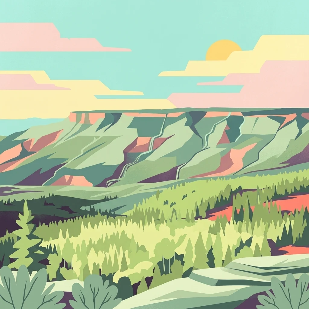
A graphic illustration depicting the Grand Mesa in Colorado with a flat top mountain, evergreen forest, and a sunset sky.

Grand Mesa National Forest

Protected landscape

Park overview

Structured park overview, official facts, and landscape profile for Grand Mesa National Forest

Grand Mesa National Forest park facts, protected area profile, and essential visitor context

Review the core facts for Grand Mesa National Forest, including designation, size, terrain, visitor scale, habitats, and operating context in one park-focused overview.

About Grand Mesa National Forest

Grand Mesa National Forest is a major public-land unit of the United States National Forest System, protecting a vast stretch of high plateau and forested mountain country in western Colorado. Located in Mesa, Delta, and Garfield counties, the forest wraps around the central and southern portions of Grand Mesa and extends southward across part of Battlement Mesa. Together these features form a continuous high-elevation landscape that visually and ecologically separates the forest from the lower valleys and canyon country that define much of the surrounding region.

The forest's character is defined by elevation. Where much of the Colorado Western Slope consists of arid mesas, irrigated agricultural valleys, and deeply cut river canyons, Grand Mesa rises as a broad, forested plateau several thousand feet above the neighboring lowlands. This elevation creates a noticeably cooler and wetter microclimate that supports forests of aspen, spruce, fir, and pine, as well as a network of lakes and reservoirs that further shape the landscape. Visitors traveling between Grand Junction and Cedaredge encounter an almost abrupt transition from dry low-country to cool, green highland forest, and the forest is structured around that experience of stepping onto an elevated, lake-dotted plateau.

In addition to its ecological role, the forest is recreational infrastructure for the broader region. It supports summer hiking, fishing, scenic driving along the mesa's rim roads, camping among the reservoirs, and extensive winter activity thanks to heavy seasonal snowfall. As one of the very first federal forest reserves in the United States, established in 1892, the forest also carries historical weight, illustrating how early American conservation thinking targeted not just remote wilderness but also prominent landmark landscapes of the West. Managed jointly with the Gunnison and Uncompahgre National Forests, Grand Mesa National Forest today functions as both a working forest and a high-country recreation destination deeply tied to the identity of western Colorado.

Quick facts and research context for Grand Mesa National Forest

Grand Mesa National Forest sits in western Colorado across Mesa, Delta, and Garfield counties, with its administrative gateway near Grand Junction. The forest wraps the majority of Grand Mesa, often described as the largest flat-top mountain in the world, as well as the southern part of Battlement Mesa.

The unit was created in the nineteenth century as one of the earliest U.S. forest reserves and is managed together with the adjacent Gunnison and Uncompahgre National Forests. Covering well over one thousand square kilometers, it functions as a high-elevation forested island above the canyons and agricultural valleys of the Colorado Western Slope, creating a distinctive mix of montane forest, subalpine habitats, reservoir systems, and plateau scenery characteristic of the Southern Rockies.

Protection and recognition

Terrestrial conservation framework and official designation history

Grand Mesa National Forest Protection Status and Land Designation Records

Grand Mesa National Forest encompasses documented terrestrial protection records and managed land classifications. Conservation frameworks outline official administrative parameters and recognized protected area boundaries.

Protection details

Protection scope
Terrestrial
Transboundary protection
No
Park context

Deeper park guide and search-rich context for Grand Mesa National Forest

Grand Mesa National Forest history, landscape, wildlife, and travel context

Explore Grand Mesa National Forest through its history, landscape character, ecosystems, wildlife, conservation priorities, cultural context, and seasonal travel timing in a structured park guide built for atlas discovery and search intent.

Why Grand Mesa National Forest stands out

Grand Mesa National Forest is best known for Grand Mesa itself, the world's largest flat-top mountain, a broad basalt-capped plateau that rises well above the surrounding Western Slope landscape. The forest is also known for its reservoir-dotted high country, its old-growth and aspen-rich montane forests, and its concentration of wildlife habitat in a region otherwise defined by lower, drier terrain. Equally distinctive is the forest's place in the early history of American forest conservation. Its 1892 establishment as the Battlement Mesa Forest Reserve places it among the very first federal forest reserves in the United States, and it remains one of the oldest continuously protected national forest landscapes in the Rockies. Today that combination of geologic drama, ecological richness, and conservation heritage gives the forest a clear identity within the Colorado public lands network.
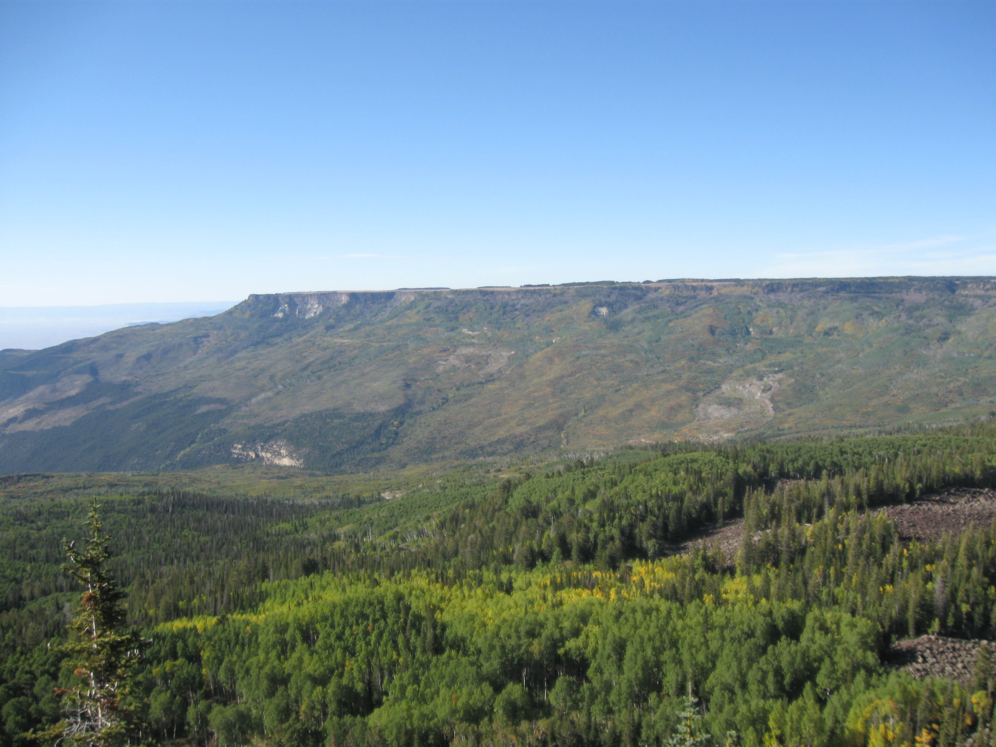
A wide, elevated landscape view featuring a large, flat topped mesa in the distance under a clear blue sky, with a vast coniferous and deciduous forest covering the foreground and midground.
A view looking toward the flat top of Grand Mesa in western Colorado, showing forested slopes and the characteristic mesa rim.

Grand Mesa National Forest history and protected-area timeline

The history of Grand Mesa National Forest begins on December 24, 1892, when President Benjamin Harrison established the Battlement Mesa Forest Reserve, making it one of the earliest federal forest reserves in the United States. At that moment the area that would become Grand Mesa National Forest was already understood as a landscape of national significance: a vast elevated plateau marked by timber, water resources, and a striking geologic profile above the Colorado Western Slope. The 1892 designation made the Battlement Mesa Forest Reserve the third such reserve created in the country, placing it alongside other pioneering forest-protection acts of the early conservation era.

In the decades that followed, the reserve evolved alongside the broader national forest system. Over time the administrative identity shifted, and the area was eventually recognized under its current name, Grand Mesa National Forest, reflecting its association with the prominent geographic feature that defines it. Today the forest is managed as part of a combined administrative unit with the Gunnison National Forest and the Uncompahgre National Forest, all coordinated from offices in Delta, Colorado, supported by ranger district offices in Grand Junction. Through that long administrative history, the original 1892 reserve has remained a continuous part of the national forest landscape, giving the present-day forest a heritage stretching back to the very first generation of federal forest conservation in the United States.

Grand Mesa National Forest landscape and geographic character

The dominant landscape feature of Grand Mesa National Forest is Grand Mesa itself, often described as the largest flat-top mountain in the world. The mesa is a broad, elevated plateau capped by basalt flows that have resisted erosion while the surrounding country has been carved away, leaving behind a wide, comparatively level top that abruptly meets the cliffs and slopes below. This produces the area's signature visual: an island of forested highland standing well above the dry river valleys, irrigated farmland, and canyon systems of the Colorado Western Slope.

Below and beyond the main mesa, the forest also extends across the southern portion of Battlement Mesa, adding more tableland and rolling forested terrain to the protected landscape. Across both mesas, the topography is shaped by ancient volcanic activity and long erosion cycles, giving way to relatively gentle upper surfaces broken by drainages, small canyons, and benches. The juxtaposition of flat-top uplift with steep flanks and deeply incised valleys is a defining scenic trait of the region.

The high country itself is interlaced with reservoir systems that function almost like a chain of inland lakes across the plateau. Combined with montane forest cover and seasonal snowpack, these water features shape both the scenery and the experience of traveling through the forest, creating repeated transitions between open water, dense tree cover, and panoramic rim views looking out over the surrounding lowlands.

Grand Mesa National Forest ecosystems, habitats, and plant life

Ecologically, Grand Mesa National Forest represents a high-elevation refuge surrounded by drier land. Because of its elevation, the forest captures significantly more moisture than nearby valleys, producing montane and subalpine vegetation communities that contrast sharply with the surrounding pinyon-juniper woodland, sagebrush steppe, and irrigated agricultural lands of the Western Slope. Aspens, mixed conifer stands, and spruce-fir forests are characteristic of the upland, while the mesa's reservoirs and meadows create additional wetland and riparian microsystems within an otherwise forested matrix.

This elevation-driven ecological gradient gives the forest its distinct identity in the regional landscape. It functions as a forested island of cool, moist habitat, supporting plant communities and animal populations that would not otherwise persist on the lower, hotter plains and canyon country around it. The plateau's combination of tableland, lakes, and forest cover also makes it ecologically richer than many surrounding public-land units, providing a relatively continuous block of high-elevation habitat for species that depend on montane environments.

Because of that ecological setting, the forest also serves as one of the more important wildlife strongholds on the Western Slope, hosting habitat for both resident species and seasonal migrants. The interplay between high plateau, forested slopes, and reservoir systems creates a layered natural environment where elevation, water, and forest cover combine to support unusually diverse wildlife communities for this part of Colorado.

Grand Mesa National Forest wildlife and species highlights

Wildlife is one of the defining attractions of Grand Mesa National Forest, and the area is well known for the mix of species supported by its high-elevation forests and reservoir systems. Large mammals are a particular feature of the forest, with elk herds, mule deer, black bears, cougars, and bighorn sheep among the most recognized residents of the area. The forest is also home to less commonly seen predators such as the Canadian lynx, as well as smaller forest-dwelling mammals like the pine marten, illustrating the range of habitats the plateau supports.

The forest is equally valued for its birdlife. The mix of conifers, aspens, lakes, and open vistas creates habitat for raptors and forest owls alike, and seasonal viewing opportunities bring birdwatchers to the mesa for species such as bald eagles, golden eagles, peregrine falcons, the Mexican spotted owl, and the boreal owl. More generalist species like the common raven and the wild turkey are also part of the area's regular bird community. The combination of large mammals, predatory cats, and raptor-rich skies gives the forest a notably complete wildlife profile for its elevation and latitude.

Beyond individual species, the forest's overall wildlife value comes from the fact that all these groups share the same high-country landscape. Elk and mule deer grazing near reservoirs, lynx and pine marten moving through dense conifer, raptors hunting over open meadow and lake edge, and bighorn sheep using rocky terrain all coexist within the same forest boundary, making the area a compact representation of Colorado's high-country wildlife systems.

Grand Mesa National Forest conservation status and protection priorities

The conservation significance of Grand Mesa National Forest is rooted in its age, its location, and the ecological role it plays on the Colorado Western Slope. Established in 1892 as the Battlement Mesa Forest Reserve, the area is among the very earliest federal forest reserves in the United States, giving it a foundational place in the history of American conservation. Its continuous protection since the late nineteenth century means that much of its present-day forest structure reflects more than a century of land management under national forest principles.

Ecologically, the forest protects an unusually extensive block of high-elevation habitat amid a largely lower and drier landscape. By safeguarding broad swaths of montane forest, subalpine habitat, lakes, and associated wetlands, the unit maintains habitat for species that depend on cooler, moister conditions than those generally found in the surrounding Western Slope valleys and canyons. This makes the forest a regional refuge for wildlife associated with montane forest environments, including both resident large mammals and seasonal raptor populations.

The forest also contributes to watershed protection in the region. The reservoirs and snowpack across the mesa support downstream water systems, and the national forest designation helps maintain the integrity of those upland water sources. In combination, the forest's age, elevation, habitat value, and watershed role make it more than simply a tract of public timberland; it functions as a long-standing conservation anchor for western Colorado.

Top sights and standout views in Grand Mesa National Forest

The standout qualities of Grand Mesa National Forest cluster around three themes: a globally distinctive landform, a deep conservation legacy, and a rich high-country wildlife environment. The forest's defining highlight is Grand Mesa itself, the world's largest flat-top mountain, a basalt-capped plateau that defines the scenery, the climate, and the ecological identity of the protected area.

Equally compelling is the forest's place in the history of American forest policy. Its 1892 creation as one of the earliest federal forest reserves places the area at the very beginning of national forest conservation in the United States, while its modern management as part of a broader administrative unit reflects how those early reserves have grown into contemporary landscape-scale conservation systems. Rounding out the highlights is the wildlife richness: large mammals like elk, mule deer, and bighorn sheep, predators such as cougar and Canadian lynx, and seasonal raptor viewing combining to give the forest one of the most complete wildlife profiles on the Western Slope.

Best time to visit Grand Mesa National Forest

The experience of visiting Grand Mesa National Forest shifts substantially with the seasons, and the most rewarding visits depend largely on what kind of landscape the visitor wants to see. Summer brings the greenest, most accessible version of the forest, with full road access across the mesa, active wildlife, hiking among aspen groves and conifer forest, and the reservoir network at its most visually prominent. This is also when most visitors can comfortably explore both the rim views and the higher trails.

Winter is a contrasting but equally characteristic season on the mesa. Because of the forest's elevation, snowfall on the plateau is heavy and persistent, transforming the tableland into a high-country snow environment that supports winter activities and dramatically changes the scenery. Spring and autumn offer transitional experiences, with aspen color in the fall and the gradual reopening of high-country areas after the snowmelt in the spring, making shoulder seasons a strong choice for visitors focused on scenery and quieter conditions rather than peak summer amenities.

Monthly climate preview

Long term temperature and precipitation averages for monthly climate comparison

Grand Mesa National Forest Climate Normals and Annual Weather Patterns

Representative coordinate sampling records measured monthly temperature fluctuations alongside consistent precipitation totals across the protected landscape. Examining the complete twelve month profile reveals detailed long term climate norms for structured geographical analysis.
Annual mean7 °C
-5 °C22 °C
Jan-5°
Feb-3°
Mar
Apr
May11°
Jun18°
Jul22°
Aug20°
Sep15°
Oct
Nov
Dec-4°
Warmest month
July

21.6 °C

Coolest month
January

-4.8 °C

Wettest month
September

1.4 mm/day

Driest month
June

0.6 mm/day

Park location guide

Geography guide, regional context, and park location map for Grand Mesa National Forest

Grand Mesa National Forest park geography, regions, and map view in United States of America

Understand where Grand Mesa National Forest sits in United States of America through a broader geographic reading of the surrounding landscape, nearby location context, and its mapped position within the national park landscape.

How Grand Mesa National Forest fits into United States of America

The United States of America is a federal presidential republic and one of the world's largest countries by area and population. It consists of 50 states across a vast territory spanning multiple time zones, with its capital in Washington, D.C. and largest city in New York City. The nation has a diverse economy, influential political system, and significant cultural and military presence globally.

Wider geography shaping Grand Mesa National Forest in United States of America

The United States occupies a vast territory in North America, bordered by Canada to the north and Mexico to the south. The 48 contiguous states stretch from the Atlantic to the Pacific Ocean, while Alaska occupies the northwestern region and Hawaii is an archipelago in the Pacific. The country encompasses diverse terrain including the Rocky Mountains, Appalachian Mountains, Great Plains, and extensive river systems.

Map view of Grand Mesa National Forest

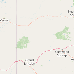
Use this park location map to pinpoint Grand Mesa National Forest in United States of America, understand its exact geographic position, and read its mapped placement within the surrounding landscape more clearly.

Pigeon | © OpenStreetMap contributors

Location context for Grand Mesa National Forest

Colorado
Recorded earthquake history

Examine the Recorded Earthquake History for Grand Mesa National Forest

Consult the historical catalogue of seismic events recorded in the vicinity of Grand Mesa National Forest. These records map past activity across the Colorado plateau and surrounding regions. MoriAtlas provides these documented references for understanding the regional seismic footprint and geological history of the landscape.

Grand Mesa National Forest Earthquake History

Catalogued events

20 events

Strongest magnitude

Magnitude 4

Most recent event

Apr 3, 2025

This history includes earthquakes recorded inside the park or within 50 km of its borders

Explore high-country scenery, basalt cliffs, and subalpine habitats across protected western Colorado terrain.

Grand Mesa National Forest Photos and Landscapes: Visualizing the World's Largest Flat-Top Mountain

Photographic collections reveal the expansive topography of Grand Mesa National Forest, capturing basalt-capped plateaus and reservoir-dotted high country. Visual records help researchers examine montane forest cover and protected landscapes across the Colorado Western Slope.

A wide, elevated landscape view featuring a large, flat topped mesa in the distance under a clear blue sky, with a vast coniferous and deciduous forest covering the foreground and midground.

Park atlas

Compare surrounding high country terrain and connected western Colorado reserves

Parks Near Grand Mesa National Forest And Related Protected Landscapes

Expand protected area discovery beyond Grand Mesa National Forest by examining adjacent national forests and regional mountain terrain. Connecting these neighboring reserves provides a clearer picture of the wider western Colorado conservation network.
Wildlife reserveColorado
10 km away#1 closest

Southwest

Dominguez Canyon Wilderness: Protected Sandstone Canyons of the Uncompahgre Plateau

An expansive BLM wilderness area in western Colorado.

Dominguez Canyon Wilderness protects a diverse landscape of sandstone cliffs, benches, and deep drainage systems that descend from the Uncompahgre Plateau. The geography spans high-desert mesa tops and lush riparian canyons, offering a significant protected area within the Dominguez-Escalante National Conservation Area framework.

Area
268.2 km²
Established
2009
IUCN
Ib
Relief
Upland
Protected areaColorado
24 km away#2 closest

East

Raggeds Wilderness: Geographic Profile and Protected Area Mapping for the Elk Mountains

High altitude wilderness terrain in west-central Colorado

Raggeds Wilderness encompasses over 65,000 acres of protected high-country terrain in the Elk Mountains. This atlas record provides a detailed look at the park, covering its dramatic vertical transitions from deep forest drainages to jagged peaks and its function as a major node in the regional wilderness network.

Area
264.64 km²
Established
1980
IUCN
Ib
Relief
Mountain
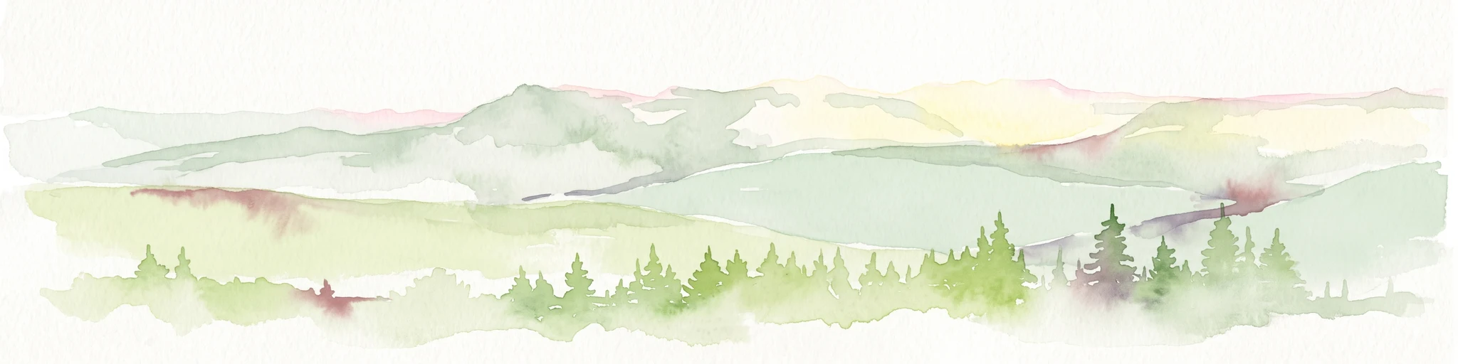
A watercolor painting showing a panoramic view of rolling green mountains with a winding stream through a forested valley.
Protected landscapeUtah
33 km away#3 closest

West

Manti, La Sal National Forest: Geographic Overview of Utah's Mountain and Canyon Landscapes

Mapped protected forest boundaries across the Colorado Plateau

Spanning over one million acres, Manti, La Sal National Forest defines a critical segment of Utah geography. This protected landscape encompasses diverse terrain including subalpine mountains, aspen-rich uplands, and deep canyon networks. Use this atlas to examine the distinct environmental characteristics that separate the northern forested plateaus from the southern wilderness canyons.

Area
5,143.09 km²
Established
1950
IUCN
V
Visitors
900K annual
National parkMontrose County
35 km away#4 closest

South

Black Canyon of the Gunnison National Park: Protected Area Geography and Mapped Landscape

Explore the natural terrain and protected boundaries in Montrose County.

Black Canyon of the Gunnison National Park is a national park defined by its profound geological features and its status as a protected landscape. Located within Montrose County, it offers a distinct geographic profile for atlas-based exploration. Users can understand the park's mapped boundaries, its relation to the surrounding regional geography, and the unique natural terrain that defines this protected area, contributing to a structured discovery of its natural landscape identity.

Area
124.4 km²
Established
1999
IUCN
II
Visitors
357.1K annual
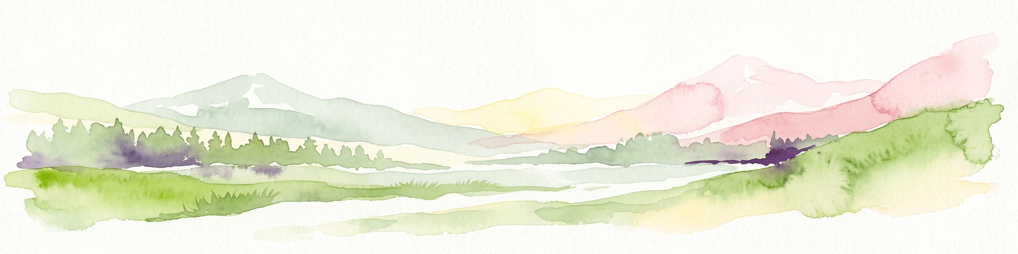
A horizontal watercolor illustration depicting soft layers of green rolling hills, a band of trees, and distant pinkish mountain peaks against a white background.
Protected landscapeColorado
About 48 km away#5 closest

Southeast

Gunnison National Forest: Atlas and Geographic Overview of a Colorado Protected Landscape

Mapping deep wilderness areas and high mountain watersheds

Spanning over one million acres in western Colorado, this protected landscape features dramatic glaciated valleys, subalpine meadows, and iconic volcanic features. The forest anchors the Gunnison River headwaters and offers significant insights into the ecological structure of the Southern Rocky Mountains and its dense concentration of wilderness zones.

Area
6,766.89 km²
Established
1905
Relief
Mountain
Climate
Alpine
National parkUtah
59 km away#6 closest

West

Arches National Park: Utah National Park Protected Landscape Exploration

Explore mapped terrain and geographic context.

Delve into the specifics of Arches National Park, a protected national park located in Utah. This atlas-focused entry provides detailed insight into the park's protected landscape features and geographic distribution. Understand the mapped park boundaries and the unique natural terrain that shapes this significant conservation area within the United States' broader regional geography.

Area
310.31 km²
Established
1971
IUCN
II
Visitors
1.5M annual
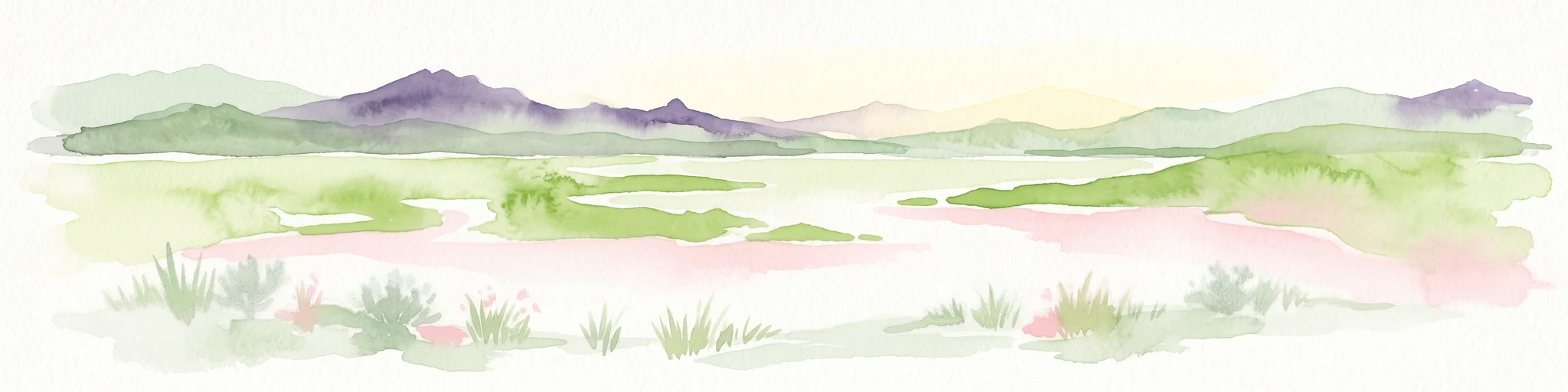
A minimalist watercolor illustration showing soft green hills, purple mountains in the background, and a reflective water body in the foreground.
Protected areaColorado
About 63 km away#7 closest

Southeast

Curecanti National Recreation Area: Mapped Geography and Protected Landscapes of Western Colorado

River-based recreation and volcanic canyon terrain

Curecanti National Recreation Area stretches across Gunnison and Montrose counties, serving as a primary water-based protected landscape in Colorado. The area preserves the geologic transitions from the broad expanse of Blue Mesa Reservoir to the granite-walled canyons of Morrow Point and Crystal, offering a deep look into the regional geography and historical infrastructure of the Gunnison basin.

Area
174.4 km²
Established
1965
Visitors
807.1K annual
Relief
Mountain
A soft watercolor illustration featuring rolling, flat-topped mountains in the background and a dense line of coniferous trees across the foreground.
Protected areaUnited States of America
About 76 km away#8 closest

Northeast

Flat Tops Wilderness: Protected Geographic Landscapes of the Colorado Rockies

High-altitude volcanic plateaus and glaciated terrain

Spanning 235,000 acres, Flat Tops Wilderness stands out as a foundational protected area in Colorado. Its unique basalt cap, carved by glacial activity into an array of high-country lakes and distinctive ridges like the Devils Causeway, creates a rare geographic profile. This overview details the structural features and regional terrain that distinguish this wilderness from the surrounding Rocky Mountain summits.

Area
951.88 km²
Established
1975
Relief
Mountain
Climate
Alpine

Common questions about visiting, size, designation, and location context for Grand Mesa National Forest

Grand Mesa National Forest FAQs for park facts, access, geography, and protected area context

Find quick answers about Grand Mesa National Forest, including protected-area facts, park geography, trail and visitor context, and how the park fits into its surrounding country and regional landscape.
MoriAtlas Explorer

Continue Your Protected Areas Search Across the Global Atlas

Deepen your exploration by continuing the structured search for national parks and protected areas worldwide. Utilize the comprehensive filtering capabilities to compare different conservation landscapes and refine your understanding of global park geography. Discover more about the distribution and characteristics of protected natural areas.

Global natural geography