
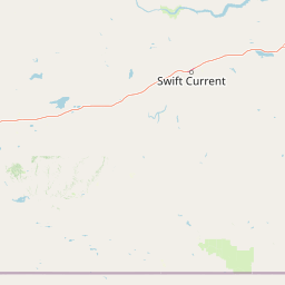
Streams
Park geography
Examining mapped boundaries, terrain relief, and regional landscape characteristics
Comprehensive Geographic Profile of Grasslands National Park in Saskatchewan, Canada
Grasslands National Park covers 907 square kilometers of upland terrain within the Saskatchewan region of Canada. The geographic profile details the park boundaries, stream networks, and diverse landscape features, including valleys, hills, cliffs, and expansive grasslands.
Related tags
Prairie GrasslandsCanadian National ParksDark-Sky PreserveEndangered EcosystemsBison Reintroduction
Protecting Canada's last remaining dry mixed-grass prairie
Grasslands National Park
Grasslands National Park is a Canadian national park located in southern Saskatchewan near the village of Val Marie. It represents one of the nation's few remaining areas of undisturbed dry mixed-grass and shortgrass prairie, protecting a critically endangered ecosystem that once covered much of the Great Plains. The park consists of two separate parcels, the East Block and West Block, situated north of the U.S. state of Montana along the Canada-United States border. Established in 1981, it is one of only two national parks in Saskatchewan and part of Canada's national park system managed by Parks Canada. The park lies within the World Wildlife Fund-defined Northern short grasslands ecoregion, which spans southern Saskatchewan, southern Alberta, and the northern Great Plains states. The unique landscape and harsh, semi-arid climate create niches for several specially adapted plants and animals, many of which are found nowhere else in Canada. The park is notably home to the country's only black-tailed prairie dog colonies and supports populations of plains bison, pronghorns, and endangered species including the black-footed ferret. Grasslands National Park holds special significance as both an ecological preserve and a cultural landscape. The area is Treaty 4 land of the Blackfoot (Niitsítapi) people and holds important historical associations with Indigenous peoples and later European exploration. The park was designated a dark-sky preserve in 2009, making it one of the few places in Canada where visitors can experience truly dark night skies and observe the Milky Way unobstructed by light pollution.
- Location
- Canada
- Park type
- National park
- Established
- 1981
- Area
- 907 km²
Location overview
Administrative placement and high-level geographic status in Saskatchewan
Grasslands National Park Geographic Location and Regional Profile
Grasslands National Park is situated within the province of Saskatchewan in Canada. Mapped geographic records confirm its status as an inland protected landscape with no coastal, island, or marine territories.
- Countries
- Canada
- Regions
- Saskatchewan
- Primary location
- Saskatchewan
- Geographic setting
- Inland
Boundary and coordinates
Mapping the 907 square kilometer spatial extent and geographic limits
Mapped Geographic Boundaries of Grasslands National Park
Detailed spatial boundaries illustrate the geographic perimeter and regional footprint of Grasslands National Park. Integrated spatial metrics provide calculated area totals, geographic centers, and coordinate limits for deeper study.
- Boundary area
- 782.8 km²
- Boundary perimeter
- 312 km
- Northernmost point
- 49.2181° N
- Southernmost point
- 48.9997° N
- Easternmost point
- 106.5075° W
- Westernmost point
- 107.7324° W
- Geographic centre
- 49.1036° N, 107.174° W
- North–south span
- 24.3 km
- East–west span
- 89.4 km
Terrain and natural features
Upland terrain classifications and recorded natural features
Grasslands National Park Terrain and Named Natural Features
Upland terrain classifications define the protected landscape alongside recorded streams, rivers, viewpoints, and peaks situated within the park boundaries. Linked feature cards supply names, types, and spatial relationships for each recorded natural landmark.
Selected named natural features
Streams
Frenchman River
Streams
Butte Creek
Streams
Boggy Creek
Viewpoints
Ta Sunka Watógla
Streams
Hellfire Creek
Environmental setting
Arid upland terrain, steppe habitats, and sparse forest cover categories
Grasslands National Park Environmental Classifications and Physical Setting
Recorded habitat types, climate zones, and landscape features organize the physical setting of Grasslands National Park into broad interpretive categories. Connected taxonomy links recorded attributes to relevant atlas destinations across related regional protected areas.
- Relief
- Upland
- Climate
- Arid
- Water
- Minor water
- Forest cover
- Sparse forest
- Seasonality
- Year-round
Landscape features
Valleys · Hills · Cliffs · Canyon · Forest · Grassland · Rivers
Habitat types
Grassland · Steppe
Park atlas
Explore the unique prairie ecosystems and conservation landscapes across the surrounding Great Plains region
Discover Other National Parks and Protected Areas Near Grasslands National Park
Continue your atlas exploration beyond Grasslands National Park by comparing nearby national parks and related protected areas across the Northern short grasslands ecoregion. Trace the geographic spread of crucial conservation landscapes and understand their place within the broader Great Plains context.
Wildlife reserveSaskatchewan
About 7.4 km away#1 closest
South

Réserve nationale de faune de Longspur: Saskatchewan Mixed-Grass Prairie Protected Area
Mapping federal wildlife reserve boundaries in southern Saskatchewan.
Located in the Rural Municipality of Val Marie, this wildlife reserve safeguards a rare combination of indigenous mixed-grass prairie and cultivated land. The area functions as a critical sanctuary for nesting songbirds, providing the expansive, open horizon terrain necessary for healthy native grass communities within the larger Saskatchewan agricultural landscape.
- Area
- 1.934 km²
- Established
- 2025
- IUCN
- IV
- Relief
- Lowland
Wildlife reserveSaskatchewan
About 15 km away#2 closest
Northwest
Val Marie Reservoir Migratory Bird Sanctuary: Protected Wetland Geography in Saskatchewan
A critical migratory bird habitat and prairie reservoir
Located in the southwestern plains of Saskatchewan, Val Marie Reservoir Migratory Bird Sanctuary forms a water-dominated mosaic of mudflats, marshes, and nesting islands. This protected area supports the central flyway by maintaining open water for waterfowl, serving as a primary sanctuary for colonial nesting birds within the larger mixedgrass prairie ecosystem.
- Area
- 4.31 km²
- Established
- 1948
- IUCN
- V
Wildlife reserveSaskatchewan
200 km away#3 closest
Northeast
Wascana Lake Migratory Bird Sanctuary: Geographic Overview and Protected Wetland Boundaries
A vital wildlife reserve located in Regina, Saskatchewan
Explore the unique geography of Wascana Lake Migratory Bird Sanctuary, where a managed reservoir creates a rich wetland habitat for migratory waterfowl. This protected area stands as a significant ecological site within the Saskatchewan prairie landscape, offering a rare look at riparian terrain integration inside a major urban center.
- Area
- 1.04 km²
- Established
- 1956
- Relief
- Lowland
- Climate
- Temperate
Wildlife reserveSaskatchewan
About 204 km away#4 closest
Northwest
Great Sandhills National Wildlife Area: Saskatchewan Protected Dune and Prairie Landscapes
Mapping the natural features and protected boundaries of this significant wildlife reserve.
The Great Sandhills National Wildlife Area represents a vital contemporary conservation effort in southwestern Saskatchewan. It encompasses a compact but biologically dense mosaic of stabilized dune fields, native mixed-grass prairie, and alkaline wetland basins. This protected area stands as a representative example of Canada's evolving strategy to preserve the most ecologically significant parcels of the prairie landscape, offering deep insights into the region's specific terrain and habitat patterns.
- Area
- 4.7 km²
- Established
- 2025
- IUCN
- IV
- Relief
- Lowland
Protected landscapeNorth Dakota
229 km away#5 closest
Southeast

Little Missouri National Grassland: Geography and Protected Landscape Context
Exploring North Dakota's expansive badlands and prairie terrain
Spanning over a million acres, Little Missouri National Grassland stands as a massive protected landscape in western North Dakota. This area showcases the complex transition where open mixed-grass prairie meets the eroded, rugged badlands of the Little Missouri River corridor. Home to White Butte, the state's highest point, the grassland offers a unique topographic profile of buttes, canyons, and canyons that defines the region's broader geographic and conservation character.
- Area
- 4,163.34 km²
- Established
- 1960
- Relief
- Upland
- Climate
- Temperate
Wildlife reserveSaskatchewan
About 255 km away#6 closest
Northeast
Zugvogelschutzgebiet Indian Head: A Wildlife Reserve in Saskatchewan Prairie Landscapes
Examining mapped boundaries and protected wetland terrain
Zugvogelschutzgebiet Indian Head represents a significant conservation footprint within the Saskatchewan prairie region. This wildlife reserve integrates managed wetlands and historic nursery grounds, showcasing how agricultural landscapes support migratory bird populations. Gain insight into its terrain, ecoregion placement, and the geographic history of these protected lands through our structured atlas data.
- Area
- 0.32 km²
- Established
- 1924
- Relief
- Lowland
- Scope
- Terrestrial
Wildlife reserveSaskatchewan
About 264 km away#7 closest
East
Moose Mountain Creek National Wildlife Area Protected Habitat and Geographic Atlas
A preserved prairie wetland complex in southeastern Saskatchewan.
Moose Mountain Creek National Wildlife Area is a federal reserve in Saskatchewan that protects a rare assembly of four distinct habitat types. The land features a functional mix of freshwater marshes, native mixed-grass prairie, and trembling aspen groves. This structured protected area highlights the importance of preserving remnant prairie ecosystems within a broader agricultural region, providing a critical baseline for understanding local geography.
- Area
- 1.63 km²
- Established
- 2025
- IUCN
- IV
- Relief
- Lowland

Protected landscapeMontana
272 km away#8 closest
Southwest
Helena-Lewis and Clark National Forest: Geographic Overview and Protected Area Map
Montana wilderness spanning the Continental Divide
Spanning from the rolling eastern plains to the crest of the Northern Rockies, Helena-Lewis and Clark National Forest serves as a massive protected landscape in central Montana. This forest system protects eight unique mountain ranges and critical wilderness corridors, offering a comprehensive look at the ecological transition zones of the American Mountain West.
- Area
- 11,000 km²
- Established
- 1897
- Relief
- Mountain
- Climate
- Temperate
MoriAtlas Explorer
Continue exploring Grasslands National Park's protected landscape and Saskatchewan geography
Deepen your understanding of Grasslands National Park by delving into its specific geographic context and protected area characteristics. This dedicated space allows for focused exploration of its mapped terrain and regional landscape identity within Saskatchewan. Discover the structured atlas information that reveals the essential geographic and conservation details of this significant national park.
Browse next
Global natural geography
Explore related park routes
Explore MoriAtlas Global ParksBrowse All MoriAtlas ParksGlobal Park Map DiscoveryMoriAtlas: Browse All CountriesBrowse All MoriAtlas ContinentsNational Park Environment AtlasGrand Canyon National Park AtlasYellowstone National Park AtlasYosemite National Park Atlas and GeographySerengeti National Park AtlasGalápagos National Park Protected LandscapeBanff National Park Geography and AtlasKruger National Park Atlas EntryUluṟu-Kata Tjuṯa National Park AtlasExplore Uluru-Kata Tjuta National Park GeographyPlitvice Lakes National Park AtlasFiordland National Park Protected LandscapeGreat Smoky Mountains National Park AtlasAfghanistan National Parks and Protected AreasAlbania National Parks and Protected AreasAlgeria National Parks and Protected AreasAmerican Samoa National Parks and Protected AreasAndorra National Parks and Protected AreasAngola National Parks and Protected AreasAntarctica National Parks and Protected AreasAntigua and Barbuda Park List