Mountain saddles
Dry Sluice Gap
1,579.1 m

A structured analysis of regional boundaries, elevation metrics, and natural terrain.
This geographic profile details the physical dimensions and environmental characteristics of Great Smoky Mountains National Park. Discover recorded boundary measurements, elevation data ranging from 267 to 2025 meters, and insights into the dominant mountain, forest, and riverine landscapes that define this protected area within Tennessee and North Carolina.
Related tags
The most biodiverse national park in the United States, protecting ancient Appalachian mountains, misty forests, and a rich cultural heritage
Great Smoky Mountains National Park is a sprawling protected area that straddles the border between Tennessee and North Carolina in the southeastern United States. The park encompasses the majority of the Great Smoky Mountains, a subrange of the Blue Ridge Mountains that forms part of the Appalachian temperate rainforest, one of the most ecologically significant forest types in North America. This mountainous region contains some of the highest elevations in eastern North America, with Kuwohi rising to 6,643 feet as the tallest peak in Tennessee and the third-highest mountain east of the Mississippi River. The park covers over 522,000 acres, making it one of the largest protected areas in the eastern United States, and preserves a remarkable diversity of ecosystems ranging from cove hardwood forests in the lower elevations to spruce-fir forests atop the highest peaks. Established in 1934 and officially dedicated by President Franklin D. Roosevelt in 1940, the park holds the distinction of being the most visited national park in the United States, welcoming more than 12 million visitors annually. The park was designated a UNESCO World Heritage Site in 1983 and an International Biosphere Reserve in 1988, recognizing its outstanding universal value in terms of biodiversity and natural heritage.
Administrative boundaries across North Carolina and Tennessee counties
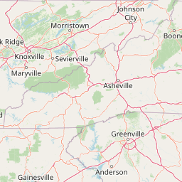
Spatial footprint and coordinate span across 2,114 square kilometers
Recorded figures from 267 to 2,025 metres with named features
Mountain saddles
1,579.1 m
Mountain saddles
613.7 m
Waterfalls
Peaks
1,505.1 m
Peaks
1,798 m
Peaks
1,819 m
Temperate mountain relief, dominant forest cover, and diverse hydrological features
Mountains · Valleys · Cliffs · Forest · Grassland · Rivers · Waterfalls
Temperate broadleaf forest · Temperate coniferous forest · Boreal forest · Montane forest · Alpine meadow · Grassland · Shrubland · Heath · Riverine habitat · Karst habitat
Compare the diverse mountain landscapes and protected-area geography of the wider Appalachian region.

Southeast

An extensive mountain forest in western North Carolina
Pisgah National Forest represents a major protected landscape in the southern Appalachian Mountains of North Carolina. Its diverse terrain includes high peaks above 6,000 feet, dense hardwood forests, and deep river gorges. Recognized as a historic center for professional forestry, the area protects extensive watersheds and wilderness zones, offering a detailed case study in Appalachian geography, conservation science, and rugged mountain topography.

South
Mapping deep river gorges and temperate rainforests in North Carolina
The Nantahala National Forest represents a significant conservation achievement, encompassing diverse southern Appalachian mountain terrain. The landscape features deep river gorges, ancient old-growth forests, and extensive networks of waterfalls. This overview provides mapped context on its vast wilderness areas, including Joyce Kilmer-Slickrock, and the long-distance trail corridors that traverse this temperate rainforest region.

Southwest
Old-growth Appalachian wilderness in North Carolina
Analyze the dramatic valley-and-ridge geography of the Joyce Kilmer-Slickrock Wilderness. This protected area, encompassing the rare Joyce Kilmer Memorial Forest, serves as a vital reference for eastern forest conservation, featuring ancient hardwood groves and sweeping mountain vistas across the Unicoi range.

Southeast
Rugged ridges and headwaters in the Pisgah National Forest
Middle Prong Wilderness encompasses nearly 7,900 acres of protected southern Appalachian terrain. This rugged landscape, ranging from deep valley floors to wind-swept high-elevation ridges, serves as a vital protected corridor adjacent to Shining Rock Wilderness, showcasing a complex mosaic of hardwood and spruce-fir forest ecosystems within the Blue Ridge Mountains.
West
Protected mountain terrain in the Tennessee foothills
Gee Creek Wilderness is a federally protected area in southeastern Tennessee characterized by its small, roadless footprint and rich Appalachian forest composition. The reserve showcases the dramatic intersection of forested ridgelines and stream-carved valleys, providing a concentrated look at the ecological character of the Cherokee National Forest's lower Appalachian zone.

Southeast
A rare tri-state wilderness in the Southern Appalachian Mountains
Discover the mapped terrain of Ellicott Rock Wilderness, a protected area defined by its steep river gorges, dense cove forests, and unique position at the tripoint of three U.S. states. This wilderness area preserves the Chattooga River corridor and historic survey landmarks within the southern Blue Ridge Mountains, offering deep insight into the regional geography of the American southeast.

Southeast
Bridging Piedmont forests and Appalachian mountain foothills
Sumter National Forest offers a study in geographic contrast, as its three districts span the transition from South Carolina Piedmont ridges to the rugged spurs of the Blue Ridge Mountains. This protected area features the Chattooga Wild and Scenic River corridor, expansive hardwood-conifer mosaics, and complex mountain watersheds. The forest provides a window into regional land restoration, where reclaimed farmland and mountain ridges now form a continuous network of protected natural terrain.

South
High-elevation wilderness area in northern Georgia.
Spanning steep ridges and narrow valleys, Raven Cliffs Wilderness represents a significant protected area within the Chattahoochee National Forest. The landscape transitions from high, exposed ridgelines to dense hardwood forest, offering a compact yet varied study in Appalachian mountain geography.
Deepen your understanding of Great Smoky Mountains National Park by exploring its detailed geographic features and protected landscape context. This national park offers rich opportunities for map-based discovery, revealing its unique terrain and its significance within the regional geography of Tennessee and beyond. Continue to uncover the mapped boundaries and ecological richness that define this important protected area.