
Mori Atlas logo
State or regional parkGuajataca State Forest

Mapping the extensive cave networks, limestone mogotes, and forest trails of this regional reserve

Guajataca State Forest: A Protected Karst Landscape in the Northwest of Puerto Rico

Guajataca State Forest represents a critical protected landscape within the Northern Karst belt of Puerto Rico. Spanning the municipalities of Isabela and Quebradillas, this forest preserves a complex terrain defined by limestone dissolution, conical mogote hills, and deep sinkholes. The area functions as a vital corridor for endemic biodiversity and birdlife, offering insight into the geological processes that have shaped this unique Caribbean environment.

karst landscapemogotescave systemsubtropical foreststate foresthiking trails
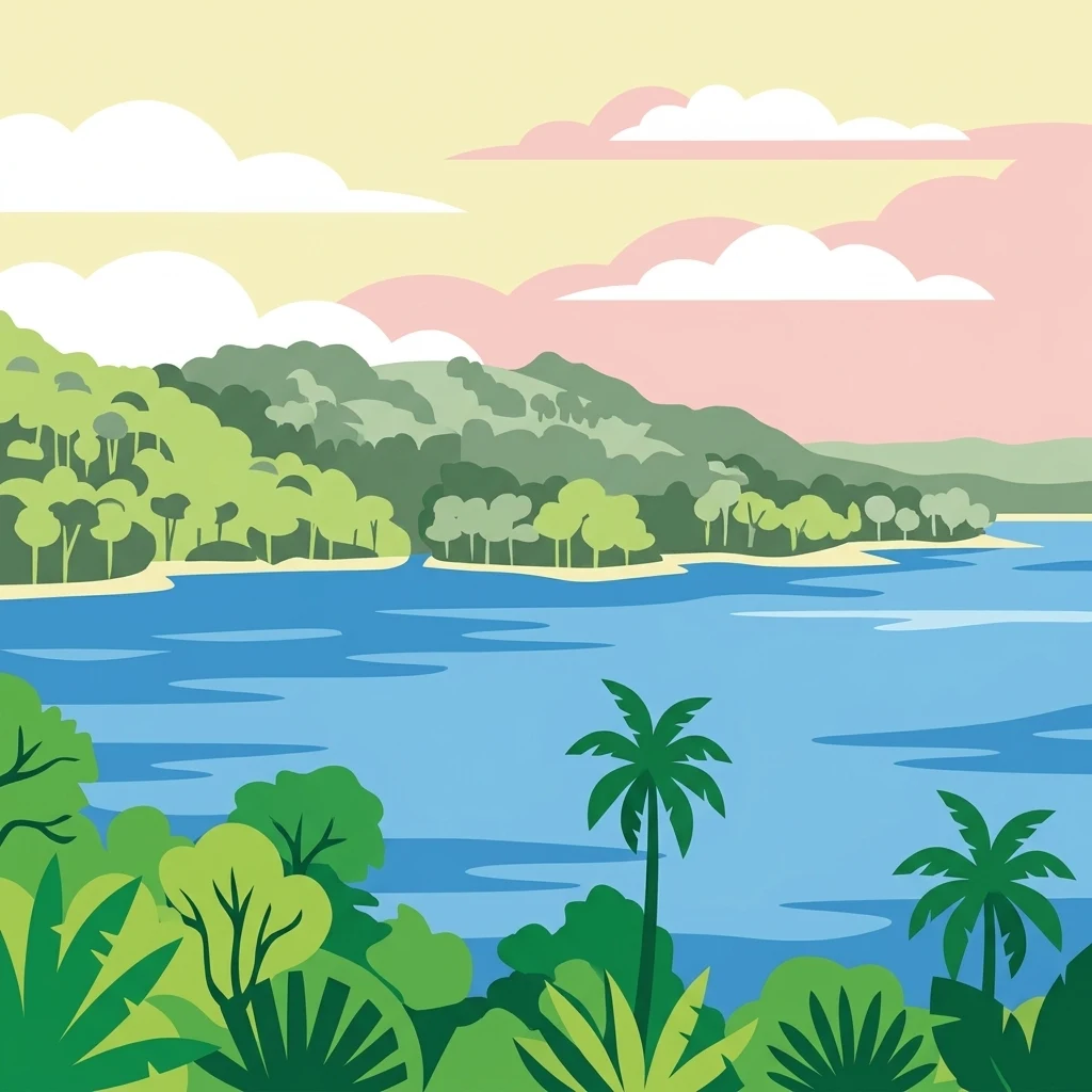
A flat-style digital illustration showing a lush green forest landscape overlooking a lake under a colorful pastel sky with clouds.

Guajataca State Forest

State or regional park

Park overview

Structured park overview, official facts, and landscape profile for Guajataca State Forest

Guajataca State Forest park facts, protected area profile, and essential visitor context

Review the core facts for Guajataca State Forest, including designation, size, terrain, visitor scale, habitats, and operating context in one park-focused overview.

About Guajataca State Forest

Guajataca State Forest occupies a strategic position in northwestern Puerto Rico, spanning parts of the municipalities of Isabela and Quebradillas near the towns of Camuy and San Sebastián. It lies at the heart of the Northern Karst zone, a landscape defined by limestone bedrock that has been slowly dissolved by water over millions of years, producing a dramatic terrain of steep mogotes, sinkholes, canyons, and underground cave systems.

The forest is one of the twenty state forests that, together, form Puerto Rico's public forest system. Its character is shaped by the underlying geology of the Aymamón and Aguada limestone formations, which together create the mogote-dominated hills and the cave-rich lowlands that define the area. Beyond geology, the protected area is valued for its mix of montane vegetation clinging to the steep karst and lower-elevation forest in the valleys, making it a compact but ecologically rich reserve.

From a recreational perspective, Guajataca stands out within the Puerto Rico state forest network. It hosts more than 44 kilometers of marked hiking trails, picnic areas, and designated camping sites, and it is widely regarded as the most extensive trail system in the Commonwealth's forest network. Although Guajataca Lake lies close to the forest and shares its name, the lake and its recreational facilities are administratively and geographically separate from the state forest itself, a common source of confusion for visitors.

Protection and recognition

Examine the established designation timeline and management scope for this protected area.

Guajataca State Forest Protection Status and Terrestrial Designation History

Guajataca State Forest maintains a documented terrestrial protection status established in nineteen seventy five. Review the complete designation history and management framework associated with this conservation landscape.

Protection details

Protection scope
Terrestrial
Designated year
1975
Transboundary protection
No
Park context

Deeper park guide and search-rich context for Guajataca State Forest

Guajataca State Forest history, landscape, wildlife, and travel context

Explore Guajataca State Forest through its history, landscape character, ecosystems, wildlife, conservation priorities, cultural context, and seasonal travel timing in a structured park guide built for atlas discovery and search intent.

Why Guajataca State Forest stands out

Guajataca State Forest is best known for its dramatic karst topography, particularly the steep, isolated mogote hills and the extensive cave systems that run beneath them. Among its caves, Cueva del Viento is the most celebrated feature, an accessible cavern with stalactites, stalagmites, and thriving bat colonies. The forest is also recognized for having the largest trail network of any forest in Puerto Rico's public forest system, surpassing even El Yunque National Forest in total trail length. Its recognition as part of an Important Bird Area reinforces its significance for endemic and migratory birdlife across the Northern Karst belt.
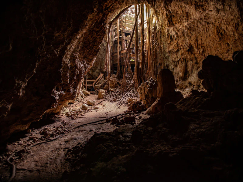
Interior view looking toward the sunlit entrance of a limestone cave, with tangled tree roots hanging from the opening above.
The entrance to Cueva del Viento, showing karst limestone formations and hanging roots at Guajataca State Forest.

Guajataca State Forest history and protected-area timeline

The Guajataca forest reserve dates back to 1943, when the Puerto Rico Reconstruction Administration set the area aside to preserve the flora and fauna of the karstic landscape of northwestern Puerto Rico. This early protection laid the foundation for what would eventually become one of the state's most ecologically distinctive forests.

In 1975, the reserve was formally incorporated into the Puerto Rico state forest system through Law 133, which broadened and standardized the legal protections applied to the Commonwealth's forest reserves. Today, the forest is administered by the Puerto Rico Department of Natural and Environmental Resources (DRNA), which continues to manage its trails, camping areas, and cave resources. The forest's role within the Northern Karst Belt was further recognized in 2007 when it was designated an Important Bird Area by BirdLife International.

Guajataca State Forest landscape and geographic character

Guajataca State Forest is fundamentally a karst landscape. The underlying bedrock consists of limestone from the Aymamón and Aguada formations, part of the tertiary limestone belt of northwestern Puerto Rico. Over time, the dissolution of this soluble rock has produced a topographically complex surface of mogotes, deep sinkholes, dry valleys, and underground drainage networks.

The mogotes are the most visually striking feature: sub-conical hills that rise steeply from the surrounding lowlands, separated by solution sinks and seasonal streambeds. Between these hills, the Aguada limestone supports an extensive network of solutional caves, including the famous Cueva del Viento. Streams fed by the Guajataca River system flow across and through this karst, contributing to the constantly changing conditions inside the caves. Elevation within the forest reaches roughly 1,100 feet, offering elevated viewpoints over the broader karst countryside.
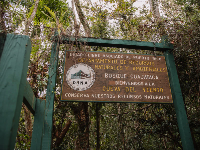
A weathered wooden park entrance sign hanging on a green wooden frame in a dense tropical forest, with text indicating Cueva del Viento and the Puerto Rico Department of Natural Resources.
Entrance sign for the Cueva del Viento trail within Guajataca State Forest.

Guajataca State Forest ecosystems, habitats, and plant life

Vegetation in the Guajataca State Forest is strongly influenced by topography, splitting into two distinct ecological zones. About three-quarters of the forest area supports montane vegetation that clings to the steepest slopes and the mogote summits, while the remaining quarter consists of lowland vegetation spread across the flatter valleys and sinks. This topographic mosaic creates a varied habitat structure within a relatively compact protected area.

The forest supports a high level of botanical diversity, with more than 186 documented tree species, including a substantial number of endemic Puerto Rican trees. Among the recorded endemics are species such as the ceboruquillo and the macho cedar, alongside more widespread forest trees like the bullet tree, Spanish elm, and white indigo berry. The combination of karst microhabitats, varied elevation, and fragmented forest patches contributes to this unusually rich species mix for such a small forest reserve.
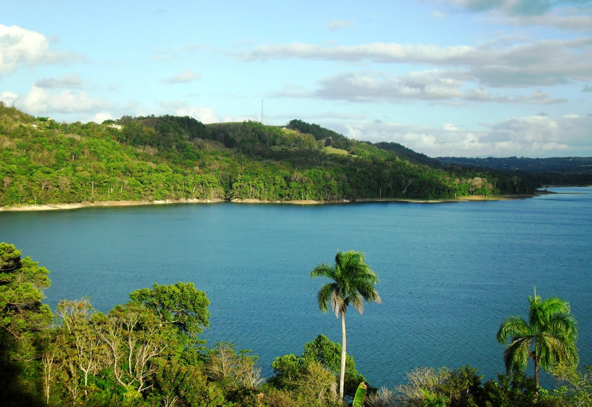
A wide, elevated view of a large blue lake surrounded by rolling, forest-covered karst hills and tropical palm trees.
A scenic view of Lago Guajataca, the central reservoir bordering the Guajataca State Forest in Puerto Rico.

Guajataca State Forest wildlife and species highlights

Wildlife in Guajataca State Forest reflects the broader biodiversity of Puerto Rico's Northern Karst belt. The abundance of caves makes the forest a particularly important refuge for bats, including the Jamaican fruit bat, which is common across the region. Reptiles are also notable: the endangered Puerto Rican boa is recorded within the forest, underscoring the area's value for native herpetofauna.

Avifauna is among the most important features of the forest's biodiversity profile. More than seventy bird species have been recorded, including native, migratory, and endemic species. Endemic species regularly observed include the Puerto Rican woodpecker, Puerto Rican tody, Puerto Rican screech owl, Puerto Rican vireo, Puerto Rican flycatcher, Puerto Rican bullfinch, Puerto Rican spindalis, and Adelaide's warbler. The combined importance of these resident and migratory populations led to the recognition of the Northern Karst Belt, including Guajataca, as an Important Bird Area by BirdLife International in 2007.

Guajataca State Forest conservation status and protection priorities

Guajataca State Forest holds significant conservation value for three interconnected reasons: its karst geology, its habitat diversity, and its biodiversity. Protection of the area preserves a representative example of Puerto Rico's Northern Karst belt, a landscape type that is both ecologically distinctive and physically fragile, where cave systems, sinkholes, and karst soils are easily disturbed by surface activity.

The forest's formal protection history, beginning in 1943 and reinforced through Law 133 in 1975, has allowed ecosystems and species to persist in a setting that would otherwise face pressure from surrounding land use. The recognition of the forest as part of an Important Bird Area further highlights its continental and Caribbean importance for resident, endemic, and migratory bird populations. Continued management by the Puerto Rico Department of Natural and Environmental Resources ensures that habitat quality, trail use, and cave visitation are balanced against the protection of bat colonies and other cave-dependent wildlife.

Top sights and standout views in Guajataca State Forest

Guajataca State Forest's standout qualities are its dramatic karst landforms, especially the mogote-dominated terrain and the extensive cave systems, and the unusually large trail network that makes this geology accessible to visitors. The Cueva del Viento is the most iconic destination within the forest, combining accessible cave exploration with opportunities to observe resident bat colonies and classic karst formations such as stalactites and stalagmites.

Equally notable is the forest's role within the Northern Karst Important Bird Area, a designation that places Guajataca in a wider regional and international context for bird conservation. Together, the geology, biodiversity, and recreational infrastructure make it a particularly well-rounded example of Puerto Rico's karst-protected natural heritage.

Best time to visit Guajataca State Forest

Guajataca State Forest sits in a tropical climate with significant rainfall throughout the year, averaging about 75 inches of precipitation annually. Conditions are generally warm, with average temperatures near the mid-70s Fahrenheit and slightly higher temperatures during the months of July and August.

Because rainfall is distributed across the year, visitors should expect humid, wet conditions in nearly any season, and trails, especially those leading into caves like Cueva del Viento, can be muddy and slippery at any time. Cooler, somewhat drier periods of the year may be more comfortable for longer hikes and cave exploration, while warmer summer months tend to bring heavier rain and lusher vegetation. Planning around weekday or early-morning visits can also help avoid the busiest periods, particularly for the Interpretative Trail and Cueva del Viento.

Monthly climate preview

Long-term representative monthly averages and temperature patterns for Guajataca State Forest

Guajataca State Forest Climate Normals, Annual Temperature and Precipitation Rhythm

Historical monitoring records establish the baseline monthly temperature ranges and precipitation rates measured at representative coordinates across Guajataca State Forest. Detailed monthly climate profiles provide complete multi-year statistical comparisons for researchers studying regional environmental patterns.
Annual mean27 °C
25 °C28 °C
Jan25°
Feb25°
Mar25°
Apr26°
May27°
Jun27°
Jul28°
Aug28°
Sep28°
Oct27°
Nov26°
Dec26°
Warmest month
August

27.9 °C

Coolest month
January

25 °C

Wettest month
September

5.7 mm/day

Driest month
February

1.9 mm/day

Park location guide

Geography guide, regional context, and park location map for Guajataca State Forest

Guajataca State Forest park geography, regions, and map view in Puerto Rico

Understand where Guajataca State Forest sits in Puerto Rico through a broader geographic reading of the surrounding landscape, nearby location context, and its mapped position within the national park landscape.

How Guajataca State Forest fits into Puerto Rico

Puerto Rico is a Caribbean archipelago and island territory of the United States, classified as an unincorporated and organized territory under commonwealth status. Located in the North Atlantic Ocean east of the Dominican Republic, it serves as a significant cultural and economic hub in the region. The territory maintains its own constitution, governor, and legislative assembly while being represented in Congress by a resident commissioner.

Wider geography shaping Guajataca State Forest in Puerto Rico

Puerto Rico is a Caribbean island archipelago located in the North Atlantic Ocean, approximately 1,600 kilometers southeast of Florida. The main island spans about 177 kilometers in length and 65 kilometers in width, with a total land area of approximately 8,868 km². The terrain ranges from coastal plains to mountainous interior regions, with the highest point at Cerro Punta reaching 1,338 meters. The island is bordered by the Atlantic Ocean and Caribbean Sea.

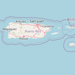
Map view of Guajataca State Forest

Use this park location map to pinpoint Guajataca State Forest in Puerto Rico, understand its exact geographic position, and read its mapped placement within the surrounding landscape more clearly.

Pigeon | © OpenStreetMap contributors

Visual reference of limestone mogotes, cave systems, and tropical karst habitats

Guajataca State Forest Photos, Landscape Scenery, and Protected Area Views

Visual documentation captures the dramatic limestone terrain, steep mogote hills, and complex cave systems that define the protected environment. Photographic records provide clear insight into the regional geology, dense subtropical vegetation, and unique natural features of the reserve.

Interior view looking toward the sunlit entrance of a limestone cave, with tangled tree roots hanging from the opening above.

A hiker with a backpack walks away along a narrow dirt path surrounded by dense tropical forest vegetation and tall bamboo stalks.

A weathered wooden park entrance sign hanging on a green wooden frame in a dense tropical forest, with text indicating Cueva del Viento and the Puerto Rico Department of Natural Resources.

A wide, elevated view of a large blue lake surrounded by rolling, forest-covered karst hills and tropical palm trees.

Park atlas

Compare regional karst terrain and connected protected areas across northern Puerto Rico

Other Parks Near Guajataca State Forest and Surrounding Protected Landscapes

Visitors exploring the limestone terrain of Guajataca State Forest can continue comparing nearby protected areas and regional conservation zones. Extending the search helps connect individual forest geographies with broader regional park networks across the island.
State or regional parkUnited States of America
About 30 km away#1 closest

East

Río Abajo State Forest: Mapping the Karst Terrain and Protected Landscapes of Puerto Rico

Protected karst landscape and regional forest geography

Río Abajo State Forest serves as an essential example of Caribbean karst ecosystems, defined by its steep limestone mogotes, hidden ravines, and extensive sinkhole networks. Located in the northern karst belt of Puerto Rico, the forest provides deep insight into complex subterranean drainage patterns and serves as a primary hub for endangered species recovery within its uniquely broken, three-dimensional terrain.

Area
14.1 km²
Established
1943
Relief
Upland
Climate
Tropical
State or regional parkPuerto Rico
About 32 km away#2 closest

South

Maricao State Forest: A Detailed Map and Geographic Overview of Puerto Rico's Mountain Wilderness

Endemic-rich mountain forests and serpentinite terrain in the Cordillera Central

Maricao State Forest represents a vital protected landscape in the western Cordillera Central of Puerto Rico. This site features distinctive serpentinite geology, complex mountainous watersheds, and diverse endemic bird habitats. The forest serves as a primary geographic anchor along the Ruta Panorámica, providing clear insight into the rugged environmental character of the central island spine.

Area
43.72 km²
Established
1919
Relief
Mountain
Climate
Tropical
A wide watercolor illustration showing a forest scene with trees in the foreground, a winding path or river, and green hills in the background.
Nature reservePuerto Rico
About 40 km away#3 closest

East

Cambalache Forest Reserve: A Detailed Look at Northern Puerto Rico Karst Geography

Protected karst landscape and forest mosaic

Focusing on the rugged limestone mogotes that define the Northern Karst Belt, Cambalache Forest Reserve serves as a vital protected area for endemic flora and fauna. This record provides geographic context on its low-elevation forest structure, the ecological significance of its varied microclimates, and its role as a persistent research site since the mid-twentieth century.

Established
1943
Relief
Upland
Access
Easy access
Scope
Terrestrial
Protected areaAdjuntas
About 41 km away#4 closest

Southeast

Bosque del Pueblo: Protected Forest Geography and Cordillera Central Landscape

A mountain watershed and ecological corridor in Adjuntas

Bosque del Pueblo represents a key protected landscape within the central mountains of Puerto Rico. As a critical forest reserve located in Adjuntas, it preserves headwaters and supports rare bird populations, serving as a permanent ecological link between several major state forest units.

Area
2.987 km²
Established
1995
Relief
Mountain
Climate
Tropical
State or regional parkPuerto Rico
About 41 km away#5 closest

Southeast

Guilarte State Forest: Protected Mountain Ecosystems and Cordillera Central Geography

Highland conservation and mapped mountain terrain in central Puerto Rico

Guilarte State Forest represents a essential protected area in the Cordillera Central of Puerto Rico. The reserve encompasses steep altitudinal shifts, ranging from mid-slope palm forests to summit-level cloud forests. As a headwater region for major river basins, the forest is a focal point for understanding the island's mountainous geography and conservation priorities for endemic species.

Area
19.514 km²
Established
1935
Relief
Mountain
Climate
Tropical
Watercolor painting of a coastal dry forest scene with mangrove-like trees and hills in the background.
State or regional parkPuerto Rico
About 51 km away#6 closest

South

Guánica State Forest: Mapped Geography and Protected Landscapes in Puerto Rico

A diverse Caribbean subtropical dry forest reserve spanning karst terrain and coastal habitats

Guánica State Forest serves as a primary protected natural area in southwestern Puerto Rico, defined by its arid subtropical climate and exceptional ecological diversity. This reserve incorporates a complex mosaic of ecosystems, including deciduous dry forest, mangrove channels, salt flats, and offshore keys. The landscape provides critical habitat for numerous endemic species while preserving the integrity of the Southern Karst geological zone and its surrounding maritime boundaries.

Area
39.97 km²
Established
1919
Relief
Lowland
Climate
Tropical
State or regional parkPuerto Rico
About 51 km away#7 closest

Southeast

Los Tres Picachos State Forest: A Geographic Guide to Puerto Rico's Mountain Protected Areas

Cloud forests, volcanic terrain, and watershed protection

Los Tres Picachos State Forest encompasses a striking landscape in the Puerto Rican interior, marked by deep river valleys and its namesake triple peaks. This atlas feature provides insights into the forest's layered ecological zones and its role as a crucial hydrological anchor for the Toro Negro and Cialitos river systems within the Cordillera Central.

Established
1999
Relief
Mountain
Climate
Tropical
Access
Remote access
A soft watercolor illustration featuring a coastal scene with a calm bay, rocky outcroppings, green hills in the background, and pale pinkish lighting.
State or regional parkPuerto Rico
About 52 km away#8 closest

South

Boquerón State Forest: Geographic Overview of Protected Coastal Wetlands in Puerto Rico

Coastal karst geology and mangrove-lined estuarine habitats

Spanning across Cabo Rojo, Lajas, and Mayagüez, Boquerón State Forest forms an essential protected landscape on the southwestern coast of Puerto Rico. The area provides a detailed atlas of ecological convergence, where extensive mangrove systems meet the dramatic limestone cliffs of the Los Morrillos peninsula and historic salt flats. This resource provides a deep look into the spatial distribution of these coastal habitats and their critical function in supporting Caribbean biodiversity and migratory bird flyways.

Established
1918
Relief
Lowland
Climate
Tropical
Access
Easy access

Common questions about visiting, size, designation, and location context for Guajataca State Forest

Guajataca State Forest FAQs for park facts, access, geography, and protected area context

Find quick answers about Guajataca State Forest, including protected-area facts, park geography, trail and visitor context, and how the park fits into its surrounding country and regional landscape.
MoriAtlas Explorer

Continue Your Protected Areas Search Across the Global Atlas

Deepen your exploration by continuing the structured search for national parks and protected areas worldwide. Utilize the comprehensive filtering capabilities to compare different conservation landscapes and refine your understanding of global park geography. Discover more about the distribution and characteristics of protected natural areas.

Global natural geography