
Mori Atlas logo
State or regional parkGuánica State Forest

Examine the mapped boundaries and complex karst terrain of this significant Caribbean Biosphere Reserve

Guánica State Forest: A Protected Subtropical Dry Forest Landscape in Southwestern Puerto Rico

(Bosque Estatal de Guánica)

Guánica State Forest represents a benchmark for subtropical dry forest conservation, sitting within the dry orographic rain shadow of Puerto Rico. This expansive protected area showcases a mosaic of habitats, ranging from limestone cliffs and arid deciduous forest to mangrove lagoons, salt flats, and coastal coral reefs. By tracing the geographic features across the Southern Karst region, researchers and explorers can understand the environmental factors that sustain such a unique concentration of endemic wildlife and Caribbean dry forest ecosystems.

subtropical dry forestCaribbean dry forestbiosphere reserveprotected natural areakarst landscapelimestone cliffs
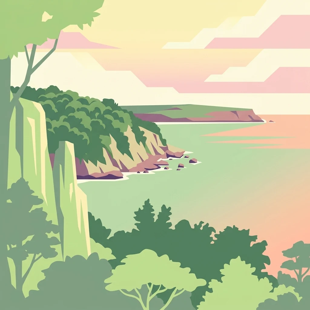
A stylized vector-style illustration of a coastal dry forest overlooking a calm sea at sunset, featuring layered cliffs and lush vegetation.

Guánica State Forest

State or regional park

Park overview

Structured park overview, official facts, and landscape profile for Guánica State Forest

Guánica State Forest park facts, protected area profile, and essential visitor context

Review the core facts for Guánica State Forest, including designation, size, terrain, visitor scale, habitats, and operating context in one park-focused overview.

About Guánica State Forest

Guánica State Forest, popularly known as the Guánica Dry Forest, occupies a critical position in the ecology of Puerto Rico and the wider Caribbean. It lies in the southwestern corner of the island, in the rain shadow of the Cordillera Central, where annual rainfall averages only around 791 millimeters and temperatures regularly exceed 100 degrees Fahrenheit in exposed areas. This aridity, combined with the karst geology of the Southern Karst region, has produced a subtropical dry forest ecosystem that differs sharply from the lush rainforests of the island's northern mountains. As a result, Guánica preserves ecological conditions that have largely disappeared from elsewhere in the Caribbean due to agriculture, development, and land conversion.

The reserve spans roughly 10,000 acres across the municipalities of Guánica, Guayanilla, Peñuelas, Ponce, and Yauco, although the forest units within Peñuelas and Ponce consist primarily of keys and small islands offshore. In addition to its upland dry forests, the protected area extends to the coast and into the sea, embracing sandy beaches, rocky shores, mangrove forests, seagrass prairies, coral reefs, saltwater lagoons, and salt flats. This juxtaposition of marine and terrestrial ecosystems, all anchored in a karstic landscape of limestone, fine lime soils, sand, and clay, gives the forest exceptional complexity for a relatively compact reserve.

Guánica's ecological significance has earned it a sequence of formal protections. It began as a forest reserve in 1919, became a United Nations Biosphere Reserve in 1981, was designated a nature reserve by the Puerto Rico Planning Board in 1985 under Law No. 133 of 1975, and was designated an Important Bird Area by BirdLife International in 2007. Today it is administered by the Puerto Rico Department of Natural and Environmental Resources, known by its Spanish acronym DRNA, and stands as both a working conservation site and a key reference area for the study of tropical and subtropical dry forests worldwide.

Quick facts and research context for Guánica State Forest

Guánica State Forest is a Commonwealth of Puerto Rico public reserve covering approximately 9,878 acres (around 39 square kilometers), making it the largest of Puerto Rico's twenty state forests. It was established in 1919 as a forest reserve, designated a United Nations Biosphere Reserve in 1981, given nature reserve protections in 1985 under Puerto Rico Law No. 133, and recognized as an Important Bird Area by BirdLife International in 2007.

The reserve sits within Puerto Rico's driest region, in the orographic rain shadow of the Cordillera Central, on the Southern Karst geology of the island. It extends across five municipalities, with the forest units in Peñuelas and Ponce consisting mainly of keys and small offshore islands. The site lies within the WWF classified Puerto Rican dry forests ecoregion and is administered by the Puerto Rico Department of Natural and Environmental Resources (DRNA).

Protection and recognition

Documented management scope and official establishment timeline

Guánica State Forest Protection Status and Designation History

Guánica State Forest holds a mixed protection scope established through designated records dating from 1981. Structured data references outline the administrative framework and international recognition history associated with this protected landscape.

Protection details

Protection scope
Mixed
Designated year
1981
Transboundary protection
No
Park context

Deeper park guide and search-rich context for Guánica State Forest

Guánica State Forest history, landscape, wildlife, and travel context

Explore Guánica State Forest through its history, landscape character, ecosystems, wildlife, conservation priorities, cultural context, and seasonal travel timing in a structured park guide built for atlas discovery and search intent.

Why Guánica State Forest stands out

Guánica State Forest is best known as the best preserved subtropical dry forest in the Caribbean and the finest remaining example of Caribbean dry forest habitat. It is recognized globally for the unusual diversity of ecosystems compressed into a relatively small area, ranging from upland deciduous forest and semi-evergreen forest to mangrove systems, salt flats, coral reefs, and limestone caverns. The reserve is especially celebrated for its rare and endemic wildlife, including the Puerto Rican crested toad's last natural population and a rich endemic bird community. The forest is also identified with the famous Guayacán Centenario, an ancient guaiacwood tree that is one of the oldest and most iconic individual features of the reserve. Together, these qualities make Guánica a benchmark site for dry forest conservation, Caribbean ecological research, and birdwatching.
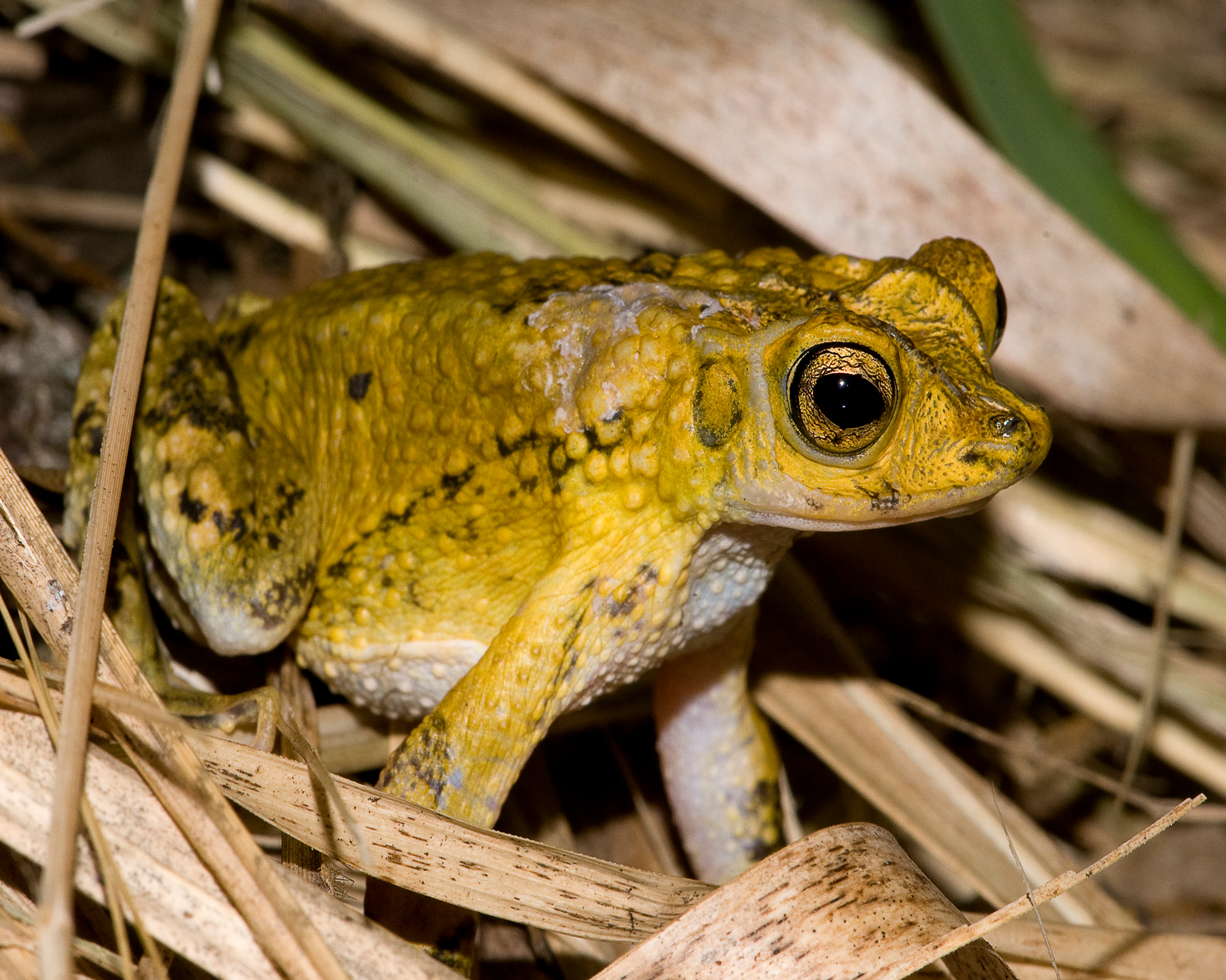
A close-up view of a Puerto Rican crested toad with golden-yellow, warty skin and large dark eyes, sitting among dry grasses and leaf litter.
A Puerto Rican crested toad, a species native to the subtropical dry forest environment of Guánica State Forest.

Guánica State Forest history and protected-area timeline

The lands that now form Guánica State Forest were first set aside as a forest reserve in 1919, making the dry forest one of the oldest formally protected natural areas in Puerto Rico. Its protection was driven largely by the unusual ecological character of southwestern Puerto Rico, where the rain shadow created by the Cordillera Central produced ecosystems unlike those found elsewhere on the island.

In 1981 the United Nations recognized the forest's global ecological importance by designating it a Biosphere Reserve, the second in Puerto Rico after El Yunque National Forest, then known as the Caribbean National Forest. Four years later, on October 16, 1985, the Puerto Rico Planning Board formally classified the area as a nature reserve and applied the provisions of Law No. 133 from 1975 to its management. In 2007, BirdLife International designated Guánica an Important Bird Area, reflecting the concentration of endemic and resident bird species within its boundaries. Through these layered designations, the forest evolved from a simple forest reserve into a multi-institutionally recognized conservation site managed today by the Puerto Rico Department of Natural and Environmental Resources.

Guánica State Forest landscape and geographic character

Geographically, Guánica State Forest lies in the driest climatic zone of Puerto Rico, sitting in the orographic rain shadow cast by the Cordillera Central to the north. This rain shadow effect creates the characteristic subtropical dry climate of the area, with average annual rainfall around 791 millimeters and average temperatures near 25.3 degrees Celsius. Daytime conditions can reach 100 degrees Fahrenheit in exposed areas, while shaded ground stays closer to 80 degrees Fahrenheit, intensifying the arid character that defines the landscape.

The underlying geology belongs to the Southern Karst region of Puerto Rico, producing a terrain of limestone formations, fine and soft lime soils, and patches of sand and clay. Deciduous plant communities tend to grow on the more granular sand-and-clay substrates where lime is dominant, while evergreen species occupy other soil variations within the same karstic system. The landscape rises and falls across rolling terrain before meeting the sea, where limestone cliffs, salt flats, mangrove channels, and offshore keys further diversify the scenery. Major features within the protected area include Fuerte Caprón ruins, scenic overlooks such as those near Carenero in Guánica, and coastal landmarks like Playa Jaboncillo.
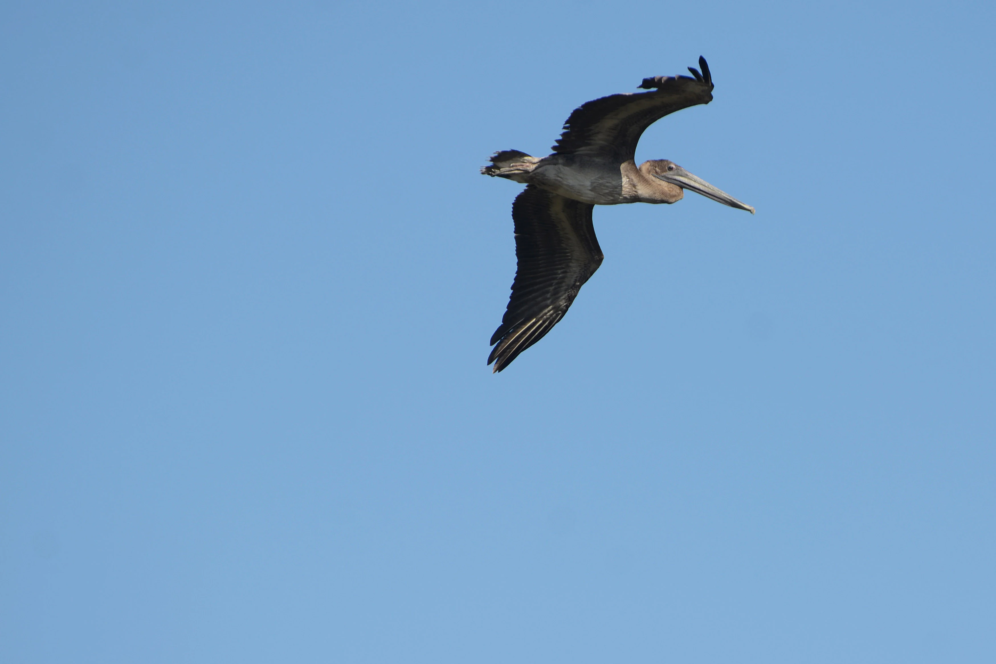
A brown pelican flying against a clear blue sky.
A brown pelican in flight over the Guánica State Forest.

Guánica State Forest ecosystems, habitats, and plant life

Guánica State Forest protects a remarkable range of ecosystems compressed into a relatively small territory. Inland vegetation is divided into three main groups: upland deciduous forest, semi-evergreen forest, and scrub forest, each occupying distinct zones of the reserve. Deciduous forest is the largest of these vegetation types, followed by semi-evergreen stands and more open scrub formations; species diversity is typical of insular dry forests, with between 30 and 50 tree species per hectare.

Beyond its terrestrial vegetation, the forest extends into coastal and marine environments that include sandy beaches, rocky shores, mangrove forests, seagrass prairies, saltwater lagoons, salt flats, coral reefs, and limestone caverns. The combination of karstic soils, seasonal freshwater pools, and coastal brackish systems creates a mosaic of microhabitats supporting more than 700 plant species, of which 48 are endangered and 16 are endemic to the forest. Wild orchids such as Tolumnia species grow alongside iconic flora like Plumeria alba, Melocactus intortus, and the rare Pilosocereus royenii, illustrating the botanical richness of this dry forest.
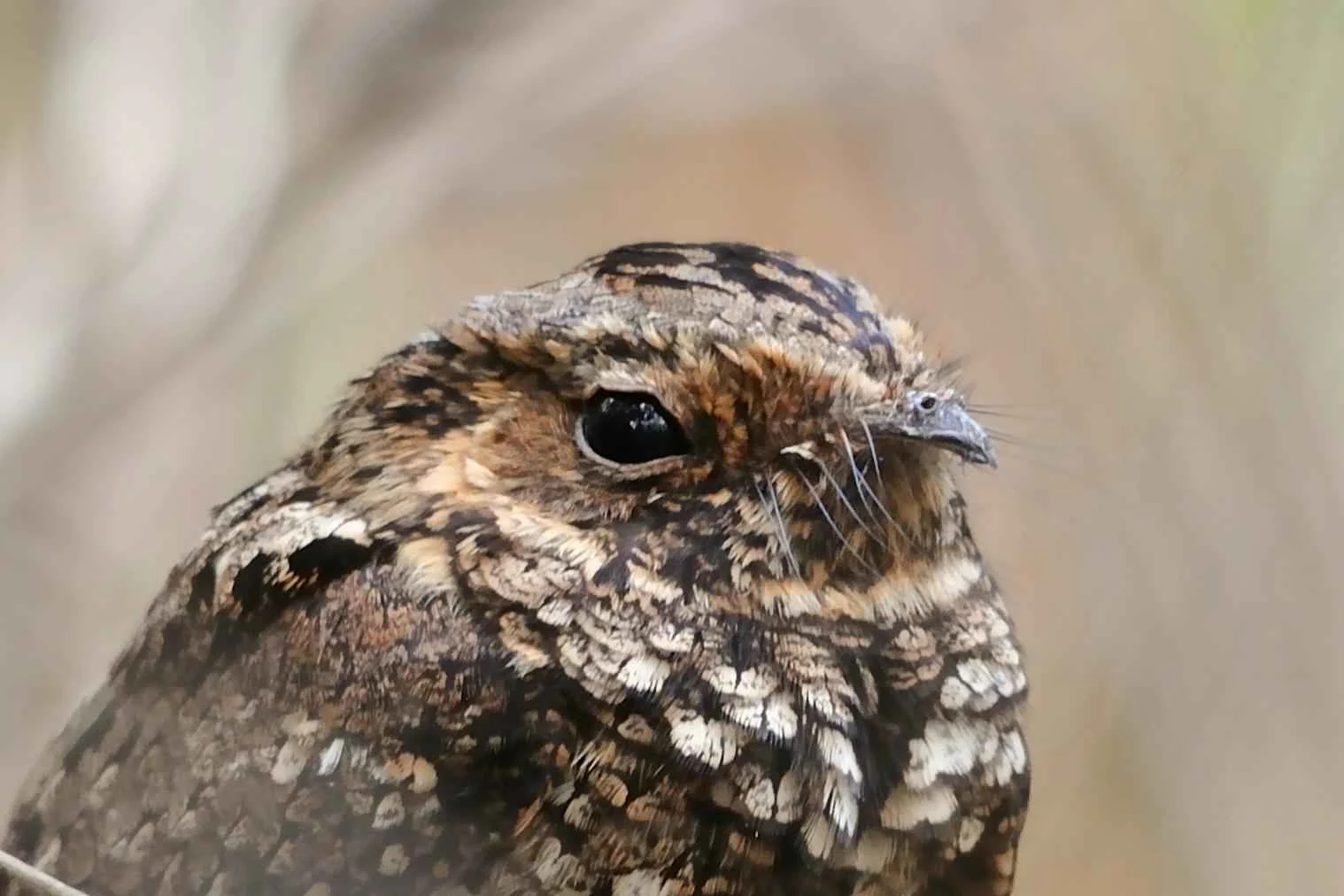
A close up profile of a Puerto Rican nightjar, showing its mottled brown and gray camouflage plumage and large dark eye.
A close up view of the endangered Puerto Rican nightjar, a rare inhabitant of the Guánica State Forest.

Guánica State Forest wildlife and species highlights

Guánica is a stronghold of Caribbean wildlife, particularly for species that rely on dry forest and coastal habitats that have been largely lost elsewhere on the island. Approximately half of all bird species recorded in Puerto Rico and nine of the island's sixteen endemic bird species occur within the forest. The reserve is widely known as an Important Bird Area, and birdwatching is one of its principal recreational activities.

Among the most notable fauna is the Puerto Rican crested toad, whose last remaining natural population breeds in the intermittent freshwater pools created by seasonal rainfall on the karstic terrain. Conservation programs led by the Association of Zoos and Aquariums include captive breeding and reintroductions into similar ecosystems at Coamo and in the Northern Karst of Puerto Rico. Other protected species include the Puerto Rican vireo, the Puerto Rican nightjar, the red land crab, the Mona basket shrimp, and the restricted-range Cook's pallid anole. The marine portions of the reserve shelter additional wildlife, including the West Indian manatee, which feeds on seaweeds in the underwater seagrass prairies offshore.
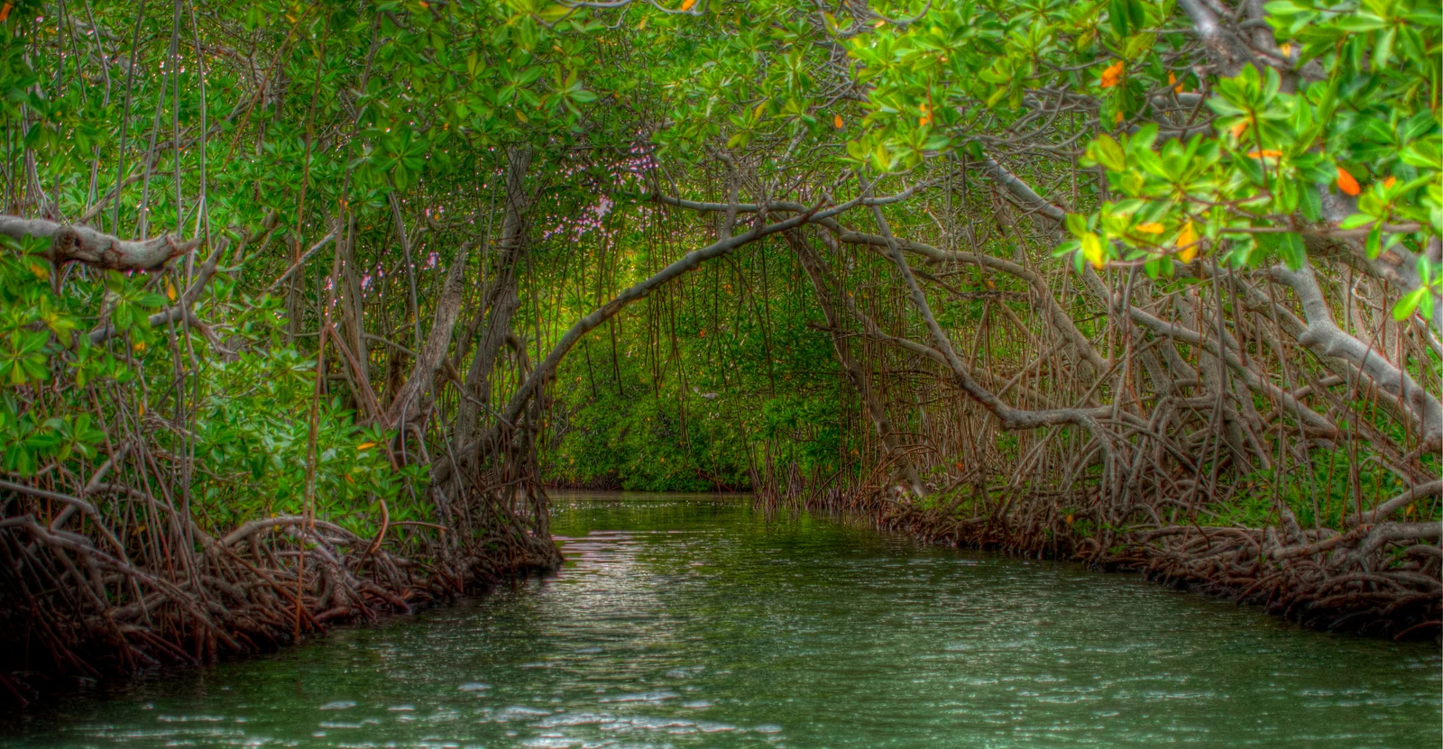
A view looking into a calm, narrow water channel surrounded by thick, arching mangrove trees with tangled prop roots visible at the waterline.
A narrow channel winds through the dense mangrove forest of Guánica State Forest.

Guánica State Forest conservation status and protection priorities

Guánica State Forest holds an unusually layered conservation status, ranging from a 1919 forest reserve to international recognition under the Man and the Biosphere Programme. Its 1981 designation as a United Nations Biosphere Reserve underscored the global importance of the dry forest as a reference site for subtropical dry forest ecology, an ecosystem type that has been severely reduced throughout the Caribbean. Its 1985 nature reserve status under Puerto Rico Law No. 133 added formal domestic legal protection, while its 2007 designation as an Important Bird Area by BirdLife International highlighted its exceptional value for endemic and resident bird species.

The reserve is also central to active species recovery efforts, most visibly through programs aimed at the Puerto Rican crested toad. Captive breeding by zoological institutions has been paired with reintroductions into ecologically similar habitats such as Coamo and the Northern Karst, helping to establish new populations of a species that once inhabited a wider portion of the island. By preserving a large, ecologically complex tract of dry forest, key freshwater breeding pools, and interconnected marine habitats, Guánica plays a disproportionate role in Caribbean biodiversity conservation relative to its size.

Guánica State Forest cultural meaning and human context

The cultural context of Guánica State Forest is closely intertwined with the southwestern Puerto Rican landscape, where dry climate, coastal geography, and long-standing forestry traditions have shaped local identity. The forest reserve dates back to 1919, and the surrounding municipalities of Guánica, Guayanilla, Peñuelas, Ponce, and Yauco have historic relationships with the land and sea that it protects. Historic features within and around the reserve, such as the ruins of Fuerte Caprón, link the modern protected area to earlier layers of human presence in the region.

Local communities continue to use the reserve as a gathering place for outdoor recreation, beachgoing, fishing, biking, birdwatching, and hiking. The reserve's name reflects both its ecological identity, the Bosque Seco de Guánica, and its administrative status under the Puerto Rico Department of Natural and Environmental Resources, anchoring it firmly within the Commonwealth's natural heritage and public land system.
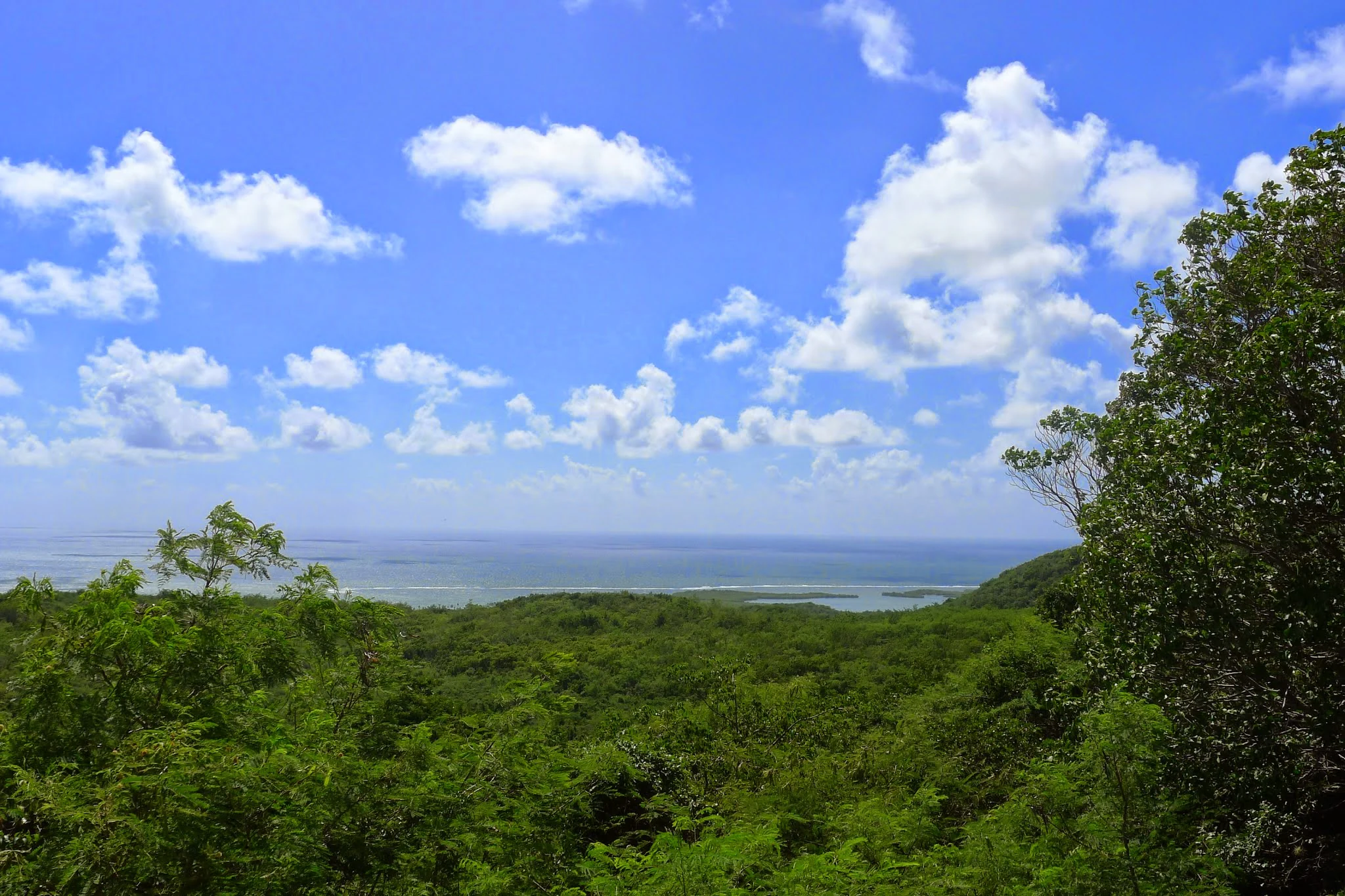
A wide, elevated view of lush green subtropical dry forest stretching toward the coastline under a bright blue sky with white clouds.
Coastal view from within Guánica State Forest.

Top sights and standout views in Guánica State Forest

The Guayacán Centenario, possibly the oldest living guaiacwood tree in Puerto Rico, stands as a single iconic individual feature and one of the most recognized highlights of the forest. The reserve's mosaic habitats, ranging from dry deciduous forest to coral reefs, salt flats, and mangrove lagoons, make it a benchmark for Caribbean ecological complexity. Its status as both a United Nations Biosphere Reserve and an Important Bird Area gives Guánica international visibility among protected areas.
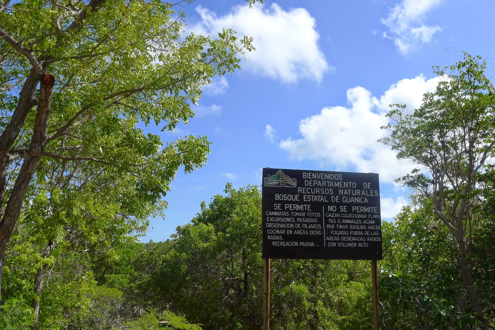
A black information sign standing in a lush green forest, detailing rules for visitors at the Guánica State Forest in Puerto Rico.
Park entrance sign for Guánica State Forest, outlining visitor rules and regulations.

Best time to visit Guánica State Forest

Guánica sits in Puerto Rico's driest climatic zone, with warm temperatures year round and rainfall that varies seasonally rather than dramatically by month. The dry conditions that define the forest are most pronounced in the months with the least seasonal rainfall, when deciduous trees drop their leaves and the landscape takes on its most characteristic arid character. Birdwatchers and naturalists often find rewarding conditions during periods when seasonal rains replenish freshwater pools used by the Puerto Rican crested toad while still leaving most of the forest open and traversable.

Because the reserve is hot and exposed in many places, with shaded ground temperatures near 80 degrees Fahrenheit and exposed areas climbing toward 100 degrees Fahrenheit, cooler parts of the day and the cooler half of the year are particularly suitable for active exploration. Visitors interested in coastal scenery, mangroves, and coral reefs will find that the marine elements of the reserve are accessible in a similar climatic window, with snorkeling and diving conditions influenced by the same subtropical patterns that shape the forest interior.

Monthly climate preview

Long term temperature and monthly precipitation patterns sampled at representative park coordinates

Guánica State Forest Climate Normals and Annual Weather by Month

Historical data records sustained average temperatures ranging from twenty four to twenty seven degrees Celsius alongside varying monthly precipitation rates across the representative coordinate. Reviewing the complete twelve month profile clarifies the full range of long term climate normals established for the protected area.
Annual mean26 °C
24 °C28 °C
Jan24°
Feb25°
Mar25°
Apr26°
May27°
Jun27°
Jul27°
Aug28°
Sep27°
Oct27°
Nov26°
Dec25°
Warmest month
August

27.6 °C

Coolest month
January

24.4 °C

Wettest month
September

4.2 mm/day

Driest month
February

1.3 mm/day

Park location guide

Geography guide, regional context, and park location map for Guánica State Forest

Guánica State Forest park geography, regions, and map view in Puerto Rico

Understand where Guánica State Forest sits in Puerto Rico through a broader geographic reading of the surrounding landscape, nearby location context, and its mapped position within the national park landscape.

How Guánica State Forest fits into Puerto Rico

Puerto Rico is a Caribbean archipelago and island territory of the United States, classified as an unincorporated and organized territory under commonwealth status. Located in the North Atlantic Ocean east of the Dominican Republic, it serves as a significant cultural and economic hub in the region. The territory maintains its own constitution, governor, and legislative assembly while being represented in Congress by a resident commissioner.

Wider geography shaping Guánica State Forest in Puerto Rico

Puerto Rico is a Caribbean island archipelago located in the North Atlantic Ocean, approximately 1,600 kilometers southeast of Florida. The main island spans about 177 kilometers in length and 65 kilometers in width, with a total land area of approximately 8,868 km². The terrain ranges from coastal plains to mountainous interior regions, with the highest point at Cerro Punta reaching 1,338 meters. The island is bordered by the Atlantic Ocean and Caribbean Sea.

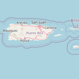
Map view of Guánica State Forest

Use this park location map to pinpoint Guánica State Forest in Puerto Rico, understand its exact geographic position, and read its mapped placement within the surrounding landscape more clearly.

Pigeon | © OpenStreetMap contributors

Explore protected area photography, karst terrain features, and rare subtropical habitats.

Guánica State Forest Photos and Landscapes: Visualizing Caribbean Dry Forest Scenery

Visual documentation captures the diverse terrain, limestone formations, and coastal ecosystems preserved across the reserve. Examining these protected area views reveals the unique environmental character and ecological complexity defining the Caribbean region.

A close-up view of a Puerto Rican crested toad with golden-yellow, warty skin and large dark eyes, sitting among dry grasses and leaf litter.

An American kestrel bird standing on the top of a tall, spiky columnar cactus against a clear blue sky.

A brown pelican flying against a clear blue sky.

A close up profile of a Puerto Rican nightjar, showing its mottled brown and gray camouflage plumage and large dark eye.

A view looking into a calm, narrow water channel surrounded by thick, arching mangrove trees with tangled prop roots visible at the waterline.

A wide outdoor shot of a calm body of water surrounded by low-lying coastal vegetation and trees under a clear blue sky.

A wide, elevated view of lush green subtropical dry forest stretching toward the coastline under a bright blue sky with white clouds.

A black information sign standing in a lush green forest, detailing rules for visitors at the Guánica State Forest in Puerto Rico.

A historic stone fort with crenelated walls stands on a hillside surrounded by dry, scrubby vegetation under a partly cloudy sky.

A close-up view of a green, elongated seed pod of the plant Ruehssia woodburyana hanging from a branch in a dry, desert-like habitat with cactus in the background.

A low angle view of a large, mature Guayacan tree with gnarled branches and exposed roots, set within a dry forest environment.

Close-up view of the green, waxy, opposite-arranged leaves of a Spanish stopper shrub, Eugenia foetida, against a background of dry forest floor.

A wide coastal view showing a turquoise bay surrounded by dry, shrubby hills under a clear blue sky.

A top-down view of a small plant with shiny, dark green, serrated leaves arranged in compound pinnate patterns, growing among dry leaf litter and rocky soil in a forest.

A view of a green, densely vegetated coastal hillside sloping down into the blue Caribbean Sea, with small rocky outcrops visible along the shoreline.

Close-up view of a flowering milktree plant, showing its long, narrow, green leaves arranged in a circular pattern against a dense forest background.

Park atlas

Compare adjacent subtropical dry forests and regional Caribbean protected landscapes.

Explore Other Parks Near Guánica State Forest and Surrounding Protected Areas

Visitors exploring Guánica State Forest can uncover other nearby protected areas and regional conservation zones across the surrounding landscape. Comparing adjacent park geography provides a broader understanding of Caribbean dry forest ecosystems and coastal habitats.
State or regional parkPuerto Rico
About 20 km away#1 closest

Northwest

Maricao State Forest: A Detailed Map and Geographic Overview of Puerto Rico's Mountain Wilderness

Endemic-rich mountain forests and serpentinite terrain in the Cordillera Central

Maricao State Forest represents a vital protected landscape in the western Cordillera Central of Puerto Rico. This site features distinctive serpentinite geology, complex mountainous watersheds, and diverse endemic bird habitats. The forest serves as a primary geographic anchor along the Ruta Panorámica, providing clear insight into the rugged environmental character of the central island spine.

Area
43.72 km²
Established
1919
Relief
Mountain
Climate
Tropical
State or regional parkPuerto Rico
About 21 km away#2 closest

Northeast

Guilarte State Forest: Protected Mountain Ecosystems and Cordillera Central Geography

Highland conservation and mapped mountain terrain in central Puerto Rico

Guilarte State Forest represents a essential protected area in the Cordillera Central of Puerto Rico. The reserve encompasses steep altitudinal shifts, ranging from mid-slope palm forests to summit-level cloud forests. As a headwater region for major river basins, the forest is a focal point for understanding the island's mountainous geography and conservation priorities for endemic species.

Area
19.514 km²
Established
1935
Relief
Mountain
Climate
Tropical
A soft watercolor illustration featuring a coastal scene with a calm bay, rocky outcroppings, green hills in the background, and pale pinkish lighting.
State or regional parkPuerto Rico
About 23 km away#3 closest

West

Boquerón State Forest: Geographic Overview of Protected Coastal Wetlands in Puerto Rico

Coastal karst geology and mangrove-lined estuarine habitats

Spanning across Cabo Rojo, Lajas, and Mayagüez, Boquerón State Forest forms an essential protected landscape on the southwestern coast of Puerto Rico. The area provides a detailed atlas of ecological convergence, where extensive mangrove systems meet the dramatic limestone cliffs of the Los Morrillos peninsula and historic salt flats. This resource provides a deep look into the spatial distribution of these coastal habitats and their critical function in supporting Caribbean biodiversity and migratory bird flyways.

Established
1918
Relief
Lowland
Climate
Tropical
Access
Easy access
Protected areaAdjuntas
About 32 km away#4 closest

Northeast

Bosque del Pueblo: Protected Forest Geography and Cordillera Central Landscape

A mountain watershed and ecological corridor in Adjuntas

Bosque del Pueblo represents a key protected landscape within the central mountains of Puerto Rico. As a critical forest reserve located in Adjuntas, it preserves headwaters and supports rare bird populations, serving as a permanent ecological link between several major state forest units.

Area
2.987 km²
Established
1995
Relief
Mountain
Climate
Tropical
Watercolor painting of a hilly, green landscape featuring rolling mountains in the distance and vegetation in the foreground.
State or regional parkUnited States of America
About 34 km away#5 closest

Northeast

Cerrillos State Forest: Protected Subtropical Woodland and Reservoir Geography

Foothill landscapes and watershed features in Ponce, Puerto Rico

This protected area features a mix of tabonuco forest and water-based recreational terrain. Spanning the slopes of the Cordillera Central foothills, the forest encompasses the Cerrillos River and the man-made Lake Cerrillos reservoir, offering a distinct example of subtropical moist forest ecology within the United States commonwealth system.

Area
0.79 km²
Established
1996
Relief
Upland
Climate
Subtropical
State or regional parkUnited States of America
About 46 km away#6 closest

Northeast

Río Abajo State Forest: Mapping the Karst Terrain and Protected Landscapes of Puerto Rico

Protected karst landscape and regional forest geography

Río Abajo State Forest serves as an essential example of Caribbean karst ecosystems, defined by its steep limestone mogotes, hidden ravines, and extensive sinkhole networks. Located in the northern karst belt of Puerto Rico, the forest provides deep insight into complex subterranean drainage patterns and serves as a primary hub for endangered species recovery within its uniquely broken, three-dimensional terrain.

Area
14.1 km²
Established
1943
Relief
Upland
Climate
Tropical
State or regional parkPuerto Rico
About 46 km away#7 closest

Northeast

Los Tres Picachos State Forest: A Geographic Guide to Puerto Rico's Mountain Protected Areas

Cloud forests, volcanic terrain, and watershed protection

Los Tres Picachos State Forest encompasses a striking landscape in the Puerto Rican interior, marked by deep river valleys and its namesake triple peaks. This atlas feature provides insights into the forest's layered ecological zones and its role as a crucial hydrological anchor for the Toro Negro and Cialitos river systems within the Cordillera Central.

Established
1999
Relief
Mountain
Climate
Tropical
Access
Remote access
A soft watercolor illustration of green hills and foliage against a pale background.
State or regional parkPuerto Rico
About 51 km away#8 closest

North

Guajataca State Forest: Geography and Protected Karst Landscapes in Puerto Rico

Explore the mogotes and cave systems of this regional forest

Guajataca State Forest protects a significant limestone karst landscape in northwestern Puerto Rico. The area is defined by its conical mogote hills, deep sinkhole drainage, and complex cave networks, including the notable Cueva del Viento. As a key part of the regional forest system, it offers a window into the geological and ecological makeup of the Northern Karst belt.

Area
9.26 km²
Established
1943
Relief
Upland
Climate
Tropical

Common questions about visiting, size, designation, and location context for Guánica State Forest

Guánica State Forest FAQs for park facts, access, geography, and protected area context

Find quick answers about Guánica State Forest, including protected-area facts, park geography, trail and visitor context, and how the park fits into its surrounding country and regional landscape.
MoriAtlas Explorer

Continue Your Protected Areas Search Across the Global Atlas

Deepen your exploration by continuing the structured search for national parks and protected areas worldwide. Utilize the comprehensive filtering capabilities to compare different conservation landscapes and refine your understanding of global park geography. Discover more about the distribution and characteristics of protected natural areas.

Global natural geography