

Mori Atlas logo
Nature reserveGuichen Bay Conservation Park

A protected nature reserve defined by ancient Holocene beach ridge plains and coastal scrubland.

Guichen Bay Conservation Park: Mapping Coastal Geologic Heritage in South Australia

Guichen Bay Conservation Park preserves a significant sequence of coastal sand ridges along the Limestone Coast of South Australia. This nature reserve serves as an important geological archive of shoreline evolution spanning seven thousand years. The dense coastal heath within the park boundaries provides a critical habitat for native bird species, offering a glimpse into the undisturbed natural terrain of the region.

coastal reservebeach ridge plainHolocene geologycoastal heathshorebird habitatLimestone Coast

Guichen Bay Conservation Park

Nature reserve

Park overview

Structured park overview, official facts, and landscape profile for Guichen Bay Conservation Park

Guichen Bay Conservation Park park facts, protected area profile, and essential visitor context

Review the core facts for Guichen Bay Conservation Park, including designation, size, terrain, visitor scale, habitats, and operating context in one park-focused overview.

About Guichen Bay Conservation Park

Guichen Bay Conservation Park sits on the southern coastline of South Australia, just a few kilometres north of the town of Robe in the Limestone Coast region. Although small in size and rarely visited, the reserve protects a section of coastal landscape that is considered scientifically important both for its geology and its wildlife. The park overlooks Guichen Bay, a broad and shallow embayment along the southeastern South Australian coast that is known for its scenic shoreline and proximity to the historic town of Robe.

The defining feature of the park is its portion of the Guichen Bay beach ridge plain, a system of low, parallel sand ridges formed during the Holocene. These ridges formed as the shoreline of the bay gradually changed and retreated over thousands of years, leaving behind a sequence of coastal landforms that today hold a detailed record of that evolution. The presence of such a well-developed and largely undisturbed example of Holocene beach ridge development gives the park a significance that extends well beyond its modest size, and is why the area has been formally recognised as a protected feature of natural heritage.

In addition to its geological value, the park protects a band of coastal vegetation that is typical of the Limestone Coast. Fairly dense coastal heath grows across the reserve, providing habitat for native wildlife and contributing to the more natural appearance of this stretch of coast. The park lies within the larger locality of Mount Benson and is administered by the South Australian Department for Environment and Water as part of the state's system of coastal conservation reserves. Its classification as an IUCN Category III protected area reflects its primary purpose of conserving a single outstanding natural feature: the beach ridge plain of Guichen Bay.

Quick facts and research context for Guichen Bay Conservation Park

Guichen Bay Conservation Park is located in the gazetted locality of Mount Benson in South Australia, approximately 8 kilometres north of Robe. It is a coastal reserve covering about 1.27 square kilometres near the shoreline of Guichen Bay on the Limestone Coast. Originally proclaimed as the Guichen Bay National Park in 1967, it was reconstituted as a conservation park in 1972, and additional land parcels were added to it in 1976 and 1991. It is managed by the South Australian Department for Environment and Water and is classified as an IUCN Category III protected area because of the natural feature it protects.

Protection and recognition

Documented terrestrial protection scope and conservation designation records

Guichen Bay Conservation Park Protection Status and Mapped Geography

Guichen Bay Conservation Park maintains a documented terrestrial protection scope within its designated reserve boundary. Official records outline the baseline conservation status and administrative management details for the protected area.

Protection details

Protection scope
Terrestrial
Transboundary protection
No
Park context

Deeper park guide and search-rich context for Guichen Bay Conservation Park

Guichen Bay Conservation Park history, landscape, wildlife, and travel context

Explore Guichen Bay Conservation Park through its history, landscape character, ecosystems, wildlife, conservation priorities, cultural context, and seasonal travel timing in a structured park guide built for atlas discovery and search intent.

Why Guichen Bay Conservation Park stands out

Guichen Bay Conservation Park is best known for preserving a classic example of a Holocene beach ridge plain, a series of ancient sand ridges that record how Guichen Bay's coastline has shifted over the past seven thousand years. Geologically, the beach ridge sequence is regarded as being of worldwide interest because it provides an unusually clear and undisturbed record of coastal evolution during the Holocene epoch. Ecologically, the park is also recognised for its population of the rufous bristlebird, a secretive species that depends on dense coastal heath habitats like the ones preserved here.

Guichen Bay Conservation Park history and protected-area timeline

The land that now forms Guichen Bay Conservation Park was first formally protected in the late 1960s, when sections 360 and 361 in the Hundred of Waterhouse were proclaimed as the Guichen Bay National Park on 27 July 1967 under the National Parks Act 1966. At that stage, the reserve was established to safeguard a stretch of coastal land at Guichen Bay north of Robe that contained an important sequence of ancient beach ridges.

In 1972, South Australia's protected-area legislation was changed with the introduction of the National Parks and Wildlife Act 1972. As part of that restructuring, the former national park was reconstituted as the Guichen Bay Conservation Park on 27 April 1972, taking on its current designation. Additional land was added to the reserve in stages over the following decades: section 555 was included on 9 September 1976, while sections 575 and 576 were added on 21 March 1991, gradually expanding the park to its present-day extent.

In 1980, the area was listed on the Register of the National Estate, a former Australian register of places of national heritage significance that has since been discontinued. The inclusion on this register reflected recognition of the park's geological and ecological values at a national level. Today, the park continues to be managed by the South Australian Department for Environment and Water as a small coastal conservation reserve.

Guichen Bay Conservation Park landscape and geographic character

The landscape of Guichen Bay Conservation Park is shaped by its position directly on the coast of Guichen Bay and by the ancient beach ridge plain that defines its interior. The most prominent landform is the sequence of low, parallel sand ridges formed during the Holocene as the shoreline of the bay shifted over roughly seven thousand years. These ridges record the gradual story of coastal change along this part of South Australia's southeastern coast and are regarded as a classic example of the beach ridge formation process.

Beyond the ridges themselves, the park encompasses a strip of coastal terrain typical of the Limestone Coast region. The vegetation is dominated by fairly dense coastal heath, which gives much of the reserve a low, scrubby character. The narrow shoreline along Guichen Bay borders the reserve and provides a transition between the terrestrial heath community and the marine environment of the bay. The combination of ancient sand ridges, low coastal scrub, and adjacent shoreline gives the park a quiet, undisturbed character that contrasts with the more busier coastal areas further to the south around Robe.

Guichen Bay Conservation Park ecosystems, habitats, and plant life

Although Guichen Bay Conservation Park is small, it supports a distinct coastal ecosystem characteristic of South Australia's southeastern shoreline. The dominant vegetation is fairly dense coastal heath, a low scrubland community adapted to the exposed conditions of the coast. This heath provides structural cover that is important for ground-dwelling and shrub-dwelling wildlife, and contributes significantly to the ecological character of the reserve.

The coastal position of the park means that the ecosystems within it are strongly shaped by exposure to the Southern Ocean, sandy substrates, and salt-laden winds. These conditions favour plant communities adapted to nutrient-poor sandy soils and coastal exposure, while the underlying beach ridge system creates a subtle pattern of slightly higher and lower ground that influences how vegetation is distributed across the reserve. The result is a small but cohesive coastal heath ecosystem that has remained largely undisturbed because of the park's limited accessibility.

Guichen Bay Conservation Park wildlife and species highlights

The wildlife of Guichen Bay Conservation Park is closely tied to its coastal heath habitat and its shoreline environment. The most notable resident species is the rufous bristlebird, a secretive and usually hard-to-see bird that depends on dense coastal scrub for cover and breeding. The presence of this species is one of the main ecological reasons the park has been highlighted as a conservation area, and it underscores the importance of preserving the heath community within the reserve.

Along the shoreline of Guichen Bay that adjoins the park, shorebirds are a regular feature of the landscape. Dotterels and oystercatchers are commonly seen along the beach, taking advantage of the intertidal environment of the bay. Together with the rufous bristlebird in the interior of the reserve, these birds form the core of the park's easily observable wildlife, reflecting the broader significance of South Australia's Limestone Coast for coastal birdlife.

Guichen Bay Conservation Park conservation status and protection priorities

Guichen Bay Conservation Park plays a focused but important role in South Australia's coastal conservation network. Its primary conservation value lies in protecting a classic example of a Holocene beach ridge plain, a type of landform that records the natural evolution of a coastline over thousands of years. Because beach ridge sequences of this quality and completeness are uncommon elsewhere, the park's value is recognised at both national and international levels.

The park is classified as an IUCN Category III protected area, a designation used for natural monuments or features whose protection is centred on a specific outstanding natural attribute. In this case, that attribute is the beach ridge plain of Guichen Bay, complemented by the coastal heath ecosystem that grows across it. Recognition of the park's significance was further reflected in its inclusion on the Register of the National Estate in 1980.

In practical terms, the conservation purpose of the park is to keep the beach ridge sequence and its surrounding vegetation largely undisturbed. Because the area is relatively inaccessible and is not promoted as a major visitor destination, it has retained much of its natural condition. The park therefore serves as a small but high-quality reference site for coastal geological processes and for the coastal heath habitats of the Limestone Coast region.

Top sights and standout views in Guichen Bay Conservation Park

The standout feature of Guichen Bay Conservation Park is the Holocene beach ridge plain that gives the park its geological importance. This system of ancient sand ridges records seven thousand years of coastal evolution along Guichen Bay and is regarded as a classic example of the beach ridge formation process.

Equally important to the park's identity is its dense coastal heath, which shelters the rufous bristlebird, one of the more unusual and secretive bird species associated with southern Australian coasts. Together, the geological record preserved in the ridges and the wildlife supported by the heath define the park as a compact but high-value coastal reserve on South Australia's Limestone Coast.

Best time to visit Guichen Bay Conservation Park

Guichen Bay Conservation Park is an all-year coastal reserve, and the experience of visiting depends more on personal interest in geology and birdlife than on seasonal scheduling. Spring and early summer tend to be the most rewarding periods for observing the coastal heath in bloom and for spotting shorebirds such as dotterels and oystercatchers along the edge of Guichen Bay. Because the park is rarely visited and does not have the infrastructure of more accessible reserves, conditions can be exposed and weather-dependent at any time of year, so calm, mild days generally offer the best conditions for exploring the shoreline and ridges.
Monthly climate preview

Long-term temperature ranges and monthly precipitation averages for South Australia

Guichen Bay Conservation Park Climate Normals and Annual Weather Patterns

Historical climate data from 1991 to 2020 outlines measured shifts in average temperatures and monthly precipitation across Guichen Bay Conservation Park. Accessing the complete twelve-month profile provides detailed long-term averages for analyzing annual environmental rhythms.
Annual mean15 °C
10 °C20 °C
Jan20°
Feb20°
Mar18°
Apr15°
May13°
Jun11°
Jul10°
Aug11°
Sep12°
Oct14°
Nov16°
Dec18°
Warmest month
January

20 °C

Coolest month
July

10.4 °C

Wettest month
June

2.5 mm/day

Driest month
February

0.6 mm/day

Park location guide

Geography guide, regional context, and park location map for Guichen Bay Conservation Park

Guichen Bay Conservation Park park geography, regions, and map view in Australia

Understand where Guichen Bay Conservation Park sits in Australia through a broader geographic reading of the surrounding landscape, nearby location context, and its mapped position within the national park landscape.

How Guichen Bay Conservation Park fits into Australia

Australia is a constitutional monarchy and federal parliamentary democracy comprising six states and ten territories. With a population of nearly 28 million, it is one of the world's most urbanised countries, with most people concentrated on the eastern seaboard. The country has a high Human Development Index and is known for its cultural diversity, ancient Aboriginal heritage, and unique wildlife.

Wider geography shaping Guichen Bay Conservation Park in Australia

Australia occupies the entire Australian continent, the island of Tasmania, and numerous smaller islands. It is the world's flattest and driest inhabited continent, featuring vast deserts in the interior (the Outback), tropical rainforests along the eastern coast, and a coastline bordering the Indian and Pacific Oceans.

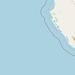
Map view of Guichen Bay Conservation Park

Use this park location map to pinpoint Guichen Bay Conservation Park in Australia, understand its exact geographic position, and read its mapped placement within the surrounding landscape more clearly.

Pigeon | © OpenStreetMap contributors

Location context for Guichen Bay Conservation Park

South Australia
Park atlas

Compare nearby reserves, regional coastal terrain, and connected protected areas across South Australia

Exploring Other Parks Near Guichen Bay Conservation Park and Protected Coastal Landscapes

Visitors exploring Guichen Bay Conservation Park can browse nearby protected areas and related coastal reserves across the Limestone Coast region. Comparing adjacent park geography provides a broader perspective on regional conservation landscapes and coastal landforms.
Nature reserveSouth Australia
About 22 km away#1 closest

North

Butcher Gap Conservation Park: A Protected Coastal Reserve in South Australia

Examining the dune-and-wetland geography along Lacepede Bay

Butcher Gap Conservation Park protects a unique, tightly layered coastal environment characterized by shifting foredunes, saline basins, and paperbark-fringed wetlands. This nature reserve provides essential habitat for migratory shorebirds and illustrates the complex geological and biological patterns defining this stretch of the South Australian Limestone Coast.

Area
1.8 km²
Established
1990
IUCN
III
Relief
Lowland
Nature reserveSouth Australia
About 53 km away#2 closest

Southeast

Furner Conservation Park Geography and Protected Woodland Atlas for South Australia

A study of forest remnants, sandy rises, and coastal dune topography

Furner Conservation Park preserves a significant mosaic of native woodlands within the Limestone Coast region. The terrain shifts between sandy rises and stony calcarenite ridges, supporting distinct forest communities that offer a vital look into the natural history and regional geography of South Australia.

Area
2.89 km²
Established
1973
IUCN
III
Relief
Upland
National parkSouth Australia
About 60 km away#3 closest

Southeast

Canunda National Park: South Australia's Protected Landscape and Geographic Atlas

Explore mapped boundaries and regional natural geography.

Canunda National Park in South Australia is presented here as a distinct protected landscape. This detail page focuses on its geographic setting, providing insights into its mapped boundaries and its role within the regional atlas context. Understand the park's natural geography and its protected status for informed exploration.

Area
96.24 km²
Established
1959
IUCN
VI
Relief
Lowland
National parkSouth Australia
About 61 km away#4 closest

North

Coorong National Park: South Australia National Park Mapped Boundaries and Landscape Context

Explore its unique protected landscape and regional geography.

Coorong National Park in South Australia is featured here as a key protected area for geographic discovery. Users can explore the park's specific landscape characteristics, mapped boundaries, and its role within the regional geography of South Australia. This detail page supports an atlas-based understanding of protected lands, offering a focused perspective on the park's natural terrain and conservation significance within Australia.

Area
490.15 km²
Established
1967
IUCN
II
Relief
Lowland
Nature reserveSouth Australia
About 62 km away#5 closest

Northeast

Fairview Conservation Park: Protected Nature Reserve and Limestone Coast Geography

Mapped wetlands, sandy ridges, and woodlands in southeastern South Australia

Explore the geographic framework of Fairview Conservation Park, a nature reserve in South Australia's Limestone Coast. The protected area features a unique intersection of semi-permanent lagoons, periodically inundated flats, and varied woodland vegetation including blue gum and manna gum, offering a clear window into the regional geological and ecological character of the area.

Area
13.94 km²
Established
1960
IUCN
Ia
Relief
Lowland
Wildlife reserveSouth Australia
About 65 km away#6 closest

East

Big Heath Conservation Park: Mapping Protected Landscapes in South Australia

A strict nature reserve of woodland and wetland mosaics.

Big Heath Conservation Park represents a significant protected area in the Limestone Coast region of South Australia. The terrain is characterized by a gently undulating plain where subtle variations in elevation and soil composition create a distinct patchwork of eucalypt woodlands, sandy heath, and seasonal depressions linked to regional hydrological drainage systems.

Area
24.72 km²
Established
1964
IUCN
Ia
Relief
Lowland
Nature reserveWattle Range
About 75 km away#7 closest

Southeast

Calectasia Conservation Park: Protected Area Mapping and Landscape Context in Wattle Range

Rare plant habitat and stranded dune ecosystems in South Australia

Calectasia Conservation Park serves as an important protected site within Wattle Range, preserving a delicate balance between seasonally inundated swampland and dry sandy-land woodland. This geographic overview examines the reserve's protected status, its history of habitat management, and the distinct physical terrain that supports a rare population of blue tinsel lily.

Area
0.14 km²
Established
1967
IUCN
IV
Relief
Lowland
Nature reserveSouth Australia
About 76 km away#8 closest

Northeast

Jip Jip Conservation Park: Geologic Formations and Protected Biodiversity in South Australia

A compact reserve of granite outcrops and sandy woodland habitats.

Jip Jip Conservation Park preserves a distinctive cluster of granite outcrops known as the Jip Jip Rocks. The park is significant for its diverse plant life, including rare ferns, and its role as a sanctuary for bird species and small marsupials within the broader South Australian landscape.

Area
1.4 km²
Established
1967
IUCN
III
Relief
Upland

Common questions about visiting, size, designation, and location context for Guichen Bay Conservation Park

Guichen Bay Conservation Park FAQs for park facts, access, geography, and protected area context

Find quick answers about Guichen Bay Conservation Park, including protected-area facts, park geography, trail and visitor context, and how the park fits into its surrounding country and regional landscape.
MoriAtlas Explorer

Continue Your Protected Areas Search Across the Global Atlas

Deepen your exploration by continuing the structured search for national parks and protected areas worldwide. Utilize the comprehensive filtering capabilities to compare different conservation landscapes and refine your understanding of global park geography. Discover more about the distribution and characteristics of protected natural areas.

Global natural geography