
Mori Atlas logo
Nature reserveHaardtrand

A diverse mosaic of sandstone forests, vineyard slopes, and riverine lowlands in Rheinland-Pfalz.

Haardtrand Nature Reserve: Exploring the Protected Landscapes and Mapped Geographic Boundaries

(Vogelschutzgebiet Haardtrand)

Haardtrand represents a significant mosaic of protected ecological zones, stretching from the dense sandstone massifs of the Palatinate Forest to the warm, vineyard-clad slopes of the Haardt ridge. This expansive nature reserve covers a complex patchwork of orchards, sandy dry grasslands, and wet meadows that provide vital habitat for a broad community of bird species. By examining the mapped boundaries and terrain, users can visualize the transition from rugged woodland uplands to the open agricultural lowlands bordering the Rhine plain.

bird protection areaNatura 2000vineyard landscapesorchard meadowsPalatinate Forestdry grassland
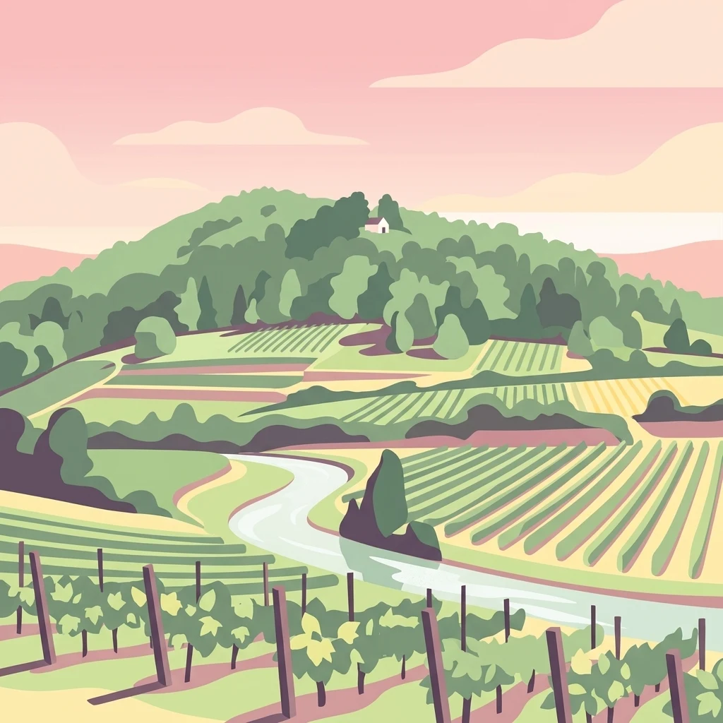
A digital illustration showing a rolling landscape with terraced vineyards in the foreground and a forested hill with a small building at the peak in the background.

Haardtrand

Nature reserve

Park overview

Structured park overview, official facts, and landscape profile for Haardtrand

Haardtrand park facts, protected area profile, and essential visitor context

Review the core facts for Haardtrand, including designation, size, terrain, visitor scale, habitats, and operating context in one park-focused overview.

About Haardtrand

The Haardtrand is a bird-focused Special Protection Area, or Vogelschutzgebiet, in Rhineland-Palatinate that falls within the larger European Natura 2000 network of protected sites. Rather than forming a unified reserve around a single landmark, it brings together a constellation of forest patches, vineyard landscapes, orchards, dry grasslands, and small wetland sites across the eastern fringe of the Palatinate Forest and the adjacent lowlands.

Geographically, the area is structured around three complementary zones. The western portion lies within the Palatinate Forest itself, the largest contiguous forest area in Germany, where coniferous and broadleaf stands create habitat for forest-interior birds. The central Haardt ridge gives the site its name and forms the steep, sun-exposed transition zone famous for its terraced vineyards. To the east, the protected parcels extend into more open terrain shaped by sandy soils, orchards, and the floodplain fringes of the Rhine plain.

Because the protected area is composed of many separately managed parcels, its conservation value lies precisely in this mosaic structure. Vineyard terraces, traditional orchards, dry nutrient-poor meadows, and remnant wet meadows each contribute specific habitat conditions that, together with the surrounding forest, support an unusually rich bird community. The Haardtrand therefore reads less as a single attractive destination and more as a landscape-scale conservation instrument, stitching together habitats across municipal boundaries to maintain favorable conditions for a defined set of European bird species.

Quick facts and research context for Haardtrand

The Haardtrand Special Protection Area was formally designated in January 2004 and carries the Natura 2000 identifier DE6514401. It belongs to Rhineland-Palatinate in southwestern Germany and lies along the eastern edge of the Palatinate Forest, between the cities of Neustadt an der Weinstraße and Grünstadt.

Its total area is approximately 14,700 hectares, but unlike many protected areas it is not contiguous. The site spans multiple municipal territories across the districts of Bad Dürkheim, Südliche Weinstraße, and Rhein-Pfalz-Kreis, as well as the city of Neustadt an der Weinstraße. The included landscapes range from pine- and broadleaf-dominated forest in the Palatinate Forest to vineyards, sandy open ground, orchards, and locally important wet and dry meadows in the foothills and lowlands.

Protection and recognition

Documented conservation status, boundary records, and international recognition sources

Haardtrand Protection Status and International Recognition Data

Protected area designation records outline the official status and management framework established for Haardtrand. International recognition details incorporate verified Natura 2000 data sources to document conservation boundaries.
Park context

Deeper park guide and search-rich context for Haardtrand

Haardtrand history, landscape, wildlife, and travel context

Explore Haardtrand through its history, landscape character, ecosystems, wildlife, conservation priorities, cultural context, and seasonal travel timing in a structured park guide built for atlas discovery and search intent.

Why Haardtrand stands out

The Haardtrand is best known for combining three contrasting landscape zones in a single bird protection designation: the dense forests of the Palatinate Forest, the warm dry slopes of the Haardt ridge with their vineyards, and the more open eastern lowlands toward the Rhine plain. It is also recognized for supporting a notably diverse set of target bird species, including woodpeckers, the Eurasian eagle-owl, the peregrine falcon, the wryneck, the European honey buzzard, the red-backed shrike, and several rare buntings, all of which depend on the mosaic of woodland, orchard, and dry-open habitats that characterize the area.
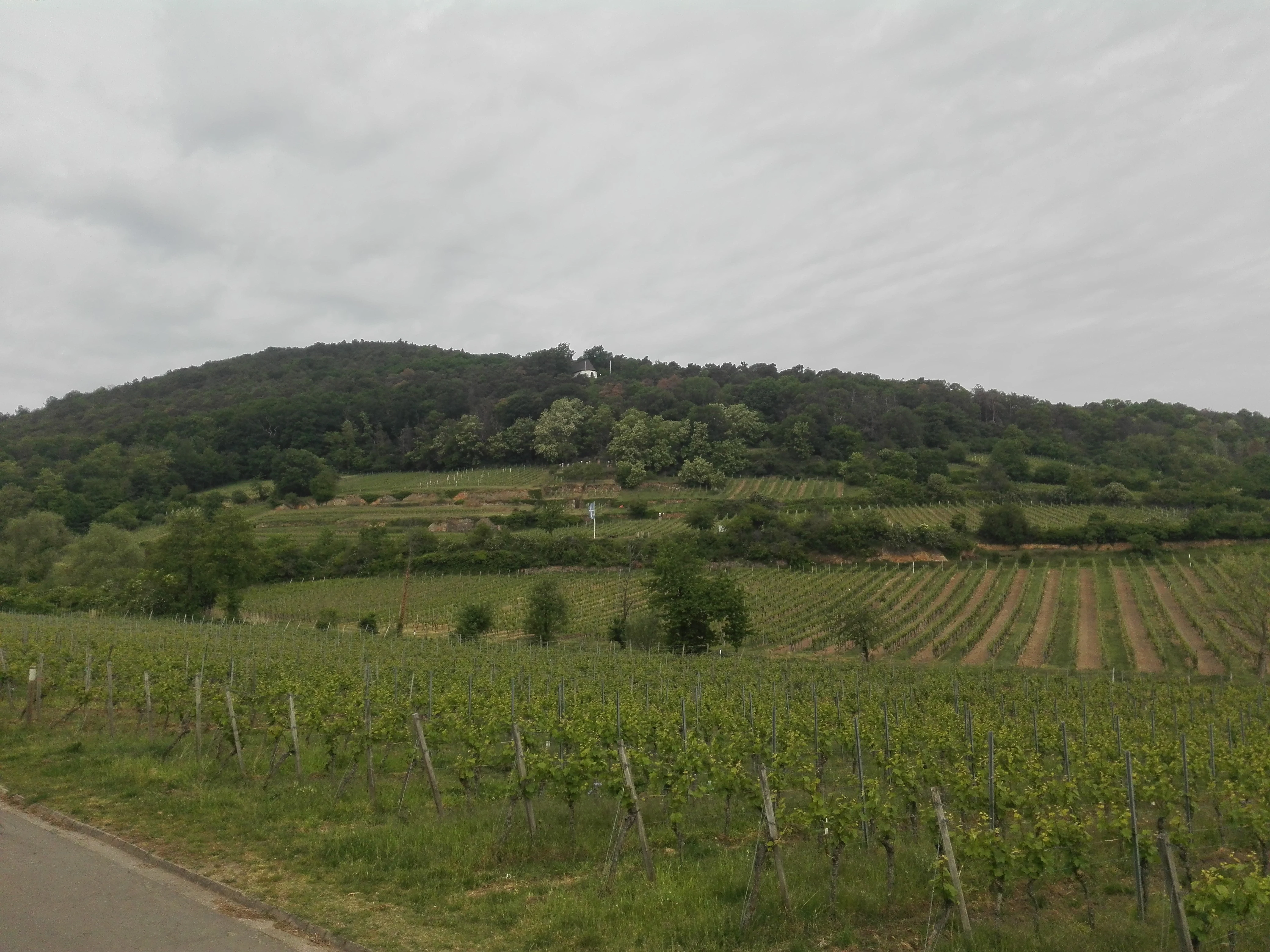
A wide view of a sloping vineyard leading up to a forested hill under a cloudy sky in Germany.
The Kirchberg hill in Deidesheim, showing the transition from vineyards to forested slopes characteristic of the Haardtrand region.

Haardtrand history and protected-area timeline

The Haardtrand was officially established as a Special Protection Area in January 2004, as part of Germany's contributions to the European Natura 2000 network under the EU Birds Directive. The designation recognized that the mosaic of habitats along the eastern edge of the Palatinate Forest already supported important populations of several protected bird species, and that coordinated protection was needed to maintain or improve their conservation status.

Since its designation, the management approach has focused on maintaining and restoring the cultivated landscape features that many of the target species depend on, including traditional orchards, dry grassland, and open or lightly structured woodland. Continued monitoring and reporting under Natura 2000 frame the area as an ongoing landscape conservation effort rather than a one-time land reservation.

Haardtrand landscape and geographic character

The physical setting of the Haardtrand is shaped by the meeting of three landscape units. To the west rises the Palatinate Forest, a sandstone massif covered largely by mixed coniferous and broadleaf forest, including pine and oak stands with a significant beech component. The central Haardt forms the steep forested and vineyard-clad eastern escarpment of that massif, dropping from the wooded uplands toward the Rhine plain. To the east, the terrain flattens into the open, sandy, and historically agricultural landscapes of the Vorderpfalz, the eastern foreland of the Palatinate.

This gradient from rugged sandstone forest through warm dry vineyard slopes to low-lying sandy open ground creates strong local contrasts in microclimate, soils, and vegetation. The associated small-scale landforms, including valley bottoms, terraces, and shallow depressions, also allow wet meadows such as the Dürkheimer Bruch to persist within an otherwise dry landscape matrix. The result is a varied, interspersed scenery in which forest, vineyard, orchard, grassland, and wetland elements regularly meet within short distances.

Haardtrand ecosystems, habitats, and plant life

Ecologically, the Haardtrand is defined by the diversity of habitats produced by the transition from forested upland to open lowland. The Palatinate Forest section is characterized by extensive pine-oak forests on acidic sandstone soils, and by mixed broadleaf stands rich in beech. These woodlands are managed in places to retain older trees, structural diversity, and dead wood, conditions favored by several woodpecker and owl species.

The eastern Haardt and its foothills combine vineyards, traditional orchards, dry nutrient-poor grassland on sandy soils, and small pockets of more mesic habitat. Where conditions are right, particularly in low-lying areas with higher groundwater, reedbeds and wet meadows such as the Dürkheimer Bruch add freshwater marsh habitat to an otherwise dry-dominated matrix. Together these habitats create a finely structured mosaic that supports forest, edge, and open-ground species within relatively close proximity.

Haardtrand wildlife and species highlights

The Haardtrand's wildlife interest is dominated by its bird fauna, in line with its status as a Special Protection Area. The list of target species reflects the combination of forest, open, and dry-warm habitats across the site.

Among forest-dependent species, the area is designated for the grey-headed woodpecker, middle spotted woodpecker, black woodpecker, Eurasian eagle-owl, tengmalm's owl, and the European honey buzzard, each of which benefits from mature stands with old trees, cavities, and suitable roosting conditions. The wryneck, a species linked to open woodland and orchard groves, is also among the targets, as is the European nightjar, which favors warm clearings and forest edges.

Open and edge habitats support additional target species, including the woodlark, the red-backed shrike, the northern wheatear, the Eurasian hoopoe, and two rare buntings, the cirl bunting and the rock bunting, both of which are characteristic of warm dry slopes and vineyard landscapes. The peregrine falcon and the corncrake round out the species list, reflecting the range from cliff and tower nesting sites to remnant meadow habitats used by ground-nesting birds.

Haardtrand conservation status and protection priorities

As a Natura 2000 Special Protection Area, the Haardtrand exists to maintain or restore favorable conservation status for a defined set of European bird species, with habitat condition rather than single-site management as the central concern. Conservation measures focus on preserving and re-establishing cultivated habitats that are otherwise in decline, particularly traditional orchards and dry nutrient-poor grassland in the open eastern parts of the area.

Within the forested portion of the Palatinate Forest, the aim is to support light-structured deciduous and oak-beech forests alongside existing pine stands, taking advantage of natural processes while also keeping mature and dead-wood elements that are important for cavity-nesting birds and owls. The combination of forest management, traditional landscape preservation, and small-scale wetland protection gives the Haardtrand a strong landscape-level conservation function, linking the Palatinate Forest, the Haardt edge, and the Rhine-adjacent lowlands within a single coordinated protection framework.

Haardtrand cultural meaning and human context

The Haardtrand area is deeply embedded in one of Germany's most culturally distinct wine-growing regions. The steep, warm slopes of the Haardt have supported viticulture for centuries, and the terraced vineyards visible along the Haardt edge are both a defining landscape feature and a continuing element of regional identity and economy.

Traditional orchards, often called Streuobstwiesen, remain a characteristic feature of the Vorderpfalz and the eastern fringe of the Palatinate Forest, and their retention is part of both local cultural heritage and the area's conservation strategy. Small rural towns such as Bad Dürkheim, Deidesheim, Wachenheim, Freinsheim, Grünstadt, Edenkoben, and Maikammer outline the protected parcels, anchoring the site in a long-established pattern of village life, agriculture, and viticulture that has shaped the landscape the protected area now also seeks to safeguard.

Top sights and standout views in Haardtrand

The Haardtrand's standout quality is its combination of three distinctly different landscapes within a single protected area: the sandstone forests of the Palatinate Forest, the vineyard-covered slopes of the Haardt ridge, and the sandy orchard landscapes toward the Rhine. This landscape mosaic, rather than any single feature, is what gives the area its ecological character.

The list of target bird species is unusually broad, pairing forest specialists such as several woodpeckers, tengmalm's owl, and the eagle-owl with open-ground and dry-slope species including the hoopoe, the wryneck, the woodlark, and the cirl and rock buntings. The site's role as a connecting element between the Palatinate Forest and the Rhine lowlands further adds to its conservation significance within the European Natura 2000 network.

Best time to visit Haardtrand

The character of the Haardtrand shifts noticeably with the seasons. Spring is the most rewarding period for birdwatchers, as arriving migrants and the courtship activity of resident species such as woodpeckers, the red-backed shrike, and the European nightjar make woodland edges, orchard meadows, and vineyard slopes easier to observe.

Early summer is also a good period to experience the area, with dry, warm slopes covered in vineyard vegetation and open meadows in full use by breeding birds. Late summer and autumn bring the visual contrast of harvest work in the vineyards and ripening fruit in traditional orchards, alongside the beginning of post-breeding dispersal among several target species. Winter is generally quieter for bird activity but remains a useful time to appreciate the broader landscape contrasts between forest, ridge, and lowland.

Monthly climate preview

Long-term representative point measurements for annual weather rhythm

Haardtrand Climate Normals, Average Temperature and Precipitation Patterns

Representative coordinate records show measured monthly temperature variations and precipitation levels across the protected landscape from 1991 to 2020. Reviewing the complete twelve-month climatology profile helps trace the full thermal range and long-term precipitation rhythm for Haardtrand.
Annual mean10 °C
0 °C20 °C
Jan
Feb
Mar
Apr
May14°
Jun18°
Jul20°
Aug20°
Sep15°
Oct10°
Nov
Dec
Warmest month
July

20.4 °C

Coolest month
January

0.3 °C

Wettest month
July

2.2 mm/day

Driest month
April

1.4 mm/day

Park location guide

Geography guide, regional context, and park location map for Haardtrand

Haardtrand park geography, regions, and map view in Germany

Understand where Haardtrand sits in Germany through a broader geographic reading of the surrounding landscape, nearby location context, and its mapped position within the national park landscape.

How Haardtrand fits into Germany

Germany is a federal republic in Western and Central Europe with a population of over 83 million across sixteen constituent states. It is Europe's largest economy by nominal GDP and a major global exporter and importer. The capital is Berlin, and the country borders Denmark, Poland, Czech Republic, Austria, Switzerland, France, Luxembourg, Belgium, and the Netherlands.

Wider geography shaping Haardtrand in Germany

Germany is located in Western and Central Europe, spanning 357,022 km². It borders Denmark to the north, Poland and the Czech Republic to the east, Austria and Switzerland to the south, and France, Luxembourg, Belgium, and the Netherlands to the west. The country has coastlines on the Baltic Sea and North Sea to the north, with the Alps located in the southern region.

Map view of Haardtrand

Use this park location map to pinpoint Haardtrand in Germany, understand its exact geographic position, and read its mapped placement within the surrounding landscape more clearly.

Pigeon | © OpenStreetMap contributors

Location context for Haardtrand

Rheinland-Pfalz
Recorded earthquake history

Explore Historical Earthquake Records Associated with Haardtrand

Access the complete MoriAtlas catalogue of seismic events recorded in the vicinity of the Haardtrand nature reserve. Review historical event data including magnitudes and proximity to the reserve's unique forest and orchard landscapes, providing context for regional geological history.

Haardtrand Earthquake Records

Catalogued events

25 events

Strongest magnitude

Magnitude 3.6

Most recent event

May 17, 2014

This history includes earthquakes recorded inside the park or within 50 km of its borders

Explore photographic records of forest slopes, vineyard terraces, and lowland plains

Haardtrand Photos and Landscape Scenery: Visualizing Protected Habitats

Visual documentation reveals the complex mosaic of woodland zones, warm dry slopes, and agricultural lowlands that define the protected area. Examining actual terrain and habitat imagery provides clearer insight into the environmental character supporting regional bird populations.

A wide view of a sloping vineyard leading up to a forested hill under a cloudy sky in Germany.

Park atlas

Compare connected conservation landscapes and adjacent regional terrain

Other Parks Near Haardtrand and Surrounding Regional Protected Areas

Browsing other parks near Haardtrand reveals broader ecological patterns across the surrounding regional terrain. Expanding the geographic scope allows continuous comparison of protected landscapes and regional habitats beyond a single site.
A minimalist watercolor illustration featuring a soft, light-toned marsh landscape with green trees, reeds, and rolling hills in the background.
Nature reserveLandkreis Bad Dürkheim
Park boundaries overlap#1 closest

North

Dürkheimer Bruch: An Ecological Mosaic in the Palatinate Landscape of Germany

A protected Natura 2000 wetland and salt meadow reserve

Dürkheimer Bruch features a finely textured lowland mosaic of wet meadows, streams, and shrubs. This nature reserve, located within the broader geography of Landkreis Bad Dürkheim, is notable for its rare inland salt meadows and its critical role in supporting protected bird species and wetland fauna.

Area
6.98 km²
Established
2005
IUCN
IV
Relief
Lowland
A watercolor painting showing a soft, panoramic landscape of rolling hills, scattered trees, and grassland on a white background.
Nature reserveRhineland-Palatinate
Mapped location lies within the park boundary#2 closest

Northwest

Felsenberg-Berntal Nature Reserve: Mapped Protected Landscapes in Rhineland-Palatinate

Geographic analysis of dry grasslands and forest transition zones.

Felsenberg-Berntal is a distinguished nature reserve that defines the transition from forested uplands to open vine country. This site preserves unique limestone and tertiary rock formations that host steppe-like vegetation and diverse insect populations, serving as a landmark example of ecological restoration in the Haardtrand region of western Germany.

Area
3 km²
Established
2000
IUCN
IV
Relief
Upland
Nature reserveRheinland-Pfalz
Mapped location lies within the park boundary#3 closest

West

Naturschutzgebiet Am Wolfsberg: Protected Nature Reserve and Botanical Landscape Atlas

Ecological terrain and geological layers in the Palatinate Forest

Naturschutzgebiet Am Wolfsberg is a specialized nature reserve in Rheinland-Pfalz, characterized by its steep, sun-exposed sandstone slopes and rare dry grassland vegetation. This protected area serves as an essential site for studying submediterranean flora and the interplay between historical quarry workings and forest ecosystems. The reserve provides a distinct glimpse into the climatic and geological variety of the Haardt massif.

Area
0.03 km²
Established
1984
Relief
Mountain
Climate
Temperate
A horizontal watercolor painting showing a soft, abstract landscape with patches of green forest, yellow meadows, and pale pink marshland against a light background.
Nature reserveRheinland-Pfalz
About 0.4 km away#4 closest

Northwest

Forster Bruch Nature Reserve: Geography and Protected Habitat Mapping in Rhineland-Palatinate

Ecological transition zone between forest slopes and agricultural loess plains.

Forster Bruch represents a rare surviving patch of Feuchtgrünland, providing a essential refuge for meadow-dwelling birdlife within the highly cultivated landscape of the Palatinate. This protected area highlights the intersection of historic rail infrastructure and natural wetland restoration, serving as a distinct geographic landmark that contrasts sharply with the surrounding vineyards and forested Haardtrand slopes.

Area
0.49 km²
Established
2008
IUCN
IV
Relief
Lowland
A horizontal watercolor illustration depicting a calm lake with grassy foreground reeds and distant soft purple hills under a clear sky.
Nature reserveRhineland-Palatinate
About 3.1 km away#5 closest

Southwest

Mußbacher Baggerweiher Nature Reserve in the Rhineland-Palatinate Protected Landscape Atlas

Wetland habitat mosaic and post-industrial geography

Mußbacher Baggerweiher stands as a textbook example of industrial recovery, where a former extraction site for motorway construction transformed into a thriving protected wetland. Situated in the eastern reaches of Neustadt an der Weinstraße, the reserve offers a dense mosaic of shoreline habitats, sheltered water, and small islands that contribute significantly to regional conservation in the Upper Rhine Plain.

Area
0.205 km²
Established
1989
Watercolor painting of a rolling landscape with green fields, forested hills in the distance, and soft hazy lighting.
Nature reserveRheinland-Pfalz
About 4.2 km away#6 closest

West

Drachenfels Nature Reserve: Geography and Protected Landscapes of the Palatinate Forest

A sandstone summit and protected ecosystem in Rheinland-Pfalz

The Drachenfels massif is a classic blocky sandstone summit located in the Palatinate Forest, characterized by its 13-hectare protected summit plateau and weathered rock outcrops. This area provides a look into the region's complex sedimentary history, where Bunter sandstone cliffs meet dense forest slopes. The site serves as a distinct landmark within the broader landscape of the Middle Palatinate Forest, showcasing geological features and natural terrain patterns that define the local environment.

Area
0.125 km²
Established
1972
Relief
Mountain
Climate
Temperate
A minimalist watercolor illustration of a wetland scene with soft green hills in the distance, a central water body, and faint pink and green vegetation in the foreground against a white background.
Protected areaRhineland-Palatinate
About 6.4 km away#7 closest

Northeast

Maudacher Bruch: Protected Wetland and Historical Meander in Rhineland-Palatinate

Mapping the urban marshes and meadows of Ludwigshafen

Maudacher Bruch is a significant protected area in Rhineland-Palatinate, defined by its origin as an ancient silted-up meander of the River Rhine. This horseshoe-shaped landscape sustains diverse wetland habitats and serves as a natural counterpoint to the surrounding industrial city. Explore its complex geography, from the central marshland meadows and ponds to the elevated views across the Upper Rhine Plain.

Area
5.23 km²
Relief
Lowland
Climate
Temperate
Access
Easy access
A soft watercolor illustration depicting a serene, rolling landscape with open fields, low hills in the distance, and light greenery against a pale, warm-toned sky.
Nature reserveRhineland-Palatinate
About 7.9 km away#8 closest

South

Ebenberg Nature Reserve: Protected Loess Grasslands in the Upper Rhine Plain of Germany

Exploring the ecology and geographic boundaries of a notable Rhineland-Palatinate nature reserve

The Ebenberg Nature Reserve preserves a significant mosaic of near-natural open habitats, including rare semi-dry grasslands and hedgerows within the intensive agricultural landscape of the Upper Rhine Plain. This site documents the successful ecological transition of a former military training area into a protected sanctuary, now valued for its biodiversity, traditional sheep grazing practices, and ongoing conservation research in the state of Rhineland-Palatinate.

Area
2.18 km²
Established
1999
Relief
Lowland
Scope
Terrestrial

Common questions about visiting, size, designation, and location context for Haardtrand

Haardtrand FAQs for park facts, access, geography, and protected area context

Find quick answers about Haardtrand, including protected-area facts, park geography, trail and visitor context, and how the park fits into its surrounding country and regional landscape.
MoriAtlas Explorer

Continue Your Protected Areas Search Across the Global Atlas

Deepen your exploration by continuing the structured search for national parks and protected areas worldwide. Utilize the comprehensive filtering capabilities to compare different conservation landscapes and refine your understanding of global park geography. Discover more about the distribution and characteristics of protected natural areas.

Global natural geography