
Mori Atlas logo
Protected areaHaleji Lake

A historic reservoir and marshland complex serving as a crucial sanctuary for migratory waterfowl within the Sindh plains.

Haleji Lake Protected Area: Mapping the Freshwater Wetland Landscapes of Thatta District, Pakistan

Haleji Lake represents a significant protected area within the Thatta District, where engineered freshwater reservoirs meet natural marshlands and brackish lagoons. This lowland Sindh landscape supports extensive migratory waterfowl populations and remains a cornerstone of the regional Indus basin wetland network. Map the intersection of freshwater inflows and saline terrain to understand the hydrological and ecological importance of this unique Ramsar-designated site.

freshwater lakewetlandRamsar sitemigratory waterfowlbird sanctuarymarshland
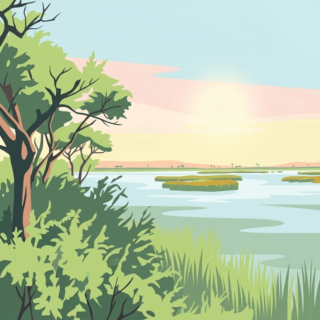
A stylized illustration showing a lake with floating vegetation patches, surrounded by green trees and bushes in the foreground, under a pastel sunset sky.

Haleji Lake

Protected area

Park overview

Structured park overview, official facts, and landscape profile for Haleji Lake

Haleji Lake park facts, protected area profile, and essential visitor context

Review the core facts for Haleji Lake, including designation, size, terrain, visitor scale, habitats, and operating context in one park-focused overview.

About Haleji Lake

Haleji Lake sits in the lowlands of Thatta District in Sindh Province, in the southeastern part of Pakistan not far from the Indus river delta and the coast. The lake itself is a relatively small but ecologically rich freshwater body, surrounded by an interconnected network of marshes and brackish seepage lagoons. Together, these features form a wetland landscape that is unusual in the region, blending managed freshwater habitat with naturally saline environments.

The lake occupies a distinctive place in the geography of Sindh. Before its transformation, the site was a saline lagoon typical of the coastal and deltaic zones shaped by the Indus. Its conversion into a freshwater reservoir in the early twentieth century linked it directly to the Indus River system through an engineered canal, an intervention that gave the lake its modern hydrological identity. Today, the surrounding marshes and seepage lagoons still carry the imprint of the area's original saline character, framing the freshwater lake in a broader mosaic of wetland habitats.

Ecologically, Haleji Lake is most notable for its avifauna. The lake is a wintering site for native and migratory waterfowl and supports populations of species such as cotton teal, Indian spot-billed duck, purple moorhen, and pheasant-tailed jacana. It also functions as a breeding area for egrets and herons, making it valuable across multiple seasons rather than only during migration. The lake's Ramsar designation, granted relatively early in the history of Pakistan's participation in the international wetland convention, reflects both its ecological importance and its status as a recognized conservation landmark.

For visitors and researchers, Haleji Lake represents an accessible example of how engineered water infrastructure and natural wetland processes can combine to create a valuable habitat. It also illustrates the wider ecological context of the Sindh coast and the Indus delta, where freshwater, brackish, and saline systems meet, supporting one of Pakistan's significant inland bird sanctuaries.

Quick facts and research context for Haleji Lake

Haleji Lake is located in Thatta District of Sindh Province in southeastern Pakistan, roughly between the Indus delta wetlands and the outskirts of Karachi. It is a perennial freshwater body surrounded by marshes and brackish seepage lagoons that together form a larger wetland complex.

The lake was converted from a saline lagoon into a freshwater reservoir during the late 1930s and early 1940s through canal works drawing on the Indus River, with major construction completed in 1943 to meet wartime water demand for Karachi. It was recognized as a Ramsar wetland of international importance in 1976, reflecting its ecological value as a refuge for waterfowl.

Protection and recognition

Documented terrestrial protection scope, designation year, and Ramsar listing

Haleji Lake Protection Status and International Recognition Record

Historical protection records for Haleji Lake outline a terrestrial designation established in 1976 alongside official Ramsar wetland recognition. Structured conservation facts document the regulatory status and institutional context associated with the protected landscape.

International recognition

Protection details

Protection scope
Terrestrial
Designated year
1976
Park context

Deeper park guide and search-rich context for Haleji Lake

Haleji Lake history, landscape, wildlife, and travel context

Explore Haleji Lake through its history, landscape character, ecosystems, wildlife, conservation priorities, cultural context, and seasonal travel timing in a structured park guide built for atlas discovery and search intent.

Why Haleji Lake stands out

Haleji Lake is best known as one of Pakistan's most important freshwater wetlands for migratory and resident waterfowl. It functions as a wintering site for native and migratory species such as cotton teal, Indian spot-billed duck, purple moorhen, and pheasant-tailed jacana, while also serving as a breeding ground for egrets and herons. The lake's combination of open freshwater, fringing marshes, and adjacent brackish lagoons creates the habitat diversity that supports these bird populations. Its long-standing Ramsar designation underscores its role as a landmark site in Pakistan's wetland conservation history.
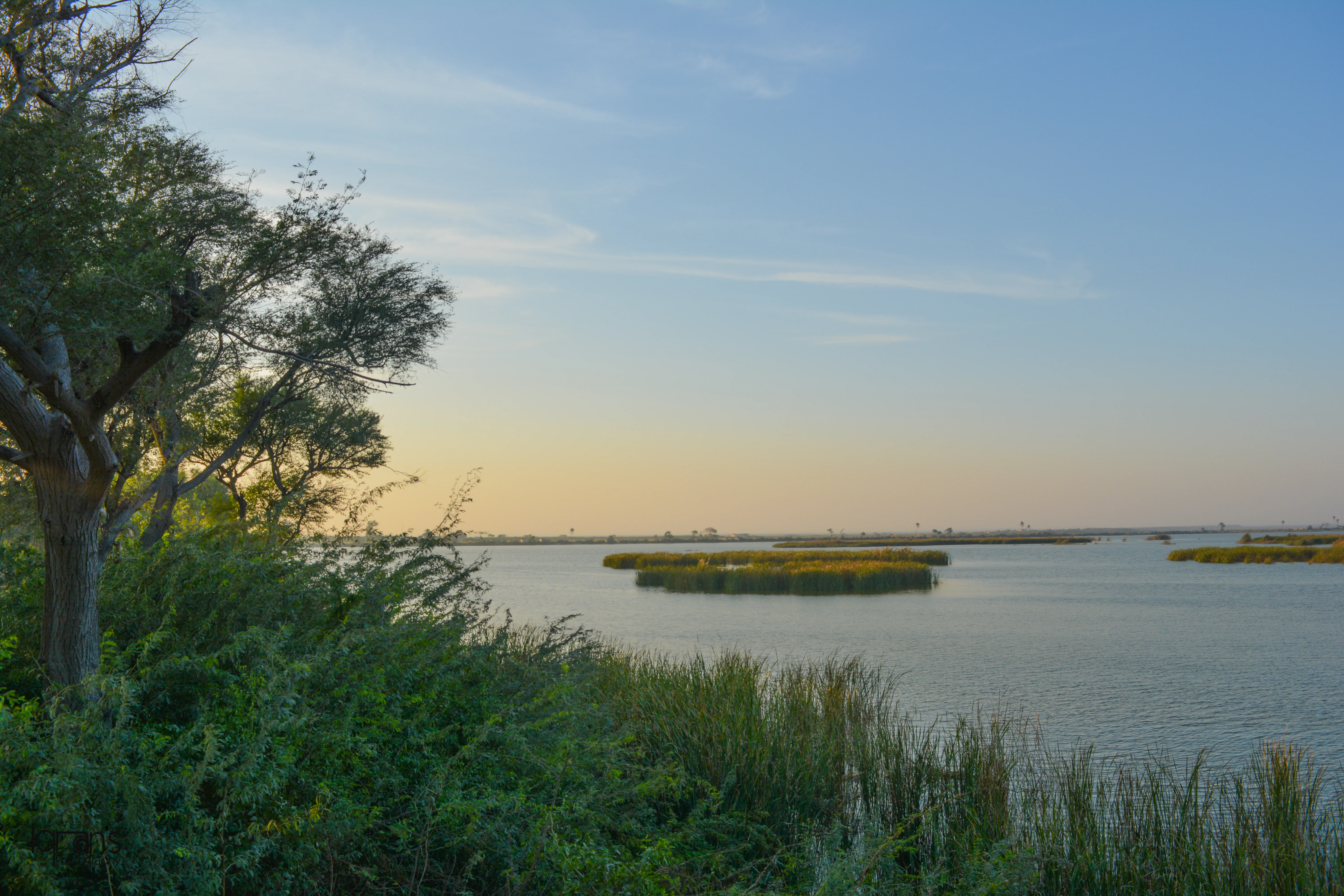
A wide landscape view of a calm lake with floating islands of vegetation, framed by green bushes and a tree on the left, under a clear sky with a soft horizon glow.
Scenic view of Haleji Lake with floating vegetation patches and foreground greenery under a soft twilight sky.

Haleji Lake history and protected-area timeline

Haleji Lake was originally a saline lagoon lying in the lowlands of Sindh. In the 1930s, as Karachi's water demand grew, authorities chose the site for conversion into a reservoir that could supply additional freshwater to the city. This marked the beginning of the lake's transformation from a natural coastal lagoon to a managed freshwater body.

The decisive phase of this transformation occurred during the Second World War. With British troops stationed in and around Karachi, additional freshwater capacity became a strategic necessity. The colonial government of Sindh Province decided to enlarge the lake's capacity by constructing an embankment and introducing a feeder canal that drew freshwater from the Indus River. Salt water inside the lagoon was drained out, and the new freshwater reservoir was developed on a wartime construction schedule. The project, placed on a war footing, was completed within roughly 24 months and finished in 1943.

In the decades after independence, the lake continued to serve as both a water source and an increasingly recognized ecological site. Its formal recognition as a Ramsar wetland of international importance in 1976 cemented its place in Pakistan's protected-area framework. This relatively early designation reflected growing awareness of the lake's value for migratory waterfowl and the broader ecological importance of the Sindh wetlands.

Haleji Lake landscape and geographic character

Haleji Lake occupies a flat, low-lying landscape characteristic of the Sindh plains east of Karachi. The lake itself is a roughly square freshwater body, flanked by surrounding marshes and brackish seepage lagoons. These adjoining wetlands remain influenced by the saline conditions that once defined the entire site, providing habitat variation that gives the broader wetland complex its distinctive character.

The lake's engineered embankments and feeder canal link it visually and functionally to the wider Indus River system. Where the canal meets the lake, the area transitions between managed freshwater inflows and the more naturally fluctuating marshland fringes. In the surrounding terrain, shallow seepage lagoons and marshy depressions create soft, open vistas typical of lowland Sindh, with reeds, scattered wetland vegetation, and seasonally inundated ground defining the view.

Alongside the freshwater lake, the persistent brackish character of neighboring lagoons reflects the area's position between the Indus delta and the Arabian Sea coast. This combination of engineered freshwater habitat and naturally saline wetland contributes to the hydrological and ecological diversity of the site, and shapes both the scenery and the biological value of the landscape.

Haleji Lake ecosystems, habitats, and plant life

Haleji Lake's ecological character is shaped by the interaction of freshwater, marshland, and brackish lagoon environments within a single wetland complex. The lake is fed by Indus River water through a canal system, supporting a stable perennial freshwater body that contrasts with the surrounding seepage lagoons, where salinity still plays a defining ecological role.

This combination of freshwater and brackish habitats supports a wide range of wetland plant communities, from aquatic and emergent vegetation around the freshwater margins to salt-tolerant species along the seepage lagoons. The result is a layered ecological system in which different plant assemblages occupy specialized niches around the lake's edges and along its inflow and outflow channels.

Such habitat diversity is the ecological foundation of the lake's importance for birds and other wetland wildlife. The freshwater open water provides feeding and resting areas for waterfowl, while the marshes and reedbeds offer nesting cover and shelter. The brackish seepage lagoons add further variability, contributing to a wetland mosaic that supports species with different salinity tolerances and seasonal behaviors.

Haleji Lake wildlife and species highlights

Haleji Lake is most renowned for its birdlife, which is the principal reason the wetland has gained both national and international recognition. The lake serves as a wintering ground for native and migratory waterfowl, attracting species that move into Sindh's milder winter climate from colder regions further north or from neighboring parts of South and Central Asia.

Species recorded at the site include cotton teal, a small dabbling duck well adapted to shallow freshwater margins, as well as the Indian spot-billed duck, another teal-like waterfowl common across South Asian wetlands. The purple moorhen, a striking wetland species with vibrant plumage, inhabits the reedy fringes, while the elegant pheasant-tailed jacana is associated with floating vegetation and shallow marshy areas. Together, these species illustrate the diversity of feeding strategies and habitat preferences supported by the lake.

In addition to wintering visitors, Haleji Lake functions as a breeding site for wading birds. Egrets and herons nest in the lake's marshy surroundings, taking advantage of the reedbeds and shallow water for foraging and raising young. The combination of resident breeders and seasonal migrants makes the lake ecologically productive across much of the year, with the peak of visible activity often coinciding with the cooler winter months when migratory species are present.

Haleji Lake conservation status and protection priorities

Haleji Lake's principal conservation significance lies in its recognition as a Ramsar wetland, an international designation reserved for wetlands of outsized ecological value. Its inclusion in this list reflects the lake's importance for migratory waterfowl and its role as a refuge for breeding and wintering bird species within the broader Indo-Pakistan flyway context.

From a habitat standpoint, the lake protects a rare inland freshwater sanctuary in a region where much of the natural water system is dominated by saline, brackish, or deltaic conditions. By maintaining open freshwater habitat, the lake sustains species that would otherwise have limited suitable refuges in Sindh. The surrounding marshes and seepage lagoons, which retain their brackish character, also protect wetland types that complement the freshwater core and add ecological resilience to the area.

The lake also illustrates how engineered water infrastructure can serve conservation objectives when paired with habitat protection. The original transformation of the site from a saline lagoon into a freshwater reservoir was driven by urban water supply needs, but the resulting wetland has been conserved for its ecological value. This dual history; engineering and ecological protection, gives Haleji Lake a distinctive place in Pakistan's conservation landscape.

Haleji Lake cultural meaning and human context

Haleji Lake's cultural context is closely tied to the city's growth. The lake's conversion into a freshwater reservoir was driven by the expanding water needs of Karachi, Pakistan's largest urban center on the Sindh coast. This urban-industrial demand shaped the lake's modern form and ensured that the site became a managed element of the regional water system rather than a purely natural feature of the landscape.

The wartime urgency of its construction also links the lake to the broader history of twentieth-century Sindh, when strategic infrastructure projects reshaped parts of the province's hydrology. Today, the lake retains a dual identity as both a functional water resource and a recognized ecological sanctuary, and it is locally associated with the wetland landscapes between Karachi and the broader Indus delta region.

Top sights and standout views in Haleji Lake

Haleji Lake stands out for its dual identity as both an engineered freshwater reservoir and a recognized international wetland sanctuary. Its Ramsar status, granted in 1976, places it among Pakistan's most established protected wetland sites and underscores its continuing ecological importance.

The most distinctive highlights of the lake are its freshwater birdlife, including wintering populations of cotton teal, Indian spot-billed duck, purple moorhen, and pheasant-tailed jacana, along with breeding colonies of egrets and herons. The surrounding complex of marshes and brackish seepage lagoons adds further distinction, providing a unique blend of freshwater and saline wetland environments in the Sindh lowlands.

Best time to visit Haleji Lake

Haleji Lake is most rewarding for visitors during the cooler months, when migratory waterfowl arrive at the lake and join the resident bird populations that breed in its marshes and reedbeds. Wintering species such as cotton teal, Indian spot-billed duck, purple moorhen, and pheasant-tailed jacana are typically associated with this season, making it a particularly appropriate period for birdwatching and wetland observation.

Outside of the migratory season, the lake retains year-round ecological value, with egrets and herons continuing to use the site as breeding and foraging habitat. The surrounding marshes and brackish lagoons offer ecological interest at any time, though the cooler, drier months tend to bring more comfortable conditions for outdoor exploration in the Sindh lowlands.
Monthly climate preview

Long-term representative measurements of monthly temperature and precipitation patterns

Haleji Lake Climate Normals, Annual Temperature and Precipitation Rhythm

Representative coordinates record measured monthly temperature swings from moderate winter lows to high summer maximums alongside light multi-month precipitation patterns. Reviewing the complete twelve-month profile provides detailed meteorological data for ongoing geographic and ecological analysis across the protected area.
Annual mean26 °C
18 °C32 °C
Jan18°
Feb21°
Mar25°
Apr29°
May31°
Jun32°
Jul31°
Aug30°
Sep29°
Oct28°
Nov24°
Dec20°
Warmest month
June

32 °C

Coolest month
January

18 °C

Wettest month
August

1.8 mm/day

Driest month
November

0 mm/day

Park location guide

Geography guide, regional context, and park location map for Haleji Lake

Haleji Lake park geography, regions, and map view in Pakistan

Understand where Haleji Lake sits in Pakistan through a broader geographic reading of the surrounding landscape, nearby location context, and its mapped position within the national park landscape.

How Haleji Lake fits into Pakistan

Pakistan, officially the Islamic Republic of Pakistan, is a federal parliamentary Islamic republic in South Asia. It is the fifth-most populous country and the 33rd-largest by area. The country gained independence from British India in 1947 and has a diverse history spanning ancient civilizations including Mehrgarh and the Indus Valley Civilisation. Pakistan shares maritime borders with Oman and is bounded by the Arabian Sea, Gulf of Oman, and several neighboring countries.

Wider geography shaping Haleji Lake in Pakistan

Pakistan is located in South Asia, bordered by the Arabian Sea to the south, the Gulf of Oman to the southwest, and shares land borders with India to the east, Afghanistan to the west, Iran to the southwest, and China to the northeast. The country also shares a maritime border with Oman in the Gulf of Oman. The Wakhan Corridor in Afghanistan separates Pakistan from Tajikistan in the northwest.

Map view of Haleji Lake

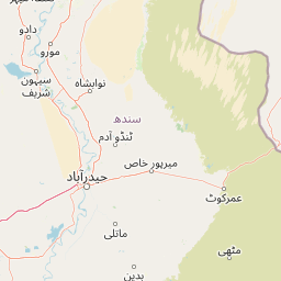
Use this park location map to pinpoint Haleji Lake in Pakistan, understand its exact geographic position, and read its mapped placement within the surrounding landscape more clearly.

Pigeon | © OpenStreetMap contributors

Location context for Haleji Lake

SindhThatta District

Explore protected area views, open water expanses, and marshland terrain across Sindh

Haleji Lake Photos and Scenery: Visualizing Wetland Landscapes and Habitats

Visual documentation of Haleji Lake reveals the flat terrain, freshwater expanses, and fringing marshes characteristic of the Sindh lowlands. Examining these protected area views helps observers understand the habitat mosaic supporting regional waterfowl populations and engineered wetland environments.

A wide landscape view of a calm lake with floating islands of vegetation, framed by green bushes and a tree on the left, under a clear sky with a soft horizon glow.

Park atlas

Compare surrounding wetland habitats and related protected landscapes across Sindh

Explore Parks Near Haleji Lake and Connected Regional Protected Areas

Visitors exploring Haleji Lake can continue comparing regional protected areas and wetland reserves throughout the surrounding Indus basin lowlands. Expanding the geographic view helps connect individual freshwater reservoirs with broader conservation corridors and adjacent marshland terrain.
Watercolor painting of a calm lake with grassy foreground, small islands, and distant hills under a soft light.
Wildlife reserveSindh
About 32 km away#1 closest

Northeast

Keenjhar Lake Wildlife Reserve: Sindh Province Protected Wetland and Geographic Atlas

Mapped freshwater wetland and regional wildlife sanctuary

Keenjhar Lake is a prominent freshwater wetland and wildlife reserve in the Thatta District of Sindh. This expansive basin serves as a key ecological anchor for migratory waterbirds and a central feature of the regional landscape. The area combines significant hydrological value with distinct cultural history, providing a unique look into the protected geography of southeastern Pakistan.

Area
134.68 km²
Relief
Lowland
Scope
Terrestrial
Water
Water-dominated
National parkPakistan
About 101 km away#2 closest

North

Kirthar National Park: Discover Pakistan's Arid Mountain Protected Landscape

Explore the mapped geography and unique terrain of this vital national park.

Kirthar National Park represents a critical expanse of protected semi-arid mountainous terrain in southern Pakistan, covering over 3,000 square kilometers. It is recognized for its significant populations of Sindh ibex, urial, and chinkara gazelles, alongside a diverse array of raptors, including migratory vulture and eagle species. The park's unique landscape, characterized by parallel ridges and deep, dry valleys, provides crucial habitat in a region facing considerable development pressures, offering a distinct geographical context for protected area exploration.

Area
3,087 km²
Established
1974
IUCN
II
Relief
Mountain
Wildlife reserveSindh
About 104 km away#3 closest

Southeast

Jubho Lagoon Wildlife Reserve: Coastal Wetland Geography and Regional Map Context

Mapping brackish lagoons and migratory bird habitats in Sindh

Investigate the protected landscape of Jubho Lagoon, a shallow brackish wetland in southern Sindh. The area features a complex mosaic of tidal inlets, exposed mudflats, and freshwater-influenced marshes that serve as a primary regional habitat for migratory flamingos and pelicans.

Area
7.06 km²
Established
2001
Relief
Lowland
Scope
Terrestrial
A pale, minimalist watercolor painting showing soft green hills or islands against a light, misty horizon.
Marine protected areaBalochistan
About 120 km away#4 closest

West

Churna Island Marine Protected Area: Geography and Coastal Atlas of Balochistan

Mapping the coral reef systems and rocky island terrain

Churna Island represents a unique marine protected area located near the border of Balochistan and Sindh. Characterized by a desolate rocky surface, the true ecological value resides in its extensive submerged reef structures, which provide habitat for a vast array of coral species and pelagic fish. This atlas resource provides a structured look at the island's coastal geography and its growing role in regional marine conservation.

Area
0.6 km²
Established
2024
Relief
Upland
Climate
Subtropical
Nature reserveSindh
About 151 km away#5 closest

North

Pai Forest Nature Reserve: Geography and Protected Landscape Context in Sindh

An Indus floodplain reserve featuring arid and riverine flora

Pai Forest in Sindh offers a distinctive study of protected landscapes where canal irrigation sustains both riverine and arid plant communities. This reserve functions as a vital ecological island amidst agricultural plains, providing a rich case for exploring the interaction between water management and natural terrain within the Indus valley geography.

Relief
Lowland
Climate
Arid
Scope
Terrestrial
Water
Major water bodies
Protected areaBalochistan
About 178 km away#6 closest

Northwest

Miani Hor Protected Area: Coastal Lagoon Mapping and Regional Geography in Balochistan

Coastal lagoon and unique mangrove wetland ecosystem

Miani Hor functions as a major tidal lagoon and protected wetland along the Balochistan coast. The area is defined by its extensive mangrove forests and connection to the Arabian Sea, providing a essential study in estuarine geography and wetland conservation within the Lasbela District.

Area
74.71 km²
Established
2001
Relief
Lowland
Scope
Mixed
National parkBalochistan
About 201 km away#7 closest

Northwest

Hingol National Park: Pakistan's Unique Protected Landscape and Geological Atlas

Discover dramatic rock formations and coastal geography.

Hingol National Park stands as a monumental protected landscape within Balochistan, Pakistan, offering an unparalleled atlas view of geological diversity. Renowned for its hoodoos like the Princess of Hope and the Balochistan Sphinx, the park also features active mud volcanoes and striking coastal semi-desert terrain. The confluence of the Hingol River with the Arabian Sea creates important wetland habitats. This national park provides a rich context for exploring unique natural formations and regional geography, making it a significant point of discovery within Pakistan's protected areas.

Area
6,100 km²
Established
1988
IUCN
II
Relief
Mixed relief
Wildlife reserveSindh
About 231 km away#8 closest

North

Deh Akro-II Desert Wetland Complex: Protected Landscape and Geographic Mapping

Inland wetland and desert sanctuary in Sindh, Pakistan

Explore the distinctive geography of Deh Akro-II Desert Wetland Complex, a protected wildlife reserve defined by its unusual combination of sand dunes and freshwater lakes. This atlas entry details the natural terrain and ecological boundaries of one of Pakistan's most significant inland wetland systems, illustrating the complex intersection of arid and aquatic habitats within the Indus River system.

Area
205 km²
Established
1988
Relief
Lowland
Climate
Arid

Common questions about visiting, size, designation, and location context for Haleji Lake

Haleji Lake FAQs for park facts, access, geography, and protected area context

Find quick answers about Haleji Lake, including protected-area facts, park geography, trail and visitor context, and how the park fits into its surrounding country and regional landscape.
MoriAtlas Explorer

Continue Your Protected Areas Search Across the Global Atlas

Deepen your exploration by continuing the structured search for national parks and protected areas worldwide. Utilize the comprehensive filtering capabilities to compare different conservation landscapes and refine your understanding of global park geography. Discover more about the distribution and characteristics of protected natural areas.

Global natural geography