
Mori Atlas logo
Nature reserveHecken- und Grünlandkomplex auf der Sonnenborner Hochfläche und dem Knappberg

A mosaic of semi-dry limestone grasslands and traditional cultural hedgerow landscapes in the Lippe hill country.

Hecken- und Grünlandkomplex auf der Sonnenborner Hochfläche und dem Knappberg Protected Nature Reserve Geography

(Naturschutzgebiet Hecken- und Grünlandkomplex auf der Sonnenborner Hochfläche und dem Knappberg)

The Hecken- und Grünlandkomplex auf der Sonnenborner Hochfläche und dem Knappberg serves as an ecologically vital nature reserve within the Lippe district of Nordrhein-Westfalen. This protected area preserves a rare cultural landscape defined by the 286.3-metre Knappberg hill, featuring distinct calcareous grasslands, rugged scree slopes, and an extensive network of traditional hedgerows. Through active conservation grazing, these parcels maintain critical habitats for specialized gentians, orchids, and grassland butterflies.

nature reservecalcareous grasslandsemi-dry grasslandhedgerowsshrub mosaiccultural landscape
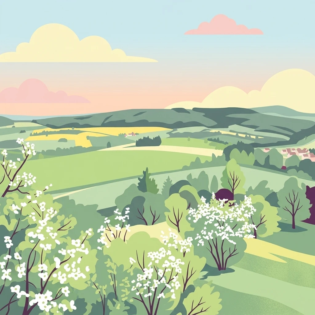
A soft-toned digital illustration of rolling hills and fields with blooming white bushes in the foreground, representing a countryside nature reserve.

Hecken- und Grünlandkomplex auf der Sonnenborner Hochfläche und dem Knappberg

Nature reserve

Park overview

Structured park overview, official facts, and landscape profile for Hecken- und Grünlandkomplex auf der Sonnenborner Hochfläche und dem Knappberg

Hecken- und Grünlandkomplex auf der Sonnenborner Hochfläche und dem Knappberg park facts, protected area profile, and essential visitor context

Review the core facts for Hecken- und Grünlandkomplex auf der Sonnenborner Hochfläche und dem Knappberg, including designation, size, terrain, visitor scale, habitats, and operating context in one park-focused overview.

About Hecken- und Grünlandkomplex auf der Sonnenborner Hochfläche und dem Knappberg

Hecken- und Grünlandkomplex auf der Sonnenborner Hochfläche und dem Knappberg is a compact, ecologically rich nature reserve in the eastern part of the Lippe district of North Rhine-Westphalia. Located on the municipal territory of Barntrup and immediately bordering the village of Sonneborn, it preserves a piece of traditional agricultural landscape that has become vanishingly rare in the intensively managed countryside of western Germany. The reserve consists of two separate parcels that together enclose the 286.3-metre Knappberg and fall on either side of the Kreisstraße 58, with the state border with Lower Saxony running roughly one kilometre to the east.

The protected area sits within the rolling hill country of the Lippe and Pyrmont Bergland, a region characterised by ridges, valley basins, and small villages with long histories of mixed farming. The reserve's ecological value rests on the convergence of several habitat types on a relatively small footprint. The semi-dry grasslands, locally known as Enzian-Zwenkenrasen, occupy the calcareous soils of the Knappberg slopes and contain some of the highest plant species diversity per square metre in the district. Hedges, shrub groups, and former pasture that has become bushy in places add structural variety and create ecotones that are important for insects, breeding birds, and small mammals. On the southern slopes, small-scale landslides have exposed bedrock and scree, producing open microhabitats used by specialist plants and invertebrates.

The reserve's significance is enhanced by the surrounding protected landscape network. The Landschaftsschutzgebiet Lipper und Pyrmonter Bergland forms a buffer wherever the nature reserve does not adjoin built-up land, while the related Landschaftsschutzgebiet Hecken- und Grünlandkomplex Sonneborn extends the hedgerow and grassland complex slightly to the south. Just about 100 metres further south lies the Biotopkomplex am Mühlenturm nature reserve, which also contains hedgerows and lean grassland. Together these adjacent areas form a coherent ecological cluster of semi-open, traditionally managed habitats that the individual reserves could not sustain on their own.

Although the nature reserve itself covers only about 51 hectares, its compact size and sharp ecological focus make it disproportionately important for regional biodiversity. The flanks of the Knappberg harbour several plant species that are listed as threatened in North Rhine-Westphalia, and the open grasslands and hedgerows support a typical fauna of culturally shaped low-intensity farmland, including breeding birds such as the Baumpieper, Dorngrasmücke, Neuntöter, Goldammer, Klappergrasmücke, and Kuckuck, as well as rare butterflies like the Nierenfleck-Zipfelfalter, Mattscheckiger Braun-Dickkopffalter, and Schachbrettfalter. Active conservation grazing with sheep and goats, in place since 2003, has been central to keeping the open character of the grasslands and counteracting the spread of mesophilic edge species and ruderal indicators.

Quick facts and research context for Hecken- und Grünlandkomplex auf der Sonnenborner Hochfläche und dem Knappberg

Hecken- und Grünlandkomplex auf der Sonnenborner Hochfläche und dem Knappberg is a Naturschutzgebiet in the Lippe district of North Rhine-Westphalia, established in 1962. It covers roughly 51.4 hectares across two separate parcels, with identifier LIP-005 and WDPA record 164159. The reserve lies northeast of the centre of Barntrup, immediately next to the village of Sonneborn and about one kilometre west of the Lower Saxony state border. Its highest point is the 286.3-metre Knappberg, which carries species-rich Enzian-Zwenkenrasen semi-dry grassland. The area is managed by the Kreis Lippe authority, with active grazing since 2003 carried out by the Biologische Station Lippe. Adjacent protected areas include the Landschaftsschutzgebiet Lipper und Pyrmonter Bergland and the nearby Biotopkomplex am Mühlenturm nature reserve.

Protection and recognition

Documented protection records and global conservation listings for this protected area

Protection Status and International Recognition for Hecken- und Grünlandkomplex auf der Sonnenborner Hochfläche und dem Knappberg

Official records outline the established protection status and management scope for Hecken- und Grünlandkomplex auf der Sonnenborner Hochfläche und dem Knappberg within global conservation databases. Verified data sources provide structured insights into the designation history and formal recognition details associated with the protected landscape.

Protection details

WDPA ID
164159
Park context

Deeper park guide and search-rich context for Hecken- und Grünlandkomplex auf der Sonnenborner Hochfläche und dem Knappberg

Hecken- und Grünlandkomplex auf der Sonnenborner Hochfläche und dem Knappberg history, landscape, wildlife, and travel context

Explore Hecken- und Grünlandkomplex auf der Sonnenborner Hochfläche und dem Knappberg through its history, landscape character, ecosystems, wildlife, conservation priorities, cultural context, and seasonal travel timing in a structured park guide built for atlas discovery and search intent.

Why Hecken- und Grünlandkomplex auf der Sonnenborner Hochfläche und dem Knappberg stands out

The reserve is best known for its species-rich Enzian-Zwenkenrasen, a type of semi-dry grassland found on the slopes of the Knappberg hill. These grasslands support a notable concentration of rare plant species, including the Fransenenzian (fringed gentian), Männliches Knabenkraut (early purple orchid), Purgier-Lein (pale flax), and several other calcareous-grassland specialists. The protected area is also recognised for its mosaic of hedgerows and lean meadows, which together form one of the more diverse small-scale cultural landscapes remaining in the Lippe hill country.
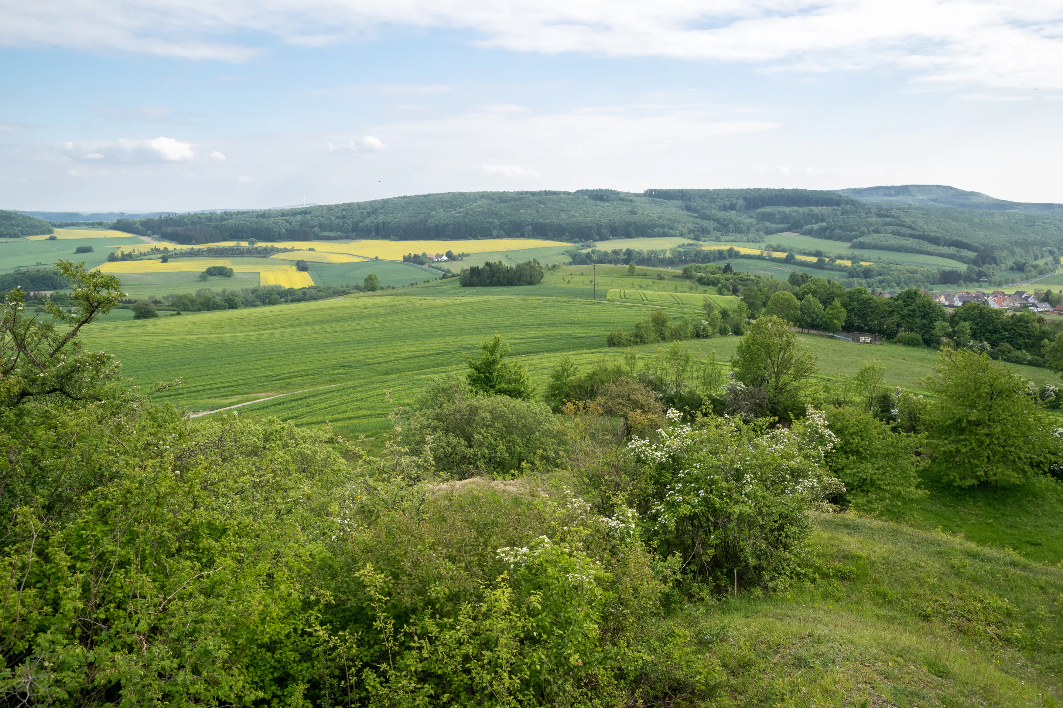
A wide landscape view of rolling green hills, agricultural fields, yellow rapeseed crops, and distant forests under a partly cloudy sky.
A view overlooking the mixed agricultural landscape and green hills of the Hecken- und Grünlandkomplex nature reserve in Barntrup.

Hecken- und Grünlandkomplex auf der Sonnenborner Hochfläche und dem Knappberg history and protected-area timeline

The area that is now the Hecken- und Grünlandkomplex auf der Sonnenborner Hochfläche und dem Knappberg was placed under formal nature protection (Naturschutz) in 1962, making it one of the earlier designated nature reserves in the Lippe district. Its protection reflects the broader post-war recognition in North Rhine-Westphalia of semi-dry grasslands, hedgerows, and traditional orchard-and-pasture landscapes as ecologically valuable features of the cultural countryside.

A defining development in the reserve's recent management came in 2003, when the Biologische Station Lippe began a consistent grazing regime using a herd of sheep and goats. According to the North Rhine-Westphalian Biotopkataster, this grazing intervention has been effective at pushing back invading mesophilic edge species and ruderal indicators that had been encroaching on the semi-dry grasslands, and has helped maintain the open character of the Knappberg slopes. The reserve now functions as a small, actively managed component of the wider landscape protection network in the Lippe and Pyrmont hill country.

Hecken- und Grünlandkomplex auf der Sonnenborner Hochfläche und dem Knappberg landscape and geographic character

The reserve occupies a gently rolling section of the Lippe hill country on the Sonnenborner Hochfläche, a small plateau whose most prominent point within the protected area is the 286.3-metre Knappberg. The terrain is shaped by the underlying geology of the region, which supports calcareous soils on the steeper, sun-exposed slopes and more acidic, deeper soils on the broader plateau. The result is a varied micro-topography that rewards close exploration.

Within the protected area, two clearly distinct landscape elements stand out. The first is the network of semi-open grasslands and lean meadows that still cover much of the Knappberg and the immediate plateau. Some of these grasslands have been gradually colonised by shrubs, particularly across the entire eastern part of the reserve and along its northern edge, where S chlehen-Liguster-Gebüsche (blackthorn-privet scrub) and individual bushes have spread into the formerly open sward. The second is the rugged southern flank, where small-scale landslides have exposed bare rock and produced sparsely vegetated scree slopes that interrupt the otherwise continuous turf.

The hedge complex that gives the reserve the first half of its name runs along parcel boundaries, slope contours, and former field edges. These hedges, together with groups of shrubs scattered across the grassland embankments, create a finely patterned cultural landscape typical of older farming systems in the region. East of the reserve, the state border with Lower Saxony runs through a continuation of the same hill landscape, and the surrounding Landschaftsschutzgebiet Lipper und Pyrmonter Bergland maintains a broadly similar character beyond the reserve's boundaries.

Hecken- und Grünlandkomplex auf der Sonnenborner Hochfläche und dem Knappberg ecosystems, habitats, and plant life

The ecological identity of the reserve is built on a mosaic of calcareous semi-dry grassland, lean meadow, hedgerow, scrub, and rock-exposure habitats compressed into a small area. The most ecologically distinctive component is the Enzian-Zwenkenrasen community on the Knappberg, a type of biodiversity-rich, nutrient-poor grassland maintained by low-intensity grazing or mowing. These communities are known to harbour specialised plant species adapted to dry, base-rich conditions, and they are among the most threatened habitat types in the North Rhine-Westphalian lowlands.

Hedgerows and scrubby edges add vertical structure and species heterogeneity. Patches of S chlehen-Liguster-Gebüsche mix with solitary bushes to form transitional zones between the open grasslands and the surrounding landscape. The exposed rock and scree on the southern slope introduce yet another habitat layer, hosting plants and invertebrates that depend on bare mineral substrate and warm microclimates.

Flora records drawn from the regional Rote Liste (Red List of threatened species in North Rhine-Westphalia) include Blutwurz (common tormentil), Deutscher Fransenenzian and Gewöhnlicher Fransenenzian (fringed gentians), Gemeines Zittergras (quaking grass), Gewöhnliche Kreuzblume (common milkwort), Großes Zweiblatt (twayblade), Frühlings-Fingerkraut (spring cinquefoil), Hain-Augentrost (eyebright), Kleiner Klappertopf (yellow rattle), Kleines Habichtskraut (hawkweed), Männliches Knabenkraut (early purple orchid), Purgier-Lein (pale flax), Rundblättrige Glockenblume (round-leaved bellflower), Saat-Esparsette (sainfoin), Schmalblättriger Hohlzahn (narrow-leaved hemp-nettle), Trauben-Gamander (wall germander), Weidenblättriger Alant (willow-leaf inula), and Wiesen-Kammgras (crested dog's-tail). The combination of these species confirms the calcareous character of the Knappberg grassland and its continuing botanical importance despite small overall size.

The fauna reflects the same cultural-grassland emphasis. Insects of conservation interest include the Kleines Wiesenvögelchen (small heath), Mattscheckiger Braun-Dickkopffalter (a skipper butterfly), Nierenfleck-Zipfelfalter (Duke of Burgundy), and Schachbrettfalter (marbled white), all reliant on open, flower-rich swards. Grasshoppers include Heidegrashüpfer and Verkannter Grashüpfer. Among breeding birds, the mix of open fields, hedgerows, and scrub produces habitat for Baumpieper (tree pipit), Dorngrasmücke (common whitethroat), Gelbspötter (melodious warbler), Goldammer (yellowhammer), Klappergrasmücke (lesser whitethroat), Kuckuck (common cuckoo), Neuntöter (red-backed shrike), and Turteltaube (European turtle dove). The area has also been recorded as supporting Wachtel (common quail). Among gastropods, the Gemeine Heideschnecke and the better-known Weinbergschnecke (Roman snail) have been documented.

Hecken- und Grünlandkomplex auf der Sonnenborner Hochfläche und dem Knappberg wildlife and species highlights

Wildlife interest in the Hecken- und Grünlandkomplex centres on the species of low-intensity, flower-rich grassland and heterogenous hedgerow landscapes. The reserve's breeding bird community is one of its strongest faunal assets. Species such as Baumpieper, Dorngrasmücke, Gelbspötter, Goldammer, Klappergrasmücke, Kuckuck, Neuntöter, Turteltaube, and Wachtel use the patchy combination of open ground, scrub, and tall hedges that the reserve preserves, and several of these are listed as threatened in North Rhine-Westphalia.

Lepidoptera are another conservation focus. The open, species-rich swards of the Knappberg host butterflies and moths that have become scarce across much of intensively farmed western Germany, including the Schachbrettfalter, Nierenfleck-Zipfelfalter, Mattscheckiger Braun-Dickkopffalter, and the day-flying moth Kleines Wiesenvögelchen. Orthopterans such as the Heidegrashüpfer and the Verkannter Grashüpfer are also documented, reinforcing the picture of an area where structural variety in vegetation supports an unusually diverse insect fauna.

Gastropods add a less showy but ecologically meaningful component: the Gemeine Heideschnecke and the Weinbergschnecke both occur in the reserve. Larger mammal fauna are not described in detail in the underlying documentation, but the pattern of habitats suggests that small to medium-sized species typical of the Lippe uplands, including various bats, foxes, and roe deer, are reasonably expected to use the area in passing or for foraging.

Hecken- und Grünlandkomplex auf der Sonnenborner Hochfläche und dem Knappberg conservation status and protection priorities

From a conservation perspective, the Hecken- und Grünlandkomplex represents a small but disproportionately valuable remnant of the calcareous semi-dry grassland and hedgerow cultural landscape that once covered much larger areas of the Lippe hill country. Such habitats have declined sharply across North Rhine-Westphalia, partly due to agricultural intensification and partly due to abandonment followed by scrub encroachment, and the reserve helps hold a reference example intact.

The active management regime introduced in 2003 has been pivotal to maintaining the reserve's open habitats. A sheep and goat herd operated by the Biologische Station Lippe has been used to control incoming mesophilic edge species and ruderal indicators that had begun to displace the specialist flora of the Knappberg's Enzian-Zwenkenrasen. Without this grazing pressure, the open character of the grasslands and the botanical diversity they support would likely degrade, as the surrounding landscape becomes less capable of sustaining the disturbance regimes that historically maintained them.

The reserve's wider conservation role is multiplied by its position within a cluster of protected sites. It is embedded in the broad Landschaftsschutzgebiet Lipper und Pyrmonter Bergland, connected southward with the Landschaftsschutzgebiet Hecken- und Grünlandkomplex Sonneborn, and lies immediately adjacent to the Biotopkomplex am Mühlenturm nature reserve. Together these areas form an ecological network in which the small Naturschutzgebiet functions as a high-quality core for calcareous grassland and hedgerow species, while the surrounding landscape protection zones buffer and extend that habitat.

Hecken- und Grünlandkomplex auf der Sonnenborner Hochfläche und dem Knappberg cultural meaning and human context

The reserve sits within a long-settled hill landscape in eastern North Rhine-Westphalia, where small villages such as Sonneborn have maintained mixed agricultural traditions for centuries. The hedgerow complexes, lean meadows, and orchard-fringed pastures that the area protects are not wild landscapes but the products of generations of low-intensity farming, and the surviving patterns of hedges and field divisions reflect land-use practices that shaped the Lippe hill country over many centuries.

The Knappberg itself, rising to 286.3 metres, has functioned as a local landmark on the Sonnenborner Hochfläche and as a focal point for grazing and hay-making in the surrounding community. Modern nature conservation in this reserve is therefore not primarily about preserving wilderness; it is about preserving the cultural countryside in a form that retains its ecological richness. The collaborative, locally embedded approach of the Biologische Station Lippe, which uses a regional sheep-and-goat herd to manage the grassland, illustrates how contemporary conservation in this region continues to work closely with traditional rural land use.

Top sights and standout views in Hecken- und Grünlandkomplex auf der Sonnenborner Hochfläche und dem Knappberg

The Hecken- und Grünlandkomplex auf der Sonnenborner Hochfläche und dem Knappberg packs several of the Lippe district's most distinctive natural heritage values into a compact footprint. The Enzian-Zwenkenrasen on the Knappberg rank among the most species-rich semi-dry grasslands in the area, supporting rare gentians, orchids, and other calcareous specialists. The hedgerow network, the scrub transitions, the small-scale landslides with exposed bedrock and scree, and the mosaic of habitats compressed into two connected parcels all contribute to a markedly heterogeneous protected area on a small scale.

The reserve's identity is also shaped by its strong, ongoing conservation management. A consistent grazing regime with sheep and goats, maintained by the Biologische Station Lippe since 2003, has proven effective at keeping the open swards from being taken over by shrubs and mesophilic edge species. Combined with a network of adjacent protected landscape areas and nature reserves, the result is a coherent, locally rooted example of how traditional cultural landscape can be conserved as an active, ecologically meaningful place.

Best time to visit Hecken- und Grünlandkomplex auf der Sonnenborner Hochfläche und dem Knappberg

The reserve is a quiet cultural landscape of hedgerows, lean meadows, and the Knappberg hill, and its atmosphere shifts strongly with the seasons. Late spring and early summer are typically the most rewarding periods for the semi-dry grasslands, when fringed gentians, early purple orchids, and other calcareous specialists come into flower and the sward is at its most diverse. This is also when many of the grassland butterflies and breeding birds are most active.

Summer brings full leaf on the hedgerows and the warmest conditions on the Knappberg's south-facing slopes, intensifying the contrast between the open, sun-baked semi-dry grassland and the shaded scrub edges. Autumn reveals the structure of the landscape more clearly as grasses seed and leaves thin out, while still offering warmth and good visibility. Winters tend to be cool and exposed on the hill, with the open grassland and scrub mosaic taking on a stark, structural beauty under frost and fog. Active grazing by the Biologische Station Lippe's herd is a year-round feature that helps maintain the open character of the area.

Monthly climate preview

Long term average temperature and monthly precipitation rhythm for regional protected areas

Climate Normals and Annual Weather Patterns for Hecken- und Grünlandkomplex auf der Sonnenborner Hochfläche und dem Knappberg

Historical climate records outline the measured monthly temperature range and daily precipitation averages across representative coordinates in Hecken- und Grünlandkomplex auf der Sonnenborner Hochfläche und dem Knappberg. Detailed twelve-month profiles provide comprehensive data for comparing seasonal thermal shifts and precipitation distribution throughout the protected landscape.
Annual mean9 °C
0 °C18 °C
Jan
Feb
Mar
Apr
May12°
Jun16°
Jul18°
Aug18°
Sep14°
Oct
Nov
Dec
Warmest month
July

17.8 °C

Coolest month
January

0 °C

Wettest month
July

2.6 mm/day

Driest month
April

1.6 mm/day

Park location guide

Geography guide, regional context, and park location map for Hecken- und Grünlandkomplex auf der Sonnenborner Hochfläche und dem Knappberg

Hecken- und Grünlandkomplex auf der Sonnenborner Hochfläche und dem Knappberg park geography, regions, and map view in Germany

Understand where Hecken- und Grünlandkomplex auf der Sonnenborner Hochfläche und dem Knappberg sits in Germany through a broader geographic reading of the surrounding landscape, nearby location context, and its mapped position within the national park landscape.

How Hecken- und Grünlandkomplex auf der Sonnenborner Hochfläche und dem Knappberg fits into Germany

Germany is a federal republic in Western and Central Europe with a population of over 83 million across sixteen constituent states. It is Europe's largest economy by nominal GDP and a major global exporter and importer. The capital is Berlin, and the country borders Denmark, Poland, Czech Republic, Austria, Switzerland, France, Luxembourg, Belgium, and the Netherlands.

Wider geography shaping Hecken- und Grünlandkomplex auf der Sonnenborner Hochfläche und dem Knappberg in Germany

Germany is located in Western and Central Europe, spanning 357,022 km². It borders Denmark to the north, Poland and the Czech Republic to the east, Austria and Switzerland to the south, and France, Luxembourg, Belgium, and the Netherlands to the west. The country has coastlines on the Baltic Sea and North Sea to the north, with the Alps located in the southern region.

Map view of Hecken- und Grünlandkomplex auf der Sonnenborner Hochfläche und dem Knappberg

Use this park location map to pinpoint Hecken- und Grünlandkomplex auf der Sonnenborner Hochfläche und dem Knappberg in Germany, understand its exact geographic position, and read its mapped placement within the surrounding landscape more clearly.

Pigeon | © OpenStreetMap contributors

Location context for Hecken- und Grünlandkomplex auf der Sonnenborner Hochfläche und dem Knappberg

Nordrhein-Westfalen

Visualizing limestone grasslands, hedgerows, and the protected hill terrain

Hecken- und Grünlandkomplex auf der Sonnenborner Hochfläche und dem Knappberg Photos and Landscapes

Visual documentation reveals the intricate topography, rare calcareous grasslands, and traditional hedgerow mosaics defining the protected area. Examining these environmental details provides clear insight into the regional terrain, vegetation patterns, and conservation character of the reserve.

A wide landscape view of rolling green hills, agricultural fields, yellow rapeseed crops, and distant forests under a partly cloudy sky.

Park atlas

Compare nearby protected areas and connected hill country landscapes across the region

Other Parks Near Hecken- und Grünlandkomplex auf der Sonnenborner Hochfläche und dem Knappberg

Browse neighboring nature reserves and protected landscapes situated near Hecken- und Grünlandkomplex auf der Sonnenborner Hochfläche und dem Knappberg. Comparing adjacent terrain helps trace broader ecological patterns across the Lippe hill country.
A watercolor painting showing a soft, green landscape with gentle rolling hills and a stream flowing through a grassy area.
Nature reserveKreis Lippe
About 11 km away#1 closest

Northwest

Quellbereich der Osterkalle: Protected Nature Reserve and Kastental Valley Atlas

A preserved stream valley landscape in Kreis Lippe

Quellbereich der Osterkalle is a protected nature reserve encompassing roughly 23 hectares of stream valley and hillside habitat. Defined by its characteristic box-shaped Kastental profile, the reserve maintains a near-natural brook system surrounded by riparian trees, wet meadows, and traditional sheep-grazed slopes within the Kreis Lippe district.

Area
0.23 km²
Established
1995
Relief
Upland
Scope
Terrestrial
A soft watercolor painting of a river flowing through a gentle green valley with scattered trees and a small stone bridge, set against a pale yellow and pink sky.
Nature reserveNordrhein-Westfalen
About 11 km away#2 closest

Southwest

Marpetal mit Passade und Zufluesse: Nature Reserve and Stream Valley Geography

Protected riparian landscapes in the district of Lippe

Marpetal mit Passade und Zufluesse consists of an 89-hectare nature reserve that safeguards the ecological integrity of small river valleys. Its terrain, defined by the Passade and Marpe streams, connects with adjacent protected lands to maintain a continuous corridor of floodplain and slope habitats within the rural Westphalian landscape.

Area
0.889 km²
Established
2005
A watercolor painting showing a stylized landscape with rolling green hills, a winding path or stream, and distant purple mountains against a white background.
Nature reserveNorth Rhine-Westphalia
About 19 km away#3 closest

West

Ilse Nature Reserve: Protected Stream Corridor and Floodplain Geography in North Rhine-Westphalia

Mapped riparian habitats and regional conservation landscape context.

Ilse Nature Reserve serves as a critical protected corridor within the Lippe district, spanning five distinct sections along the Ilse stream. The reserve is defined by its near-natural watercourse, wet meadows, and traditional orchard remnants that safeguard species-rich habitats. This geographic focus provides essential insights into the conservation of lowland stream ecosystems and their role in maintaining the ecological connectivity of the broader Bega river valley.

Area
0.142 km²
Established
2009
IUCN
IV
Relief
Upland
A soft watercolor illustration depicting a line of trees and greenery along a shoreline with rolling hills in the background.
Nature reserveKreis Lippe
About 20 km away#4 closest

Northwest

Naturschutzgebiet Abgrabung Stemmen: Protected Landscape and Regional Geography in Kreis Lippe

Post-mining habitat restoration in North Rhine-Westphalia

Gain insights into the geography and conservation status of Naturschutzgebiet Abgrabung Stemmen. This 20-hectare nature reserve in Kreis Lippe showcases the development of ruderal grasslands, willow pioneer woodland, and wetland ecosystems across a reclaimed industrial site.

Area
0.2 km²
Established
1995
A watercolor illustration of a rural landscape with a single prominent tree in the foreground, green hills in the distance, and soft fields in between.
Nature reserveNordrhein-Westfalen
About 23 km away#5 closest

Northwest

Kleiner Selberg Nature Reserve: Protected Landscape and Geographic Mapping

Essential geographic context for the Lipper Bergland protected areas

Kleiner Selberg stands as a prominent hill and nature reserve within the Kreis Herford region. Its landscape is defined by a dense population of juniper shrubs and restored heathland, offering a vital ecological corridor in the Weserbergland. Explore the spatial arrangement of its woodland patches and pasture slopes that characterize this protected hill environment.

Area
0.136 km²
Established
1971
Relief
Mountain
Climate
Temperate
A watercolor painting showing a stylized landscape with gentle, rolling hills in soft green, yellow, and purple tones, with simple evergreen trees in the midground.
Nature reserveNordrhein-Westfalen
About 24 km away#6 closest

Southwest

Hohe Warte Nature Reserve: Sandstone Landscapes of the Teutoburg Forest

Protected heath and woodland mosaic in Nordrhein-Westfalen

Hohe Warte stands as a significant protected nature reserve, encompassing a diverse mosaic of heather, birches, and dry sandstone terrain. This area at the edge of the Teutoburg Forest illustrates the ongoing transition between open pasture landscapes and regenerating woodland. The site provides a valuable look into small-scale habitat management and the geological features shaping the local Nordrhein-Westfalen environment.

Area
0.06 km²
Established
2006
IUCN
IV
Nature reserveLower Saxony
About 24 km away#7 closest

East

Weserniederung am Heiligenberg: Geography and Protected Area Overview

A rare calcareous spring system in Lower Saxony

Weserniederung am Heiligenberg protects a critical mosaic of spring-fed mires, gallery forests, and riverine woodlands in the Weserbergland of Lower Saxony. This nature reserve serves as an important hub for specialized biodiversity, preserving a rare spring horizon and high-quality floodplain forest habitats that provide nesting grounds for eagle owls and black storks.

Area
0.07 km²
Established
2016
Relief
Upland
Climate
Temperate
Watercolor painting of a rolling, forested ridge landscape in shades of green, yellow, and soft pink.
Protected areaLower Saxony
About 26 km away#8 closest

East

Ith Protected Area: Mapped Limestone Ridge Geography and Geological Features

Continuous limestone cliff formations in the Lower Saxony uplands

The Ith stands as a major geological landmark in Lower Saxony, featuring a 22 kilometer spine of Upper Jurassic limestone. This protected area preserves a unique collection of cliff crags, dense beech forests, and limestone-dependent plant communities that span the districts of Hameln-Pyrmont and Holzminden.

Relief
Mountain
Climate
Temperate
Access
Access unknown
Scope
Terrestrial

Common questions about visiting, size, designation, and location context for Hecken- und Grünlandkomplex auf der Sonnenborner Hochfläche und dem Knappberg

Hecken- und Grünlandkomplex auf der Sonnenborner Hochfläche und dem Knappberg FAQs for park facts, access, geography, and protected area context

Find quick answers about Hecken- und Grünlandkomplex auf der Sonnenborner Hochfläche und dem Knappberg, including protected-area facts, park geography, trail and visitor context, and how the park fits into its surrounding country and regional landscape.
MoriAtlas Explorer

Continue Your Protected Areas Search Across the Global Atlas

Deepen your exploration by continuing the structured search for national parks and protected areas worldwide. Utilize the comprehensive filtering capabilities to compare different conservation landscapes and refine your understanding of global park geography. Discover more about the distribution and characteristics of protected natural areas.

Global natural geography