
Mori Atlas logo
Protected landscapeHiawatha National Forest

A detailed geographic overview of protected forest boundaries, Great Lakes shorelines, and wild river corridors.

Hiawatha National Forest Protected Landscape: Atlas and Geographic Map of the Upper Peninsula

Hiawatha National Forest preserves nearly 900,000 acres of diverse terrain across the Upper Peninsula of Michigan. Defined by its dual East and West units, this protected landscape connects over 100 miles of Great Lakes coastline with inland hardwood ridges, glacial plains, and five National Wild and Scenic Rivers. The region serves as a vital ecological link in the Great Lakes basin, offering a complex, mapped expanse of wilderness areas and forested river corridors.

national forestGreat LakesLake SuperiorLake MichiganLake HuronUpper Peninsula
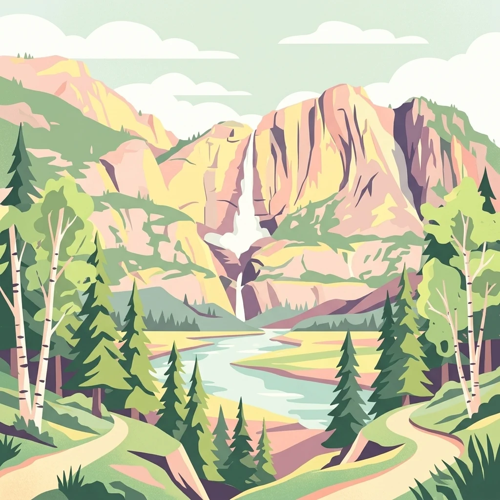
A flat-style digital illustration showing a tiered waterfall cascading down steep, stylized mountains, with a river flowing through a valley surrounded by pine and birch trees and dirt paths in the foreground.

Hiawatha National Forest

Protected landscape

Park overview

Structured park overview, official facts, and landscape profile for Hiawatha National Forest

Hiawatha National Forest park facts, protected area profile, and essential visitor context

Review the core facts for Hiawatha National Forest, including designation, size, terrain, visitor scale, habitats, and operating context in one park-focused overview.

About Hiawatha National Forest

Hiawatha National Forest is one of the flagship National Forests of the Upper Midwest, occupying a substantial portion of the eastern Upper Peninsula of Michigan and extending into the central Upper Peninsula. Its nearly 895,000 acres place it among the larger National Forests east of the Mississippi River, and its unusual geography, with extensive inland forest wrapped around Great Lakes coastlines, gives it a unique identity within the National Forest System.

The forest is organized into two non-contiguous subunits. The East Unit lies in Chippewa and Mackinac counties and contains roughly 44 percent of the total area, including portions of Lake Superior, Lake Michigan, and Lake Huron shoreline and the island of Round Island in Lake Huron. The West Unit, slightly larger and covering about 56 percent of the forest, lies across Delta, Alger, Schoolcraft, and Marquette counties and includes segments of Lake Superior and Lake Michigan. Forest headquarters are located in Gladstone, with district offices in Sault Ste. Marie, St. Ignace, Manistique, Munising, and Rapid River.

Hiawatha is significant both as a working forest and as a conservation landscape. The U.S. Forest Service conducts active management, including commercial logging in some areas, even as the forest protects extensive wilderness and river systems. Its proximity to adjacent high-profile protected areas such as Pictured Rocks National Lakeshore and the Grand Island National Recreation Area reinforces the forest's role as a central landscape feature of Michigan's Upper Peninsula. Visitors come for shoreline scenery, river paddling, wildlife viewing, lighthouse tourism, and long-distance hiking along the North Country Trail, which passes through the forest on its way to a cross-country route of more than 4,600 miles.

Quick facts and research context for Hiawatha National Forest

Hiawatha National Forest covers approximately 894,836 acres in the Upper Peninsula of Michigan and is divided into an East Unit and a slightly larger West Unit. It spans parts of Chippewa, Delta, Mackinac, Alger, Schoolcraft, and Marquette counties, with headquarters in Gladstone, Michigan. The forest is managed by the U.S. Forest Service under IUCN Category VI, recognizing sustainable multiple-use management alongside conservation.

The forest is named after the Mohawk chief Hiawatha, who is credited with bringing together the confederation of the Five Nations of the Iroquois. It was formally designated on January 16, 1931, and incorporates lands that were previously part of the Marquette National Forest and the historic Michigan National Forest. The West Unit was extensively replanted by the Civilian Conservation Corps during the twentieth century.

Protection and recognition

Explore documented terrestrial protection metrics and conservation history

Hiawatha National Forest Protection Status and International Recognition

Terrestrial protection metrics for Hiawatha National Forest outline the documented conservation framework and boundary scope. Structured records provide verified administrative details without attributing external management effectiveness.

Protection details

Protection scope
Terrestrial
Transboundary protection
No
Park context

Deeper park guide and search-rich context for Hiawatha National Forest

Hiawatha National Forest history, landscape, wildlife, and travel context

Explore Hiawatha National Forest through its history, landscape character, ecosystems, wildlife, conservation priorities, cultural context, and seasonal travel timing in a structured park guide built for atlas discovery and search intent.

Why Hiawatha National Forest stands out

Hiawatha National Forest is best known for the unusual combination of large stretches of northern hardwood forest with extensive Great Lakes shoreline. With over 100 miles of coastline along Lake Superior, Lake Michigan, and Lake Huron, it is one of the few major U.S. National Forests that defines itself as much by water as by timber. It is also widely recognized for its protected interior landscapes: six designated wilderness areas and five National Wild and Scenic Rivers, including segments of the Carp, Indian, Sturgeon, Tahquamenon, and Whitefish rivers. These designations set Hiawatha apart as a forest where conservation, recreation, and active forest management coexist across an unusually diverse Upper Midwest landscape.
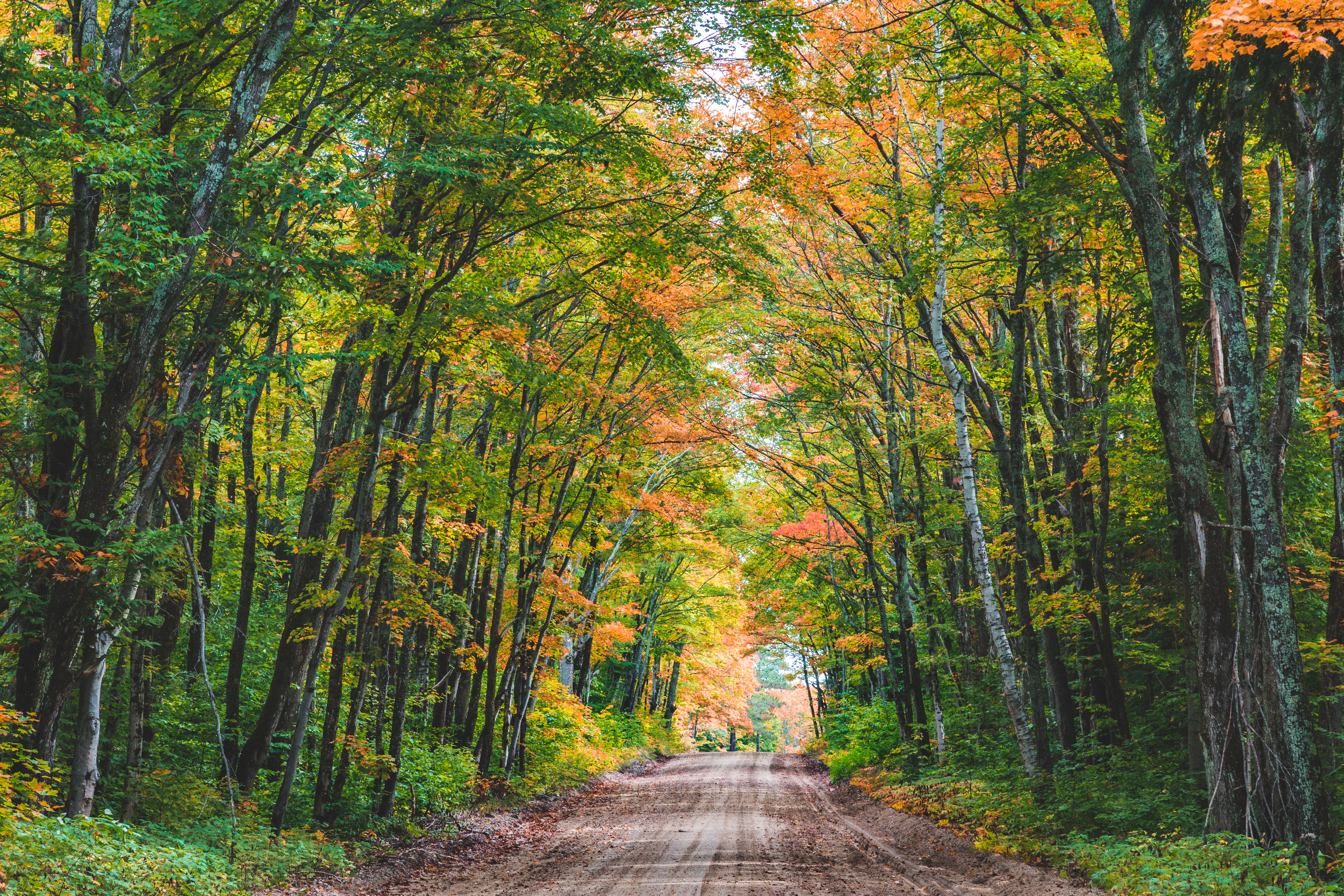
A dirt road stretches into the distance, flanked by tall deciduous trees displaying vibrant yellow and orange fall foliage.
An unpaved dirt road winds through a dense tunnel of autumn trees in Hiawatha National Forest.

Hiawatha National Forest history and protected-area timeline

The lands that make up Hiawatha National Forest have a layered administrative history that reflects more than a century of U.S. forest policy. The East Unit originated as large, infertile sandy plains that were never successfully homesteaded. In 1909, President Theodore Roosevelt designated this landscape as Marquette National Forest. From 1918 until 1962, it was administered jointly with Huron National Forest under the broader designation of the Michigan National Forest before being transferred into what is now Hiawatha.

Federal interest in expanding the forest grew in the early twentieth century. In 1925, the government was authorized to acquire an additional 307,000 acres, and a further 50,000 acres were authorized in 1935. The lands that became the West Unit began to be purchased in 1928, and on January 16, 1931, this new acquisition was formally designated Hiawatha National Forest.

The West Unit was heavily impacted by earlier logging and settlement, and the Civilian Conservation Corps undertook extensive reforestation work there during the New Deal era. Throughout the twentieth century, additional wilderness and river protections were layered onto the forest, including the designation of six wilderness areas and five National Wild and Scenic Rivers. The forest received its name in honor of the Mohawk chief Hiawatha, who helped bring about the confederation of the Five Nations of the Iroquois.

Hiawatha National Forest landscape and geographic character

Hiawatha National Forest occupies a transitional landscape between the agricultural plains of the lower Great Lakes and the boreal character of far northern Michigan. The East Unit is dominated by extensive sandy outwash plains, broad pine and oak flats, and a long, indented shoreline that stretches from the Straits of Mackinac area along the northern coast. Its terrain is comparatively flat in many places, with low dunes, and the soils historically discouraged farming, leaving much of the land forested.

The West Unit is more varied in elevation, with a mix of forested ridges, river valleys, glacial lake plains, and coastal bluffs that overlook Lake Superior and Lake Michigan. River systems are central to its identity: the Sturgeon, Indian, Tahquamenon, Whitefish, and Carp rivers carve through the forest and support a series of protected river corridors.

Across the forest, more than 100 miles of Great Lakes shoreline define the landscape as strongly as the inland forests. The East Unit includes Round Island in Lake Huron, while the West Unit borders the dramatic scenery of Pictured Rocks National Lakeshore and the Grand Island National Recreation Area. The result is a landscape that alternates between quiet interior woodland and dramatic lake scenery.

Hiawatha National Forest ecosystems, habitats, and plant life

Vegetation across Hiawatha National Forest reflects its position at the meeting point of Great Lakes and northern forest biomes. In the northern portions of the forest, classic sugar maple and paper birch communities dominate the uplands, producing the mixed hardwood stands that define much of the Upper Peninsula's interior. Elsewhere, sandy plains support pine-oak barrens and aspen groves, while lowland areas harbor cedar swamps, alder thickets, and other wetland types characteristic of the region.

The forest's rivers and lakes host additional communities of wetland and aquatic vegetation, and the long shoreline creates unique coastal plant environments where Great Lakes sand ecosystems meet forest interiors. These habitat transitions contribute to the high ecological diversity of the forest.

Because the forest sits on a major migratory corridor along the Great Lakes, it also supports a dynamic mix of breeding, wintering, and transient bird communities. The result is an ecological mosaic in which upland hardwood, coniferous flats, river corridors, freshwater shoreline, and island habitats all coexist within a single federal forest.

Hiawatha National Forest wildlife and species highlights

Hiawatha National Forest supports an especially broad range of wildlife for a region of the United States, in part because it combines extensive forest cover with major Great Lakes frontage. White-tailed deer are widespread throughout both units, and American black bears remain a hallmark species of the Upper Peninsula's larger forested tracts. Moose, although less commonly seen than in past decades, are part of the forest's wildlife profile, alongside gray wolves and the smaller, more frequently encountered coyotes.

Predators of various sizes continue to use the forest. Bobcats and Canada lynxes are present in the more remote areas, and rare or occasional visitors such as cougars have also been documented. Mid-size carnivores like red foxes, fishers, weasels, minks, and river otters occupy river, lake, and wetland habitats, while beavers and muskrats are active in the forest's many wetlands.

The forest draws raptors in particular numbers. Both bald eagles and golden eagles have been observed, alongside hawks, and the area is known for sandhill cranes, especially during migration seasons. Wild turkeys have become an established presence as well. The blend of forest, water, and shoreline creates enough habitat diversity to support this unusually full community of mammals and birds.

Hiawatha National Forest conservation status and protection priorities

Hiawatha National Forest represents a significant conservation landscape within the Great Lakes region, recognized under IUCN Category VI as a protected area with sustainable use of natural resources. Beyond ordinary forest management, the forest contains six congressionally or administratively designated wilderness areas: Big Island Lake Wilderness, Delirium Wilderness, Horseshoe Bay Wilderness, Mackinac Wilderness, Rock River Canyon Wilderness, and Round Island Wilderness, each protecting some of the forest's most intact interior landscapes.

The forest also includes five National Wild and Scenic Rivers: the Carp River, Indian River, Sturgeon River, the East Branch of the Tahquamenon River, and the Whitefish River. These designations extend federal protection to specific river corridors and their immediate surroundings, preserving both water quality and the riparian habitat that connects the forest's interior to the Great Lakes.

Conservation in Hiawatha also includes landscape-scale connectivity. The forest borders Pictured Rocks National Lakeshore and the Grand Island National Recreation Area, while also contributing shoreline and island habitat along three Great Lakes. Together, these designations create a network of protected spaces across the Upper Peninsula, of which Hiawatha is a central anchor.

Hiawatha National Forest cultural meaning and human context

The forest's name carries significant cultural weight, honoring the Mohawk chief Hiawatha, who is associated with the confederation of the Five Nations of the Iroquois. The name was also reinforced in popular culture by Henry Wadsworth Longfellow's poem "The Song of Hiawatha," which gave the chief a lasting presence in American literary tradition.

Beyond the name, the forest preserves a tangible maritime heritage along its Great Lakes shoreline. Several lighthouses remain along the coast, including Point Iroquois Light, which is operated as a museum and serves as a key heritage tourism site. Round Island in Lake Huron carries its own historic Round Island Light. The presence of these lighthouses anchors the forest's identity to the broader shipping and navigation history of the Upper Great Lakes, while also reminding visitors of how human activity and natural landscape have long met on these shores.

Top sights and standout views in Hiawatha National Forest

Hiawatha National Forest's most distinctive highlight is the marriage of large-scale northern forest with over 100 miles of Great Lakes shoreline, giving visitors a chance to experience both inland wilderness and freshwater coast in a single protected landscape.

The forest's six designated wilderness areas, including Round Island Wilderness and Rock River Canyon Wilderness, sit alongside five National Wild and Scenic Rivers: the Carp, Indian, Sturgeon, East Branch Tahquamenon, and Whitefish. Add in the North Country Trail passing through the forest, historic lighthouses such as Point Iroquois, and proximity to Pictured Rocks National Lakeshore, and Hiawatha emerges as one of the most varied outdoor landscapes in the Great Lakes region.

Best time to visit Hiawatha National Forest

Hiawatha National Forest is a four-season landscape, but the character of a visit shifts considerably through the year. Late spring and early summer bring lush green forest, active river systems, and the emergence of migratory songbirds and raptors, making these months inviting for birdwatching, paddling on the Wild and Scenic Rivers, and shoreline exploration along Lake Superior and Lake Michigan.

Summer is the main season for camping, beach use along forest campgrounds near the Mackinac Bridge and Lake Superior, and boat-based recreation. Autumn is widely considered one of the strongest seasons to visit. The sugar maple and paper birch stands in the northern part of the forest turn vivid shades of orange, red, and gold, and cooler weather reduces insect pressure while bringing elk-or rather, moose-and-deer movements into clearer view. Winter quiets much of the visitor traffic but brings snow-covered forest and ice-edged shoreline, suited to those seeking solitude and a different kind of Great Lakes atmosphere.

Monthly climate preview

Trace long term temperature and precipitation patterns across the representative coordinate.

Hiawatha National Forest Climate Normals and Annual Weather by Month

Hiawatha National Forest exhibits a measured annual temperature range from deep sub-zero winter minimums to warm summer maximums alongside steady daily precipitation averages. Examining the complete monthly climate profile reveals precise variations in long term temperature and precipitation across the protected area.
Annual mean6 °C
-8 °C19 °C
Jan-8°
Feb-8°
Mar-3°
Apr
May10°
Jun15°
Jul19°
Aug19°
Sep15°
Oct
Nov
Dec-5°
Warmest month
July

18.9 °C

Coolest month
January

-8.5 °C

Wettest month
September

3.1 mm/day

Driest month
February

1.4 mm/day

Park location guide

Geography guide, regional context, and park location map for Hiawatha National Forest

Hiawatha National Forest park geography, regions, and map view in United States of America

Understand where Hiawatha National Forest sits in United States of America through a broader geographic reading of the surrounding landscape, nearby location context, and its mapped position within the national park landscape.

How Hiawatha National Forest fits into United States of America

The United States of America is a federal presidential republic and one of the world's largest countries by area and population. It consists of 50 states across a vast territory spanning multiple time zones, with its capital in Washington, D.C. and largest city in New York City. The nation has a diverse economy, influential political system, and significant cultural and military presence globally.

Wider geography shaping Hiawatha National Forest in United States of America

The United States occupies a vast territory in North America, bordered by Canada to the north and Mexico to the south. The 48 contiguous states stretch from the Atlantic to the Pacific Ocean, while Alaska occupies the northwestern region and Hawaii is an archipelago in the Pacific. The country encompasses diverse terrain including the Rocky Mountains, Appalachian Mountains, Great Plains, and extensive river systems.

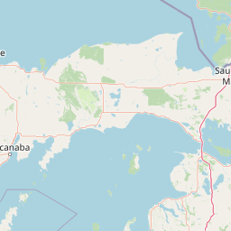
Map view of Hiawatha National Forest

Use this park location map to pinpoint Hiawatha National Forest in United States of America, understand its exact geographic position, and read its mapped placement within the surrounding landscape more clearly.

Pigeon | © OpenStreetMap contributors

Location context for Hiawatha National Forest

MichiganUpper Peninsula of Michigan
Natural feature types

Browse the Geographic Landmarks and Natural Features of Hiawatha National Forest

Navigate the complete dataset of named natural landforms and water systems mapped within Hiawatha National Forest. This MoriAtlas resource provides context on the diverse terrain of the East and West units, enabling precise geographic discovery of the forest's primary physical landscapes.

Explore protected landscapes, freshwater shorelines, and northern hardwood habitats.

Hiawatha National Forest Photos and Scenery: Visualizing Great Lakes Wilderness

Visual records reveal the diverse terrain of Hiawatha National Forest, featuring extensive Great Lakes shorelines, sandy outwash plains, and protected river corridors. Examining these protected area views helps researchers and visitors understand the distinctive ecological character of Michigan's upper peninsula wilderness.

A dirt road stretches into the distance, flanked by tall deciduous trees displaying vibrant yellow and orange fall foliage.

Park atlas

Compare connected protected landscapes and surrounding Great Lakes geography.

Exploring Other Parks Near Hiawatha National Forest and Regional Wilderness Areas

Continue geographic comparison by browsing nearby national forests and protected river corridors adjacent to Hiawatha National Forest. Examine surrounding regional terrain to understand the wider ecological transition spanning the upper midwest.
Wildlife reserveMichigan
Park boundaries overlap#1 closest

East

Horseshoe Bay Wilderness: A Detailed Geographic Overview of Michigan Protected Lands

Protected wetland habitat and Lake Huron coastal geography

Horseshoe Bay Wilderness represents a pristine 3,787-acre protected area located along the northwestern corner of Lake Huron in Michigan. Administered as part of the Hiawatha National Forest, this wilderness features an intricate post-glacial landscape of riparian wetlands, dense northern whitecedar stands, and quiet shallow waters that serve as vital spawning ground for local aquatic life.

Area
15.33 km²
Established
1987
IUCN
Ib
Relief
Lowland
Wildlife reserveMichigan
Park boundaries overlap#2 closest

East

Mackinac Wilderness Protected Area: Glacial Terrain and River Geography in Upper Michigan

A roadless wilderness reserve within Hiawatha National Forest

Uncover the geographic significance of Mackinac Wilderness, an IUCN Category Ib protected area in Michigan. The unit provides a distinct look at northern forest recovery through a terrain of sandy ridges, aspen and birch cover, and aquatic corridors. This study examines the interplay between postglacial landforms and the ongoing natural succession occurring along the Carp River drainage basin.

Area
49.5 km²
IUCN
Ib
Relief
Lowland
Climate
Temperate
Wildlife reserveAlger County
Park boundaries overlap#3 closest

Northwest

Rock River Canyon Wilderness: Geographic Atlas and Protected Landscape Overview

Sandstone canyons and unmanaged forest terrain in Alger County

Covering 4,640 acres of the Upper Peninsula, Rock River Canyon Wilderness offers a rare look at natural forest processes. This protected area is defined by two 150-foot deep sandstone canyons, the flow of the Rock River, and the scenic Rock River Falls, serving as an ecological buffer within the broader Hiawatha National Forest landscape.

Area
18.8 km²
Established
1987
IUCN
Ib
Relief
Upland
A watercolor painting showing a winding river flowing through a lush, green valley with rolling mountains in the distance.
Wildlife reserveUnited States of America
Mapped location lies within the park boundary#4 closest

East

Round Island Wilderness: Geographic Overview of the Straits of Mackinac Wildlife Reserve

Coastal marsh, conifer forest, and hardwood interior terrain

Round Island Wilderness encompasses nearly all of a 378-acre island sanctuary, distinguished by its mature beech-maple hardwood interior and boreal-leaning conifer forests. This protected land remains an essential study of Great Lakes island ecology, standing as a quiet, undisturbed wilderness edge along the transit routes of the Michigan straits.

Area
1.53 km²
Relief
Lowland
Climate
Temperate
Access
Remote access
Marine protected areaMichigan
13 km away#5 closest

Southeast

Thunder Bay National Marine Sanctuary: Geography and Protected Maritime Landscape Context

Mapping underwater heritage in the Michigan Great Lakes region

Spanning 4,300 square miles of Lake Huron, Thunder Bay National Marine Sanctuary preserves a significant collection of shipwrecks within a glacially shaped freshwater terrain. This marine protected area offers a look at submerged geography ranging from shallow coastal bays to deep lake basins. It serves as a vital anchor for understanding maritime history and freshwater ecosystem stability across the Michigan shoreline.

Area
11,000 km²
Established
2000
Relief
Lowland
Climate
Temperate
A watercolor painting showing a rolling landscape with green fields, sandy dunes, and a purple mountain range in the distance.
Natural monumentAlger County
About 24 km away#6 closest

Northeast

Pictured Rocks National Lakeshore: Geographic Atlas of Cliffs and Shoreline Terrain

Protected landscape geography in Alger County, Michigan

Pictured Rocks National Lakeshore offers a deep look into the Great Lakes coastal geography. Explore the intersection of Cambrian-era sandstone cliffs, perched dune systems, and inland forested wilderness. This area provides a clear record of glacial and lake-driven erosion, featuring unique formations like Miners Castle and Chapel Rock across its extensive Lake Superior boundary.

Area
296.38 km²
Established
1966
IUCN
III
Visitors
953.1K annual
Wildlife reserveMichigan
65 km away#7 closest

Northwest

McCormick Wilderness: Protected Forest and Hydrology in Michigan's Upper Peninsula

A federally protected wildlife reserve and river headwaters landscape

Centrally located within the western Upper Peninsula of Michigan, McCormick Wilderness preserves 17,000 acres of dense, regrown northern forest. The area is defined by its unusual density of river headwaters, providing significant ecological value as a quiet, roadless tract within the Ottawa National Forest network.

Area
69 km²
Established
1987
IUCN
Ib
Relief
Upland
A soft watercolor painting showing green rolling hills, a calm body of water, and small clusters of pink flowers against a light, hazy background.
National parkMichigan
88 km away#8 closest

South

Sleeping Bear Dunes National Lakeshore: Atlas, Maps, and Protected Landscape Geography

Great Lakes freshwater coast and glacial dune systems

Sleeping Bear Dunes National Lakeshore showcases the unique intersection of glacial geology and freshwater ecology. This protected area features massive dunes resting on ancient glacial deposits, backed by beech and maple forests. The geographic scope includes the vast shoreline of Lake Michigan, inland waters such as Glen Lake, and the distinct maritime history found across the remote North and South Manitou Islands.

Area
288.13 km²
Established
1970
IUCN
III
Visitors
1.5M annual

Common questions about visiting, size, designation, and location context for Hiawatha National Forest

Hiawatha National Forest FAQs for park facts, access, geography, and protected area context

Find quick answers about Hiawatha National Forest, including protected-area facts, park geography, trail and visitor context, and how the park fits into its surrounding country and regional landscape.
MoriAtlas Explorer

Continue Your Protected Areas Search Across the Global Atlas

Deepen your exploration by continuing the structured search for national parks and protected areas worldwide. Utilize the comprehensive filtering capabilities to compare different conservation landscapes and refine your understanding of global park geography. Discover more about the distribution and characteristics of protected natural areas.

Global natural geography