Mori Atlas logo
Marine protected areaHikurangi Marine Reserve

Discover the complex seafloor topography and marine ecosystems of this Canterbury landmark.

Hikurangi Marine Reserve: Mapping the Deep Submarine Canyons and Protected Coastal Waters

Hikurangi Marine Reserve stands as a significant marine protected area off the coast of the Kaikoura District in New Zealand. This expansive reserve encompasses the dramatic depth of the Kaikoura Canyon, where the seafloor plunges to 1,000 metres and creates a powerful system of nutrient upwellings. Beyond the deep-sea trenches, the reserve protects rugged greywacke reefs and island habitats that serve as vital feeding grounds for diverse marine mammal and seabird species.

marine reservemarine protected areadeep-sea canyonKaikoura coastsubmarine canyonwhale watching

Hikurangi Marine Reserve

Marine protected area

Park overview

Structured park overview, official facts, and landscape profile for Hikurangi Marine Reserve

Hikurangi Marine Reserve park facts, protected area profile, and essential visitor context

Review the core facts for Hikurangi Marine Reserve, including designation, size, terrain, visitor scale, habitats, and operating context in one park-focused overview.

About Hikurangi Marine Reserve

Hikurangi Marine Reserve is a strictly protected marine area on the eastern coast of New Zealand's South Island, framing the coastal waters and deep submarine terrain south of the town of Kaikōura. Although it is relatively young as a formal reserve, having been established only in 2014, it has quickly become one of the most ecologically significant marine protected areas in New Zealand because of the unusual depth and oceanographic complexity along this stretch of coast.

The reserve's defining feature is its relationship with the Kaikōura Canyon, a steep, branching submarine valley that drops dramatically from the continental shelf into much deeper water. This canyon funnels nutrients upward through the water column, supporting an exceptional concentration of marine life across a wide vertical range from intertidal reefs to deep-sea habitats. The cold Southland Current flowing north from the Southern Ocean mixes here with the warmer East Cape Current arriving from the subtropics, reinforcing the productivity of the system.

Beyond its deep-sea character, the reserve also protects a varied inshore environment of greywacke boulder reefs and bedrock reefs, with offshore islets including Panau Island. These shallow and mid-depth habitats support a dense community of reef invertebrates and coastal fish species. With fishing, harvesting, and mining prohibited, Hikurangi functions as a reference site for understanding how these interconnected ecosystems function without human extraction pressure, and it also serves as a major draw for marine wildlife viewing from the adjacent Kaikōura coastline.

Quick facts and research context for Hikurangi Marine Reserve

Hikurangi Marine Reserve lies off the Kaikōura District in the Canterbury Region of New Zealand's South Island, with the nearest town being Kaikōura. The reserve was established in 2014 and is governed by the New Zealand Department of Conservation, classified as a strict nature reserve under IUCN Category Ia. It spans over 10,000 hectares of coastal and offshore waters, making it the country's largest and deepest no-take marine area.

Protection and recognition

Explore the documented marine protection scope and official designation records for Hikurangi Marine Reserve.

Hikurangi Marine Reserve Protection Status and International Recognition Data

Marine protection status and management scope details for Hikurangi Marine Reserve are compiled directly from verified conservation records. Official recognition parameters provide structured insight into the protected area designation and international framework metrics.

Protection details

Protection scope
Marine
Transboundary protection
No
Park context

Deeper park guide and search-rich context for Hikurangi Marine Reserve

Hikurangi Marine Reserve history, landscape, wildlife, and travel context

Explore Hikurangi Marine Reserve through its history, landscape character, ecosystems, wildlife, conservation priorities, cultural context, and seasonal travel timing in a structured park guide built for atlas discovery and search intent.

Why Hikurangi Marine Reserve stands out

The reserve is best known for the Kaikōura Canyon, a roughly 1,000-metre-deep submarine trench that functions as a natural feeding ground for whales, dolphins, and seabirds. It is widely regarded as one of the most reliable places in New Zealand to encounter marine mammals in the wild, including sperm whales, dusky dolphins, Hector's dolphins, orca, and migrating humpback whales. The reserve is equally notable for the unusual oceanographic conditions that occur where cold Southland Current water from the Southern Ocean meets warm subtropical East Cape Current water, producing a nutrient-rich, biologically diverse marine environment.

Hikurangi Marine Reserve history and protected-area timeline

Hikurangi Marine Reserve was formally established in 2014, making it a relatively recent addition to New Zealand's network of marine protected areas. From its inception it was conceived as a strictly protected reserve, with no fishing, harvesting, or mining permitted within its boundaries, reflecting both the ecological importance of the Kaikōura Canyon system and the long-running local interest in conserving the waters off Kaikōura.

The reserve's early years were shaped by a major natural disturbance. In November 2016, a magnitude 7.8 earthquake centred near Kaikōura triggered large submarine mudslides and sediment flows that devastated deep-sea communities within the canyon. The same earthquake severely disrupted road access along the coast, complicating both scientific work and public engagement with the area.

By September 2017, a National Institute of Water and Atmospheric Research expedition found that deep-sea species in the canyon were recovering faster than researchers had anticipated, suggesting a relatively resilient ecosystem beneath the disrupted sediment layers. The reserve has not been free of human conflict: in March 2019 a subsidiary of the Talley's Group was convicted and fined for trawling inside the protected area, and in October 2023 two divers were caught with a large haul of pāua taken illegally from the reserve. These incidents have highlighted the ongoing enforcement challenges associated with protecting a large, deep, and partly remote marine area.

Hikurangi Marine Reserve landscape and geographic character

The landscape of Hikurangi Marine Reserve is defined less by visible landforms than by the dramatic underwater terrain that lies beneath its waters. The reserve is anchored to the Kaikōura Canyon, a roughly 1,000-metre-deep side branch of the broader Hikurangi Trough. This canyon has steep walls, complex seafloor topography, and a deep axis that creates a powerful upwelling system bringing nutrients from the ocean depths into the sunlit layers above.

Along the shoreline, the reserve encompasses a rocky coastal environment made up of greywacke boulder fields and exposed bedrock reefs. These rugged nearshore reefs drop quickly into deeper water, producing a sharp transition between shallow, wave-influenced habitats and the calmer, darker environments of the continental shelf and canyon beyond.

Offshore, the reserve includes Panau Island and two smaller islets, which rise from the surrounding waters and contribute to the mosaic of shoreline, reef, and offshore island habitats within the protected boundary. The combined effect is a landscape that extends from wave-battered coastal rocks down through progressively deeper submarine terrain to one of the most dramatic underwater valleys on New Zealand's continental margin.

Hikurangi Marine Reserve ecosystems, habitats, and plant life

The ecological character of Hikurangi Marine Reserve is shaped by an unusual convergence of physical conditions. Cold, nutrient-rich water flowing north from the Southern Ocean as part of the Southland Current meets warmer subtropical water arriving via the East Cape Current, creating a mixing zone that enhances biological productivity across the water column. Several small rivers and streams draining the nearby mountain ranges add freshwater input and terrestrial nutrients to the coastal zone.

This physical setting supports a layered ecosystem. Inshore reefs and boulder habitats are dominated by algae, sponges, anemones, and a rich assemblage of mobile invertebrates, including molluscs, crustaceans, and echinoderms. Mid-depth waters are home to common reef fish such as blue cod, butterfish, tarakihi, blue moki, red moki, sea perch, wrasse, and triplefin. In deeper waters farther from shore, the community shifts toward rattails, hapuku, ling, hoki, lantern fish, sharks, rays, skates, and squid, illustrating a clear depth-related change in species composition.

Because portions of the reserve extend into very deep water within the Kaikōura Canyon, the full biological inventory remains incompletely documented. The depth of the canyon makes systematic wildlife surveys difficult, and some of the deepest habitats remain among the least understood parts of New Zealand's marine environment.

Hikurangi Marine Reserve wildlife and species highlights

Hikurangi Marine Reserve is widely recognised as one of the most important marine mammal viewing areas in New Zealand. The Kaikōura Canyon within the reserve provides a predictable, productive feeding environment, and as a result the waters are home to large pods of dusky dolphins, smaller groups of the endangered Hector's dolphins, and significant colonies of New Zealand fur seals haul out along the coast. The canyon is also the only place where sperm whales can regularly be viewed close to the New Zealand mainland.

Beyond these resident and frequently seen species, the reserve attracts a striking range of visiting marine life. Orca patrol the area regularly, and humpback whales pass through during their northern winter migration as they move between Antarctic feeding grounds and tropical breeding waters. Other whale species also gather in the area, taking advantage of the same canyon-driven upwelling that supports the more commonly encountered cetaceans.

The reserve is equally important for seabirds. The coast off Kaikōura hosts the only known breeding ground in the world for Hutton's shearwater, a burrow-nesting species restricted to the surrounding mountains and nearby marine area. Albatrosses, petrels, shearwaters, and prions also gather in the waters offshore, often in association with the same productive frontal zones used by cetaceans. Together, this combination of marine mammals and seabirds makes the reserve exceptional for wildlife viewing from both boat and shore.

Hikurangi Marine Reserve conservation status and protection priorities

Hikurangi Marine Reserve is a strictly protected no-take marine reserve under IUCN Category Ia, with all fishing, harvesting, and mining activities prohibited within its boundaries. The reserve's conservation significance lies in the breadth and depth of the habitats it protects, ranging from nearshore rocky reefs to the deep Kaikōura Canyon system, and in the unusually productive oceanographic conditions that sustain its biological communities.

The reserve also functions as an important benchmark site for understanding ecosystem recovery after large-scale disturbance. Following the 2016 Kaikōura earthquake, deep-sea habitats within the canyon experienced catastrophic sediment disturbance, but subsequent research has shown that species assemblages began recovering comparatively quickly. This makes the reserve valuable for studying the resilience of canyon ecosystems and the pace of recovery from natural disturbance.

At the same time, the reserve illustrates the enforcement challenges of protecting a large marine area. Documented illegal trawling and poaching incidents have highlighted the need for ongoing surveillance, monitoring, and public awareness to maintain the integrity of the no-take protections in a region close to major ports and fishing activity.

Top sights and standout views in Hikurangi Marine Reserve

Hikurangi Marine Reserve stands out for the sheer depth of its protected waters, anchored by the Kaikōura Canyon, which falls roughly 1,000 metres from the continental shelf into the Hikurangi Trough. This depth, combined with the convergence of cold southern and warm subtropical currents, supports an unusually dense and diverse community of marine mammals, seabirds, reef fish, and deep-sea species.

Equally distinctive is the reserve's role as a wildlife viewing destination. It is the only place on mainland New Zealand where sperm whales can reliably be observed, and it offers regular encounters with dusky dolphins, Hector's dolphins, fur seals, orca, and migrating humpback whales. The presence of the world's only breeding colony of Hutton's shearwater along the adjacent coast adds a further layer of ecological importance that reinforces the reserve's standing as one of New Zealand's most significant marine protected areas.

Best time to visit Hikurangi Marine Reserve

The character of a visit to Hikurangi Marine Reserve is shaped less by a narrow peak season than by the species a visitor hopes to encounter. Year-round calm periods along the Kaikōura coast support regular sightings of dusky dolphins, fur seals, and seabirds, while the cooler months coincide with the northern migration of humpback whales and increased sperm whale presence along the productive edges of the Kaikōura Canyon.

Warmer months generally offer more settled sea conditions for boat-based viewing and broader visibility along the coastal reefs, which can also be good for observing reef fish and inshore marine life. Because the reserve's marine mammal viewing is closely tied to oceanographic conditions rather than a single calendar window, visits across multiple seasons can each reveal a different facet of the reserve's wildlife. The limited recreational access under no-take rules means that viewing is largely passive, focused on observation from boats and the shoreline rather than active use of the marine environment.
Monthly climate preview

Long-term representative monthly averages for temperature and precipitation rhythm

Hikurangi Marine Reserve Climate Normals and Measured Annual Temperature Patterns

Representative coordinate records show measured monthly temperature variations alongside steady precipitation patterns across the year. Reviewing twelve-month baseline averages provides clear context for evaluating regional atmospheric conditions without relying on live forecasts.
Annual mean12 °C
8 °C16 °C
Jan16°
Feb16°
Mar15°
Apr13°
May11°
Jun
Jul
Aug
Sep10°
Oct11°
Nov13°
Dec15°
Warmest month
February

16.3 °C

Coolest month
July

8 °C

Wettest month
June

2.8 mm/day

Driest month
January

1.7 mm/day

Park location guide

Geography guide, regional context, and park location map for Hikurangi Marine Reserve

Hikurangi Marine Reserve park geography, regions, and map view in New Zealand

Understand where Hikurangi Marine Reserve sits in New Zealand through a broader geographic reading of the surrounding landscape, nearby location context, and its mapped position within the national park landscape.

How Hikurangi Marine Reserve fits into New Zealand

New Zealand is an island nation in the southwestern Pacific Ocean comprising two main islands and numerous smaller islands. Located east of Australia across the Tasman Sea, it features varied topography with the Southern Alps running along the South Island and volcanic terrain on the North Island. The country was settled by Maori people between 1280 and 1350, followed by European exploration beginning in 1642, and became a Dominion in 1907 before gaining full independence in 1947.

Wider geography shaping Hikurangi Marine Reserve in New Zealand

New Zealand lies in the southwestern Pacific Ocean, east of Australia across the Tasman Sea. The country consists of two main islands, the North Island and South Island, plus over 600 smaller islands. The North Island features volcanic plateaus and hills while the South Island is dominated by the Southern Alps mountain range. The country has a long coastline and is surrounded by the Pacific Ocean.

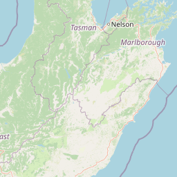
Map view of Hikurangi Marine Reserve

Use this park location map to pinpoint Hikurangi Marine Reserve in New Zealand, understand its exact geographic position, and read its mapped placement within the surrounding landscape more clearly.

Pigeon | © OpenStreetMap contributors

Location context for Hikurangi Marine Reserve

Canterbury
Recorded earthquake history

Explore Recorded Earthquake History for Hikurangi Marine Reserve

Review the established record of seismic activity associated with the geographic footprint of Hikurangi Marine Reserve. MoriAtlas provides a clean, searchable catalogue of historical earthquake events including magnitude and location data to support your interest in the seismic profile of this coastal protected area.

Hikurangi Marine Reserve Earthquake Records

Catalogued events

248 events

Strongest magnitude

Magnitude 7.8

Most recent event

Jul 12, 2026

This history includes earthquakes recorded inside the park or within 50 km of its borders

Park atlas

Compare adjacent marine reserves and coastal protected landscapes across the region

Explore Parks Near Hikurangi Marine Reserve and Surrounding Protected Areas

Discover other protected areas near Hikurangi Marine Reserve to examine regional marine habitats and coastal geography. Broader park comparison reveals connected conservation landscapes and diverse natural settings across the surrounding territory.
National parkNew Zealand
79 km away#1 closest

Northwest

Nelson Lakes National Park: Alpine Geography and Glacial Lakes Atlas

Explore New Zealand's protected mountain terrain and natural landscapes.

Nelson Lakes National Park provides a deep dive into a dramatic alpine environment situated at the northern edge of New Zealand's Southern Alps. This national park is characterized by its striking glacial lakes, Rotoiti and Rotoroa, and the extensive mountain ranges that surround them, offering a rich context for understanding protected land distribution. Explore the park's mapped geography, its distinct beech forest ecosystems, and the rugged natural terrain that makes it a significant feature within the broader South Island landscape.

Area
1,018.8 km²
Established
1956
IUCN
II
Relief
Mountain
Protected landscapeMarlborough Region
92 km away#2 closest

North

Mount Richmond Forest Park: Geography and Protected Landscapes in the Marlborough Region

Expansive native bush and mountain peak terrain

Mount Richmond Forest Park stands as one of the largest protected forest areas on the South Island of New Zealand. Dominated by dense native bush and rugged subalpine ridges, the park offers a complex topography of river valleys and high-altitude peaks, including its namesake Mount Richmond. It serves as a vital conservation landscape and a core segment of the regional geography between Nelson and the Marlborough district.

Area
1,659 km²
Established
1977
Relief
Mountain
Scope
Terrestrial
Protected landscapeCanterbury
About 107 km away#3 closest

West

Lake Sumner Forest Park: Geography and Protected Landscape Atlas for Canterbury

Mountainous river valleys and remote beech forests

Spanning over 100,000 hectares of the Canterbury high country, Lake Sumner Forest Park stands as a prime example of New Zealand's protected backcountry. This mapping resource details the park's river-carved terrain, subalpine fringes, and its role as a connective wilderness area between major South Island mountain ranges.

Area
1,051 km²
Relief
Mountain
Climate
Temperate
Access
Moderate access
A horizontal watercolor illustration depicting a coastal landscape with winding light-colored sandbars, pale water channels, and soft green rolling hills under a muted pastel sky.
Regional parkCanterbury Region
About 114 km away#4 closest

Southwest

Northern Pegasus Bay Regional Park: Canterbury Coastal Geography and Protected Land Atlas

Mapping the beaches, estuaries, and dunes of Northern Pegasus Bay.

Northern Pegasus Bay spans a long, curving stretch of the Canterbury coastline on New Zealand's South Island. This regional park protects a range of coastal landforms, including pebbly beaches, dune systems, and the regionally significant Ashley Rakahuri Estuary. The geography reflects a dynamic exchange of sediment across multiple river mouths, creating a distinct environmental corridor between coastal communities and the sea.

Relief
Lowland
Climate
Temperate
Access
Easy access
Scope
Mixed
Watercolor painting of mountains, green valleys, and a winding river under a soft sky
National parkWest Coast Region
115 km away#5 closest

Northwest

Kahurangi National Park: A National Park of Ancient Geology and Diverse Protected Landscapes in New Zealand

Explore the mapped natural terrain and regional geographic context.

Kahurangi National Park is distinguished by its extraordinary geological diversity, representing New Zealand's finest Paleozoic rock sequence and expansive karst features. Covering a vast area in the West Coast Region, it protects a remarkable array of natural landscapes, from coastal cliffs and nikau palm forests to alpine tussock basins and deep gorges. This national park is crucial for understanding New Zealand's natural heritage, offering a rich tapestry of mapped terrain and protected biodiversity for dedicated geographic exploration.

Area
5,193 km²
Established
1996
IUCN
II
Relief
Mixed relief
National parkNew Zealand
127 km away#6 closest

West

Arthur's Pass National Park: Dramatic Alpine Protected Landscape in the Southern Alps

Explore the unique geography and mapped boundaries of this South Island national park.

Arthur's Pass National Park, a substantial protected area within New Zealand's Southern Alps, presents a compelling focus for geographic and atlas exploration. Characterized by dramatic alpine terrain shaped by ancient glacial forces, the park exhibits a striking ecological contrast between its drier eastern beech forests and wetter western rainforests. Users can delve into the mapped park boundaries and understand the regional landscape context of this unique protected area, making it a key destination for understanding New Zealand's natural geography.

Area
1,184.7 km²
Established
1929
IUCN
II
Relief
Mountain
Regional parkCanterbury Region
About 129 km away#7 closest

Southwest

Waimakariri River Regional Park: Geography and Protected Landscape Atlas for Canterbury

Braided river corridors and wetland habitats in the Canterbury Region

Waimakariri River Regional Park encompasses a significant managed corridor along the Waimakariri River, featuring an intricate mix of braided riverbeds, saltmarshes, and reforested land. This profile details the park topography, highlighting its role in regional flood management and its varied natural terrain across the Canterbury Plains, providing a clear geographic view of its multi-use protected boundaries.

Area
150 km²
Relief
Lowland
Access
Easy access
Scope
Terrestrial
Protected landscapeSouth Island
About 140 km away#8 closest

West

Victoria Forest Park: A Deep Dive Into New Zealand's Largest Protected Forest Landscape

Inland West Coast mountain ranges and beech forest ecosystems

Spanning over 200,000 hectares, Victoria Forest Park stands as a defining geographic feature of the South Island. It acts as a critical refuge for endemic species and preserves all five native beech tree types within a massive, continuous protected area. The landscape integrates rugged mountain ranges with deep river valleys and historical industrial artifacts, providing a comprehensive look at the intersection of conservation and regional history.

Area
2,069 km²
Established
1981
Relief
Mountain
Climate
Temperate

Common questions about visiting, size, designation, and location context for Hikurangi Marine Reserve

Hikurangi Marine Reserve FAQs for park facts, access, geography, and protected area context

Find quick answers about Hikurangi Marine Reserve, including protected-area facts, park geography, trail and visitor context, and how the park fits into its surrounding country and regional landscape.
MoriAtlas Explorer

Continue Your Protected Areas Search Across the Global Atlas

Deepen your exploration by continuing the structured search for national parks and protected areas worldwide. Utilize the comprehensive filtering capabilities to compare different conservation landscapes and refine your understanding of global park geography. Discover more about the distribution and characteristics of protected natural areas.

Global natural geography