
Mori Atlas logo
Protected landscapeHumedales de Santa Lucía

Discover the dynamic fluvial mosaic and brackish marsh terrain near the confluence of the Santa Lucía River and Río de la Plata

Humedales de Santa Lucía: Exploring the Tidal Wetland Geography and Protected Landscapes of Southern Uruguay

(Área protegida con recursos manejados Humedales de Santa Lucía)

Humedales de Santa Lucía represents a critical protected landscape located where the Santa Lucía River meets the Río de la Plata in southern Uruguay. This managed wetland system functions as a complex mosaic of channels, sediment-formed islands, and marshland, influenced by both freshwater river flow and saline tidal surges from the estuary. Through its diverse riparian corridors, the area serves as a vital natural habitat within the Montevideo region, offering insight into the unique interaction between coastal estuaries and inland water systems.

wetlandstidal ecosystemsfreshwater wetlandbrackish waterriver estuarywaterbirds
A flat-style digital illustration showing a scenic wetland with calm water, three sailboats, grassy marsh banks in the foreground, and distant cliffs with a waterfall under a soft sunset sky.

Humedales de Santa Lucía

Protected landscape

Park overview

Structured park overview, official facts, and landscape profile for Humedales de Santa Lucía

Humedales de Santa Lucía park facts, protected area profile, and essential visitor context

Review the core facts for Humedales de Santa Lucía, including designation, size, terrain, visitor scale, habitats, and operating context in one park-focused overview.

About Humedales de Santa Lucía

Humedales de Santa Lucía is a large managed wetland ecosystem in southern Uruguay, positioned at a critical hydrological meeting point between the Santa Lucía River and the Río de la Plata estuary. The protected area overlaps three administrative departments: San José upstream, Canelones along the central stretches, and Montevideo at the southern river-mouth end, giving the wetland both an inner-country and a metropolitan character. Although the headline figures span tens of thousands of hectares across the full system, only a modest portion lies within the capital district, and the most accessible and visited zone adjoins the town of Santiago Vázquez, roughly twenty kilometers from central Montevideo.

The wetland's physical character reflects the interaction between freshwater and tidal saline dynamics. The Santa Lucía River, after flowing through varied biogeographic regions of Uruguay, drains into the Río de la Plata at this point, where periodic southeasterly storm surges push salt water inland. The result is a brackish, fluctuating environment further enriched by water from surrounding streams and gullies such as the arroyo San Gregorio, the cañada del Peral, and the arroyo de la Tortuga.

The protected area's importance also lies in the long-running human efforts to conserve it. Adjacent lands near Santiago Vázquez, owned by the Intendencia de Montevideo, were designated a municipal natural park in June 1999, with a team of park rangers managing the protected wildlife area. National-level recognition arrived later, in February 2015, when the broader wetland complex was incorporated into Uruguay's National System of Protected Natural Areas, cementing its status as a key managed resource area in the country's conservation framework.

Quick facts and research context for Humedales de Santa Lucía

The protected area straddles three departments in southern Uruguay: San José, Canelones, and Montevideo, with the capital's metropolitan area providing the closest access point. Designated as an área protegida con recursos manejados (managed resources protected area), it covers a very large wetland footprint, although only a fraction lies within Montevideo itself. It was incorporated into Uruguay's National System of Protected Natural Areas in February 2015 under Decree 55/015. The dominant environmental setting is the tidal confluence zone where the Santa Lucía River enters the Río de la Plata, making it one of the country's most significant freshwater-brackish wetland complexes.

Protection and recognition

Documented terrestrial protection scope and historical designation data

Humedales de Santa Lucía Protection Status and Designation History

Humedales de Santa Lucía features a documented terrestrial protection scope established in the year 2015. Recorded designation history provides essential framework details for analyzing the administrative profile and formal conservation context.

Protection details

Protection scope
Terrestrial
Designated year
2015
Transboundary protection
No
Park context

Deeper park guide and search-rich context for Humedales de Santa Lucía

Humedales de Santa Lucía history, landscape, wildlife, and travel context

Explore Humedales de Santa Lucía through its history, landscape character, ecosystems, wildlife, conservation priorities, cultural context, and seasonal travel timing in a structured park guide built for atlas discovery and search intent.

Why Humedales de Santa Lucía stands out

The park is best known for its tidal freshwater wetland character at the confluence of the Santa Lucía River and the Río de la Plata. Periodic southeasterly storm surges push saline water inland, shaping a dynamic brackish environment fed by smaller streams and gullies. The deposition of sediments by these tributaries forms small islands within the wetland, while the broader mosaic of channels and marshes supports rich waterbird populations, including species such as the thick-billed grebe. It is also recognized as the principal managed wetland ecosystem on Montevideo's doorstep.
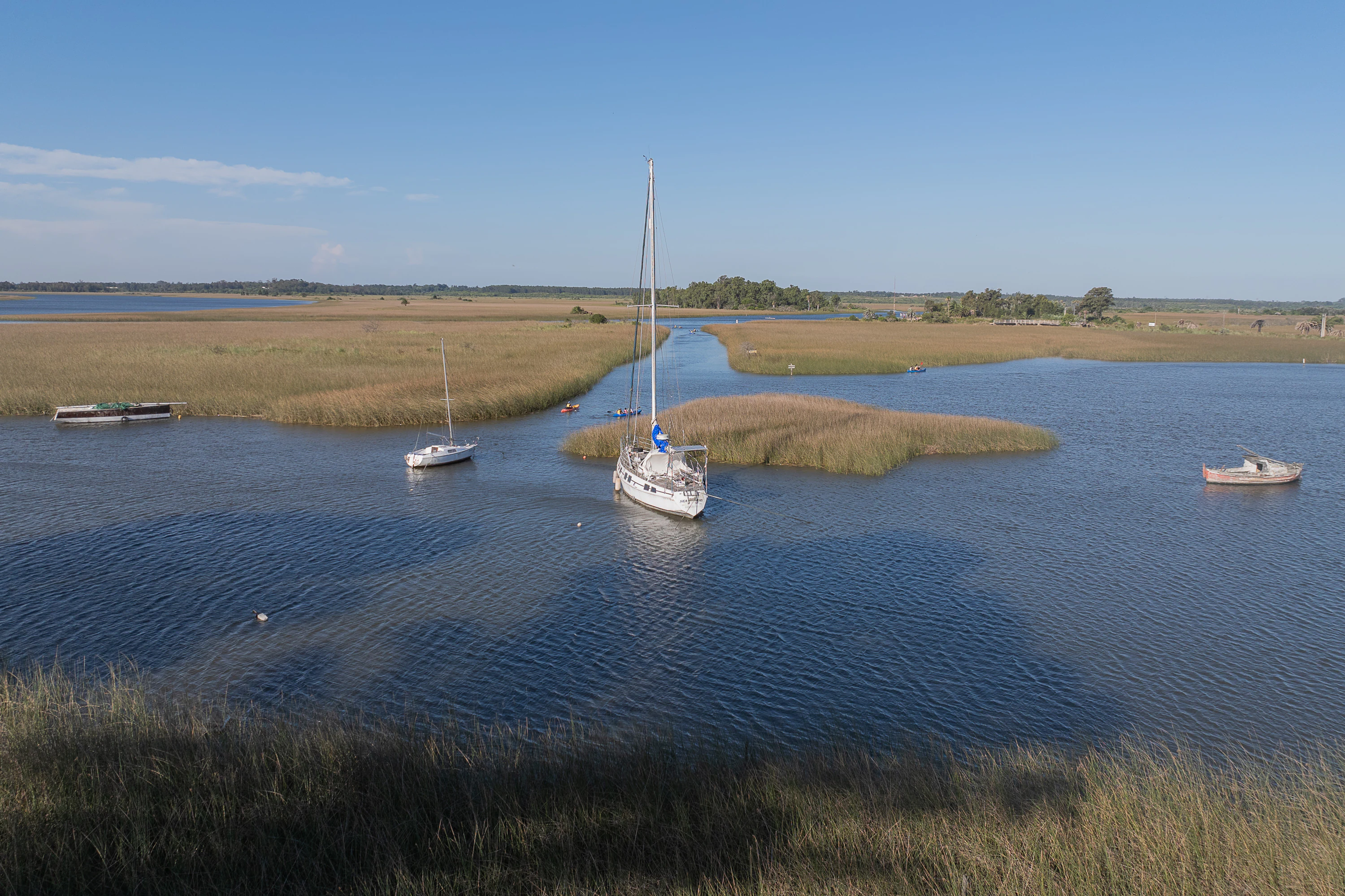
An aerial drone view of the Santa Lucia Wetlands shows a calm waterway winding through marshland with three small boats and sailboats anchored or floating.
A peaceful aerial view of the Santa Lucia Wetlands, featuring sailboats navigating the tidal waterways.

Humedales de Santa Lucía history and protected-area timeline

Formal protection of the Santa Lucía wetlands evolved in layers over more than two decades. As early as June 1999, approximately one thousand hectares of land near Santiago Vázquez were acquired or held by the Intendencia de Montevideo and designated a municipal natural park, the first strong step toward managed conservation of the wetland environment. A ranger team was put in place to implement the management plan for the protected wildlife area.

National recognition followed in February 2015, when the broader wetland complex was incorporated into Uruguay's Sistema Nacional de Áreas Naturales Protegidas (SNAP) under Decree 55/015. This elevated the site to an área protegida con recursos manejados, a managed resources protected area category that emphasizes sustainable use alongside conservation. The designation brought together departments of San José, Canelones, and Montevideo under one integrated framework, formalizing the ecological and administrative importance of a wetland system that locals had long recognized as significant.

Humedales de Santa Lucía landscape and geographic character

The landscape of Humedales de Santa Lucía is shaped by a meeting of waters. The Santa Lucía River, having traversed multiple biogeographic regions, flows into the Río de la Plata and creates a wide tidal zone where freshwater and estuarine conditions blend. Periodic storm surges from the southeast drive salt water inland, generating a saline wetland environment, while smaller tributaries and seasonal watercourses feed in additional fresh water and sediments.

These sediment inputs have built up small islands distributed across the marsh, breaking the surface into a mosaic of channels, shallow flats, and vegetated patches. Near Santiago Vázquez, the riverside terrain includes an embanked rambla along the water and a wooden walkway extending alongside rowing facilities, signaling how closely the urban edge meets the wetland ecology. The result is a low-lying, gently contoured landscape defined by water, marsh vegetation, and open sky rather than dramatic topography.
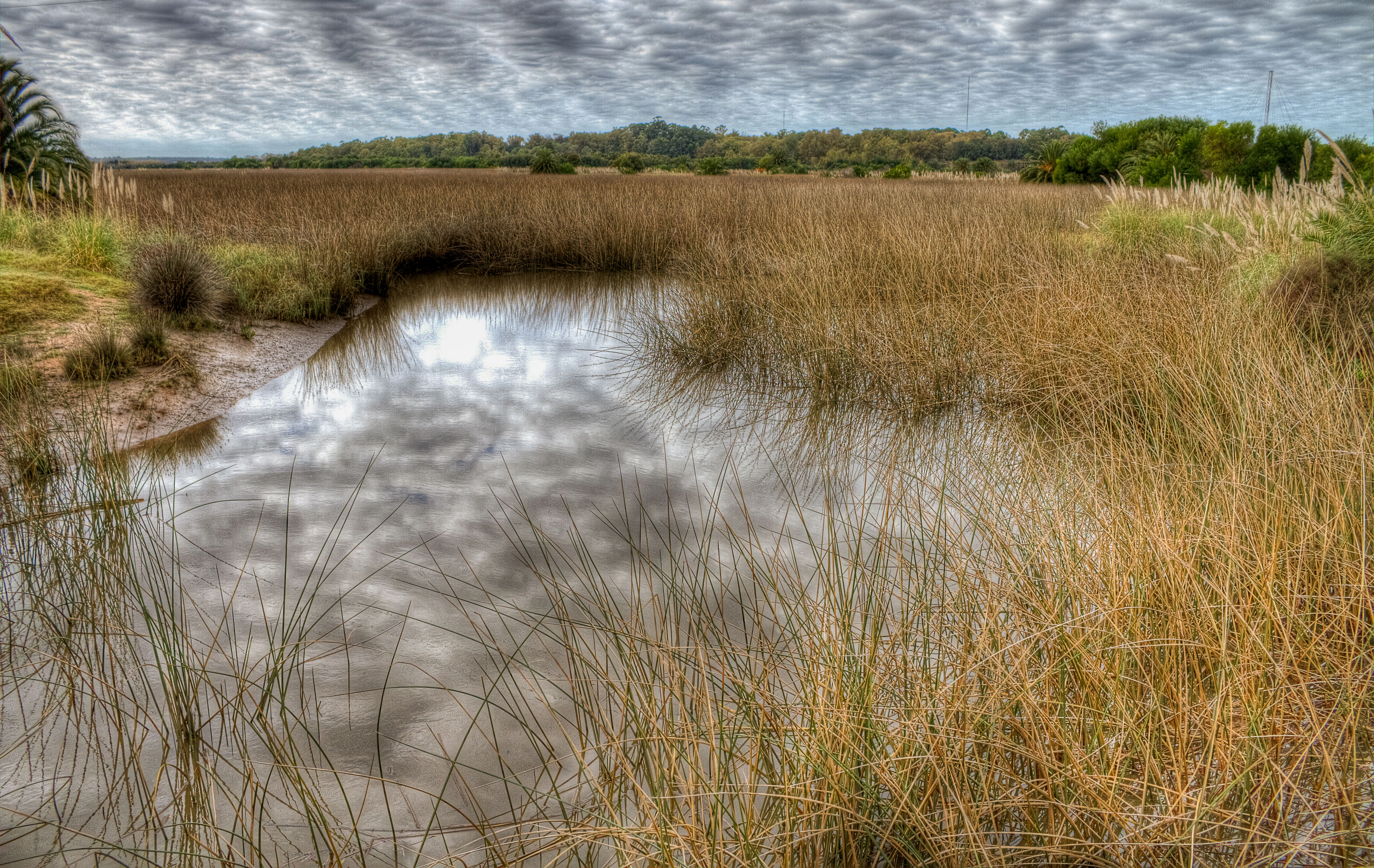
A small canal reflects a cloudy sky, surrounded by tall golden-brown grasses and low-lying vegetation in a wetland environment.
A narrow waterway meandering through the dry grasses of the Santa Lucia Wetlands.

Humedales de Santa Lucía ecosystems, habitats, and plant life

The ecological character of the park revolves around its function as a brackish tidal freshwater wetland. The regularly pulsed saline influence from the Río de la Plata, combined with inputs from inland streams, sustains a unique environmental gradient where marine, estuarine, and freshwater conditions overlap. Sediments carried by tributaries accumulate into small islands, while shallow channels, seasonal pools, and marshy fringes provide a wide variety of aquatic and semi-aquatic habitats within a relatively compact geographic area.

Vegetation typically follows the wetness gradients imposed by these conditions, with marsh plants and riparian species dominating the moistest zones and more terrestrial flora occupying slightly elevated areas. The complexity of microhabitats is part of what allows the wetland to support rich and diverse bird communities throughout the year.

Humedales de Santa Lucía wildlife and species highlights

The wildlife profile of Humedales de Santa Lucía is dominated by waterbirds adapted to the brackish, tidal wetland environment. The complex of channels, small islands, and marshy shallows provides feeding and resting habitat for a range of species that depend on this kind of fluctuating saline-freshwater interface. Records from the area highlight the presence of grebes, including the thick-billed grebe, which uses the wetland's quieter zones. Beyond birds, the mosaic of aquatic habitats supports the broader faunal community typical of Uruguayan coastal wetlands, including fish populations in the connected channels and streams, and small mammals along the vegetated edges.

Humedales de Santa Lucía conservation status and protection priorities

Conservation significance at Humedales de Santa Lucía centers on protecting a rare kind of habitat within Uruguay, a tidal freshwater wetland of considerable size sitting on the edge of a major capital city. Its formal designation as a managed resources protected area under the national SNAP framework acknowledges that the wetland requires active stewardship rather than passive protection. The 2015 national designation also created a unified framework across departments that had previously managed parts of the system in isolation.

Equally important is the municipal layer of conservation. The earlier 1999 designation of a park near Santiago Vázquez, supported by a dedicated ranger team, established an on-the-ground management presence that continues to oversee protection of the wildlife area. Together, these layers make the site a notable example of layered governance in Uruguayan wetland conservation, combining local upkeep with national recognition.

Humedales de Santa Lucía cultural meaning and human context

Although the wetland itself is an ecological resource, its surrounding communities have a strong cultural and practical relationship with the river and marsh landscape. Santiago Vázquez, the closest settlement, has long been associated with rowing, riverside recreation, and small-scale use of the riverfront facilities such as the nearby rowing club. Urban Montevideo is also intimately linked to the site, since the wetland begins only about twenty kilometers from the city center. This proximity has made the area a place where urban residents interact directly with a substantial natural system, blending recreational, educational, and conservation functions in everyday life.

Top sights and standout views in Humedales de Santa Lucía

The most distinguishing feature of Humedales de Santa Lucía is its status as a tidal freshwater wetland at the confluence of a major river and the Río de la Plata estuary. The deposition-fed islands, saline-freshwater mixing, and dense waterbird populations define its ecological identity. Equally notable is the layered conservation story, with municipal protection beginning in 1999 and national recognition arriving in 2015. The rarity of a complex managed wetland so close to a national capital adds practical and educational value to its ecological importance.

Best time to visit Humedales de Santa Lucía

Because Humedales de Santa Lucía depends on tidal rhythms and seasonal storm-driven surges, the character of the wetland varies throughout the year. Periods of strong southeasterly weather typically intensify the saline influence of the Río de la Plata deep into the marsh, producing higher water levels and more dramatic habitat shifts. Cooler months can be productive for observing wintering and migratory waterfowl that use the wetland's open water and mudflats, while the relatively mild climate of southern Uruguay allows year-round access. Visitors will find the wetland a different experience at each tide and season, with waterbird presence and visibility shifting accordingly.

Monthly climate preview

Long-term representative monthly averages and temperature ranges for Humedales de Santa Lucía

Humedales de Santa Lucía Climate Normals, Temperature and Precipitation

Representative coordinates record measured monthly temperature swings from 10.16 degrees Celsius to 22.95 degrees Celsius alongside steady precipitation patterns. Analyzing the complete twelve-month climate profile reveals detailed thermal ranges and multi-year meteorological data across the protected area.
Annual mean17 °C
10 °C23 °C
Jan23°
Feb23°
Mar21°
Apr18°
May15°
Jun12°
Jul10°
Aug11°
Sep13°
Oct16°
Nov19°
Dec21°
Warmest month
January

23 °C

Coolest month
July

10.2 °C

Wettest month
April

3.9 mm/day

Driest month
August

2.6 mm/day

Park location guide

Geography guide, regional context, and park location map for Humedales de Santa Lucía

Humedales de Santa Lucía park geography, regions, and map view in Uruguay

Understand where Humedales de Santa Lucía sits in Uruguay through a broader geographic reading of the surrounding landscape, nearby location context, and its mapped position within the national park landscape.

How Humedales de Santa Lucía fits into Uruguay

Uruguay is a unitary presidential republic located in southeastern South America. It covers approximately 176,215 km² and has a population of nearly 3.5 million people. The capital and largest city is Montevideo, where roughly 2 million people live in the metropolitan area. Uruguay gained independence between 1825 and 1828 following territorial disputes involving Portugal, Spain, Brazil, and the United Provinces of the Río de la Plata.

Wider geography shaping Humedales de Santa Lucía in Uruguay

Uruguay is situated in the southeastern part of South America, bordering Argentina to its west and southwest, Brazil to its north and northeast, the Río de la Plata estuary to the south, and the Atlantic Ocean to the southeast. The terrain consists primarily of rolling plains and low hills, with the highest point being Cerro Catedral at approximately 514 meters. The country has several rivers including the Uruguay River, Paraná River, and Negro River.

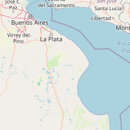
Map view of Humedales de Santa Lucía

Use this park location map to pinpoint Humedales de Santa Lucía in Uruguay, understand its exact geographic position, and read its mapped placement within the surrounding landscape more clearly.

Pigeon | © OpenStreetMap contributors

Location context for Humedales de Santa Lucía

CanelonesMontevideoSan José

Visual reference of tidal wetlands, river estuaries, and protected marsh habitats

Humedales de Santa Lucía Photos and Landscape Scenery

Visual documentation of Humedales de Santa Lucía reveals the intricate terrain of tidal freshwater channels, sediment islands, and riparian corridors meeting the Río de la Plata estuary. Photographic records of protected wetland environments help researchers and naturalists examine low-lying marsh ecologies and waterbird habitats across southern Uruguay.

An aerial drone view of the Santa Lucia Wetlands shows a calm waterway winding through marshland with three small boats and sailboats anchored or floating.

A small pied-billed grebe with dark-tipped beak swimming in calm water with a clear reflection, surrounded by blurred tall aquatic grasses.

A small canal reflects a cloudy sky, surrounded by tall golden-brown grasses and low-lying vegetation in a wetland environment.

Park atlas

Compare adjacent wetland reserves and regional conservation landscapes in southern Uruguay

Explore Parks Near Humedales de Santa Lucía and Surrounding Protected Areas

Browse protected areas and wetland reserves situated near Humedales de Santa Lucía to understand regional ecological connectivity. Continuing the park comparison reveals broader wetland distribution patterns across the Montevideo watershed and surrounding coastal terrain.
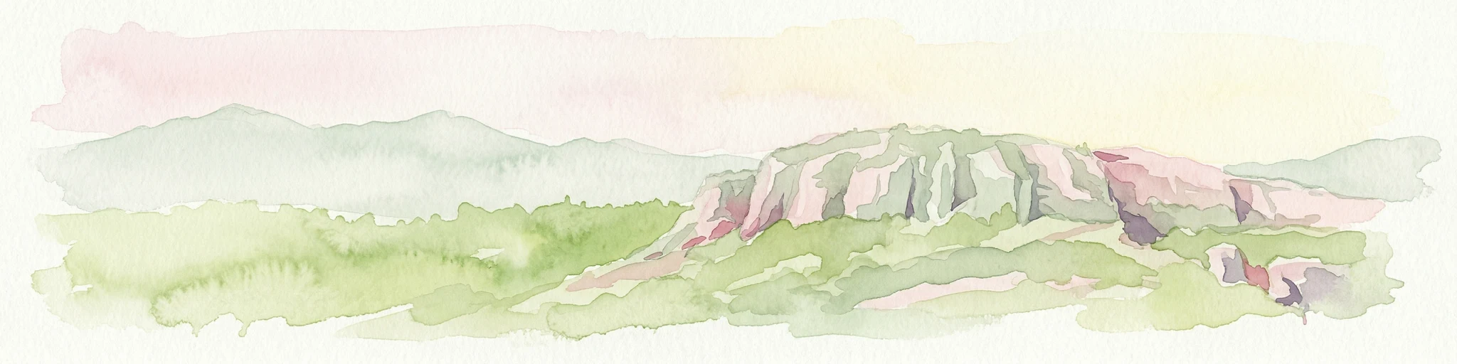
A watercolor painting showing stylized, rolling hills in shades of purple, green, yellow, and soft pink against a white background.
National parkCanelones Department
About 42 km away#1 closest

Southeast

Isla de Flores National Park: Geographic Map and Protected Landscape Overview

Tidal island geography within the Río de la Plata estuary.

Located in the Canelones Department, Isla de Flores National Park represents a significant protected maritime area. Its landscape consists of a low-lying island reaching only two meters above sea level, featuring a protected maritime buffer that supports the integrity of this historic Río de la Plata site. Examine the mapped boundaries and the unique interplay between the estuary currents and this shifting coastal terrain.

Area
0.31 km²
Established
2018
Relief
Lowland
Climate
Temperate
Watercolor painting showing a hill with green landscape and distant mountains
National parkUruguay
About 111 km away#2 closest

Northeast

Arequita National Park: Uruguay's National Park Protected Landscape and Geography

Mapped boundaries and regional natural terrain context for a key protected area.

Delve into Arequita National Park, a designated national park contributing to Uruguay's protected land inventory. This resource explores the park's unique geographic setting, its mapped boundaries, and its significance within the natural landscape of the Southern Cone. Gain structured insight into its role as a protected area and its contribution to the regional geography of South America.

Scope
Terrestrial
Water
No major water
Watercolor painting of a soft landscape with rolling hills in the background and grassy plains in the foreground on a white background.
National parkLavalleja Department
About 111 km away#3 closest

Northeast

Parque nacional Arequita: Protected Landscape and Volcanic Geography in Lavalleja

Mapped natural terrain and protected ecosystems of southeastern Uruguay.

Parque nacional Arequita preserves a unique volcanic landscape in the Lavalleja Department, centered on the ancient basalt hill of Cerro Arequita. The area protects diverse environments ranging from rocky cave systems and native forests to critical freshwater watersheds. This record offers a deep look into the geographical character, internal boundaries, and ecological importance of one of Uruguay's most prominent natural sites.

Area
5.6 km²
Established
2024
Relief
Upland
Climate
Temperate
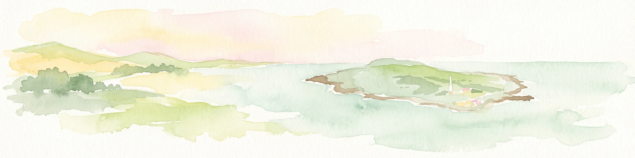
A soft watercolor painting showing an island surrounded by water, with distant green hills on the horizon under a light-colored sky.
National parkMaldonado
About 136 km away#4 closest

East

Parque nacional Isla e islote de Lobos y su entorno sumergido: Protected Area Atlas

Mapping the oceanic terrain and rocky coastal landscapes of Uruguay

This resource provides a detailed geographic overview of Parque nacional Isla e islote de Lobos y su entorno sumergido. Explore the composition of this protected marine environment, which spans both rugged island terrain and extensive submerged rocky formations within the Atlantic waters of Maldonado.

Area
40 km²
Established
2024
Relief
Lowland
Climate
Temperate
Protected landscapeFlores Department
About 136 km away#5 closest

North

Localidad Rupestre de Chamangá: An Archaeological Protected Landscape in Flores Department

Explorations into the prehistoric rock art of rural Uruguay.

Located in central Uruguay, Localidad Rupestre de Chamangá protects a sprawling 12,000-hectare rural landscape notable for its dense cluster of rare open-air pictographs. The site offers profound insights into how prehistoric art interacts with granite topography and pastoral terrain, bridging cultural heritage and natural landscape conservation in the department of Flores.

Area
120 km²
Established
2010
Relief
Upland
Climate
Subtropical
A horizontal watercolor illustration of a gentle landscape with rolling green hills, a winding river, and a light-colored mountainous horizon.
National parkColonia Department
About 161 km away#6 closest

West

Parque Nacional Aarón de Anchorena: Protected Geography and Riverine Landscape

An expansive arboretum and presidential estate in Colonia

Parque Nacional Aarón de Anchorena is a protected territory in southwestern Uruguay, defined by its position on the Río de la Plata estuary. The area encompasses an extensive arboretum, ornamental gardens, and riparian habitats that house unique animal populations. The site serves as a vital geographic anchor for the region, combining historic architecture with the broad, reflective horizons of the river coast.

Area
13.69 km²
Established
1908
Relief
Lowland
Climate
Temperate
Wildlife reserveMaldonado
About 163 km away#7 closest

East

Area de manejo de habitats y/o especies Laguna Garzon: Wildlife Reserve and Coastal Atlas

Mapped wetlands and Atlantic coastal landscapes in Maldonado, Uruguay.

The Area de manejo de habitats y/o especies Laguna Garzon protected area features a unique mosaic of interconnected lagoons and dune-backed shorelines. This coastal wildlife reserve offers a significant geographic study of wetland habitats and their interaction with the Atlantic maritime zone, providing essential context for understanding Uruguay's southeastern coastal terrain.

Established
2014
Water
Water-dominated
National parkBuenos Aires Province
About 180 km away#8 closest

South

Campos del Tuyú National Park: National Park Protected Area and Landscape Context

Mapped boundaries and regional geography for this Buenos Aires Province natural reserve.

Campos del Tuyú National Park represents a protected landscape within Argentina's Buenos Aires Province, offering a focused point for atlas-driven exploration. This entry details the park's designation as a national park, providing insights into its mapped geographic scope and its contribution to the regional natural landscape. Understand the foundational elements of this protected area for comparative geography and a structured understanding of conservation lands.

Area
30.4 km²
Established
2009
IUCN
II
Relief
Lowland

Common questions about visiting, size, designation, and location context for Humedales de Santa Lucía

Humedales de Santa Lucía FAQs for park facts, access, geography, and protected area context

Find quick answers about Humedales de Santa Lucía, including protected-area facts, park geography, trail and visitor context, and how the park fits into its surrounding country and regional landscape.
MoriAtlas Explorer

Continue Your Protected Areas Search Across the Global Atlas

Deepen your exploration by continuing the structured search for national parks and protected areas worldwide. Utilize the comprehensive filtering capabilities to compare different conservation landscapes and refine your understanding of global park geography. Discover more about the distribution and characteristics of protected natural areas.

Global natural geography