
Mori Atlas logo
Nature reserveIl-Ballut ta' Marsaxlokk

A critical salt marsh habitat within the South Eastern Region of Malta

Il-Ballut ta' Marsaxlokk Nature Reserve: Coastal Wetland Geography and Mapped Protected Landscapes

Il-Ballut ta' Marsaxlokk represents a rare and significant salt marsh ecosystem situated along the coastal fringe of the South Eastern Region in Malta. This protected nature reserve features a distinct landscape of low-lying muddy terrain and dredged canal systems that provide essential shelter for diverse migratory bird species. As a key site within the Natura 2000 network, the reserve offers a focused look at Mediterranean wetland geography and the ongoing efforts to conserve delicate coastal habitats.

salt marshwetlandcoastal reserveNatura 2000birdwatchingmigratory birds
A flat-style digital illustration depicting a rocky coastline with a small waterfall flowing into the ocean, set against a soft sunset sky.

Il-Ballut ta' Marsaxlokk

Nature reserve

Park overview

Structured park overview, official facts, and landscape profile for Il-Ballut ta' Marsaxlokk

Il-Ballut ta' Marsaxlokk park facts, protected area profile, and essential visitor context

Review the core facts for Il-Ballut ta' Marsaxlokk, including designation, size, terrain, visitor scale, habitats, and operating context in one park-focused overview.

About Il-Ballut ta' Marsaxlokk

Il-Ballut ta' Marsaxlokk is a compact yet ecologically significant reserve in southeastern Malta, positioned within the Marsaxlokk coastal area and forming one of the country's few surviving fragments of natural salt marsh habitat. The site sits in a transitional zone where freshwater seepage, marine influence, and human settlement interact, and it is precisely this mix of conditions that has shaped the muddy substrate, shallow canals, and salt-tolerant plant communities that define the reserve.

Although surrounded by the expanding coastal development of the Marsaxlokk region, the protected area remains a quiet refuge for wetland biodiversity. The muddy stretches and shallow waters attract wading birds, while the shrubby margins and nearby terrestrial habitats support sedentary species. Migratory and wintering birds have been recorded here in substantial numbers, with over 90 species documented through ornithological research in the period 2014 to 2020. A notable ornithological moment came in November 2017 when the first Brown Shrike recorded in Malta was observed within the salt marsh.

The reserve is formally integrated into the Natura 2000 network, situating it within Europe's broader ecological infrastructure. Its management has been taken on by Nature Trust Malta in partnership with the Environment and Resources Authority, and it has become a focal point for community-based nature conservation on the eastern coast of Malta. Despite the many challenges it faces, Il-Ballut ta' Marsaxlokk offers a vivid example of how small coastal wetlands can play an outsized role in protecting Mediterranean biodiversity.

Quick facts and research context for Il-Ballut ta' Marsaxlokk

Il-Ballut ta' Marsaxlokk is a salt marsh reserve located in Marsaxlokk, in Malta's South Eastern Region, near the town of Żejtun. It is classified as an IUCN Category IV protected area, focused on habitat and species management, and forms part of the Natura 2000 network of the European Union, placing it within the framework of internationally recognized European nature protection.

The reserve covers a small footprint dominated by muddy substrate, shallow dredged canals, and characteristic salt marsh flora such as Salicornia, Juncus, and Arthrocnemum species. Wildlife value is primarily ornithological, with over 90 bird species recorded during research carried out between 2014 and 2020, including important wintering and migratory species. Management is carried out by Nature Trust Malta, working alongside the Environment and Resources Authority, Infrastructure Malta, and the Marsaxlokk Local Council.

Protection and recognition

Examine documented terrestrial boundaries and official conservation status data.

Il-Ballut ta' Marsaxlokk Protection Status and Designated Area Records

Il-Ballut ta' Marsaxlokk features a defined terrestrial protection scope within the regional park inventory. Structured conservation data outlines available designation records and management frameworks for analysis.

Protection details

Protection scope
Terrestrial
Transboundary protection
No
Park context

Deeper park guide and search-rich context for Il-Ballut ta' Marsaxlokk

Il-Ballut ta' Marsaxlokk history, landscape, wildlife, and travel context

Explore Il-Ballut ta' Marsaxlokk through its history, landscape character, ecosystems, wildlife, conservation priorities, cultural context, and seasonal travel timing in a structured park guide built for atlas discovery and search intent.

Why Il-Ballut ta' Marsaxlokk stands out

Il-Ballut ta' Marsaxlokk is best known as one of Malta's most important surviving salt marsh habitats, a rare wetland type in the Maltese Islands. It is valued for its muddy canal system, its halophytic vegetation communities, and its function as a refuge for waders, wintering birds, and scarce or vagrant bird species that arrive from across Europe and beyond. The reserve's small size concentrates an unusually rich bird diversity in a tight coastal setting, making every visit potentially productive for birdwatchers interested in Mediterranean wetland species. Its inclusion in the Natura 2000 network and its role as a refuge for migratory species give it an ecological standing that extends well beyond the local level, while its position next to the Marsaxlokk fishing village gives it a tangible cultural and geographic identity.
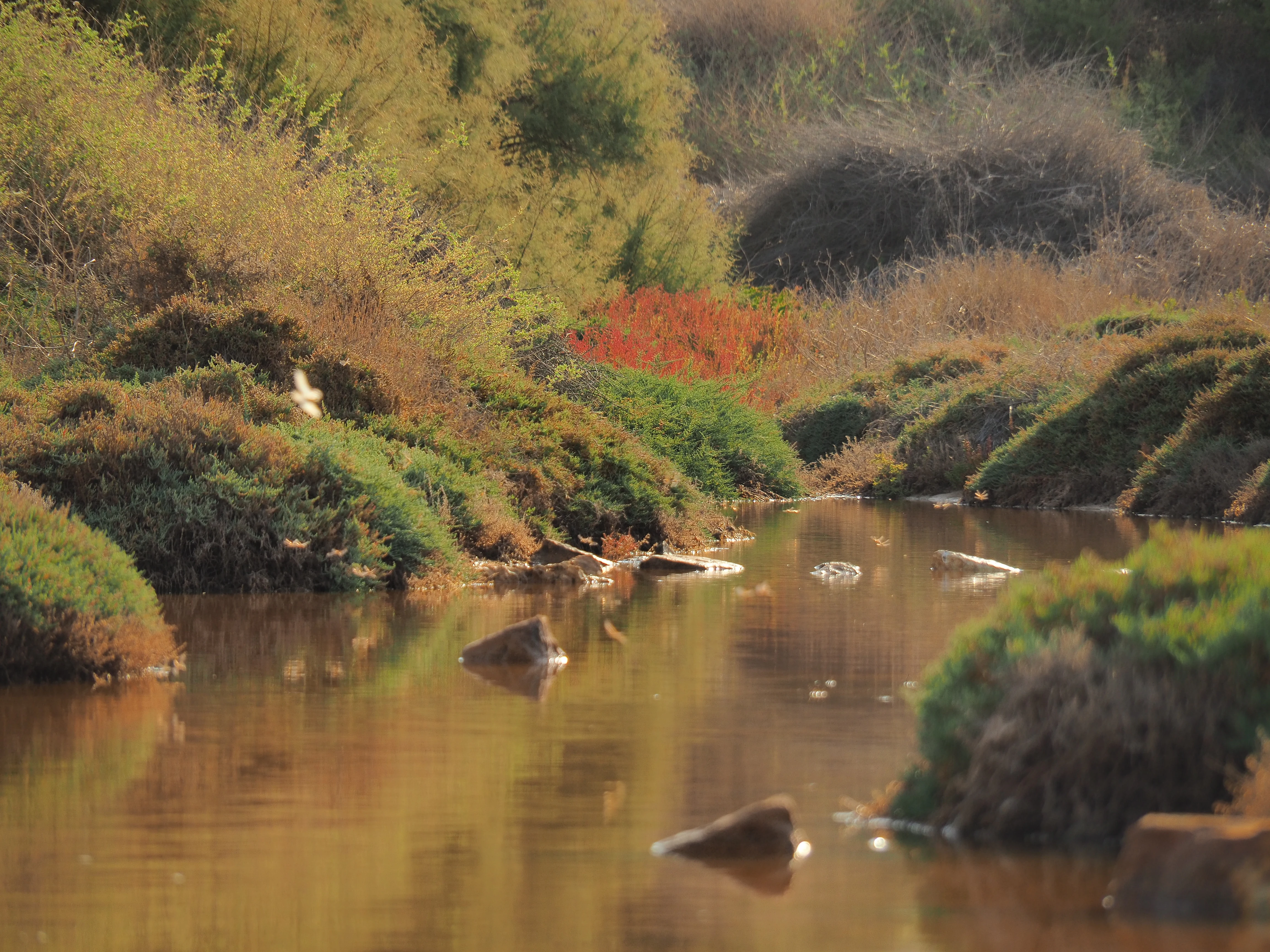
A calm, shallow stream winds through a salt marsh, surrounded by low-lying, textured green and reddish coastal vegetation.
A serene view of the salt marsh at Il-Ballut ta' Marsaxlokk.

Il-Ballut ta' Marsaxlokk history and protected-area timeline

The area now known as Il-Ballut ta' Marsaxlokk has long been known locally by alternative names such as Il-Kanal and Ir-Riserva, reflecting its traditional role as a recognizable natural landmark. Before its protection, it functioned informally as a hunting ground, where local people were familiar with its seasonal rhythms and wildlife.

In the 1980s, the site first attracted the organized attention of conservationists through the Society for the Study and Conservation of Nature, an organization later incorporated into Nature Trust Malta. By that time, the reserve was already suffering severe and ongoing degradation, with rubble from the construction of the Delimara Power Station dumped on and around the site. Further damage occurred in 1999, when sand, soil, and rubble were deposited just outside the reserve in an apparent attempt at replenishing the nearby beach.

Environmental protection was eventually granted to the site, but meaningful active management only began in 2018, when Nature Trust Malta assumed responsibility through a formal agreement with the Environment and Resources Authority. Since then, the reserve has been the focus of coordinated cleanup work, habitat restoration, replanting of indigenous vegetation, and collaboration with Infrastructure Malta and the Marsaxlokk Local Council to address the combined pressures of pollution, erosion, and infrastructure development in the surrounding area.

Il-Ballut ta' Marsaxlokk landscape and geographic character

The landscape of Il-Ballut ta' Marsaxlokk is defined by flat, low-lying coastal terrain shaped by water and sediment. The reserve sits at sea level along the Marsaxlokk coast, where the dominant features are expanses of soft muddy ground crossed by a series of shallow, dredged canals. These canals were historically deeper, but siltation from dumped material and other disturbances has gradually reduced their depth and clarity.

The wider setting blends seamlessly with the surrounding coastal environment of southeastern Malta. Mediterranean shrubs fringe the edges of the marsh, while the nearby Marsaxlokk bay influences both the hydrology and atmosphere of the site. Coastal erosion is visible along parts of the reserve's margin, reshaping the boundary between wetland and sea and adding urgency to the site's conservation profile.

Despite its small footprint, the reserve presents a layered Mediterranean coastal landscape: muddy wetland in the interior, transitional halophytic vegetation on the edges, and a coastline exposed to both natural erosion and the effects of human activity in the catchment. This compressed mosaic of coastal features gives Il-Ballut ta' Marsaxlokk a strong visual and ecological identity.

Il-Ballut ta' Marsaxlokk ecosystems, habitats, and plant life

The ecological heart of Il-Ballut ta' Marsaxlokk is its salt marsh habitat, one of the few remaining examples in the Maltese Islands. The wet core of the reserve is characterized by muddy substrate and shallow standing water in the canals, while the drier fringes support specialized salt-tolerant plant communities. These halophytic species, including representatives of the Salicornia, Juncus, and Arthrocnemum genera, have adapted to the fluctuating salinity and seasonal drying that defines the marsh.

The site also retains vegetation such as Pancratium maritimum and Juncus maritimus, both of which have been actively planted as part of restoration efforts to reinforce local populations. The dense mats of low-growing marsh plants and the bordering shrubs together create a patchwork of microhabitats that differ in moisture, salinity, and shelter conditions.

Ecologically, the reserve demonstrates the delicate balancing act typical of Mediterranean coastal wetlands. Changes in water depth, salinity, and nutrient load can quickly shift the balance between plant communities and water quality, and the loss of the historic connection to the Marsaxlokk port has already demonstrated how vulnerable the system is. Despite these pressures, the site continues to function as a coherent salt marsh ecosystem, providing refuge and resources for species that depend on this rare habitat type.

Il-Ballut ta' Marsaxlokk wildlife and species highlights

The wildlife profile of Il-Ballut ta' Marsaxlokk is dominated by birds, with the small wetland's proximity to the coast making it especially attractive to vagrant, rare, and scarce species. Ornithological research carried out between 2014 and 2020 recorded over 90 different bird species, highlighting the reserve's value relative to its size.

The flat muddy stretches provide ideal feeding conditions for waders such as the Common Sandpiper, while the shrubs surrounding the area support a variety of sedentary species. The site has also proven important as a wintering ground for birds that migrate from colder parts of northern Europe to avoid freezing temperatures, reinforcing its role within wider European flyway networks.

A particularly notable wildlife moment came in November 2017, when the first Brown Shrike ever recorded in Malta was observed inside the salt marsh. While the loss of historical conditions has affected some elements of the fauna, including the local disappearance of the Mediterranean killifish Aphanius fasciatus, the reserve continues to function as an important refuge for both resident and migratory wildlife in southeastern Malta.

Il-Ballut ta' Marsaxlokk conservation status and protection priorities

Conservation at Il-Ballut ta' Marsaxlokk is driven by the recognition that the reserve offers a rare and increasingly threatened habitat type in the Maltese Islands. Its inclusion in the Natura 2000 network places it within the European Union's framework for protecting habitats and species of community interest, giving it a formal status beyond its small territorial extent.

Practical conservation work has been led by Nature Trust Malta, which assumed official management of the site in 2018 under an agreement with the Environment and Resources Authority. Routine cleanups are a central activity, addressing the persistent problem of waste accumulating within and around the marsh. Restoration efforts also include replanting indigenous species such as Pancratium maritimum and Juncus maritimus to reinforce local plant populations.

Conservation activities are coordinated in partnership with Infrastructure Malta and the Marsaxlokk Local Council, reflecting the need to integrate ecological management with broader decisions about coastal infrastructure, drainage, and land use in the surrounding area. The reserve has become a local reference point for community-based wetland conservation, demonstrating how multiple institutions can collaborate around a small but ecologically valuable site.

Il-Ballut ta' Marsaxlokk cultural meaning and human context

Il-Ballut ta' Marsaxlokk carries a strong local identity, traditionally referred to by residents as Il-Kanal or Ir-Riserva, names that emphasize its role as a familiar feature of the Marsaxlokk coastal landscape. For generations, the area was known as a hunting ground, and this long history of informal use shaped early community relationships with the site.

The reserve is closely tied to the broader identity of Marsaxlokk, a fishing village well known in Malta for its harbor and traditional maritime culture. The proximity of the salt marsh to this working coastal community means that conservation efforts at Il-Ballut are embedded in a setting where fishing, settlement, and nature conservation intersect. The site's modern role, however, marks a transition from a place of traditional hunting use to one of formal ecological protection, with local institutions now engaged in collaborative management.

Top sights and standout views in Il-Ballut ta' Marsaxlokk

Among the most distinctive features of Il-Ballut ta' Marsaxlokk is its status as one of Malta's few surviving salt marsh ecosystems, embedded within the Natura 2000 network and managed actively by Nature Trust Malta. The reserve concentrates a remarkable diversity of birdlife into a very small footprint, with over 90 species documented, including an important wintering and migratory population.

The site also stands out for its layered coastal landscape, where muddy canals, halophytic vegetation, and Mediterranean shrub cover come together in a compact setting. Its conservation story, marked by an ongoing fight against pollution, dumping, and coastal erosion, gives it an additional layer of significance as a symbol of local environmental resilience in southeastern Malta.

Best time to visit Il-Ballut ta' Marsaxlokk

Il-Ballut ta' Marsaxlokk can be appreciated across the seasons, though the character of the experience varies with the year. In the cooler and wetter months, the reserve retains more water in its canals, supporting higher numbers of migratory and wintering birds, which is often when the birdwatching potential is at its peak.

During the dry summer period, parts of the canal system can desiccate, which generally reduces wader activity and shifts the emphasis toward terrestrial and shrub-dwelling species. The transitional seasons of spring and autumn tend to offer a balance, with both wintering birds still present and returning migrants passing through, while plant communities across the marsh remain active. Visitors should be aware that access involves coastal terrain that can be affected by erosion, especially after storms.
Monthly climate preview

Long-term representative measurements of monthly temperature and precipitation rhythms

Il-Ballut ta' Marsaxlokk Climate Normals and Annual Temperature Patterns

Long-term representative records reveal measured shifts in average temperatures and daily precipitation rates across the coordinate. Detailed monthly climate profiles provide complete twelve-month temperature ranges and precipitation trends for comprehensive analytical comparison.
Annual mean20 °C
14 °C27 °C
Jan15°
Feb14°
Mar15°
Apr16°
May19°
Jun22°
Jul25°
Aug27°
Sep25°
Oct23°
Nov19°
Dec16°
Warmest month
August

26.6 °C

Coolest month
February

13.9 °C

Wettest month
November

3 mm/day

Driest month
July

0.1 mm/day

Park location guide

Geography guide, regional context, and park location map for Il-Ballut ta' Marsaxlokk

Il-Ballut ta' Marsaxlokk park geography, regions, and map view in Malta

Understand where Il-Ballut ta' Marsaxlokk sits in Malta through a broader geographic reading of the surrounding landscape, nearby location context, and its mapped position within the national park landscape.

How Il-Ballut ta' Marsaxlokk fits into Malta

Malta is a small island nation in the Mediterranean, located between Italy, Tunisia, and Libya. With a population of about 520,000 spread over 316 km², it is one of the world's most densely populated countries. The country has a long history of foreign rule and is known for its strategic position, historic sites, and membership in the EU, Commonwealth, and UN.

Wider geography shaping Il-Ballut ta' Marsaxlokk in Malta

Malta is located in the Mediterranean Sea between Sicily and North Africa, approximately 80 km south of Italy, 284 km east of Tunisia, and 333 km north of Libya. The archipelago sits at coordinates 35°54′N 14°31′E.

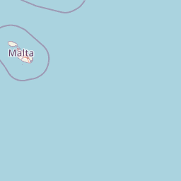
Map view of Il-Ballut ta' Marsaxlokk

Use this park location map to pinpoint Il-Ballut ta' Marsaxlokk in Malta, understand its exact geographic position, and read its mapped placement within the surrounding landscape more clearly.

Pigeon | © OpenStreetMap contributors

Location context for Il-Ballut ta' Marsaxlokk

South Eastern Region

Visualizing the rare salt marsh habitats, muddy canals, and coastal terrain of Malta

Il-Ballut ta' Marsaxlokk Photos and Landscape Scenery

Visual documentation reveals the distinct coastal terrain, soft muddy substrates, and shallow wetland canals that define the protected environment of Il-Ballut ta' Marsaxlokk. Detailed imagery provides clear insight into the halophytic vegetation communities and Mediterranean reserve character found along the southeastern Maltese coast.

A calm, shallow stream winds through a salt marsh, surrounded by low-lying, textured green and reddish coastal vegetation.

A coastal salt marsh area with rocky shoreline and low vegetation, with the tall stacks of a power plant visible in the distance across the water.

Park atlas

Compare adjacent wetland habitats and protected landscapes across the region

Explore Parks Near Il-Ballut ta' Marsaxlokk and Surrounding Coastal Reserves

Browse other protected areas near Il-Ballut ta' Marsaxlokk to examine similar coastal wetland ecosystems and Mediterranean habitats. Comparing these regional conservation sites provides broader context for understanding local bird migration routes and salt marsh geography.
Nature reserveMarsaxlokk
About 1.9 km away#1 closest

East

Xrobb l-Għaġin Nature Park: Protected Coastal Landscape in Marsaxlokk, Malta

A compact peninsula of protected cliffs and historic archaeological sites

Xrobb l-Għaġin Nature Park spans a low-lying coastal peninsula near Marsaxlokk, combining rocky Mediterranean shoreline with significant prehistoric temple remains. This protected area serves as a focal point for environmental education and coastal terrain analysis, showcasing the integration of natural heritage and historical coastal defense within a compact geographic boundary.

Area
0.155 km²
Relief
Lowland
Scope
Terrestrial
Water
Minor water
A horizontal watercolor illustration showing soft, blended washes of green, yellow, and pale pink depicting an abstract rolling landscape or horizon line against a white background.
Natural monumentMalta
About 1.9 km away#2 closest

West

Għar Dalam Natural Monument: A Protected Maltese Cave and Paleontological Landmark

Geological and prehistoric landscape context in southeastern Malta

Għar Dalam is a protected natural monument in Malta that preserves a complex phreatic cave passage and essential fossil records of extinct dwarf species. This cave site acts as a major cornerstone for understanding the prehistoric Mediterranean, documenting the arrival of early Neolithic cultures and the long-term evolution of island-bound animal life through stratified sediment analysis.

Established
1933
Relief
Lowland
Climate
Mediterranean
Access
Easy access
National parkMalta
About 13 km away#3 closest

Northwest

Ta' Qali National Park: Malta's Largest Urban Protected Landscape and Recreation Hub

Mapped Gardens, Event Venues, and Recreational Zones

Ta' Qali National Park serves as a vital green lung in central Malta, showcasing a landscape transformed from a wartime airfield into a modern urban protected area. This national park is recognized for its extensive recreational zones, meticulously designed formal gardens, and a prominent open-air concert venue that hosts major cultural events. Its relatively flat terrain and planned infrastructure offer a distinct map-based perspective on urban parkland, highlighting its significance as a major public amenity and a key feature of Malta's landscape.

Area
0.35 km²
IUCN
V
Relief
Lowland
Climate
Mediterranean
A pale, minimalist watercolor illustration showing soft, rolling green and yellow hills against a white background.
Nature reserveMalta
About 14 km away#4 closest

Southwest

Filfla Nature Reserve: The Protected Limestone Plateau and Geography of Malta

Tracing the limestone cliffs and seabird sanctuary of the Maltese archipelago

Filfla is a small, uninhabited limestone islet lying 4.5 kilometres south of the main island of Malta. Defined by its 60-metre sea cliffs and flat plateau, this protected nature reserve functions as a crucial Important Bird Area and a landmark for regional Mediterranean biodiversity. Examine the mapped boundaries and geological profile of this site to understand its status as the southernmost extremity of the Maltese archipelago.

Area
0.06 km²
Established
1980
Relief
Upland
Climate
Mediterranean
A soft, pastel-toned watercolor painting of a rolling green landscape with a small body of water in the foreground and a silhouette of a building on a hill in the distance.
Wildlife reserveMalta
About 14 km away#5 closest

West

Buskett Gardens Wildlife Reserve: Geography and Protected Landscape Map of Malta

A rare sheltered woodland valley in the central Mediterranean

Buskett Gardens serves as a critical protected woodland in the heart of the Maltese islands. Nestled in the fertile Wied il-Luq valley, the site offers an unusually green, shaded environment of broadleaved trees and conifers. This reserve functions as an Important Bird Area and a historic cultural landscape, providing a lush contrast to the exposed limestone plateau of rural Malta.

Area
0.47 km²
Relief
Upland
Scope
Terrestrial
Water
Minor water
A pale, minimalist watercolor painting depicting St Paul's Island in Malta, showing green rolling landforms and a hint of a structure against a light background.
Protected areaMalta
About 19 km away#6 closest

Northwest

St Paul's Island Protected Landscape and Maltese Coastal Geography Overview

Uninhabited Mediterranean island and heritage landmark

St Paul's Island represents a unique Mediterranean limestone islet featuring maritime garigue habitat and historic ruins. Located near the Mellieħa coastline, this protected area provides a compact example of Maltese coastal geography, defined by exposed cliffs and an enduring connection to local maritime history.

Area
0.101 km²
Relief
Lowland
Scope
Mixed
Water
Water-dominated
A horizontal watercolor painting depicting a soft-toned, abstract coastal landscape with gentle green hills, grassy foreground patches, and a calm, pale pool of water against a white background.
Marine protected areaMalta
About 21 km away#7 closest

West

Ras ir-Raħeb Marine Protected Area: Geographic Profile and Mapped Coastal Landscape

Coastal cliffs and protected marine zones in north western Malta.

Ras ir-Raħeb serves as a pivotal marine protected area along the Malta coastline, where high limestone cliffs meet complex underwater habitats. This site links historical archaeological remnants with modern ecological conservation, offering a unique geographic snapshot of the Rabat plateau edge. Its mapped boundaries encompass both the terrestrial promontory and the essential seagrass meadows beneath the surface, providing a critical reference point for Mediterranean coastal geography and protected land status.

Established
2005
Relief
Upland
Climate
Mediterranean
Access
Moderate access
A horizontal watercolor painting showing soft green hills, grassy marshland, and a calm water channel under a light, hazy sky.
Nature reserveGozo
About 27 km away#8 closest

Northwest

Comino Nature Reserve: Geography, Protected Marine Areas, and Karst Terrain in Gozo

Island ecology and coastal landscape mapping

Examine the protected geography of Comino, an island nature reserve near Gozo defined by limestone plateaus and sheltered bays. This overview covers the ecological boundaries of the Natura 2000 marine area, the distribution of coastal sea caves, and the topographic patterns of this Important Bird Area.

Area
3.5 km²
Relief
Lowland
Climate
Mediterranean
Access
Moderate access

Common questions about visiting, size, designation, and location context for Il-Ballut ta' Marsaxlokk

Il-Ballut ta' Marsaxlokk FAQs for park facts, access, geography, and protected area context

Find quick answers about Il-Ballut ta' Marsaxlokk, including protected-area facts, park geography, trail and visitor context, and how the park fits into its surrounding country and regional landscape.
MoriAtlas Explorer

Continue Your Protected Areas Search Across the Global Atlas

Deepen your exploration by continuing the structured search for national parks and protected areas worldwide. Utilize the comprehensive filtering capabilities to compare different conservation landscapes and refine your understanding of global park geography. Discover more about the distribution and characteristics of protected natural areas.

Global natural geography