
Mori Atlas logo
Nature reserveIm Binner

Examining the ecological structure, hydrological features, and habitat mosaic of this protected German lowland area

Im Binner Nature Reserve and the Protected Wet Meadow Landscapes of the Ems Sand Plain

(Naturschutzgebiet Im Binner)

Im Binner represents a critical conservation fragment within the Ems sand plain of North Rhine-Westphalia, Germany. This nature reserve, located in the district of Kreis Gütersloh, protects a traditional wet meadow landscape characterized by historical hedgerows, mature tree lines, and restored aquatic habitats. Its compact geography demonstrates the value of habitat mosaics in sustaining rare meadow species within a broader agricultural terrain.

wet meadownature reserveNorth Rhine-WestphaliaEms sand plainmeadow birdshedgerows
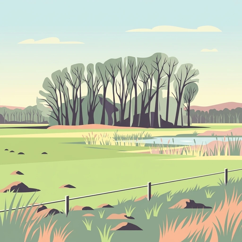
Digital vector-style illustration of a rural wetland scene with a cluster of bare trees in the midground, a small pond with reeds, and a wire fence in the foreground.

Im Binner

Nature reserve

Park overview

Structured park overview, official facts, and landscape profile for Im Binner

Im Binner park facts, protected area profile, and essential visitor context

Review the core facts for Im Binner, including designation, size, terrain, visitor scale, habitats, and operating context in one park-focused overview.

About Im Binner

Im Binner is a compact nature reserve in northwestern Germany, situated in the rural surroundings of the Druffel village north of Rietberg in the district of Gütersloh. Although it is a small site, it captures a particularly characteristic landscape of the Ems sand plain, a lowland area shaped by sandy soils, historical meadow use, and a network of small streams and ditches. The reserve protects roughly 30 hectares of this landscape and represents one of the remaining places where the original wet meadow vegetation of the region can still be observed.

The reserve is essentially a richly structured grassland mosaic. The dominant land use is meadowland, but the open areas are broken up by mature hedgerows and tree rows that have grown into the grassland over many decades. This division is a defining feature of the site: it recreates the kind of small-scale, semi-structured agricultural landscape that once covered much of the Ems lowlands and that is now rare in intensively farmed regions. To the northeast, the reserve borders an area of woodland with older trees, adding an additional habitat type to the mosaic and supporting edge species that prefer the transition between open and wooded environments.

Water is another important element of Im Binner. On the eastern side of the reserve, two ponds that were originally dug for fish farming have been transformed into conservation waters designed to support amphibians, aquatic invertebrates, and wetland plants. In the center of the reserve, a drainage ditch runs southward and eventually links up with the Merschgraben, a separate nearby protected area. Together these water features complement the meadow habitat and maintain the wet conditions that sustain the site's rare plant life.

Beyond its ecological value, the reserve is an example of how small, locally managed protected areas can play an important role in conservation strategy in densely populated regions like North Rhine-Westphalia. As the surrounding agricultural landscape continues to intensify, the relatively undisturbed wet meadows, hedges, and ponds of Im Binner remain a refuge for species that depend on traditional land use patterns and that would otherwise have lost their habitat in the modern Ems lowland.

Quick facts and research context for Im Binner

Im Binner is a protected nature reserve of about 30 hectares in the Druffel district of Rietberg, in the district of Gütersloh, North Rhine-Westphalia. It carries the official designation NSG GT-022 and is classified under IUCN Category IV as a habitat and species management area.

The reserve was established in 1988 to conserve wild plant and animal communities and their habitats, and because of the area's rarity, distinctive character, and scenic quality. It is administered by the lower landscape authority of the district of Gütersloh and is one of several nature reserves within the wider Ems lowland landscape.

Protection and recognition

Examine documented conservation frameworks and formal recognition metrics for Im Binner

Im Binner Protection Status and Official Protected Area Designation Records

Examine the verified protection status and administrative designation records established for Im Binner. Available registry data outlines the formal conservation framework and official management metrics assigned to the protected area.

Protection details

WDPA ID
163853
Park context

Deeper park guide and search-rich context for Im Binner

Im Binner history, landscape, wildlife, and travel context

Explore Im Binner through its history, landscape character, ecosystems, wildlife, conservation priorities, cultural context, and seasonal travel timing in a structured park guide built for atlas discovery and search intent.

Why Im Binner stands out

Im Binner is best known for preserving a representative fragment of the traditional wet meadow vegetation of the Ems sand plain, a habitat type that has become rare in modern agricultural landscapes. The reserve is structured by long-established hedgerows, tree lines, and shrub strips that divide the grassland into smaller plots and create transitional edge habitats supporting both meadow plants and breeding birds. Equally characteristic are the small water bodies within and adjacent to the reserve, including two former fish ponds that have been converted into species conservation waters. Together with a central drainage ditch connecting to the Merschgraben, these waters add a wetland dimension to what is otherwise a meadow-dominated site.
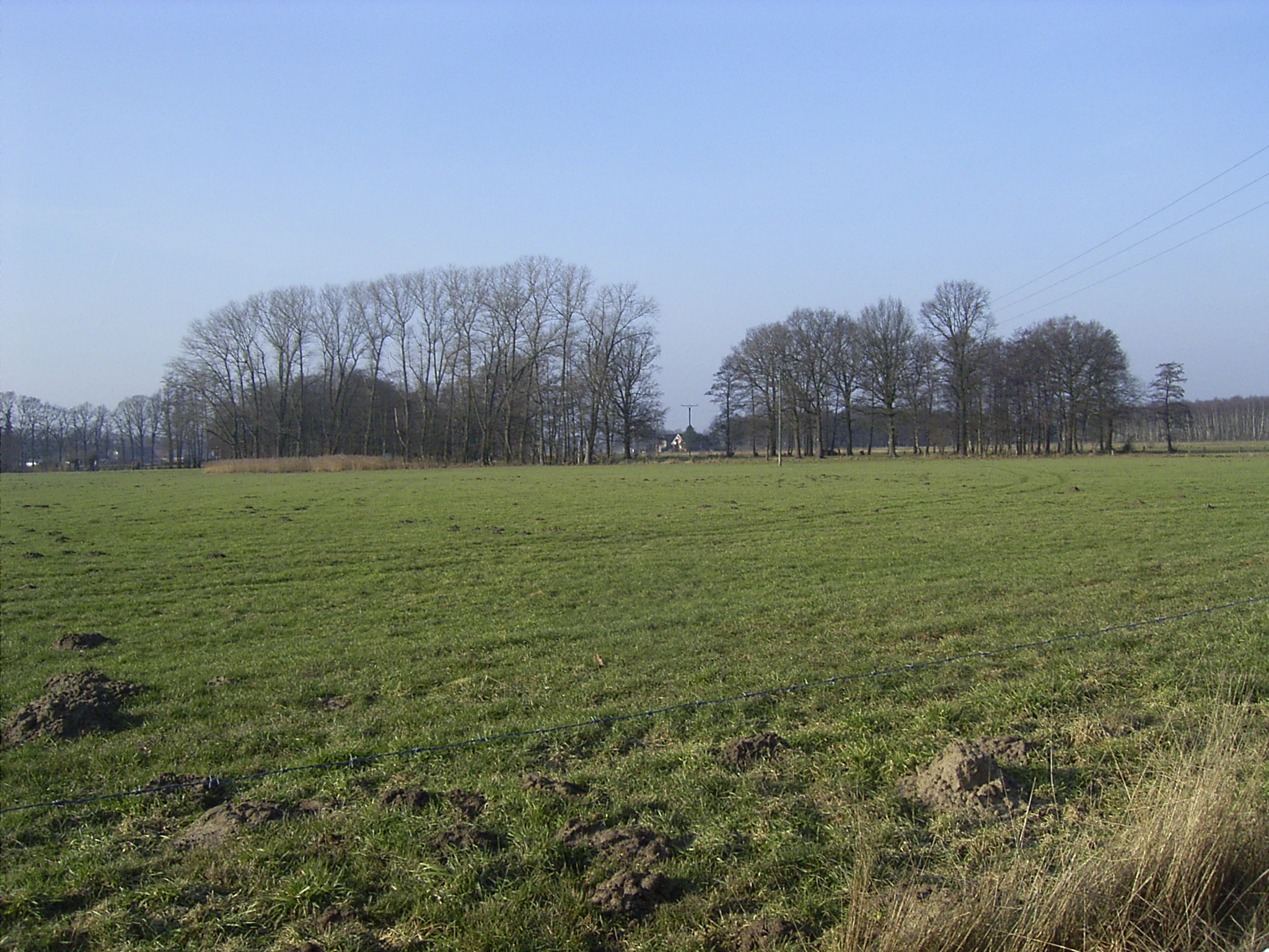
A wide view of a green, grassy meadow at Im Binner, with groups of bare-branched trees in the background under a clear light blue sky.
The open wetland meadows and characteristic tree stands of the Im Binner nature reserve in North Rhine Westphalia.

Im Binner history and protected-area timeline

Im Binner was officially designated as a nature reserve in 1988, making it part of a generation of smaller German nature reserves created during the second wave of formal nature protection in North Rhine-Westphalia. Its designation was motivated by the desire to protect wild plant and animal communities and their habitats, and by recognition of the area's rarity, distinctive character, and scenic value.

At the time of designation, the site already functioned as a traditional wet meadow landscape that had escaped the more intensive agricultural conversions affecting much of the Ems sand plain. The formal protection was therefore less about restoring a new habitat than about safeguarding a fragment of a historical landscape that was still recognizable on the ground.

In the years following designation, the reserve was shaped by deliberate management to maintain its conservation value. Two former fish ponds were redesigned for species protection, and a regular mowing regime was implied to keep the meadow character intact. Floristic and ornithological surveys carried out in the early 2000s documented the site's biodiversity and continue to underpin its management.

Im Binner landscape and geographic character

The landscape of Im Binner is flat to gently undulating, typical of the Ems sand plain, where sandy substrates and a high water table have historically supported wet meadows rather than arable land. The reserve lies northwest of the Druffel settlement area, surrounded by a broader agricultural landscape of fields, meadows, and small villages.

Within the reserve, the dominating visual element is open grassland interrupted by hedgerows and tree lines. These woody strips are not incidental; they are integral to the landscape structure, formed by hedges that have grown over time and now extend as continuous bands through the meadow. They give the reserve a distinctive divided appearance, with smaller meadow compartments set between lines of shrubs and mature trees. To the northeast, the transition into a wooded area produces a clear edge between open meadow and older forest stand.

Water shapes the landscape on a small but important scale. The two former fish ponds along the eastern edge, and the central ditch leading south toward the Merschgraben, create a sequence of open water, moist banks, and saturated meadow areas. Together they reinforce the wet character of the reserve and tie it hydrologically to the wider Ems lowland network.

Im Binner ecosystems, habitats, and plant life

Ecologically, Im Binner is a grassland-dominated reserve with a strong wet meadow character. The open areas retain vegetation typical of the Ems sand plain, an ecological community defined by sandy soils, fluctuating moisture, and traditional hay meadow management. Unlike many modern grasslands in the region, the meadows of Im Binner have not been replaced by monoculture forage or heavily fertilized pastures, and this is what allows their characteristic flora to persist.

The hedge and tree line structure adds a wooded component to what would otherwise be a pure meadow habitat. These linear woody features provide nesting sites, shelter, and food resources for species that use the edge between open meadow and shrubby or wooded habitat. The adjacent forest on the northeastern edge extends this gradient, allowing the reserve to support both meadow and edge-loving species.

The ponds and ditches introduce wetland and aquatic habitats into the reserve, supporting amphibian breeding, aquatic plants, and invertebrates that depend on standing or slow-flowing fresh water. The wet meadow vegetation itself, with moisture-loving grasses, sedges, and herbs, ties the terrestrial and aquatic elements of the site together into a coherent habitat complex.

Im Binner wildlife and species highlights

Breeding meadow birds are the most prominent wildlife interest of Im Binner. A territory mapping effort in 2000 recorded a total of 33 breeding bird species within the reserve, reflecting the habitat diversity of meadow, hedge, pond, and woodland edge. Among the most notable species recorded were lapwing, little woodpecker, little owl, Eurasian curlew, green woodpecker, and barn swallow.

The presence of these species is closely tied to the reserve's structure. Lapwings and curlews depend on open wet meadows with short vegetation, which is precisely what the grassland compartments of the reserve provide. Little owl and the woodpeckers benefit from the older trees in and around the reserve, particularly along the hedgerows and the bordering woodland. The swallow makes use of the agricultural buildings in the surrounding landscape, taking advantage of the reserve's open flight space for feeding.

Although ornithological surveys form the most detailed wildlife record of the reserve, the mosaic of meadow, pond, hedge, and forest also supports amphibians, aquatic invertebrates, and a range of small mammals typical of the Ems lowland. The site's value lies less in any single charismatic species than in the persistence of a working bird community tied to traditional landscape features.

Im Binner conservation status and protection priorities

Im Binner is recognized for its role in protecting a relic of the Ems sand plain wet meadow landscape, one of the most depleted habitat types in the modern northwestern German countryside. Intensive agriculture, drainage, and land consolidation have largely eliminated the traditional meadow vegetation that once covered the region, and reserves like Im Binner are now the most important repositories of what remains.

The site's conservation strategy focuses on maintaining the existing mosaic rather than on restoring a different one. By keeping the grasslands as meadow, preserving the hedgerow and tree line structure, and managing the former fish ponds as conservation waters, the reserve protects both the species that live in these habitats and the wider ecological processes that sustain them. The site is registered internationally in the World Database on Protected Areas and is part of a broader network of nature reserves around Rietberg and across the Gütersloh district.

As a small, locally managed reserve under the lower landscape authority of the district of Gütersloh, Im Binner illustrates how focused, small-scale conservation areas can stabilize biodiversity at a regional scale. Its continued protection depends on maintaining low-intensity management that simulates the historical land use pattern that shaped its habitat diversity.

Im Binner cultural meaning and human context

Im Binner sits within a cultivated agricultural region where traditional land use patterns shaped both the village structure and the surrounding landscape. The Druffel area of Rietberg has long been a working rural community, and the historic meadows of the Ems sand plain were originally part of the common farming fabric of such villages, providing hay, modest grazing, and small-scale fishing.

The presence of old fish ponds on the site reflects this rural heritage. These ponds were originally created for fish farming, a traditional use of small water bodies in the Ems lowlands, before they were repurposed for species conservation. The hedge and tree line structure of the reserve is also a cultural artifact, having grown out of historical field boundaries and windbreaks that once divided the farmed landscape.

Top sights and standout views in Im Binner

Im Binner's most distinctive quality is its preserved wet meadow vegetation, still recognizable as belonging to the broader Ems sand plain ecological tradition. Few reserves in the region combine so clearly the elements of meadow, hedgerow, pond, and woodland edge within such a compact area.

The site's bird community, with 33 recorded breeding species including lapwing and curlew, is another defining strength, tied directly to the reserve's habitat structure. Equally important is its quiet role as a locally managed refuge within a heavily farmed German lowland, demonstrating that even small reserves can hold real conservation value when they protect intact historical landscape features.

Best time to visit Im Binner

The wet meadows of Im Binner are at their most expressive from late spring through summer, when hay meadow grasses and herbs are in full growth and breeding birds are active across the site. Early mornings in late spring and early summer are generally the best times to observe meadow bird behavior and to hear territorial songs, though the reserve is best approached as a quiet landscape walk rather than as a heavily visited tourist site.

Winter and early spring visits emphasize the reserve's structure rather than its color or sound, with hedge lines, bare trees, and open water dominating the view. There is no formal visitor infrastructure; visits are best suited to walkers and observers comfortable interpreting a small, low-key nature reserve on their own.

Monthly climate preview

Long-term representative point measurements for annual temperature and precipitation rhythm

Im Binner Climate Normals, Measured Monthly Temperature and Precipitation Patterns

Im Binner records measured long-term temperature ranges and monthly precipitation averages across a representative coordinate in Kreis Gütersloh. Accessing the complete twelve-month climatology profile allows detailed comparison of historical weather patterns throughout the year.
Annual mean9 °C
1 °C18 °C
Jan
Feb
Mar
Apr
May13°
Jun16°
Jul18°
Aug18°
Sep14°
Oct10°
Nov
Dec
Warmest month
July

18.4 °C

Coolest month
January

0.9 °C

Wettest month
December

2.6 mm/day

Driest month
April

1.6 mm/day

Park location guide

Geography guide, regional context, and park location map for Im Binner

Im Binner park geography, regions, and map view in Germany

Understand where Im Binner sits in Germany through a broader geographic reading of the surrounding landscape, nearby location context, and its mapped position within the national park landscape.

How Im Binner fits into Germany

Germany is a federal republic in Western and Central Europe with a population of over 83 million across sixteen constituent states. It is Europe's largest economy by nominal GDP and a major global exporter and importer. The capital is Berlin, and the country borders Denmark, Poland, Czech Republic, Austria, Switzerland, France, Luxembourg, Belgium, and the Netherlands.

Wider geography shaping Im Binner in Germany

Germany is located in Western and Central Europe, spanning 357,022 km². It borders Denmark to the north, Poland and the Czech Republic to the east, Austria and Switzerland to the south, and France, Luxembourg, Belgium, and the Netherlands to the west. The country has coastlines on the Baltic Sea and North Sea to the north, with the Alps located in the southern region.

Map view of Im Binner

Use this park location map to pinpoint Im Binner in Germany, understand its exact geographic position, and read its mapped placement within the surrounding landscape more clearly.

Pigeon | © OpenStreetMap contributors

Location context for Im Binner

Kreis GüterslohNordrhein-Westfalen

Explore protected area views, wet meadow terrain, and conservation habitats

Im Binner Photos and Landscape Scenery: Visualizing Ems Sand Plain Habitats

Examine detailed imagery showcasing the distinctive grassland terrain, traditional hedgerows, and aquatic conservation habitats defining the protected landscape. Visual documentation reveals the ecological structure and natural scenery characterizing the lowland nature reserve.

A wide view of a green, grassy meadow at Im Binner, with groups of bare-branched trees in the background under a clear light blue sky.

A small, quiet pond surrounded by tall dried reeds and grasses in a meadow setting, with bare trees and a forest edge in the background under a pale sky.

Park atlas

Compare surrounding lowland habitats, wet meadows, and connected regional landscapes

Explore Protected Areas and Nature Reserves Near Im Binner in the Regional Lowland

Browse other protected areas and nature reserves located near Im Binner across the wider Ems sand plain. Comparing these nearby lowland habitats reveals connected conservation networks and shared regional landscape features.
Watercolor painting of a peaceful wetland landscape with green grassy fields, small groups of trees, and a central pond, set against a soft, pale background.
Nature reserveNordrhein-Westfalen
About 4.6 km away#1 closest

Southeast

Rietberger Emsniederung mit Steinhorster Becken: Geography and Nature Reserve Atlas

Protected floodplain habitats in North Rhine-Westphalia

Situated along the upper Ems river, this protected area serves as an essential ecological corridor. Examine the mapped extent of its wet meadows, basin structures, and riverine channels that distinguish this region from the surrounding agricultural landscape.

Area
9.28 km²
Established
2000
Relief
Lowland
Climate
Temperate
A horizontal watercolor painting showing a small winding river flowing through a lush green forest with soft pink and yellow meadow areas in the foreground.
Nature reserveKreis Gütersloh
About 13 km away#2 closest

Northeast

Holter Wald Nature Reserve: Mapping the Protected Woodland and Senne Landscape of Kreis Gütersloh

A major contiguous forest block on the eastern edge of the Westfälische Bucht

Situated in the district of Kreis Gütersloh, Holter Wald is a significant protected area defined by its sandy Senne soils and network of parallel brook valleys. The forest provides a critical lowland habitat for diverse flora and fauna, serving as a rare, large-scale woodland anchor within a largely agricultural region. Explore the terrain characteristics and ecological structure of this key North Rhine Westphalia site.

Area
6.13 km²
Established
2008
IUCN
IV
Relief
Lowland
Watercolor painting of a green and pink moor landscape with a distant tree line.
Nature reserveNordrhein-Westfalen
About 14 km away#3 closest

Northwest

Hühnermoor Nature Reserve: Geographic Analysis of a Protected Peatland in Nordrhein-Westfalen

A preserved raised-bog landscape and historic botanical refuge

Hühnermoor represents a rare, compact peatland ecosystem situated between ancient sand dunes in the Münsterland region. This nature reserve functions as a critical protected landscape, offering deep insights into regional vegetation history through its stratified peat layers while supporting threatened specialist wetland species.

Area
0.085 km²
Established
1938
IUCN
IV
Relief
Lowland
A watercolor painting showing a soft, peaceful landscape with bare trees in the foreground, green trees in the midground, and distant hills under a pale sky.
Nature reserveNorth Rhine-Westphalia
About 14 km away#4 closest

Northeast

Kampeters Kolk Nature Reserve: Geographic Overview and Protected Wetland Boundaries

Senne region heath pond and wetland mosaic in North Rhine-Westphalia

Kampeters Kolk preserves a significant fragment of the historic Senne heath landscape in North Rhine-Westphalia. The reserve centers on a small, artificial pond created by peat extraction, now surrounded by a rich sequence of sedges, reed stands, and willow-alder shrub thickets that provide critical habitats for local amphibian populations.

Area
0.02 km²
Established
1993
IUCN
IV
Protected landscapeKreis Paderborn
About 15 km away#5 closest

East

Landschaftsschutzgebiet Delbrücker Rücken Protected Landscape Map and Regional Context

A rural ridge mosaic in the Kreis Paderborn district

This protected landscape in the Kreis Paderborn district features a characteristic mix of deciduous forests, field hedgerows, and agricultural zones on a gentle Westphalian ridge. Its geographic layout provides a clear example of rural land protection integrated into the local environmental buffer system, showcasing a distinct mosaic of terrain that stretches across the lands north and east of Delbrück.

Area
16.1 km²
Established
1970
Relief
Lowland
Climate
Temperate
Nature reserveNordrhein-Westfalen
About 16 km away#6 closest

Southwest

Märzenbecherwald Nature Reserve: Wetland Mosaic and Protected Forest in Nordrhein-Westfalen

A rare calcareous fen and alder swamp forest ecosystem

This protected nature reserve in the Warendorf district serves as a vital ecological anchor, preserving a mosaic of spring-fed seeps, damp woodlands, and calcareous fens. Despite its modest size, the area provides a sharp contrast to the surrounding agricultural fields of the Münsterland region, maintaining a essential water-logged habitat for specialized plant species.

Area
0.016 km²
Established
1995
IUCN
IV
Relief
Lowland
A watercolor painting of a wetland landscape with soft green hills, trees, and a winding waterway.
Nature reserveNorth Rhine-Westphalia
About 18 km away#7 closest

Northeast

Kipshagener Teiche Nature Reserve: A Protected Wetland Sanctuary in North Rhine-Westphalia

Geographic analysis of historic bogs and managed wetland habitats

Kipshagener Teiche is a small but essential nature reserve in the Senne region, characterized by a distinct mosaic of ponds, transitional bog, and wet heath. Originally protected in 1937, the site serves as a vital record of wetland biodiversity and recovery in western Germany. Its varied topography, featuring dune-based pine plantations and swamp forest, offers a precise look at the intersection of conservation and landscape management in a human-influenced region.

Area
0.113 km²
Established
1970
IUCN
IV
A horizontal watercolor painting depicting a soft-toned landscape with scattered evergreen trees and undulating, sandy terrain under a light sky.
Nature reserveNordrhein-Westfalen
About 19 km away#8 closest

East

Moosheide Nature Reserve: Mapping the Ancient Inland Dune Landscapes of Nordrhein-Westfalen

Protected heathland and spring-fed habitat geography.

Moosheide provides a focused look at the geomorphology of the western Senne region. This reserve protects some of the oldest inland dunes in northwestern Germany, alongside a rare juxtaposition of dry sandy grasslands and groundwater-dependent stream valleys that support high species diversity.

Area
4.427 km²
Established
1994
IUCN
IV
Relief
Lowland

Common questions about visiting, size, designation, and location context for Im Binner

Im Binner FAQs for park facts, access, geography, and protected area context

Find quick answers about Im Binner, including protected-area facts, park geography, trail and visitor context, and how the park fits into its surrounding country and regional landscape.
MoriAtlas Explorer

Continue Your Protected Areas Search Across the Global Atlas

Deepen your exploration by continuing the structured search for national parks and protected areas worldwide. Utilize the comprehensive filtering capabilities to compare different conservation landscapes and refine your understanding of global park geography. Discover more about the distribution and characteristics of protected natural areas.

Global natural geography