
Mori Atlas logo
Nature reserveIn den Weiden bei Blankenheim

Analyzing the topography, riparian habitats, and regional river valley geography of this protected Hessian wetland site.

In den Weiden bei Blankenheim Nature Reserve: Mapped Protected Landscapes in the Fulda Valley

(Naturschutzgebiet In den Weiden bei Blankenheim)

Situated along the middle reaches of the Fulda river in Hesse, In den Weiden bei Blankenheim represents a significant transformation of former gravel-pit terrain into a vital protected wetland. This nature reserve, integrated within the Natura 2000 network, features a groundwater-fed lake bordered by alder and willow thickets, functioning as a key stepping-stone habitat for migratory waterfowl and resident bird species within the broader valley corridor.

wetlandgravel-pit lakefloodplainwaterbirdsNatura 2000riparian woodland
A flat vector illustration showing a tall waterfall cascading from rocky mountains into a river or lake, surrounded by coniferous forests under a pale sky.

In den Weiden bei Blankenheim

Nature reserve

Park overview

Structured park overview, official facts, and landscape profile for In den Weiden bei Blankenheim

In den Weiden bei Blankenheim park facts, protected area profile, and essential visitor context

Review the core facts for In den Weiden bei Blankenheim, including designation, size, terrain, visitor scale, habitats, and operating context in one park-focused overview.

About In den Weiden bei Blankenheim

In den Weiden bei Blankenheim is a compact protected wetland in the lower elevations of the East Hessian hill country, set within the floodplain of the Fulda at roughly 190 meters above sea level. Although the reserve covers only a few hectares, it punches above its size in regional ecological terms, because its seasonally integrated connection with the river's flooding regime effectively multiplies the habitat available to birds and aquatic life across the wider valley.

The defining feature of the area is a former gravel pit that was flooded by rising groundwater after extraction stopped in the mid-1960s, forming a lake of approximately four meters in depth. Because there were at the time no requirements for renaturation or shoreline reshaping, the lake developed steep banks that have prevented the formation of typical reed fringes. Instead, the shoreline is dominated by a dense ring of woody vegetation, with willows dominant and their branches arching down toward the water surface. A narrow belt of former meadow land in the southern part of the reserve has matured through tall herb communities into floodplain forest, and a small island in the lake carries alder and willow growth that the cormorants of the region use as a communal roost.

The reserve's significance is anchored both in its protected status under Hessian nature conservation law and in its integration into the Natura 2000 network. It lies within the Fauna-Flora-Habitat site Auenwiesen von Fulda, Rohrbach und Solz, the Special Protection Area Fuldatal zwischen Rotenburg und Niederaula, and the broader Auenverbund Fulda landscape protection area. Together those designations place the Weiden bei Blankenheim in a framework where the management of one small waterbody is tied to the long-term hydrology and habitat quality of the whole middle Fulda valley.

Quick facts and research context for In den Weiden bei Blankenheim

In den Weiden bei Blankenheim is a nature reserve in the Hersfeld-Rotenburg district of eastern Hesse, situated south of the village of Blankenheim in the municipality of Bebra along the middle course of the Fulda river. The reserve was formally designated in September 1983 by the regional forestry and nature conservation authority, with the explicit purpose of securing an ornithologically valuable waterbody as a permanent habitat for several bird species of conservation concern.

Although small in scale, the area holds layered protection: it is a designated Naturschutzgebiet under Hessian law and is also incorporated into the larger landscape protection area Auenverbund Fulda and the European Natura 2000 network. The reserve lies within the Fulda-Werra-Bergland, a transition zone between the Bebra basin and the broader East Hessian hill country.

Protection and recognition

Documented terrestrial protection history established in 2008

In den Weiden bei Blankenheim Protection Status and Official Designation Record

In den Weiden bei Blankenheim maintains a documented terrestrial protection status established in the year 2008. Verified records assemble official designation details, management scope, and international recognition sources into a unified atlas profile.

Protection details

Protection scope
Terrestrial
Designated year
2008
Transboundary protection
No
WDPA ID
81989
Park context

Deeper park guide and search-rich context for In den Weiden bei Blankenheim

In den Weiden bei Blankenheim history, landscape, wildlife, and travel context

Explore In den Weiden bei Blankenheim through its history, landscape character, ecosystems, wildlife, conservation priorities, cultural context, and seasonal travel timing in a structured park guide built for atlas discovery and search intent.

Why In den Weiden bei Blankenheim stands out

The reserve is best known for its compact former gravel-pit lake and its consistent importance for waterbirds, despite the small water surface. It was pioneering in the region as the first gravel pit in the middle Fulda course to be formally transferred into conservation use after extraction ceased, setting an early precedent for the chain of post-extraction wetlands that now line the river. The lake is also recognized as a meaningful stopover and wintering site for ducks, rails, grebes, cormorants, and assorted wetland and meadow birds, and as a breeding ground for songbirds in the surrounding willow- and alder-dominated shore vegetation. Within the wider Fulda valley, the Weiden bei Blankenheim function as a stepping-stone biotope, strengthening the corridor effect of the river for migratory and resident birdlife.
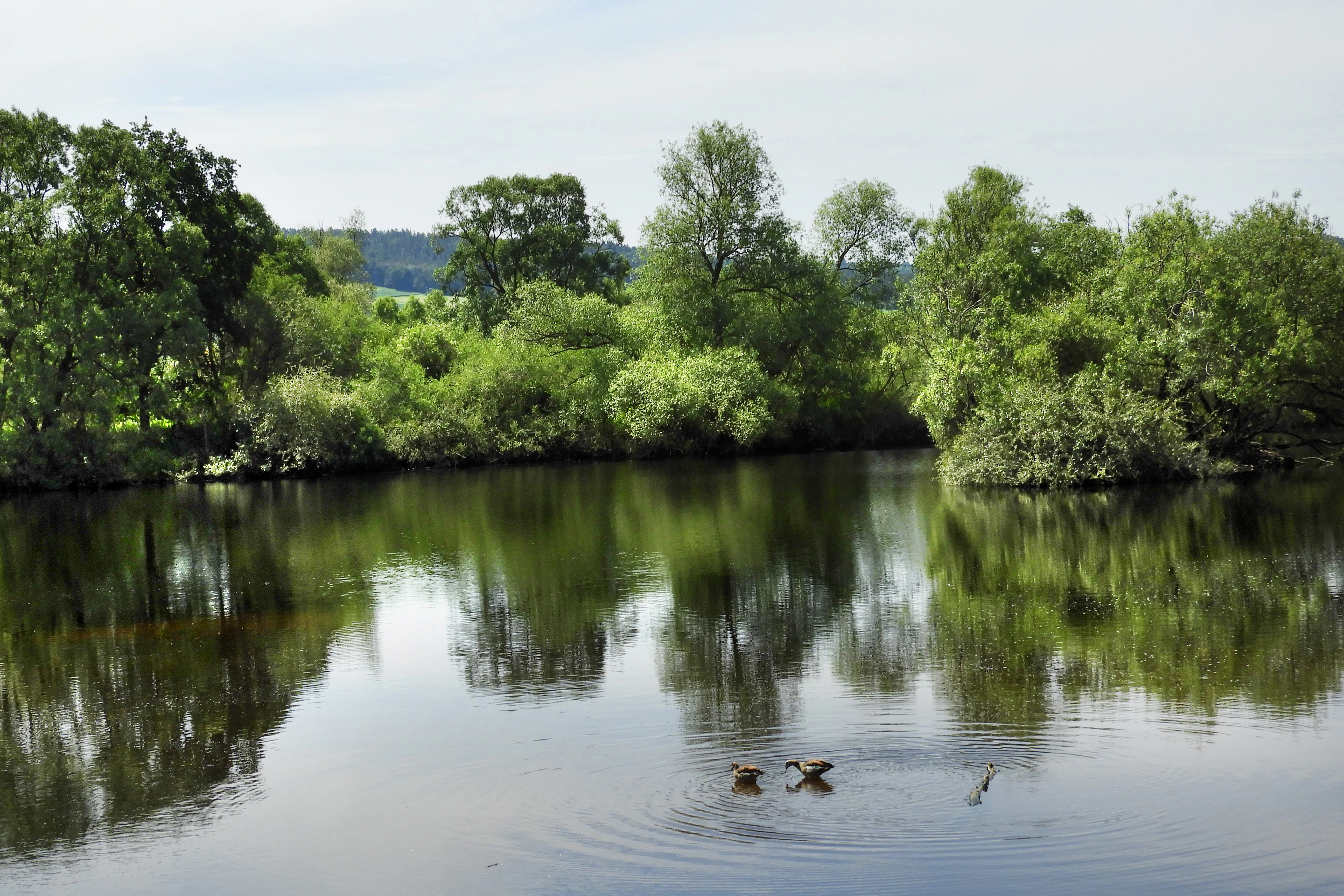
A calm lake reflecting surrounding trees, with a few birds swimming in the foreground.
The groundwater lake within the In den Weiden bei Blankenheim nature reserve.

In den Weiden bei Blankenheim history and protected-area timeline

The history of In den Weiden bei Blankenheim is essentially a layered story of land-use change followed by progressive conservation designation. Gravel was extracted from the site from the early post-war decades until the mid-1960s, when mining activities were terminated. At that stage, with no legal obligation to restore the pit, the workings were left to fill naturally with groundwater, and over time a stable lake formed, surrounded by vegetation that established itself without active intervention.

This abandoned gravel pit was the first site in the middle course of the Fulda to be formally allocated to nature conservation as a follow-up use once extraction finished. On 12 September 1983, a decree issued by the regional forestry and nature conservation office in Kassel designated the area as a nature reserve, with the explicit purpose of permanently securing the waterbody as habitat for numerous bird species of conservation concern and improving it through management measures for its particular ornithological value.

In 2004, the site was notified to the European Union as part of the transboundary Natura 2000 network, and in January 2008, the Hessian "Verordnung über Natura 2000-Gebiete" gave formal force to that European protection at the state level. From that point onward, the reserve has operated simultaneously as a Hessian Naturschutzgebiet and as a component of two European protected-area designations, while also sitting within the Auenverbund Fulda landscape protection area established in 1993 to preserve varied wetness-dependent shoreline communities and to restore near-natural river sections through conversion of arable land to extensive grassland.

In den Weiden bei Blankenheim landscape and geographic character

The landscape setting of In den Weiden bei Blankenheim is defined by the broad valley floor of the Fulda and the gentle transitions between floodplain and the surrounding East Hessian hill ridges. The reserve sits at about 190 meters above sea level, on a triangular plot bounded by the Bebra-to-Fulda railway line, the left bank of the Fulda, and meadowland of the river's floodplain. The natural area classification places it on the boundary between the Bebra basin and the Friedlos-Mecklar Fulda valley, with the Neuenstein-Ludwigseck ridge to the west and the Seulingswald to the east, all part of the broader Fulda-Werra-Bergland.

Topographically, the dominant landform within the protected area is the artificial lake basin left behind by gravel extraction. The lake has unusually steep banks, a consequence of the unregulated cessation of mining, and its shoreline is irregular and colonized rather than shaped by active reed development. Surrounding the lake, the topography stays low and flat, with wet meadows grading into the active floodplain of the Fulda. Outside the immediate reserve, the broader valley floor continues to the north toward Bad Hersfeld and to the south toward Rotenburg, with the upper slopes rising into wooded ridges that frame the open valley.

In den Weiden bei Blankenheim ecosystems, habitats, and plant life

The ecological character of the reserve sits at the intersection of a man-made standing waterbody and a naturally dynamic floodplain. The lake itself is poor in reed fringe because of its steep banks, but it is encircled by a thick ring of willow-dominated woodland whose branches hang over the water, providing cover for nesting songbirds and habitat structure for invertebrates at the shoreline. The former meadow edges in the southern part of the reserve have progressed through tall herb vegetation into incipient floodplain forest, and a small wooded island in the lake contributes an additional structural element.

At a landscape scale, the lake acts as a permanent water surface in a floodplain whose other waters are intermittent, refreshed by recurring Fulda floods. The combination of consistently open water, woody shoreline, periodically inundated meadows, and adjacent river channels produces a densely layered mosaic of aquatic, semi-aquatic, and terrestrial microhabitats within a very compact footprint.

The fish community of the lake reflects the post-extraction origin of the waterbody. Recorded species include common bream, tench, pike, roach, rudd, perch, common carp, eel, and pikeperch, with pike functioning as a natural regulator of the overall fish stock. The combination of coarse fish and predatory pike supports a functioning food web that in turn sustains the waterbird populations using the lake.

In den Weiden bei Blankenheim wildlife and species highlights

The wildlife profile of the reserve is dominated by birds, particularly waterbirds and wetland-associated passerines. The lake functions as a breeding site, a roost site, and a wintering and staging point depending on the season, and the surrounding shoreline and meadow habitats extend the area's carrying capacity for birds well beyond the water surface itself.

Documented breeding and territorial species include mute swan, mallard, great crested grebe, common moorhen, and Eurasian coot. Frequent or irregular guests, including several specially protected species, comprise bean goose, greylag goose, Egyptian goose, gadwall, Eurasian wigeon, common teal, garganey, common pochard, tufted duck, common merganser, little grebe, great egret, grey heron, osprey, common sandpiper, green sandpiper, black-headed gull, common kingfisher, and grey wagtail. Cormorants use the alder-and-willow island as a communal roost site.

The ornithological importance of the reserve is monitored regionally by ornithological organizations, and assessments of wintering waterfowl have highlighted consistently high teal numbers relative to other sites in the region and even occasional unusual records such as the first observation of a herring gull in the area, while also noting declines in roosting cormorants over time. Beyond birds, the lake supports a varied fish community that sustains the waterbird food chain, and the dense shore vegetation supports invertebrate life and a quieter presence of small woodland animals typical of willow- and alder-dominated riparian woodland in central Germany.

In den Weiden bei Blankenheim conservation status and protection priorities

The conservation profile of In den Weiden bei Blankenheim is shaped by overlapping layers of protection at Hessian, national, and European levels. The area's primary designation is as a Naturschutzgebiet, but the reserve is simultaneously embedded in the Auenverbund Fulda landscape protection area, the Fauna-Flora-Habitat site Auenwiesen von Fulda, Rohrbach und Solz, and the Special Protection Area Fuldatal zwischen Rotenburg und Niederaula under the EU Birds Directive.

The protection rationale at the time of designation in 1983 emphasized ornithological value: securing an ecologically valuable waterbody as permanent habitat for threatened bird species and improving its condition through targeted management. Today, the reserve's conservation importance extends beyond the lake itself because the wider Fulda floodplain is recognized as a significant resting and wintering area for waterbirds, waders, and meadow birds, and the Weiden bei Blankenheim function as a stepping-stone biotope that strengthens the corridor function of the river.

The reserve contributes to broader regional conservation goals of preserving variable wetness-dependent shoreline vegetation communities, restoring near-natural river sections through conversion of arable land to extensive grassland, and maintaining connectivity of aquatic habitats along the middle Fulda. Within the EU Birds Directive context, several of the recorded species are target species for which the Special Protection Area is designated, giving the small lake a measurable role in the regional protection network.

In den Weiden bei Blankenheim cultural meaning and human context

The cultural context of the reserve is shaped by its position in a long-settled river valley landscape where floodplain meadows and gravel deposits have shaped both livelihoods and the local sense of place. The village of Blankenheim, after which the reserve is named, is a small settlement within the municipality of Bebra; the surrounding floodplain meadows supported traditional grassland use, and the railway line along the valley edge has long framed how residents move through and perceive the landscape.

The conversion of a working gravel pit into a protected area reflects a broader regional shift in the middle Fulda valley, where post-extraction sites have been progressively integrated into conservation land use rather than left as derelict industrial land. The reserve is documented in regional literature on Hessian nature reserves, including the volume Naturschutzgebiete in Hessen, and forms part of the recognized inventory of protected areas in the Landkreis Hersfeld-Rotenburg.

Top sights and standout views in In den Weiden bei Blankenheim

The reserve's standout qualities are its compactness and its disproportionate ornithological value relative to its size. It was the first former gravel pit in the middle Fulda course to be formally transferred into conservation use after extraction ended, giving it a foundational role in what has since become a chain of post-extraction wetland sites along the river. Its dense willow-dominated shoreline creates unusually intimate cover for breeding waterbirds and songbirds, and its small wooded island provides the regional cormorant roost with a distinctive focal point.

At the same time, the reserve's integration into three nested levels of protected area designation, a Hessian nature reserve, a Natura 2000 Fauna-Flora-Habitat site, and a Natura 2000 Special Protection Area, means that its conservation value is reinforced and tracked within a coordinated management framework. For visitors and birdwatchers, the presence of a single accessible observation platform with information panels offers a rare vantage point from which a small but ecologically rich floodplain lake can be experienced without intruding on the protected habitats.

Best time to visit In den Weiden bei Blankenheim

Seasonal timing strongly shapes what a visit to the reserve can offer. The lake's profile as a wintering site for waterfowl means that the colder months bring the highest concentrations of ducks, grebes, and other waterbirds, while the regularly flooding Fulda extends open water across the wider floodplain. Spring and early summer are the most rewarding period for breeding species, with mute swans, mallards, great crested grebes, moorhens, coots, and a range of songbirds using the shore vegetation and surrounding meadows. Late summer and autumn combine ongoing waterbird presence with migratory passage and shifting waterfowl composition as conditions change.

Because the reserve is not crossed by paths and can only be viewed from a single observation stand at the northern edge, timing a visit to coincide with calm weather generally improves the chances of seeing bird activity on the lake, and cooler months tend to reduce vegetative obscuration of the water surface.

Monthly climate preview

Long-term monthly temperature and precipitation data for Hesse

In den Weiden bei Blankenheim Climate Normals and Temperature Patterns

Representative coordinates track twelve-month temperature swings from sub-zero winter lows to warm summer maximums alongside measured daily precipitation rates. Examining the full climate profile reveals detailed monthly variations across this protected area.
Annual mean8 °C
-1 °C18 °C
Jan-1°
Feb
Mar
Apr
May12°
Jun16°
Jul18°
Aug18°
Sep14°
Oct
Nov
Dec
Warmest month
July

18.3 °C

Coolest month
January

-1.1 °C

Wettest month
July

2.6 mm/day

Driest month
April

1.4 mm/day

Park location guide

Geography guide, regional context, and park location map for In den Weiden bei Blankenheim

In den Weiden bei Blankenheim park geography, regions, and map view in Germany

Understand where In den Weiden bei Blankenheim sits in Germany through a broader geographic reading of the surrounding landscape, nearby location context, and its mapped position within the national park landscape.

How In den Weiden bei Blankenheim fits into Germany

Germany is a federal republic in Western and Central Europe with a population of over 83 million across sixteen constituent states. It is Europe's largest economy by nominal GDP and a major global exporter and importer. The capital is Berlin, and the country borders Denmark, Poland, Czech Republic, Austria, Switzerland, France, Luxembourg, Belgium, and the Netherlands.

Wider geography shaping In den Weiden bei Blankenheim in Germany

Germany is located in Western and Central Europe, spanning 357,022 km². It borders Denmark to the north, Poland and the Czech Republic to the east, Austria and Switzerland to the south, and France, Luxembourg, Belgium, and the Netherlands to the west. The country has coastlines on the Baltic Sea and North Sea to the north, with the Alps located in the southern region.

Map view of In den Weiden bei Blankenheim

Use this park location map to pinpoint In den Weiden bei Blankenheim in Germany, understand its exact geographic position, and read its mapped placement within the surrounding landscape more clearly.

Pigeon | © OpenStreetMap contributors

Location context for In den Weiden bei Blankenheim

Hesse

Visualizing the wetland habitats and floodplain terrain of the protected area

In den Weiden bei Blankenheim Photos and Landscape Scenery

Visual records illustrate the groundwater lake, shoreline willow growth, and broader Fulda valley floodplain characteristics of In den Weiden bei Blankenheim. Examining these protected area environments provides deeper clarity on local terrain and avian habitats without visiting in person.

A calm lake reflecting surrounding trees, with a few birds swimming in the foreground.

A small island covered in leafy willow trees sits in the middle of a calm lake, with several black birds perched in the branches and two ducks swimming in the foreground.

Park atlas

Compare nearby regional nature reserves and connected river valley protected areas

Parks Near In den Weiden bei Blankenheim, Exploring Surrounding Protected Landscapes

Browse other protected areas and wetland habitats situated within the surrounding Fulda river valley region. Comparing adjacent nature reserves expands geographical understanding of regional conservation networks and wildlife corridors.
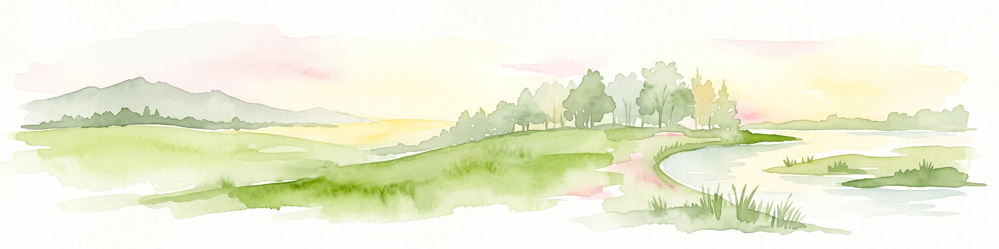
Watercolor painting of a river landscape with lush green vegetation and soft pink hills in the background.
Nature reserveLandkreis Hersfeld-Rotenburg
About 1.6 km away#1 closest

North

Alte Fulda bei Blankenheim Nature Reserve: Mapping the Fulda Valley Floodplain Ecosystem

Protected riparian landscapes in Landkreis Hersfeld-Rotenburg

Alte Fulda bei Blankenheim is a vital nature reserve featuring a restored oxbow, wet meadows, and secondary flood channels. This site showcases the intersection of traditional land management and modern wetland conservation within the broader landscape of the Fulda valley. Explore the boundaries, terrain, and regional geography of this important Hessian bird sanctuary and floodplain habitat.

Area
0.236 km²
Established
1981
IUCN
IV
Relief
Lowland
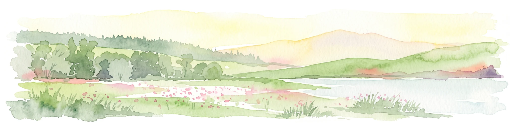
A soft, painterly watercolor landscape showing a green grassy meadow beside a calm lake with a stand of trees and rolling hills in the background.
Nature reserveLandkreis Hersfeld-Rotenburg
About 4.4 km away#2 closest

North

Forbachsee bei Bebra Nature Reserve: Mapped Protected Landscape in Landkreis Hersfeld-Rotenburg

River-connected gravel-pit lake and floodplain geography

Analyze the protected boundaries of Forbachsee bei Bebra, a nature reserve defined by its active connection to the River Fulda. The site features an evolving shoreline of gravel banks and softwood forest, showcasing how industrial extraction areas mature into essential refuges for migratory waterbirds within the larger regional valley system.

Area
0.219 km²
Established
1985
IUCN
IV
Relief
Lowland
Watercolor painting of a lush, open landscape with a pond in the foreground, rolling green hills, and a forest in the background.
Nature reserveHesse
About 7.2 km away#3 closest

Northeast

Auf dem Ried bei Iba Nature Reserve and Protected Wetland Landscape in Northern Hesse

Mapped brook valley and wet grassland geography

Auf dem Ried bei Iba stands as a significant nature reserve in the Iba valley of eastern Hesse, Germany. This protected area preserves a rare sequence of reedbeds, marshes, and spring-fed wet meadows that sustain diverse aquatic plant communities. By maintaining the natural hydrology of the local brook system, the reserve offers a unique look at the wetland terrain and riparian geography characteristic of the Hesse hill country.

Area
0.047 km²
Established
1985
IUCN
IV
Relief
Lowland
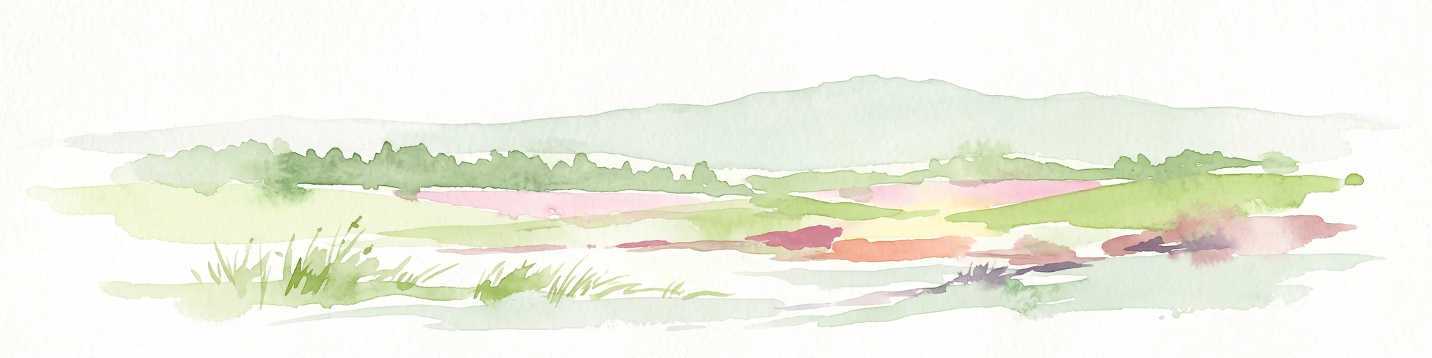
A soft, minimalist watercolor illustration showing a rolling green landscape with distant hills and patches of pink and yellow vegetation.
Nature reserveHessen
About 7.3 km away#4 closest

Northeast

Dachsberg bei Iba Nature Reserve: Protected Landscapes and Geography in Hessen

Rare calcareous dry grasslands and juniper heath terrain

Located in the Ibaer Hügelland of northeastern Hessen, Dachsberg bei Iba encompasses 27 hectares of lime-rich, shallow-soil slopes. This nature reserve provides essential habitat for threatened orchids and invertebrates, serving as an important example of a traditional cultural landscape preserved through ongoing conservation efforts and historical pastoral land use.

Area
0.271 km²
Established
1993
IUCN
IV
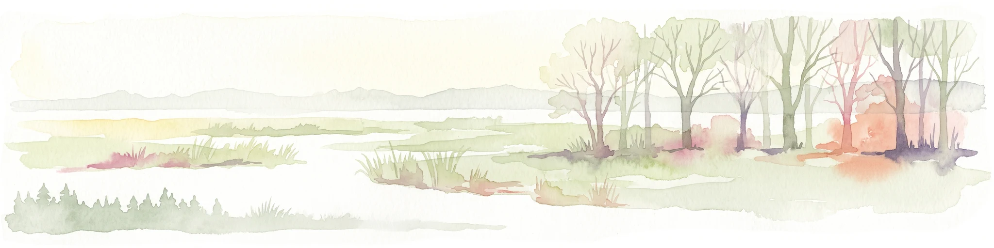
A pale, panoramic watercolor painting of a wetland landscape with a row of trees on the right side and low hills in the distance.
Nature reserveLandkreis Hersfeld-Rotenburg
About 9.7 km away#5 closest

Northwest

Im Sand bei Rotenburg Nature Reserve: Mapping the Fulda River Floodplain and Wetland Mosaic

A structured floodplain refuge in Landkreis Hersfeld Rotenburg

Located in the low-lying reaches of the Fulda River, Im Sand bei Rotenburg represents a significant shift from industrial land use to a protected, structurally rich riverine mosaic. The area features a complex of water-filled pits, reedbeds, and alluvial forest patches that serve as a crucial migratory stopover for diverse waterbird populations in northeastern Hesse.

Area
0.102 km²
Established
1997
IUCN
IV
Relief
Lowland
Nature reserveThuringia
About 13 km away#6 closest

Northeast

Werra-Aue zwischen Breitungen und Creuzburg: Protected Floodplain and River Geography

Nature reserve sanctuary in western Thuringia

Spanning over 33 kilometers of the Werra river, this protected floodplain is defined by its distinctive geological sinkholes, seasonal wetlands, and diverse bird habitats. Discover the layered conservation status and riparian terrain that mark this significant Thuringian nature reserve as a crucial node for European ecological connectivity.

Area
25.78 km²
Established
2007
IUCN
IV
Relief
Lowland
A soft watercolor illustration of rolling green hills under a sparse, light sky.
Nature reserveHessen
About 13 km away#7 closest

Southeast

Landecker Berg: A Detailed Look at the Nature Reserve and Mountain Geography in Hessen

Exploration of the Rhön table mountain and protected landscape.

Landecker Berg presents a classic example of a Triassic limestone massif in the northern Kuppenrhön. This nature reserve, located in the German state of Hessen, offers significant geographic interest due to its flat-topped plateau and dense forest mantle. Navigate the mapped boundaries of this protected area, which features unique geological formations, surrounding castle ruins, and an integral role in the local watershed systems.

Area
1.044 km²
Established
1992
Relief
Mountain
Climate
Temperate
A watercolor illustration showing a winding river flowing through a grassy field, with a cluster of green trees on the right and soft pink and gray hills in the background.
Nature reserveGermany
About 13 km away#8 closest

Northwest

Kiesgrube bei Baumbach Nature Reserve: River Meander and Wetland Geography in Germany

A preserved riparian landscape and bird habitat in northern Hesse

Located along the middle Fulda, this nature reserve represents an engineered success story where a former quarry transformed into a vital wetland ecosystem. Its shallow lake margins, willow thickets, and floodplain forests create a critical protected area for local waterbird populations, serving as an essential node within the Auenverbund Fulda floodplain conservation network.

Area
0.23 km²
Established
1995
Relief
Lowland
Climate
Temperate

Common questions about visiting, size, designation, and location context for In den Weiden bei Blankenheim

In den Weiden bei Blankenheim FAQs for park facts, access, geography, and protected area context

Find quick answers about In den Weiden bei Blankenheim, including protected-area facts, park geography, trail and visitor context, and how the park fits into its surrounding country and regional landscape.
MoriAtlas Explorer

Continue Your Protected Areas Search Across the Global Atlas

Deepen your exploration by continuing the structured search for national parks and protected areas worldwide. Utilize the comprehensive filtering capabilities to compare different conservation landscapes and refine your understanding of global park geography. Discover more about the distribution and characteristics of protected natural areas.

Global natural geography