

Mori Atlas logo
Protected landscapeInyo National Forest

Traverse an expansive high-country corridor defined by glacial peaks, volcanic systems, and arid valley basins.

Inyo National Forest: Mapping the Protected Landscapes of the Eastern Sierra and White Mountains

Inyo National Forest serves as a monumental protected landscape stretching along the eastern flank of the Sierra Nevada in California and extending into the White Mountains. This expansive territory encompasses the highest summits in both the contiguous United States and Nevada, while sheltering ancient bristlecone pine woodlands and vast glacial canyons. Through its varied terrain, the forest offers a complex look at high alpine ridges, high-desert flats, and active volcanic chains within the Long Valley Caldera region.

Eastern Sierra Nevadaalpine landscapeshigh desertMount WhitneyAncient Bristlecone Pine Forestbristlecone pines
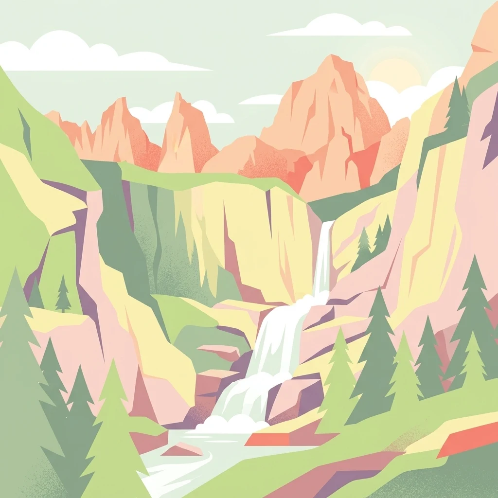
A digital illustration of a waterfall cascading down rocky cliffs between mountain peaks, with stylized pine trees in the foreground.

Inyo National Forest

Protected landscape

Park overview

Structured park overview, official facts, and landscape profile for Inyo National Forest

Inyo National Forest park facts, protected area profile, and essential visitor context

Review the core facts for Inyo National Forest, including designation, size, terrain, visitor scale, habitats, and operating context in one park-focused overview.

About Inyo National Forest

Inyo National Forest stretches across the eastern face of the Sierra Nevada and into the neighboring White Mountains, making it one of the most topographically dramatic units in the U.S. National Forest System. The forest's western boundary adjoins iconic protected landscapes such as Yosemite, Sequoia, and Kings Canyon, while its eastern boundary drops into the dry, stark basin of the Owens Valley and beyond into Nevada. This geography places Inyo at the meeting point of the Sierra Nevada, the White Mountains, and the Great Basin, creating an unusual blend of alpine, montane, and desert environments.

The forest is administered by the U.S. Forest Service and is headquartered in Bishop, California, with additional ranger districts in Lee Vining, Lone Pine, and Mammoth Lakes. Its jurisdiction spans portions of five California counties, Inyo, Mono, Tulare, Fresno, and Madera, as well as Esmeralda and Mineral counties in Nevada. Although managed as a single national forest, the landscape is effectively split in two by the Long Valley Caldera and the Owens Valley, giving Inyo two distinct geographic personalities: a Sierra crest zone and a White Mountains zone.

Inyo is also notable for being one of the least wooded national forests in the United States, a consequence of its position in the deep rain shadow east of the Sierra Nevada. This aridity, combined with the extreme elevation gradient from roughly 4,000 feet in the valley floors to over 14,500 feet on the Sierra crest, produces a transition from high desert scrub through jeffrey and lodgepole pine forests into true alpine terrain. The result is a working landscape that has historically supported grazing, mining, watershed protection for the Los Angeles Aqueduct, and an extraordinary network of backcountry trails, including the famous John Muir Trail.

Quick facts and research context for Inyo National Forest

Inyo National Forest covers roughly 1.9 million acres across eastern California and a smaller portion of western Nevada. It was established on May 25, 1907, by President Theodore Roosevelt and is administered by the U.S. Forest Service with headquarters in Bishop, California. The forest includes Mount Whitney, Boundary Peak, and the Ancient Bristlecone Pine Forest, home to trees older than 4,800 years. Its elevation range spans from about 4,000 feet in the Owens Valley to 14,505 feet at Mount Whitney, and it contains nine designated wilderness areas covering more than 800,000 acres.

Protection and recognition

Examine the documented protection framework and recognized management boundaries for Inyo National Forest.

Inyo National Forest Protection Status and Terrestrial Conservation Scope

Inyo National Forest maintains a documented terrestrial protection scope without imported international recognition sources. Review the structured administrative records and verified designation parameters for this protected area.

Protection details

Protection scope
Terrestrial
Transboundary protection
No
Park context

Deeper park guide and search-rich context for Inyo National Forest

Inyo National Forest history, landscape, wildlife, and travel context

Explore Inyo National Forest through its history, landscape character, ecosystems, wildlife, conservation priorities, cultural context, and seasonal travel timing in a structured park guide built for atlas discovery and search intent.

Why Inyo National Forest stands out

Inyo is best known for containing three of the American West's most celebrated landmarks: Mount Whitney, the highest summit in the contiguous United States; Boundary Peak, the highest point in Nevada; and the Ancient Bristlecone Pine Forest, a protected grove of Great Basin bristlecone pines in the White Mountains that includes Methuselah, one of the oldest known living non-clonal trees in the world. These features give the forest an unusually concentrated identity as a place of extremes. Within a single management unit, visitors can move from the bristlecone-studded high desert of the White Mountains to the alpine crest of the Sierra Nevada, traversing elevations, ecosystems, and geological histories that range from ancient pine woodlands to active volcanic landscapes tied to the Long Valley Caldera and the Mono Inyo Craters.
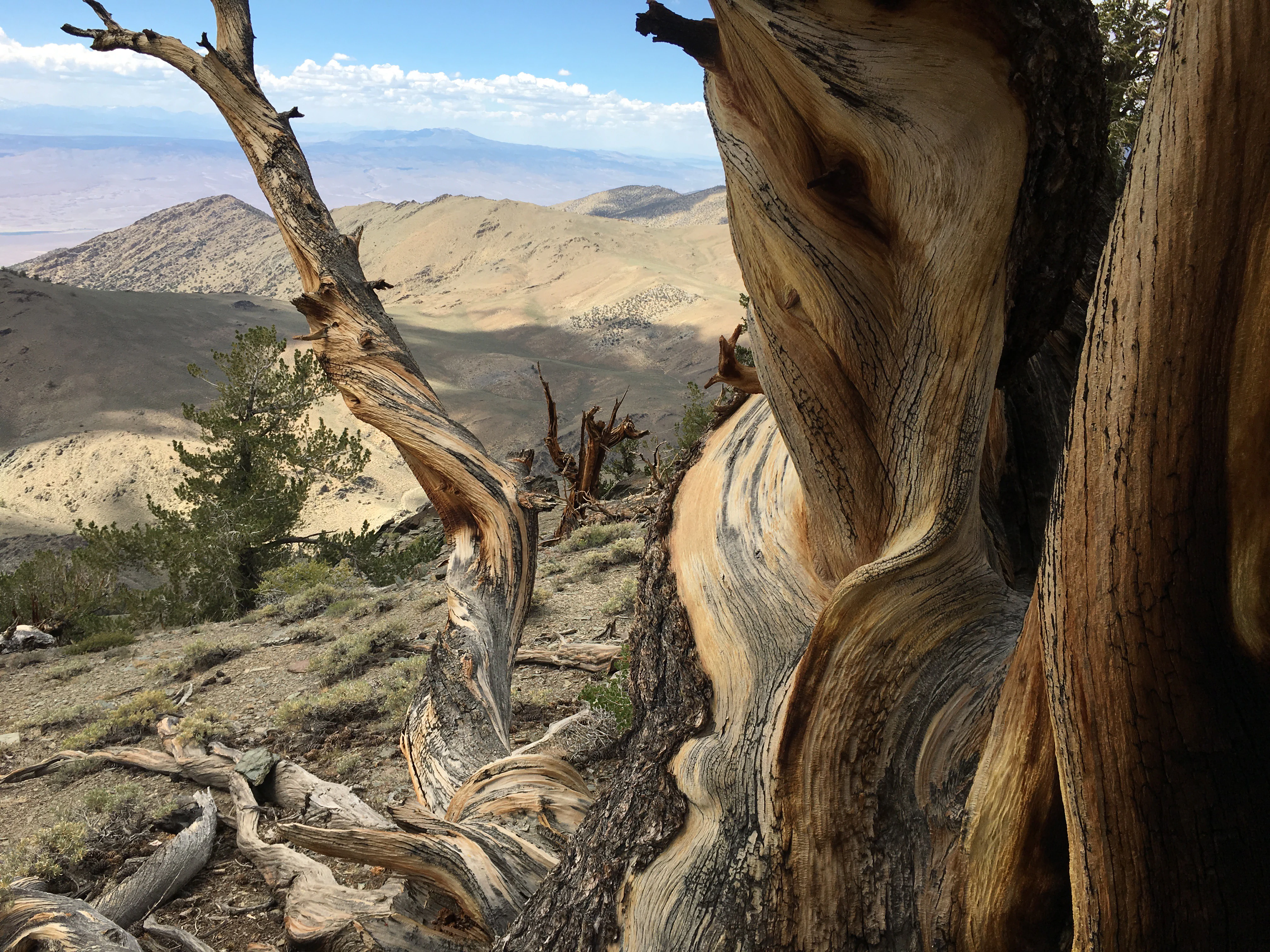
Close-up of a gnarled, ancient bristlecone pine trunk showing intricate wood patterns and twisted bark, with a vast mountain range and desert valley in the soft-focus background.
A weathered bristlecone pine with twisted, ancient wood overlooking a high-altitude desert landscape in Inyo National Forest.

Inyo National Forest history and protected-area timeline

Inyo National Forest was established on May 25, 1907, by President Theodore Roosevelt as part of the early twentieth century expansion of the national forest system in the American West. Its creation was closely tied to the development of the Los Angeles Aqueduct, which required federal protection and oversight of the Eastern Sierra watersheds that fed the Owens Valley. By placing these lands into a national forest, the federal government could regulate grazing, water use, and resource extraction in a region whose water resources were becoming increasingly important to a growing Southern California.

On July 1, 1945, additional lands from the former Mono National Forest were absorbed into Inyo, expanding its footprint northward and consolidating management of the eastern Sierra landscape under a single administrative unit. Throughout the twentieth century, the forest's wildest portions were progressively protected through the National Wilderness Preservation System, beginning with the John Muir and Hoover wilderness areas and eventually expanding to include nine separate wilderness designations covering more than 800,000 acres.

The forest's name comes from Inyo County, California, in which much of its area lies. The county name itself derives from a Native American word meaning "dwelling place of the great spirit," reflecting the long Indigenous presence in the Eastern Sierra and the White Mountains prior to Euro American settlement.

Inyo National Forest landscape and geographic character

The landscape of Inyo National Forest is defined by an extraordinary vertical range and the dramatic contrast between the high Sierra crest and the arid basin east of it. The eastern face of the Sierra Nevada rises sharply from the Owens Valley, with deep canyons carved by glaciers and rivers that descend into one of the driest valleys in California. Above the valley floor, the terrain climbs through montane forest zones to the alpine ridgeline of the Sierra crest and the iconic summits of Mount Whitney and Mount Ritter.

East of the Owens Valley, the White Mountains present a parallel high country of rounded ridges, deep canyons, and high sagebrush flats. Although lower in elevation than the Sierra, the White Mountains reach above 14,000 feet at White Mountain Peak and support ecological zones that resemble, and in some cases rival, the Sierra environments across the valley.

A third important element of Inyo's landscape is its volcanic terrain. The Mono Inyo Craters, a chain of volcanic domes and craters stretching from Mono Lake south toward Mammoth Lakes, are part of an active volcanic system associated with the Long Valley Caldera. The interplay of glacial, tectonic, and volcanic forces across these three major landscape systems alpine Sierra, desert White Mountains, and recent volcanic chain, gives Inyo one of the most geologically varied landscapes of any U.S. national forest.
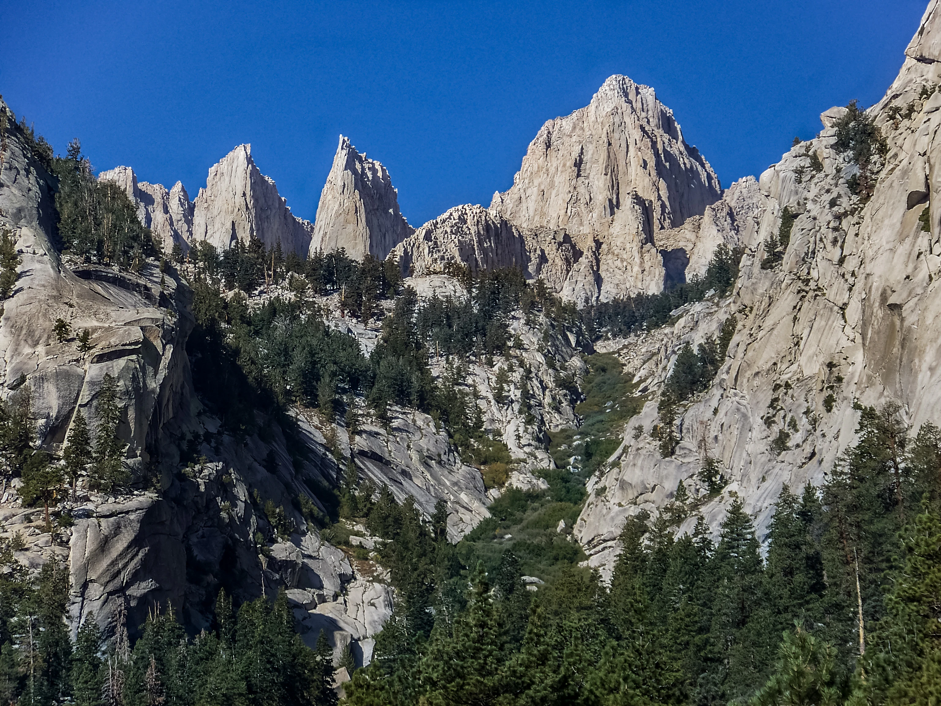
A wide view of craggy granite peaks against a clear deep blue sky, with a forest of conifers in the foreground and valley below.
The jagged peaks of Mount Whitney and the surrounding high Sierra Nevada landscape.

Inyo National Forest ecosystems, habitats, and plant life

The ecological character of Inyo National Forest is shaped by its position in the rain shadow of the Sierra Nevada. Most of the forest receives modest precipitation, and large portions are dominated by high desert scrub, sagebrush steppe, and piñon juniper woodland rather than dense forest. This dryness gives Inyo a distinctive open character and supports plant communities adapted to arid conditions, even at relatively high elevations.

Where moisture is sufficient, the forest transitions into montane conifer zones dominated by jeffrey pine and lodgepole pine, the two most abundant tree species in Inyo's old growth stands. Higher still, subalpine forests give way to alpine fell fields and exposed granite, while, across the valley in the White Mountains, the Ancient Bristlecone Pine Forest protects some of the oldest and most ecologically significant woodland on Earth. The bristlecone pines of the White Mountains survive in harsh, alkaline soils at elevations around 11,000 feet, growing at extraordinarily slow rates that allow individuals to live for thousands of years.

Inyo also encompasses a wide range of aquatic and wetland habitats, from high Sierra lakes and meadow systems along the John Muir Trail to saline and alkaline shoreline environments associated with Mono Lake at its northern edge.
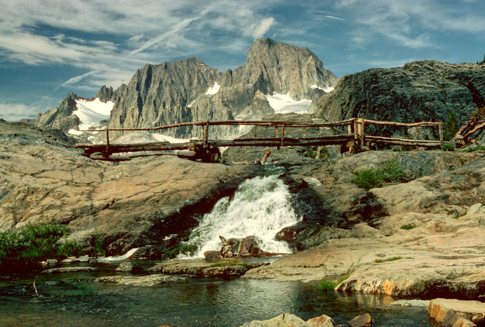
A rustic log footbridge crosses a small waterfall cascading over rocky terrain, with prominent snow-capped jagged mountain peaks in the distance.
A rustic wooden bridge spans a waterfall in the Ansel Adams Wilderness, with Mount Ritter and Banner Peak in the background.

Inyo National Forest wildlife and species highlights

The wildlife of Inyo National Forest reflects its position at the intersection of Sierra Nevada, Great Basin, and Mojave influenced ecosystems. Large mammals commonly associated with the Eastern Sierra, such as mule deer, black bear, and mountain lion, are present throughout the forested and montane zones, while bighorn sheep are notable residents of the rugged White Mountains. The forest's high country also provides seasonal habitat for species such as pikas and marmots in the alpine zone.

Birdlife is a defining feature of the forest. Mono Lake and its surrounding wetlands are internationally important stopover habitat for migratory birds, and the saline lake supports massive brine shrimp populations that feed vast numbers of California gulls, eared grebes, and other waterbirds. Across the rest of the forest, raptors such as golden eagles and bald eagles are regularly observed, and the bristlecone pine woodlands of the White Mountains support bird communities adapted to high elevation conifer habitat.

Aquatic environments, particularly along the creeks, lakes, and meadow systems of the Sierra and the headwaters of the Owens River, sustain populations of native trout and provide habitat for amphibians sensitive to clean, cold water, making these watershed areas a focus of ongoing ecological attention.
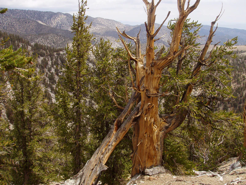
A weathered, gnarled ancient bristlecone pine stands in the foreground, with a mountainous, forested landscape visible in the background under an overcast sky.
Ancient bristlecone pines in the Schulman Grove area of Inyo National Forest.

Inyo National Forest conservation status and protection priorities

Inyo National Forest holds substantial conservation significance because it ties together a contiguous protected landscape of more than 1.5 million acres stretching from Yosemite to Sequoia and Kings Canyon. Its nine designated wilderness areas, including the John Muir, Ansel Adams, Hoover, and Inyo Mountains wildernesses, protect vast tracts of alpine and high desert terrain from development, road building, and mechanical intrusion, preserving intact ecological systems at a scale that requires landscape level management.

A second major focus of conservation in Inyo is watershed protection. Because much of the forest's water historically fed the Los Angeles Aqueduct, the management of forest cover, grazing, and watershed health has long carried significance well beyond the forest's boundaries. The forest's roughly 238,000 acres of old growth forest, dominated by lodgepole and jeffrey pine, are another important conservation resource, providing carbon storage, habitat connectivity, and reference baselines for ecological monitoring across the Eastern Sierra.

The Ancient Bristlecone Pine Forest is perhaps the forest's most globally significant conservation feature. By protecting the world's oldest known living trees, including Methuselah and potentially older specimens, Inyo safeguards a living archive of climate history and a genetic resource of unparalleled scientific value. The bristlecone groves are managed with particular care to limit soil compaction, trampling, and other forms of visitor impact on these fragile trees and their stony soils.

Inyo National Forest cultural meaning and human context

The name Inyo comes from a Native American word meaning "dwelling place of the great spirit," reflecting the deep Indigenous history of the Eastern Sierra and the White Mountains. For thousands of years, the Owens Valley and the surrounding high country supported Native communities whose seasonal movements, trade, and resource use shaped the landscape long before the establishment of any federal protected area.

Beyond its Indigenous heritage, Inyo has acquired a strong cultural identity through its role in the development of the American West. The Eastern Sierra's dramatic scenery made it a frequent backdrop for twentieth century western films, including productions starring actors such as Randolph Scott, Steve McQueen, Charlton Heston, and Clint Eastwood. The forest has also shaped broader cultural imagination through its association with writers and naturalists, including John Muir, whose name lives on in one of the forest's most celebrated wilderness areas.

Top sights and standout views in Inyo National Forest

Inyo National Forest gathers a remarkable set of headline landscapes and ecological treasures within a single administrative boundary. Mount Whitney and the John Muir Trail offer some of the most recognizable high Sierra experiences in North America, while Boundary Peak gives Nevada its true high point. The Ancient Bristlecone Pine Forest provides the most dramatic highlight of all, with trees that have stood for nearly five millennia in the White Mountains above the Owens Valley.

Other signature destinations, including Convict Lake, June Lake, Lake Sabrina, Mammoth Lakes, Mono Lake, and the Mono Inyo Craters, round out a forest that offers everything from volcanic craters and alkaline lake shores to glacier carved cirques and one of the world's most important old growth pine preserves.

Best time to visit Inyo National Forest

Inyo National Forest is a strongly seasonal landscape, and the character of a visit changes dramatically with elevation and time of year. Summer and early autumn are the most accessible months for high country exploration, when snow has melted from most trails, alpine wildflowers bloom in the meadows, and the Sierra crest and the higher reaches of the John Muir Trail are typically free of snow. This is also the season when mountain lakes are fully thawed and bristlecone pine groves in the White Mountains are accessible by road.

Winter transforms Inyo into a quieter, snow covered landscape dominated by subalpine and valley level recreation such as cross country skiing, snowshoeing, and low elevation hiking. Because of the forest's extreme elevation range, visitors in winter can often hike at lower elevations in mild conditions while the high Sierra remains buried under deep snowpack. Spring and late autumn offer transitional periods that combine open, accessible trails with fewer visitors and dramatic light across the Eastern Sierra and the White Mountains.

Monthly climate preview

Long-term representative point measurements tracking monthly averages across elevations

Inyo National Forest Climate Normals, Annual Temperature and Precipitation Rhythm

Representative coordinate records show measured monthly temperatures ranging from sub-zero winter lows to warm summer peaks alongside distinct annual precipitation shifts. Examining the complete twelve-month climatology profile reveals deeper meteorological context for terrain analysis.
Annual mean8 °C
-2 °C20 °C
Jan-2°
Feb-2°
Mar
Apr
May10°
Jun16°
Jul20°
Aug19°
Sep15°
Oct
Nov
Dec-2°
Warmest month
July

20.2 °C

Coolest month
January

-2.4 °C

Wettest month
January

2.6 mm/day

Driest month
September

0.3 mm/day

Park location guide

Geography guide, regional context, and park location map for Inyo National Forest

Inyo National Forest park geography, regions, and map view in United States of America

Understand where Inyo National Forest sits in United States of America through a broader geographic reading of the surrounding landscape, nearby location context, and its mapped position within the national park landscape.

How Inyo National Forest fits into United States of America

The United States of America is a federal presidential republic and one of the world's largest countries by area and population. It consists of 50 states across a vast territory spanning multiple time zones, with its capital in Washington, D.C. and largest city in New York City. The nation has a diverse economy, influential political system, and significant cultural and military presence globally.

Wider geography shaping Inyo National Forest in United States of America

The United States occupies a vast territory in North America, bordered by Canada to the north and Mexico to the south. The 48 contiguous states stretch from the Atlantic to the Pacific Ocean, while Alaska occupies the northwestern region and Hawaii is an archipelago in the Pacific. The country encompasses diverse terrain including the Rocky Mountains, Appalachian Mountains, Great Plains, and extensive river systems.

Map view of Inyo National Forest

Use this park location map to pinpoint Inyo National Forest in United States of America, understand its exact geographic position, and read its mapped placement within the surrounding landscape more clearly.

Pigeon | © OpenStreetMap contributors

Location context for Inyo National Forest

CaliforniaNevada
Natural feature types

Continue Exploring Inyo National Forest Natural Features and Geological Landmarks

Navigate the structured index of summits, glacial canyons, and volcanic systems that constitute the complex landscape of Inyo National Forest. MoriAtlas provides detailed spatial data for the natural features that shape this significant American West protected area.
Recorded earthquake history

Explore the Historical Earthquake Catalogue for Inyo National Forest

Consult the historical earthquake records associated with Inyo National Forest to analyze regional seismic activity. This MoriAtlas catalogue provides structured access to event metadata, including magnitude, depth, and distance, for those investigating the geological history of the Sierra Nevada and the White Mountains.

Inyo National Forest Earthquake History

Catalogued events

6,491 events

Strongest magnitude

Magnitude 7.1

Most recent event

Aug 23, 2026

This history includes earthquakes recorded inside the park or within 50 km of its borders

Visual exploration of Sierra Nevada terrain, alpine ridges, and ancient pine habitats.

Inyo National Forest Photos and Landscape Scenery

Visual records capture the dramatic contrast between the high Sierra crest and the arid basin of the Owens Valley. Examining protected area imagery reveals glacial canyons, volcanic craters, and ancient bristlecone groves across the region.

Close-up of a gnarled, ancient bristlecone pine trunk showing intricate wood patterns and twisted bark, with a vast mountain range and desert valley in the soft-focus background.

A wide view of a large, steep, rocky mountain reflecting in a clear lake, with scattered stones and a fallen branch along the foreground shoreline.

A wide view of craggy granite peaks against a clear deep blue sky, with a forest of conifers in the foreground and valley below.

A rustic log footbridge crosses a small waterfall cascading over rocky terrain, with prominent snow-capped jagged mountain peaks in the distance.

A weathered, gnarled ancient bristlecone pine stands in the foreground, with a mountainous, forested landscape visible in the background under an overcast sky.

Park atlas

Compare regional geography, alpine ridgelines, and neighboring wilderness areas

Exploring Parks Near Inyo National Forest and Connected Protected Landscapes

Browse other parks near Inyo National Forest to compare adjacent alpine terrain, high desert basins, and connected wilderness corridors along the Sierra Nevada. Extending geographic research across nearby protected areas provides broader context for regional conservation systems and volcanic landscapes.
National parkCalifornia
Park boundaries overlap#1 closest

Southeast

Death Valley National Park: Exploring California's Mapped Protected Landscape

View the geographic boundaries and desert terrain.

Access a detailed atlas perspective of Death Valley National Park, a protected national park situated in California. Understand the park's distinct mapped boundaries and its role within the regional geography. This resource highlights the unique desert landscape, offering focused insights into its protected-area identity and natural terrain for geographic discovery.

Area
13,848.4 km²
Established
1994
IUCN
II
Visitors
1.1M annual
Wildlife reserveCalifornia
Park boundaries overlap#2 closest

Northwest

Hoover Wilderness: Protected Alpine Geography in the Central Sierra Nevada, California

High-altitude glacial basins and Sierra crest wilderness

The Hoover Wilderness preserves a vital strip of high-elevation terrain along the eastern Sierra Nevada crest. Characterized by glacier-carved basins, interconnected alpine lakes, and sharp granite ridges, this protected area serves as a primary ecological gateway to the high country. Its landscape features define the headwaters of the Walker River, offering a compact yet significant look at California's protected alpine wilderness.

Area
518.89 km²
Established
1964
IUCN
Ib
Relief
Mountain
A watercolor painting showing soft green hills, distant pink-hued mountains, and a pale blue lake in a serene, stylized landscape.
Protected landscapeNevada
Park boundaries overlap#3 closest

Northeast

Humboldt, Toiyabe National Forest: Protected Landscape and Regional Mountain Geography

A vast network of Nevada mountain ranges and alpine wilderness

Humboldt, Toiyabe National Forest serves as a defining public land entity across Nevada and eastern California. As the largest national forest in the contiguous United States, it preserves a striking collection of isolated mountain ranges, including the Ruby Mountains and the rugged Jarbidge wilderness, within a broader basin-and-range landscape. Examine the boundaries and terrain that characterize this complex, high-desert ecosystem.

Area
25,454 km²
Established
1908
Relief
Mountain
Access
Easy access
A watercolor painting showing a panoramic view of mountain ranges, a treeline, and a calm body of water in the foreground.
Wildlife reserveCalifornia
Park boundaries overlap#4 closest

South

John Muir Wilderness: Sierra Nevada Protected Landscape and High Mountain Geography

California wilderness area with glacial basins and granite peaks

John Muir Wilderness represents one of the largest protected high-elevation areas in the contiguous United States. Spanning the Sierra Nevada crest, its granite terrain is sculpted by Pleistocene glaciation into sharp arêtes, deep canyons, and hundreds of alpine lakes. This wilderness serves as a vital geographic anchor for mountain ecosystems, offering an extensive look at the high-country landscape of eastern California.

Area
2,641.76 km²
Established
1964
IUCN
Ib
Relief
Mountain
National parkCalifornia
Park boundaries overlap#5 closest

South

Kings Canyon National Park National Park: California Protected Landscape & Geography Atlas

Mapped park boundaries and regional natural context.

Kings Canyon National Park stands as a key protected national park within California, offering a specific focus for geographic understanding and atlas-based exploration. This page details the park's mapped boundaries and its integration into the broader regional geography of California. For users interested in the distribution of protected lands and the mapping of natural landscapes, Kings Canyon National Park provides a crucial point of study within the comprehensive park atlas.

Area
1,869.25 km²
Established
1890
IUCN
II
Visitors
641K annual
Watercolor painting of a panoramic mountain landscape with stylized pine trees and soft green meadows.
Protected landscapeCalifornia
Park boundaries overlap#6 closest

South

Sequoia National Forest: Protected Sierra Nevada Geography and Mountain Terrain

A vast protected landscape spanning 1.1 million acres in California

Spanning Tulare, Kern, and Fresno counties, Sequoia National Forest preserves iconic giant sequoia groves across multiple river watersheds. The terrain features vertical relief exceeding 11,000 feet, showcasing a range of ecosystems from chaparral slopes and coniferous forests to glacial cirques and granite spires located within the southern Sierra Nevada range.

Area
4,829.17 km²
Established
1908
Relief
Mountain
Climate
Mediterranean
National parkCalifornia
Park boundaries overlap#7 closest

South

Sequoia National Park National Park: Geographic Identity and Protected Landscape Atlas

Explore mapped boundaries and the terrain of this California protected area.

Gain a structured understanding of Sequoia National Park as a protected landscape, focusing on its mapped geographic boundaries and its context within California. This entry provides foundational data for exploring the park's natural terrain and its role in a broader atlas of conservation lands, ideal for users seeking detailed geographic information.

Area
1,635.19 km²
Established
1890
IUCN
II
Visitors
1.2M annual
A soft watercolor painting showing a range of gentle rolling hills and mountains in pale green, yellow, and violet tones against a white background.
Protected landscapeCalifornia
Park boundaries overlap#8 closest

South

Sierra National Forest: Protected Landscapes of the Central California Sierra Nevada

Geography of alpine lakes, conifer forests, and mountain basins

Spanning from 900 to nearly 14,000 feet in elevation, Sierra National Forest protects a massive vertical range of California terrain. Discover its iconic wilderness areas and reservoir-studded landscape, providing a deep look at the geographic connectivity between major national parks in the central Sierra Nevada.

Area
5,300 km²
Established
1893
Relief
Mountain
Climate
Alpine

Common questions about visiting, size, designation, and location context for Inyo National Forest

Inyo National Forest FAQs for park facts, access, geography, and protected area context

Find quick answers about Inyo National Forest, including protected-area facts, park geography, trail and visitor context, and how the park fits into its surrounding country and regional landscape.
MoriAtlas Explorer

Continue Your Protected Areas Search Across the Global Atlas

Deepen your exploration by continuing the structured search for national parks and protected areas worldwide. Utilize the comprehensive filtering capabilities to compare different conservation landscapes and refine your understanding of global park geography. Discover more about the distribution and characteristics of protected natural areas.

Global natural geography


