
Mori Atlas logo
Wildlife reserveÎle Haute

Examining the Jurassic volcanic cliffs and extreme tidal terrain of this Bay of Fundy sanctuary

Île Haute Wildlife Reserve: Geological Landscapes and Coastal Protected Areas in Nova Scotia

(Isle Haute National Wildlife Area)

Île Haute stands as a distinct protected landscape rising sharply from the Bay of Fundy in Nova Scotia. This wildlife reserve preserves rare Jurassic-age volcanic bedrock, where dramatic basalt cliffs and columnar formations record ancient geological activity. The island functions as a critical sanctuary for migratory bird species and marine wildlife, with its rugged terrain offering a concentrated look at the intense erosive power of Atlantic Canada tides.

islandbay of fundyvolcanic landscapebasalt cliffscolumnar basaltjurassic geology
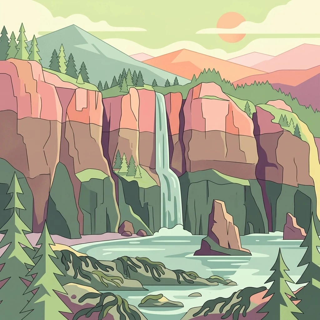
An illustration of a coastal park with tall, layered cliffs, a waterfall cascading into the water, and pine trees under a sunlit sky.

Île Haute

Wildlife reserve

Park overview

Structured park overview, official facts, and landscape profile for Isle Haute

Isle Haute park facts, protected area profile, and essential visitor context

Review the core facts for Isle Haute, including designation, size, terrain, visitor scale, habitats, and operating context in one park-focused overview.

About Isle Haute

Isle Haute occupies a distinctive position in the Bay of Fundy, one of the most studied and celebrated marine environments in North America. The island lies relatively close to the Nova Scotia mainland, off the northern coast in Cumberland County, yet it feels strikingly remote because of the cliffs that surround it and the powerful tidal currents that sweep past its shores. With an area of approximately 80 hectares, it is small in scale but unusually rich in both geological and biological character.

The defining feature of the island is its bedrock. Isle Haute is composed entirely of Jurassic basalt, making it one of the few exposed remnants of ancient volcanic activity in the region. Its southern coastline, in particular, displays clearly visible layers of basaltic lava flows and columnar basalt formations produced as the rock cooled and contracted after eruption. These features rise as cliffs of around 100 meters, giving the island a vertical, fortress-like appearance from the sea.

Ecologically, the island supports roughly 300 recorded plant taxa, a figure that may understate the true diversity given that parts of Isle Haute remain incompletely surveyed. The cliffs and interior habitats provide refuge for around 60 species of migratory birds, including species of conservation interest such as the bald eagle and peregrine falcon. Resident species such as the great blue heron are also part of the island's year-round avian community. The surrounding waters and intertidal reefs support harbour seals and grey seals, the latter frequently hauled out on the island's rocky shores.

The island's combination of isolated habitat, dramatic geology, and ecological richness led Environment and Climate Change Canada to propose it as a National Wildlife Area in 2019. The formal designation followed in January 2025, recognizing Isle Haute's importance as both a refuge for wildlife and a protected geological landmark within the Bay of Fundy.

Quick facts and research context for Isle Haute

Isle Haute is a small island in the Bay of Fundy, located roughly eight kilometers from Cape Chignecto in Cumberland County, Nova Scotia. The island covers about 80 hectares and reaches a maximum elevation of 105 meters, with cliffs of approximately 100 meters enclosing most of its shoreline. Geologically, the island is formed entirely of Jurassic basalt, including notable columnar basalt formations along its southern coast.

Biologically, Isle Haute supports around 300 recorded plant taxa and at least 60 species of migratory birds, alongside permanent avian residents and marine mammals such as harbour and grey seals. The island was designated a National Wildlife Area in January 2025, following a proposal by Environment and Climate Change Canada in 2019.

Protection and recognition

Documented conservation scope and official recognition history for Île Haute

Île Haute Protection Status and Official Designation Records

Examine the recorded protection status and official designation history established for Île Haute. Structured records outline the mixed conservation scope and historical baseline tied to the protected area.

Protection details

Protection scope
Mixed
Designated year
2025
Park context

Deeper park guide and search-rich context for Isle Haute

Isle Haute history, landscape, wildlife, and travel context

Explore Isle Haute through its history, landscape character, ecosystems, wildlife, conservation priorities, cultural context, and seasonal travel timing in a structured park guide built for atlas discovery and search intent.

Why Isle Haute stands out

Isle Haute is best known for its dramatic Jurassic basalt cliffs rising from the extreme tides of the Bay of Fundy, creating one of the most visually striking geological showcases in Atlantic Canada. The island's volcanic origin is exposed along its shoreline through columnar basalt formations and layered lava flows that are clearly visible in the coastal cliffs. The island is equally recognized for its ecological richness within a very small area. The combination of steep sea cliffs, isolated interior habitat, and seasonal exposure to enormous tidal fluctuations produces conditions that support a high diversity of plant taxa and a remarkable concentration of migratory and nesting seabirds, alongside grey and harbour seals that use the surrounding reefs and rocky shores.
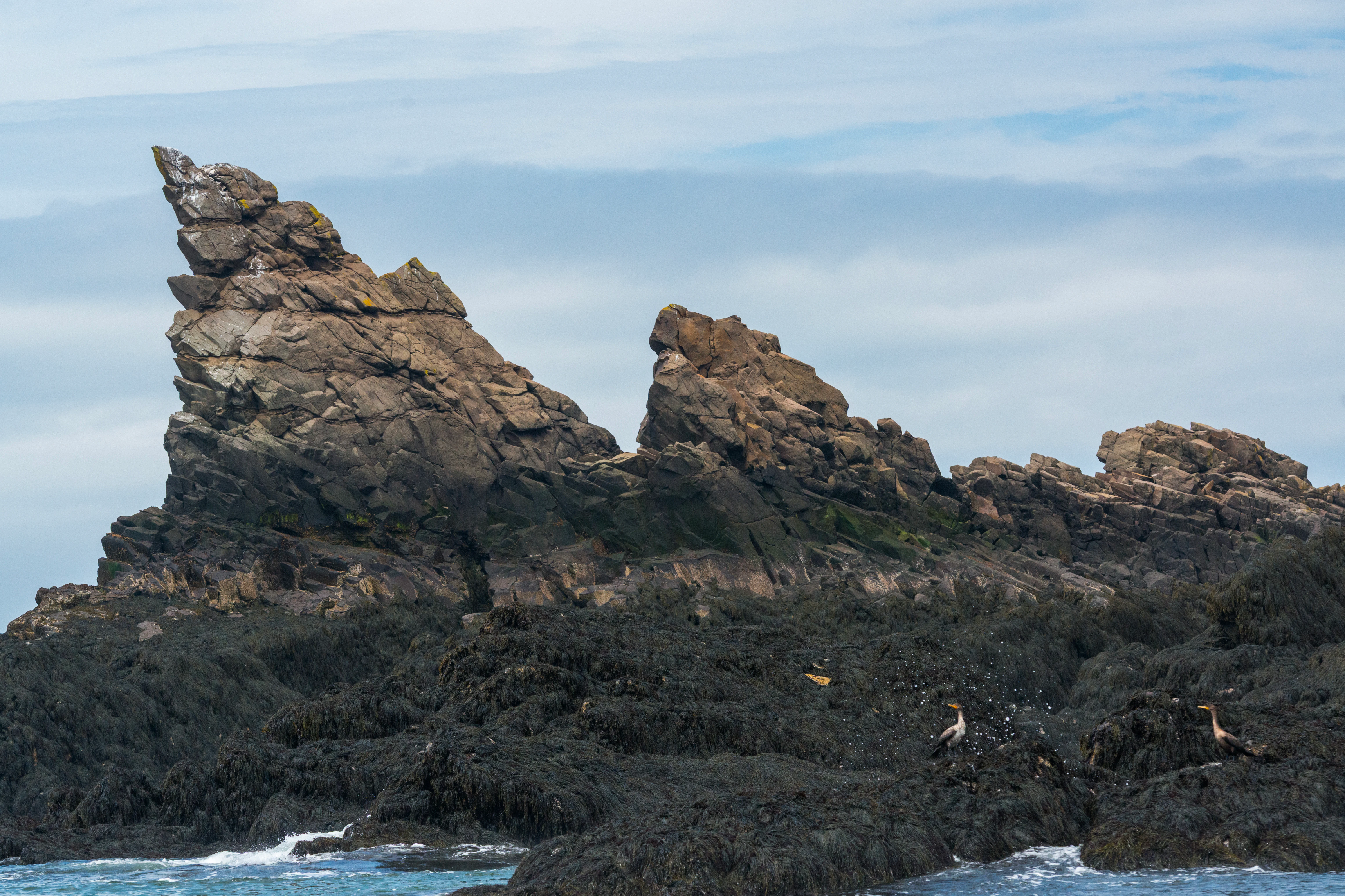
A jagged basalt rock formation known as the Shark Fins rises above dark, wet coastal rocks with seabirds perched in the foreground against a cloudy sky.
The Shark Fins rock formation along the rugged coastline of Île Haute in the Bay of Fundy.

Isle Haute history and protected-area timeline

Isle Haute has a long human history that stretches back into the deep past of the region. Archaeological traces indicate Mi'kmaq presence on or near the island going back roughly eleven thousand years, placing the island within the broader Indigenous heritage landscape of Atlantic Canada. This long history of Indigenous connection is still reflected in the Mi'kmaq name for the island, Maskusetik.

The island entered the written historical record in 1604, when Samuel de Champlain mentioned Isle Haute during his early exploration of the Bay of Fundy. This early European documentation places the island among the earliest charted landmarks of the region and ties it to the wider history of French exploration in Acadia.

In more recent centuries, the island remained sparsely populated and largely undisturbed, which helped preserve its ecological character. During the twentieth and early twenty-first centuries, its conservation profile gradually grew as its geological and biological significance became better understood. In 2019, Environment and Climate Change Canada proposed the formal protection of Isle Haute as a National Wildlife Area, a designation that was confirmed in January 2025, securing the island's status as a federally protected natural area.

Isle Haute landscape and geographic character

The landscape of Isle Haute is dominated by its geological character and its relationship with the sea. The island stretches roughly three kilometers in length and rises to a high point of about 105 meters, but the most visually defining feature is the near-continuous wall of cliffs that encircles much of the shoreline. Along the southern coast, these cliffs reach approximately 100 meters in height and expose a fascinating cross-section of Jurassic-age volcanic bedrock.

Within these cliffs, several distinct volcanic features are visible, including layered basalt flows that record successive eruptions, and striking columnar basalt formations created by the contraction of molten rock as it cooled. The interplay of these formations with the erosive power of Bay of Fundy tides has produced rugged coastal features such as the Shark Fins rock formation on the western side of the island, named for its distinctive profile above the water.

The interior of Isle Haute rises above these cliffs into a more sheltered plateau-like terrain, while the shoreline drops sharply into tidal waters. The result is an island that reads almost entirely from the water as a steep, dark wall of rock, contrasting strongly with the surrounding seascape and giving the landscape a powerful sense of isolation and scale.
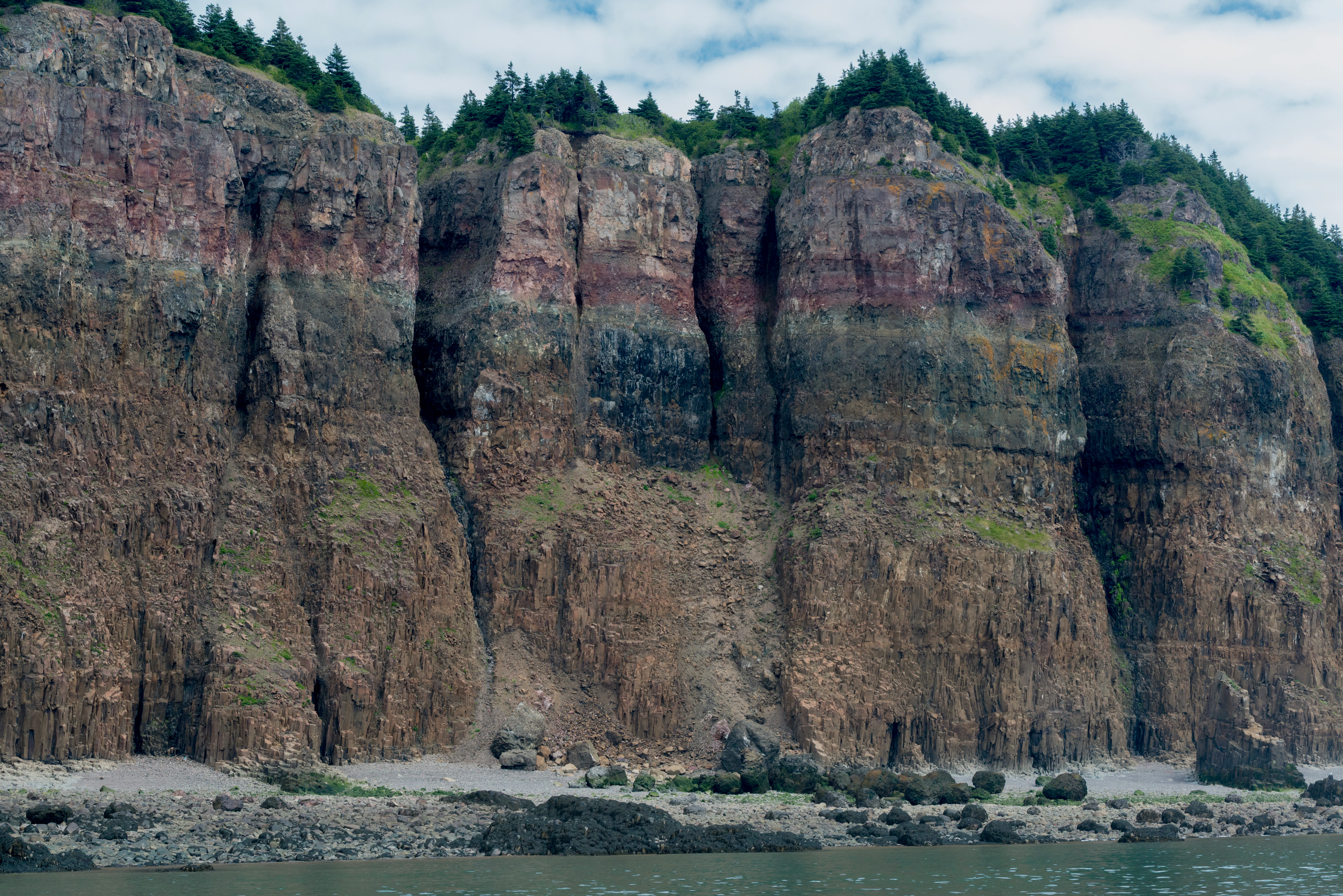
A wide shot of steep, layered basalt cliffs on the coastline of Île Haute, with coniferous forest at the crest and a rocky shoreline below.
The dramatic basalt cliffs of Île Haute, rising above the Bay of Fundy.

Isle Haute ecosystems, habitats, and plant life

Isle Haute's nature is shaped by the narrow band between volcanic rock and turbulent sea. The island's vegetation reflects both the fertility of basalt-derived soils and the exposure to salt spray, wind, and shifting tidal conditions. Roughly 300 plant taxa have been recorded on the island, a remarkable concentration given its small size, and additional surveys may reveal even greater diversity since some interior areas remain incompletely inventoried.

Habitats on the island range from cliff-top vegetation and exposed coastal ledges to more sheltered pockets of interior growth. The Bay of Fundy's extreme tidal range plays a major ecological role, regularly exposing and submerging rocky reefs and intertidal zones around the island. These zones create feeding areas for seabirds and haul-out sites for marine mammals.

The island functions as a stepping stone within the larger Bay of Fundy ecosystem, providing nesting, resting, and feeding habitat for both resident and migratory species. Remote from major development and surrounded by strong currents, Isle Haute remains a relatively undisturbed natural environment within an already exceptional regional ecosystem.
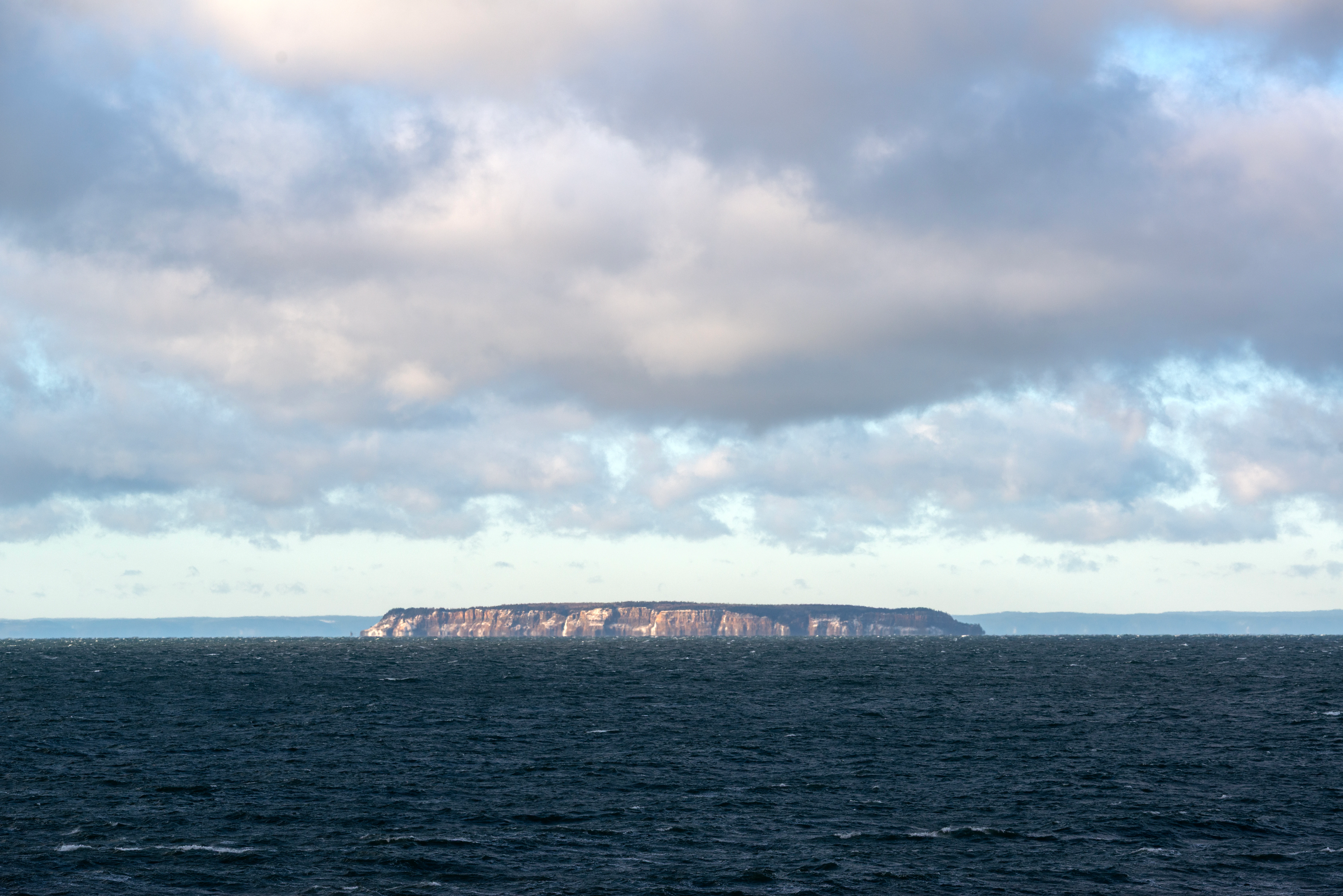
A distant, low-angle shot of a rocky island with flat-topped cliffs rising from a dark, choppy ocean under a cloudy sky.
A view of Isle Haute rising from the waters of the Bay of Fundy.

Isle Haute wildlife and species highlights

Wildlife on Isle Haute reflects the island's location along a major Atlantic migratory route and within a highly productive marine environment. Around 60 species of migratory birds have been recorded, including notable species such as the Leach's storm-petrel, common eider, bald eagle, and peregrine falcon. The island also supports permanent resident birds, with the great blue heron among the recognized year-round species.

Marine wildlife is equally visible around Isle Haute. Harbour seals and grey seals use the surrounding waters and rocky reefs, with grey seals commonly seen resting on the shoreline rocks. Seabirds such as cormorants frequent the intertidal reefs exposed at low tide, taking advantage of the rich feeding opportunities created by the Bay of Fundy's enormous tidal exchange.

On land, the island also hosts smaller fauna adapted to its isolated conditions, including red-backed salamanders, which contribute to the broader biodiversity supported by the island's varied microhabitats. Together, these groups of wildlife underline the importance of Isle Haute as a refuge for species that rely on both terrestrial and marine conditions in the Bay of Fundy.
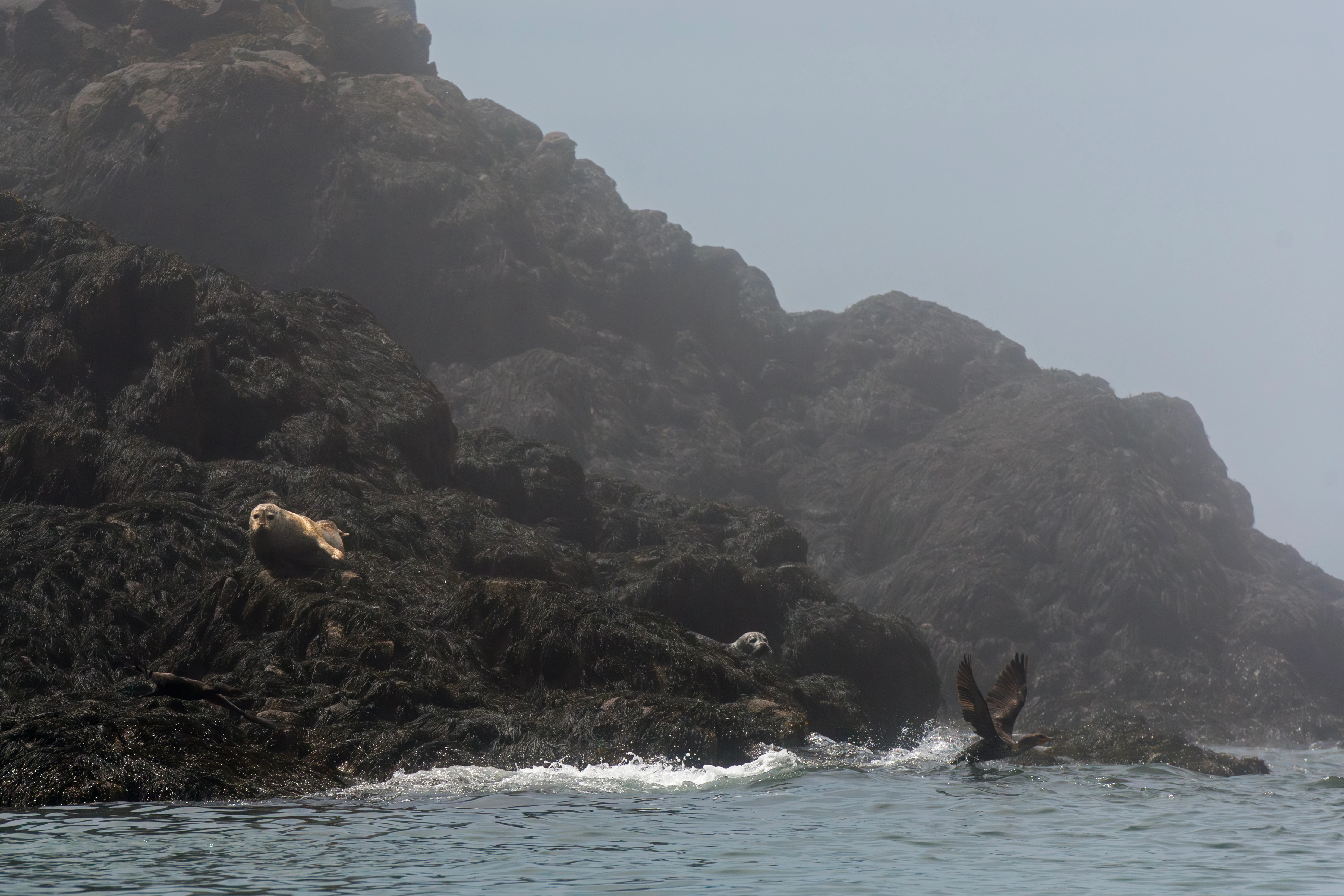
A group of grey seals resting on jagged, dark basalt rocks along a foggy coastline, with waves lapping at the shore.
Grey seals resting on the rocky basalt coastline of Isle Haute in the Bay of Fundy.

Isle Haute conservation status and protection priorities

Isle Haute's conservation significance lies in the unusually tight overlap of geological heritage, biodiversity, and isolation within a small protected area. The island's volcanic formations, including columnar basalts and visible lava flow structures, make it one of the most accessible Jurassic igneous exposures in eastern Canada. Combined with its concentration of plant taxa and migratory birdlife, the island represents a high-value site for both geological and ecological study.

The recognition of these values led Environment and Climate Change Canada to propose the formal protection of Isle Haute as a National Wildlife Area in 2019. The designation followed a standard regulatory review process and was confirmed in January 2025, placing the island under federal wildlife protection. This status provides a long-term framework for habitat conservation, scientific research, and the management of human activity on and around the island.

By protecting both the marine and terrestrial components of this small but ecologically rich environment, the designation supports the broader conservation of the Bay of Fundy ecosystem. Isle Haute now serves as a reference site within a network of protected areas that safeguard the natural character of one of the most dynamic coastal regions in North America.

Isle Haute cultural meaning and human context

Isle Haute carries a layered cultural significance that complements its natural value. The Mi'kmaq name for the island, Maskusetik, reflects a longstanding Indigenous relationship with this part of the Bay of Fundy, and archaeological traces suggest that the Mi'kmaq have been connected to the island for approximately eleven thousand years. This deep Indigenous heritage places Isle Haute within the broader cultural landscape of Atlantic Canada's First Nations.

The island also occupies an early place in European documentary history of the region. Its mention by Samuel de Champlain in 1604 connects it to the earliest phase of French exploration and mapping of the Bay of Fundy and Acadia. Since then, the island has remained sparsely populated, which has helped preserve not only its ecological systems but also a sense of historical continuity between its ancient Indigenous past and its more recent documented history.

Top sights and standout views in Isle Haute

Isle Haute stands out as one of the most visually arresting small islands in the Bay of Fundy. Its 100-meter basalt cliffs, exposed Jurassic volcanic geology, and columnar basalt formations make it a rare natural showcase of igneous processes along an Atlantic coastline. These geological features are unusually accessible and clearly visible from the water.

Equally important are the island's ecological highlights, including roughly 300 plant taxa, around 60 migratory bird species, and populations of grey and harbour seals. The 2025 designation of Isle Haute as a National Wildlife Area formalized the protection of these values, securing the island's future as both a scientific reference site and a refuge for wildlife within the Bay of Fundy.

Best time to visit Isle Haute

The experience of visiting or viewing Isle Haute is strongly shaped by season and tide. Late spring through early fall generally offers the mildest conditions and the most active wildlife, with migratory birds present in greatest diversity during these months and seal haul-outs most frequently observed on the rocky reefs as tides recede.

Tidal conditions are always a defining factor in the Bay of Fundy, and low-tide periods expose intertidal zones, reefs, and formations such as the Shark Fins rocks that are otherwise submerged. Clear weather after passing weather systems commonly produces the most dramatic views of the basalt cliffs, as shifting light emphasizes the layered volcanic structure of the southern shoreline. Winter visits are possible but reflect the harsher Atlantic conditions, with reduced wildlife activity and more challenging sea states.
Monthly climate preview

Long-term temperature and precipitation records across representative coordinate sampling.

Île Haute Climate Normals and Monthly Weather Patterns

Representative measurements from NASA POWER document average temperatures and daily precipitation rates across twelve distinct intervals for Île Haute. Detailed monthly data breakdowns allow comparison of thermal ranges and precipitation rhythms across the protected area.
Annual mean5 °C
-7 °C17 °C
Jan-7°
Feb-6°
Mar-2°
Apr
May
Jun13°
Jul16°
Aug17°
Sep14°
Oct
Nov
Dec-3°
Warmest month
August

16.7 °C

Coolest month
January

-6.6 °C

Wettest month
November

3.7 mm/day

Driest month
August

2.5 mm/day

Park location guide

Geography guide, regional context, and park location map for Isle Haute

Isle Haute park geography, regions, and map view in Canada

Understand where Isle Haute sits in Canada through a broader geographic reading of the surrounding landscape, nearby location context, and its mapped position within the national park landscape.

How Isle Haute fits into Canada

Canada is a federal parliamentary constitutional monarchy spanning North America from the Atlantic to the Pacific and Arctic Oceans. With a population of over 41 million, it is officially bilingual in English and French at the federal level. The country gained independence from the United Kingdom through a gradual process culminating in 1982.

Wider geography shaping Isle Haute in Canada

Canada occupies the northern portion of North America, sharing its longest international border with the United States. The country extends from the Atlantic Ocean to the Pacific Ocean and northward into the Arctic Ocean, giving it the longest coastline of any nation.

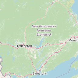
Map view of Isle Haute

Use this park location map to pinpoint Isle Haute in Canada, understand its exact geographic position, and read its mapped placement within the surrounding landscape more clearly.

Pigeon | © OpenStreetMap contributors

Location context for Isle Haute

Nova Scotia

Explore photographic records of volcanic terrain, steep sea cliffs, and protected island habitats.

Île Haute Photos and Scenery: Visualizing Jurassic Basalt Cliffs in the Bay of Fundy

Visual documentation reveals the rugged topography and steep basalt formations that define the shoreline of Île Haute. Examining these protected area views clarifies the geological scale and marine habitat character of the island.

A jagged basalt rock formation known as the Shark Fins rises above dark, wet coastal rocks with seabirds perched in the foreground against a cloudy sky.

A close up view of rugged, dark gray columnar basalt rock formations set against a taller, layered brown cliff face on the coast of Île Haute.

A wide shot of steep, layered basalt cliffs on the coastline of Île Haute, with coniferous forest at the crest and a rocky shoreline below.

A distant, low-angle shot of a rocky island with flat-topped cliffs rising from a dark, choppy ocean under a cloudy sky.

A group of grey seals resting on jagged, dark basalt rocks along a foggy coastline, with waves lapping at the shore.

A horizontal, long-distance view of the flat-topped Isle Haute island rising above the water of the Bay of Fundy, framed by foreground trees and power lines.

Park atlas

Discover connected coastal landscapes and regional nature reserves

Explore Other Parks Near Île Haute and Regional Protected Areas

Compare Île Haute with nearby national parks and protected areas across the surrounding coastal region. Regional park exploration reveals shared geological formations, marine habitats, and tidal ecosystems.
National parkNew Brunswick
About 31 km away#1 closest

North

Fundy National Park: New Brunswick National Park Atlas and Geographic Exploration

Mapped protected landscape and regional park context.

Fundy National Park represents a vital protected area, offering rich geographic discovery within New Brunswick, Canada. This national park detail provides context for its mapped boundaries and landscape, supporting atlas-based exploration of its regional significance. Understand Fundy National Park's protected status and its contribution to the mapped natural terrain of eastern Canada.

Area
207 km²
Established
1948
IUCN
II
Visitors
303.6K annual
Wildlife reserveNova Scotia
About 38 km away#2 closest

Southeast

Kentville Migratory Bird Sanctuary: A Protected Wetland Reserve in the Cornwallis River Valley

Mapped riparian ecosystems and migratory bird habitats in Nova Scotia.

Discover the unique geography of the Kentville Migratory Bird Sanctuary, a compact wildlife reserve in Nova Scotia. This protected area features a blend of river channels, open fields, and forest mosaic that serves as a seasonal sanctuary for waterfowl. Learn about the riparian terrain that defines this critical node in the broader Atlantic flyway network.

Area
5.06 km²
Established
1939
Relief
Lowland
Scope
Terrestrial
Watercolor painting of a coastal landscape with green marshlands in the foreground, water, and soft, warm-toned rolling hills in the background.
Wildlife reserveNew Brunswick
About 54 km away#3 closest

North

Réserve nationale de faune de Shepody: Geographic Overview of a New Brunswick Wildlife Reserve

Coastal wetlands and protected intertidal geography

Located along the Bay of Fundy, Réserve nationale de faune de Shepody represents an essential network of salt marshes and freshwater habitats. This mapping analysis traces the intersection of tidal dynamics, riverine estuaries, and ancient sandstone formations that define this critical protected area in New Brunswick.

Area
10.69 km²
Established
1980
IUCN
IV
Relief
Lowland
A soft watercolor painting showing a coastal landscape with green low-lying vegetation, a stretch of water, and rolling hills in the distance under a pale sky.
Wildlife reserveNova Scotia
About 59 km away#4 closest

East

Boot Island National Wildlife Area: Mapping Coastal Conservation in Nova Scotia

Protecting intertidal mudflats and migratory bird habitats

Located in the Southern Bight of the Minas Basin, Boot Island National Wildlife Area serves as a key protected refuge within the Bay of Fundy. This reserve safeguards essential coastal and marshland habitats that support migratory bird populations, offering a focused look at how specific island geography functions within a larger, dynamic estuarine wetland system.

Area
1.07 km²
Established
1979
IUCN
Ia
Relief
Lowland
Watercolor painting of a tranquil marshy wetland with calm water, sparse dead trees, and distant hills under a light, hazy sky.
Wildlife reserveNova Scotia
About 84 km away#5 closest

Northeast

Amherst Point Migratory Bird Sanctuary: Wetland Protected Landscape and Map Explorer

Nova Scotia Wildlife Reserve and Managed Marshland Habitat

Amherst Point Migratory Bird Sanctuary protects a significant freshwater marsh and ponded wetland network in Nova Scotia. This reserve is defined by its engineered diked impoundments and role as a crucial stopover for migratory birds in the Atlantic flyway, offering a clear window into managed wetland conservation and coastal marsh terrain.

Area
4.33 km²
Established
1947
IUCN
IV
Watercolor painting showing a river landscape with green trees, rolling hills, and mountains in the background
National parkNova Scotia
About 89 km away#6 closest

South

Kejimkujik National Park: Detailed Protected Landscape and Regional Geography

Explore mapped boundaries and geographic context in Nova Scotia.

Kejimkujik National Park offers a dedicated entry for understanding protected natural areas. As a national park in Nova Scotia, its geographic features and protected boundaries are detailed here to support atlas-based exploration. Discover the park's unique landscape context and its positioning within regional geography, providing a factual basis for comprehending its role as a conservation area.

Area
404 km²
Established
1967
IUCN
II
Visitors
75.3K annual
Wildlife reserveNew Brunswick
About 127 km away#7 closest

Northwest

Portobello Creek National Wildlife Area: Protected Wetland Geography and Regional Atlas

Saint John River floodplain reserve in New Brunswick

Portobello Creek National Wildlife Area protects an expansive wetland complex characterized by riverine marshes, shrub thickets, and low-lying floodplain forests. As a key site within the Saint John River system, the reserve offers unique insight into the geomorphic and ecological character of Atlantic Canadian wetlands.

Area
21.54 km²
Established
1995
IUCN
Ia
Relief
Lowland
A horizontal watercolor painting showing a pale green and soft pink landscape with distant hills, a calm body of water, and a tree-lined shore.
Wildlife reserveNew Brunswick
About 136 km away#8 closest

Northeast

Réserve nationale de faune du Cap-Jourimain: Protected Coastal Wetlands and Wildlife Maps

Essential geographic context for a strategic New Brunswick wildlife reserve

Examine the mapped boundaries and complex ecosystem transitions of Réserve nationale de faune du Cap-Jourimain. This federally protected area in New Brunswick offers a distinct look at coastal marshlands, tidal flats, and island topography situated at the narrowest point of the Northumberland Strait.

Area
6.617 km²
Established
1980
IUCN
IV
Relief
Lowland

Common questions about visiting, size, designation, and location context for Isle Haute

Isle Haute FAQs for park facts, access, geography, and protected area context

Find quick answers about Isle Haute, including protected-area facts, park geography, trail and visitor context, and how the park fits into its surrounding country and regional landscape.
MoriAtlas Explorer

Continue Your Protected Areas Search Across the Global Atlas

Deepen your exploration by continuing the structured search for national parks and protected areas worldwide. Utilize the comprehensive filtering capabilities to compare different conservation landscapes and refine your understanding of global park geography. Discover more about the distribution and characteristics of protected natural areas.

Global natural geography