
Mori Atlas logo
Protected areaIth

A sprawling limestone ridge formation characterized by dramatic cliff lines and ancient beech forests

Ith Protected Area and Limestone Ridge: Geographic Context in Lower Saxony, Germany

The Ith represents a prominent geological feature in Lower Saxony, forming a continuous 22 kilometer limestone ridge across the Weser-Leine uplands. This protected area showcases an extensive series of Jurassic limestone cliffs, known locally as Klippen, which define the western flank of the landscape. Beyond the exposed rock formations, the terrain encompasses mature beech woodlands, sheltered valley systems, and rare grassland habitats that support localized biodiversity.

Mittelgebirgelimestone ridgeKlippen cliffsbeech forestNatura 2000nature reserve
A flat-style digital illustration of a green forested ridge with prominent vertical rock cliffs in the middle ground, set against a soft sunset sky, with cultivated fields in the foreground.

Ith

Protected area

Park overview

Structured park overview, official facts, and landscape profile for Ith

Ith park facts, protected area profile, and essential visitor context

Review the core facts for Ith, including designation, size, terrain, visitor scale, habitats, and operating context in one park-focused overview.

About Ith

The Ith is a compact but ecologically rich low mountain ridge in central Lower Saxony, located southwest of Hannover and forming the northwestern continuation of the neighboring Hils ridge. Its roughly 22-kilometer-long crest runs in a northwest to southeast direction between the towns of Coppenbrügge, Salzhemmendorf, Eschershausen, and Bodenwerder, and its silhouette has been popularly compared to a seahorse, with the northern section often called the Ithkopf.

Geologically, the Ith is a textbook example of relief inversion: Jurassic sedimentary rocks of the Hils syncline that once formed low ground were etched out of the surrounding softer material to become the elevated ridge seen today. The crest and slopes are dominated by Upper Jurassic limestone, especially a hard, partly dolomitized coral oolite, which produces the sharp, prominent cliff walls for which the ridge is famous. The base of the ridge consists of Middle Jurassic rocks that are geologically distinct from the dramatic upper cliffs.

The Ith's biological and scenic character makes it significant beyond its modest elevation. Its continuous cliff system supports communities of orchids, mosses, ferns, and rare grasses that are otherwise uncommon in northern Germany. The beechwoods on the slopes and the traditional Glatthafer meadows on the lower hillsides are among the most species-rich examples of their kinds in the Weserbergland region. The ridge is also an important bat habitat, with several cave systems and rock crevices providing winter and summer roosts for species such as the Greater Mouse-eared Bat.

Large portions of the Ith are formally protected under multiple designations. Nature reserves cover significant sections, and the ridge is part of a large contiguous Natura 2000 FFH site. The northern part of the ridge additionally falls within the Naturpark Weserbergland Schaumburg-Hameln, integrating the Ith into a broader regional network of protected landscapes. Beyond ecology, the Ith is also notable as a recreational landscape, with a dense network of hiking trails, a long tradition of rock climbing on its cliffs, and the historic Ithwiesen gliding airfield at its southern end.

Quick facts and research context for Ith

The Ith is a forested Mittelgebirge ridge in Lower Saxony, within the Weser-Leine-Bergland, reaching a maximum elevation of about 439 meters at the Lauensteiner Kopf. It extends roughly 22 kilometers in a northwest-southeast direction and is regarded as the longest Klippen, or cliff line, in northern Germany. Geologically, it consists of Upper Jurassic limestone, particularly a hard, partly dolomitized coral oolite that forms the prominent cliff walls along its western flank. Large areas are protected as nature reserves and form part of a Natura 2000 FFH site covering more than 3,655 hectares. The northern part of the ridge also lies within the Naturpark Weserbergland Schaumburg-Hameln.

Protection and recognition

Examine documented terrestrial conservation frameworks and official recognition records for Ith.

Ith Protection Status, Terrestrial Scope, and Natura 2000 Recognition

Terrestrial protection status, management scope, and verified Natura 2000 designation records define conservation boundaries across Ith. Conservation researchers review documented protection data and international recognition sources to verify territorial boundaries.

International recognition

Protection details

Protection scope
Terrestrial
Transboundary protection
No
Park context

Deeper park guide and search-rich context for Ith

Ith history, landscape, wildlife, and travel context

Explore Ith through its history, landscape character, ecosystems, wildlife, conservation priorities, cultural context, and seasonal travel timing in a structured park guide built for atlas discovery and search intent.

Why Ith stands out

The Ith is most widely recognized for its continuous wall of limestone Klippen, or cliff faces, which are the longest exposed cliff formation of their kind in northern Germany. These dramatic rock walls, formed by a hard Upper Jurassic coral oolite limestone, rise along the western flank of the ridge and have shaped both the visual identity of the Ith and its cultural history. The cliffs are home to rare flora, including orchid populations and specialized grass and fern communities, and have made the ridge one of the most visited climbing areas in Lower Saxony. Equally distinctive is the Ith's ecological profile. Near-natural limestone beech forests cover much of the ridge, while the warm, sunny cliff ledges support threatened plant communities such as Blaugrasrasen. The combination of cliff habitat, mature forest, cave systems, and traditional meadows gives the Ith a particularly rich biodiversity, further reinforced by its formal protection as a nature reserve and EU FFH area.
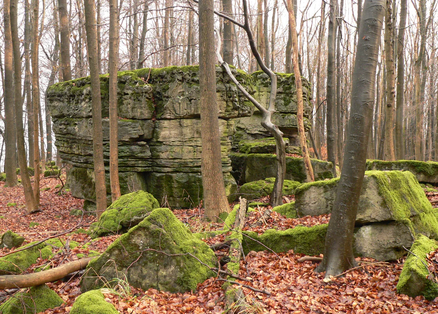
A large, blocky limestone rock formation covered in green moss, surrounded by thin deciduous trees and a ground covered in brown autumn leaves within a forest.
A characteristic mossy limestone rock formation on the Ith ridge in Lower Saxony.

Ith history and protected-area timeline

The Ith's human history is closely connected to the early development of nature conservation in Germany. In the 19th century, the composer and educator Ernst Rudorff lived in Lauenstein at the northern foot of the Ith. Disturbed by changes to the local landscape, he became a foundational figure in the Heimatschutz, or homeland protection, movement and in 1904 co-founded the Bund Heimat und Umwelt in Deutschland, one of the earliest organized conservation bodies in the country. Lauenstein, with its ruined castle above the Ith, became a symbolic site in this conservation tradition.

The 20th century brought more turbulent chapters. During the Second World War, the ridge and its surrounding villages were used for aviation training: in the Nazi era, the so-called Reichssegelflugschule Ith trained glider pilots at Holzen-Ith. After the war, British occupation forces used the site briefly as a rest center before a Royal Air Force gliding club took over training there until 1964. The site's buildings became Germany's first civilian service school, the Zivildienstschule I, in 1971.

The Ith was also touched by the wider histories of the war. In April 1945, as Allied forces advanced, prisoners from the Hameln penitentiary were forced on a death march along the ridge toward an external camp near Eschershausen, an event commemorated locally. Two aviation accidents are also linked to the ridge: a Bundeswehr helicopter crash in 1979 near the Rothenstein, and a small aircraft crash into one of the cliff faces in 2017 during foggy conditions.

Ith landscape and geographic character

The Ith is a long, narrow ridge of moderate elevation, with its crest largely below 450 meters but presenting a much more dramatic visual profile than its modest heights suggest. The ridge runs roughly 22 kilometers from the Lauensteiner Pass in the north to the southern end near Holzen, forming a clear spine that separates the Weser valley watershed to the west from tributaries of the Leine to the east.

The most distinctive visual feature of the Ith is the western cliff line, the Klippen, where the resistant Upper Jurassic limestone has been carved into a series of exposed rock faces, named crags, and boulders. Some of these cliffs, such as the Lüerdissener Klippen, rise to heights of around 30 meters, while other iconic formations include the Adam-and-Eva rocks, the Kamel, the Teufelsküche, and the Mönchstein. The eastern side of the ridge is gentler, sloping gradually into forested valleys and meadows rather than breaking into sheer cliffs.

Below the crest, the Ith's slopes are deeply cut by streams that drain in two directions. On the west, water flows into the Ilse, Hamel, Remte, and Lenne, which ultimately reach the Weser. On the east, the Saale carries Ith waters into the Leine. This dual drainage pattern has produced a series of small, sheltered valleys with their own microclimates, contributing to the habitat diversity that characterizes the ridge.
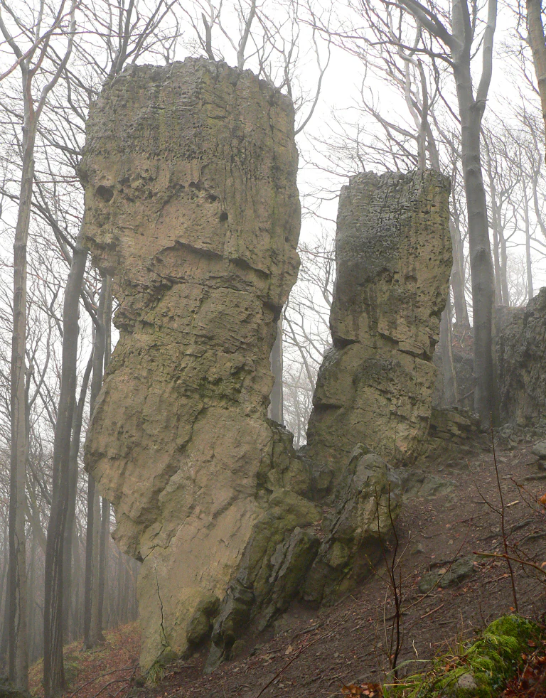
Two prominent, tall, weathered limestone rock pillars standing in a dense, misty deciduous forest.
The Adam and Eva rock formations, a natural monument within the Ith range.

Ith ecosystems, habitats, and plant life

The Ith hosts an unusually rich concentration of habitats for its size, which is why large portions of the ridge are formally protected. Its ecological identity is dominated by extensive stands of near-natural limestone beech forest, which cloak much of the ridge's slopes and crest. Where the rocky, sun-exposed cliff faces interrupt the woodland, specialized plant communities take over, including Blaugrasrasen dominated by Sesleria albicans, a vegetation type more typical of southern German limestone landscapes and only patchily present in the north.

In shaded fissures and cavities along the cliffs, rare moss and fern communities persist, contributing to the diversity of non-vascular species for which the Ith is noted. Hanging forests and slope woodlands at the northern Ithkopf add further structural variety, while the dry, nutrient-poor Glatthafer meadows on the lower slopes are recognized as one of the largest concentrations of such species-rich meadows in the Weserbergland. Together, these elements support a small but exceptional suite of orchids and other flowering plants rare to northern Germany.

Cave systems and rock fissures also play an important ecological role, providing roosting and wintering habitat for several bat species. The combination of mature forest, cliff, meadow, and cave habitats, all within a relatively compact ridge, gives the Ith a near-complete cross-section of the typical habitats of the Lower Saxon Mittelgebirge.
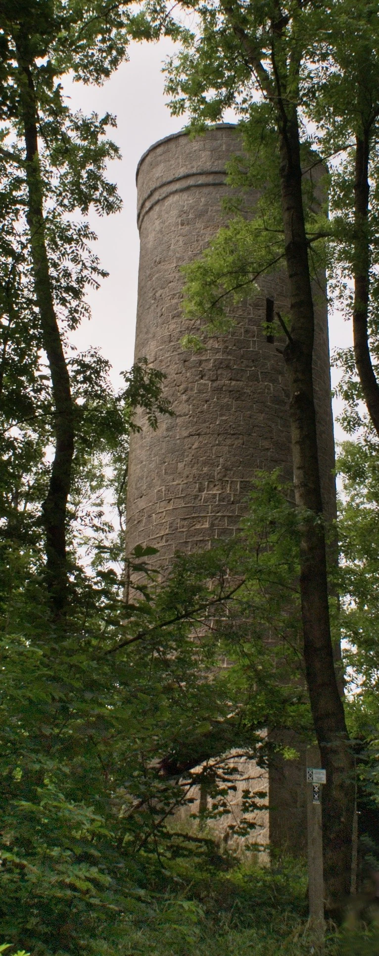
A tall, cylindrical stone observation tower stands partially obscured by dense green deciduous trees in a forest.
The Ithturm observation tower located within the forested ridge of the Ith.

Ith wildlife and species highlights

Wildlife significance on the Ith lies less in charismatic large mammals than in its rich bat populations and breeding bird communities. The ridge's numerous caves, rock fissures, and old tree hollows provide crucial roosting habitat for bats, including the Greater Mouse-eared Bat, a species of conservation concern in much of its European range.

The Ith is also an important area for breeding raptors and woodland birds. Among the species recorded as significant breeders are the Red Kite, the Eurasian Eagle-Owl, and the Grey-headed Woodpecker, each of which depends on the combination of mature forest, cliff habitat, and minimal disturbance that the ridge still largely provides. The meadows and forest edges add supplementary foraging habitat for these and other bird species.

Below the bird and bat level, the Ith's beech forests and limestone meadows support a diverse invertebrate community typical of near-natural Central European woodland and grassland ecosystems, though these species are less explicitly highlighted in available sources than the ridge's larger and more visible fauna.
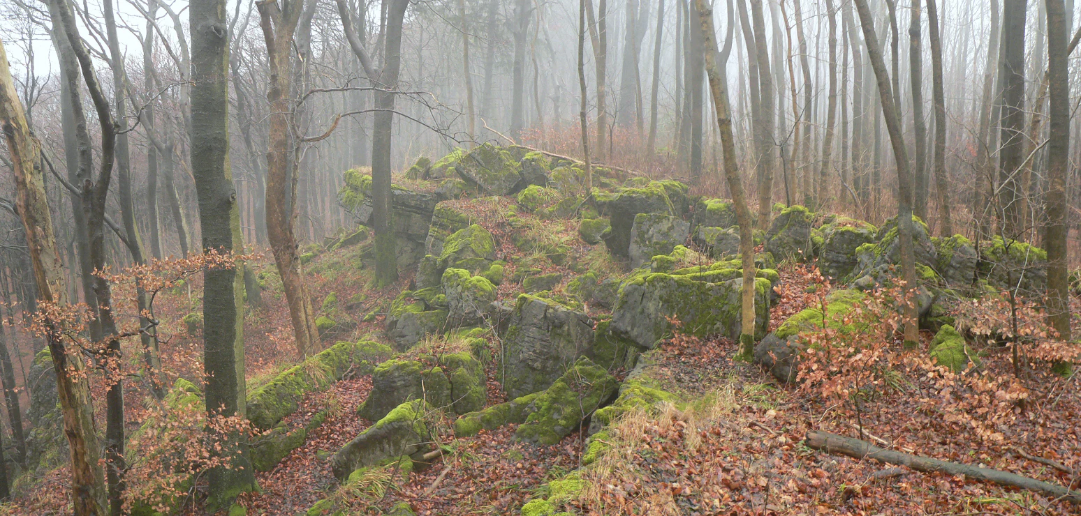
A misty, fog-filled forest scene featuring mossy rock formations among bare trees and fallen leaves.
Moss-covered rocky cliffs emerging from the fog-drenched forest of the Ith ridge.

Ith conservation status and protection priorities

Conservation is central to the identity of the Ith. Large parts of the ridge are protected under the Nature Reserve designations Ith, Ithwiesen, Naturwald Saubrink/Oberberg, and Pöttcher Grund, each recognizing different aspects of the ridge's ecological value, from its forest reserves to its meadow habitats.

At the European level, the Ith forms part of a contiguous Natura 2000 FFH site of more than 3,655 hectares, formally designated under reference number 114. The FFH designation recognizes the ridge's importance for the conservation of natural and semi-natural habitats listed under the EU Habitats Directive, particularly its limestone beech forests, orchid-rich sites, and cave systems. The northern part of the ridge additionally lies within the Naturpark Weserbergland Schaumburg-Hameln, integrating the Ith into a wider protected landscape framework.

Conservation importance extends beyond formal designations into cultural memory. The historical association of the Ith with Ernst Rudorff and the early Heimatschutz movement, anchored at Lauenstein, means the ridge occupies a symbolic place in the history of German landscape conservation. In 2019, local concerns about a planned construction debris landfill in a former quarry near the Lauensteiner Pass mobilized a citizens' initiative known as DepoNIE Ith, which collected thousands of signatures and called attention to potential impacts on drinking water and the protected landscape.

Ith cultural meaning and human context

The Ith is deeply embedded in the cultural landscape of the Weserbergland. Its northeastern edge, anchored by the town of Lauenstein and dominated visually by the ruins of Burg Lauenstein, has long been one of the most symbolically charged locations in the history of German nature conservation. It was here that Ernst Rudorff, frustrated by industrial changes to his surroundings, articulated what would become a national conservation philosophy and helped found a precursor organization of today's major nature and landscape protection associations in Germany.

The villages and farmsteads surrounding the ridge, from Coppenbrügge and Salzhemmendorf in the east to Bodenwerder, the legendary home of Baron Münchhausen, in the west, place the Ith within a region rich in folklore and historical narrative. Traditional land use, including the Glatthafer meadows that still clothe the slopes, reflects centuries of pastoral and agricultural practice that shaped both the landscape and the ecological communities supported there.

Traces of more recent and darker history also mark the ridge. The ridge was the setting for a wartime death march of prisoners from the Hameln penitentiary in 1945, and aviation accidents in 1979 and 2017 have left memorials and local memory. Today, the Ith's combination of heritage sites, working agricultural landscape, ecological richness, and outdoor recreation gives it a dense and layered cultural identity unusual for a ridge of its modest elevation.
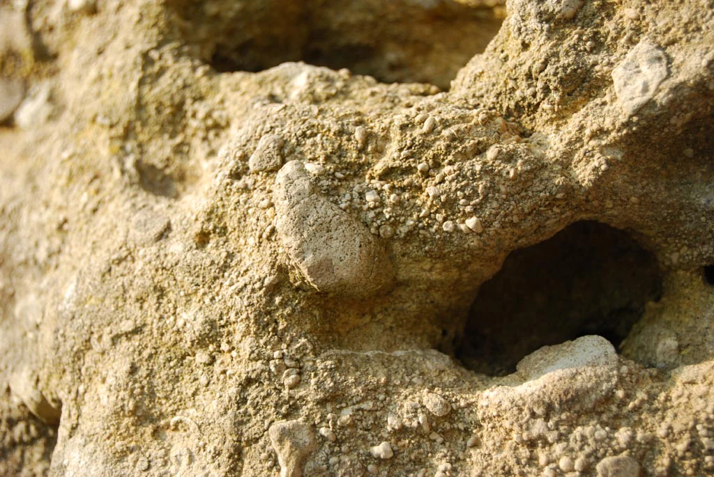
Detailed close-up shot of weathered, granular rock showing embedded pebbles and small cavities.
A close-up view showing the textured, pebbled surface of limestone rock within the Ith ridge.

Top sights and standout views in Ith

The Ith's defining highlight is its continuous wall of limestone Klippen, which stretches along much of the western flank of the ridge. These cliffs, formed from hard Upper Jurassic coral oolite, are the longest single cliff formation of their type in northern Germany and have made the Ith the most-visited climbing area in Lower Saxony. Named rock features such as the Adam-and-Eva stones, the Kamel, and the Lüerdissener Klippen are not just recreational landmarks but also host rare cliff-edge flora and cave-dwelling bats.

Equally notable is the Ith's commitment to landscape-scale conservation. Whether appreciated through its quarry-free forest slopes, the rare orchid populations, the species-rich meadows, or its designation as part of the European Natura 2000 network, the ridge stands out as a coherent example of a protected Mittelgebirge landscape in northern Germany. Its long association with the early Heimatschutz movement adds a distinctive cultural dimension that links the Ith to the broader story of European nature conservation.
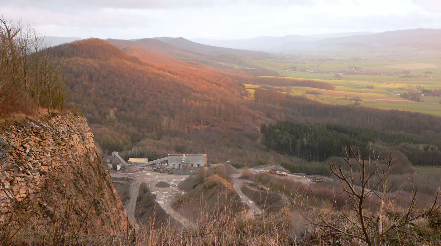
A wide angle landscape view of the Ith mountain range showing a steep rock face of a quarry in the foreground and a forested ridge sloping down into a valley in the distance.
View of the forested Ith ridge in Lower Saxony with a visible stone quarry nestled in the landscape.

Best time to visit Ith

The Ith is accessible year-round, but its character changes meaningfully with the seasons. Spring is traditionally the most popular time to walk the Ith-Kammweg, when extensive carpets of Wood Anemones and Hollow Larkspur bloom across the beech forest floor, drawing large numbers of day visitors to the ridge crest.

Summer brings the most active lifestyle on the ridge, with rock climbing on the named cliff formations, hiking along long-distance trails like the Ith-Hils-Weg and the European long-distance path E11, and glider flying over the boundary meadows of the Ithwiesen. Autumn offers quieter conditions, strong views from cliff viewpoints like the Ithturm, and a more contemplative experience of the forests, while winter reveals the structure of the cliff walls and the bare outlines of the ridge in a way that highlights its geological character, though access may depend on weather on the cliff paths.

Monthly climate preview

Long term temperature and precipitation patterns across the year

Ith Climate Normals and Average Temperature Profiles

Representative coordinate records show measured monthly temperature ranges and precipitation rates for Ith from long term climate data. Reviewing the complete twelve month profile provides deeper insight into annual meteorological rhythms across the protected area.
Annual mean9 °C
0 °C18 °C
Jan
Feb
Mar
Apr
May12°
Jun16°
Jul18°
Aug18°
Sep14°
Oct
Nov
Dec
Warmest month
July

17.8 °C

Coolest month
January

0 °C

Wettest month
July

2.6 mm/day

Driest month
April

1.6 mm/day

Park location guide

Geography guide, regional context, and park location map for Ith

Ith park geography, regions, and map view in Germany

Understand where Ith sits in Germany through a broader geographic reading of the surrounding landscape, nearby location context, and its mapped position within the national park landscape.

How Ith fits into Germany

Germany is a federal republic in Western and Central Europe with a population of over 83 million across sixteen constituent states. It is Europe's largest economy by nominal GDP and a major global exporter and importer. The capital is Berlin, and the country borders Denmark, Poland, Czech Republic, Austria, Switzerland, France, Luxembourg, Belgium, and the Netherlands.

Wider geography shaping Ith in Germany

Germany is located in Western and Central Europe, spanning 357,022 km². It borders Denmark to the north, Poland and the Czech Republic to the east, Austria and Switzerland to the south, and France, Luxembourg, Belgium, and the Netherlands to the west. The country has coastlines on the Baltic Sea and North Sea to the north, with the Alps located in the southern region.

Map view of Ith

Use this park location map to pinpoint Ith in Germany, understand its exact geographic position, and read its mapped placement within the surrounding landscape more clearly.

Pigeon | © OpenStreetMap contributors

Location context for Ith

Lower Saxony
Recorded earthquake history

Review Recorded Seismic Events and Earthquake History Near the Ith Ridge

Examine the historical catalogue of earthquakes documented in the vicinity of the Ith. This MoriAtlas collection tracks recorded seismic activity by proximity, providing essential data for those studying the regional geography of the Weser-Leine uplands.

Ith Earthquake History Records

Catalogued events

1 event

Strongest magnitude

Magnitude 3

Most recent event

Mar 30, 1995

This history includes earthquakes recorded inside the park or within 50 km of its borders

Visualizing limestone cliffs, beech forests, and protected ridge habitats

Ith Photos and Landscapes: Exploring Northern Germany Cliff Scenery

Photographs of Ith reveal rugged limestone cliffs, dense beech woodland, and specialized cliff habitats spanning the protected mountain ridge. Visual exploration of the park terrain provides clear insight into regional geology, forest ecology, and dramatic scenery.

A large, blocky limestone rock formation covered in green moss, surrounded by thin deciduous trees and a ground covered in brown autumn leaves within a forest.

A thick, foggy forest of tall, leafless trees during the winter or dormant season, with a leaf-covered slope in the foreground.

Two prominent, tall, weathered limestone rock pillars standing in a dense, misty deciduous forest.

A tall, cylindrical stone observation tower stands partially obscured by dense green deciduous trees in a forest.

A misty, fog-filled forest scene featuring mossy rock formations among bare trees and fallen leaves.

A wide view of a limestone quarry cliff face cut into a forested hillside, with a meadow in the foreground.

Detailed close-up shot of weathered, granular rock showing embedded pebbles and small cavities.

A wide angle landscape view of the Ith mountain range showing a steep rock face of a quarry in the foreground and a forested ridge sloping down into a valley in the distance.

Several white gliders parked on a wide green meadow under a clear blue sky, with people standing nearby and a van in the background.

A rock climber wearing a white shirt and climbing harness scales a vertical limestone rock face in a forest setting.

A distant view of the forested Ith mountain ridge rising above a patchwork of rural fields and farmland.

A wide panoramic landscape view featuring a forested ridge in the background, with rolling green agricultural fields and a small village in the foreground and midground.

Park atlas

Compare limestone ridges, beech forests, and regional upland protected areas

Exploring Parks Near Ith and Adjacent Weser-Leine Protected Landscapes

Browsing other protected areas near Ith provides a broader geographic view of the Weser-Leine uplands and surrounding Lower Saxony terrain. Comparing adjacent nature reserves helps trace regional conservation patterns and connected forest ecosystems beyond a single limestone ridge.
Nature reserveLower Saxony
About 2.9 km away#1 closest

East

Südhang des Thüster Berges: Protected Limestone Landscape and Regional Terrain in Lower Saxony

Nature reserve located in the Weserbergland range

Südhang des Thüster Berges offers a focused look at a sixty-hectare nature reserve defined by steep, sun-exposed limestone slopes. This protected area in Lower Saxony preserves a specialized mosaic of calcareous semi-dry grassland, traditional meadow, and near-natural forest that stands out within the broader, densely forested ridges of the German Weserbergland landscape.

Area
0.6 km²
Established
1989
IUCN
IV
Relief
Mountain
Nature reserveLower Saxony
About 5 km away#2 closest

Southwest

Weserniederung am Heiligenberg: Geography and Protected Area Overview

A rare calcareous spring system in Lower Saxony

Weserniederung am Heiligenberg protects a critical mosaic of spring-fed mires, gallery forests, and riverine woodlands in the Weserbergland of Lower Saxony. This nature reserve serves as an important hub for specialized biodiversity, preserving a rare spring horizon and high-quality floodplain forest habitats that provide nesting grounds for eagle owls and black storks.

Area
0.07 km²
Established
2016
Relief
Upland
Climate
Temperate
Natural monumentRheinland-Pfalz
About 6.6 km away#3 closest

North

Steinbruch Holzmühle Natural Monument: Protected Limestone Landscapes and Geological Map

Mapping the geological strata and amphibian habitats of the Osterwald hills.

Investigate the geological significance and managed ecological profile of Steinbruch Holzmühle. This site features preserved Kimmeridgian limestone formations and restored habitats that provide a unique case study in post-industrial conservation within the local regional hill network.

Nature reserveLower Saxony
About 13 km away#4 closest

Northeast

Zigeunerwäldchen Nature Reserve: A Detailed Geographic Atlas of the Haller River Floodplain

Protected riparian forest boundaries in Lower Saxony

Zigeunerwäldchen is a protected nature reserve in Lower Saxony that preserves a vital fragment of the Haller river floodplain. The landscape is defined by willow-dominated alluvial forest, marshy clearings, and thick stands of sedge. By maintaining these natural water-influenced terrains, the reserve provides a rare glimpse into the historical floodplain architecture of the Calenberger Land region.

Area
0.15 km²
Established
1986
Nature reserveHolzminden
About 13 km away#5 closest

South

Südliche Burgberghänge, Weinberge bei Holenberg und Rühle Nature Reserve and Protected Lands

Geographic atlas and landscape overview in Holzminden

Situated in the Solling foothills, this nature reserve integrates calcareous beech forests and semi-dry grasslands into a singular protected entity. The site highlights complex geological gradients and supports specialized flora and fauna, including rare orchids and woodland birds, within a mosaic of limestone and sandstone terrain near the Bremke brook.

Area
1.77 km²
Established
2020
Relief
Upland
Climate
Temperate
Nature reserveGermany
About 17 km away#6 closest

Northwest

Walterbachtal Nature Reserve: A Detailed Geographic Atlas of the Deister Stream Valley

Mapping protected meadow and forest landscapes in Germany

Walterbachtal offers a unique look at small-scale conservation in the Weserbergland. This nature reserve protects a dynamic stream, traditional wet meadows, and oak-hornbeam forests that thrive on the slopes of the Deister. The reserve provides a distinct transition between aquatic and terrestrial zones, serving as a critical corridor for biodiversity in the regional landscape between Hannover and Hameln.

Area
0.32 km²
Established
1987
IUCN
IV
Relief
Upland
Nature reserveLandkreis Holzminden
About 18 km away#7 closest

South

Teiche am Erz- und Finkenbruch im Solling: Protected Nature Reserve and Wetland Geography

Mapped forest ponds and bog-margin habitat in Landkreis Holzminden

Teiche am Erz- und Finkenbruch im Solling comprises a network of forest ponds and peat-moss communities protected within a two-zone nature reserve. Its sheltered position in the Solling range preserves critical habitat for rare dragonfly populations, serving as an essential wetland segment within the larger Solling-Vogler landscape protection area.

Area
0.03 km²
Established
2016
Nature reserveLower Saxony
18 km away#8 closest

South

Wälder im Solling bei Lauenberg Nature Reserve: Geographic and Landscape Analysis

Protected oak pasture remnants in the Lower Saxony Solling

Analyze the mapped parcels of Wälder im Solling bei Lauenberg. This protected site integrates old growth oak forest with open meadows and brook corridors, showcasing the unique cultural and ecological legacy of the Solling region in southern Lower Saxony.

Area
3.22 km²
Established
2020

Common questions about visiting, size, designation, and location context for Ith

Ith FAQs for park facts, access, geography, and protected area context

Find quick answers about Ith, including protected-area facts, park geography, trail and visitor context, and how the park fits into its surrounding country and regional landscape.
MoriAtlas Explorer

Continue Your Protected Areas Search Across the Global Atlas

Deepen your exploration by continuing the structured search for national parks and protected areas worldwide. Utilize the comprehensive filtering capabilities to compare different conservation landscapes and refine your understanding of global park geography. Discover more about the distribution and characteristics of protected natural areas.

Global natural geography