
Mori Atlas logo
Natural monumentSteinbruch Holzmühle

A mapped analysis of Late Jurassic limestone strata and managed amphibian habitats within the Osterwald hills.

Steinbruch Holzmühle Natural Monument: Geological Profile and Protected Landscape Boundaries

(Naturschutzgebiet Steinbruch Holzmühle)

Steinbruch Holzmühle is a specialized protected area defined by its striking limestone quarry walls and rare geological exposures. The site serves as a vital habitat for threatened amphibians, featuring a unique mosaic of scree slopes, temporary breeding pools, and engineered earth banks. This atlas provides a detailed look at the internal terrain and the surrounding forested ridges of the Osterwald that characterize this significant geological landmark.

former quarrylimestone quarrygeological siteKimmeridgian strataKorallenoolithUpper Jurassic fossils
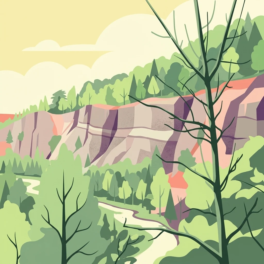
A stylized digital illustration of a limestone quarry cliff face layered with rock strata, surrounded by green forest under a pale sky.

Steinbruch Holzmühle

Natural monument

Park overview

Structured park overview, official facts, and landscape profile for Steinbruch Holzmühle

Steinbruch Holzmühle park facts, protected area profile, and essential visitor context

Review the core facts for Steinbruch Holzmühle, including designation, size, terrain, visitor scale, habitats, and operating context in one park-focused overview.

About Steinbruch Holzmühle

Steinbruch Holzmühle occupies a compact 9-hectare footprint within the gently rolling landscape of the Osterwald hill range, southwest of Springe, in the German state of Lower Saxony. Although modest in size, the reserve punches well above its weight in ecological and scientific value because it preserves a sequence of features that rarely coexist in such a small perimeter: a tall, exposed limestone quarry wall, natural rubble and scree habitats, and a series of artificial temporary pools carefully maintained for sensitive wildlife.

The defining element of the reserve is the disused quarry itself. Active limestone extraction long ago ceased, leaving behind a dramatic southern cliff face that reveals a layered geological profile of the Kimmeridgian stage of the Late Jurassic, including the distinctive Korallenoolith, a rock formation rich in fossil coral debris. The exposed succession is of regional geoscientific interest, providing researchers and educators with an accessible, naturally weathered cross-section of Jurassic marine sedimentation that is otherwise concealed beneath forest cover across much of the surrounding Osterwald.

Ecologically, the reserve functions as a managed habitat refuge. The former quarry floor now hosts rubble fields, scattered limestone blocks, and a network of temporary standing waters. These ponds, protected by low earth banks, are deliberately maintained as breeding habitat for amphibians whose traditional wetlands in the wider region have been lost or fragmented. By pairing geological protection with species-oriented habitat management, the reserve embodies the IUCN Category IV philosophy of targeted intervention on behalf of particular species and habitat types, rather than broad landscape wilderness.

Administratively, Steinbruch Holzmühle has been a formally designated Naturschutzgebiet since Christmas Eve 1985, and it sits within the broader network of protected natural areas in the Region Hannover, immediately next to the larger Saupark. Its continuing presence in this protected-area cluster links it to one of Lower Saxony's most prominent wildlife landscapes and underlines its role as a specialized complement to surrounding forest and game-park habitats.

Quick facts and research context for Steinbruch Holzmühle

Steinbruch Holzmühle is a 9-hectare nature reserve in the Region Hannover, Lower Saxony, designated on 24 December 1985 under the identifier NSG HA 090. The site lies in the western Osterwald near Springe and abuts the larger Saupark Springe reserve. It protects a former limestone quarry with exposed Kimmeridgian and Korallenoolith strata, talus slopes, and temporary pools maintained as amphibian breeding habitat. It is classified as an IUCN Category IV Habitat/Species Management Area and is administered by the NLWKN with the Region Hannover serving as the responsible lower nature conservation authority.

Protection and recognition

Examine documented protection metrics and official registry records for Steinbruch Holzmühle.

Steinbruch Holzmühle Protection Status and Official Designation Records

Examine documented protection status, management scope, and official designation records for Steinbruch Holzmühle. Regional conservation data highlights verified registry entries and administrative boundaries without asserting specific ecological outcomes.

Protection details

WDPA ID
165696
Park context

Deeper park guide and search-rich context for Steinbruch Holzmühle

Steinbruch Holzmühle history, landscape, wildlife, and travel context

Explore Steinbruch Holzmühle through its history, landscape character, ecosystems, wildlife, conservation priorities, cultural context, and seasonal travel timing in a structured park guide built for atlas discovery and search intent.

Why Steinbruch Holzmühle stands out

Steinbruch Holzmühle is best known for its geological exposure of Upper Jurassic limestone, particularly the Kimmeridgian strata and the fossil-rich Korallenoolith formation visible in the steep quarry wall. It is equally valued as one of a handful of small Lower Saxon reserves where a former industrial quarry has been intentionally rewilded to provide breeding pools and shelter for endangered amphibian species. The combination of accessible rock-face science and managed habitat restoration is what sets the reserve apart from purely forested or aquatic protected areas in the Region Hannover network.
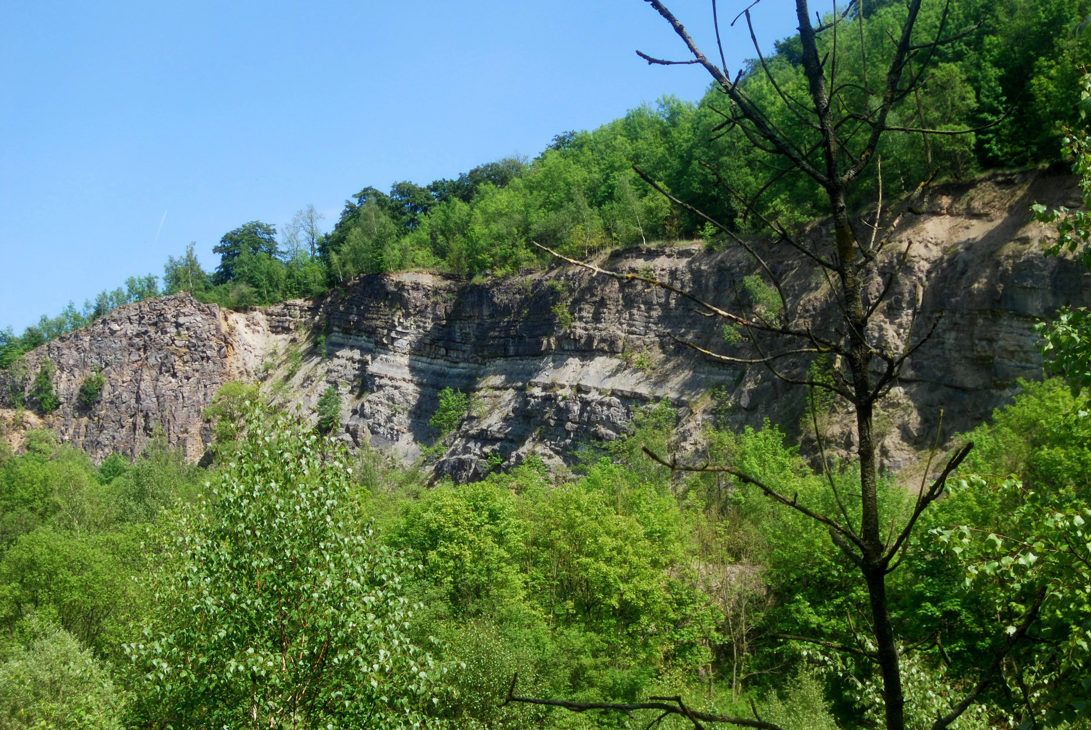
A view of a steep, layered limestone quarry cliff face with green deciduous trees growing along the top and in the foreground.
The limestone cliff face of Steinbruch Holzmühle.

Steinbruch Holzmühle history and protected-area timeline

The Steinbruch Holzmühle reserve has its origins in industrial activity rather than in conservation planning. For much of the nineteenth and twentieth centuries, the site operated as a small limestone quarry, exploiting the Jurassic carbonate rocks of the western Osterwald for local construction and agricultural needs.

As quarrying wound down, the exposed rock face and disturbed quarry floor transitioned from a working industrial site into a landscape of unexpected scientific and ecological interest. By the early 1980s, regional conservation planners recognized both the geo-scientific importance of the exposed Kimmeridgian strata and the opportunity the abandoned workings offered for amphibian habitat creation.

On 24 December 1985, the area was officially designated a Naturschutzgebiet under the identifier NSG HA 090, anchoring it within Germany's formal nature-protection framework. Since that designation, responsibility for the site has rested with the Region Hannover as the lower nature conservation authority, with technical oversight provided by the Lower Saxony State Office for Water Management, Coastal Defense and Nature Conservation (NLWKN).

Steinbruch Holzmühle landscape and geographic character

The landscape of Steinbruch Holzmühle is defined by contrast on a very compact scale. The southern boundary rises as a steep quarry cliff, cut directly into the Jurassic limestone bedrock and showing the visible layers of the Kimmeridgian and the Korallenoolith formation. This abrupt artificial cliff interrupts the otherwise gentle forested slopes of the western Osterwald and gives the reserve its characteristic terrain.

At the foot of the wall, the former quarry floor is a mosaic of loose rock, scree, and angular limestone blocks. These rough surfaces, together with the rubble banks added for habitat management, create a stony micro-relief that looks almost lunar against the surrounding deciduous forest. Artificial pools enclosed by low earth banks occupy depressions within this stony ground, forming small temporary water bodies that fill and evaporate with the seasons.

Just beyond the reserve's borders, the landscape settles back into the wooded ridges and valleys of the Osterwald, while the neighboring Saupark extends a much larger continuous forest park landscape to the east. The combination of sharp quarry topography and enclosing hill forest defines the visual character of the Steinbruch Holzmühle.

Steinbruch Holzmühle ecosystems, habitats, and plant life

Although only nine hectares in area, Steinbruch Holzmühle concentrates several distinct habitat types within a single footprint. The open rock face and scree create xeric, sun-exposed conditions very different from the shaded forest around it, favouring drought-tolerant plants, lichens, and invertebrates adapted to bare rock. The temporary pools, by contrast, host a dynamic annual cycle of flooding and drying that supports amphibians and aquatic invertebrates needing fish-free breeding waters.

Transitional zones along the quarry floor and the artificial earth banks blur the boundary between these extremes, producing a rich patchwork of bare mineral substrate, sparse vegetation, mossy rubble, and shallow water. The surrounding Osterwald forest further enriches the reserve by providing connective habitat and dispersal corridors for woodland species moving into and out of the protected area.

As a Category IV Habitat/Species Management Area, the reserve is managed less for wilderness and more for the persistence of these specific habitat mosaics, with active measures, including the maintenance of protective earth banks around the pools, designed to keep the site suitable for the species that defined its designation.

Steinbruch Holzmühle wildlife and species highlights

The wildlife profile of Steinbruch Holzmühle is dominated by amphibian species that depend on the reserve's unusual combination of safe temporary pools and sheltered rocky terrain. The artificial ponds, ringed by earth banks to keep out disturbance and predators, are actively maintained as breeding habitat. Beyond amphibians, the scree slopes and stone-rich margins host reptiles and a variety of invertebrates that thrive on warm, exposed mineral ground.

Because of the reserve's small size and tight adjacency to the Saupark, the area also benefits from the larger forest mammal and bird community moving through the Osterwald, though the quarry itself tends to be quieter, more open-country habitat than the dense woodland surrounding it. The deliberate management of the reserve keeps the balance tilted toward species that genuinely require disturbed, rocky, or temporary-water environments rather than generalist forest wildlife.

Steinbruch Holzmühle conservation status and protection priorities

Steinbruch Holzmühle's principal conservation significance lies in its dual role as a geological reference site and a managed biodiversity refuge. The exposed Kimmeridgian rock profile and the Korallenoolith formation give the reserve lasting value for stratigraphy, paleontology, and earth-science education, marking it as one of few places in the Region Hannover where Jurassic marine deposits are openly accessible for study.

At the same time, the protected area demonstrates the value of post-industrial land in conservation. By transforming a former quarry into a deliberately managed mosaic of scree, stone-block fields, and engineered amphibian pools, the reserve contributes to species protection in a region where natural rocky wetlands have largely disappeared.

Since 1985, the reserve's status as an IUCN Category IV Habitat/Species Management Area has given it formal standing within Lower Saxony's protected-area network, ensuring ongoing active management by the Region Hannover and the NLWKN rather than passive protection alone.

Top sights and standout views in Steinbruch Holzmühle

Among the most distinctive features of Steinbruch Holzmühle is its combination of an exposed Late Jurassic rock profile and active amphibian habitat management in a single compact site. Visitors and researchers value the visible Kimmeridgian and Korallenoolith strata along the southern quarry wall, while conservation managers emphasize the engineered earth banks and temporary pools that protect vulnerable amphibian populations.

The reserve's location, tucked into the western Osterwald immediately beside Saupark Springe, makes it a small but specialized component of a much larger forested protected landscape in the Region Hannover.

Best time to visit Steinbruch Holzmühle

Late spring and early summer are generally the most rewarding window for visiting Steinbruch Holzmühle in ecological terms, when the temporary pools are likely to hold water and amphibian activity peaks, and the quarry wall is most accessible for observing the exposed rock profile in clear, snow-free conditions. Late summer exposes the dry-weather character of the scree and stone-block habitats, while autumn brings the broader Osterwald forest around the reserve into color. Winters can be cold, with the quarry face occasionally holding snow and ice that highlights its geology, but should be approached with awareness of unstable ground after thaw.


Monthly climate preview

Measured monthly climate patterns and representative temperature ranges for Steinbruch Holzmühle

Steinbruch Holzmühle Climate Normals, Long-Term Temperature and Precipitation Rhythm

Long-term data records for Steinbruch Holzmühle trace a measured annual cycle of shifting temperatures and precipitation rates across twelve distinct intervals. Detailed monthly averages provide deeper context for studying the protected area environment through comprehensive climate records.
Annual mean9 °C
0 °C18 °C
Jan
Feb
Mar
Apr
May12°
Jun16°
Jul18°
Aug18°
Sep14°
Oct
Nov
Dec
Warmest month
July

17.8 °C

Coolest month
January

0 °C

Wettest month
July

2.6 mm/day

Driest month
April

1.6 mm/day

Park location guide

Geography guide, regional context, and park location map for Steinbruch Holzmühle

Steinbruch Holzmühle park geography, regions, and map view in Germany

Understand where Steinbruch Holzmühle sits in Germany through a broader geographic reading of the surrounding landscape, nearby location context, and its mapped position within the national park landscape.

How Steinbruch Holzmühle fits into Germany

Germany is a federal republic in Western and Central Europe with a population of over 83 million across sixteen constituent states. It is Europe's largest economy by nominal GDP and a major global exporter and importer. The capital is Berlin, and the country borders Denmark, Poland, Czech Republic, Austria, Switzerland, France, Luxembourg, Belgium, and the Netherlands.

Wider geography shaping Steinbruch Holzmühle in Germany

Germany is located in Western and Central Europe, spanning 357,022 km². It borders Denmark to the north, Poland and the Czech Republic to the east, Austria and Switzerland to the south, and France, Luxembourg, Belgium, and the Netherlands to the west. The country has coastlines on the Baltic Sea and North Sea to the north, with the Alps located in the southern region.

Map view of Steinbruch Holzmühle

Use this park location map to pinpoint Steinbruch Holzmühle in Germany, understand its exact geographic position, and read its mapped placement within the surrounding landscape more clearly.

Pigeon | © OpenStreetMap contributors

Location context for Steinbruch Holzmühle

Rheinland-Pfalz

Examine the rugged terrain, exposed geological strata, and managed amphibian pools of the reserve.

Steinbruch Holzmühle Photos and Scenery: Visualizing the Limestone Quarry and Protected Habitats

Visual documentation reveals the sharp topography and exposed Jurassic rock formations that define the reserve environment. Examining these protected landscapes provides direct insight into the unique blend of industrial heritage and ecological conservation.

A view of a steep, layered limestone quarry cliff face with green deciduous trees growing along the top and in the foreground.

Park atlas

Compare nearby regional reserves and connected forest landscapes in Lower Saxony.

Other Parks Near Steinbruch Holzmühle and Surrounding Protected Areas

Browse protected areas situated across the surrounding region to compare geological formations and managed habitats. Regional park exploration reveals wider ecological networks connected to local hill reserves.
Nature reserveLower Saxony
About 6.4 km away#1 closest

Northeast

Zigeunerwäldchen Nature Reserve: A Detailed Geographic Atlas of the Haller River Floodplain

Protected riparian forest boundaries in Lower Saxony

Zigeunerwäldchen is a protected nature reserve in Lower Saxony that preserves a vital fragment of the Haller river floodplain. The landscape is defined by willow-dominated alluvial forest, marshy clearings, and thick stands of sedge. By maintaining these natural water-influenced terrains, the reserve provides a rare glimpse into the historical floodplain architecture of the Calenberger Land region.

Area
0.15 km²
Established
1986
Watercolor painting of a rolling, forested ridge landscape in shades of green, yellow, and soft pink.
Protected areaLower Saxony
About 6.6 km away#2 closest

South

Ith Protected Area: Mapped Limestone Ridge Geography and Geological Features

Continuous limestone cliff formations in the Lower Saxony uplands

The Ith stands as a major geological landmark in Lower Saxony, featuring a 22 kilometer spine of Upper Jurassic limestone. This protected area preserves a unique collection of cliff crags, dense beech forests, and limestone-dependent plant communities that span the districts of Hameln-Pyrmont and Holzminden.

Relief
Mountain
Climate
Temperate
Access
Access unknown
Scope
Terrestrial
Nature reserveLower Saxony
About 13 km away#3 closest

South

Südhang des Thüster Berges: Protected Limestone Landscape and Regional Terrain in Lower Saxony

Nature reserve located in the Weserbergland range

Südhang des Thüster Berges offers a focused look at a sixty-hectare nature reserve defined by steep, sun-exposed limestone slopes. This protected area in Lower Saxony preserves a specialized mosaic of calcareous semi-dry grassland, traditional meadow, and near-natural forest that stands out within the broader, densely forested ridges of the German Weserbergland landscape.

Area
0.6 km²
Established
1989
IUCN
IV
Relief
Mountain
Nature reserveGermany
About 17 km away#4 closest

Northwest

Walterbachtal Nature Reserve: A Detailed Geographic Atlas of the Deister Stream Valley

Mapping protected meadow and forest landscapes in Germany

Walterbachtal offers a unique look at small-scale conservation in the Weserbergland. This nature reserve protects a dynamic stream, traditional wet meadows, and oak-hornbeam forests that thrive on the slopes of the Deister. The reserve provides a distinct transition between aquatic and terrestrial zones, serving as a critical corridor for biodiversity in the regional landscape between Hannover and Hameln.

Area
0.32 km²
Established
1987
IUCN
IV
Relief
Upland
Watercolor illustration depicting a landscape with soft green hills, forest edges, and distant purple-hued mountains.
Protected areaRegion Hannover
About 17 km away#5 closest

North

Binnensalzstelle am Kaliwerk Ronnenberg: Mapped Protected Area and Industrial Landscape Context

A rare inland saline ecosystem in Region Hannover

Investigate the Binnensalzstelle am Kaliwerk Ronnenberg, a protected area in Region Hannover defined by its unusual saline conditions. This site presents a concentrated intersection of industrial history and ecological rarity, showcasing how potash mine tailings foster salt-dependent habitats in a inland landscape.

Area
0.017 km²
Established
2004
Relief
Lowland
Climate
Temperate
A soft watercolor illustration of a river winding through a green floodplain with rolling hills in the background.
Nature reserveRegion Hannover
About 18 km away#6 closest

Northeast

Leineaue zwischen Hannover und Ruthe: Protected Floodplain and River Geography

Nature reserve geography and alluvial habitat mapping.

Examine the topographic and hydrological features of the Leineaue zwischen Hannover und Ruthe nature reserve. This atlas entry provides insights into the site's dual-channel river structure, calcareous tufa springs, and fragmented alluvial woodlands that define this significant conservation area near Hannover.

Area
9.678 km²
Established
2007
Relief
Lowland
Scope
Terrestrial
Nature reserveLower Saxony
About 19 km away#7 closest

South

Weserniederung am Heiligenberg: Geography and Protected Area Overview

A rare calcareous spring system in Lower Saxony

Weserniederung am Heiligenberg protects a critical mosaic of spring-fed mires, gallery forests, and riverine woodlands in the Weserbergland of Lower Saxony. This nature reserve serves as an important hub for specialized biodiversity, preserving a rare spring horizon and high-quality floodplain forest habitats that provide nesting grounds for eagle owls and black storks.

Area
0.07 km²
Established
2016
Relief
Upland
Climate
Temperate
A minimalist watercolor painting featuring soft green, yellow, and purple tones depicting a rolling hill landscape with trees and distant hills.
Nature reserveNiedersachsen
About 19 km away#8 closest

East

Haseder Busch, Giesener Berge, Gallberg, Finkenberg Protected Landscape and Map Data

A diverse hill and floodplain ecosystem in Niedersachsen, Germany.

Trace the ecological boundaries and terrain of this expansive nature reserve. The site features a rare convergence of Triassic sedimentary landscapes, including the northernmost calcareous semi-dry grasslands and beech forests in the region, alongside historic floodplain meadows shaped by the Innerste river.

Area
7.42 km²
Established
2019

Common questions about visiting, size, designation, and location context for Steinbruch Holzmühle

Steinbruch Holzmühle FAQs for park facts, access, geography, and protected area context

Find quick answers about Steinbruch Holzmühle, including protected-area facts, park geography, trail and visitor context, and how the park fits into its surrounding country and regional landscape.
MoriAtlas Explorer

Continue Your Protected Areas Search Across the Global Atlas

Deepen your exploration by continuing the structured search for national parks and protected areas worldwide. Utilize the comprehensive filtering capabilities to compare different conservation landscapes and refine your understanding of global park geography. Discover more about the distribution and characteristics of protected natural areas.

Global natural geography