
Mori Atlas logo
Nature reserveHaseder Busch, Giesener Berge, Gallberg, Finkenberg

A diverse mosaic of limestone hills, floodplain forests, and rare calcareous dry grasslands in Lower Saxony.

Haseder Busch, Giesener Berge, Gallberg, Finkenberg Protected Area and Regional Geography

(FFH-Gebiet Haseder Busch, Giesener Berge, Gallberg, Finkenberg)

The Haseder Busch, Giesener Berge, Gallberg, Finkenberg site represents a significant Natura 2000 protected landscape on the edge of the Innerste river valley. This geography comprises a complex alternation of Triassic limestone, sandstone, and loess soils, supporting diverse ecosystems ranging from rare calcareous beech forests at the Finkenberg to highly preserved hardwood floodplain forests. Mapped terrain features reveal a unique geological structure shaped by salt tectonics, where steep ridges and karst springs create a habitat-rich mosaic across the Niedersachsen hill region.

Natura 2000FFH sitecalcareous beech foresthardwood floodplain forestcalcareous dry grasslandInnerste river
A flat vector illustration of a natural landscape with a winding trail leading toward a blue pond, surrounded by evergreen trees, grassy hills, and a rocky cliff in the distance.

Haseder Busch, Giesener Berge, Gallberg, Finkenberg

Nature reserve

Park overview

Structured park overview, official facts, and landscape profile for Haseder Busch, Giesener Berge, Gallberg, Finkenberg

Haseder Busch, Giesener Berge, Gallberg, Finkenberg park facts, protected area profile, and essential visitor context

Review the core facts for Haseder Busch, Giesener Berge, Gallberg, Finkenberg, including designation, size, terrain, visitor scale, habitats, and operating context in one park-focused overview.

About Haseder Busch, Giesener Berge, Gallberg, Finkenberg

Haseder Busch, Giesener Berge, Gallberg, Finkenberg is a composite Natura 2000 area on the western margin of Hildesheim that ties together hill ridges, valley ponds, dry grassland slopes, and Innerste river floodplains into a single protected entity. The site stretches across two distinct sub-areas divided by the federal highway B 1 and the high-speed Hannover–Würzburg railway line, and it surrounds the Himmelsthür district of Hildesheim on the north and south sides. The topography rises from about 75 meters near the Innerste up to roughly 181 meters on the Osterberg, producing a small-scale mosaic of geological substrates including Triassic Muschelkalk limestone, Buntsandstein sandstone, marl, and windblown loess.

The ecological identity of the area is defined by thirteen Annex I habitat types. These include oligo- to mesotrophic calcareous waters with charophyte vegetation at the Giesener Teiche, rich ponds and water lily communities, calcareous dry and semi-dry grasslands on south-facing slopes, species-rich mesophile meadows on the Pferdeanger wet grassland, calcareous fens with blunt-flowered rush, and a layered forest complex ranging from Galio-Carpinet oak-hornbeam forests on the Osterberg to Asperulo-Fagetum beech forests on the slopes near the Giesener Teiche. Hardwood floodplain forest along the Innerste in the Haseder Busch is recognized as the best-preserved of its kind in Lower Saxony.

Two species of European Community interest are documented in the habitats: the narrow-mouthed whorl snail (Vertigo angustior), which survives in a very small population at the Lange Dreisch and Osterberg reserve, and the great crested newt (Triturus cristatus), whose populations have been stabilized through pond restoration work since 2009. The Inlandste river landscape, with its oxbows, alluvial hardwood forest, and reedbeds, also supports beaver, otter, white stork, black stork, red kite, honey buzzard, middle spotted woodpecker, grey woodpecker, and other Annex I bird species within the adjoining Hildesheimer Wald bird protection area. Collectively this mixture of habitats gives the site an unusually complete representation of Central European hill-and-floodplain biodiversity within a relatively compact area.

Quick facts and research context for Haseder Busch, Giesener Berge, Gallberg, Finkenberg

Haseder Busch, Giesener Berge, Gallberg, Finkenberg is a Natura 2000 Fauna-Flora-Habitat (FFH) site code DE-3825-301, designated in January 2019 and confirmed as a Site of Community Importance in January 2021. Covering roughly 7.4 square kilometers, it lies on the western border of Hildesheim in Lower Saxony and is administered by the city of Hildesheim's lower nature conservation authority.

Protection and recognition

Examining documented designation records, conservation frameworks, and international recognition sources.

Haseder Busch, Giesener Berge, Gallberg, Finkenberg Protection Status and Natura 2000 Recognition

Official records document protected area status and Natura 2000 recognition for Haseder Busch, Giesener Berge, Gallberg, Finkenberg through verified international sources. Structured administrative facts provide clear insight into conservation frameworks and designation history.
Park context

Deeper park guide and search-rich context for Haseder Busch, Giesener Berge, Gallberg, Finkenberg

Haseder Busch, Giesener Berge, Gallberg, Finkenberg history, landscape, wildlife, and travel context

Explore Haseder Busch, Giesener Berge, Gallberg, Finkenberg through its history, landscape character, ecosystems, wildlife, conservation priorities, cultural context, and seasonal travel timing in a structured park guide built for atlas discovery and search intent.

Why Haseder Busch, Giesener Berge, Gallberg, Finkenberg stands out

The site is especially known for three biogeographic extremes within Lower Saxony: the northernmost calcareous beech forests at Finkenberg, the northernmost calcareous semi-dry grasslands at Osterberg, and the best-preserved hardwood floodplain forests in the state at Haseder Busch. Together with the Giesener Teiche ponds and the Lange Dreisch open pasture, it forms a rare hill-and-floodland complex on Triassic limestone and Buntsandstein near the Innerste river.
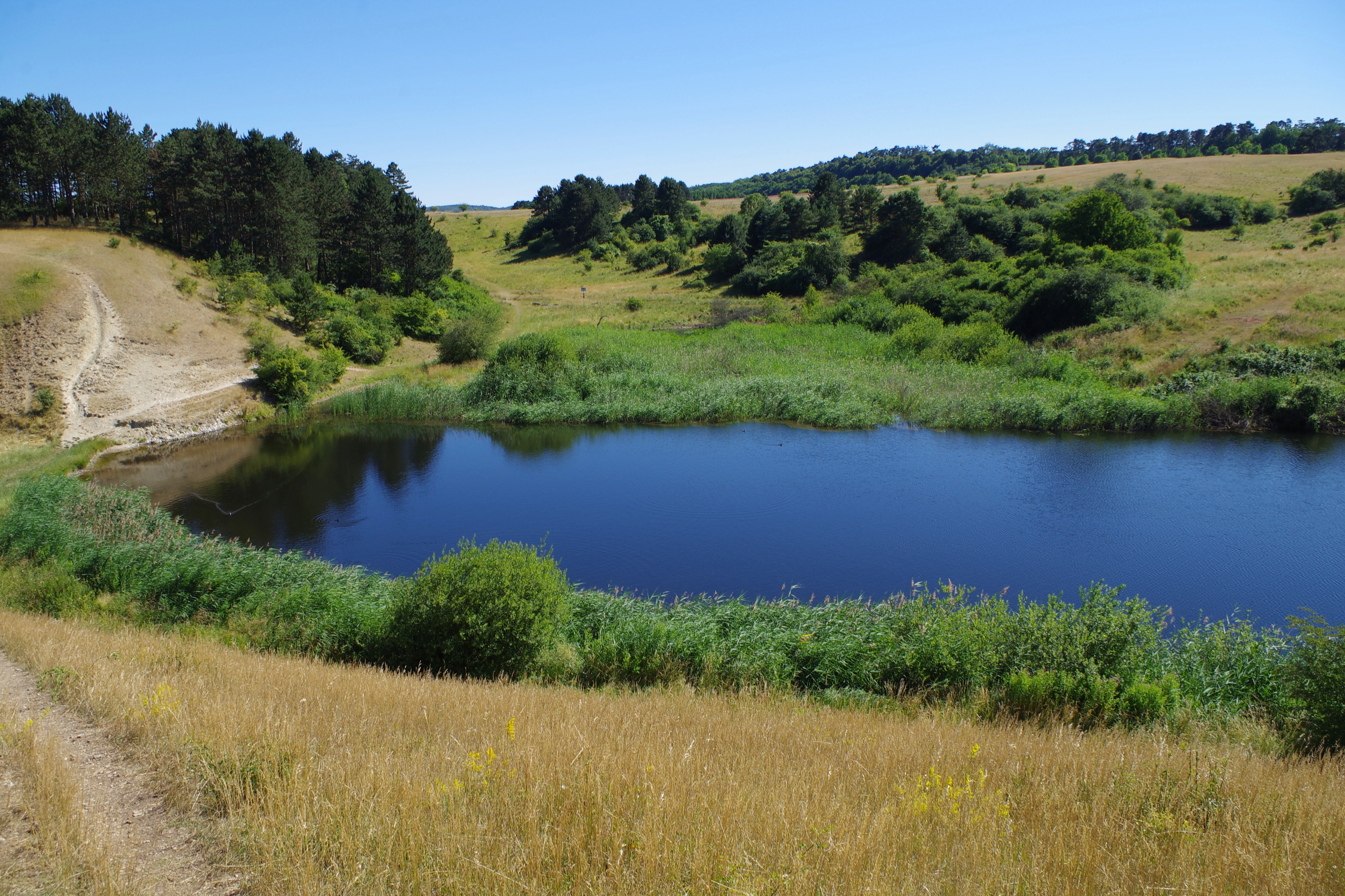
A peaceful pond sits in a valley surrounded by dry grassy hills and patches of mixed forest under a clear blue sky.
A view of the pond at Giesener Teiche within the nature reserve.

Haseder Busch, Giesener Berge, Gallberg, Finkenberg history and protected-area timeline

Human use of the Haseder Busch, Giesener Berge, area dates back to the Neolithic period, when a stone-age settlement more than 600 meters long occupied the dry warm eastern slope of the Gallberg. Arrowheads, quern fragments, axe pieces, and dagger fragments made of flint and stone tools have been recovered there from the early 20th century onward.

In 1329, the Bishop of Hildesheim granted the citizens of Dammstadt a meeting site and place of execution 'uppe dem Galchberghe bi Himdesdore', anchoring this location in medieval civic life. The open grazing commons that historically dominated the area were largely privatized during the 19th century Allmende-partitioning process, leaving only fragments as the modern hut-like landscape of the Lange Dreisch.

The Giesener Teiche ponds were first established in the 18th century as fish-rearing ponds and continue to shape the area's hydrology. Sheep and goat grazing created and maintained the species-rich calcareous semi-dry grasslands over centuries, while selective browsing, trampling, and herding rotations shaped floral composition. After the First World War, sewage sludge application expanded nutrient-loving species and pushed arable farming to its peak extent. From 1961 until late 2007, parts of the Lange Dreisch served as a military training area; the heavy vehicles unintentionally created small pool biotopes that today support the rare living-fossil Triops cancriformis. Mittelwald coppice management, including bark stripping for tanneries and acorn fattening of pigs, is still visible in the form of pollarded hornbeams scattered through the forest stands.

Haseder Busch, Giesener Berge, Gallberg, Finkenberg landscape and geographic character

The protected area occupies the northernmost promontory of the Innerste Bergland within the broader Weser-Leine-Bergland, pushing westward into the loess Börde landscape. Steep ridges and valleys shaped by tilted, partly near-vertical Triassic sedimentary layers create a small-scale alternation of landforms. The terrain drops from the Osterberg summit at about 181 meters above sea level eastward through the open Lange Dreisch pastures down to roughly 75 meters near the Innerste river, exposing both limestone cliffs and deep loess hollows along the way.

Geology at the surface is dominated by Muschelkalk limestone, marl, and Buntsandstein sandstone, capped in many places by loess soils carried in by Pleistocene winds. Salt tectonics from the Permian Zechstein sea lifted these layers into the Giesener salt saddle, raising the Triassic sequence to current surface levels. The Giesener Berge rise on Buntsandstein, while the Giesener Teiche nestle in a steep-walled valley traversed by alternating Buntsandstein and Muschelkalk layers.

The resulting patchwork of rendzina soils on limestone, parabrown soils on loess, and gley soils on alluvial loam supports the wide habitat diversity described in the protected-area documentation. Karst springs emerge at the foot of fissured Muschelkalk slopes around the Rottsberg and Lerchenberg, feeding small streams and pools; one such brook was uncovered and re-pooled in 1993.
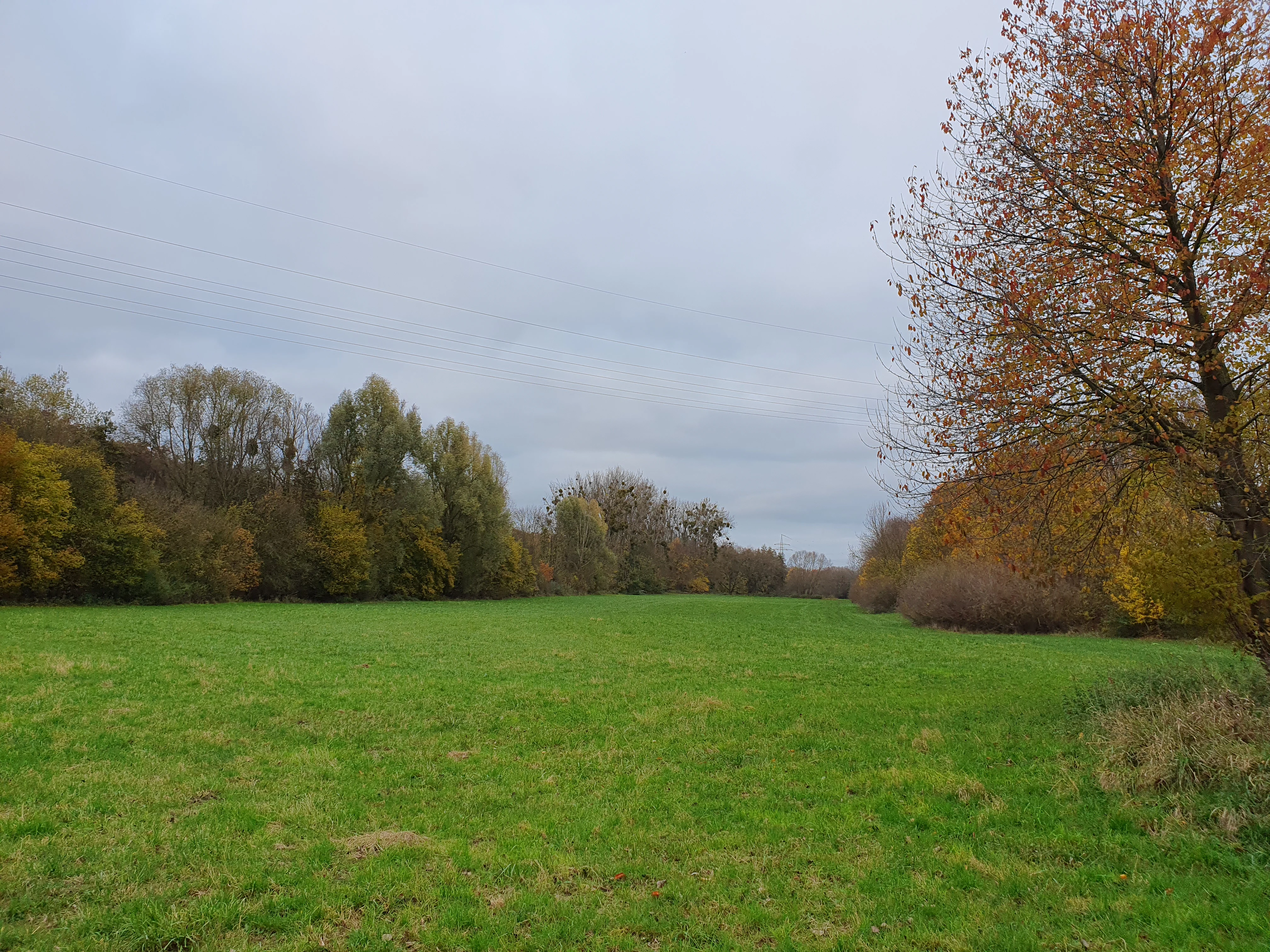
A wide, flat green meadow surrounded by deciduous trees with autumn foliage under a cloudy sky.
A lowland hay meadow in the Haseder Busch nature reserve during autumn.

Haseder Busch, Giesener Berge, Gallberg, Finkenberg ecosystems, habitats, and plant life

The ecological heart of the site rests on its combination of calcareous dry grasslands, hardwood floodplain, and beech-oak forests. The dry grasslands of the Osterberg represent the northernmost Kalk-Halbtrockenrasen in Lower Saxony, and their most species-rich areas were restored from encroaching scrub in late 2023 by the Ökologische Station Hildesheim. These slopes depend on continued extensive sheep and goat grazing to maintain their botanical character.

The calcareous fens harbor blunt-flowered rush (Juncus subnodulosus), short-winged conehead (Conocephalus dorsalis), and marsh grasshopper populations alongside Parnassia palustris and adder's tongue fern. Chara-species stonewort communities recover in the restored upper Giesener Teich, including Nitellopsis obtusa with its characteristic bulbils. Along the Innerste, alder-ash-willow floodplain forests develop tall multiple-stemmed trees with a notably rich liana cover of hop.

Forest communities range from Galio-Carpinetum oak-hornbeam woodland on the Osterberg through Asperulo-Fagetum beech forests near the Giesener Teiche to orchid-beech forests on south- and west-facing Muschelkalk slopes. Pollarded hornbeams, former Mittelwald indicators, survive as scattered veteran trees across the Giesener Wald and Mastberg stands.
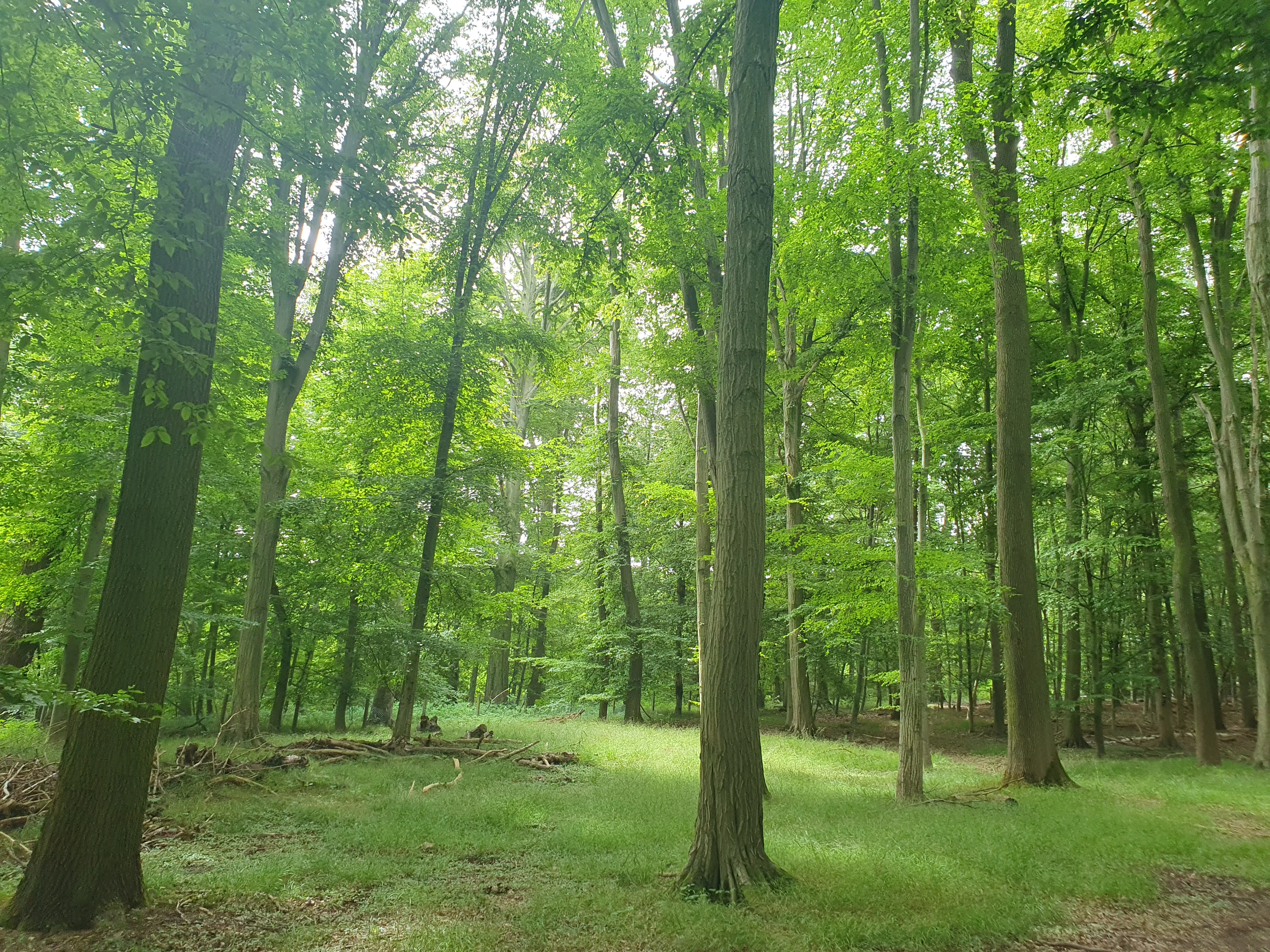
A bright green forest scene featuring tall, straight tree trunks with thick foliage and a grassy forest floor.
A deciduous forest with a lush green understory in the Haseder Busch area.

Haseder Busch, Giesener Berge, Gallberg, Finkenberg wildlife and species highlights

Wildlife in the area reflects the unusually broad spectrum of habitat types. Amphibians are particularly well represented: great crested newts (Triturus cristatus) maintain viable populations in the two restored Giesener Teiche ponds and in newly created micro-waterbodies along former tank tracks at the Lange Dreisch; yellow-bellied toads (Bombina variegata) were reintroduced under the EU LIFE BOVAR project, although drought conditions of 2020 to 2022 disrupted recovery. The rare living-fossil notostracan Triops cancriformis exploits seasonal pools in the former military area.

Reptiles include sand lizard (Lacerta agilis) on the Gallberg and Finkenberg, viviparous lizard (Zootoca vivipara) on the Giesener Berge and the Giesener Teiche, slow worm (Anguis fragilis) distributed throughout, and the smooth snake (Coronella austriaca) and adder (Vipera berus) as historical and current residents.

Invertebrate diversity is similarly high. Heath grasshopper (Stenobothrus lineatus), slender groundhopper (Tetrix tenuicornis), and the regionally threatened saw-tailed bush-cricket (Barbitistes serricauda) occur on the dry slopes; the marsh grasshopper (Stethophyma grossum) inhabits wet meadows and fens. Butterflies include swallowtail, golden eight, small blue, silvery blue, the very rare Berghexe (Chazara briseis), and the nationally endangered silver-washed fritillary (Argynnis paphia). A 2019 moth survey at the Moritzberg by the University of Hildesheim recorded the triangle moth (Xestia triangulum), the nutmeg (Anarta trifolii), and the buff arches (Habrosyne pyritoides). Along the Innerste, the banded demoiselle (Calopteryx splendens) breeds in the reedbed and oxbow habitats.

Birds make this site regionally important. The protected forest holds black stork, middle spotted woodpecker, grey-headed woodpecker, black woodpecker, red-breasted flycatcher, red kite, and honey buzzard, while the wet meadows of the Pferdeanger and Haseder Busch attract white stork, yellow wagtail, quail, lapwing, meadow pipit, and whinchat, and the banded demoiselle's habitat supports marsh warbler. Mammals such as beaver (Castor fiber), otter (Lutra lutra), and wildcat find shelter in the larger woodland and floodplain tracts, hunting the rich insect fauna of the unmanaged wet meadows.
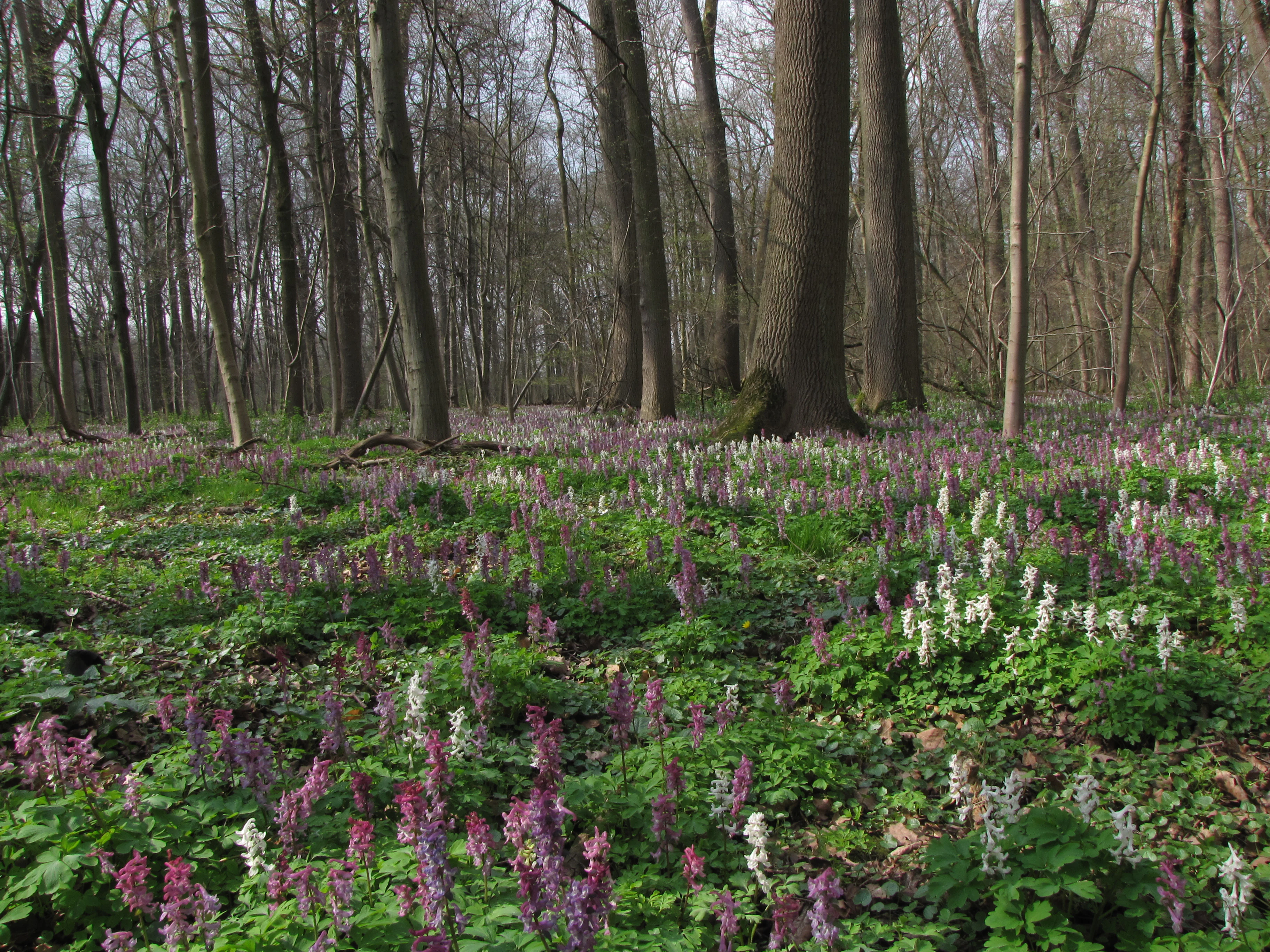
A forest floor covered in purple and white corydalis flowers beneath tall deciduous trees.
Spring wildflowers in the hardwood riparian forest of Haseder Busch.

Haseder Busch, Giesener Berge, Gallberg, Finkenberg conservation status and protection priorities

The site forms part of the European Natura 2000 network, designated under the EU Habitats Directive and, in its southern portion, also under the Birds Directive through overlap with the Hildesheimer Wald bird protection area. Designation as a Site of Community Importance in January 2021 underlined its role in maintaining biodiversity at the EU level. The former training area in the north has also been declared a National Natural Heritage site, locking in long-term conservation status.

Conservation management focuses on habitat restoration rather than passive protection. The upper Giesener Teich was re-excavated from 2009 onward, with annual winter draining to support charophyte stonewort populations and micro-waterbodies for great crested newts. Calcareous dry grasslands at the Osterberg have been actively restored through scrub removal with forestry mulchers, followed by reintroduction of extensive sheep and goat grazing. Hardwood floodplain forest in the Haseder Busch is managed without felling, with deliberate retention of deadwood both in the stand and in the river to support wood-dependent insects, fungi, and bryophytes.

Soil conservation measures, including herbicide- and fertilizer-free farming on the Gallberg's calcareous shard field, are supported by state subsidies to maintain rare arable wild plants such as pointed-leaved fluellen (Kickxia elatine), small-fruited false flax (Camelina microcarpa), and field larkspur (Delphinium consolida). The 450 documented plant species in that single nature reserve, including 43 Red List species, illustrate how concentrated the conservation value has become.

Haseder Busch, Giesener Berge, Gallberg, Finkenberg cultural meaning and human context

The cultural landscape of the protected area is layered. Prehistoric settlement evidence on the Gallberg and medieval judicial assemblies on the same hill connect the landscape to deep human history. Long-running customary land use shaped the current mosaic: communal grazing created the open pastures of the Lange Dreisch; Mittelwald coppice harvesting of hornbeam, oak, and lime produced the veteran tree structure that still underpins much of the forest habitat; bark stripping for tanneries and acorn mast for pigs extended the human footprint into the woodlands. Fish ponds established at the Giesener Teiche in the 18th century have continued to function as both aquatic habitat and historical landscape markers, while the military training area of 1961 to 2007 unintentionally created today's Triops pools.

Local environmental education is reflected in the BodenBlick soil trail around the Giesener Teiche, the nature experience trail in the Gallberg reserve, and ongoing university research projects on reptiles, moths, bats, and amphibians, which connect the protected area to the city of Hildesheim's civic identity.
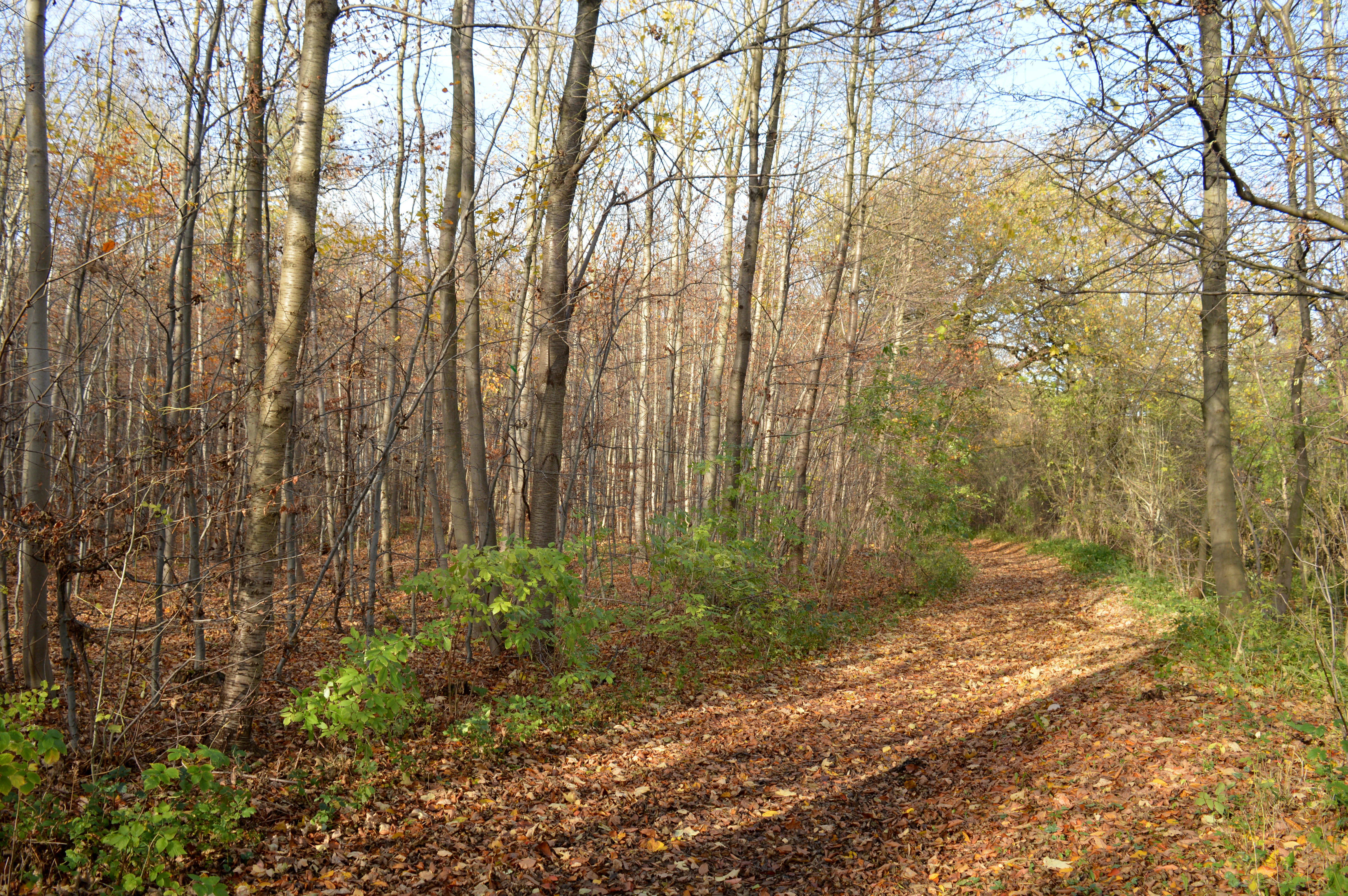
A dirt forest path covered in fallen autumn leaves, leading through a deciduous forest with thin trees and scattered green undergrowth.
A woodland trail during autumn in the Finkenberg area of the nature reserve.

Top sights and standout views in Haseder Busch, Giesener Berge, Gallberg, Finkenberg

The strongest features of this Natura 2000 site are its three biogeographic extremes: the northernmost calcareous beech forests at Finkenberg, the northernmost calcareous semi-dry grasslands at Osterberg, and the best-preserved hardwood floodplain forests of Lower Saxony in the Haseder Busch. Its two Giesener Teiche ponds, with restored charophyte communities, the mesophile Pferdeanger wet meadows with their insect-rich grassland fauna, and the unusual Triops population in the Lange Dreisch training-area pools add further distinct identity.

Best time to visit Haseder Busch, Giesener Berge, Gallberg, Finkenberg

Spring through early summer offers the richest experience, when calcareous dry grasslands at the Osterberg and Lange Dreisch bloom most intensively, woodland geophytes cover the beech forest floor, and great crested newts are most easily observed in the Giesener Teiche ponds. Late summer and early autumn bring the warmest, driest conditions for reptiles such as sand lizard and smooth snake on sun-exposed Muschelkalk slopes, while the Innerste floodplain shows fuller foliage and active beaver and otter presence. Winter visits are best for observing the area's structural forest features, deadwood in floodplain stands, and the seasonal draining of the upper Giesener Teich.

Monthly climate preview

Examine the long-term annual temperature and precipitation rhythm across representative coordinates

Haseder Busch, Giesener Berge, Gallberg, Finkenberg Climate Normals and Weather by Month

Representative coordinates track measured monthly temperature fluctuations alongside consistent precipitation totals throughout the year. Detailed climatological records provide deeper insight into annual averages and long-term environmental patterns.
Annual mean9 °C
0 °C18 °C
Jan
Feb
Mar
Apr
May13°
Jun16°
Jul18°
Aug18°
Sep14°
Oct
Nov
Dec
Warmest month
July

18.4 °C

Coolest month
January

-0.1 °C

Wettest month
July

2.6 mm/day

Driest month
April

1.4 mm/day

Park location guide

Geography guide, regional context, and park location map for Haseder Busch, Giesener Berge, Gallberg, Finkenberg

Haseder Busch, Giesener Berge, Gallberg, Finkenberg park geography, regions, and map view in Germany

Understand where Haseder Busch, Giesener Berge, Gallberg, Finkenberg sits in Germany through a broader geographic reading of the surrounding landscape, nearby location context, and its mapped position within the national park landscape.

How Haseder Busch, Giesener Berge, Gallberg, Finkenberg fits into Germany

Germany is a federal republic in Western and Central Europe with a population of over 83 million across sixteen constituent states. It is Europe's largest economy by nominal GDP and a major global exporter and importer. The capital is Berlin, and the country borders Denmark, Poland, Czech Republic, Austria, Switzerland, France, Luxembourg, Belgium, and the Netherlands.

Wider geography shaping Haseder Busch, Giesener Berge, Gallberg, Finkenberg in Germany

Germany is located in Western and Central Europe, spanning 357,022 km². It borders Denmark to the north, Poland and the Czech Republic to the east, Austria and Switzerland to the south, and France, Luxembourg, Belgium, and the Netherlands to the west. The country has coastlines on the Baltic Sea and North Sea to the north, with the Alps located in the southern region.

Map view of Haseder Busch, Giesener Berge, Gallberg, Finkenberg

Use this park location map to pinpoint Haseder Busch, Giesener Berge, Gallberg, Finkenberg in Germany, understand its exact geographic position, and read its mapped placement within the surrounding landscape more clearly.

Pigeon | © OpenStreetMap contributors

Location context for Haseder Busch, Giesener Berge, Gallberg, Finkenberg

Niedersachsen
Recorded earthquake history

Explore Recorded Earthquake History for Haseder Busch, Giesener Berge, Gallberg, Finkenberg

Access the MoriAtlas seismic catalogue for the Haseder Busch, Giesener Berge, Gallberg, Finkenberg nature reserve. View historical event records including magnitude and epicentre distance, providing a clearer geographic context for seismic activity near this protected German landscape.

Haseder Busch Earthquake History

Catalogued events

1 event

Strongest magnitude

Magnitude 3

Most recent event

Mar 30, 1995

This history includes earthquakes recorded inside the park or within 50 km of its borders

Visualizing calcareous beech forests, floodplain woods, and limestone terrain across the protected area.

Haseder Busch, Giesener Berge, Gallberg, Finkenberg Photos and Protected Landscapes

Photographic records illustrate the varied topography, limestone ridges, and diverse habitats spanning the protected area. Visual documentation reveals the distinct character of the northernmost beech forests, dry grasslands, and river valley terrain.

A peaceful pond sits in a valley surrounded by dry grassy hills and patches of mixed forest under a clear blue sky.

A calm, narrow river or stream flows through a forested area with deciduous trees in late autumn, under a cloudy, overcast sky.

A wide, flat green meadow surrounded by deciduous trees with autumn foliage under a cloudy sky.

A bright green forest scene featuring tall, straight tree trunks with thick foliage and a grassy forest floor.

A forest floor covered in purple and white corydalis flowers beneath tall deciduous trees.

A landscape view of a grassy hillside slope under an overcast sky with a forest visible in the background.

A dirt forest path covered in fallen autumn leaves, leading through a deciduous forest with thin trees and scattered green undergrowth.

Park atlas

Compare nearby protected areas and regional landscapes across Lower Saxony

Exploring Other Parks Near Haseder Busch, Giesener Berge, Gallberg, Finkenberg

Browsing other parks near Haseder Busch, Giesener Berge, Gallberg, Finkenberg reveals adjacent protected landscapes and similar terrain variations. Comparing these neighboring reserves provides broader geographic context for the surrounding regional ecosystem.
A soft watercolor illustration of a river winding through a green floodplain with rolling hills in the background.
Nature reserveRegion Hannover
7.1 km away#1 closest

Northwest

Leineaue zwischen Hannover und Ruthe: Protected Floodplain and River Geography

Nature reserve geography and alluvial habitat mapping.

Examine the topographic and hydrological features of the Leineaue zwischen Hannover und Ruthe nature reserve. This atlas entry provides insights into the site's dual-channel river structure, calcareous tufa springs, and fragmented alluvial woodlands that define this significant conservation area near Hannover.

Area
9.678 km²
Established
2007
Relief
Lowland
Scope
Terrestrial
Nature reserveLower Saxony
9 km away#2 closest

Southeast

Steinberg bei Wesseln Nature Reserve: A Protected Limestone Slope in Lower Saxony

Geographic focus on calcareous grassland and ridge topography

Explore the geography of Steinberg bei Wesseln, a nature reserve in the Hildesheim district of Lower Saxony. This protected area features a steep, south-facing Muschelkalk ridge that supports a rich mosaic of semi-dry grassland and scrub. Its unique microclimate makes it a significant site for understanding habitat conservation within the broader landscape of the German hill country.

Area
0.16 km²
Established
2007
IUCN
IV
Nature reserveHildesheim District
About 9 km away#3 closest

North

Wätzumer Tonkuhle Nature Reserve: Geography and Protected Boundaries in Hildesheim District

A restored wetland refuge in the Lower Saxony agricultural landscape

Wätzumer Tonkuhle offers a rare glimpse into secondary wetland succession within the Hildesheim District. This nature reserve features two primary ponds and an extensive fallow corridor along the Alpebach, serving as a critical sanctuary amidst the surrounding intensive farmland of Northern Germany.

Area
0.105 km²
Established
1986
IUCN
IV
Nature reserveLower Saxony
About 14 km away#4 closest

West

Zigeunerwäldchen Nature Reserve: A Detailed Geographic Atlas of the Haller River Floodplain

Protected riparian forest boundaries in Lower Saxony

Zigeunerwäldchen is a protected nature reserve in Lower Saxony that preserves a vital fragment of the Haller river floodplain. The landscape is defined by willow-dominated alluvial forest, marshy clearings, and thick stands of sedge. By maintaining these natural water-influenced terrains, the reserve provides a rare glimpse into the historical floodplain architecture of the Calenberger Land region.

Area
0.15 km²
Established
1986
Nature reserveRegion Hannover
About 17 km away#5 closest

Northwest

Sundern Nature Reserve and Floodplain Forest Landscapes of Region Hannover

Historic river meander and alluvial habitat preservation

Sundern represents a critical fragment of the historic Leine river floodplain in the Region Hannover. This nature reserve features a complex mosaic of moist backwaters and dry deciduous woodlands, including old-growth oak-hornbeam stands. The area is defined by its glacial valley setting, where centuries of sediment accumulation have shaped a distinct, slightly elevated landscape mosaic that remains vital for regional conservation.

Area
0.504 km²
Established
1931
IUCN
IV
Relief
Lowland
Natural monumentRheinland-Pfalz
About 19 km away#6 closest

West

Steinbruch Holzmühle Natural Monument: Protected Limestone Landscapes and Geological Map

Mapping the geological strata and amphibian habitats of the Osterwald hills.

Investigate the geological significance and managed ecological profile of Steinbruch Holzmühle. This site features preserved Kimmeridgian limestone formations and restored habitats that provide a unique case study in post-industrial conservation within the local regional hill network.

Nature reserveLower Saxony
About 21 km away#7 closest

Southwest

Südhang des Thüster Berges: Protected Limestone Landscape and Regional Terrain in Lower Saxony

Nature reserve located in the Weserbergland range

Südhang des Thüster Berges offers a focused look at a sixty-hectare nature reserve defined by steep, sun-exposed limestone slopes. This protected area in Lower Saxony preserves a specialized mosaic of calcareous semi-dry grassland, traditional meadow, and near-natural forest that stands out within the broader, densely forested ridges of the German Weserbergland landscape.

Area
0.6 km²
Established
1989
IUCN
IV
Relief
Mountain
Watercolor illustration depicting a landscape with soft green hills, forest edges, and distant purple-hued mountains.
Protected areaRegion Hannover
21 km away#8 closest

Northwest

Binnensalzstelle am Kaliwerk Ronnenberg: Mapped Protected Area and Industrial Landscape Context

A rare inland saline ecosystem in Region Hannover

Investigate the Binnensalzstelle am Kaliwerk Ronnenberg, a protected area in Region Hannover defined by its unusual saline conditions. This site presents a concentrated intersection of industrial history and ecological rarity, showcasing how potash mine tailings foster salt-dependent habitats in a inland landscape.

Area
0.017 km²
Established
2004
Relief
Lowland
Climate
Temperate

Common questions about visiting, size, designation, and location context for Haseder Busch, Giesener Berge, Gallberg, Finkenberg

Haseder Busch, Giesener Berge, Gallberg, Finkenberg FAQs for park facts, access, geography, and protected area context

Find quick answers about Haseder Busch, Giesener Berge, Gallberg, Finkenberg, including protected-area facts, park geography, trail and visitor context, and how the park fits into its surrounding country and regional landscape.
MoriAtlas Explorer

Continue Your Protected Areas Search Across the Global Atlas

Deepen your exploration by continuing the structured search for national parks and protected areas worldwide. Utilize the comprehensive filtering capabilities to compare different conservation landscapes and refine your understanding of global park geography. Discover more about the distribution and characteristics of protected natural areas.

Global natural geography