
Mori Atlas logo
National parkJiuzhaigou

Examining the complex geography and protected mountain ecosystems of Sichuan, China

Jiuzhaigou National Park: An Atlas of Alpine Lakes, Travertine Terraces, and Forested Valleys

(Jiuzhaigou Valley Scenic and Historic Interest Area)

Jiuzhaigou represents a distinctive high-elevation valley system within the Min Mountains of Sichuan, China. This protected area features a unique Y-shaped layout of three major gullies, carved by glacial activity and defined by a staircase of calcium-rich travertine lakes, vibrant waterfalls, and expansive subalpine coniferous forests. The park serves as a critical refuge for biodiversity, where dense bamboo groves and mixed broadleaf stands support habitats for species like the giant panda and golden snub-nosed monkey. Through this mapped landscape, users can trace the hydrological and geological formations that define one of the most iconic natural regions in Southwestern China.

travertine lakesalpine forestwaterfallsUNESCO World Heritagenational nature reserveMin Mountains
A flat-style vector illustration depicting a tiered waterfall flowing into a turquoise lake, framed by stylized forested mountains and cliffs.

Jiuzhaigou

National park

Park overview

Structured park overview, official facts, and landscape profile for Jiuzhaigou Valley

Jiuzhaigou Valley park facts, protected area profile, and essential visitor context

Review the core facts for Jiuzhaigou Valley, including designation, size, terrain, visitor scale, habitats, and operating context in one park-focused overview.

About Jiuzhaigou Valley

Jiuzhaigou is a large, Y-shaped valley system comprising three principal gullies, Shuzheng, Rize, and Zechawa, joined near the central Nuorilang waterfall. The protected area covers roughly 720 square kilometers, with a further buffer zone extending the landscape footprint beyond the core reserves, and the terrain rises from around 2000 meters into the low alpine zone above 3000 meters. The park's identity is built on the interplay between water, forest, and geology.

The water is the valley's signature feature. The lakes of Jiuzhaigou are best understood as travertine barrier lakes, formed when mineral-rich water deposits calcium carbonate to build natural dams across the streams. Over time these have accumulated into terraced pools whose clarity and color depend on depth, mineral content, and light. Lakes such as Five Flower Lake, Five Color Pond, Long Lake, Mirror Lake, and Reed Lake each present a different palette, while waterfalls like Nuorilang and Pearl Shoal spread the same mineral-rich flow across broad ledges of pale carbonate rock.

Surrounding these waters is a dense cover of subalpine forest. Approximately half of the reserve area is cloaked in old-growth forest, with mixed stands of spruce, fir, and birch interspersed with rhododendron, arrow bamboo, and pockets of high-elevation meadow. The combined effect is the patchwork of "emerald seas, tiered waterfalls, colorful forests, snow peaks, and Tibetan culture" that has long defined the park's identity. As a UNESCO site recognized for natural criterion (vii), Jiuzhaigou is internationally valued for the exceptional combination of geological, hydrological, and ecological features found within a single accessible landscape.

Quick facts and research context for Jiuzhaigou Valley

Jiuzhaigou lies in Jiuzhaigou County, Aba Tibetan and Qiang Autonomous Prefecture, in the northern reaches of Sichuan Province, at the southeastern edge of the Qinghai-Tibet Plateau.

The reserve sits within the Min Mountains at altitudes that climb from roughly 2000 meters at the valley floors up to around 3100 meters on nearby ridges, encompassing a combination of high-elevation karst features and old-growth forest. It is a UNESCO World Natural Heritage Site, a Man and the Biosphere Programme reserve, a national nature reserve, a national scenic area, and a 5A-rated tourist destination, reflecting both its ecological and cultural importance.

Protection and recognition

Terrestrial conservation framework and official international recognition details

Jiuzhaigou Protection Status, Designation History, and UNESCO Recognition

Documented protection records outline the terrestrial scope and establishment history established for Jiuzhaigou in 1992. International recognition sources incorporate the official UNESCO World Heritage designation for the Jiuzhaigou Valley Scenic and Historic Interest Area.

International recognition

Protection details

Protection scope
Terrestrial
Designated year
1992
Transboundary protection
No
Buffer area
600 km²
Park context

Deeper park guide and search-rich context for Jiuzhaigou Valley

Jiuzhaigou Valley history, landscape, wildlife, and travel context

Explore Jiuzhaigou Valley through its history, landscape character, ecosystems, wildlife, conservation priorities, cultural context, and seasonal travel timing in a structured park guide built for atlas discovery and search intent.

Why Jiuzhaigou Valley stands out

Jiuzhaigou is most famous for its staircase of travertine lakes, known locally as haizi, whose strikingly clear and intensely colored waters have given the valley a near-mythic reputation. Among these, the Five Flower Lake and the Long Lake stand out as particular icons, alongside wide, terraced waterfalls such as Nuorilang and Pearl Shoal whose flows cross the white calcium carbonate terraces below them. The park is equally renowned for its autumn coloration, when broadleaf stands and mixed forest turn red, gold, and orange against the deep evergreen backdrop, framing the lakes with vivid reflections. It is also well known for being one of the few protected areas where remaining populations of the giant panda, golden snub-nosed monkey, and white-lipped deer still overlap in a contiguous mountain landscape.
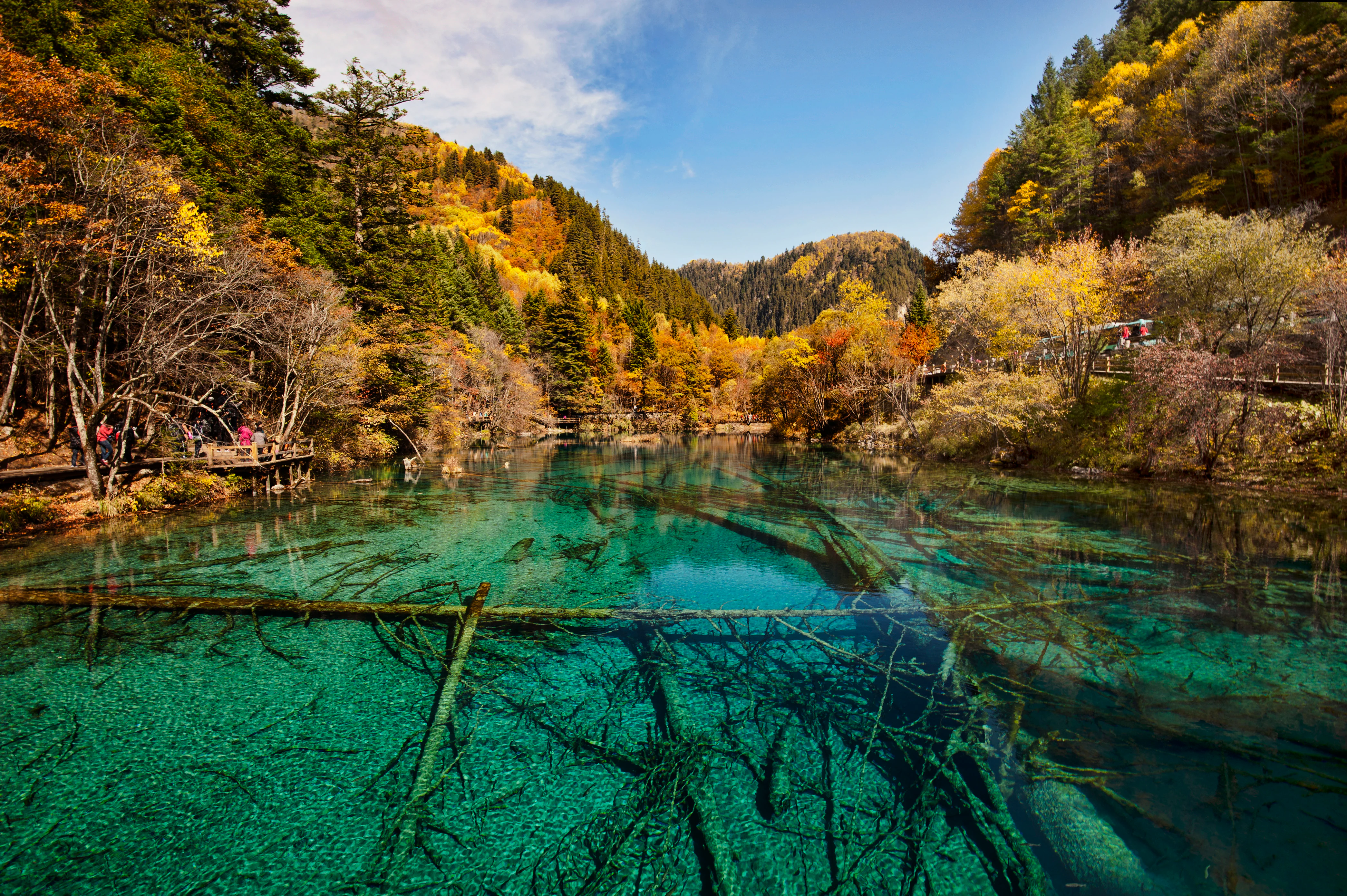
A clear, turquoise-colored lake filled with submerged tree trunks, surrounded by autumn forests with yellow and orange leaves under a blue sky.
The vibrant turquoise waters of Five Flower Lake in Jiuzhaigou National Park, surrounded by autumn foliage.

Jiuzhaigou Valley history and protected-area timeline

The cultural roots of Jiuzhaigou reach back many centuries. The valley lies within the historical Yangdong region of what was once Nanping County, and nine Tibetan villages including Shuzheng, Heye, Zechawa, Panxin, Heiguo, Panzhazhu, Guwa, Pengbu, and Jianpan have long been home to Tibetan communities. During the late Qing dynasty, the area was administered under the Yangdong Zhai tusi system as the Three-She Yangdong and Yao Jiuzhai, a name from which the modern Jiuzhaigou derives. The historical record in the Republican-era Songpan County Gazetteer already noted the elongated, mirror-like splendor of the Long Lake basin, suggesting the landscape's beauty was recognized even before modern conservation efforts.

The modern period brought both threat and rescue. From the late 1950s onward, state forestry operations turned parts of the valley into an active logging frontier, with two forestry camps operating across Shuzheng and Rize gullies under the Nanping Forestry Bureau. A small but persistent movement of scientists, including Yin Kaipu of the Chengdu Institute of Biology, forester Wu Zhonglun, and provincial officials, repeatedly warned that logging was destroying an irreplaceable landscape. Public concern crescendoed in 1978 with the publication of an internal report entitled "Urgent Call to Protect Jiuzhaigou Natural Scenic Area," which prompted decisive action.

On 15 December 1978, the State Council formally approved the establishment of the Jiuzhaigou National Nature Reserve, ending logging in the valley and beginning a long restoration. By the early 1980s the area had been included in the first batch of National Key Scenic Areas, and in 1984 a dedicated scenic area administration opened the valley to visitors. In 1992 Jiuzhaigou was inscribed as a UNESCO World Natural Heritage Site, and in 1997 it joined the UNESCO Man and the Biosphere network. The 2017 Jiuzhaigou earthquake caused significant damage to several lakes and falls, including Nuorilang, prompting temporary closure, phased reopening, and a long-term reconstruction effort that has shaped the park's modern management.

Jiuzhaigou Valley landscape and geographic character

The landscape of Jiuzhaigou is a high-elevation valley system carved into the Min Mountains, where three main gullies branch upward from a central hub. The valley floor sits around 2000 to 2600 meters, while surrounding ridges climb to roughly 3100 meters, and beyond the immediate park walls the Min Mountains rise into higher snow-capped peaks. Glacial and periglacial processes during the Quaternary period shaped the broad U-form of the valleys, leaving behind moraines, polished rock, and other traces of the ancient ice that once filled these basins.

At the valley floor, the dominant landforms are water-driven. Calcium carbonate deposits have built a staircase of terraces and natural dams, creating more than a hundred lakes of varying size along the gullies. White travertine rims, sand spits, and shallow shelves host reeds, mosses, and isolated clumps of trees, producing reed-fringed lakes like Reed Lake, terraced pool sequences like Shuzheng Lakes, and deeper reservoirs like Long Lake at the head of Zechawa. Waterfalls, including Nuorilang and Pearl Shoal, pour across the same carbonate ledges and dominate the soundscape of the central valley.

Above the lakes and falls, the lower slopes give way to coniferous forest and, on drier ridges, mixed stands of spruce, fir, birch, and rhododendron. Arrow bamboo patches thicken on shaded hillsides, while higher elevations thin into subalpine scrub and meadow. The result is a layered landscape where open water, white stone terraces, colored forest, and distant snow ridges work together, producing the contrast that defines Jiuzhaigou as a "fairyland" and gives the park its unmistakable visual identity.
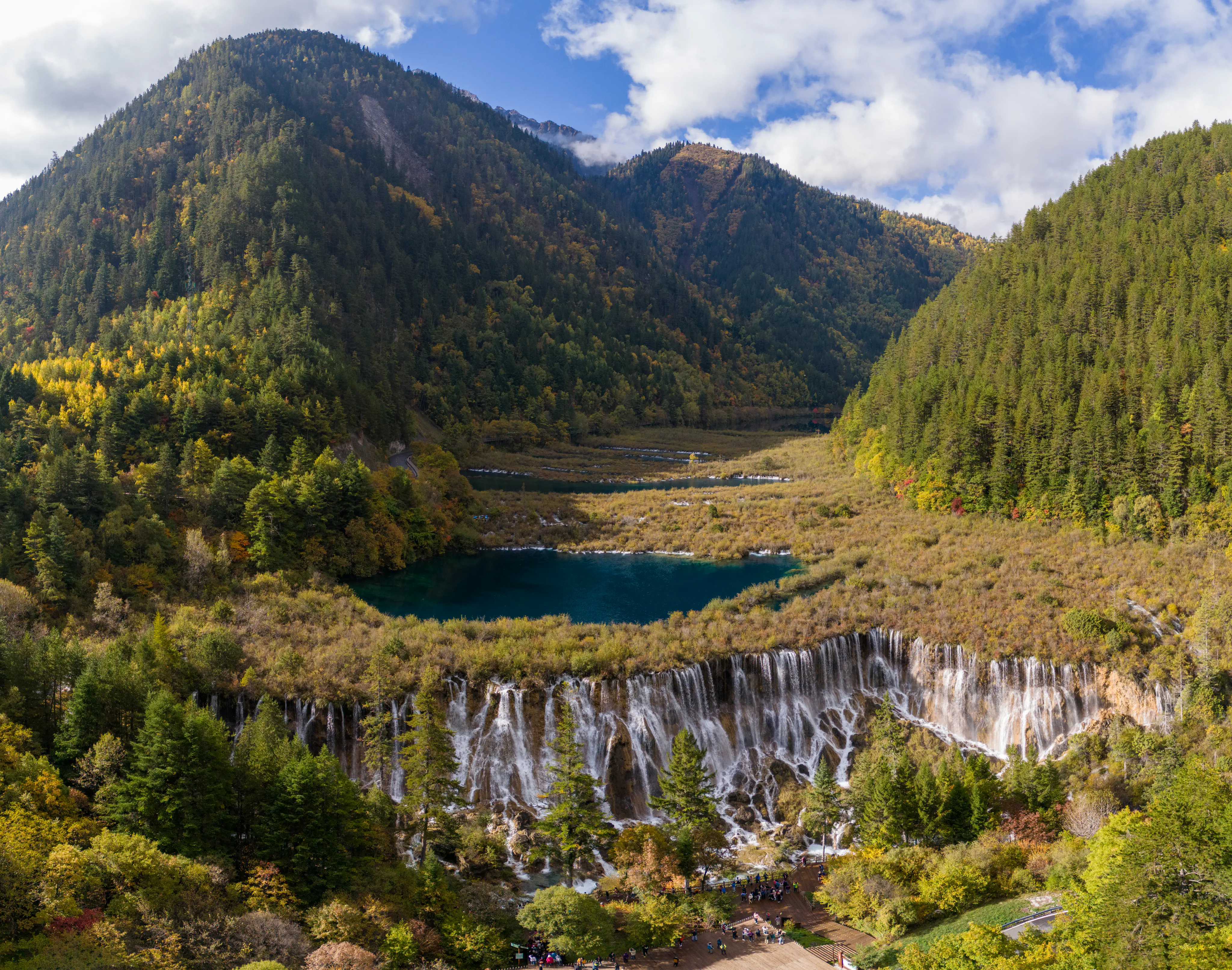
An elevated, wide-angle view of the iconic Nuorilang Waterfall flowing from a deep blue-green lake, set within a lush, forested valley in the mountains during autumn.
Nuorilang Waterfall cascades from a vibrant, turquoise lake surrounded by the lush forests of Jiuzhaigou National Park.

Jiuzhaigou Valley ecosystems, habitats, and plant life

Jiuzhaigou protects a substantial block of relatively undisturbed subalpine forest and freshwater habitat, offering a rare combination of high-altitude karst, travertine pools, and old-growth vegetation within a single protected landscape. Altitude gradients inside the park generate distinct ecological zones, from moist valley-bottom coniferous and mixed forest through bamboo groves on shaded slopes, into subalpine scrub and meadow along the highest ridges.

Forests blanket roughly half of the reserve. Spruce and fir dominate the canopy, with birch, rhododendron, and arrow bamboo filling mid- and understorey niches. The presence of arrow bamboo is ecologically important as a favored food source for the giant panda, and the undergrowth of mixed forest supports a wide variety of smaller mammals, amphibians, and insects. The mosaic of forest types around the travertine pools creates rich edge habitats and contributes to the autumn coloration that turns the broadleaf component of the forest into bands of red, orange, and gold.

Wetland and freshwater habitats are central to the park's ecology. More than a hundred lakes and pools, fed by snowmelt and high-elevation springs, filter through natural carbonate terraces to produce some of the clearest freshwater environments in the region. Reed beds and shallow marsh fringes line several lakes, while submerged and shoreline vegetation stabilize the delicate travertine structures. These habitats are classified as a high-altitude karst system and are protected as both a national nature reserve and a World Natural Heritage Site for their outstanding natural value.
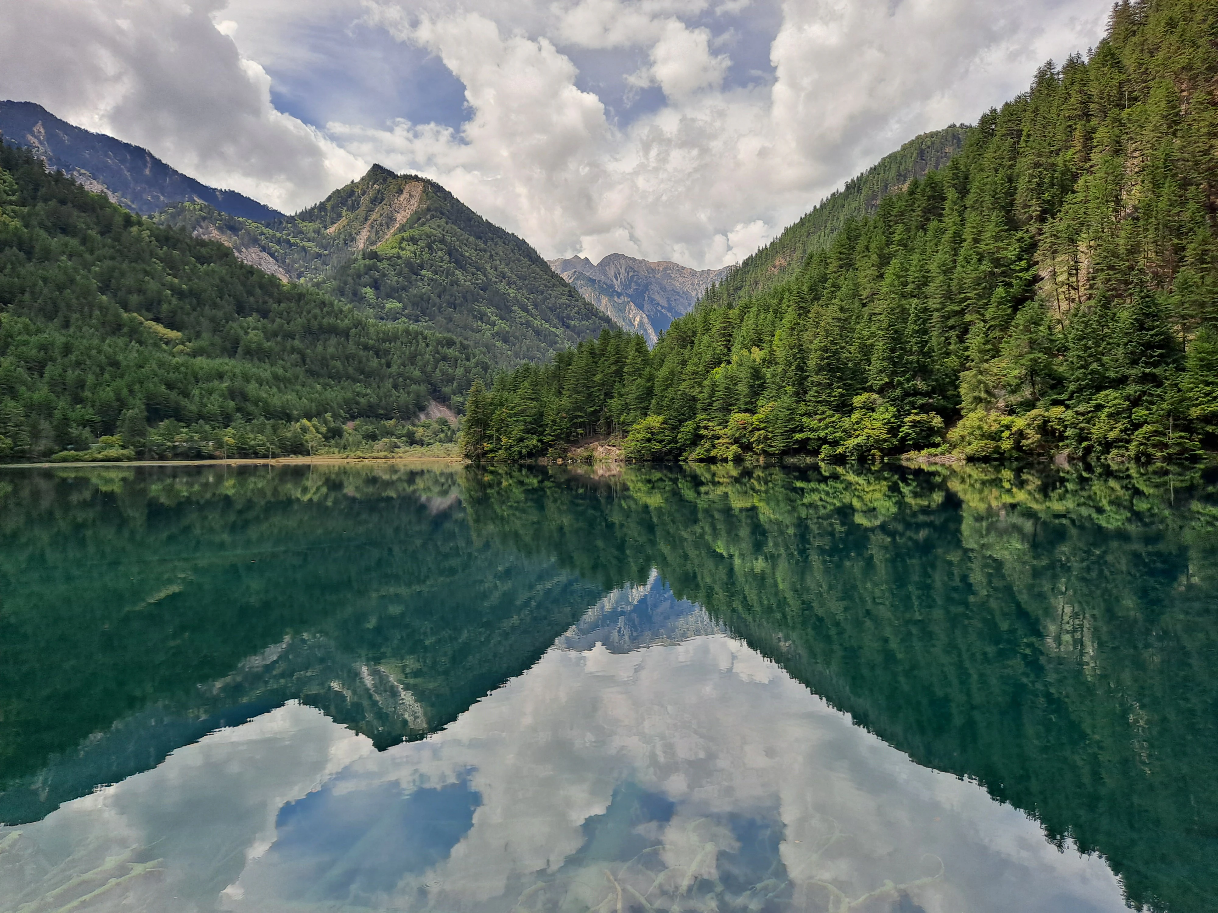
A wide, scenic view of Mirror Lake, where the deep green water creates a near-perfect mirror reflection of the steep, forested mountains and cloudy sky above.
A perfect reflection of the surrounding mountains and forests in the clear water of Mirror Lake at Jiuzhaigou National Park.

Jiuzhaigou Valley wildlife and species highlights

Jiuzhaigou is home to a notable concentration of large mammals characteristic of the Min Mountains, including species that are emblematic of conservation in China. The giant panda is one of the most important flagship species, owing its year-round residence in the valley in part to the abundant arrow bamboo that carpets shaded slopes. The reserve also supports the golden snub-nosed monkey and the white-lipped deer, two further icons of China's mountain biodiversity.

Beyond these flagship species, the park harbors a wider community of forest wildlife typical of subalpine Sichuan ecosystems. Mixed and coniferous forests provide habitat for a range of small mammals, while the wetlands and lake margins host waterbirds, amphibians, and aquatic invertebrates that thrive in the clean, cold waters of the travertine pools. The combination of intact forest, intact wetland, and limited historical hunting within the protected core has allowed the valley to retain a richer and more diverse fauna than many surrounding landscapes, contributing to its scientific as well as its scenic value.
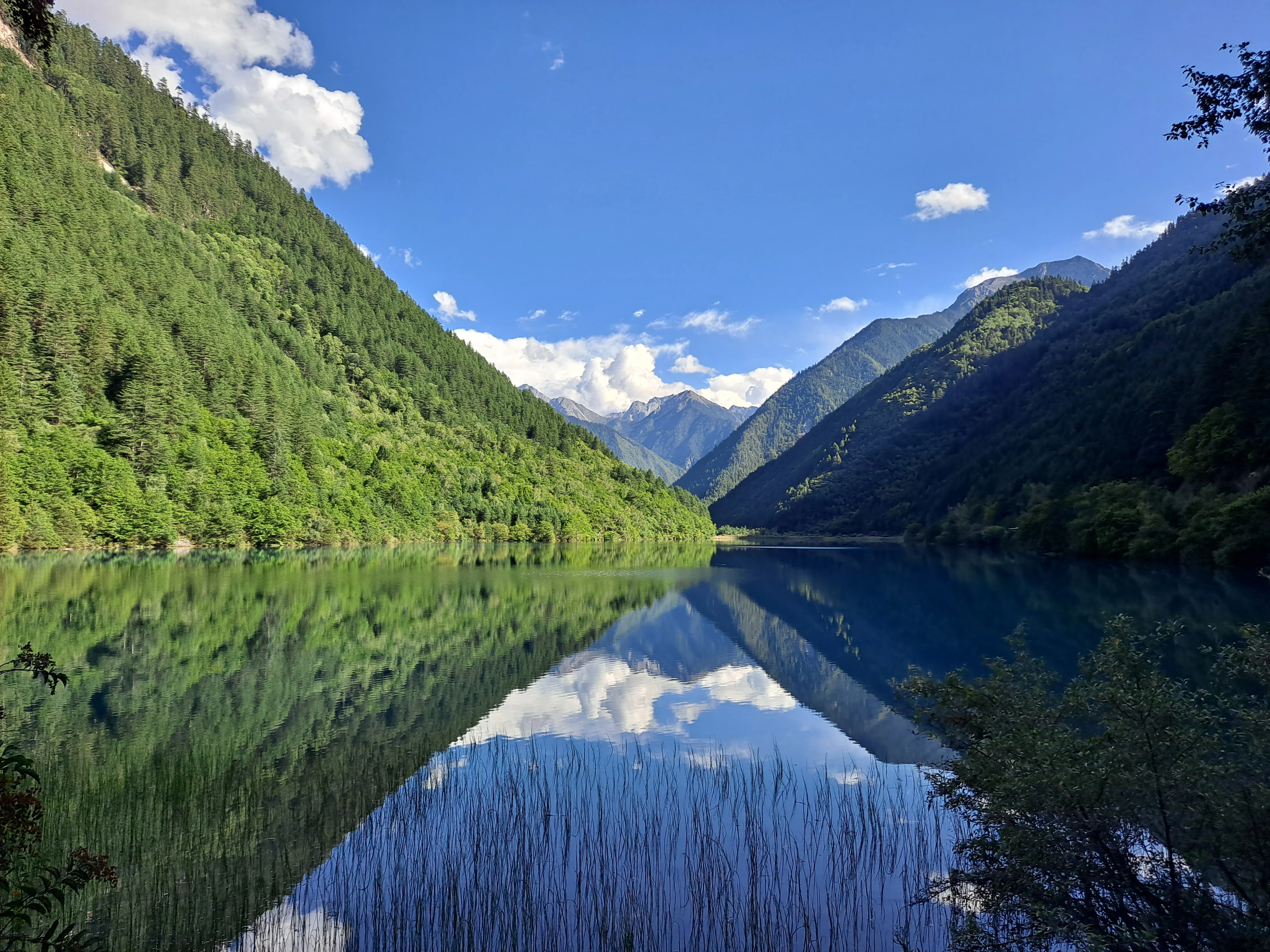
A wide shot of a calm mountain lake mirroring the forested green hills and blue sky above, with tall reeds emerging from the water in the foreground.
The tranquil waters of Rhino Lake reflecting the surrounding mountains and forest in Jiuzhaigou National Park.

Jiuzhaigou Valley conservation status and protection priorities

Jiuzhaigou is one of China's most important high-altitude conservation units, recognized at multiple levels of national and international protection. It was formally established as a national nature reserve in 1978 following years of advocacy by scientists and journalists concerned about logging, and since then has been steadily upgraded in status and management capacity. Designations now include national nature reserve, National Key Scenic Area, national geopark, Man and the Biosphere reserve, and UNESCO World Natural Heritage Site.

Conservation significance runs on several axes. Geologically, the valley preserves a textbook example of high-altitude karst and travertine lake formation, with step-wise barrier lakes that took thousands of years to build. Hydrologically, it anchors a freshwater system whose headwaters ultimately feed the Yangtze River. Ecologically, the integrity of its old-growth forest and bamboo understorey supports rare species that depend on unbroken habitat. The park's layered designations reflect the recognition that all three of these values must be managed together, and management policies for decades have aimed to retire logging, remove in-valley hotels, retire steps, and limit visitor use in order to protect the very features that make the landscape famous.

Jiuzhaigou Valley cultural meaning and human context

The cultural identity of Jiuzhaigou is inseparable from the Tibetan communities who have lived in and around the valley for generations. The park's name itself comes from the historical settlement of nine Tibetan villages across the three main gullies: Shuzheng, Heye, Zechawa, and others, each with its own traditions and Buddhist practices. Prayer wheels turn at Shuzheng village, monasteries mark the surrounding cultural landscape, and Tibetan language, dress, and customs remain visible elements of daily life in Jiuzhaigou County and Zhangzha Town, which administratively envelops the scenic area.

The valley's cultural heritage is deeply tied to its natural setting. The mineral-rich waters and the surrounding mountains hold spiritual significance, and Tibetan life has long been organized around the lakes, forests, and seasonal rhythms of the Min Mountains. Recognition of this intertwined human and ecological history is part of why Jiuzhaigou was inscribed both as a natural heritage site and as a Man and the Biosphere reserve, the latter honoring the long-standing relationship between local Tibetan communities and the landscape they have helped shape.
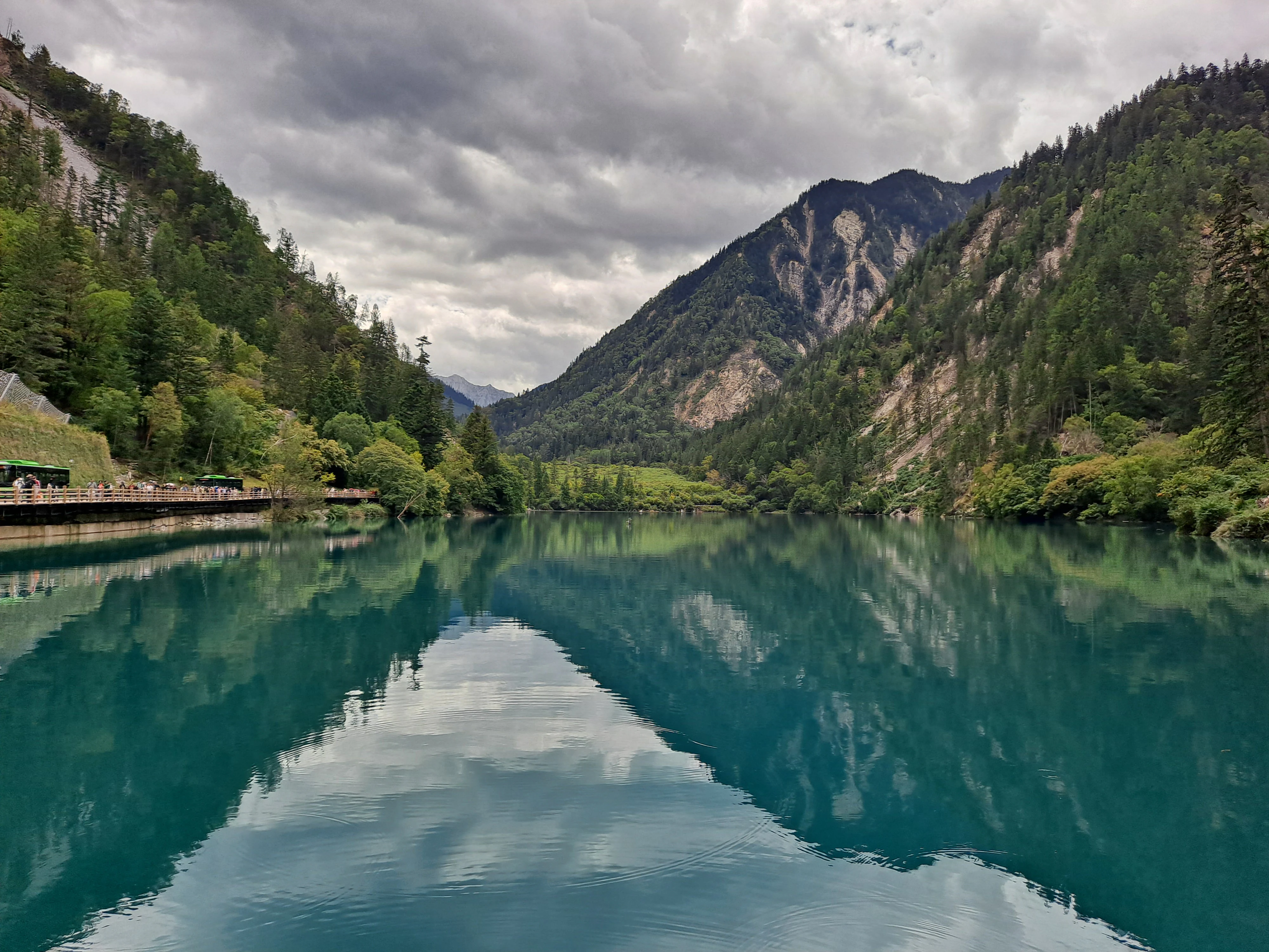
A wide shot of a calm, turquoise lake surrounded by steep, forested mountains under a cloudy sky; a wooden boardwalk is visible on the left bank.
The turquoise waters of Panda Lake reflect the surrounding forested mountains in Jiuzhaigou National Park.

Top sights and standout views in Jiuzhaigou Valley

Three features carry most of Jiuzhaigou's reputation. First, the terraced travertine lakes, especially Five Flower Lake, whose shifting palette of blues, greens, and yellows has become the park's visual emblem. Second, the broad tiered waterfalls at Nuorilang and Pearl Shoal, where the same mineral-rich water that builds the lakes flows across wide, pale carbonate ledges. Third, the seasonal drama of the forest, in which mixed broadleaf stands turn brilliant red and gold each autumn against the dark evergreen backdrop, intensifying the contrast between water, rock, and forest.

Set against these comes the presence of flagship species like the giant panda, golden snub-nosed monkey, and white-lipped deer, whose overlapping ranges in a single accessible reserve give the park unusually strong biodiversity credentials for a landscape of its fame. The combination of clear lakes, white stone terraces, colored foliage, snow peaks, and living Tibetan village culture justifies Jiuzhaigou's standing as one of China's most visited and most carefully managed natural areas.
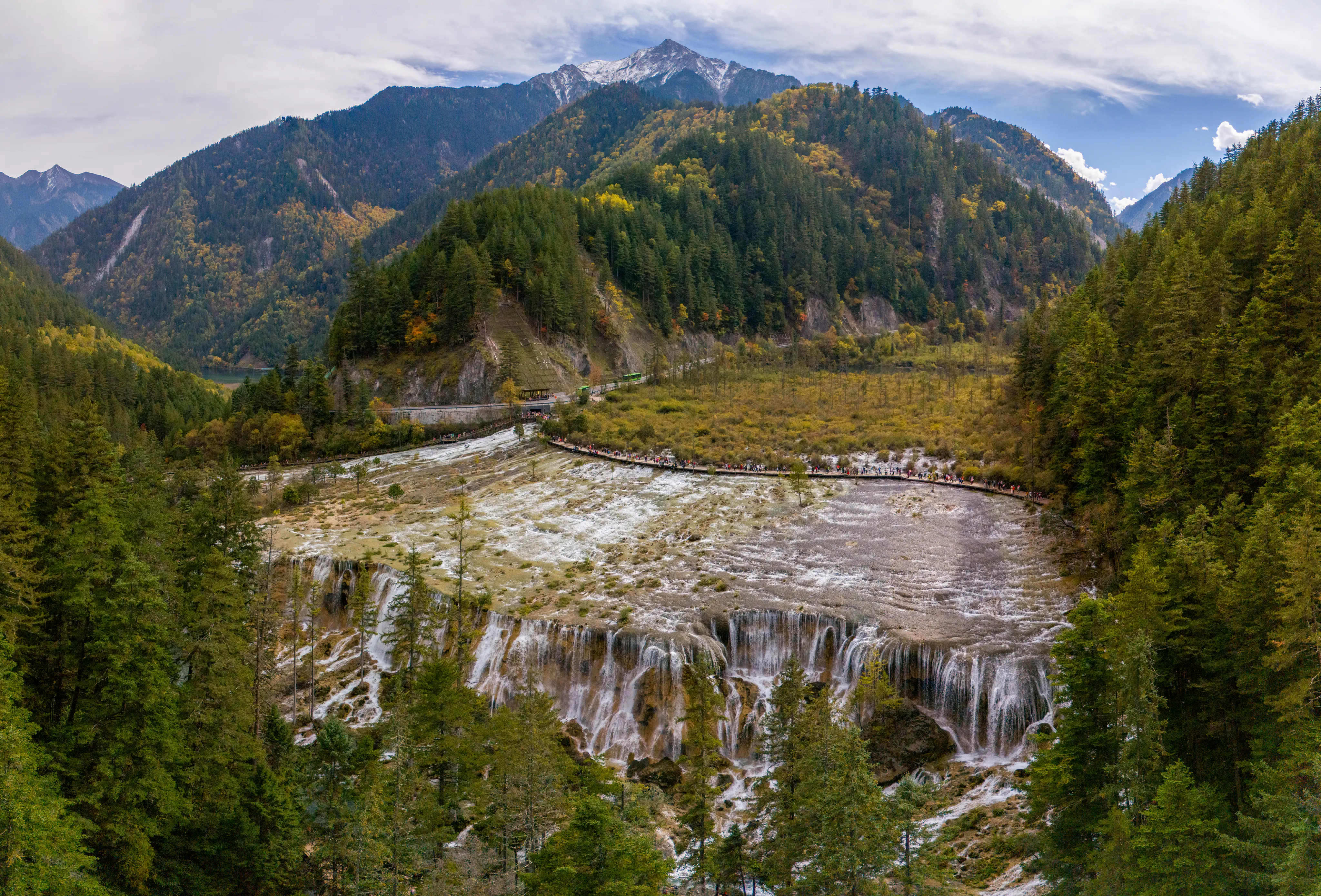
A wide, high-angle landscape shot of Pearl Shoal Falls in Jiuzhaigou, featuring a broad, shallow waterfall cascading over terraced rock steps surrounded by dense coniferous forest and towering, snow-dusted mountains under a cloudy sky.
A wide, elevated view of Pearl Shoal Falls, showcasing the expansive, tiered cascading water and the forested mountain valley of Jiuzhaigou.

Best time to visit Jiuzhaigou Valley

Jiuzhaigou has a cool, high-altitude climate that shapes its seasonal character. Spring brings melting frost and thawing soils, with cool daytime temperatures that hover in the teens Celsius; summer is the green, lush season, with mild daytime temperatures and cool nights, alongside the year's rainiest months in July and August. Winter freezes almost all of the lakes solid, with the notable exception of Five Flower Lake, whose subterranean springs keep a pocket of unfrozen water even in the coldest weeks.

Autumn is widely regarded as the most striking season at Jiuzhaigou. Cooling temperatures produce large day-to-night swings, and the broadleaf component of the mixed forest turns red, orange, and gold for several weeks, framing the blue-green lakes with vibrant color. Travelers seeking the park's most iconic combinations of forest color and reflective water tend to favor these autumn weeks, while summer is more typical for visitors who prefer full greenery and a wider window of mild weather.
Monthly climate preview

Measured monthly weather rhythms and representative coordinate climatology for Sichuan

Jiuzhaigou Climate Normals, Long Term Temperature and Precipitation Patterns

Long term climate data for Jiuzhaigou records average monthly temperatures ranging from sub-zero winter lows to milder summer peaks alongside distinct annual precipitation shifts. Analyzing these detailed twelve month weather patterns provides clear insight into the environmental conditions shaping this protected high elevation landscape.
Annual mean3 °C
-7 °C12 °C
Jan-7°
Feb-4°
Mar-1°
Apr
May
Jun10°
Jul12°
Aug11°
Sep
Oct
Nov-2°
Dec-6°
Warmest month
July

11.7 °C

Coolest month
January

-7.1 °C

Wettest month
July

3.8 mm/day

Driest month
December

0.1 mm/day

Park location guide

Geography guide, regional context, and park location map for Jiuzhaigou Valley

Jiuzhaigou Valley park geography, regions, and map view in China

Understand where Jiuzhaigou Valley sits in China through a broader geographic reading of the surrounding landscape, nearby location context, and its mapped position within the national park landscape.

How Jiuzhaigou Valley fits into China

China is a unitary communist state in East Asia, governed by the Chinese Communist Party. The country's capital is Beijing, while Shanghai is the largest city by urban population. China has 33 province-level divisions including provinces, autonomous regions, municipalities, and special administrative regions. The nation has a long history spanning thousands of years, with achievements including the invention of gunpowder, paper, printing, and the compass.

Wider geography shaping Jiuzhaigou Valley in China

China is located in East Asia, bordering fourteen countries: Russia, North Korea, Vietnam, Laos, Myanmar, India, Bhutan, Nepal, Pakistan, Afghanistan, Tajikistan, Kyrgyzstan, Kazakhstan, and Mongolia. The country spans diverse terrain including deserts, mountains, plateaus, and river valleys. Major river systems include the Yellow River and Yangtze River. The coastline stretches along the East China Sea, South China Sea, and Yellow Sea.

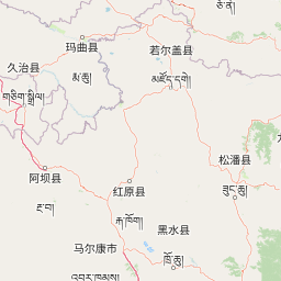
Map view of Jiuzhaigou Valley

Use this park location map to pinpoint Jiuzhaigou Valley in China, understand its exact geographic position, and read its mapped placement within the surrounding landscape more clearly.

Pigeon | © OpenStreetMap contributors

Location context for Jiuzhaigou Valley

Sichuan
Recorded earthquake history

Explore the Historical Earthquake Data for Jiuzhaigou National Park

Review the recorded seismic history associated with the valleys and ridges of Jiuzhaigou. This MoriAtlas catalogue provides structured access to historical earthquake data, including magnitude and location metrics, for those researching seismic activity in this Sichuan alpine region.

Jiuzhaigou Earthquake History

Catalogued events

44 events

Strongest magnitude

Magnitude 6.9

Most recent event

Sep 4, 2021

This history includes earthquakes recorded inside the park or within 50 km of its borders

Explore national park photography showcasing travertine lakes, waterfalls, and mountain forest habitats.

Jiuzhaigou Photos and Protected Landscape Scenery: Visualizing the Alpine Valleys

Visual records capture the distinctive three-valley terrain, cascading travertine pools, and subalpine coniferous forest defining Jiuzhaigou. Examining protected area imagery provides a clear spatial reference for understanding regional ecosystems and valley landforms.

A clear, turquoise-colored lake filled with submerged tree trunks, surrounded by autumn forests with yellow and orange leaves under a blue sky.

A wide, multi-tiered waterfall flows over rocky, moss-covered ledges, surrounded by a dense coniferous forest in an autumn valley with snow-capped peaks in the background.

An elevated, wide-angle view of the iconic Nuorilang Waterfall flowing from a deep blue-green lake, set within a lush, forested valley in the mountains during autumn.

A wide, scenic view of Mirror Lake, where the deep green water creates a near-perfect mirror reflection of the steep, forested mountains and cloudy sky above.

A wide shot of a calm mountain lake mirroring the forested green hills and blue sky above, with tall reeds emerging from the water in the foreground.

Visitors walking through the paved plaza of the Jiuzhaigou National Park entrance, with a large, modern arched structure and a domed visitor building set against steep, forested mountains.

A wide shot of a calm, turquoise lake surrounded by steep, forested mountains under a cloudy sky; a wooden boardwalk is visible on the left bank.

A wide, high-angle landscape shot of Pearl Shoal Falls in Jiuzhaigou, featuring a broad, shallow waterfall cascading over terraced rock steps surrounded by dense coniferous forest and towering, snow-dusted mountains under a cloudy sky.

A clear, bright turquoise lake surrounded by green trees, with several submerged tree trunks visible beneath the water surface.

A wide view of a tranquil river winding through a grassy meadow surrounded by dense evergreen forests and mountain slopes under a cloudy sky.

A clear, turquoise-colored pond surrounded by a rocky shore and a dense, green forest under a cloudy sky.

A wide view of a multi-tiered waterfall cascading into a calm turquoise lake, surrounded by forested mountains displaying autumn foliage and misty peaks.

A clear, brilliant turquoise pool surrounded by rocky shores and a thick evergreen forest in Jiuzhaigou National Park.

A wetland area called Penjing Shoal featuring shallow pools of water, small shrubs, and grass, set against a steep, densely forested hillside exhibiting vibrant autumn colors of yellow, orange, and deep green.

Panoramic view of traditional wooden buildings in Shuzheng Village at the base of a forested mountain slope in autumn.

A wooden boardwalk pathway leads along the shore of a vibrant blue lake with mountain slopes and forest in the background.

Park atlas

Compare regional alpine reserves and connected mountain landscapes across the surrounding region.

Explore Protected Areas and National Parks Near Jiuzhaigou

Browse other national parks and protected areas sharing the rugged terrain and high-elevation ecosystems of the Min Mountains. Comparing adjacent reserves reveals the broader conservation geography connecting Jiuzhaigou to neighboring mountain valleys.
National parkChina
Park boundaries overlap#1 closest

Southeast

Giant Panda National Park: China's Premier Panda Habitat and Protected Landscape

Mapped terrain and conservation significance in the mountains of western China.

Giant Panda National Park is a critically important protected area in China, established to conserve the primary habitat for the giant panda. This national park, spanning a vast mountainous region across Sichuan, Gansu, and Shaanxi, integrates numerous former reserves into a unified landscape. It serves as a vital sanctuary, protecting approximately 80 percent of the world's wild panda population and offering deep insights into the geographic distribution and ecological requirements of these endangered animals.

Area
27,134 km²
Established
2020
IUCN
II
Relief
Mountain
A soft, watercolor painting of a terraced landscape with shallow pools, grassy slopes, and distant tree-lined hills.
Protected areaSichuan
Park boundaries overlap#2 closest

South

Huanglong Scenic and Historic Interest Area: Protected Alpine Landscapes and Travertine Map

High-altitude karst geography in the Minshan Mountains of Sichuan

Huanglong Scenic and Historic Interest Area presents a unique geological profile centered on a long valley of stepped travertine pools that cascade through alpine forests and meadows. This protected area offers a distinct look at the high-mountain geography of Sichuan, providing a clear view of how mineral-rich springs, deep canyons, and glaciated summits create a layered and ecologically significant environment for rare wildlife.

Area
600 km²
Established
1992
Nature reserveSichuan
187 km away#3 closest

South

Wolong National Nature Reserve: Mapping Sichuan's Rugged Mountain Protected Lands

A critical mountain nature reserve in the Qionglai range.

Delve into the geography of Wolong National Nature Reserve, a cornerstone of China's protected areas. This site offers insight into the vertical ecology of the eastern Qionglai Mountains, where steep river valleys and extensive bamboo forests characterize the transition toward the Tibetan Plateau. Access map-based insights into this essential wildlife corridor and its role in the larger regional landscape.

Area
2,000 km²
Established
1963
Relief
Mountain
Climate
Alpine
Nature reserveChina
About 334 km away#4 closest

East

Changqing Nature Reserve: Mountain Forest Geography and Conservation Mapping

A vital Qinling Range protected area in Shaanxi Province, China

This reserve provides a deep look at the biodiversity of the Qinling Mountains, featuring steep terrain, bamboo-rich slopes, and vital forest river corridors. It serves as a globally recognized model for protected area management and provides a habitat for rare species within its vertical landscape.

Area
300 km²
Established
1995
Relief
Mountain
Access
Access unknown
National parkQinghai
351 km away#5 closest

West

Sanjiangyuan National Park: Qinghai's High-Altitude Headwater Protected Landscape

Mapped geography of the Yellow, Yangtze, and Mekong river sources.

Sanjiangyuan National Park, situated in the high-altitude Qinghai region of China, is a crucial protected area established to safeguard the headwaters of three of Asia's most significant rivers: the Yellow, Yangtze, and Mekong. Covering an immense area with an average elevation exceeding 4,700 meters, the park preserves vital alpine wetlands, grasslands, and the source ecosystems that sustain hundreds of millions downstream. Its protected landscape identity is defined by its extreme elevation, vast marshlands, and its role as a critical water source, offering unparalleled opportunities for geographic and atlas-style exploration of pristine high-altitude terrain.

Area
190,700 km²
Established
2021
IUCN
II
Relief
Highland
A minimalist watercolor painting featuring soft, abstract layers of rolling green hills in the midground and pale, hazy mountain peaks in the background, set against a light background.
Nature reserveSichuan
About 613 km away#6 closest

Southwest

Sichuan Yading National Nature Reserve: Mapped Protected Landscapes in Western Sichuan

High altitude terrain, glaciated peaks, and alpine geography.

Sichuan Yading National Nature Reserve is a significant protected area in the Garzê Tibetan Autonomous Prefecture, home to the Three Holy Mountains and extensive glacial features. This entry details the reserve geography, focusing on the distribution of alpine meadows, high elevation forests, and the dramatic vertical landscape carved by the Litang River tributaries.

Area
3,815.06 km²
Established
1996
Relief
Mountain
Climate
Alpine
Nature reserveZhaotong
About 613 km away#7 closest

South

Dashanbao Black-necked Crane National Nature Reserve Geographic and Atlas Overview

Protected highland wetlands within the Zhaotong regional geography.

Dashanbao Black-necked Crane National Nature Reserve is a nationally significant protected area in Zhaotong, representing a rare high-elevation wintering habitat for migratory cranes. This rugged plateau landscape features shallow marshlands, alpine grasslands, and an interconnected system of lakes that support delicate highland ecological zones. Use this atlas resource to understand the park terrain and its formal conservation boundaries within the broader context of northeast Yunnan.

Area
192 km²
Established
1990
Relief
Mountain
Climate
Subtropical
Protected areaHunan
729 km away#8 closest

Southeast

Wulingyuan Scenic and Historic Interest Area: Quartz-Sandstone Peak Forest and Protected Geography

Explore the tectonic landscape and forest-covered plateau in Hunan Province.

Wulingyuan Scenic and Historic Interest Area represents a massive protected landscape in Hunan, China, defined by its extraordinary density of quartz-sandstone pillars. This atlas record documents the geological signature of these vertical rock formations, the surrounding gorge networks, and the high-canopy forest environment that characterizes this significant regional landform.

Area
264 km²
Established
1982
Relief
Mountain
Climate
Subtropical

Common questions about visiting, size, designation, and location context for Jiuzhaigou Valley

Jiuzhaigou Valley FAQs for park facts, access, geography, and protected area context

Find quick answers about Jiuzhaigou Valley, including protected-area facts, park geography, trail and visitor context, and how the park fits into its surrounding country and regional landscape.
MoriAtlas Explorer

Continue Your Protected Areas Search Across the Global Atlas

Deepen your exploration by continuing the structured search for national parks and protected areas worldwide. Utilize the comprehensive filtering capabilities to compare different conservation landscapes and refine your understanding of global park geography. Discover more about the distribution and characteristics of protected natural areas.

Global natural geography