
Mori Atlas logo
Wildlife reserveJohn Muir Wilderness

A vast mountain wilderness spanning California with high-elevation glacial basins and peaks

John Muir Wilderness: Mapping the High Sierra Nevada Granite Landscape and Protected Alpine Terrain

John Muir Wilderness preserves one of the most concentrated collections of high-elevation landforms in the United States. Spanning the Sierra Nevada crest, this expansive protected area showcases dramatic granite peaks, deep glacial canyons, and a vast network of alpine lakes. The geography serves as a critical link for high-altitude ecosystems, stretching across the Inyo and Sierra National Forests to define the rugged character of the eastern California high country.

wilderness areaSierra Nevadaalpine landscapegranite peaksglacial lakessubalpine meadows
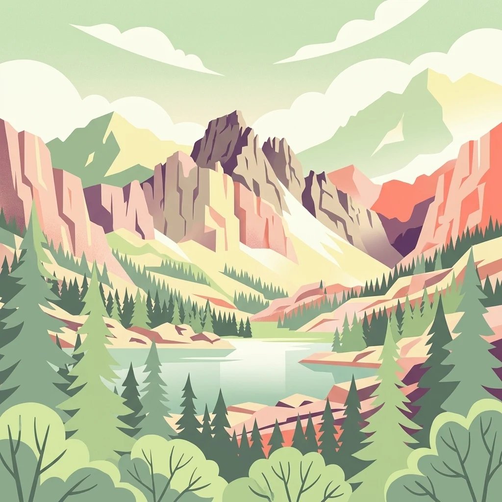
A stylized vector illustration featuring jagged mountain peaks behind a calm lake, surrounded by a coniferous forest under a soft sky.

John Muir Wilderness

Wildlife reserve

Park overview

Structured park overview, official facts, and landscape profile for John Muir Wilderness

John Muir Wilderness park facts, protected area profile, and essential visitor context

Review the core facts for John Muir Wilderness, including designation, size, terrain, visitor scale, habitats, and operating context in one park-focused overview.

About John Muir Wilderness

The John Muir Wilderness occupies a central place in the geography of the Sierra Nevada. It runs for approximately 90 miles along the Sierra crest, stretching from the Mammoth Lakes and Devils Postpile area in the north to Cottonwood Pass near Mount Whitney in the south. On its eastern flank, the wilderness follows the dramatic escarpment that drops from the high crest down toward the Owens Valley, while on the west it extends through forested slopes toward the Monarch Wilderness and the high country edging Kings Canyon National Park.

The landscape is overwhelmingly shaped by granitic rocks of the Sierra Nevada Batholith, exposed and reshaped by repeated glacial episodes. The high country is studded with sharp peaks, broad cirques, U-shaped valleys, and the polished basins that today hold hundreds of clear alpine lakes. The wilderness contains the southernmost glacier in the United States, the Palisade Glacier, and a network of deeply glaciated canyons drained by streams such as Rock Creek, McGee Creek, and Bishop Creek.

Ecologically, the John Muir Wilderness is one of the most important alpine ecosystems in the country. It hosts the largest contiguous expanse above 10,000 feet in the continental United States, with extensive subalpine meadows, fellfields, and whitebark and foxtail pine stands above 10,800 feet, lodgepole pine forests through the mid-elevations, and Jeffrey pine woodlands below. Wildlife includes yellow-bellied marmots, pikas, Clark's nutcrackers, golden trout, black bears, and Sierra Nevada bighorn sheep, which benefit from specially designated zoological areas within the wilderness.

The wilderness is also a recreational landmark, offering nearly 600 miles of hiking trails, including the John Muir Trail and the Pacific Crest Trail. It is the second most-visited wilderness in the United States, with overnight quotas in place at most trailheads to balance heavy use with protection of its fragile high-country environment.

Quick facts and research context for John Muir Wilderness

The John Muir Wilderness is a federally protected wilderness area located in the Sierra Nevada of California and managed by the U.S. Forest Service. It spans parts of four California counties: Fresno, Inyo, Mono, and Madera.

It was established in 1964 under the Wilderness Act and encompasses roughly 653,000 acres of high-mountain terrain. The wilderness is notable for housing 57 peaks above 13,000 feet, hundreds of glacial lakes, the country's southernmost glacier, and the largest continuous block of land above 10,000 feet in the continental United States.

Park context

Deeper park guide and search-rich context for John Muir Wilderness

John Muir Wilderness history, landscape, wildlife, and travel context

Explore John Muir Wilderness through its history, landscape character, ecosystems, wildlife, conservation priorities, cultural context, and seasonal travel timing in a structured park guide built for atlas discovery and search intent.

Why John Muir Wilderness stands out

The John Muir Wilderness is best known for its dramatic high Sierra scenery, including some of the highest and most rugged peaks in the range. Mount Whitney, the tallest mountain in the contiguous United States, lies within or directly adjacent to the wilderness, alongside Mount Williamson, the Palisades, and Mount Humphreys. Equally important to its identity are the deep glacial canyons on the east side of the range and the extraordinary concentration of alpine lakes formed by Pleistocene glaciation. These features, combined with the area's large contiguously high-elevation landscape above 10,000 feet, give the John Muir Wilderness its distinctive character as one of the premier alpine wildernesses in North America.
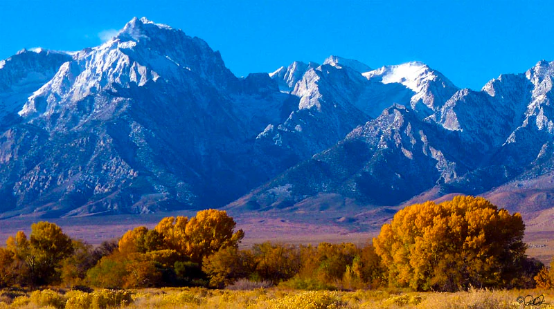
A panoramic view of the snow-capped Eastern Sierra Nevada mountains in the background, with bright yellow autumn trees in the foreground.
Mount Williamson and the Eastern Sierra Nevada rising above the valley floor.

John Muir Wilderness history and protected-area timeline

The John Muir Wilderness was established on January 1, 1964, under the Wilderness Act, which set a new national framework for protecting undeveloped federal lands. It was named after John Muir, the Scottish-American naturalist whose writings, including his work on the Sierra Nevada, were instrumental in building American support for wildland conservation and the creation of the National Park Service.

The area's existing landscape long predates its formal designation. The granitic backbone of the Sierra Nevada was uplifted and shaped over millions of years before being further sculpted by Pleistocene glaciers, which carved the cirques, basins, and lake-filled valleys that define the region today.

Since 1964, the wilderness has been managed by the U.S. Forest Service, principally within the Inyo and Sierra National Forests. Over time, growing visitor interest has required the gradual introduction of overnight quotas at most trailheads, recognizing the wilderness's national prominence as a destination for backpackers and high-country travelers.

John Muir Wilderness landscape and geographic character

The John Muir Wilderness presents one of the most concentrated collections of high Sierra landforms in California. The Sierra crest runs through its center as a long, serrated ridge of granite, while the eastern escarpment rises abruptly from 6,000 to 8,000 feet at its base to peaks between roughly 12,000 and 14,000 feet within only a few horizontal miles.

The terrain is overwhelmingly granitic. The exposed rock of the Sierra Nevada Batholith has been sharpened by glacial action into spires, arêtes, and broad cirques. Mount Whitney, the highest peak in the contiguous United States, anchors the southern end of the range. Mount Williamson rises in a single sweeping wall of granite from the floor of the Owens Valley, while the Palisades form a jagged northern cluster of alpine rock. Mount Humphreys adds another dramatic summit to the east of the main crest.

Glaciation continues to define the visible landscape. U-shaped valleys, hanging tributaries, polished basins, and the Palisade Glacier, the southernmost glacier in the United States, illustrate how powerfully ice has reshaped the wilderness. Canyons such as those of Rock Creek, McGee Creek, and Bishop Creek have been cut deeply into the eastern face of the range and serve as major drainage routes out of the high country.
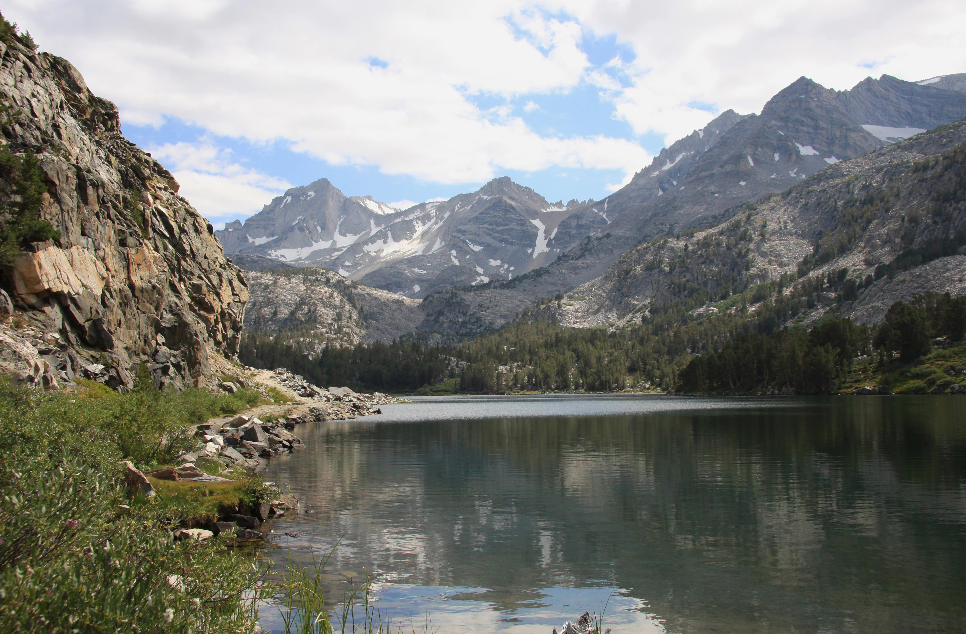
An alpine lake with calm, reflective water surrounded by rocky cliffs, pine trees, and snow-capped peaks in the background under a partly cloudy sky.
A scenic view of Long Lake nestled within the high alpine terrain of the Little Lakes Valley in the John Muir Wilderness.

John Muir Wilderness ecosystems, habitats, and plant life

The John Muir Wilderness contains the largest contiguous expanse of land above 10,000 feet in the continental United States, giving it an unusually coherent high-elevation ecological identity. This vertical world stretches from montane forest floors below into the alpine zone above the tree line.

At the highest elevations, above roughly 10,800 feet, the wilderness supports subalpine meadows and fellfields interspersed with sparse, wind-shaped stands of whitebark pine and foxtail pine. Between about 9,000 and 10,800 feet, lodgepole pine dominates vast tracts of forest, much of it shaped by past fire regimes. Below this band, the slopes are cloaked in Jeffrey pine forests that grade into the broader mixed conifer woodlands of the Sierra slopes.

The combination of elevation, glaciation, and climatic gradients makes the wilderness a stronghold of alpine and subalpine ecosystems in California. Wet meadows and lake margins thread through the basins, providing rich habitat for pollinators, small mammals, and migratory birds, while the rocky ridges and talus slopes support specialized alpine flora adapted to harsh, short-growing-season conditions.
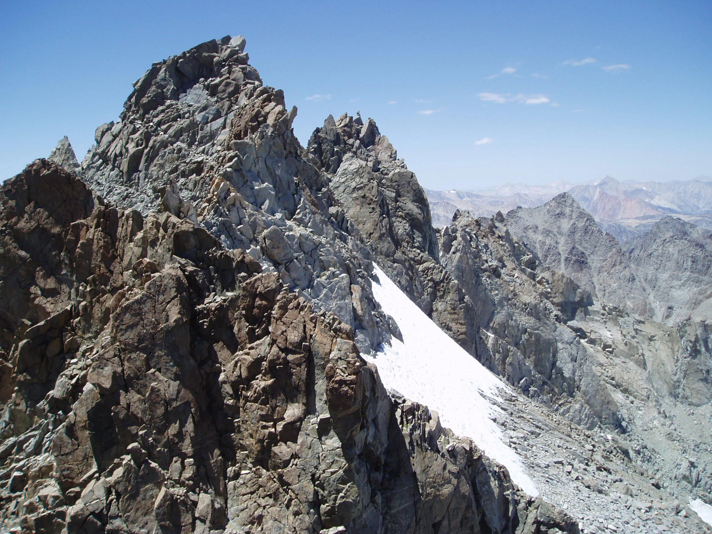
A high angle view of jagged, rocky mountain peaks with a patch of snow visible on the steep slope.
The rugged peaks and snowfields of the Palisade Crest in the John Muir Wilderness.

John Muir Wilderness wildlife and species highlights

Wildlife in the John Muir Wilderness reflects the strong vertical zonation of its habitats. In the rocky alpine and subalpine zone, characteristic species include yellow-bellied marmots, pikas, and golden-mantled ground squirrels, all well adapted to cold winters and short summers. These small mammals are familiar presences along trails and talus slopes.

The forests and meadows host Clark's nutcrackers and other high-elevation birdlife, while the wilderness's many lakes and streams support populations of golden trout, a fish strongly associated with Sierra alpine waters. Black bears are resident throughout the forested elevations, taking advantage of seasonal berry crops, carrion, and stored foods.

A particularly important feature is the presence of designated zoological areas for Sierra Nevada bighorn sheep, a rare species whose survival depends heavily on the open, rugged terrain preserved within and around the wilderness.
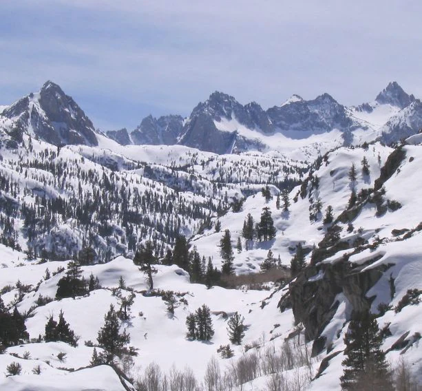
Wide view of rugged, snow-dusted Sierra Nevada mountain peaks rising above a subalpine forest blanketed in winter snow.
A snow-covered alpine landscape in the Sabrina Basin of the John Muir Wilderness.

John Muir Wilderness conservation status and protection priorities

The John Muir Wilderness holds a prominent position in the American wilderness preservation system. Its 1964 designation under the Wilderness Act, the same year the Act itself became law, places it among the earliest and most significant units of the National Wilderness Preservation System.

From a conservation standpoint, the wilderness's value is exceptional because of the scale and continuity of its high-elevation landscape. The largest contiguous area above 10,000 feet in the contiguous United States lies within its boundaries, supporting ecological processes that depend on large, unbroken blocks of habitat, from subalpine forest and meadow communities to alpine rock and ice environments.

The wilderness is also a refuge for sensitive species, particularly Sierra Nevada bighorn sheep, whose designated zoological areas reflect ongoing efforts to protect and recover populations in the high Sierra. Because it is one of the most heavily visited wildernesses in the country, active management by the U.S. Forest Service, including overnight permit quotas at trailheads, plays a critical role in balancing recreational use with the long-term protection of its soils, lakes, wildlife, and vegetation.

John Muir Wilderness cultural meaning and human context

The John Muir Wilderness carries a strong cultural identity tied to its namesake, John Muir, whose essays and advocacy in the late 19th and early 20th centuries helped inspire the American conservation movement. His passion for the Sierra Nevada, and especially for the landscapes that now bear his name, gave the wilderness a literary and symbolic resonance that extends well beyond its physical boundaries.

The region also belongs to a wider California outdoor culture, in which high-country travel on trails such as the John Muir Trail and the Pacific Crest Trail is woven into national traditions of wilderness recreation. Indigenous peoples of the Sierra, including Paiute and other groups, had deep relationships with this landscape long before European American arrival, and place names such as Nüümü Hu Hupi reflect that continuing heritage.

Top sights and standout views in John Muir Wilderness

The John Muir Wilderness stands out for the sheer concentration of high Sierra attributes compressed into a single protected area. Within its boundaries are some of the tallest peaks in the contiguous United States, including Mount Whitney, as well as the Palisade Glacier, the country's southernmost active glacier.

Its ecological significance is equally striking, with the largest contiguously high-elevation landscape in the lower 48 states, hundreds of glacial lakes, and large blocks of subalpine and alpine habitat. Combined with nearly 600 miles of trails and its role as a flagship unit of the National Wilderness Preservation System, these features make the John Muir Wilderness one of the defining alpine landscapes of North America.

Best time to visit John Muir Wilderness

The character of a visit to the John Muir Wilderness changes sharply with the seasons. The short summer window, generally from late June or July through September, is the most accessible period for high-country travel, when snow has melted from most trails, alpine lakes are fully thawed, and subalpine meadows are in bloom.

In winter and early spring, conditions are deeply snowy and persist at higher elevations into June and beyond, making winter conditions linger in basins such as Sabrina well into early summer. Late summer brings drier footing, stable weather patterns, and intensely clear skies over the granitic peaks. Wildlife viewing is best when animals are active around meadows and lake margins in the cooler morning and evening hours of summer and early fall.

Monthly climate preview

Long-term representative measurements showing annual temperature and precipitation patterns

John Muir Wilderness Climate Normals, Average Temperature and Precipitation

John Muir Wilderness exhibits a measured annual temperature range from sub-zero winter minimums to warm summer maximums alongside varying monthly precipitation rates. Reviewing the complete twelve-month profile provides detailed climate statistics derived from long-term coordinate sampling.
Annual mean5 °C
-3 °C17 °C
Jan-3°
Feb-3°
Mar-1°
Apr
May
Jun12°
Jul17°
Aug16°
Sep12°
Oct
Nov
Dec-3°
Warmest month
July

16.5 °C

Coolest month
December

-3.4 °C

Wettest month
January

4.1 mm/day

Driest month
August

0.2 mm/day

Park location guide

Geography guide, regional context, and park location map for John Muir Wilderness

John Muir Wilderness park geography, regions, and map view in United States of America

Understand where John Muir Wilderness sits in United States of America through a broader geographic reading of the surrounding landscape, nearby location context, and its mapped position within the national park landscape.

How John Muir Wilderness fits into United States of America

The United States of America is a federal presidential republic and one of the world's largest countries by area and population. It consists of 50 states across a vast territory spanning multiple time zones, with its capital in Washington, D.C. and largest city in New York City. The nation has a diverse economy, influential political system, and significant cultural and military presence globally.

Wider geography shaping John Muir Wilderness in United States of America

The United States occupies a vast territory in North America, bordered by Canada to the north and Mexico to the south. The 48 contiguous states stretch from the Atlantic to the Pacific Ocean, while Alaska occupies the northwestern region and Hawaii is an archipelago in the Pacific. The country encompasses diverse terrain including the Rocky Mountains, Appalachian Mountains, Great Plains, and extensive river systems.

Map view of John Muir Wilderness

Use this park location map to pinpoint John Muir Wilderness in United States of America, understand its exact geographic position, and read its mapped placement within the surrounding landscape more clearly.

Pigeon | © OpenStreetMap contributors

Location context for John Muir Wilderness

California
Natural feature types

Explore the Geological Features and Landforms of the John Muir Wilderness

Navigate the complete set of natural features associated with the John Muir Wilderness. MoriAtlas provides structured geographic data on the peaks, glaciers, and canyons that define this critical section of the Sierra Nevada. Examine the physical terrain and alpine characteristics of this vast wilderness area.
Recorded earthquake history

Explore the Historical Earthquake Catalogue for the John Muir Wilderness

Review the history of recorded seismic activity associated with the high peaks and canyons of the John Muir Wilderness. This MoriAtlas dataset organizes historical earthquake records by location, magnitude, and date to support geographic research and landscape analysis in this Sierra Nevada region.

John Muir Wilderness Earthquake History

Catalogued events

3,914 events

Strongest magnitude

Magnitude 6.4

Most recent event

Aug 14, 2026

This history includes earthquakes recorded inside the park or within 50 km of its borders

Visual reference guide to granite peaks, glacial lakes, and alpine habitats

John Muir Wilderness Photos and High Sierra Landscape Scenery

Visual documentation provides a clear record of high Sierra landforms, granitic spires, and alpine lake basins across the protected terrain. Examining these protected area views helps reveal the distinct geological scale and high-elevation character of the wilderness.

A panoramic view of the snow-capped Eastern Sierra Nevada mountains in the background, with bright yellow autumn trees in the foreground.

A calm, clear lake with rocky shores and pine trees reflects the surrounding jagged Sierra Nevada mountain peaks and a blue sky with white clouds.

An alpine lake with calm, reflective water surrounded by rocky cliffs, pine trees, and snow-capped peaks in the background under a partly cloudy sky.

A high angle view of jagged, rocky mountain peaks with a patch of snow visible on the steep slope.

Wide view of rugged, snow-dusted Sierra Nevada mountain peaks rising above a subalpine forest blanketed in winter snow.

Park atlas

Compare adjacent high Sierra wilderness areas and regional mountain terrain

Explore Parks Near John Muir Wilderness and Surrounding Protected Landscapes

Browse nearby national parks and protected areas sharing the rugged terrain of the eastern Sierra Nevada. Comparing adjacent wilderness landscapes provides broader geographic context for high elevation alpine ecosystems.
A horizontal watercolor painting depicting a mountain range in the background with rolling hills and a winding river or stream in the foreground.
Protected landscapeCalifornia
Park boundaries overlap#1 closest

North

Inyo National Forest: An Atlas of Protected Landscapes and Sierra Nevada Geography

High altitude wilderness and volcanic terrain in Eastern California

Spanning from the arid Owens Valley floor to the 14,000 foot crest of the Sierra Nevada, Inyo National Forest remains a cornerstone of the American West. This protected landscape contains the Ancient Bristlecone Pine Forest, Mount Whitney, and the Mono Inyo volcanic chain, providing a dense geographic record of glacial, tectonic, and ecological diversity across a vast managed corridor.

Area
7,702.71 km²
Established
1907
IUCN
Ib
Relief
Mountain
National parkCalifornia
Park boundaries overlap#2 closest

Southeast

Kings Canyon National Park National Park: California Protected Landscape & Geography Atlas

Mapped park boundaries and regional natural context.

Kings Canyon National Park stands as a key protected national park within California, offering a specific focus for geographic understanding and atlas-based exploration. This page details the park's mapped boundaries and its integration into the broader regional geography of California. For users interested in the distribution of protected lands and the mapping of natural landscapes, Kings Canyon National Park provides a crucial point of study within the comprehensive park atlas.

Area
1,869.25 km²
Established
1890
IUCN
II
Visitors
641K annual
National parkCalifornia
Park boundaries overlap#3 closest

South

Sequoia National Park National Park: Geographic Identity and Protected Landscape Atlas

Explore mapped boundaries and the terrain of this California protected area.

Gain a structured understanding of Sequoia National Park as a protected landscape, focusing on its mapped geographic boundaries and its context within California. This entry provides foundational data for exploring the park's natural terrain and its role in a broader atlas of conservation lands, ideal for users seeking detailed geographic information.

Area
1,635.19 km²
Established
1890
IUCN
II
Visitors
1.2M annual
A soft watercolor painting showing a range of gentle rolling hills and mountains in pale green, yellow, and violet tones against a white background.
Protected landscapeCalifornia
Park boundaries overlap#4 closest

Northwest

Sierra National Forest: Protected Landscapes of the Central California Sierra Nevada

Geography of alpine lakes, conifer forests, and mountain basins

Spanning from 900 to nearly 14,000 feet in elevation, Sierra National Forest protects a massive vertical range of California terrain. Discover its iconic wilderness areas and reservoir-studded landscape, providing a deep look at the geographic connectivity between major national parks in the central Sierra Nevada.

Area
5,300 km²
Established
1893
Relief
Mountain
Climate
Alpine
Watercolor painting of a panoramic mountain landscape with stylized pine trees and soft green meadows.
Protected landscapeCalifornia
6.7 km away#5 closest

South

Sequoia National Forest: Protected Sierra Nevada Geography and Mountain Terrain

A vast protected landscape spanning 1.1 million acres in California

Spanning Tulare, Kern, and Fresno counties, Sequoia National Forest preserves iconic giant sequoia groves across multiple river watersheds. The terrain features vertical relief exceeding 11,000 feet, showcasing a range of ecosystems from chaparral slopes and coniferous forests to glacial cirques and granite spires located within the southern Sierra Nevada range.

Area
4,829.17 km²
Established
1908
Relief
Mountain
Climate
Mediterranean
Wildlife reserveFresno County
About 8 km away#6 closest

Northwest

Kaiser Wilderness: Exploring the Alpine Ridges and Glacial Terrain of the Central Sierra Nevada

A federally protected wilderness area in Fresno County, California.

Kaiser Wilderness offers a dense collection of signature Sierra Nevada landforms, including granite cliffs, subalpine forests, and high-altitude lakes. This wildlife reserve preserves a rugged, glacier-scoured interior that provides a distinct contrast to the surrounding regional landscape of the Sierra National Forest, making it a critical entity for understanding mid-elevation mountain ecology.

Area
92 km²
Established
1976
IUCN
Ib
Relief
Mountain
Watercolor painting showing mountains, a winding river, and green forests in the foreground and background
National parkCalifornia
20 km away#7 closest

Northwest

Yosemite National Park: Protected Landscape Identity and Geographic Atlas Context

Mapped boundaries and regional setting for a key California national park.

Delve into the protected landscape identity of Yosemite National Park, examining its specific geographic features and its place within the broader atlas of California's natural areas. This entry provides detailed context on its mapped boundaries, regional positioning, and significance as a protected natural site, essential for understanding its landscape and conservation geography.

Area
3,070 km²
Established
1890
IUCN
II
Visitors
3.9M annual
Watercolor painting of a lake bordered by a coniferous forest with mountain silhouettes in the distance.
Wildlife reserveTulare County
22 km away#8 closest

South

Jennie Lakes Wilderness in Tulare County: Sierra Nevada Protected Landscape Map

High-country geography and wilderness boundaries

Jennie Lakes Wilderness offers a distinct look at high Sierra Nevada topography, featuring granite ridges, alpine lakes, and deep canyons. This Tulare County reserve acts as a critical transition zone between adjacent national parks, preserving a diverse mix of subalpine forests and rugged mountain peaks within its 10,500 acre boundary.

Area
42.72 km²
Established
1984
IUCN
Ib
Relief
Mountain

Common questions about visiting, size, designation, and location context for John Muir Wilderness

John Muir Wilderness FAQs for park facts, access, geography, and protected area context

Find quick answers about John Muir Wilderness, including protected-area facts, park geography, trail and visitor context, and how the park fits into its surrounding country and regional landscape.
MoriAtlas Explorer

Continue Your Protected Areas Search Across the Global Atlas

Deepen your exploration by continuing the structured search for national parks and protected areas worldwide. Utilize the comprehensive filtering capabilities to compare different conservation landscapes and refine your understanding of global park geography. Discover more about the distribution and characteristics of protected natural areas.

Global natural geography