
Mori Atlas logo
Nearby park discovery

A geographic exploration of protected lands bordering the Sierra Nevada crest

Regional Protected Areas and National Park Landscapes Near John Muir Wilderness

Examine the distribution of protected areas and wild landscapes surrounding the John Muir Wilderness in eastern California. This geographic perspective clarifies the proximity of neighboring high elevation territories and mountain regions, enabling a better understanding of the continuous granite terrain and glacial geography across this sector of the Sierra Nevada.

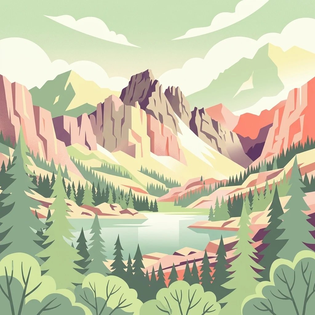
A stylized vector illustration featuring jagged mountain peaks behind a calm lake, surrounded by a coniferous forest under a soft sky.

A high-Sierra wilderness of granite peaks, glacial lakes, and alpine meadows named for naturalist John Muir.

John Muir Wilderness

The John Muir Wilderness is a large federally designated wilderness area that stretches along the crest of the Sierra Nevada in eastern California. Spanning roughly 90 miles of high mountain country, the wilderness connects the Inyo and Sierra National Forests on both sides of the Sierra crest and forms a critical link in one of the most continuous high-elevation landscapes in the lower 48 states. Its terrain is defined by sharp granite peaks, deeply carved glacial canyons, and an extraordinary density of alpine lakes. The wilderness contains the largest contiguous area above 10,000 feet in the continental United States, along with the southernmost glacier in the country. It is named for John Muir, the Scottish-American naturalist whose writing and advocacy helped shape modern American conservation. Today the area is recognized as one of the most significant backcountry landscapes in the United States, valued alike for its geology, its alpine ecosystems, its wildlife, and its long hiking traditions along routes such as the John Muir Trail and the Pacific Crest Trail.

Location
United States of America
Park type
Wildlife reserve
Established
1964
Area
2,641.8 km²
Highest point
4,421 m
John Muir Wilderness Geography and Map
Regional park map

See the ranked park cluster in its geographic setting

Nearby parks around John Muir Wilderness

This regional map shows the same 20 nearby parks ranked below around John Muir Wilderness. Select a ranked marker to highlight that park’s boundary where boundary data is available.
Reference park: John Muir WildernessRanked nearby parkSelected boundary: John Muir Wilderness20 nearby parks shown
20 nearby parks

Distance ranked collection and regional park geography for comparison

Parks and Protected Areas Geographically Near John Muir Wilderness

Browse parks near John Muir Wilderness ordered by direct geographic separation and spatial proximity along regional protected landscapes. Compare surrounding terrain characteristics and environmental data to evaluate patterns across connected mountain ecosystems.
A horizontal watercolor painting depicting a mountain range in the background with rolling hills and a winding river or stream in the foreground.
Protected landscapeCalifornia
Park boundaries overlap#1 closest

North

Inyo National Forest: An Atlas of Protected Landscapes and Sierra Nevada Geography

High altitude wilderness and volcanic terrain in Eastern California

Spanning from the arid Owens Valley floor to the 14,000 foot crest of the Sierra Nevada, Inyo National Forest remains a cornerstone of the American West. This protected landscape contains the Ancient Bristlecone Pine Forest, Mount Whitney, and the Mono Inyo volcanic chain, providing a dense geographic record of glacial, tectonic, and ecological diversity across a vast managed corridor.

Area
7,702.71 km²
Established
1907
IUCN
Ib
Relief
Mountain
National parkCalifornia
Park boundaries overlap#2 closest

Southeast

Kings Canyon National Park National Park: California Protected Landscape & Geography Atlas

Mapped park boundaries and regional natural context.

Kings Canyon National Park stands as a key protected national park within California, offering a specific focus for geographic understanding and atlas-based exploration. This page details the park's mapped boundaries and its integration into the broader regional geography of California. For users interested in the distribution of protected lands and the mapping of natural landscapes, Kings Canyon National Park provides a crucial point of study within the comprehensive park atlas.

Area
1,869.25 km²
Established
1890
IUCN
II
Visitors
641K annual
National parkCalifornia
Park boundaries overlap#3 closest

South

Sequoia National Park National Park: Geographic Identity and Protected Landscape Atlas

Explore mapped boundaries and the terrain of this California protected area.

Gain a structured understanding of Sequoia National Park as a protected landscape, focusing on its mapped geographic boundaries and its context within California. This entry provides foundational data for exploring the park's natural terrain and its role in a broader atlas of conservation lands, ideal for users seeking detailed geographic information.

Area
1,635.19 km²
Established
1890
IUCN
II
Visitors
1.2M annual
A soft watercolor painting showing a range of gentle rolling hills and mountains in pale green, yellow, and violet tones against a white background.
Protected landscapeCalifornia
Park boundaries overlap#4 closest

Northwest

Sierra National Forest: Protected Landscapes of the Central California Sierra Nevada

Geography of alpine lakes, conifer forests, and mountain basins

Spanning from 900 to nearly 14,000 feet in elevation, Sierra National Forest protects a massive vertical range of California terrain. Discover its iconic wilderness areas and reservoir-studded landscape, providing a deep look at the geographic connectivity between major national parks in the central Sierra Nevada.

Area
5,300 km²
Established
1893
Relief
Mountain
Climate
Alpine
Watercolor painting of a panoramic mountain landscape with stylized pine trees and soft green meadows.
Protected landscapeCalifornia
6.7 km away#5 closest

South

Sequoia National Forest: Protected Sierra Nevada Geography and Mountain Terrain

A vast protected landscape spanning 1.1 million acres in California

Spanning Tulare, Kern, and Fresno counties, Sequoia National Forest preserves iconic giant sequoia groves across multiple river watersheds. The terrain features vertical relief exceeding 11,000 feet, showcasing a range of ecosystems from chaparral slopes and coniferous forests to glacial cirques and granite spires located within the southern Sierra Nevada range.

Area
4,829.17 km²
Established
1908
Relief
Mountain
Climate
Mediterranean
Wildlife reserveFresno County
About 8 km away#6 closest

Northwest

Kaiser Wilderness: Exploring the Alpine Ridges and Glacial Terrain of the Central Sierra Nevada

A federally protected wilderness area in Fresno County, California.

Kaiser Wilderness offers a dense collection of signature Sierra Nevada landforms, including granite cliffs, subalpine forests, and high-altitude lakes. This wildlife reserve preserves a rugged, glacier-scoured interior that provides a distinct contrast to the surrounding regional landscape of the Sierra National Forest, making it a critical entity for understanding mid-elevation mountain ecology.

Area
92 km²
Established
1976
IUCN
Ib
Relief
Mountain
Watercolor painting showing mountains, a winding river, and green forests in the foreground and background
National parkCalifornia
20 km away#7 closest

Northwest

Yosemite National Park: Protected Landscape Identity and Geographic Atlas Context

Mapped boundaries and regional setting for a key California national park.

Delve into the protected landscape identity of Yosemite National Park, examining its specific geographic features and its place within the broader atlas of California's natural areas. This entry provides detailed context on its mapped boundaries, regional positioning, and significance as a protected natural site, essential for understanding its landscape and conservation geography.

Area
3,070 km²
Established
1890
IUCN
II
Visitors
3.9M annual
Watercolor painting of a lake bordered by a coniferous forest with mountain silhouettes in the distance.
Wildlife reserveTulare County
22 km away#8 closest

South

Jennie Lakes Wilderness in Tulare County: Sierra Nevada Protected Landscape Map

High-country geography and wilderness boundaries

Jennie Lakes Wilderness offers a distinct look at high Sierra Nevada topography, featuring granite ridges, alpine lakes, and deep canyons. This Tulare County reserve acts as a critical transition zone between adjacent national parks, preserving a diverse mix of subalpine forests and rugged mountain peaks within its 10,500 acre boundary.

Area
42.72 km²
Established
1984
IUCN
Ib
Relief
Mountain
National parkCalifornia
27 km away#9 closest

East

Death Valley National Park: Exploring California's Mapped Protected Landscape

View the geographic boundaries and desert terrain.

Access a detailed atlas perspective of Death Valley National Park, a protected national park situated in California. Understand the park's distinct mapped boundaries and its role within the regional geography. This resource highlights the unique desert landscape, offering focused insights into its protected-area identity and natural terrain for geographic discovery.

Area
13,848.4 km²
Established
1994
IUCN
II
Visitors
1.1M annual
Watercolor painting of a mountain landscape with trees in the midground and a simple river or valley floor in the foreground, executed in a soft, light-toned palette.
Protected areaUnited States of America
About 36 km away#10 closest

Southeast

Inyo Mountains Wilderness: Protected Landscapes and Geographic Features in California

A study of fault block terrain and desert mountain ecosystems.

The Inyo Mountains Wilderness serves as a dramatic ecological bridge between the Owens Valley and Saline Valley. This expansive protected area offers a look into late Proterozoic to Cambrian geology and distinct vertical plant zonation. Mapping the range reveals a network of canyons, ridges, and slopes that sustain endemic biodiversity and ancient bristlecone pine stands within the Great Basin periphery.

Area
806.17 km²
Relief
Mountain
Climate
Arid
Access
Remote access
Wildlife reserveCalifornia
38 km away#11 closest

North

Hoover Wilderness: Protected Alpine Geography in the Central Sierra Nevada, California

High-altitude glacial basins and Sierra crest wilderness

The Hoover Wilderness preserves a vital strip of high-elevation terrain along the eastern Sierra Nevada crest. Characterized by glacier-carved basins, interconnected alpine lakes, and sharp granite ridges, this protected area serves as a primary ecological gateway to the high country. Its landscape features define the headwaters of the Walker River, offering a compact yet significant look at California's protected alpine wilderness.

Area
518.89 km²
Established
1964
IUCN
Ib
Relief
Mountain
A soft watercolor painting of rolling hills and mountain ridges, featuring shades of green, yellow, and faint pink on a white background.
Wildlife reserveCalifornia
48 km away#12 closest

Southeast

Domeland Wilderness: Granite Spires and Kern Plateau Geography in the Southern Sierra Nevada

A protected wilderness landscape on the California high plateau

Spanning over 130,000 acres, Domeland Wilderness offers a deep look into the geological transition zone of the southern Sierra Nevada. The protected landscape is characterized by its iconic granite domes and spires, vast summer range meadows for deer, and the winding course of the Wild and Scenic South Fork Kern River. This atlas entry details the rugged terrain, ridge boundaries, and ecological diversity found across this lightly visited high-altitude wilderness.

Area
526.42 km²
Established
1964
IUCN
Ib
Relief
Mountain
A watercolor painting showing soft green hills, distant pink-hued mountains, and a pale blue lake in a serene, stylized landscape.
Protected landscapeNevada
51 km away#13 closest

Northeast

Humboldt, Toiyabe National Forest: Protected Landscape and Regional Mountain Geography

A vast network of Nevada mountain ranges and alpine wilderness

Humboldt, Toiyabe National Forest serves as a defining public land entity across Nevada and eastern California. As the largest national forest in the contiguous United States, it preserves a striking collection of isolated mountain ranges, including the Ruby Mountains and the rugged Jarbidge wilderness, within a broader basin-and-range landscape. Examine the boundaries and terrain that characterize this complex, high-desert ecosystem.

Area
25,454 km²
Established
1908
Relief
Mountain
Access
Easy access
Watercolor painting of green rolling hills, a tree-lined foreground, and a soft pink sunset sky.
Protected landscapeCalifornia
58 km away#14 closest

Northwest

Stanislaus National Forest: Sierra Nevada Mountain Geography and Protected Wilderness Lands

California mountain terrain and forest landscape map

Stanislaus National Forest is a sprawling protected landscape located in the central Sierra Nevada of California. Characterized by volcanic and granite formations, the area protects critical watersheds, Wild and Scenic rivers, and large swaths of old growth forest that define the rugged mountain interior.

Area
3,634.48 km²
Established
1897
Relief
Mountain
Climate
Temperate
Watercolor painting of a tranquil mountain lake surrounded by pine forests and distant rolling peaks in muted green and pink tones.
Wildlife reserveTuolumne County
79 km away#15 closest

Northwest

Emigrant Wilderness: A Detailed Geographic Atlas of Protected Sierra Nevada Landscapes

Mapping glaciated granite basins and volcanic ridges in Tuolumne County.

Emigrant Wilderness is a sprawling protected area defined by a distinct mix of granitic domes, cirques, and a unique volcanic sector in its northeastern reaches. Spanning from lower forest elevations to alpine peaks, the area provides a window into the complex geological history of the central Sierra Nevada. The terrain includes hundreds of high-country lakes and meadow systems that support diverse alpine ecosystems and represent the rugged nature of the Pacific Crest Trail corridor.

Area
454.37 km²
Established
1974
IUCN
Ib
Relief
Mountain
Wildlife reserveKern County
81 km away#16 closest

Southeast

Kiavah Wilderness: Geographic Overview of the Scodie Mountains Plateau

Protected desert wilderness in Kern County, California

Kiavah Wilderness provides a vital protected landscape in Kern County, defined by the Scodie Mountains and a dramatic escarpment above the Mojave Desert floor. Known for its rare pinyon-juniper woodlands and seasonal springs, this wilderness area preserves the complex geography linking the southern Sierra Nevada to the broader Mojave basin.

Area
357.3 km²
Established
1994
IUCN
Ib
Relief
Mountain
A watercolor illustration showing a soft-focused desert landscape with gentle rolling hills, sparse desert vegetation, and muted earthy tones.
Wildlife reserveKern County
104 km away#17 closest

Southeast

El Paso Mountains Wilderness: Geological Atlas and Protected Landscape Overview

Mojave Desert geography within Kern County, California

Explore the volcanic structure of El Paso Mountains Wilderness, a desert landscape dominated by Black Mountain, red buttes, and narrow canyons. This atlas entry details the protected boundary and geological features of this Mojave Desert wildlife reserve, highlighting the intersection of volcanic badlands and ancient archaeological sites.

Area
96.2 km²
Established
1994
IUCN
Ib
Relief
Mountain
Watercolor painting of a mountain landscape with forested foothills and a valley in the foreground.
Protected landscapeCalifornia
186 km away#18 closest

South

Los Padres National Forest: Geography and Protected Landscape Map of Central California

Extensive wilderness corridors and high mountain ridges

Spanning from the Big Sur coastline to the interior ranges of the Santa Lucia and San Rafael mountains, Los Padres National Forest represents a significant protected area in California. The region contains deep gorges, forest-covered canyons, and high-altitude pine ridges that provide essential habitat and support major river headwaters.

Area
7,700 km²
Established
1936
Relief
Mountain
Climate
Mediterranean
Watercolor painting of green rolling hills and distant purple mountains with a small waterfall flowing into a body of water in the foreground.
Protected landscapeNevada
187 km away#19 closest

East

Spring Mountains National Recreation Area: Alpine Geography and Protected Mountain Landscapes

A rugged mountain anchor in the southern Nevada desert

Rising sharply from the desert floor, Spring Mountains National Recreation Area features dramatic elevation shifts across 316,000 acres of forested canyons and rocky ridges. This protected landscape preserves vital mountain habitat and diverse terrain, ranging from pinyon-juniper woodlands to high-alpine environments near Mount Charleston, serving as a distinct natural contrast to the Mojave surroundings.

Area
1,280 km²
Established
1993
IUCN
V
Relief
Mountain
Protected landscapeCalifornia
188 km away#20 closest

Northwest

Tahoe National Forest: Exploring Protected Mountain Landscapes in the California Sierra Nevada

An atlas of granite river canyons and alpine ridge terrain

Tahoe National Forest defines a critical segment of the western Sierra Nevada, containing granite river canyons, numerous reservoirs, and summits reaching above 9,000 feet. This protected landscape acts as a vital headwater for California foothill communities and Nevada, hosting significant natural features like the Placer County Big Trees Grove and segments of the Pacific Crest Trail.

Area
3,526.82 km²
Established
1899
Relief
Mountain
Climate
Mediterranean
Distance methodology

Geographic measurements, not driving distances

How nearby park distances are calculated

Distances use park boundaries whenever the available geometry allows it. When one or both boundaries are missing, the mapped park locations provide a clearly labelled estimate. Every value represents straight-line geographic separation and does not use roads or routing.

Boundary distance

Calculated between the nearest points of both park boundaries.

Location-to-boundary estimate

Estimated from one mapped park location to the nearest boundary of the other park.

Mapped-location estimate

Estimated between the mapped locations of both parks.

MoriAtlas Explorer

Continue Exploring the Geography and Boundaries of John Muir Wilderness

Investigate the high-altitude terrain and protected boundaries of John Muir Wilderness through our detailed geographic data. Learn how these glacial landscapes and alpine peaks contribute to the broader Sierra Nevada mountain system on MoriAtlas. Access maps and structured facts to deepen your understanding of this significant California protected area.