
Streams
Park geography
Analyzing the physical expanse, regional terrain, and internal landscape features of this protected area.
Comprehensive Geographic Profile and Mapped Boundaries of Judbarra National Park in Northern Territory
This geographic profile details the physical characteristics of Judbarra National Park within the Northern Territory of Australia. The data covers a recorded boundary area of 13004.12 square kilometers, encompassing diverse terrain types including mountains, valleys, and cliffs. Explore structured information regarding regional elevation, river systems, and prominent natural features located within the park boundaries.

Vast remote park with exceptional Indigenous rock art heritage in the Northern Territory
Judbarra National Park
Judbarra National Park is a sprawling protected area in the remote reaches of the Northern Territory, Australia, situated roughly 359 kilometers south of Darwin. Encompassing over 13,000 square kilometers, it stands as the second-largest national park in the Northern Territory, surpassed only by Kakadu National Park. The park is distinguished by its two geographically disjoint sections, with the larger southwestern portion containing the majority of the park's terrain and the smaller northeastern section separated by intervening land. The park's name derives from the Indigenous term reflecting deep cultural significance, and it represents a landscape where ancient Aboriginal heritage and remarkable ecological diversity converge across a transition zone between tropical and semi-arid environments.
- Location
- Australia
- Park type
- National park
- Established
- 1990
- Area
- 13,004.1 km²
Location overview
Regional placement within Northern Territory, Australia
Geographic Setting of Judbarra National Park in Australia
Judbarra National Park is located in the Northern Territory of Australia as an inland protected area. Mapping reveals the regional administrative relationships and national status of the conservation zone.
- Countries
- Australia
- Regions
- Northern Territory
- Primary location
- Northern Territory
- Geographic setting
- Inland
Boundary and coordinates
Spatial data and size measurements covering over 13,000 square kilometers
Judbarra National Park Geographic Boundaries and Spatial Mapping
The mapped spatial outline of Judbarra National Park defines the physical limits of its protected landscape. Accompanying spatial metrics detail key geographic facts including estimated area, center coordinates, and span.
- Boundary area
- 13,005.7 km²
- Boundary perimeter
- 1,140.3 km
- Northernmost point
- 15.3499° S
- Southernmost point
- 17.2205° S
- Easternmost point
- 131.4038° E
- Westernmost point
- 129.9768° E
- Geographic centre
- 16.3826° S, 130.457° E
- North–south span
- 207 km
- East–west span
- 152.5 km
Terrain and natural features
Recorded peaks, streams, and valleys across the protected landscape
Judbarra National Park Terrain and Named Natural Features
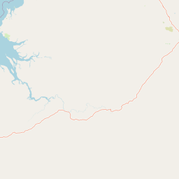
Judbarra National Park exhibits a mixed relief classification alongside various recorded streams, rivers, peaks, and viewpoints located within its boundaries. Linked feature cards supply official names, types, and spatial relationships for each mapped natural landmark.
Selected named natural features
Streams
East Baines Creek
Streams
Big Horse Creek
Streams
Joe Creek
Streams
Dick Creek
Streams
Bob Creek
Environmental setting
Interpreting tropical relief, seasonal habitats, and terrain types
Judbarra National Park Environmental Setting and Landscape Classifications
Recorded landscape features, habitat types, and tropical climate zones function as complementary categories for reading physical terrain. Associated classifications link directly to relevant protected area records across the geographic atlas.
- Relief
- Mixed relief
- Climate
- Tropical
- Water
- Minor water
- Seasonality
- Year-round
Landscape features
Mountains · Valleys · Cliffs
Habitat types
Tropical forest · Savanna · Grassland
Park atlas
Trace the broader regional park geography and diverse protected landscapes that surround Judbarra National Park in Australia's Northern Territory.
Explore Nearby National Parks and Protected Areas Beyond Judbarra National Park in Australia's Northern Territory
Explore a curated selection of national parks and protected areas related to Judbarra National Park, expanding your geographic discovery across Australia's Northern Territory. Compare distinct protected landscapes, Indigenous rock art sites, and diverse savanna ecosystems to gain comprehensive regional context for Australia's vast conservation efforts.
National parkNorthern Territory
73 km away#1 closest
West

Keep River National Park: Northern Territory National Park Atlas and Mapped Landscape
Explore the dramatic sandstone terrain and protected boundaries of this Top End gem.
Keep River National Park in Australia's Northern Territory is a protected landscape of immense geological and cultural significance. This park is best known for its striking sandstone formations, the scenic Keep River Gorge, and its importance as habitat for endangered species like the Gouldian finch. Its rugged terrain offers a distinct view into the Top End's natural heritage, providing rich context for understanding protected areas and regional geography through mapped exploration.
- Area
- 574.37 km²
- Established
- 1981
- IUCN
- II
- Visitors
- 23.2K annual
Nature reserveNorthern Territory
About 85 km away#2 closest
Northeast
Giwining / Flora River Nature Park: Protected Limestone Landscapes of Northern Territory
Geological spring systems and tropical riverine corridors.
The landscape of Giwining / Flora River Nature Park is defined by a network of calcium-rich springs emerging from Tindall Limestone. These waters have sculpted tufa dams and cascading waterfalls along the Flora River, creating a unique geological environment within the savanna woodlands of the Northern Territory.
- Area
- 78.24 km²
- Established
- 1993
- IUCN
- V
- Relief
- Lowland
National parkWestern Australia
117 km away#3 closest
Southwest
Purnululu National Park: National Park Atlas and Mapped Protected Landscape
Explore Western Australia's Purnululu National Park geography.
Gain a structured atlas-style understanding of Purnululu National Park, a key protected area in Western Australia. This page details the park's geographic identity, its role as a national park, and its relationship to the surrounding regional landscapes. Engage with mapped park boundaries and factual context to appreciate its place in the broader Australian conservation geography.
- Area
- 2,397.23 km²
- Established
- 1987
- IUCN
- II
- Relief
- Mountain
National parkNorthern Territory
About 130 km away#4 closest
North
Fish River Station National Park: Protected Landscapes and Geographic Atlas
Indigenous-managed conservation in the Northern Territory
Fish River Station serves as a critical conservation block south of Darwin, featuring a distinctive blend of riverine floodplains, billabongs, and rugged upland ranges. Its protected boundaries preserve a wide array of tropical habitats, highlighting the intersection of traditional land management and large-scale environmental preservation within the Australian National Reserve System.
- Area
- 1,781 km²
- Established
- 2010
- IUCN
- II
- Relief
- Mixed relief
National parkWestern Australia
About 132 km away#5 closest
West
Mirima National Park: Exploring Its Protected Landscape and Regional Geography in Western Australia
Discover mapped boundaries and the national park's place in regional context.
Mirima National Park is a significant protected area offering insights into the natural landscapes of Western Australia. This page provides a detailed view of its protected landscape identity and its geographic position within the larger atlas of Australian conservation lands. Explore the mapped boundaries and understand how Mirima National Park contributes to the regional geography and the broader framework of protected areas.
- Area
- 20.68 km²
- Established
- 1982
- IUCN
- II
- Access
- Easy access
Protected landscapeNorthern Territory
About 144 km away#6 closest
Northeast
Kintore Caves Conservation Reserve: Karst Geography and Protected Landscape Analysis
Mapping subterranean terrain and cultural heritage in Australia's Northern Territory.
Kintore Caves Conservation Reserve in the Northern Territory is a vital protected area defined by its rare limestone karst geology and extensive cave networks. This site provides a concentrated look at subterranean biodiversity and archaeological history within a transitional rural setting near Katherine, showcasing the importance of focused conservation boundaries in safeguarding geological and human-linked landscapes.
- Area
- 4.23 km²
- Established
- 1965
- IUCN
- V
- Access
- Access unknown
Nature reserveNorthern Territory
About 155 km away#7 closest
Northeast
Cutta Cutta Caves Nature Park: A Tropical Karst and Cave Reserve in Northern Territory
Protected tropical limestone karst and subterranean landscape geography.
Cutta Cutta Caves Nature Park is a specialized protected area in Australia, safeguarding a unique tropical limestone karst landscape near Katherine. This reserve manages subterranean cave systems, mineral-rich chambers, and the surrounding woodland terrain. As a significant ecological site, it provides essential habitat for rare wildlife, highlighting the complex intersection of geological formations and tropical biodiversity within the Northern Territory.
- Area
- 14.99 km²
- Established
- 1967
- IUCN
- III
- Visitors
- 17.2K annual
National parkNorthern Territory
161 km away#8 closest
Northeast
Nitmiluk National Park: Detailed Protected Landscape and Geographic Context
Explore mapped park boundaries and regional terrain.
Delve into the specifics of Nitmiluk National Park, a designated national park within the Northern Territory of Australia. This section focuses on its protected-area status and how its geography contributes to the regional landscape. Users can explore the park's mapped extent and understand its placement within the broader geographical atlas, highlighting its importance as a distinct protected natural area.
- Area
- 2,946.64 km²
- Established
- 1977
- IUCN
- II
- Visitors
- 309.8K annual
MoriAtlas Explorer
Continue exploring Judbarra National Park's geographic context and protected landscape atlas
Further your discovery of Judbarra National Park by examining its distinct geographical sections and the rich cultural narratives embedded within its landscape. Understanding its position within the Northern Territory's atlas of protected areas offers a deeper appreciation for its ecological significance and ancient heritage.
Browse next
Global natural geography
Explore related park routes
Explore MoriAtlas Global ParksBrowse All MoriAtlas ParksGlobal Park Map DiscoveryMoriAtlas: Browse All CountriesBrowse All MoriAtlas ContinentsNational Park Environment AtlasGrand Canyon National Park AtlasYellowstone National Park AtlasYosemite National Park Atlas and GeographySerengeti National Park AtlasGalápagos National Park Protected LandscapeBanff National Park Geography and AtlasKruger National Park Atlas EntryUluṟu-Kata Tjuṯa National Park AtlasExplore Uluru-Kata Tjuta National Park GeographyPlitvice Lakes National Park AtlasFiordland National Park Protected LandscapeGreat Smoky Mountains National Park AtlasAfghanistan National Parks and Protected AreasAlbania National Parks and Protected AreasAlgeria National Parks and Protected AreasAmerican Samoa National Parks and Protected AreasAndorra National Parks and Protected AreasAngola National Parks and Protected AreasAntarctica National Parks and Protected AreasAntigua and Barbuda Park List