
Mori Atlas logo
Wildlife reserveKanab Creek Wilderness

Mapping the extensive tributary network and rugged topography of a vast desert wilderness

Kanab Creek Wilderness: An Atlas of Deep Canyons and Protected Landscapes in Northern Arizona

Kanab Creek Wilderness functions as the most significant tributary canyon system on the north side of the Grand Canyon. Spanning elevations from 2,000 feet at the river corridor to 6,000 feet along the Kaibab and Kanab Plateaus, this protected area features complex vertical-walled gorges and incised drainage networks. The landscape represents a vital segment of the Colorado Plateau, preserved through joint federal stewardship to protect both the dramatic terrain and significant prehistoric archaeological sites.

wilderness areacanyon systemGrand Canyon watershedColorado Plateauriparian habitatdesert shrubland
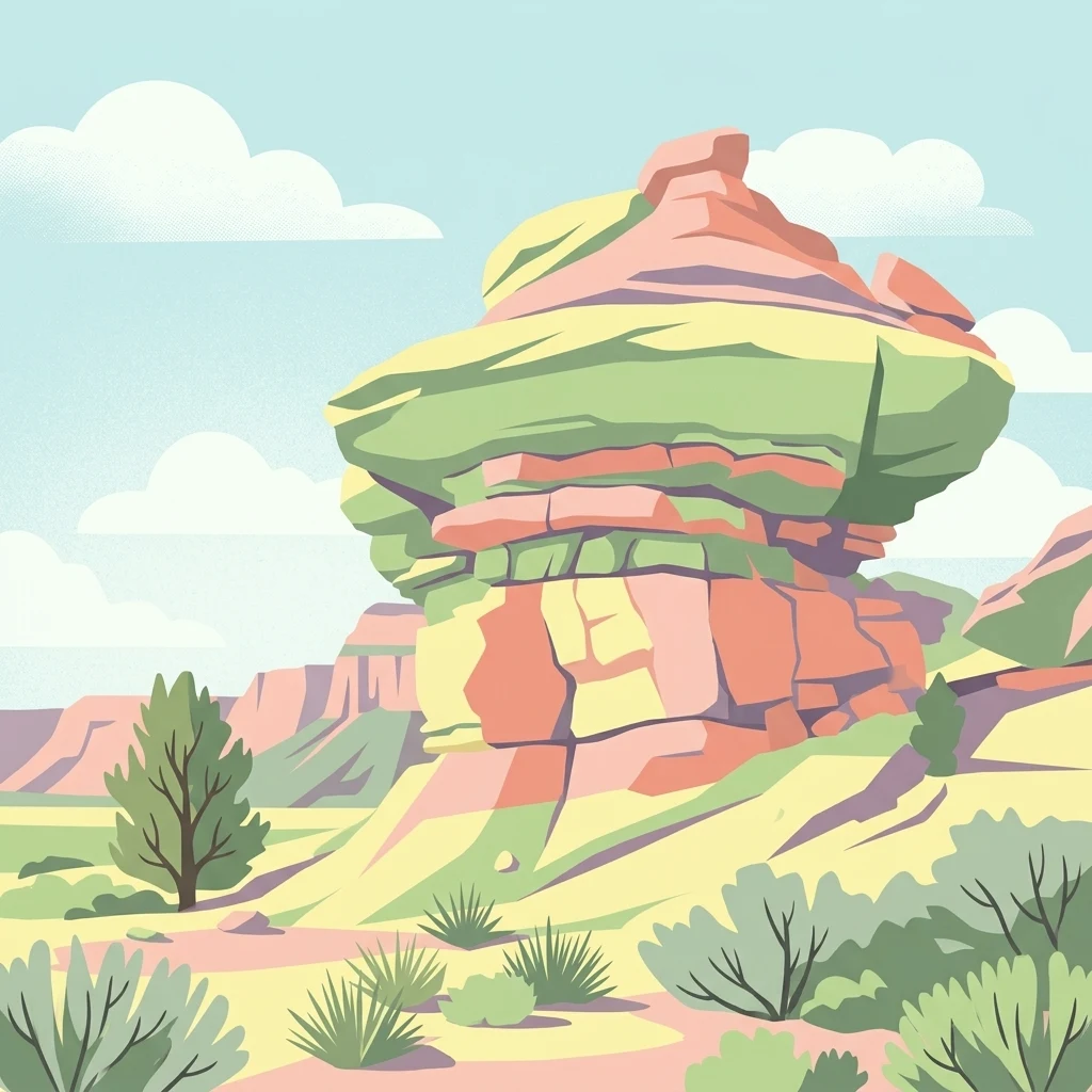
A flat style digital illustration of a layered desert rock formation in a canyon landscape, surrounded by desert shrubs and small trees under a blue sky with soft white clouds.

Kanab Creek Wilderness

Wildlife reserve

Park overview

Structured park overview, official facts, and landscape profile for Kanab Creek Wilderness

Kanab Creek Wilderness park facts, protected area profile, and essential visitor context

Review the core facts for Kanab Creek Wilderness, including designation, size, terrain, visitor scale, habitats, and operating context in one park-focused overview.

About Kanab Creek Wilderness

Kanab Creek Wilderness is a sizable, federally designated wilderness in northern Arizona that protects a critically positioned segment of the Grand Canyon's northern watershed. The area straddles the county line between Coconino and Mohave counties and lies south of the small town of Fredonia. Roughly 68,600 acres fall within the North Kaibab Ranger District of the Kaibab National Forest, managed by the U.S. Forest Service, while about 6,700 acres are administered by the Bureau of Land Management, creating a blended management framework typical of large western wilderness complexes.

At the heart of the wilderness is Kanab Creek, one of the major tributaries of the Colorado River and the largest tributary canyon system on the north side of the Grand Canyon. Originating roughly 50 miles north in southern Utah, the creek and its feeder streams have carved an extensive network of gorges with vertical walls deep into both the Kanab Plateau and the Kaibab Plateau. This drainage pattern produces a landscape of sheer cliffs, narrow side canyons, mesa-like benches, and deeply incised drainages, with elevations dropping from approximately 6,000 feet on the plateau rims down to about 2,000 feet at the Colorado River corridor.

The wilderness is not solely a geological showcase. Archaeological evidence indicates that the canyon system supported prehistoric peoples for long periods, with occupation extending up to approximately AD 1100. Rock art sites scattered through the area are considered among the most significant in the American Southwest. In 2023, part of the wilderness was included within the boundaries of the Baaj Nwaavjo I'tah Kukveni Ancestral Footprints of the Grand Canyon National Monument, reinforcing the area's cultural and ecological importance on a broader national scale.

Vegetation in the wilderness reflects its dramatic elevation range and arid setting. Lower elevations are dominated by desert shrub communities, particularly blackbush, with grasses such as Indian ricegrass and needle-and-thread grass appearing in open patches. Drainage bottoms support cottonwood, desert almond, western redbud, and single-leaf ash, although some of these riparian habitats are being affected by invasions of salt cedar. Higher elevations transition into sagebrush-dominated landscapes with scattered stands of pinyon pine and juniper.

Wildlife use this vertical landscape extensively. Mule deer rely on the higher elevations as winter range, and the area supports a notable concentration of chukar partridge, along with bobcat, fox, coyote, and a range of small mammals. Reptiles and amphibians, including toads, frogs, lizards, snakes, and the area's only known venomous snake, the rattlesnake, occupy the canyon's varied microhabitats. Access into this remote terrain is limited to a small number of long foot trails, including the Jumpup-Nail Trail, the Ranger Trail, and the Snake Gulch-Kanab Creek Trail, which together provide the primary routes into the canyon depths.

Quick facts and research context for Kanab Creek Wilderness

Kanab Creek Wilderness spans about 75,300 acres across northern Arizona, with the majority of its acreage (roughly 68,600 acres) managed by the U.S. Forest Service as part of the North Kaibab Ranger District of the Kaibab National Forest. The remaining 6,700 acres are administered by the Bureau of Land Management. The wilderness was designated in 1984 and is classified as IUCN Category Ib.

Located approximately 30 miles south of Fredonia, Arizona, the area encompasses the upper drainage of Kanab Creek, the largest tributary canyon system on the north side of the Grand Canyon. Elevations range from about 2,000 feet along the Colorado River to roughly 6,000 feet on the surrounding plateau rims. The wilderness also contains notable prehistoric archaeological evidence and rock art, and a portion of it falls within the Baaj Nwaavjo I'tah Kukveni Ancestral Footprints of the Grand Canyon National Monument.

Protection and recognition

Documented terrestrial protection scope and historical designation data

Kanab Creek Wilderness Protection Status and Designation History

Kanab Creek Wilderness maintains a terrestrial protection scope established through official designation records from 2023. Structured protected area details outline the legal framework governing this terrain without relying on external recognition programs.

Protection details

Protection scope
Terrestrial
Designated year
2023
Transboundary protection
No
Park context

Deeper park guide and search-rich context for Kanab Creek Wilderness

Kanab Creek Wilderness history, landscape, wildlife, and travel context

Explore Kanab Creek Wilderness through its history, landscape character, ecosystems, wildlife, conservation priorities, cultural context, and seasonal travel timing in a structured park guide built for atlas discovery and search intent.

Why Kanab Creek Wilderness stands out

Kanab Creek Wilderness is best known for protecting the largest tributary canyon system on the north side of the Grand Canyon, a vast network of deep, vertical-walled gorges cut by Kanab Creek and its feeder streams into the Kanab and Kaibab Plateaus. The dramatic elevation span, from river level near 2,000 feet up to plateau rims near 6,000 feet, defines the area's ecological and visual identity. The wilderness is also recognized for its cultural heritage, including prehistoric habitation extending up to roughly AD 1100 and some of the most significant rock art sites in the American Southwest. Combined with its joint Forest Service and Bureau of Land Management stewardship, these qualities make Kanab Creek a distinctive blend of geological grandeur, ecological layering, and archaeological importance within the greater Grand Canyon landscape.
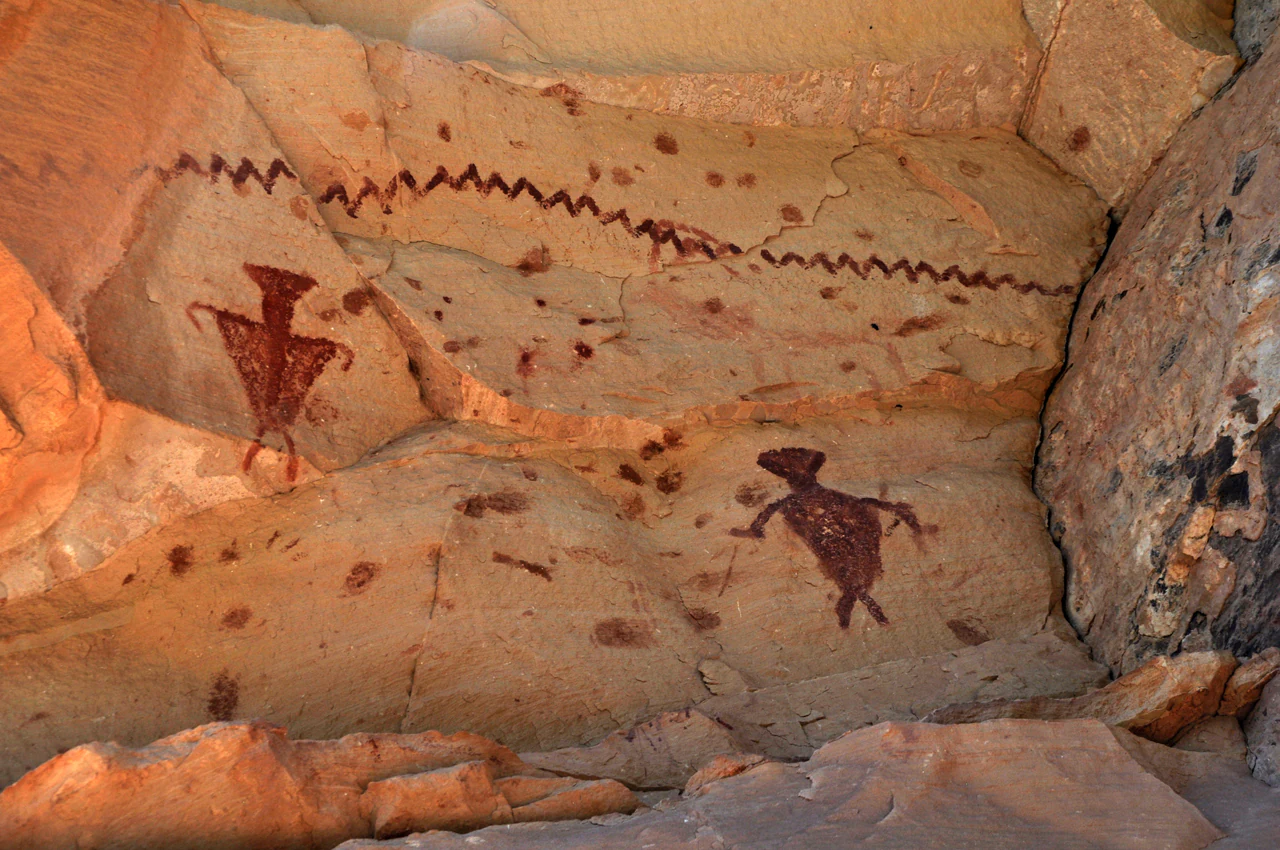
Ancient Native American rock art pictographs of anthropomorphic figures and a zigzag line painted in red pigment on a textured tan sandstone canyon wall.
Ancient red pigment pictographs painted on a sandstone rock face within the Kanab Creek Wilderness.

Kanab Creek Wilderness history and protected-area timeline

Kanab Creek Wilderness was formally designated in 1984 as part of the broader expansion of the National Wilderness Preservation System in the American Southwest. Its establishment recognized both the ecological value of the Kanab Creek drainage and the geological significance of its deeply entrenched canyon system, which forms a critical piece of the Grand Canyon's northern watershed. Since designation, the wilderness has been managed jointly by the U.S. Forest Service, which oversees the majority of the acreage within the Kaibab National Forest, and the Bureau of Land Management, which administers the remaining lands.

Long before federal protection, however, the canyon system had a much older human history. Archaeological evidence indicates that the area was inhabited by prehistoric peoples, with occupation extending up to approximately AD 1100. The canyon's sheltered overhangs and rock surfaces preserve some of the most interesting and significant rock art in the Southwest, including pictograph sites that continue to be studied for their cultural and historical meaning. Among the more recent landmarks in the area is the historic Jump Up Cabin, built in 1906 overlooking the wilderness and later restored by the Forest Service in 2009, representing early nineteenth and twentieth century pastoral and Forest Service use of the surrounding rim country.

In 2023, the cultural and natural importance of the area received additional federal recognition when a portion of the wilderness was incorporated into the newly designated Baaj Nwaavjo I'tah Kukveni Ancestral Footprints of the Grand Canyon National Monument. This designation placed the prehistoric sites, canyon landscapes, and ecological values of the Kanab Creek system within a broader national monument context, underscoring the area's significance to both Indigenous heritage and the protection of the greater Grand Canyon ecosystem.

Kanab Creek Wilderness landscape and geographic character

The landscape of Kanab Creek Wilderness is defined by an exceptionally deep and complex tributary canyon system, etched by Kanab Creek and its many feeder streams into the Kanab and Kaibab Plateaus. Because Kanab Creek is the largest tributary canyon system on the north side of the Grand Canyon, the area functions as one of the most significant side drainages feeding the Colorado River in this region. The result is a rugged terrain of nearly vertical cliffs, narrow gorges, canyon benches, and deeply incised drainage networks that drop thousands of feet from plateau rim to river.

Elevations within the wilderness span roughly 2,000 feet at the river to about 6,000 feet along the plateau rims, producing dramatic topographic relief within a relatively compact geographic footprint. This elevation range not only shapes the visual character of the area but also drives strong ecological transitions between canyon bottom, mid-slope benches, and high rim environments, all expressed within the broader context of the Colorado Plateau.
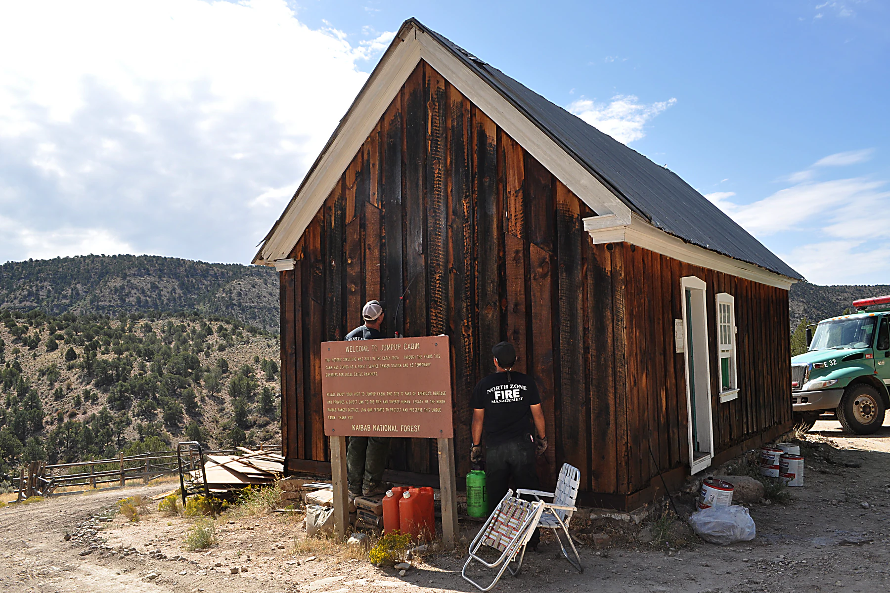
A weathered, dark wooden cabin with a gabled roof stands in a remote landscape, with two workers standing near a wooden historical sign in front of the structure, and a truck parked nearby.
Maintenance work being performed on the historic Jump Up Cabin in the Kanab Creek Wilderness area.

Kanab Creek Wilderness ecosystems, habitats, and plant life

Ecologically, Kanab Creek Wilderness represents a vertically layered desert-to-plateau system. Lower elevations are dominated by desert shrub vegetation, especially blackbush, with scattered clumps of grasses such as Indian ricegrass and needle-and-thread grass occupying open slopes and flats. The drainage bottoms along Kanab Creek and its tributaries support a distinctive ribbon of riparian vegetation, including cottonwood, desert almond, western redbud, and single-leaf ash. These linear riparian corridors are critical habitats within an otherwise arid matrix, though some are facing pressure from invasive salt cedar.

As elevation increases toward the plateau rims, vegetation shifts into sagebrush-dominated landscapes interrupted by small stands of pinyon pine and juniper. The combination of arid shrublands, narrow riparian greenways, and higher-elevation woodland patches creates a diverse ecological fabric within the wilderness. This mosaic of habitats, layered over thousands of feet of vertical relief, gives Kanab Creek a strong ecological identity distinct from both the open rim grasslands of the Kaibab and the deeper, narrower corridors lower in the Grand Canyon itself.

Kanab Creek Wilderness wildlife and species highlights

Kanab Creek Wilderness supports a robust and varied wildlife profile shaped by its canyon-and-plateau topography. The higher elevations of the wilderness serve as important winter range for mule deer, a key seasonal movement that takes advantage of the area's elevation gradient. The area is also a stronghold for chukar partridge, which is found throughout the canyon system in notable numbers.

Carnivores and small mammals are well represented as well. Bobcat, fox, and coyote occupy the broader landscape, while a range of smaller mammals, including rabbits, squirrels, and mice, inhabit the varied terrain at multiple elevations. Reptiles and amphibians thrive in the canyon's microhabitats, with several species of toads, frogs, lizards, and snakes present throughout the wilderness. The only known venomous snake in the area is the rattlesnake, though it shares the landscape with numerous non-venomous snake species.

Kanab Creek Wilderness conservation status and protection priorities

As a federally designated wilderness since 1984, Kanab Creek Wilderness carries strong long-term protections that limit road construction, mechanized use, and development, helping preserve the area's natural character. Its position within and adjacent to the Kaibab National Forest further integrates it into a broader forest-level conservation framework managed by the U.S. Forest Service, while Bureau of Land Management oversight of the smaller acreage extends consistent wilderness protections across administrative boundaries.

The area's conservation significance is reinforced by its ecological function as part of the Grand Canyon's northern watershed. Kanab Creek's drainage contributes to the hydrological and sediment systems of the Colorado River, while its elevation gradient sustains diverse plant communities and wildlife habitats. The documented presence of invasive salt cedar in some riparian zones highlights an ongoing management challenge. In 2023, the partial inclusion of the wilderness within the Baaj Nwaavjo I'tah Kukveni Ancestral Footprints of the Grand Canyon National Monument added a new layer of federal recognition, strengthening the area's combined natural and cultural conservation importance.

Kanab Creek Wilderness cultural meaning and human context

The cultural significance of Kanab Creek Wilderness stretches back well over a thousand years. Archaeological evidence indicates that prehistoric peoples inhabited the canyon system for extended periods, with documented occupation extending up to approximately AD 1100. The vertical-walled canyons provided natural shelter and visible surfaces for cultural expression, and the wilderness preserves some of the most significant rock art and pictographs in the American Southwest.

These sites continue to hold meaning for descendant communities and are central to the area's identity. In 2023, the inclusion of a portion of the wilderness within the Baaj Nwaavjo I'tah Kukveni Ancestral Footprints of the Grand Canyon National Monument formally recognized the deep Indigenous connections to the landscape. More recent cultural landmarks include the Jump Up Cabin, a historic structure built in 1906 that overlooks the wilderness, reflecting early twentieth century ranching and Forest Service presence on the rims above the canyons.

Top sights and standout views in Kanab Creek Wilderness

Kanab Creek Wilderness encompasses a sweeping tributary canyon system, the largest on the north side of the Grand Canyon, defined by vast elevation contrasts and intricate drainage patterns. Within this terrain lie significant prehistoric archaeological sites, including some of the most important rock art panels in the Southwest, and a landscape that ranges from river-level canyon bottoms in the Colorado River corridor to sagebrush-covered plateau rims.

Best time to visit Kanab Creek Wilderness

The experience of Kanab Creek Wilderness changes meaningfully with the seasons because of the area's strong elevation differences. Cooler months are favorable for exploring lower canyon sections without extreme desert heat and for observing mule deer as they shift toward higher winter range. Spring and fall generally offer milder conditions across the elevation gradient, while summer temperatures in the canyon bottoms can be intense, making higher-elevation travel more comfortable. Wildlife viewing, including chukar partridge and other resident species, is possible throughout much of the year, though seasonal conditions along the trails can strongly influence the character of any visit.

Monthly climate preview

Long term temperature averages and precipitation records across representative terrain coordinates

Kanab Creek Wilderness Climate Normals and Monthly Weather Patterns

Representative coordinate records show measured multi year temperature extremes alongside consistent monthly precipitation rates across twelve distinct annual cycles. Detailed twelve month statistical profiles provide complete historical baseline comparisons for ongoing ecological analysis.
Annual mean12 °C
0 °C24 °C
Jan
Feb
Mar
Apr10°
May15°
Jun22°
Jul24°
Aug23°
Sep19°
Oct12°
Nov
Dec
Warmest month
July

24.5 °C

Coolest month
December

0.1 °C

Wettest month
August

1.4 mm/day

Driest month
June

0.2 mm/day

Park location guide

Geography guide, regional context, and park location map for Kanab Creek Wilderness

Kanab Creek Wilderness park geography, regions, and map view in United States of America

Understand where Kanab Creek Wilderness sits in United States of America through a broader geographic reading of the surrounding landscape, nearby location context, and its mapped position within the national park landscape.

How Kanab Creek Wilderness fits into United States of America

The United States of America is a federal presidential republic and one of the world's largest countries by area and population. It consists of 50 states across a vast territory spanning multiple time zones, with its capital in Washington, D.C. and largest city in New York City. The nation has a diverse economy, influential political system, and significant cultural and military presence globally.

Wider geography shaping Kanab Creek Wilderness in United States of America

The United States occupies a vast territory in North America, bordered by Canada to the north and Mexico to the south. The 48 contiguous states stretch from the Atlantic to the Pacific Ocean, while Alaska occupies the northwestern region and Hawaii is an archipelago in the Pacific. The country encompasses diverse terrain including the Rocky Mountains, Appalachian Mountains, Great Plains, and extensive river systems.

Map view of Kanab Creek Wilderness

Use this park location map to pinpoint Kanab Creek Wilderness in United States of America, understand its exact geographic position, and read its mapped placement within the surrounding landscape more clearly.

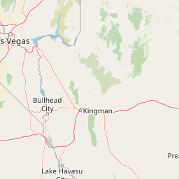
Pigeon | © OpenStreetMap contributors

Location context for Kanab Creek Wilderness

Arizona
Natural feature types

Explore the Geological Features and Canyon Systems of Kanab Creek Wilderness

Examine the specific landforms and drainage networks associated with Kanab Creek Wilderness. This collection supports a deeper understanding of the canyon geography and topographic relief that shape this protected Arizona landscape.
Recorded earthquake history

Examine the Recorded Earthquake History of Kanab Creek Wilderness

Review the historical collection of seismic events recorded near the canyons and plateaus of this northern Arizona wilderness. Browse the data to understand the recorded frequency, magnitude, and epicentre proximity of past activity in the greater Grand Canyon watershed.

Kanab Creek Wilderness Earthquake History

Catalogued events

29 events

Strongest magnitude

Magnitude 3.8

Most recent event

Aug 15, 2024

This history includes earthquakes recorded inside the park or within 50 km of its borders

Visual reference for deep vertical gorges, canyon rims, and protected plateau environments.

Kanab Creek Wilderness Photos and Scenery: Exploring Northern Arizona Canyon Landscapes

Examine detailed photographs of Kanab Creek Wilderness to understand the rugged topography, vertical cliffs, and dramatic elevation gradients defining this northern Arizona protected area. Visual exploration reveals the complex canyon systems and diverse ecological habitats shaped by the Colorado River watershed.

Ancient Native American rock art pictographs of anthropomorphic figures and a zigzag line painted in red pigment on a textured tan sandstone canyon wall.

A large red sandstone rock formation stands in the foreground, with distant canyon walls and a cloudy sky in the background.

A weathered, dark wooden cabin with a gabled roof stands in a remote landscape, with two workers standing near a wooden historical sign in front of the structure, and a truck parked nearby.

Park atlas

Compare regional protected areas and connected canyon terrain across northern Arizona

Explore Other Parks Near Kanab Creek Wilderness and Surrounding Protected Landscapes

Browse nearby national parks and protected areas sharing the rugged geological context of the Colorado Plateau. Compare surrounding canyon systems and federal wilderness lands to expand regional geographic discovery.
National parkArizona
Park boundaries overlap#1 closest

Southeast

Grand Canyon National Park: Arizona National Park Protected Landscape & Geography

Explore mapped boundaries and regional atlas context.

Grand Canyon National Park stands as a premier national park, showcasing a unique protected landscape within Arizona's diverse geography. This detailed entry focuses on the park's specific geographic identity, its mapped boundaries, and its significance within the regional atlas. Discover the contours of this protected area and its place in the natural terrain of the American Southwest.

Area
4,926.08 km²
Established
1919
IUCN
II
Visitors
4.9M annual
A horizontal watercolor illustration showing a calm lake in the foreground, surrounded by grassy banks, evergreen trees, and rolling mountains in the distance under a pale sky.
Protected landscapeArizona
Park boundaries overlap#2 closest

Southeast

Kaibab National Forest: Protected Plateau Landscapes and Forested Geography in Arizona

High-elevation forest terrain bordering the Grand Canyon

Spanning over 1.6 million acres in Arizona, Kaibab National Forest is characterized by its split geographic configuration, with distinct sections flanking the North and South rims of the Grand Canyon. The terrain ranges from the high-altitude Kaibab Plateau to volcanic uplands near Williams, encompassing four designated wilderness areas and varied forest ecosystems that provide a critical buffer for the surrounding canyon country.

Area
6,500 km²
Established
1909
Relief
Mountain
Climate
Temperate
Watercolor painting of a forested landscape featuring pine trees and distant rolling mountains on a white background.
Wildlife reserveArizona
36 km away#3 closest

West

Mount Trumbull Wilderness: A Detailed Geographic Overview of Northern Arizona Volcanic Protected Lands

Mapping basalt mesas and cinder cone ecosystems on the Uinkaret Plateau

Mount Trumbull Wilderness represents a distinct volcanic protected area located on the Uinkaret Plateau of the Arizona Strip. This rugged wilderness encompasses a massive basalt-capped mesa, scattered cinder cones, and deep ecological gradients ranging from pinyon-juniper woodlands to ancient ponderosa forests, providing a vivid look at the complex geological history near the Colorado River.

Area
31 km²
Established
1984
IUCN
Ib
Relief
Mountain
National parkUtah
56 km away#4 closest

Northwest

Zion National Park National Park: Detailed Mapped Geography and Protected Landscape Identity

Explore the mapped terrain and regional context of this Utah national park.

Zion National Park represents a key protected area within Utah, ideal for detailed geographic exploration. This canonical page offers insights into the park's specific mapped boundaries, its inherent landscape character, and its regional geographic setting. It is designed for users seeking to understand the atlas-level significance of Zion National Park as a national park entity, focusing on its protected terrain and natural geography.

Area
593.26 km²
Established
1919
IUCN
II
Visitors
4.9M annual
A horizontal watercolor painting showing a soft-focus landscape with a pale river winding through desert terrain under a hazy sky, with stylized cacti in the foreground.
Protected landscapeUnited States of America
65 km away#5 closest

Northeast

Glen Canyon National Recreation Area: Protected Landscape and High Desert Geography Map

Colorado Plateau canyons, sandstone strata, and reservoir environments

Explore the geological architecture of Glen Canyon National Recreation Area, a vast federal protected landscape. The area showcases towering Navajo Sandstone cliffs, deep blue reservoir arms, and remote backcountry canyons that exemplify the distinct high desert terrain of the Colorado Plateau in the United States.

Area
5,075.23 km²
Established
1972
Visitors
5.2M annual
Relief
Upland
National parkUtah
81 km away#6 closest

North

Bryce Canyon National Park: Utah's Mapped Protected Landscape and Geographic Context

Explore the unique geology and protected boundaries of Bryce Canyon National Park.

Bryce Canyon National Park offers a distinct protected landscape within the geography of Utah, characterized by its unique geological formations. This entry provides essential context for understanding its mapped boundaries and natural terrain, serving as a vital component for atlas-based discovery of protected areas. Investigate the specific geographic setting and conservation significance of this iconic national park.

Area
145.02 km²
Established
1928
IUCN
II
Visitors
2.5M annual
Wildlife reserveWashington County
About 96 km away#7 closest

Northwest

LaVerkin Creek Wilderness: Mapping Protected Landscapes in Southwestern Utah

Wildlife reserve and watershed protection in Washington County

This protected area unit serves as a critical buffer for the upper LaVerkin Creek corridor. Its terrain spans the transition from high-elevation forested plateaus to deeply carved sedimentary canyons. By maintaining an unroaded status, the wilderness preserves essential riparian habitats and geological features that define the character of the surrounding southwestern Utah plateau region.

Area
1.8 km²
Established
2009
IUCN
Ib
Relief
Highland
A watercolor painting showing a soft-toned landscape with a winding river in the foreground, a forested middle ground, and rolling mountains in the distance.
Protected landscapeUnited States of America
106 km away#8 closest

West

Lake Mead National Recreation Area: Desert Reservoir and Protected Landscape Atlas

United States protected geography and reservoir terrain

Spanning the lower Colorado River, Lake Mead National Recreation Area represents a unique convergence of desert ecosystems and large-scale water management. Its geography includes extensive reservoir shorelines, deep canyon corridors, and volcanic basin terrain that provide a foundational look at the arid environments of the American Southwest. The area remains a significant study of how engineered water features alter and interact with complex desert landscapes.

Area
6,053.31 km²
Established
1936
IUCN
V
Visitors
6.4M annual

Common questions about visiting, size, designation, and location context for Kanab Creek Wilderness

Kanab Creek Wilderness FAQs for park facts, access, geography, and protected area context

Find quick answers about Kanab Creek Wilderness, including protected-area facts, park geography, trail and visitor context, and how the park fits into its surrounding country and regional landscape.
MoriAtlas Explorer

Continue Your Protected Areas Search Across the Global Atlas

Deepen your exploration by continuing the structured search for national parks and protected areas worldwide. Utilize the comprehensive filtering capabilities to compare different conservation landscapes and refine your understanding of global park geography. Discover more about the distribution and characteristics of protected natural areas.

Global natural geography