Mori Atlas logo
Nature reserveKaraagash Nature Reserve

Examining the ecological transition between open steppe and woodland in central Kazakhstan

Karaagash Nature Reserve: A Protected Mosaic of Granite Ridges and Forested Foothills

Karaagash Nature Reserve encompasses a distinct landscape of low granite mountains and crystalline-schist ridges within the heart of the Karaganda Region. This zoological sanctuary preserves a vital mosaic of pine-birch forests, forb-rich meadows, and rocky outcrops that serve as essential habitat for roe deer, wild boar, and various ground-dwelling bird species. The reserve acts as a critical refuge for the forest-steppe transition, maintaining native vegetation patterns and habitat connectivity across the rugged terrain of central Kazakhstan.

low mountainsgranite hillsforest-steppepine-birch forestwildlife sanctuaryzoological reserve

Karaagash Nature Reserve

Nature reserve

Park overview

Structured park overview, official facts, and landscape profile for Karaagash Nature Reserve

Karaagash Nature Reserve park facts, protected area profile, and essential visitor context

Review the core facts for Karaagash Nature Reserve, including designation, size, terrain, visitor scale, habitats, and operating context in one park-focused overview.

About Karaagash Nature Reserve

Karaagash Nature Reserve represents one of the regional-scale zoological protection areas in central Kazakhstan, centered on the low Karaagash mountain range in the Zhanaarka district of the Karaganda region. Although modest in size compared to Kazakhstan's large national parks, the reserve plays a meaningful role in preserving the wildlife, vegetation, and soils of a transitional landscape where true steppe gives way to granite foothill ridges.

The reserve's terrain is shaped by ancient geological processes: the hills are built primarily of granite and crystalline schists, while the surrounding plains show a rolling ridge-and-hill character with brown, sandy soils laid down by long weathering cycles. This mix of rocky uplands and softer intermontane basins produces a patchwork of habitats within a relatively compact area, supporting a richer set of species than the surrounding flat steppes typically can.

As a state zoological sanctuary (zakaznik), Karaagash is managed primarily for wildlife conservation rather than for mass tourism, and its importance lies in safeguarding year-round habitat for ungulates and ground-nesting birds across seasons. The surrounding region has a long history of pastoral land use, which makes the reserve's protected status especially relevant for maintaining ecological continuity in the Karaagash hills.

Visitors and researchers value the area for its relatively undisturbed pine-birch forests on north-facing slopes, its forb-rich meadows where cereals, fescues, and feather grasses dominate, and its role as a stepping stone between the upland ecosystems of the broader Kazakh highlands and the open plains to the south.

Quick facts and research context for Karaagash Nature Reserve

Karaagash Nature Reserve is a state zoological sanctuary (zakaznik) administered by Kazakhstan and located in the Zhanaarka district of the Karaganda region. It was established in 1986 and occupies an area of roughly 6,800 hectares. The reserve sits within the Karaagash low-mountain system, a granite and crystalline schist ridge surrounded by ridge-and-hill plains.

Its habitat mosaic includes sparse pine and birch forest on hillslopes, mixed deciduous growth such as aspen, hawthorn, and willow in lower zones, and forb-rich meadows in the valleys between ridges, with bunchgrass steppe elements including fescue, wheatgrass, feather grass, and achnatherum in open areas. Soils are predominantly sandy brown soils typical of the central Kazakh uplands.

Protection and recognition

Examine documented conservation parameters and international recognition frameworks.

Karaagash Nature Reserve Protection Status and Designated Terrestrial Scope

Karaagash Nature Reserve maintains a documented terrestrial protection scope without external international designation sources. Reviewing these verified administrative records clarifies the baseline conservation framework governing the protected landscape.

Protection details

Protection scope
Terrestrial
Transboundary protection
No
Park context

Deeper park guide and search-rich context for Karaagash Nature Reserve

Karaagash Nature Reserve history, landscape, wildlife, and travel context

Explore Karaagash Nature Reserve through its history, landscape character, ecosystems, wildlife, conservation priorities, cultural context, and seasonal travel timing in a structured park guide built for atlas discovery and search intent.

Why Karaagash Nature Reserve stands out

Karaagash is best known as a refuge for typical central-Kazakhstan low-mountain wildlife, particularly roe deer, wild boar, black grouse, and gray and willow ptarmigan, set against a backdrop of granite ridges and patchy pine-birch woodland. Its ecological character lies in the transition between true steppe and foothill forest, making it useful as a protected benchmark for the Karaagash hill landscape.

Karaagash Nature Reserve history and protected-area timeline

Karaagash Nature Reserve was formally established in 1986 as a state zoological zakaznik under the Soviet-era system of nature protection, which at that time emphasized the creation of dedicated wildlife reserves across the Kazakh republic. Its creation came in response to the need to protect natural ungulate populations and upland habitats in a region otherwise dominated by grazing and resource extraction.

The reserve was designed around the Karaagash low-mountain massif, recognizing that the granite ridges and their associated forest-steppe mosaic provided unusually good habitat for species such as roe deer and wild boar compared with the surrounding plains. Since independence, the sanctuary has continued under the management framework of the Republic of Kazakhstan, retaining its original function as a zoological protection area rather than being converted into a national park or recreation-oriented territory.

Karaagash Nature Reserve landscape and geographic character

The landscape of Karaagash Nature Reserve is defined by the Karaagash low-mountain system, where modest granite and crystalline-schist ridges rise above a broader matrix of rolling ridge-and-hill plains. The geological substrate gives the area a rugged, weathered character, with exposed rock outcrops on steeper slopes and accumulations of sandy material in the lower basins.

Soils across the reserve are predominantly brown, sandy types, reflecting both the granite parent material and the semi-arid climatic conditions of central Kazakhstan. North-facing slopes tend to support thin pine and birch forests, while sun-exposed slopes and ridge tops transition quickly into steppe-like open vegetation, producing a clear vertical zonation within the relief.

The intermontane depressions and valley floors form a second key element of the landscape, where brown and pale brown soils support forb-rich meadows and bunchgrass communities. Together, the rocky ridges, forested slopes, and grassy basins create a small but ecologically expressive cross-section of central Kazakhstan's foothill geography.

Karaagash Nature Reserve ecosystems, habitats, and plant life

Ecologically, Karaagash falls within the forest-steppe and upland-steppe transition zone typical of central Kazakhstan. The mosaic of granite ridges and sandy plains supports a layered vegetation pattern, with sparse woodlands on slopes and more open grass and shrub communities in the lowlands.

On the slopes, pine and birch dominate the tree cover, accompanied by aspen, elm (karagach), hawthorn, blackthorn, and willow thickets. The intermontane depressions carry herb-rich meadows where fescue, wheatgrass, feather grass, achnatherum (chiy), and other bunchgrasses form the structural backbone of the vegetation, interspersed with berry-bearing shrubs in small clearings.

The combination of forest patches, rocky escapes, and open meadows gives the reserve a relatively diverse ecological profile for its size, supporting both forest-edge species and open-steppe fauna in close proximity.

Karaagash Nature Reserve wildlife and species highlights

Wildlife is the core focus of Karaagash Nature Reserve, reflecting its status as a zoological zakaznik. Roe deer are among the most characteristic mammals, using the combination of forest cover and open valleys as their preferred habitat. Wild boar are similarly associated with the wetter and more vegetated parts of the reserve, particularly in the deciduous thickets along valley floors.

The reserve is also notable for several bird species typical of central Kazakh uplands, including black grouse, which favor the forest-edge and meadow transition zones, and both gray partridge and willow ptarmigan (white partridge), which occupy more open steppe-influenced habitat. Occasional records of saiga antelope in the broader landscape around the reserve underscore the area's importance for migratory and wide-ranging ungulate species.

The generalist-rich mammal and bird community reflects both the forest-steppe character of the site and its position within a wider landscape where steppe species and foothill species coexist.

Karaagash Nature Reserve conservation status and protection priorities

As a state-managed zoological sanctuary, Karaagash contributes to the conservation of representative upland-forest-steppe ecosystems in central Kazakhstan, where land-use pressure from grazing and resource extraction has historically been intense. Its protected status helps maintain year-round habitat conditions for ungulates and ground-nesting birds that depend on a stable mix of forest cover and open feeding grounds.

The reserve's role in preserving soil structure and native vegetation mosaics, including the brown sandy soils and their associated plant communities, gives it additional conservation significance beyond the direct protection of individual species. By securing the natural dynamics of the Karaagash hills, the sanctuary also supports broader ecological processes such as seasonal movement and habitat connectivity in the region.

Karaagash Nature Reserve cultural meaning and human context

The Karaagash hills and their surrounding plains have a long history of pastoral land use, reflecting the broader cultural identity of central Kazakhstan as a region of seasonal grazing and traditional steppe livelihoods. The reserve's modern protective status represents a shift toward formal ecological conservation while the surrounding lands continue to carry this pastoral heritage.

The reserve also carries significance as a place-name reference within Kazakh geography, with 'Karaagash' serving as a local toponym for both the hills and the protected area. While the territory is not heavily used for cultural or spiritual purposes today, its role as a protected landscape contrasts with the intense human use of the surrounding steppe.

Top sights and standout views in Karaagash Nature Reserve

Karaagash Nature Reserve stands out for its granite-based low-mountain landscape, its mosaic of pine-birch forest and forb-rich meadows, and its focused role in protecting central Kazakh upland wildlife.

The reserve offers a compact but ecologically expressive example of the forest-steppe transition, with roe deer, wild boar, and characteristic grouse and partridge species supported within a relatively small protected footprint.

Best time to visit Karaagash Nature Reserve

The Karaagash hills experience a strongly continental climate with cold winters and warm, relatively dry summers, and seasonal conditions affect both wildlife visibility and the character of the landscape.

Late spring and early summer tend to bring the most active vegetation and the most diverse bird presence, including the breeding season for black grouse and partridges, while autumn brings cooler temperatures and the chance to observe ungulate movements before winter snow sets in. Winter conditions can limit access to remote ridge areas, making the warmer seasons generally more suitable for casual exploration of the reserve's landscapes.

Monthly climate preview

Long-term temperature ranges and precipitation patterns across representative coordinates

Karaagash Nature Reserve Climate Normals and Monthly Weather Statistics

Historical data records wide annual temperature shifts from deep winter freezes to warm summer peaks alongside steady low daily precipitation rates at Karaagash Nature Reserve. Reviewing the complete twelve-month profile provides deeper insight into measured long-term meteorological averages across the protected terrain.
Annual mean5 °C
-15 °C23 °C
Jan-15°
Feb-13°
Mar-5°
Apr
May15°
Jun21°
Jul23°
Aug21°
Sep13°
Oct
Nov-5°
Dec-12°
Warmest month
July

22.5 °C

Coolest month
January

-15 °C

Wettest month
June

0.9 mm/day

Driest month
September

0.4 mm/day

Park location guide

Geography guide, regional context, and park location map for Karaagash Nature Reserve

Karaagash Nature Reserve park geography, regions, and map view in Kazakhstan

Understand where Karaagash Nature Reserve sits in Kazakhstan through a broader geographic reading of the surrounding landscape, nearby location context, and its mapped position within the national park landscape.

How Karaagash Nature Reserve fits into Kazakhstan

Kazakhstan is a Central Asian country spanning vast steppes and plains, bordered by Russia, China, Kyrgyzstan, Uzbekistan, and Turkmenistan, with a coastline along the Caspian Sea. It gained independence from the Soviet Union in 1991 and has a population of approximately 20.5 million people. The country is officially secular but predominantly Muslim, with Kazakh and Russian as official languages.

Wider geography shaping Karaagash Nature Reserve in Kazakhstan

Kazakhstan occupies a vast territory in Central Asia, extending into Eastern Europe. Its terrain consists largely of hilly plateaus and plains, with lowlands covering about a third of the area. The southern and eastern regions are mountainous. The country borders Russia to the north and west, China to the east, Kyrgyzstan to the southeast, Uzbekistan to the south, and Turkmenistan to the southwest. It has a coastline along the Caspian Sea.

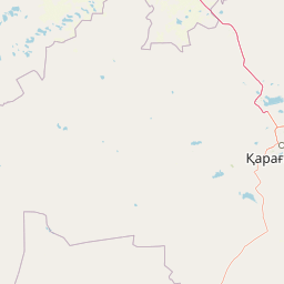
Map view of Karaagash Nature Reserve

Use this park location map to pinpoint Karaagash Nature Reserve in Kazakhstan, understand its exact geographic position, and read its mapped placement within the surrounding landscape more clearly.

Pigeon | © OpenStreetMap contributors

Location context for Karaagash Nature Reserve

Karaganda Region
Park atlas

Compare adjacent granite uplands, foothill forests, and central steppe reserves.

Explore Parks Near Karaagash Nature Reserve and Regional Protected Landscapes

Browse nearby national parks and protected areas connected to the broader geographic context of Karaagash Nature Reserve. Comparing adjacent natural habitats provides deeper insight into the regional terrain and wildlife distribution across central Kazakhstan.
A pale, minimalist watercolor illustration of a soft, rolling landscape with light green and pink washes against a white background.
Wildlife reserveKaraganda Region
About 157 km away#1 closest

East

Bugyly Sanctuary Wildlife Reserve and Protected Mountain Terrain in Karaganda Region

A protected zoological landscape in the heart of central Kazakhstan

Bugyly Sanctuary is a specialized wildlife reserve defined by its low mountain topography, rocky outcrops, and narrow stream-side groves. Situated in the Karaganda Region, the protected area functions as a vital refuge for argali sheep, roe deer, and various ground-nesting birds, standing as a testament to the diverse interior uplands of the Sarysu River basin.

Area
85 km²
Relief
Lowland
Water
Minor water
National parkUlytau Region
About 298 km away#2 closest

West

Ulytau National Park: Mapping the Mountain-Steppe Ecosystems of Central Kazakhstan

Protected rocky uplands and sacred steppe landscapes

Ulytau National Park stands as a major protected area in central Kazakhstan, established to unify the management of the Ulytau massif. The park preserves a unique interplay of low mountain ridges, deep intermountain hollows, and semi-arid steppe. It represents a significant effort to secure the geographic and historical integrity of the region, offering a window into the transition between Kazakhstan's open grasslands and its isolated, rugged upland systems.

Area
589.12 km²
Established
2022
IUCN
II
Scope
Terrestrial
Watercolor illustration of a landscape with green forests, rolling hills, and distant mountains under a soft sky
National parkAkmola Region
About 315 km away#3 closest

Northeast

Buiratau State National Nature Park: Kazakhstan National Park within Akmola Region

Explore unique steppe-forest transition ecosystems and geography.

Buiratau State National Nature Park in Kazakhstan's Akmola Region protects a significant transitional zone between dry steppe and semi-arid forest. This national park showcases a diverse landscape of low ridges, plains, and salt lakes, contributing to its rich biodiversity. Discover the mapped boundaries and the unique ecological character of this protected area within the context of the Kazakh Uplands atlas and its regional geography.

Area
890 km²
Established
2011
IUCN
II
Relief
Upland
Watercolor illustration of a mountainous landscape with green hills, trees, and a river in the foreground
National parkKazakhstan
About 316 km away#4 closest

East

Karkaraly State National Nature Park: Kazakhstan's Mountain-Forest Protected Area

Discover unique geology, archaeology, and regional landscape context.

Delve into the distinctive protected landscape of Karkaraly State National Nature Park, situated in Kazakhstan's Karaganda Region. This park preserves a rare mountain-forest ecosystem with dramatic granite formations, ancient archaeological sites, and lakes, presenting a rich geographic contrast to the surrounding Kazakh Steppe. MoriAtlas provides structured insights into Karkaraly State National Nature Park's unique terrain, its conservation value, and its position within the broader regional geography of Central Asia.

Area
1,121.2 km²
Established
1998
IUCN
II
Relief
Mountain
Wildlife reserveAkmola Region
About 325 km away#5 closest

Northwest

Atbasar Wildlife Reserve: Protected Steppe Grasslands and Wildlife Habitat in the Akmola Region

Mapping conservation landscapes of northern Kazakhstan

Explore the geographic scope of Atbasar Wildlife Reserve, a significant sanctuary in northern Kazakhstan. This protected area preserves key steppe ecosystems and habitat for marmots and migratory birds within a unique terrain of rocky spurs and open feather grass plains.

Area
751 km²
Established
1976
IUCN
IV
Relief
Upland
National parkKazakhstan
About 372 km away#6 closest

Northeast

Bayanaul National Park: Kazakhstan's First National Park Mapped Landscape

Explore granite mountains, unique lakes, and striking rock formations.

Bayanaul National Park, situated in Kazakhstan's Pavlodar Province, represents a significant protected area renowned for its extraordinary granite mountain landscape. Established as the country's first national park, it showcases unique erosion-shaped rock formations, diverse vegetation including rare pines, and four significant freshwater lakes. This park offers a distinct visual tapestry of mountainous terrain and geological wonders within the broader Central Asian geography, making it a key destination for atlas-based discovery.

Area
684.53 km²
Established
1985
IUCN
II
Relief
Mountain
Watercolor illustration of a landscape with green hills, a body of water, and grassy foreground under a pink-hued sky
National parkAqmola Region
About 423 km away#7 closest

North

Kokshetau National Park: A Protected Granite Mountain and Forest-Steppe Landscape in Kazakhstan

Explore Aqmola Region's unique protected geography and mapped terrain.

Kokshetau National Park stands as a remarkable protected landscape within Kazakhstan, defined by its ancient granite mountains and its unique position as a forest-steppe island surrounded by open plains. This national park preserves a rich tapestry of boreal forests, lake-filled depressions, and geological wonders, including some of the planet's most ancient rock formations. MoriAtlas provides a structured view of Kokshetau National Park, detailing its mapped boundaries and geographic context within the Aqmola Region, offering users a deep dive into its protected area identity and ecological significance.

Area
1,821 km²
Established
1996
IUCN
II
Relief
Upland
Nature reserveKostanay Region
About 424 km away#8 closest

West

Altyn Dala Nature Reserve: Mapping Steppe Biodiversity and Migratory Corridors in Kazakhstan

A comprehensive look at the three-cluster protected landscape and regional geography

Spanning over 489,000 hectares, Altyn Dala Nature Reserve preserves diverse habitats ranging from the Sarykopa lake system to the vast Uly-Zhylyanshyk semi-desert steppe. This detail page tracks the reserve's unique cluster structure, geographic boundaries, and essential role in maintaining the historical integrity of northern Kazakhstan's grassland and river corridor ecosystems.

Area
4,897.66 km²
Established
2012
IUCN
VI
Relief
Lowland

Common questions about visiting, size, designation, and location context for Karaagash Nature Reserve

Karaagash Nature Reserve FAQs for park facts, access, geography, and protected area context

Find quick answers about Karaagash Nature Reserve, including protected-area facts, park geography, trail and visitor context, and how the park fits into its surrounding country and regional landscape.
MoriAtlas Explorer

Continue Your Protected Areas Search Across the Global Atlas

Deepen your exploration by continuing the structured search for national parks and protected areas worldwide. Utilize the comprehensive filtering capabilities to compare different conservation landscapes and refine your understanding of global park geography. Discover more about the distribution and characteristics of protected natural areas.

Global natural geography