
Mori Atlas logo
Protected landscapeKaulsdorfer Seen

A detailed look at the post-mining lake basins and groundwater protection zones of Berlin

Kaulsdorfer Seen Protected Landscape: Exploring Glacial Terrain and Water Habitats in Berlin

(Landschaftsschutzgebiet Kaulsdorfer Seen)

The Kaulsdorfer Seen protected landscape serves as a vital green space within Berlin, defined by its origins as sand and gravel extraction pits from the 1930s. Centered around the Butzer See and Habermannsee, the area features a mosaic of mixed forest, reed-lined shorelines, and groundwater-fed basins. Situated at the geological intersection of the Barnim Plateau and the Berlin Urstromtal, the site provides essential drinking-water protection for the capital.

landscape protection areapost-mining lakesgroundwater protection zonemixed forestreed bedsurban nature
A graphic illustration featuring a mountainous landscape with a waterfall cascading down a cliff into a winding river valley surrounded by pine trees under a pale sky.

Kaulsdorfer Seen

Protected landscape

Park overview

Structured park overview, official facts, and landscape profile for Kaulsdorfer Seen

Kaulsdorfer Seen park facts, protected area profile, and essential visitor context

Review the core facts for Kaulsdorfer Seen, including designation, size, terrain, visitor scale, habitats, and operating context in one park-focused overview.

About Kaulsdorfer Seen

The Kaulsdorfer Seen landscape protection area preserves one of eastern Berlin's quieter mosaic landscapes, where small open-water lakes alternate with forest, meadow, and wetland habitats. Though only around 93 hectares in extent, the area combines several layers of environmental significance: ecological diversity, drinking-water protection, and historical industrial legacy.

The lakes themselves are not natural in origin. Both the Butzer See and the Habermannsee were created through sand and gravel mining during the 1930s, after which rising groundwater filled the resulting pits. Over the decades, these artificial basins have matured into ecologically rich freshwater habitats surrounded by reed belts, willow scrub, and mixed woodland. The nearby Kaulsdorfer Busch, a fenced mature stand of poplars, pines, and spruces, functions simultaneously as a forest under active woodland management and as a buffer zone for the historic Kaulsdorf waterworks.

The protected area is bounded clearly by streets and allotment gardens: Am Niederfeld to the north, Kressenweg to the east, Mannheimer, Grenz-, and Eschenstraße to the south, and the Kaulsdorfer Busch allotment gardens and Lassaner Straße to the west. This compact outline keeps a continuous belt of vegetation and shoreline intact amid the surrounding urban fabric. Geologically, the area lies just south of the elevated Berliner Balkon, the morphological step that marks the passage between two ice-age landscapes, the smoother Berlin Urstromtal to the south and the higher Barnim Plateau to the north.

Recreationally, the area is best known for the biannual "Rund um die Kaulsdorfer Seen" cross-country run, and for the SG Stern Kaulsdorf sports grounds west of the Butzer See. Despite the protection status, both lakes also serve as informal and unauthorized swimming spots in summer, creating ongoing management challenges around water quality and habitat disturbance.

Quick facts and research context for Kaulsdorfer Seen

The Kaulsdorfer Seen (designated LSG 41) is a landscape protection area of 93.7 hectares in Berlin-Kaulsdorf-Süd, within the Marzahn-Hellersdorf district. It comprises two lakes, the Butzer See and the Habermannsee, alongside the forested Kaulsdorfer Busch enclosure, all of which lie inside the groundwater protection zone of the Kaulsdorf waterworks, established in 1916.

The protected zone is bounded by Am Niederfeld to the north, Kressenweg to the east, the streets Mannheimer, Grenz, and Eschenstraße to the south, and the Kaulsdorfer Busch allotment gardens and Lassaner Straße to the west. The area straddles the boundary between the Berlin Urstromtal to the south and the Barnim Plateau to the north, the transition marked by the elevated Berliner Balkon just beyond the lakes.

Park context

Deeper park guide and search-rich context for Kaulsdorfer Seen

Kaulsdorfer Seen history, landscape, wildlife, and travel context

Explore Kaulsdorfer Seen through its history, landscape character, ecosystems, wildlife, conservation priorities, cultural context, and seasonal travel timing in a structured park guide built for atlas discovery and search intent.

Why Kaulsdorfer Seen stands out

The Kaulsdorfer Seen are best known as a compact Berlin landscape protection area built around two former 1930s sand and gravel pit lakes, set within an enclosed drinking-water protection forest. The combination of post-mining lake basins, mixed forest, meadows, and reed-fringed shores, all embedded in the water management zone of the historic Kaulsdorf waterworks, gives the area a distinct identity. Its post-glacial, ice-age geographic setting also stands out: the lakes occupy the transitional belt between the flat Berlin Urstromtal and the higher Barnim Plateau, with the Berliner Balkon viewpoint marking the boundary just to the north.
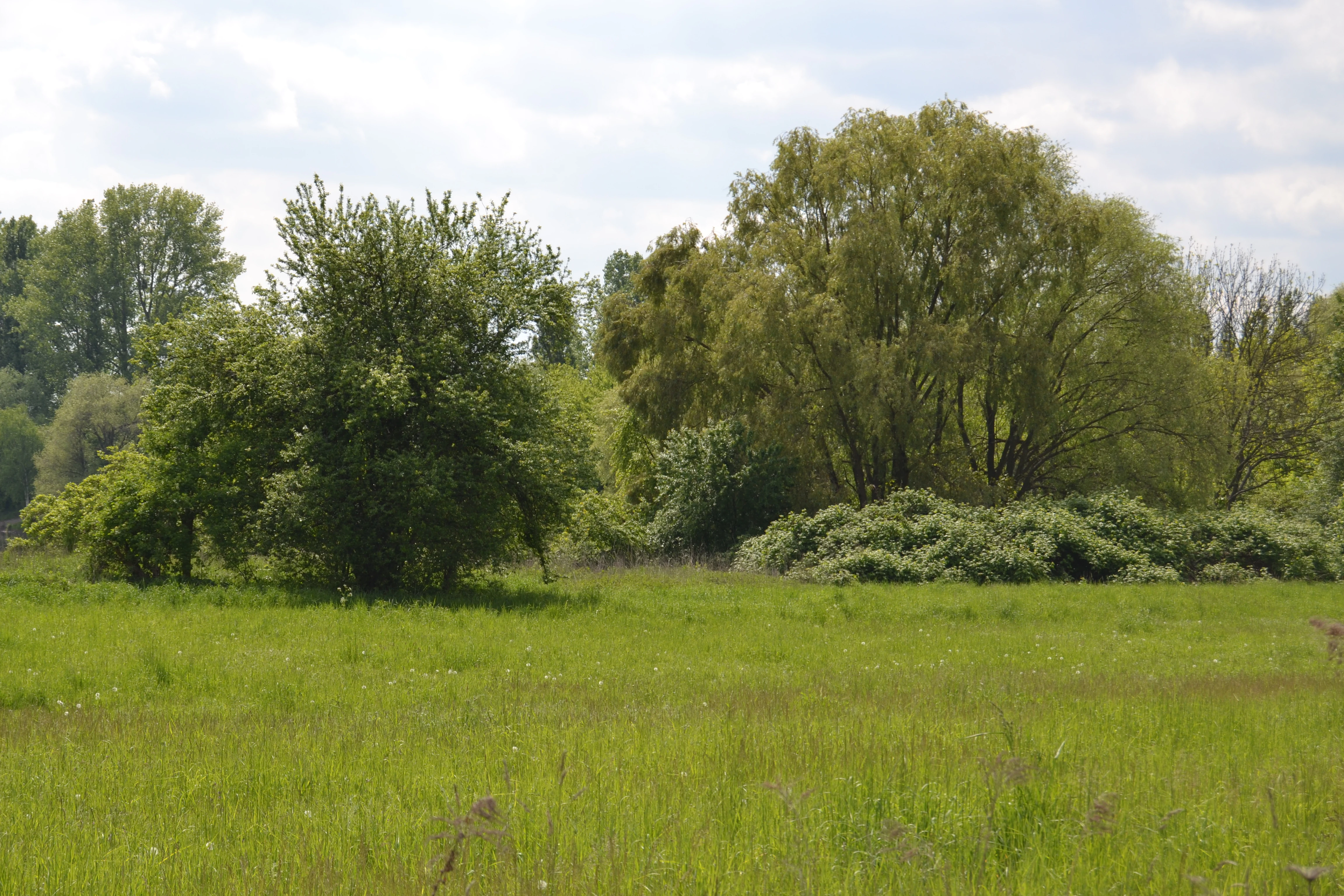
A wide view of a green meadow in the foreground with clusters of trees and shrubs in the midground under a cloudy sky.
A scenic view of the lush greenery within the Kaulsdorfer Seen protected landscape area.

Kaulsdorfer Seen history and protected-area timeline

The modern identity of the Kaulsdorfer Seen is closely tied to the long history of groundwater use in eastern Berlin. The waterworks at Kaulsdorf were established in 1916 on the western side of the Habermannsee, making the surrounding land a designated groundwater protection zone early in the twentieth century and shaping how the landscape would be managed from that point on.

The lakes themselves are a product of twentieth-century industrial activity rather than natural formation. In the 1930s, sand and gravel extraction opened pits at the sites of what would become the Butzer See and the Habermannsee. Once mining ceased, the basins gradually filled with rising groundwater, and the surrounding land began to develop a varied cover of forest, meadow, and wetland vegetation. Over time, the wooded Kaulsdorfer Busch enclosure took on a managed, partly commercial forest character, with poplar, pine, and spruce stands.

By the late twentieth and early twenty-first centuries, the area had been formally designated as landscape protection area LSG 41, with defined boundaries along the surrounding streets. The site remains embedded in the operational infrastructure of Berlin's drinking-water supply, even as it functions as a local recreational and ecological space.

Kaulsdorfer Seen landscape and geographic character

The terrain around the Kaulsdorfer Seen is shaped by the geological aftermath of the last ice age, sitting where two distinct glacial natural regions meet. To the north rises the Barnim Plateau, a slightly higher ground belt whose transition edge, the Berliner Balkon, lies immediately beyond the protected area. To the south stretches the broader, flatter Berlin Urstromtal, an ancient meltwater channel of the Weichsel glaciation that underpins much of Berlin's surface morphology.

Within this setting, the lakes themselves are not natural bodies of water but former extraction pits. They occupy shallow basins left behind by 1930s sand and gravel mining, with water levels controlled by surrounding groundwater dynamics. At times of lower groundwater, a narrow vegetated sand ridge divides the Habermannsee into an eastern and a western basin, the latter sometimes referred to informally as the Kiessee.

The shoreline vegetation is a defining feature of the area's appearance. Reed belts line the lakes, giving way to willow scrub and mixed woodland further inland. Stands of poplar, pine, spruce, and other native trees form the Kaulsdorfer Busch, while open meadows and pasture-like clearings break up the wooded canvas. Together, these elements create a soft, varied lowland landscape framed by urban streets, offering a transitional visual zone between dense city districts and more open eastern Berlin countryside.
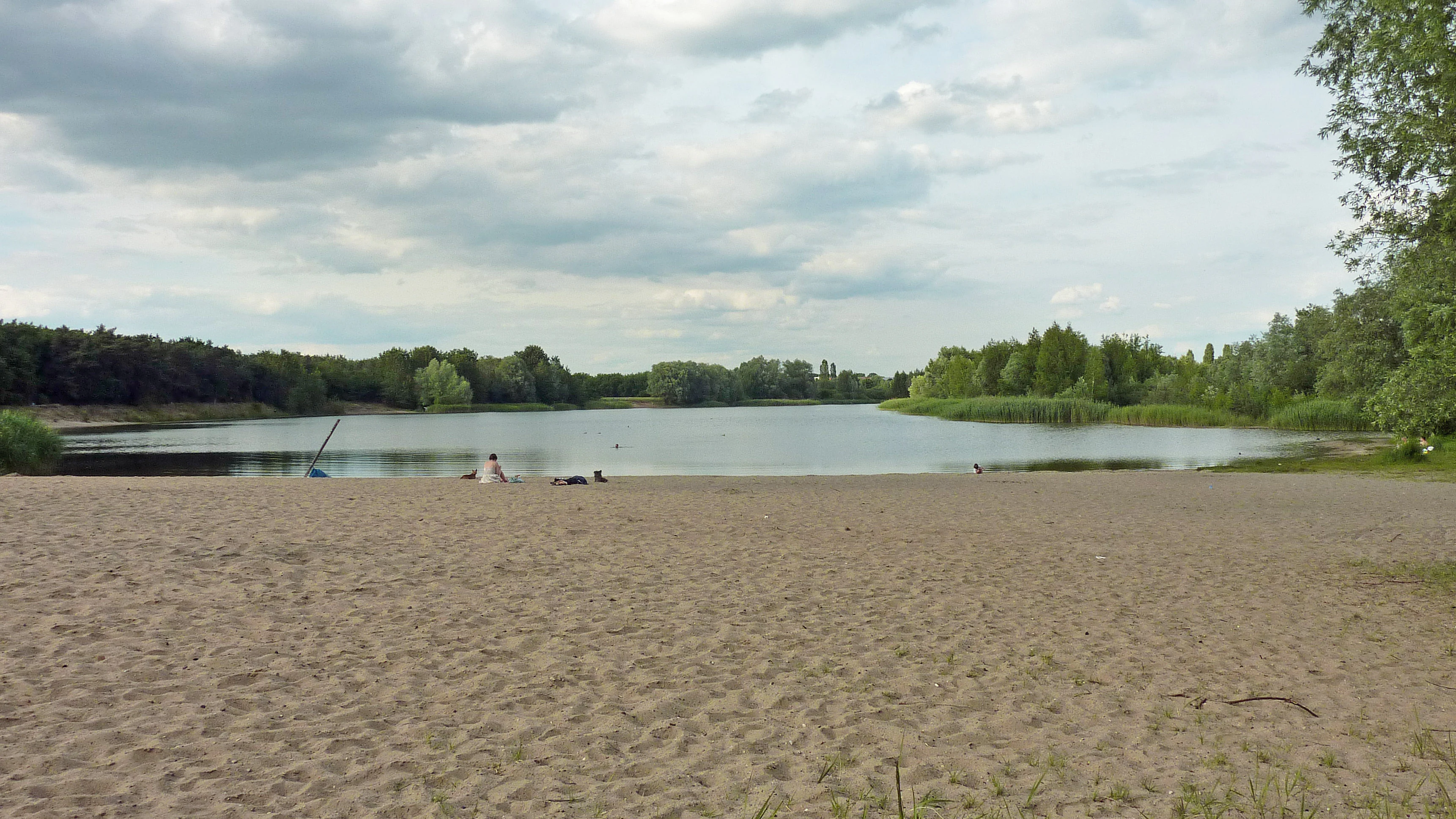
A wide shot of a sandy beach in the foreground leading to a calm lake, with forested shorelines and a cloudy sky in the background.
The sandy beach and waters of Habermannsee in the Kaulsdorfer Seen protected area.

Kaulsdorfer Seen ecosystems, habitats, and plant life

The declared value of the Kaulsdorfer Seen lies in its mosaic of closely integrated habitats, unusual within a heavily urbanized district. The protected area bundles several distinct vegetation types into a compact footprint: mature mixed forest of poplars, pines and spruces, open meadows, willow stands and associated scrub, and reed-fringed lakeshore. This layering allows wetland, forest, and grassland communities to coexist within a few hundred meters of each other.

The lakes provide freshwater habitat for several native fish species, with eel, pike, and common roach among the most characteristic inhabitants. The reed and willow zones along the shore support nesting, sheltering, and feeding conditions for a range of water-associated birds and small wildlife, while the wooded Kaulsdorfer Busch contributes forest-dwelling species to the wider ecological package.

The overarching natural character of the area is that of a recovering post-industrial lowland landscape, shaped by sand and gravel extraction, groundwater management, and decades of secondary forest growth. Its protected status is intended to preserve this diversity of habitats against urban encroachments and damaging recreational pressures.

Kaulsdorfer Seen wildlife and species highlights

The wildlife profile of the Kaulsdorfer Seen reflects the mixed habitat structure described above, with aquatic, wetland, woodland, and meadow communities each contributing to the local fauna. The lakes host fish species typical of Berlin's lowland water bodies, with eel, pike, and roach documented as characteristic residents.

The reed and willow zones around the shoreline provide sheltered habitat for water-associated birdlife and small vertebrates, while the wooded Kaulsdorfer Busch supports typical central European forest fauna, helped by the structural variety of poplar, pine, and spruce stands. Open meadow strips contribute additional habitat for insects and ground-nesting birds.

Because the site is small, embedded in an urban matrix, and subject to ongoing informal recreation, its wildlife value is closely tied to long-term protection of habitat continuity and water quality rather than to large-scale animal populations.

Kaulsdorfer Seen conservation status and protection priorities

The conservation significance of the Kaulsdorfer Seen rests on three parallel functions: habitat preservation, groundwater protection, and urban green-space protection. As a designated landscape protection area (LSG 41), it enjoys formal protection from many forms of land-use change, while its position within the groundwater protection zone of the historic Kaulsdorf waterworks adds a second layer of environmental safeguard.

The lakes and their surroundings contribute to Berlin's broader network of protected open spaces, offering valuable lowland mosaic habitat in an otherwise heavily developed part of the city. The combination of artificial lakes, reed beds, mixed woodland, and meadows supports biodiversity that would otherwise be difficult to sustain in the urban district.

At the same time, the site faces persistent conservation challenges. Both lakes serve as informal, unauthorized swimming spots during summer months, with limited enforcement of the bathing ban. Associated littering and trampling of shoreline vegetation, along with pollutant input into groundwater, pose ongoing threats to both flora, fauna, and the drinking-water protection function of the surrounding land.

Kaulsdorfer Seen cultural meaning and human context

The Kaulsdorfer Seen reflect a distinctly Berlin-style relationship between industrial heritage, water management, and everyday urban nature. The lakes are a direct legacy of interwar sand and gravel mining, while the surrounding forest has long been managed in the shadow of the Kaulsdorf waterworks, a 1916 piece of municipal infrastructure still relevant to the city's drinking-water supply today.

On a community level, the area is woven into the rhythm of local outdoor life. Allotment gardens ring the protected area on its western side, the SG Stern Kaulsdorf sports grounds sit west of the Butzer See, and the biannual "Rund um die Kaulsdorfer Seen" cross-country run has become a recurring fixture, anchoring the lakes in the cultural memory of Kaulsdorf-Süd and wider Marzahn-Hellersdorf.

Top sights and standout views in Kaulsdorfer Seen

Two distinct lakes, the Butzer See and the Habermannsee, sit at the heart of the protected area, joined by a continuous belt of reed, willow, meadow, and forest.

The site lies at the morphological meeting point of two ice-age natural regions, the Berlin Urstromtal to the south and the Barnim Plateau to the north, with the Berliner Balkon transition just to the north.

The area combines drinking-water protection, landscape conservation, local recreation, and a clearly visible geological legacy from twentieth-century sand and gravel extraction.

Best time to visit Kaulsdorfer Seen

The most rewarding periods to experience the Kaulsdorfer Seen are spring and early autumn, when milder temperatures reduce the heavy informal summer use of the lakes and make the wetland and woodland edges more pleasant to walk. In spring, reed growth, willow catkins, and the early leaf canopy of the mixed forest bring much of the habitat mosaic back into active visibility, while autumn colors across the poplar, birch, and oak components of the Kaulsdorfer Busch give the area a softer seasonal character.

Summer is the period when the lakes most resemble a busy urban outdoor space rather than a quiet nature area, with informal bathing and shoreline use peaking in warm weather. Winter visits are less ecologically expressive but can be useful for appreciating the underlying glacial and post-mining landforms of the area, including the visible sand ridge that periodically crosses the Habermannsee.

Monthly climate preview

Long-term representative monthly averages for temperature and precipitation

Kaulsdorfer Seen Climate Normals and Annual Temperature Patterns

Historical NASA Power records track measured monthly temperature ranges and daily precipitation rates across twelve distinct intervals for Kaulsdorfer Seen. Reviewing the complete multi-year climate profile provides detailed context on long-term weather by month without relying on short-term forecasts.
Annual mean9 °C
-1 °C20 °C
Jan-1°
Feb
Mar
Apr
May14°
Jun18°
Jul20°
Aug20°
Sep15°
Oct
Nov
Dec
Warmest month
July

20.3 °C

Coolest month
January

-0.9 °C

Wettest month
July

2.4 mm/day

Driest month
April

1.1 mm/day

Park location guide

Geography guide, regional context, and park location map for Kaulsdorfer Seen

Kaulsdorfer Seen park geography, regions, and map view in Germany

Understand where Kaulsdorfer Seen sits in Germany through a broader geographic reading of the surrounding landscape, nearby location context, and its mapped position within the national park landscape.

How Kaulsdorfer Seen fits into Germany

Germany is a federal republic in Western and Central Europe with a population of over 83 million across sixteen constituent states. It is Europe's largest economy by nominal GDP and a major global exporter and importer. The capital is Berlin, and the country borders Denmark, Poland, Czech Republic, Austria, Switzerland, France, Luxembourg, Belgium, and the Netherlands.

Wider geography shaping Kaulsdorfer Seen in Germany

Germany is located in Western and Central Europe, spanning 357,022 km². It borders Denmark to the north, Poland and the Czech Republic to the east, Austria and Switzerland to the south, and France, Luxembourg, Belgium, and the Netherlands to the west. The country has coastlines on the Baltic Sea and North Sea to the north, with the Alps located in the southern region.

Map view of Kaulsdorfer Seen

Use this park location map to pinpoint Kaulsdorfer Seen in Germany, understand its exact geographic position, and read its mapped placement within the surrounding landscape more clearly.

Pigeon | © OpenStreetMap contributors

Location context for Kaulsdorfer Seen

Berlin

Visual reference guide to the lakes, woodland habitats, and post-mining terrain of Berlin

Kaulsdorfer Seen Landscape Photos and Protected Area Scenery

Visual records reveal the diverse habitats and post-mining lake basins that define Kaulsdorfer Seen. Photographic documentation helps researchers examine shoreline vegetation, mixed forest tracts, and glacial transition terrain.

A wide view of a green meadow in the foreground with clusters of trees and shrubs in the midground under a cloudy sky.

Panoramic view of a quiet lake surrounded by trees and green grassy shores under a cloudy sky.

A wide shot of a sandy beach in the foreground leading to a calm lake, with forested shorelines and a cloudy sky in the background.

Park atlas

Compare adjacent lowland reserves and regional glacial terrain

Explore Parks Near Kaulsdorfer Seen and Surrounding Protected Landscapes

Continue browsing other parks near Kaulsdorfer Seen to discover related protected landscapes and wetland habitats across the surrounding region. Comparing these nearby conservation areas reveals broader patterns in regional geography and ice-age terrain morphology.
A pale, minimalist watercolor painting depicting an open field with a winding stream, scattered trees, and distant rolling hills on a white background.
Nature reserveBerlin
About 3.2 km away#1 closest

West

Biesenhorster Sand Nature Reserve: Protected Glacial Landscape in Berlin

Urban nature reserve featuring dry grassland and rare species habitats.

Located in eastern Berlin, Biesenhorster Sand preserves a significant glacial outwash plain that supports an extraordinary concentration of rare species. This nature reserve serves as a vital ecological corridor, protecting a mosaic of dry grassland and open sand terrain that contrasts with the surrounding urban fabric of Germany's capital.

Area
0.429 km²
Established
2021
Relief
Lowland
Scope
Terrestrial
Nature reserveBerlin
About 7 km away#2 closest

Northwest

Unkenpfuhle Marzahn Nature Reserve: Geographic Context and Protected Landscape Map

Urban amphibian habitat in Berlin, Germany

Unkenpfuhle Marzahn is a protected nature reserve spanning over three hectares of glacial moraine terrain in Berlin. The site provides a critical haven for threatened amphibians, featuring a unique combination of wetland ponds, reedbeds, and dry grassland habitats tucked between urban and cemetery zones.

Area
0.033 km²
Established
2001
IUCN
IV
Scope
Terrestrial
Nature reserveBerlin
About 8.8 km away#3 closest

South

Teufelsseemoor Köpenick: Protected Kettle Bog Geography and Urban Wetland Atlas

Glacial landscape and conservation zone in Berlin, Germany

Teufelsseemoor Köpenick is a key nature reserve in Berlin that showcases the transition from post-glacial kettle hole to a thriving peatland and swamp forest. This protected area stands out for its ecological gradient and serves as a model of urban wilderness conservation. The site is defined by the contrast between its still waters and the surrounding moraine ridges of the Müggelberge.

Area
0.065 km²
Established
2016
IUCN
IV
Nature reserveBerlin
About 8.9 km away#4 closest

Southwest

Wasserwerk Johannisthal Nature Reserve: Mapping Berlin's Industrial and Hydrological Landscape

A protected urban groundwater zone in Treptow-Köpenick.

Explore the unique geography of Wasserwerk Johannisthal, a nature reserve in Berlin that balances industrial heritage with modern environmental management. This thirty-five-hectare site offers insights into urban protected areas, showing how historic water infrastructure is now secured for groundwater monitoring and remediation, set against the backdrop of the city's complex transport and green-space network.

Area
0.35 km²
Established
2007
IUCN
IV
Relief
Lowland
A watercolor painting of a flat, marshy landscape with soft green trees in the midground and pale hills under a light sky in the background.
Nature reserveBerlin
About 9.2 km away#5 closest

North

Falkenberger Rieselfelder Nature Reserve: A Detailed Atlas of Berlin Protected Lands

Reclaimed wetland geography and urban conservation habitats

Falkenberger Rieselfelder acts as an ecologically rich refuge where former industrial irrigation fields have been repurposed into a mosaic of seasonal pools and meadows. Located on the urban fringe of Berlin, this nature reserve offers a unique look at how conservation grazing and habitat management support species like the great crested newt within a dense metropolitan region.

Area
0.881 km²
Established
1995
IUCN
IV
Relief
Lowland
A watercolor painting showing a soft, abstract landscape with rolling hills, a central body of water, and a tree-lined shoreline.
Nature reserveBerlin
About 9.8 km away#6 closest

South

Krumme Lake Nature Reserve: Geographic Overview and Protected Wetland Boundaries in Berlin

A preserved mosaic of alder swamp forest and Dahme floodplain habitat

Krumme Lake preserves a dense network of wetland habitats within the pine-dominated forests of Berlin's Treptow-Köpenick borough. This protected nature reserve integrates groundwater-influenced ecosystems and riparian forest remnants, providing a sanctuary for diverse amphibians and invertebrates that have become increasingly rare in surrounding urbanized landscapes.

Area
0.452 km²
Established
2004
IUCN
IV
Relief
Lowland
Watercolor painting of a peaceful wetland landscape with lush green trees, reeds, and soft hills in the background under a light sky.
Nature reserveBerlin
About 12 km away#7 closest

Northwest

Malchower Aue Nature Reserve: A Detailed Atlas of Urban Protected Landscapes in Berlin

Wetland habitats and glacial terrain within the Berlin city limits.

Malchower Aue stands as a protected enclave of wetland diversity featuring a system of reed-fringed peat-cutting ponds, wet meadows, and rare dry-grassland vegetation on historical soil mounds. This site provides a vital geographic perspective on how post-glacial relief and human land-use history shape protected areas within the modern urban landscape of Berlin.

Area
0.222 km²
Established
1995
Relief
Lowland
Climate
Temperate
Protected landscapeBerlin
About 12 km away#8 closest

Southwest

Vogelschutzgebiet am Wildmeisterdamm in Rudow: Berlin Urban Protected Woodland Map

Historical bird sanctuary and broadleaf landscape in Neukölln

Spanning roughly 3.75 hectares in the Gropiusstadt district, this site functions as an important refuge for urban birdlife amidst dense residential development. The woodland features a mix of oak, birch, and elm trees, preserved for their ecological continuity since the site first gained official protection in the early twentieth century.

Area
0.038 km²
Established
1934
IUCN
V
Relief
Lowland

Common questions about visiting, size, designation, and location context for Kaulsdorfer Seen

Kaulsdorfer Seen FAQs for park facts, access, geography, and protected area context

Find quick answers about Kaulsdorfer Seen, including protected-area facts, park geography, trail and visitor context, and how the park fits into its surrounding country and regional landscape.
MoriAtlas Explorer

Continue Your Protected Areas Search Across the Global Atlas

Deepen your exploration by continuing the structured search for national parks and protected areas worldwide. Utilize the comprehensive filtering capabilities to compare different conservation landscapes and refine your understanding of global park geography. Discover more about the distribution and characteristics of protected natural areas.

Global natural geography