
Mori Atlas logo
Nature reserveKilverbachtal

A cross-border protected stream system showcasing traditional meadow and woodland valley geography.

Kilverbachtal Nature Reserve: Mapping the Protected Siek Valley Landscapes of North Rhine-Westphalia

Kilverbachtal represents a quintessential example of the Siek valley system, characterized by its narrow, box-shaped topography carved into the Ravensberger Land. Located on the border between North Rhine-Westphalia and Lower Saxony, this protected area preserves vital alder floodplains, wet meadows, and beech-dominated slopes. The site serves as an essential ecological link within the broader regional network of lowland brooks, offering a distinct study in micro-topography and riverine conservation.

stream valleynature reserveSiek valleywet meadowsriparian habitatbeech woodland
A colorful vector illustration showing a stream flowing out from under a road bridge, surrounded by green trees and bushes, with pink and purple mountains and a waterfall in the distance under a yellow sky.

Kilverbachtal

Nature reserve

Park overview

Structured park overview, official facts, and landscape profile for Kilverbachtal

Kilverbachtal park facts, protected area profile, and essential visitor context

Review the core facts for Kilverbachtal, including designation, size, terrain, visitor scale, habitats, and operating context in one park-focused overview.

About Kilverbachtal

Kilverbachtal is a small but ecologically rich protected valley in the low hills of northwestern Germany. It lies along the Kilverbach, an 8.4 kilometer left tributary of the Else that rises at roughly 149 meters above sea level near Rödinghausen on the northern edge of the Wiehengebirge. The stream drops about 81 meters along its course before reaching the Else near Bruchmühlen at around 66 to 68 meters elevation, an unusually steep gradient for such a short lowland stream.

The valley forms part of the border between the German federal state of North Rhine-Westphalia and the state of Lower Saxony for roughly seven kilometers. In administrative terms, the North Rhine-Westphalian portion lies in the municipality of Rödinghausen within the Regierungsbezirk Detmold, while the Lower Saxony portion belongs to the city of Melle. Surrounding land use is dominated by agriculture, which makes the relatively natural valley floor and stream course a particularly important local refuge for native flora and fauna.

Although the Kilverbachtal is small in scale, it is representative of a wider regional type. Together with neighboring valleys such as the Auebachtal, it belongs to a network of Siek valleys in the Ravensberger Mulde that the regional authorities have recognized as culturally and ecologically significant. The protected area is also closely linked with the broader Else and Werre river system, and on the North Rhine-Westphalian side it has been formally integrated into the EU Habitats Directive site known as the System Else/Werre.

Protection and recognition

Examine the documented conservation scope and territorial management framework for Kilverbachtal.

Kilverbachtal Protection Status and International Recognition Records

Kilverbachtal maintains a recorded terrestrial protection scope alongside associated designation parameters and administrative frameworks. Verified conservation records assemble official management details and international recognition metrics into a unified reference profile.

Protection details

Protection scope
Terrestrial
Transboundary protection
No
Park context

Deeper park guide and search-rich context for Kilverbachtal

Kilverbachtal history, landscape, wildlife, and travel context

Explore Kilverbachtal through its history, landscape character, ecosystems, wildlife, conservation priorities, cultural context, and seasonal travel timing in a structured park guide built for atlas discovery and search intent.

Why Kilverbachtal stands out

Kilverbachtal is best known for being a classic example of a Siek valley, a narrow, box-shaped, traditionally managed stream valley typical of the Ravensberger Land. The protected area preserves near-natural upper and middle reaches of the Kilverbach with wet meadows, alder floodplains, and beech-dominated slopes, providing habitat for rare plants, butterflies, and the colorful kingfisher.
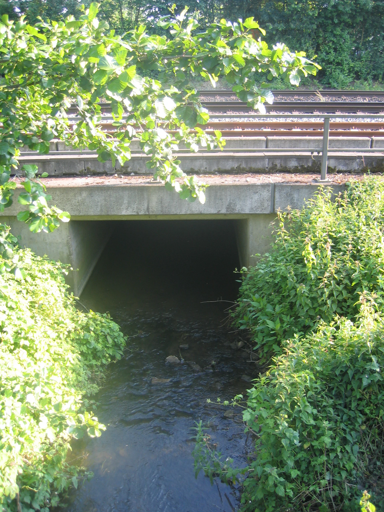
A small stream flows towards a dark concrete tunnel under a railway track, with green bushes and overhanging tree branches framing the scene.
The Kilverbach stream flows into a concrete culvert beneath the Minden-Rheine railway line, framed by lush green vegetation.

Kilverbachtal history and protected-area timeline

The Kilverbach has played a role as a political boundary for centuries. Long before the modern states existed, the stream served as a state border between the Kingdom of Hanover, or the Prince-Bishopric of Osnabrück on the Lower Saxony side, and the Kingdom of Prussia on the North Rhine-Westphalian side.

In the early nineteenth century, the Kilverbach briefly took on an international character: between 1807 and 1811, during the Napoleonic reorganization of Germany, the stream marked the border between French territory and the Kingdom of Westphalia. After this period, the older Prussian-Hanoverian boundary role of the valley resumed until the modern German states were formed.

A more subtle historical thread is visible in the shape of the valley itself. The course of the Kilverbach was originally in the middle of the valley floor but, centuries ago, was deliberately shifted to the base of the slope to free up more land for agricultural use. This modification created the characteristic steep, box-shaped Siek profile that today defines both the appearance and the ecological value of the Kilverbachtal.

Kilverbachtal landscape and geographic character

The Kilverbachtal is a textbook example of a Siek valley, the narrow, deeply incised, box-shaped stream valleys that are characteristic of the Ravensberger Mulde in northwestern Germany. The valley floor is flat and often wet, while the lower slopes drop steeply on either side, producing a distinctive cross-section that is uncommon elsewhere in the region.

Geologically, the area belongs to the northern slopes of the Wiehengebirge, a low mountain range that forms the southern edge of the North German Plain. The Kilverbach descends from the wooded heights near Rödinghausen through roughly 81 meters of elevation over only 8.4 kilometers, giving it an average gradient of about 9.7 per mille. Despite this modest scale, the descent gives the valley a varied micro-topography of small cascades, meanders, and seasonally flooded zones.

Where the original middle-of-the-valley course has been restored or preserved, the stream runs through naturally shaped meanders bordered by alder stands; where older drainage shifts still dominate, the brook runs in straight, narrow channels along the foot of the slope. Together with neighboring stream valleys such as the Auebachtal, the Kilverbachtal forms a connected network of lowland brooks set into an otherwise agricultural rolling landscape.

Kilverbachtal ecosystems, habitats, and plant life

Ecologically, the Kilverbachtal belongs to a network of near-natural lowland streams embedded in an intensively farmed cultural landscape. The wet meadows on the valley floor, the alder stands along the watercourse, and the beech-dominated field groves on the slopes together create a layered mosaic of microhabitats over a relatively small area.

The brook itself is fed by several smaller tributaries, including the left-bank Kollbach and Bursieksbach and the right-bank Hagensieksbach. Together these form a Siek system whose upper and middle reaches are considered close to natural. Because most of the surrounding landscape has been converted to pasture or cropland, the valley functions as a refuge for plant and animal species that have otherwise become rare in the Ravensberger Land.

Consistent moisture along the stream and on the floodplain supports wet grassland vegetation, while the relatively dry, sun-exposed upper slopes favor different plant communities. The result is a compressed but ecologically diverse cross-section in which floodplain, brook, slope margin, and beech grove all occur within a few hundred meters of one another.

Kilverbachtal wildlife and species highlights

The Kilverbachtal is home to several species that have become uncommon elsewhere in the Ravensberger Mulde. The colorful kingfisher is among the most charismatic residents, fishing regularly in the Kilverbach and using the steep Siek banks for nesting. Its presence is often taken as an indicator of good water quality and intact riparian habitat.

Wet meadows in the valley support spring-blooming wildflowers such as cuckooflower, various buttercups, and the strikingly named cuckoo campion, which in turn provide resources for butterflies. Two notable day-flying moths recorded in the valley are the orange tip and the six-spotted burnet, both of which depend on the mix of open meadow and shrubby margin that the Siek valley provides.

Beyond these highlight species, the combination of flowing water, alder stands, and beech groves supports a broad community of stream invertebrates, amphibians, and typical lowland forest birds. Although the valley is small, this layered habitat structure gives it a disproportionate value for local biodiversity in a region dominated by open farmland.

Kilverbachtal conservation status and protection priorities

Kilverbachtal is protected at several nested levels. The North Rhine-Westphalian portion of the valley is formally designated as the Naturschutzgebiet Kilverbachtal, covering about 107 hectares and making it the largest of six nature reserves in the municipality of Rödinghausen, whose combined area is roughly 189 hectares. The Lower Saxony side has been placed under landscape-protection status as a Landschaftsschutzgebiet.

The North Rhine-Westphalian designation is connected to the broader EU Habitats Directive site known as System Else/Werre, which ties the valley into a pan-European network aimed at preserving representative examples of natural and semi-natural habitat types. This linkage gives Kilverbachtal protection beyond purely regional or national nature reserve law.

The underlying conservation rationale is that an unusually near-natural Siek stream system has survived in a region that is otherwise heavily agricultural. Protecting the valley floor, the slope forests, and the wet meadows secures both habitat connectivity along the Else/Werre river system and a refuge for plant and animal species that are declining elsewhere in the Ravensberger Land.

Kilverbachtal cultural meaning and human context

The Kilverbachtal sits within the cultural landscape known as the Ravensberger Land, and more specifically within the Ravensberger Mulde, a region defined by its characteristic Siek valleys, small farmsteads, and long agricultural history. Centuries of careful land management, including the deliberate relocation of the brook to the foot of the slope, have shaped both the valley's appearance and its current ecological character.

The valley's role as a historical border between Prussia and the Hochstift Osnabrück, and later between Prussia and the Kingdom of Hanover, also gives it a regional identity that extends beyond natural heritage. Local cultural landscape inventories, such as those maintained by the Landschaftsverband Westfalen-Lippe, recognize the broader area around Rödinghausen, Westkilver, and Bruchmühlen as a regionally significant cultural landscape.

Top sights and standout views in Kilverbachtal

As a small but well-protected valley in an otherwise heavily agricultural region, Kilverbachtal offers a compact example of a near-natural Siek stream system. Its combination of wet meadows, alder-lined brook, and beech-dominated slopes supports rare plants, butterflies such as the orange tip and the six-spotted burnet, and the kingfisher along the water itself.

Larger-scale significance comes from its integration into the System Else/Werre Habitats Directive site on the North Rhine-Westphalian side, with landscape-protection status on the Lower Saxony side. The valley's long history as a state border, and its present-day role as a refuge of traditional Ravensberger Land cultural landscape, add a further layer of identity that goes beyond its modest size.

Best time to visit Kilverbachtal

Late spring is generally the most rewarding time to experience the Kilverbachtal, when wet meadows come into bloom with cuckooflower, buttercups, and cuckoo campion, and when day-flying butterflies are most active along the warm valley margins.

Early summer and high summer offer strong riparian foliage along the alder stands and the best chances of seeing kingfishers along the stream, while early autumn tends to bring out the structural contrast between the still-green floodplain and the changing colors of the beech woods on the slopes. The valley can be wet and slippery underfoot at any time of year, so conditions along the bottom of the Siek are best approached with sturdy footwear.

Monthly climate preview

Long-term monthly temperature and precipitation patterns sampled at representative park coordinates

Kilverbachtal Climate Normals and Annual Temperature Rhythm

Kilverbachtal displays a measured annual temperature range from negative averages in winter months up to warm summer maximums alongside steady daily precipitation values. Examining the complete twelve-month climatology profile provides deeper insight into long-term averages across the entire protected area.
Annual mean9 °C
1 °C18 °C
Jan
Feb
Mar
Apr
May13°
Jun16°
Jul18°
Aug18°
Sep14°
Oct
Nov
Dec
Warmest month
July

18.1 °C

Coolest month
January

0.5 °C

Wettest month
December

2.6 mm/day

Driest month
April

1.6 mm/day

Park location guide

Geography guide, regional context, and park location map for Kilverbachtal

Kilverbachtal park geography, regions, and map view in Germany

Understand where Kilverbachtal sits in Germany through a broader geographic reading of the surrounding landscape, nearby location context, and its mapped position within the national park landscape.

How Kilverbachtal fits into Germany

Germany is a federal republic in Western and Central Europe with a population of over 83 million across sixteen constituent states. It is Europe's largest economy by nominal GDP and a major global exporter and importer. The capital is Berlin, and the country borders Denmark, Poland, Czech Republic, Austria, Switzerland, France, Luxembourg, Belgium, and the Netherlands.

Wider geography shaping Kilverbachtal in Germany

Germany is located in Western and Central Europe, spanning 357,022 km². It borders Denmark to the north, Poland and the Czech Republic to the east, Austria and Switzerland to the south, and France, Luxembourg, Belgium, and the Netherlands to the west. The country has coastlines on the Baltic Sea and North Sea to the north, with the Alps located in the southern region.

Map view of Kilverbachtal

Use this park location map to pinpoint Kilverbachtal in Germany, understand its exact geographic position, and read its mapped placement within the surrounding landscape more clearly.

Pigeon | © OpenStreetMap contributors

Location context for Kilverbachtal

North Rhine-Westphalia

Explore detailed imagery of stream habitats, wet meadows, and beech slopes in northwestern Germany

Kilverbachtal Photos and Scenery: Visualizing Protected Valley Landscapes

Visual records capture the distinctive topography of Kilverbachtal, showcasing near-natural stream channels, wet meadows, and steep beech-dominated slopes across the Ravensberger Land. Examining these protected area photographs reveals the micro-topography, riparian habitats, and valley character that define regional conservation efforts.

A small stream flows towards a dark concrete tunnel under a railway track, with green bushes and overhanging tree branches framing the scene.

Park atlas

Compare adjacent stream valleys and regional protected areas in northwestern Germany.

Explore Parks Near Kilverbachtal and Surrounding Protected Landscapes

Browse other parks near Kilverbachtal to examine connected lowland brooks and shared regional topography across the surrounding agricultural landscape. Extending the geographic review helps map broader conservation corridors and compare protected natural habitats throughout the region.
Watercolor painting of a rolling forested landscape with hills in the background and a gentle valley floor in the foreground, rendered in soft green and earth tones.
Nature reserveNorth Rhine-Westphalia
About 6.7 km away#1 closest

Northeast

Limberg und Offelter Berg: Exploring Protected Forest Landscapes in North Rhine-Westphalia

Nature reserve geography and Wiehen Hills woodland terrain

Limberg und Offelter Berg is a foundational nature reserve in eastern Westphalia, known for its well-preserved beech forest mosaic and the protected headwaters of the Landwehrbach. Positioned on the eastern ridge of the Wiehen Hills, the area features a varied terrain of forested slopes and small valleys. It remains a critical study area for native woodland communities, reflecting eight decades of continuous landscape protection in the Minden-Lübbecke district.

Area
1.861 km²
Established
1935
Relief
Upland
Scope
Terrestrial
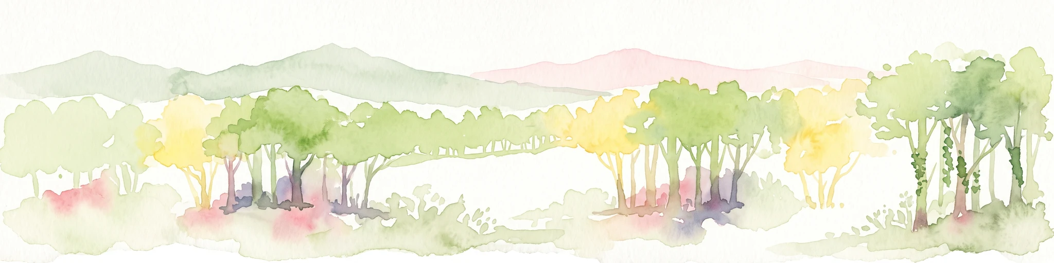
A horizontal watercolor illustration featuring a stylized forest with shades of green and yellow trees against a backdrop of soft, faint hills.
Nature reserveNorth Rhine-Westphalia
About 12 km away#2 closest

Northeast

Sonnenwinkel Nature Reserve: Protected Landscape and Forest Ecology in North Rhine-Westphalia

Calcareous beech forest and seasonal woodland habitats

Sonnenwinkel is a dedicated nature reserve near Lübbecke, North Rhine-Westphalia, providing a critical refugium for calcareous beech forest. The site exhibits distinct ecological boundaries defined by the Wiehengebirge foothills and remains a significant example of protected lowland forest habitat in Germany.

Area
0.047 km²
Relief
Mountain
Climate
Temperate
Access
Easy access
Watercolor painting of a rolling forested landscape with hills and a central water feature, stylized with soft green and peach tones.
Nature reserveNorth Rhine-Westphalia
About 18 km away#3 closest

Southwest

Johannisegge-Schornstein Nature Reserve: Protected Woodland and Ridge Terrain Atlas

Exploring the Teutoburg Forest ridge geography in North Rhine-Westphalia.

Johannisegge-Schornstein stands as a vital nature reserve in Borgholzhausen, characterized by its exposed beech stands and its position on the Teutoburg Forest ridge. The reserve offers a clear look at historic coppice woodland management and local watershed geography, stretching from the rocky Bönkersche Steinbruch quarry to the prominent Luisenturm lookout point.

Area
2.255 km²
Established
2001
IUCN
IV
Relief
Mountain
Watercolor painting of soft, rolling green hills and a gentle mountain silhouette against a pastel sunrise sky.
Nature reserveNordrhein-Westfalen
About 19 km away#4 closest

South

Knüll-Storkenberg Nature Reserve: Mapping the Protected Terrain of the Teutoburg Forest

A diverse protected landscape of forest, spring-fed valleys, and grassland

Knüll-Storkenberg stands as a protected nature reserve in Nordrhein-Westfalen, encompassing a range of habitats from beech forests to sedge-filled valley meadows. This area integrates an abandoned limestone quarry into its managed landscape, creating a varied microclimate that supports distinct plant and animal communities. Its geography is anchored by the Knüll and Storkenberg hills, connected by the Wiesental valley.

Area
0.789 km²
Established
2001
IUCN
IV
Watercolor painting of a green, rolling landscape with trees and soft hills, rendered in a minimalist, light-toned style on a white background.
Nature reserveNordrhein-Westfalen
About 23 km away#5 closest

Southeast

In der Masch Nature Reserve: Mapped Floodplain Geography in Nordrhein-Westfalen

Protected nature reserve with rare lowland meadow habitats.

In der Masch offers a focused look at protected lowland river-meadow terrain within Germany. This 23-hectare nature reserve in Nordrhein-Westfalen protects interconnected oat-grass grasslands, riparian wood fringes, and historical boundary markers, providing a distinct study in regional floodplain topography and habitat preservation.

Area
0.23 km²
Established
2002
IUCN
IV
A watercolor illustration of a calm stream flowing through a green valley with trees and gentle hills in the background.
Nature reserveNorth Rhine-Westphalia
About 24 km away#6 closest

East

Naturschutzgebiet Mittelbach Nature Reserve: Mapped Protected Landscapes in Vlotho

Classic Siek stream valley geography and riparian woodland habitats

The Naturschutzgebiet Mittelbach is a protected area in eastern Westphalia that defines the local landscape with its deeply cut moisture-rich valley. This site serves as a vital reference for the traditional Ravensberger Siek morphology, preserving a compact ecological network of sedge communities, beech forest patches, and riparian alder stands along a two-kilometer stream stretch.

Area
0.341 km²
Established
1998
Relief
Upland
Climate
Temperate
Nature reserveBavaria
About 25 km away#7 closest

Northwest

Steinernes Meer Nature Reserve: Protected Glacial Boulder Landscapes and Geological Terrain

Geological heritage and forest terrain in the Osnabrück district

Steinernes Meer Nature Reserve covers a dense cluster of large glacial erratic boulders known as findlings. These massive stones, left by retreating ice sheets, create a striking, stony forest floor that defines the reserve as a significant geological landmark within the broader regional landscape.

Area
0.127 km²
Established
1937
Relief
Upland
Climate
Temperate
Nature reserveNordrhein-Westfalen
About 26 km away#8 closest

Southeast

Windweheniederung Nature Reserve: Geographic Atlas of an East Westphalian Floodplain

Riparian ecosystems and protected valley land mapping

Windweheniederung represents a specialized nature reserve in Nordrhein-Westfalen that centers on the natural morphology of the Windwehe stream. This protected area provides a critical refuge for wetland-dependent species through its alder-ash woodland and reed-fringed pools. Explore the structural geography of this lowland catchment and understand its role in maintaining functional floodplains amidst a heavily developed regional environment.

Area
0.297 km²
Established
1991
IUCN
IV

Common questions about visiting, size, designation, and location context for Kilverbachtal

Kilverbachtal FAQs for park facts, access, geography, and protected area context

Find quick answers about Kilverbachtal, including protected-area facts, park geography, trail and visitor context, and how the park fits into its surrounding country and regional landscape.
MoriAtlas Explorer

Continue Your Protected Areas Search Across the Global Atlas

Deepen your exploration by continuing the structured search for national parks and protected areas worldwide. Utilize the comprehensive filtering capabilities to compare different conservation landscapes and refine your understanding of global park geography. Discover more about the distribution and characteristics of protected natural areas.

Global natural geography