
Mori Atlas logo
Nature reserveKlapperkop Nature Reserve

A vital protected landscape in Gauteng featuring unique bankenveld topography and historic heritage sites.

Klapperkop Nature Reserve: Exploring Protected Highveld Grasslands and Historic Terrain

Klapperkop Nature Reserve represents a critical fragment of bankenveld grassland, situated on a prominent east-to-west spur at the southern edge of Pretoria. This protected area preserves a mosaic of rocky ridges and open savanna, functioning as an essential ecological link within the Gauteng metropolitan landscape. Beyond its natural value, the reserve is defined by the historic Fort Klapperkop, which sits among indigenous woodland and rolling highveld terrain.

grasslandbankenveldkopjeurban nature reservePretoriahighveld
A flat-style digital illustration of a landscape with green hills, a cascading waterfall on a cliff, sparse trees, and a tall communication tower in the distant horizon under a soft sunset sky.

Klapperkop Nature Reserve

Nature reserve

Park overview

Structured park overview, official facts, and landscape profile for Klapperkop Nature Reserve

Klapperkop Nature Reserve park facts, protected area profile, and essential visitor context

Review the core facts for Klapperkop Nature Reserve, including designation, size, terrain, visitor scale, habitats, and operating context in one park-focused overview.

About Klapperkop Nature Reserve

Klapperkop Nature Reserve occupies a notable position in the protected-area landscape of Pretoria. While small in extent, it carries an outsized role for the South African capital because it preserves a piece of the original grassland system that once characterized this part of Gauteng. The reserve was established in 1898 and has been shaped over more than a century by decisions ranging from military fortification to invasive plant clearance. Today it is managed by the Department of Nature Conservation of the City of Tshwane, with an emphasis on restoring and maintaining bankenveld grassland as well as supporting reintroduced game populations.

The reserve lies on a ridgeline, or spur, that runs from west to east along the southern fringe of Pretoria. It shares boundaries with the Groenkloof Nature Reserve and lies near the Voortrekker Monument Nature Reserve, so that, taken together, these neighbouring protected areas form a credible belt of green space that defines the city's southern gateway. The landscape has been opened up and made accessible through Johann Rissik Drive, which traces through the reserve and connects Nelson Mandela Drive in the west with the Waterkloof Ridge residential area in the east. From this road, visitors gain panoramic views back across the city, including sightlines toward the Union Buildings.

Beyond its ecological function, the reserve carries strong cultural and historical weight. Fort Klapperkop, completed in 1897 as one of the cluster of forts built around Pretoria, sits inside the reserve and serves as a tangible reminder of the region's colonial and Anglo-Boer War era history. The reserve is also a place of everyday recreation for Pretoria residents, popular with cyclists, joggers and sightseers, and permitted for self-guided hiking on its network of trails. Although its formal daylight visiting hours have been recommended for some time and the road has at times been used as a city thoroughfare, the current management arrangement closes the two entrances on Johann Rissik Drive at night for visitor safety.

Quick facts and research context for Klapperkop Nature Reserve

Klapperkop Nature Reserve covers approximately 460 hectares in Pretoria, South Africa, and lies within the Tshwane metropolitan municipality in Gauteng. It was established in 1898 and is managed by the Department of Nature Conservation, which falls under the City of Tshwane. The reserve sits on a west to east spur between the Voortrekker Monument and Groenkloof Nature Reserves, at the southern entrance to the city, and is connected by Johann Rissik Drive from Nelson Mandela Drive in the west to the Waterkloof Ridge residential area in the east.

The reserve is named after the Klapperkop hill covered with klapper trees (Strychnos pungens), and contains Fort Klapperkop, a fortification completed in 1897. Together with adjoining reserves, it conserves around 1,400 hectares of bankenveld, a grassland vegetation type considered threatened in Gauteng. Game restocking began in the late 1990s, simultaneously with the clearing of extensive black wattle plantations to restore natural grassland.

Protection and recognition

Documented terrestrial conservation measures and international recognition frameworks

Klapperkop Nature Reserve Protection Status and Territorial Management Records

Klapperkop Nature Reserve maintains a defined terrestrial protection scope within its regional landscape. Structured records outline documented conservation parameters and official international recognition frameworks where available.

Protection details

Protection scope
Terrestrial
Transboundary protection
No
Park context

Deeper park guide and search-rich context for Klapperkop Nature Reserve

Klapperkop Nature Reserve history, landscape, wildlife, and travel context

Explore Klapperkop Nature Reserve through its history, landscape character, ecosystems, wildlife, conservation priorities, cultural context, and seasonal travel timing in a structured park guide built for atlas discovery and search intent.

Why Klapperkop Nature Reserve stands out

Klapperkop Nature Reserve is best known for protecting a representative fragment of bankenveld grassland at a sensitive ecological threshold within urban Gauteng. The vegetation it conserves, when combined with neighboring reserves, forms one of the more meaningful surviving examples of this threatened highveld mosaic in the province. The reserve is named for its defining feature, the Klapperkop hill and its klapper tree woodland, which gives the landscape both its identity and its visual focal point. Equally distinctive is the pairing of natural and cultural heritage: Fort Klapperkop, completed in 1897 and situated inside the reserve, links the protected area to Pretoria's late nineteenth century military history. The reserve is also closely associated with the nearby Voortrekker Monument, placing it within a cluster of significant South African heritage sites at the city's southern edge.
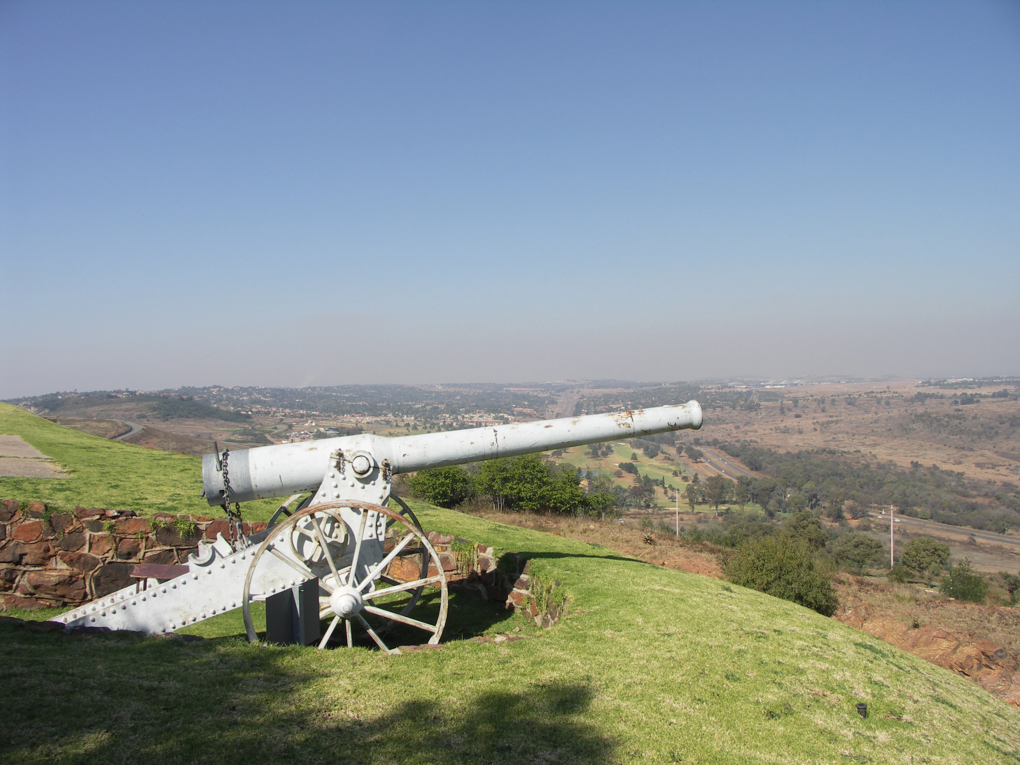
A metal Long Tom cannon replica sits on a grassy hill overlooking a valley.
A Long Tom cannon replica positioned at Fort Klapperkop.

Klapperkop Nature Reserve history and protected-area timeline

The reserve has an unexpectedly long administrative history for a small urban green space. It was formally established in 1898, only a year after the completion of Fort Klapperkop, one of the four Pretoria forts built at the close of the nineteenth century to defend the city. From its earliest days, the protected area therefore combined two purposes: conserving the natural vegetation of the Klapperkop hill and its surroundings, and safeguarding a key piece of late nineteenth century military infrastructure.

For most of its modern history the reserve has been managed as a municipal nature conservation asset under what is now the Department of Nature Conservation within the City of Tshwane. During the late 1990s the reserve entered a more active ecological management phase. Extensive plantations of invasive black wattle were removed, a process that gradually allowed the native grassland vegetation to re-establish. At roughly the same time, the reserve was restocked with game species, transforming it from a primarily cultural and scenic site into a functioning small-scale wildlife area within the urban edge of Pretoria.

Klapperkop Nature Reserve landscape and geographic character

The defining landform of the reserve is the Klapperkop hill, or kopje, that gives the area its name. This rocky elevation rises above the surrounding terrain and supports its own microclimate and vegetation, particularly the klapper trees that cloak its northern slopes. The broader reserve is built on a spur running west to east, which gives the area its elongated layout and produces the elevated viewpoints that the reserve is known for. Johann Rissik Drive follows this spur and offers sweeping views across Pretoria and toward landmarks such as the Union Buildings.

In ecological terms, the underlying vegetation of the reserve is bankenveld, a savanna and grassland mosaic typical of the rocky ridges and plains of the broader Gauteng highveld. The broken terrain of the spur produces areas of denser woody cover around the koppie, more open grassland on flatter sections, and transitional zones where the two intergrade. The removal of black wattle plantations has allowed natural grassland to recolonize much of the central plateau, restoring a more open, rolling savanna character to large parts of the reserve.
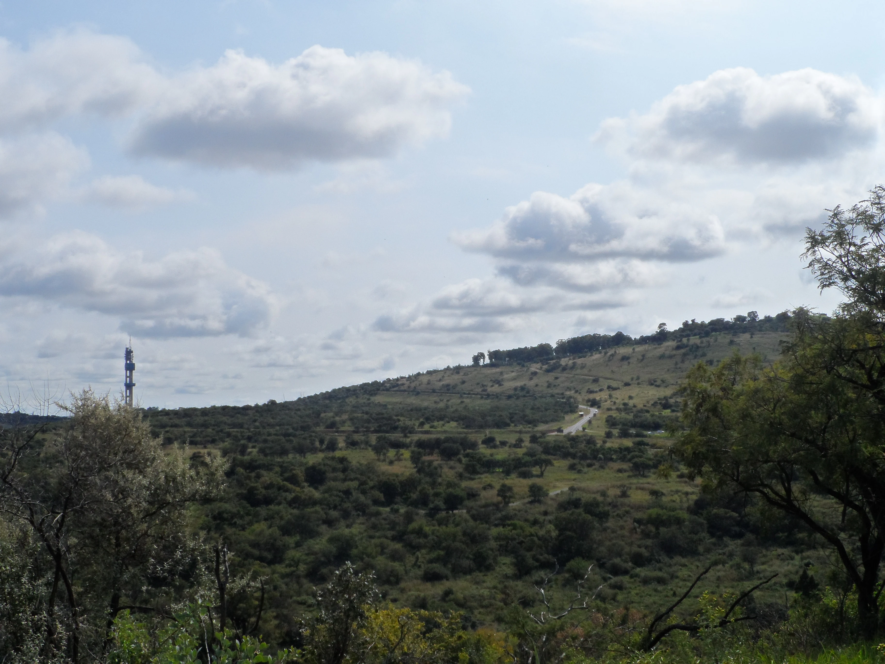
A wide landscape view of rolling hills with scattered trees, shrubs, and a winding road in the distance under a blue sky with scattered clouds.
A view looking over the rolling hills of the nature reserve.

Klapperkop Nature Reserve ecosystems, habitats, and plant life

Bankenveld is the foundational ecosystem of Klapperkop Nature Reserve. This vegetation type combines elements of grassland and woodland in patterns determined largely by soil depth, rockiness, and slope, and it supports a specialized mix of grasses, forbs, woody shrubs, and scattered trees. In Gauteng, bankenveld has been heavily reduced by urban expansion, agriculture, and invasive plants, which makes the surviving examples around the southern entrance of Pretoria ecologically significant. Together with neighbouring Groenkloof, the Klapperkop reserve protects roughly 1,400 hectares of this threatened vegetation.

The northern slopes of the Klapperkop hill itself are notable for their concentration of klapper trees (Strychnos pungens), a hardy woody species adapted to rocky highveld sites. Around the base and across the spur, the vegetation is dominated by open grassland transitioning into denser savanna patches. This patchwork of microhabitats is what gives the reserve its relatively high ecological value despite its small size.

For decades, the reserve was compromised by extensive plantations of black wattle (Acacia mearnsii), an invasive Australian tree that suppresses indigenous grasses and shrubs. Their systematic removal during the late 1990s and into the 2000s has been one of the defining ecological moves in the reserve's history, allowing bankenveld species to return. The recovery of grassland has, in turn, supported the reintroduction of grazing animals, which now interact with the vegetation in ways that help maintain its character.

Klapperkop Nature Reserve wildlife and species highlights

Although Klapperkop was historically a relatively quiet reserve in terms of larger mammals, deliberate game restocking from the late 1990s onward has significantly changed its wildlife profile. Burchell's zebra, blue wildebeest, and red hartebeest are now regularly seen across the open grassland sections, often grazing in loose groups together. These use the reserve as both grazing habitat and a refuge from the surrounding urban density, and their presence has become one of the most recognizable features of visits to the area.

Alongside the larger game, the reserve supports a variety of smaller mammals typical of the highveld. Black-backed jackal, several species of mongoose, hedgehogs, hares, and porcupines are recorded, and these smaller animals occupy the wooded fringes and rocky zones around the Klapperkop hill. Birdlife is also a feature of the reserve. Species such as Swainson's spurfowl occur on the open slopes and in the grassland, adding a strong birding element to a site that is otherwise best known for its scenery and history.

The combination of relatively open grassland, scattered rocky outcrops, and woodland patches supports a wide community of small reptiles, insects, and seasonal migrants, contributing to a more diverse reserve than its compact size would suggest. The presence of game also helps shape the vegetation, with grazing and trampling influencing grass composition and turnover.

Klapperkop Nature Reserve conservation status and protection priorities

The conservation importance of Klapperkop Nature Reserve is rooted chiefly in the protection of bankenveld vegetation at a scale that is meaningful within Gauteng. This vegetation type has been substantially reduced across the province, and the combined 1,400 hectares conserved by Klapperkop and its immediate neighbours represents one of the more concentrated surviving blocks. The reserve therefore functions as a refuge for the plants, animals, and ecological processes associated with rocky highveld grassland.

A major part of the reserve's conservation story has been ecological restoration. The removal of black wattle plantations was a priority intervention, because invasive wattles suppress native grasses and alter fire regimes, fundamentally changing the character of bankenveld. By clearing these plantations, managers reopened the landscape to indigenous vegetation, which has since recovered to occupy much of the former plantation footprint. This recovery is closely linked to the reserve's game restocking programme, which has helped reintroduce native herbivores into an ecosystem that had effectively lost its large grazing component.

The reserve also plays a role in conservation awareness and urban ecological connectivity. By maintaining a sizeable patch of natural habitat directly adjacent to a major city, it offers a visible example of integrated conservation at the urban edge, and provides ecological stepping stones between the broader highveld landscape and protected spaces elsewhere in the region.

Klapperkop Nature Reserve cultural meaning and human context

Klapperkop Nature Reserve carries a layered cultural identity that reflects both South African military history and the modern identity of Pretoria as a capital city. The reserve is home to Fort Klapperkop, completed in 1897 as one of the late nineteenth century forts built around Pretoria. The fort remains a tangible piece of the region's colonial-era military architecture and is recognized in heritage discussions of the Pretoria fort system. Its continued presence within an actively managed nature reserve gives the site a distinctive heritage-and-conservation character.

Beyond the fort, the reserve's proximity to the Voortrekker Monument and its neighbours places it within a wider cultural landscape at the southern entrance to Pretoria. This area is strongly associated with Afrikaner and broader South African historical narratives, and the reserve is part of the broader setting within which visitors approach these monuments. In more everyday terms, the reserve has also become a part of contemporary urban culture in Pretoria, used regularly by cyclists, joggers, hikers, and sightseers as a place for outdoor recreation at the edge of the city.

Top sights and standout views in Klapperkop Nature Reserve

One of the standout features of Klapperkop Nature Reserve is the concentration of protected bankenveld at the southern edge of Pretoria, a vegetation type that is heavily threatened in Gauteng and that gives the site genuine ecological weight despite its compact size. The recovery of native grassland following the removal of invasive black wattle plantations, combined with the reintroduction of game, has produced a working highveld ecosystem visible from roads and trails within the reserve.

The reserve is also distinguished by the way natural and historical features interlock. The Klapperkop hill and its klapper tree slopes define both the visual landscape and the name of the reserve, while Fort Klapperkop anchors the cultural landscape and creates direct links to Pretoria's late nineteenth century history. From the elevated road through the reserve, visitors gain viewpoints that connect the grasslands, the fort, and broader city landmarks such as the Union Buildings.

Best time to visit Klapperkop Nature Reserve

Because the reserve is centered on open grassland and exposed koppie slopes, the character of a visit shifts meaningfully with the seasons. In the wetter summer months, the bankenveld greens up, grasses grow tall, and game such as zebra and wildebeest are more easily seen across open ground, while bird activity generally increases around the reserve. The cooler dry winter months bring shorter, more golden grasses, clearer views from the higher portions of the spur, and cooler conditions suited to longer hiking and cycling outings.

Wildlife viewing and birding are typically best during the warmer months, when both resident and seasonal species are more active. Conversely, the cooler season makes hiking and scenic enjoyment of the reserve's viewpoints more comfortable and reduces the need for early starts. As with most highveld reserves, dawn and late afternoon are generally the most rewarding times of day for wildlife spotting, and the reserve is recommended for daylight visits given its safety considerations.
Monthly climate preview

Long term monthly temperature and precipitation rhythm for Gauteng protected areas

Klapperkop Nature Reserve Climate Normals and Annual Temperature Patterns

Klapperkop Nature Reserve records long term monthly temperature and precipitation normals derived from representative coordinate sampling across the landscape. The complete twelve month profile details average minimum and maximum temperature swings alongside daily precipitation rates.
Annual mean17 °C
10 °C21 °C
Jan21°
Feb21°
Mar20°
Apr16°
May13°
Jun10°
Jul10°
Aug13°
Sep17°
Oct20°
Nov20°
Dec21°
Warmest month
January

21.5 °C

Coolest month
July

9.8 °C

Wettest month
December

4.1 mm/day

Driest month
July

0.1 mm/day

Park location guide

Geography guide, regional context, and park location map for Klapperkop Nature Reserve

Klapperkop Nature Reserve park geography, regions, and map view in South Africa

Understand where Klapperkop Nature Reserve sits in South Africa through a broader geographic reading of the surrounding landscape, nearby location context, and its mapped position within the national park landscape.

How Klapperkop Nature Reserve fits into South Africa

South Africa is the southernmost country in Africa, spanning 1.22 million km² with a population of over 63 million. The country operates with three capital cities, Pretoria (executive), Cape Town (legislative), and Bloemfontein (judicial), and is renowned for its biodiversity, national parks, and multicultural society.

Wider geography shaping Klapperkop Nature Reserve in South Africa

South Africa occupies the southernmost region of Africa, with coastline along both the Atlantic Ocean to the west and the Indian Ocean to the east. The interior features elevated plateaus including the Highveld, with the Drakensberg escarpment marking the eastern highlands. The country shares borders with Namibia, Botswana, Zimbabwe, Mozambique, Eswatini, and Lesotho.

Map view of Klapperkop Nature Reserve

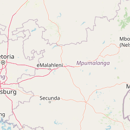
Use this park location map to pinpoint Klapperkop Nature Reserve in South Africa, understand its exact geographic position, and read its mapped placement within the surrounding landscape more clearly.

Pigeon | © OpenStreetMap contributors

Location context for Klapperkop Nature Reserve

Gauteng

Visualizing the bankenveld grassland, highveld ridge terrain, and historic fort surroundings

Klapperkop Nature Reserve Landscape, Scenery, and Protected Area Photography

Photographic records reveal the distinct bankenveld grassland, rocky kopje slopes, and native tree habitats defining Klapperkop Nature Reserve. Visualizing these protected landscapes clarifies the ecological character and terrain variations of the highveld conservation area.

A metal Long Tom cannon replica sits on a grassy hill overlooking a valley.

A brown Swainson's francolin bird with a visible red throat area standing on a dark, weathered rock surface against a pale sky.

A wide landscape view of rolling hills with scattered trees, shrubs, and a winding road in the distance under a blue sky with scattered clouds.

Park atlas

Compare regional highveld reserves and connected conservation landscapes

Explore Parks Near Klapperkop Nature Reserve and Surrounding Protected Areas

Visitors exploring Klapperkop Nature Reserve can browse adjacent highveld grasslands and nearby protected areas across the surrounding region. Comparing these connected natural reserves reveals broader ecological patterns across the urban fringe.
Watercolor illustration depicting a winding river through a grassy landscape with rolling hills and distant trees under a soft yellow sky.
Wildlife reserveGauteng
About 47 km away#1 closest

East

Dinokeng Game Reserve: Geographic Atlas and Protected Wildlife Area Profile

Savanna Landscapes and Riverine Corridors in Gauteng

Dinokeng Game Reserve functions as a primary wildlife sanctuary within Gauteng, South Africa, featuring a diverse mosaic of grassland and riverine bushveld. This atlas profile details the reserve geographic layout, from the Pienaars River watercourses to its integrated conservation zones, providing a clear overview of the terrain that supports its status as a significant regional protected area.

Area
210 km²
Established
2011
Relief
Upland
Climate
Subtropical
Watercolor painting of a river flowing through a hilly, green valley with rocky cliffs on the right.
Biosphere reserveNorth West
About 62 km away#2 closest

West

Magaliesberg Biosphere Reserve: Geographic Overview and Protected Area Landscape Mapping

Ancient mountain ranges in South Africa

The Magaliesberg Biosphere Reserve features a rugged terrain of high ridges and deep kloofs that support a vast array of bird species and vegetation. As a significant conservation area in North West, it preserves geological history alongside critical transitional ecosystems. Discover the mapped boundaries and natural features of this protected region that bridges urban centers and wilderness.

Area
3,578.7 km²
Established
2015
Relief
Mountain
Climate
Subtropical
A watercolor illustration of rolling green hills, distant mountains, and a pale sky.
Protected landscapeNorth West
About 63 km away#3 closest

West

Magaliesberg Protected Natural Environment: Mapped Geography and Protected Landscape Context

Ancient mountain ridges between Rustenburg and Pretoria

Spanning a long quartzite ribbon, the Magaliesberg Protected Natural Environment represents a sophisticated model of private land conservation. The geography reveals a dramatic elevation gradient where Highveld plateaus meet lower-lying bushveld terrain. This atlas entry details the protected boundaries and the integrated landscape connection between surrounding nature reserves.

Area
343.56 km²
Established
1994
Relief
Mountain
Scope
Terrestrial
Wildlife reserveGauteng
About 70 km away#4 closest

Southeast

Marievale Bird Sanctuary: A Wildlife Reserve and Wetland Habitat in Gauteng, South Africa

Discover protected floodplain geography and wetland mapping

Marievale Bird Sanctuary preserves a complex network of pans and reedbeds along the Blesbokspruit. As a landmark of South African conservation, the area offers a focused look at how wetland ecosystems function within the Highveld topography of Gauteng, providing a critical refuge for diverse water-dependent species and migratory birds.

Area
15.26 km²
Established
1978
Relief
Lowland
Climate
Temperate
Wildlife reserveNorth West Province
About 79 km away#5 closest

Northwest

Borakalalo Game Reserve: Protected Bushveld and Aquatic Landscapes in North West Province

Mapping a diverse South African wildlife reserve

Borakalalo Game Reserve features a distinct ecological setting within South Africa, combining woodland bushveld with the aquatic ecosystems of Klipvoor Dam. This protected area provides a habitat for varied mammal species and an extensive bird list, set against the backdrop of the interior plateau landscape in North West Province.

Area
130 km²
Relief
Upland
Access
Access unknown
Scope
Terrestrial
A watercolor painting showing a wide, panoramic view of rolling green and yellow hills, scattered acacia-like trees, and a distant purple mountain range under a light sky.
Nature reserveNorth West
About 96 km away#6 closest

West

Kgaswane Mountain Reserve: Map and Geographic Profile of the Magaliesberg Range

A protected nature reserve in the North West province of South Africa.

Kgaswane Mountain Reserve stands as a pivotal protected landscape within the Magaliesberg Biosphere. This atlas record provides insights into its quartzitic ridges, complex grassland and woodland ecosystems, and status as a Ramsar wetland site, offering a clear view of its geographic and conservation significance.

Area
53 km²
Established
1967
Nature reserveGauteng
About 105 km away#7 closest

Southwest

Abe Bailey Nature Reserve: Geographic Profile and Highveld Protected Area Atlas

Mapped wetlands and grassland ecosystems in Gauteng, South Africa

Spanning 4,200 hectares, Abe Bailey Nature Reserve provides a vital green refuge on the West Rand. This protected area features a unique combination of highveld grassland, seasonal wetlands, and rocky ridges that support rich birdlife and antelope populations, standing as a significant conservation feature within an urbanized province.

Area
42 km²
Relief
Upland
Climate
Temperate
Access
Access unknown
Nature reserveLimpopo
About 107 km away#8 closest

North

Mabalingwe Nature Reserve: Protected Bushveld Geography and Terrain Analysis

Mapping the Limpopo reserve landscape and habitat features

Examine the 8,800-hectare landscape of Mabalingwe Nature Reserve. From its malaria-free bushveld habitat to its network of seasonal dams and mixed woodland terrain, this entry provides a clear look at the environmental context of this private Limpopo protected area.

Area
88 km²
Established
1989
Relief
Upland
Climate
Subtropical

Common questions about visiting, size, designation, and location context for Klapperkop Nature Reserve

Klapperkop Nature Reserve FAQs for park facts, access, geography, and protected area context

Find quick answers about Klapperkop Nature Reserve, including protected-area facts, park geography, trail and visitor context, and how the park fits into its surrounding country and regional landscape.
MoriAtlas Explorer

Continue Your Protected Areas Search Across the Global Atlas

Deepen your exploration by continuing the structured search for national parks and protected areas worldwide. Utilize the comprehensive filtering capabilities to compare different conservation landscapes and refine your understanding of global park geography. Discover more about the distribution and characteristics of protected natural areas.

Global natural geography