
Mori Atlas logo
Nature reserveKlosterholz und Nordmannssteine

Examining the steep Muschelkalk cliffs, limestone terrain, and protected forest mosaics of the Werra valley

Klosterholz und Nordmannssteine: A Protected Nature Reserve in the Wartburgkreis River Valley

(Naturschutzgebiet Klosterholz und Nordmannssteine)

Klosterholz und Nordmannssteine occupies a dramatic stretch of the Werra river valley in western Thuringia, where shell limestone bedrock creates high-relief canyons and vertical slopes. This nature reserve protects a mosaic of priority habitat types including sun-exposed calcareous rock communities, semi-dry grasslands, and humid beech-dominated forests. Its distinct geography offers a unique look at how river erosion and historical quarry activity have shaped a dense, ecologically rich landscape in the Wartburgkreis district.

Muschelkalk cliffsWerra valleyshell-limestone landscapecalcareous grasslandsbeech forestsravine forests
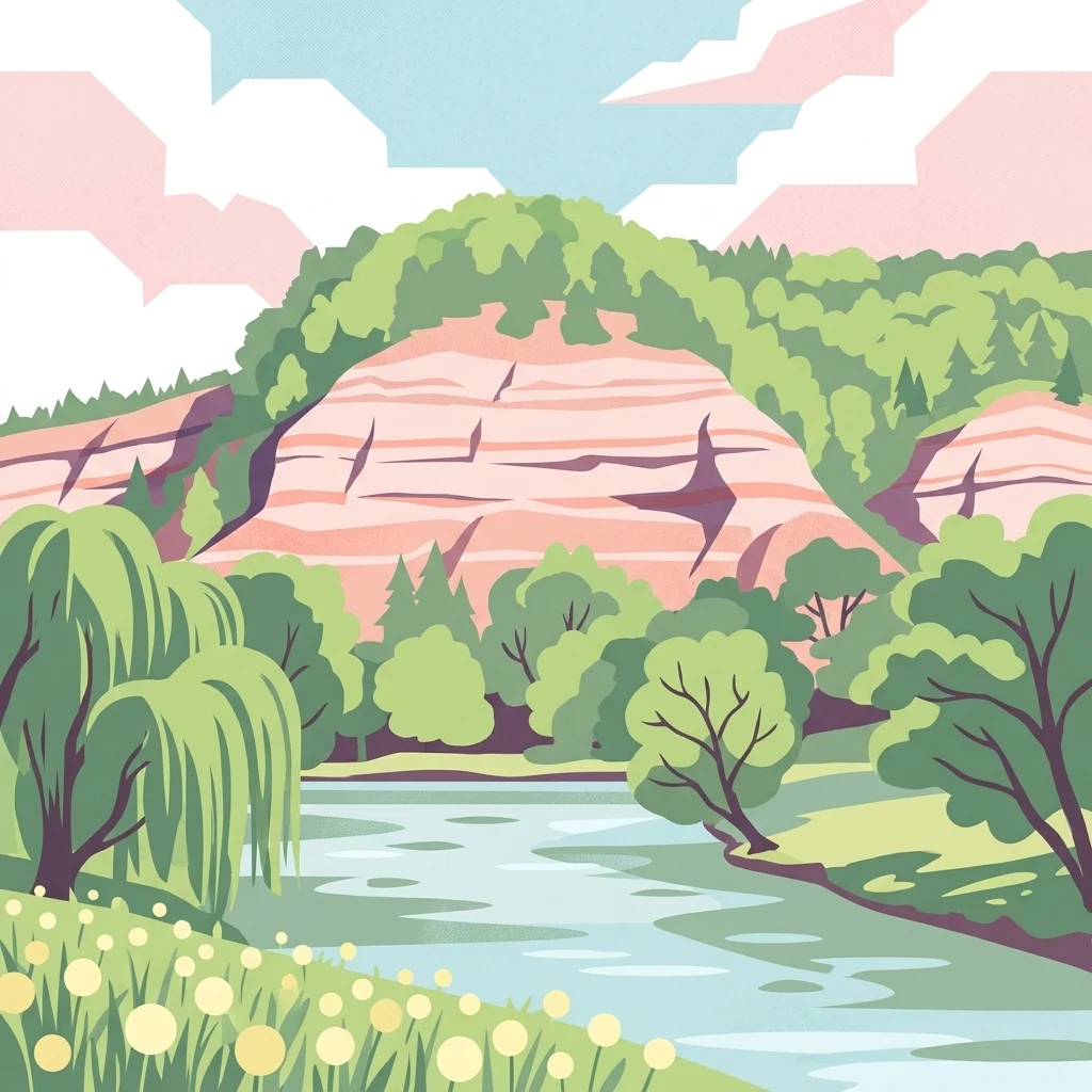
A flat-style digital illustration of a landscape with a river in the foreground, lush green trees and shrubs, and tall pinkish-tan limestone cliffs in the background under a blue sky with stylized clouds.

Klosterholz und Nordmannssteine

Nature reserve

Park overview

Structured park overview, official facts, and landscape profile for Klosterholz und Nordmannssteine

Klosterholz und Nordmannssteine park facts, protected area profile, and essential visitor context

Review the core facts for Klosterholz und Nordmannssteine, including designation, size, terrain, visitor scale, habitats, and operating context in one park-focused overview.

About Klosterholz und Nordmannssteine

Klosterholz und Nordmannssteine sits at one of the most striking sections of the Werra valley in western Thuringia, where the river has carved a deep, narrow passage through the Triassic shell-limestone uplands around the towns of Creuzburg and Mihla. The protected area lies on the northwest-exposed slope above the river, transitioning from sheer rock faces through dry grasslands and mixed forests up to a more gently sloping plateau. Its position inside the broader Creuzburger Werradurchbruch creates a landscape of unusual geological visibility, with layered Muschelkalk formations forming cliffs, ledges, and erosion features that define much of the visual character of the site.

Ecologically, the reserve represents a compact but very rich patchwork of calcareous habitats. The Nordmannssteine cliffs carry open rock vegetation, pioneer plant communities, and unusual moss and lichen assemblages, while the slopes above them support calcareous beech forests of both the Waldmeister and the orchid-rich types. These forests harbor trees such as European beech, sycamore maple, and ash, with remnant structures from earlier coppice-with-standards forestry and an unusually high amount of deadwood. Remnant stands of spruce and Scots pine on the upper slopes recall the area's 20th-century reforestation of former juniper-rich semi-dry grassland.

The protected area is also a product of more recent industrial history. The abandoned Buchenau quarry at the northern end once supplied limestone to a soda factory that operated under the Solvay process, and its settling ponds, spoil heaps, and the quarry floor that later filled with rainwater, the so-called Blaue Lagune, now form a secondary habitat complex. These unusual substrates have developed into ecologically valuable successional stages hosting orchids, wintergreen species, and rare mosses. Their conservation value is part of the reason the area received renewed protected status in 2017, alongside its more traditional natural limestone habitats.

Quick facts and research context for Klosterholz und Nordmannssteine

Klosterholz und Nordmannssteine is a 139.5-hectare nature reserve (Naturschutzgebiet) in the Wartburgkreis of Thuringia, Germany, located on the right bank of the Werra between Creuzburg and Mihla. It lies within the creeping valley known as the Creuzburger Werradurchbruch and is part of the Eichsfeld-Hainich-Werratal Nature Park. The reserve is incorporated into the European Natura 2000 network through the Creuzburger Werratal-Hänge Habitat/Species Management Area and the Werra bis Treffurt mit Zuflüssen Habitat/Species Management Area. Its core landscapes are steep shell-limestone cliffs, dry and semi-dry calcareous grasslands, and beech-dominated slope and ravine forests ranging from about 187 to 331 meters in elevation.

Protection and recognition

Explore documented conservation details, designation history, and administrative records

Klosterholz und Nordmannssteine Protection Status and Official Protected Area Records

Klosterholz und Nordmannssteine compiles verified protection records, administrative scope, and official recognition data into one structured overview. Researchers can examine foundational conservation documentation and protected area parameters associated with this location.

Protection details

WDPA ID
164150
Park context

Deeper park guide and search-rich context for Klosterholz und Nordmannssteine

Klosterholz und Nordmannssteine history, landscape, wildlife, and travel context

Explore Klosterholz und Nordmannssteine through its history, landscape character, ecosystems, wildlife, conservation priorities, cultural context, and seasonal travel timing in a structured park guide built for atlas discovery and search intent.

Why Klosterholz und Nordmannssteine stands out

The reserve is best known for its steep Muschelkalk (shell-limestone) cliffs of the Nordmannssteine, which rise in near-vertical faces above the Werra and harbor a nationally significant diversity of calcareous lichens, mosses, and orchids. It is also recognized for the unusual combination of natural shell-limestone habitats and industrial-era secondary habitats created by the former Buchenau soda works, including abandoned quarry pools known locally as the Blaue Lagune. Equally distinctive is its role within the European Natura 2000 framework. Several of its habitats, including calcareous rocks with pioneer grasslands and mixed slope forests, are classified as priority habitat types of community interest, while the area supports protected bird species such as the grey-headed woodpecker, black woodpecker, red kite, and Eurasian eagle-owl. This combination of geological drama, ecological richness, and conservation importance gives the protected area a clearly defined identity within the Werratal.

A wide, calm river winding through a lush green valley with high, light-colored limestone cliffs and dense deciduous forests on either side under a blue sky with white clouds.
The Werra river flows through the steep, forested gorge of the Klosterholz und Nordmannssteine nature reserve.

Klosterholz und Nordmannssteine history and protected-area timeline

The first part of today's reserve, the Klosterholz area, was placed under protection as a Naturschutzgebiet in May 1961, mainly to safeguard the forested slopes with their exceptional landscape character above the Werra. The reserve was later extended to include the Nordmannssteine cliffs in May 1995, and after a renewed survey and redrawing of boundaries it was re-designated under a new ordinance of the Thüringer Landesverwaltungsamt in November 2017, with a current area of 139.5 hectares and the regional number TH24.

In September 2000 the Thuringian Ministry for the Environment proposed the area, together with the neighboring Naturschutzgebiete of Lienig and Ebenauer Köpfe, as a candidate Habitat/Species Management Area under the EU Habitats Directive. Confirmation of its inclusion in the transboundary Natura 2000 network followed, and the legal framework was completed through the Thüringer Natura 2000-Erhaltungsziele-Verordnung of May 2008, creating the 147-hectare Creuzburger Werratal-Hänge Habitat/Species Management Area.

The northern portion of the reserve also intersects with the larger Werra bis Treffurt mit Zuflüssen Habitat/Species Management Area, recognized for protecting river habitats and species such as brook lamprey, bullhead, otter, yellow-bellied toad, and various bat species. Today the area is fully embedded within the 858 square kilometer Eichsfeld-Hainich-Werratal Nature Park, originally secured under the Nationalparkprogramm of the former GDR in March 1990 and given legal status through a Thuringian ordinance of December 2011. The Naturschutzgebiet itself has the international identifier TH24, while the Natura 2000 sites have their own separate codes.

Klosterholz und Nordmannssteine landscape and geographic character

The landscape of Klosterholz und Nordmannssteine is defined above all by the dramatic erosional valley of the Werra as it crosses the Muschelkalk (shell-limestone) plateau between Creuzburg and Mihla. The protected slopes form the steep right-hand Prallhang of the river, rising rapidly from a narrow floodplain to a high plateau. The valley is unusually canyon-like for central Germany and gives the reserve an immediate sense of enclosure and vertical scale.

Geologically, the cliffs and slopes are built from a sequence of Lower Muschelkalk (Wellenkalk) and Middle Muschelkalk limestones, with harder oolite and Terebratula beds standing out as rocky ledges. Higher up, softer dolomite and marl stones of the Middle Muschelkalk create gentler gradients, so the profile shifts abruptly from near-vertical rock to more rounded, forested upper slopes. An erosion gully with dells and small ridges gives the southern Klosterholz section a more dissected, rolling appearance. Soils are mainly stony rendzinas, which, despite their loamy-clay texture, are well aerated because of the high proportion of rock fragments.

The contrast between the open, sun-exposed Nordmannssteine cliffs and the shaded, humid forested slopes creates strong microclimatic gradients within a very small area. This juxtaposition of dry rock and cool woodland, set against the backdrop of the long Werra valley, gives the area a visual and ecological diversity that is unusually concentrated for its modest size.
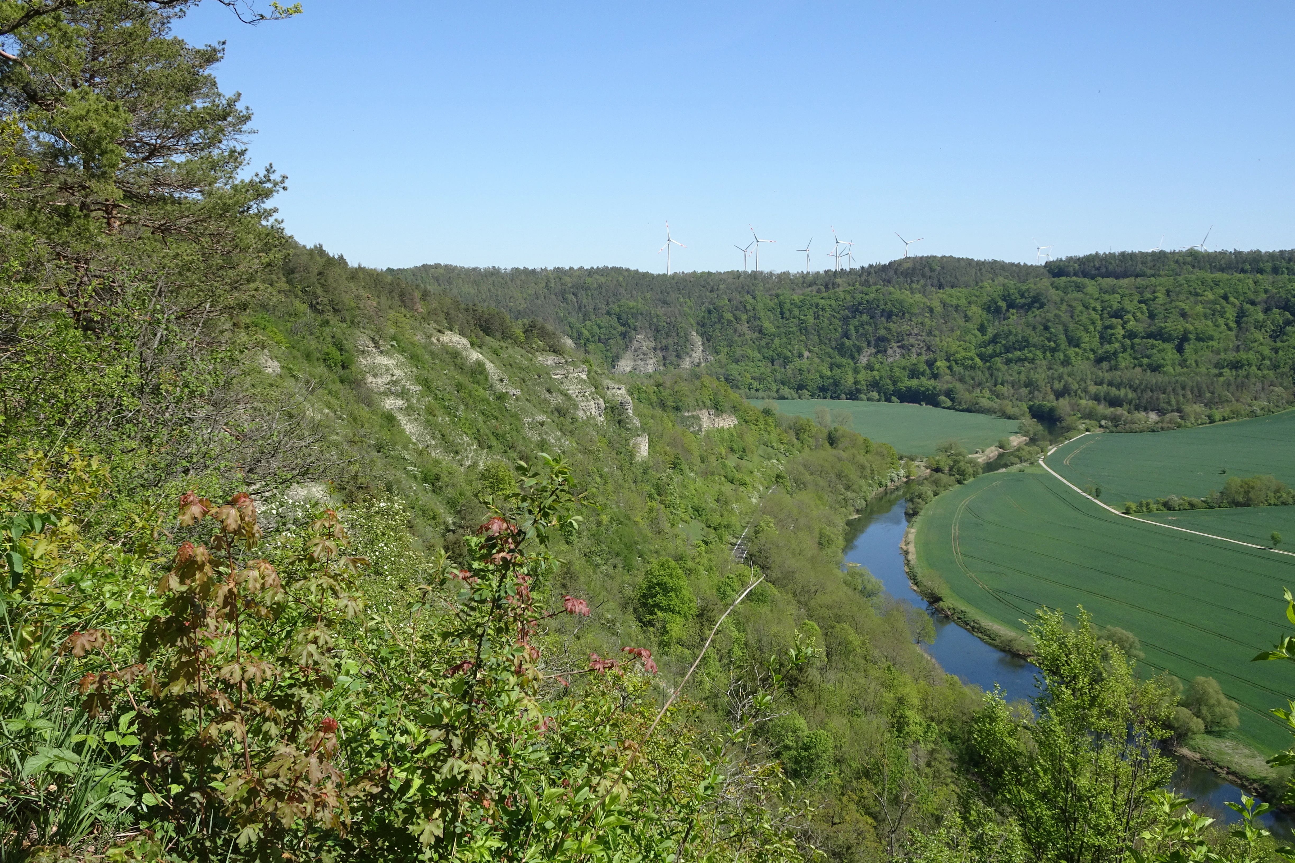
A wide, eye-level view of a lush green river valley with limestone cliff slopes on the left and a winding river with green fields on the right.
A scenic view of the limestone cliffs at Ebenauer Kopfe overlooking the meandering Werra river valley.

Klosterholz und Nordmannssteine ecosystems, habitats, and plant life

The protected area is recognized above all for its mosaic of calcareous habitats developed on shell-limestone. Among the priority habitat types of community interest present in the reserve are calcareous or base-rich rocks with pioneer grasslands (habitat type 6110), and mixed slope and ravine forests clinging to the steep Werra slopes (habitat type 9180). Additional habitat types of community interest include watercourses with floating vegetation (3260), broom and fescue calcareous dry grasslands (6210), vegetation of rock fissures on calcareous rocks (8210), woodruff-rich beech forests (9130), and orchid-rich calcareous beech forests (9150).

Forests cover a significant part of the area, dominated by European beech with sycamore maple and ash in the steeper sections. Many parts of the woodland still carry features of earlier coppice-with-standards management and contain high amounts of deadwood, which supports rare bryophyte species. An older grove of spruce and Scots pine on the upper slopes preserves a record of 20th-century afforestation that replaced former juniper-rich semi-dry grasslands. Along the Werra itself a narrow band of riparian woodland completes the transition from river to slope.

The open rocks of the Nordmannssteine are especially valuable for cryptogams. Mid-2000s surveys recorded more than 160 moss species in roughly 40 moss communities across the area, and the calcareous cliffs host lichen communities that include threatened species of the colorful soil-lichen group. Secondary habitats on former soda-factory and quarry sites have developed their own distinctive successional stages, which support orchids such as military orchid, bee orchid, and greater butterfly-orchid, as well as wintergreen species and rare mosses.
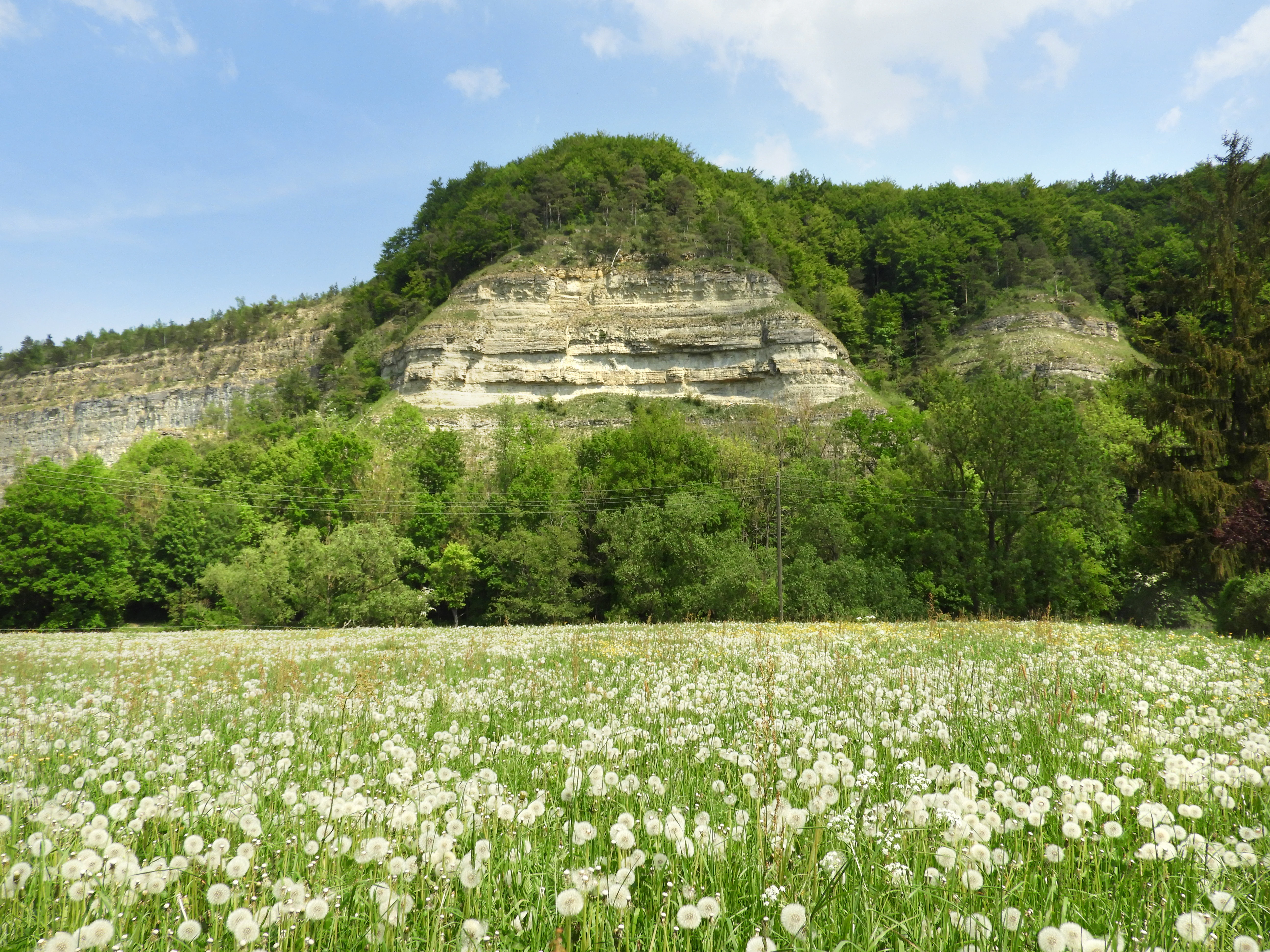
A wide view of a vibrant green meadow filled with white dandelion seed heads in the foreground, with a steep, forested limestone cliff rising in the background under a blue sky.
A summer meadow filled with seed-bearing dandelions below the limestone cliffs of the Klosterholz und Nordmannssteine nature reserve.

Klosterholz und Nordmannssteine wildlife and species highlights

The reserve supports a breeding bird community of considerable conservation interest. Documented breeding species include grey-headed woodpecker, black woodpecker, red-backed shrike, red kite, and Eurasian eagle-owl, all of which are listed under Annex I of the EU Birds Directive and require the designation of suitable protected areas across the European Union. This bird community reflects the combination of mature beech forest, open cliff areas, and varied topography that the reserve provides.

Reptiles recorded in the area include slow worm, smooth snake, and sand lizard, which benefit from the warm, sun-exposed rocky slopes and dry grasslands. A butterfly survey in the early 1990s identified 31 day-flying species in the area, including noteworthy specialists such as the white admiral, silver-spotted skipper, grayling, and Scotch argus, species that often depend on the kind of structurally varied calcareous habitat the reserve maintains.

Within the broader Natura 2000 framework, the area also contributes to the conservation of river-associated species. The overlapping Werra bis Treffurt mit Zuflüssen Habitat/Species Management Area targets brook lamprey, bullhead, otter, yellow-bellied toad, northern crested newt, and bat species such as lesser horseshoe, Bechstein's, and pond bats. Although these river species are not the focus of the Naturschutzgebiet itself, their protection is part of the integrated conservation framework that surrounds the cliffs and forests of Klosterholz und Nordmannssteine.
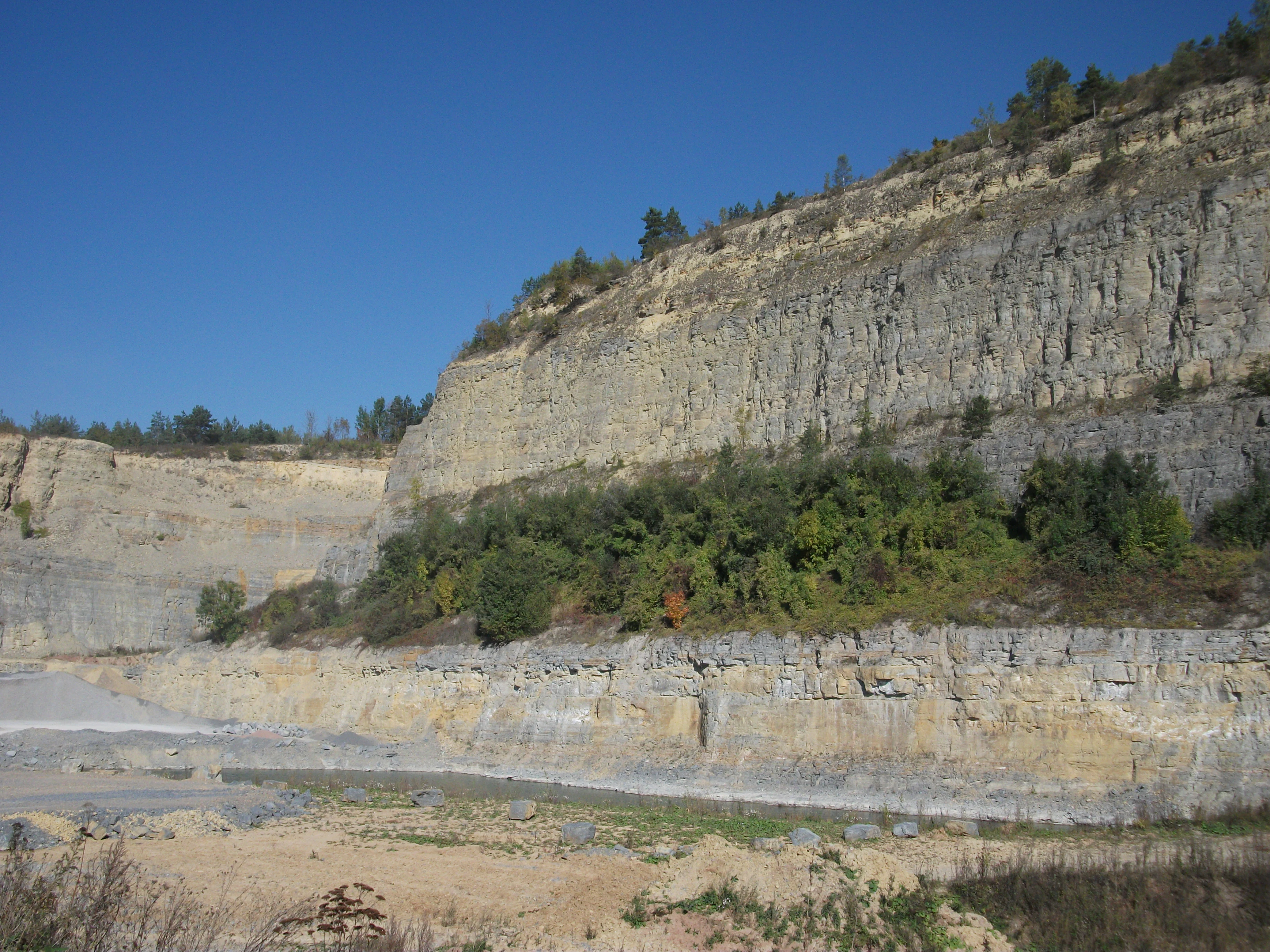
A wide view of a limestone quarry with exposed stratified rock walls, a flat rocky quarry floor, and sparse trees growing along the middle ledges against a clear blue sky.
Reclaimed quarry site near Buchenau within the Klosterholz und Nordmannssteine nature reserve.

Klosterholz und Nordmannssteine conservation status and protection priorities

Klosterholz und Nordmannssteine is significant for conservation because it concentrates a high number of priority and community-interest habitat types within a relatively small area. Its shell-limestone cliffs with pioneer grasslands and its mixed slope forests are both priority habitat types of community interest under the EU Habitats Directive, giving the reserve a heightened protection status within the European Natura 2000 network. The integration of the site into the Creuzburger Werratal-Hänge Habitat/Species Management Area is intended to preserve this habitat mosaic in the long term.

The reserve also addresses the conservation of threatened species. It harbors Annex II species such as Buxbaumia viridis (green shield-moss), Annex I bird species including eagle-owl and red kite, and a range of nationally red-listed lichens, mosses, orchids, and butterflies adapted to calcareous substrates. The conservation value of the industrial secondary habitats, the former quarry and soda-works grounds, is also officially recognized, as these sites are explicitly protected to allow scientific study and to preserve their unusual successional stages.

From a landscape perspective, the area sits at the gateway to the Creuzburger Werradurchbruch, one of the most visually striking valley sections in the Thuringian Werra region. Its protection is therefore seen as essential not only for habitat and species conservation but also for safeguarding the natural character, distinctiveness, and beauty of the surrounding landscape, a value explicitly cited when its protected status was renewed in 2017.

Klosterholz und Nordmannssteine cultural meaning and human context

The reserve's cultural history is closely tied to quarrying and chemical industry along the Werra. In 1922 a soda factory was established at Buchenau, later acquired by the Belgian Solvay group, which used the Nordmannssteine limestone for the Solvay process. Salt was extracted from the opposite bank of the Werra and dumped into settling ponds, some of which lie within today's protected area. The factory was a major regional employer until production was halted by East German economic authorities in 1968.

Quarrying continued into the post-reunification period for road and pathway construction until the end of 2014, when the Buchenau workings were finally closed and released from mining law. The former quarry floor, which fills with rainwater and is locally known as the Blaue Lagune, has become an unofficial swimming site despite prohibitions, illustrating both the cultural pull of the landscape and its contemporary management challenges. Settling ponds, spoil heaps, and quarry walls have slowly become part of the protected area's ecological story, recognized as secondary habitats of conservation interest.

Top sights and standout views in Klosterholz und Nordmannssteine

Key features of Klosterholz und Nordmannssteine include the near-vertical Muschelkalk cliffs of the Nordmannssteine above the Werra, their protected status as a Natura 2000 priority habitat for calcareous rock communities with pioneer grasslands, and their exceptionally diverse lichen and moss flora. The reserve also stands out for the contrast between the dry, sun-exposed cliff habitats and the cooler, more humid beech-dominated slope forests, a juxtaposition that supports both rare rock-dwelling plants and structured old-growth woodland.

Other highlights are the orchid- and wintergreen-rich secondary habitats on the former Buchenau soda-factory grounds, the still-visible historical stone quarry and its rainwater-filled Blaue Lagune, and the area's integration into a broader conservation landscape that includes two overlapping Habitat/Species Management Areas and the large Eichsfeld-Hainich-Werratal Nature Park. The dramatic view from Creuzburg's historic stone bridge toward the Klosterholz slope is often cited as an iconic perspective into this reserve.

Best time to visit Klosterholz und Nordmannssteine

Spring and early summer are particularly rewarding for visiting Klosterholz und Nordmannssteine, when the calcareous slopes come alive with wildflowers in the beech forests and orchids in the secondary habitats near Buchenau. This period is also when many of the protected bird species are most active and easier to observe, and when butterfly species recorded in the reserve are on the wing across the dry grasslands.

Late summer and autumn tend to emphasize the geological character of the site, with clearer light on the Nordmannssteine cliffs and the broader landscape of the Werra valley on display. Cooler months and the wetter season highlight the area's moss flora and the contrast between dry rocks and the shaded, humid beech forests, while winter can offer quieter conditions for appreciating the dramatic valley scenery around Creuzburg. Visitors should be aware that access to certain parts of the former quarry is officially restricted due to rockfall risk and unofficial recreational use.

Monthly climate preview

Long-term representative point measurements for temperature and precipitation patterns

Klosterholz und Nordmannssteine Climate Normals and Annual Weather Rhythm

Klosterholz und Nordmannssteine records measured monthly temperature variations alongside steady precipitation data across the representative coordinate. Reviewing the complete twelve-month profile provides detailed meteorological context for regional analysis.
Annual mean8 °C
-1 °C18 °C
Jan-1°
Feb
Mar
Apr
May12°
Jun16°
Jul18°
Aug18°
Sep14°
Oct
Nov
Dec
Warmest month
July

18.3 °C

Coolest month
January

-1.1 °C

Wettest month
July

2.6 mm/day

Driest month
April

1.4 mm/day

Park location guide

Geography guide, regional context, and park location map for Klosterholz und Nordmannssteine

Klosterholz und Nordmannssteine park geography, regions, and map view in Germany

Understand where Klosterholz und Nordmannssteine sits in Germany through a broader geographic reading of the surrounding landscape, nearby location context, and its mapped position within the national park landscape.

How Klosterholz und Nordmannssteine fits into Germany

Germany is a federal republic in Western and Central Europe with a population of over 83 million across sixteen constituent states. It is Europe's largest economy by nominal GDP and a major global exporter and importer. The capital is Berlin, and the country borders Denmark, Poland, Czech Republic, Austria, Switzerland, France, Luxembourg, Belgium, and the Netherlands.

Wider geography shaping Klosterholz und Nordmannssteine in Germany

Germany is located in Western and Central Europe, spanning 357,022 km². It borders Denmark to the north, Poland and the Czech Republic to the east, Austria and Switzerland to the south, and France, Luxembourg, Belgium, and the Netherlands to the west. The country has coastlines on the Baltic Sea and North Sea to the north, with the Alps located in the southern region.

Map view of Klosterholz und Nordmannssteine

Use this park location map to pinpoint Klosterholz und Nordmannssteine in Germany, understand its exact geographic position, and read its mapped placement within the surrounding landscape more clearly.

Pigeon | © OpenStreetMap contributors

Location context for Klosterholz und Nordmannssteine

Wartburgkreis

Visualizing the rugged limestone terrain, steep river valley, and forest habitats of Thuringia

Klosterholz und Nordmannssteine Photos: Scenery, Cliffs, and Protected Landscapes

Visual documentation reveals the dramatic vertical scale of the Muschelkalk cliffs and the rich mosaic of beech-dominated slopes rising above the Werra river. Examining these protected habitats provides a clearer understanding of the terrain, microclimates, and ecological diversity defining the reserve.

A wide, calm river winding through a lush green valley with high, light-colored limestone cliffs and dense deciduous forests on either side under a blue sky with white clouds.

A wide view of a calm river in the foreground, with grassy banks, a line of deciduous trees, and light-colored limestone cliff formations rising above the forest canopy under a partly cloudy sky.

A wide, eye-level view of a lush green river valley with limestone cliff slopes on the left and a winding river with green fields on the right.

A wide view of a vibrant green meadow filled with white dandelion seed heads in the foreground, with a steep, forested limestone cliff rising in the background under a blue sky.

A wide view of a limestone quarry with exposed stratified rock walls, a flat rocky quarry floor, and sparse trees growing along the middle ledges against a clear blue sky.

Park atlas

Compare adjacent shell limestone reserves and connected regional nature parks across the valley

Explore Parks Near Klosterholz und Nordmannssteine and Surrounding Protected Landscapes

Continue exploring regional conservation areas by comparing nearby protected landscapes sharing similar limestone geology and river valley terrain. Browsing adjacent reserves provides broader geographic context for understanding the wider ecological network surrounding the Werra river basin.
A horizontal watercolor illustration showing a landscape with rolling, misty purple hills in the background and a line of stylized green and pink trees in the foreground, with a meandering river winding through the scene.
Nature reserveThuringia
Mapped location lies within the park boundary#1 closest

North

Creuzburger Werratal-Hänge Nature Reserve: Geography and Protected Landscape Analysis

Muschelkalk cliffs and calcareous dry grasslands in Thuringia

Located in western Thuringia, the Creuzburger Werratal-Hänge nature reserve features an intricate mosaic of cliff faces, ravine forests, and nutrient-poor dry grasslands. This protected area stands out for its high density of orchid species and mosses, all sculpted by the erosional force of the river Werra through the regional limestone bedrock.

Area
1.47 km²
Established
2000
IUCN
IV
Relief
Mountain
Nature reserveThuringia
About 0.2 km away#2 closest

North

Werra bis Treffurt mit Zuflüssen: Protected River and Floodplain Network in Thuringia

Mapping an extensive 191 kilometer Natura 2000 river corridor.

The Werra bis Treffurt mit Zuflüssen protected area serves as a vital ecological corridor in Thuringia. This site encompasses a complex mosaic of fast-flowing highland brooks, expansive floodplain meadows, inland salt sites, and rare dissolution lakes. Its geography bridges high-altitude source regions with lower river valleys, creating a distinctive landscape transect that supports essential freshwater habitats and rare aquatic species across the state.

Area
22.6 km²
Established
2008
IUCN
IV
Relief
Mixed relief
A soft watercolor painting showing a green landscape with a winding river and a prominent cliff face on the left, set against a white background.
Nature reserveWartburgkreis
About 1.7 km away#3 closest

Northwest

Ebenauer Köpfe und Wisch Protected Landscape Map and Regional Geography

Nature reserve featuring Muschelkalk cliffs in the Wartburgkreis district

Analyze the geological formation and ecological importance of Ebenauer Köpfe und Wisch. This nature reserve encompasses steep canyon slopes, rare calcareous dry grasslands, and ancient rock communities essential to the Werra valley network.

Area
0.797 km²
Established
1996
IUCN
IV
Relief
Upland
A soft watercolor painting of a river landscape with rolling green hills and gentle slopes.
Nature reserveWartburgkreis
About 1.7 km away#4 closest

Northwest

Lienig Nature Reserve: Protected Karst Forest Landscapes in the Wartburgkreis Region

A study of steep forested slopes and limestone gullies

Lienig acts as a crucial protected sanctuary for deciduous forest communities situated on the steep, north-facing slopes of the Werra valley. The terrain presents a complex geological profile defined by shell limestone bedrock, small-scale karst features, and deeply incised erosion ravines that support a rare assembly of spring geophytes and old-growth forest characteristics.

Area
0.225 km²
Established
1961
IUCN
IV
Relief
Upland
Nature reserveThuringia
About 2.6 km away#5 closest

North

Werra-Aue zwischen Breitungen und Creuzburg: Protected Floodplain and River Geography

Nature reserve sanctuary in western Thuringia

Spanning over 33 kilometers of the Werra river, this protected floodplain is defined by its distinctive geological sinkholes, seasonal wetlands, and diverse bird habitats. Discover the layered conservation status and riparian terrain that mark this significant Thuringian nature reserve as a crucial node for European ecological connectivity.

Area
25.78 km²
Established
2007
IUCN
IV
Relief
Lowland
Nature reserveThuringia
About 3.2 km away#6 closest

West

Wilhelmsglücksbrunn Nature Reserve and Werra Valley Protected Landscape Geography

A mapped overview of inland saline springs in Thuringia

The Wilhelmsglücksbrunn nature reserve preserves a rare inland saline ecosystem within the flat Werra floodplain of western Thuringia. This site sustains a complex landscape of reed beds, wet meadows, and brine-fed habitats that connect to the broader Green Band ecological corridor, providing essential staging grounds for diverse migratory bird populations.

Area
0.773 km²
Established
2000
IUCN
IV
Relief
Lowland
Nature reserveThuringia
About 4.5 km away#7 closest

North

Werrahänge von Frankenroda bis Falken: A Deep Dive into Thuringian Protected Landscapes

Mapping limestone river canyons and unique forest habitats in Wartburgkreis.

This protected area captures a distinct geomorphological intersection of river-cut canyons and plateau ridges in Thuringia. The site preserves an intense mosaic of juniper heath, dry grasslands, and ancient beech forests, functioning as a vital link for species conservation. Examine the mapped boundaries, karst features, and the sculptural topography formed by the Werra river as it winds through the Muschelkalk rim of the Thuringian Basin.

Area
5.69 km²
Established
1999
IUCN
IV
Relief
Upland
A wide watercolor painting depicting a landscape with green and purple trees and pale hills in the background.
Nature reserveGermany
About 6.4 km away#8 closest

North

Probsteizella Nature Reserve: A Geographical Overview of Limestone Cliffs and Forested Valleys in Germany

Mapping the Muschelkalk sequences and woodland habitats of the Werra valley.

Probsteizella is a distinctive nature reserve in Germany that showcases the dramatic geomorphology of the Werra valley. The site features the Falkener Klippen, an exposed limestone cliff face showing a full stratigraphic sequence, and the historic Bauernkanzel outcrop. This area supports a rich diversity of beech-woodland communities, providing a focused example of central German river valley protected terrain.

Area
0.269 km²
Established
1961
Relief
Upland
Climate
Temperate

Common questions about visiting, size, designation, and location context for Klosterholz und Nordmannssteine

Klosterholz und Nordmannssteine FAQs for park facts, access, geography, and protected area context

Find quick answers about Klosterholz und Nordmannssteine, including protected-area facts, park geography, trail and visitor context, and how the park fits into its surrounding country and regional landscape.
MoriAtlas Explorer

Continue Your Protected Areas Search Across the Global Atlas

Deepen your exploration by continuing the structured search for national parks and protected areas worldwide. Utilize the comprehensive filtering capabilities to compare different conservation landscapes and refine your understanding of global park geography. Discover more about the distribution and characteristics of protected natural areas.

Global natural geography