
Mori Atlas logo
Nature reserveKlosterschranne – Faulunger Stein

Explore the Muschelkalk valley topography and protected forest habitats of this Eichsfeld highland landmark.

Klosterschranne – Faulunger Stein Nature Reserve: Mapped Geography and Protected Landscapes

(Naturschutzgebiet Klosterschranne – Faulunger Stein)

Klosterschranne – Faulunger Stein encompasses a protected nature reserve defined by the deep incision of the Frieda and Faulunger Bach river valleys into the Muschelkalk plateau of Upper Eichsfeld. This area preserves a diverse landscape featuring steep limestone cliffs, mature beech forests, and notable populations of European yew trees. Through integrated mapping of regional conservation boundaries, the reserve offers a window into the complex geological terrain of the Unstrut-Hainich-Kreis region in Germany.

nature reserveMuschelkalk plateaubeech forestyew treeslimestone cliffsvalley landscape
A stylized vector illustration of a green mountain valley featuring steep cliffs, a winding river, a waterfall, and pine trees under a pastel sky with a sun.

Klosterschranne – Faulunger Stein

Nature reserve

Park overview

Structured park overview, official facts, and landscape profile for Klosterschranne, Faulunger Stein

Klosterschranne, Faulunger Stein park facts, protected area profile, and essential visitor context

Review the core facts for Klosterschranne, Faulunger Stein, including designation, size, terrain, visitor scale, habitats, and operating context in one park-focused overview.

About Klosterschranne, Faulunger Stein

Klosterschranne – Faulunger Stein safeguards a characteristic section of the Muschelkalk plateau in the Upper Eichsfeld, in western Thuringia. The reserve wraps around the wooded slopes of the valleys of the Frieda (a tributary of the Werra) and the Faulunger Bach, together with their small tributary valleys. These right-bank side valleys have cut deep and steeply into the plateau, producing pronounced valley spurs, cliff edges, and a layered topography of forested slopes, valley bottoms, and narrow plateau areas.

The reserve stretches from the southern valley floor of the Frieda, also known locally as the Zellaer Grund, through the Muschelkalk cliffs at the Brandkopf, around the wooded Schlegelsberg with the Faulunger Schranne, the Petersberg, and the Großes Hegeholz, ending in the upper valley of the Faulunger Bach. Elevations along the ridges and spurs reach roughly 440 to 460 meters. At the upper edge of the slopes, limestone cliffs form rock faces and step drops up to about 30 meters high, which create several prominent viewpoints over the valleys.

The geological substrate shapes the ecology of the reserve. The west- and north-facing slopes expose lower Wellenkalk, while plateau areas include upper Wellenkalk, and the valley bottoms show Röt-Formation deposits. Within the valley floors, several springs produce strongly calcareous water. Forests cover most of the protected area, with only the gentler valley floors and the Schlegelsberg plateau open for agricultural use, primarily as pasture.

Designated in 1996 and numbered NSG 203, the nature reserve is one component in a layered system of protection. It lies within the Obereichsfeld Landscape Protection Area and overlaps with the FFH site Muschelkalkhänge von Großbartloff bis Faulungen and the Vogelschutzgebiet Südliches Eichsfeld. A short nature trail near Faulungen introduces visitors to the area, while a natural monument summer linden above the Faulungen cemetery marks one of the reserve's small cultural-natural landmarks.

Quick facts and research context for Klosterschranne, Faulunger Stein

Klosterschranne – Faulunger Stein is located in western Thuringia, within the Unstrut-Hainich district, near the communities of Faulungen, Lengenfeld unterm Stein, Struth, and Eigenrieden. The reserve covers about 298 hectares and was designated as a Naturschutzgebiet in 1996, with the designation number NSG 203.

The protected area is classified as an IUCN Category IV site (Habitat/Species Management Area) and lies on the Muschelkalk plateau of the Upper Eichsfeld. It is embedded within the Obereichsfeld Landscape Protection Area, the FFH site Muschelkalkhänge von Großbartloff bis Faulungen, and the Südliches Eichsfeld bird protection area. Its most notable natural features are the beech forests with understory yew trees and the steep limestone cliffs rising to roughly 440 to 460 meters in elevation.

Protection and recognition

Examine documented terrestrial protection metrics and official conservation status details.

Klosterschranne – Faulunger Stein Protection Status and International Recognition

Klosterschranne – Faulunger Stein maintains a documented terrestrial protection scope backed by official database records. Review verified administrative designations and international recognition parameters without speculative assumptions.

Protection details

Protection scope
Terrestrial
Transboundary protection
No
WDPA ID
164152
Park context

Deeper park guide and search-rich context for Klosterschranne, Faulunger Stein

Klosterschranne, Faulunger Stein history, landscape, wildlife, and travel context

Explore Klosterschranne, Faulunger Stein through its history, landscape character, ecosystems, wildlife, conservation priorities, cultural context, and seasonal travel timing in a structured park guide built for atlas discovery and search intent.

Why Klosterschranne, Faulunger Stein stands out

The reserve is best known for its deeply dissected Muschelkalk valley landscape on the Upper Eichsfeld plateau, where steep limestone cliffs and forested spurs form the dominant scenery. Within these forests, the area hosts a notable population of European yew (Eibe) trees growing in the shade of mature beech woodland, one of its defining natural features. A second defining element is the layered system of overlapping protections around the valley slopes. The same terrain that forms the nature reserve also contributes to a larger landscape protection area, an FFH (Habitats Directive) site, and a bird protection area, reflecting both the geological and the ecological value of the Muschelkalk slopes of this part of the Eichsfeld.
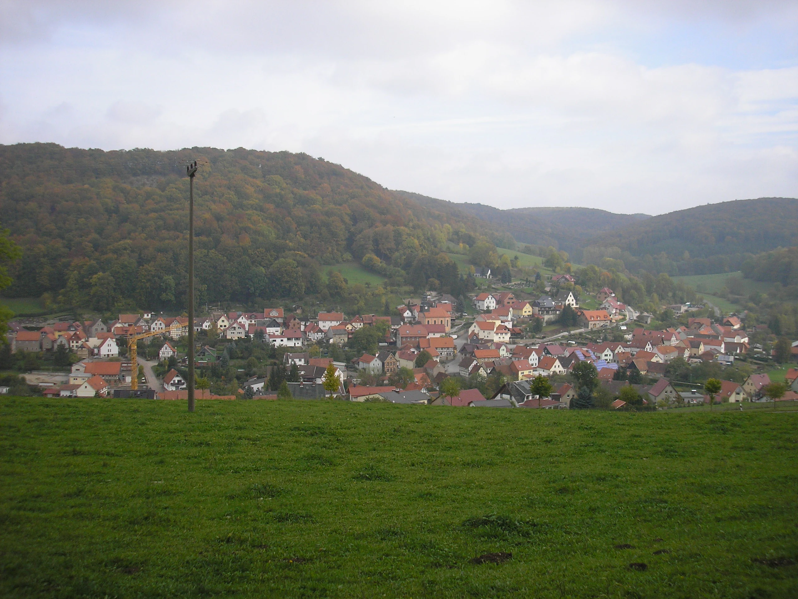
A wide landscape view showing a green meadow in the foreground, a village with red-roofed houses and a church steeple in the middle distance, and forested hills under an overcast sky in the background.
View of Faulungen village nestled in a valley, with the forested Schlegelsberg and Pfaffenkopf hills rising in the background.

Klosterschranne, Faulunger Stein history and protected-area timeline

The area around Klosterschranne – Faulunger Stein has long been shaped by the interplay of forest cover and agricultural use on the Muschelkalk plateau of the Upper Eichsfeld, with pasture on the gentler valley floors and plateau sections. While the broader landscape has retained much of this traditional land-use pattern, formal protection of the core valley slopes, cliffs, and beech forests came only in the late twentieth century.

In 1996, the state of Thuringia designated the area as a Naturschutzgebiet with the identifier NSG 203, covering roughly 298 hectares. This step formalized the conservation of the steep Muschelkalk slopes, the forested spurs, the prominent yew population beneath the beech canopy, and the cliff-side viewpoints. Subsequent regional planning expanded the surrounding protective framework: the Obereichsfeld Landscape Protection Area was reorganized in 2009, integrating ten previously separate smaller landscape protection areas into one large zone, and the reserve now sits within this landscape-scale protection as well as within the relevant FFH and bird protection area designations.

Klosterschranne, Faulunger Stein landscape and geographic character

The reserve's landscape is defined by the deep incision of small streams into the Muschelkalk plateau of the Upper Eichsfeld. The Frieda and the Faulunger Bach, together with their tributary branches, have cut narrow, steep valleys into the limestone surface, leaving sharply defined valley spurs between them. Prominent elevations include the Brandkopf at about 440 meters and the Schlegelsberg, reaching up to about 460 meters, along with the Petersberg and the Großen Hegeholz.

Along the upper edges of the slopes, sections of cliff and steep rock faces rise up to roughly 30 meters, forming visible landmarks in the valley topography. These cliffs double as viewpoints looking out over the Frieda valley, the Faulunger Bach valley, and across to surrounding villages. Where the terrain levels off into the valley floors or onto the Schlegelsberg plateau, the landscape opens into flatter, agriculturally used ground, dominated by pasture, while the steep slopes remain under continuous forest cover.

The substrate contributes strongly to the visual character of the area. Lower Wellenkalk dominates the steep western and northern slopes, upper Wellenkalk appears on the plateaus, and Röt-Formation sediments line the valley bottoms, where several calcareous springs emerge. The resulting contrast between white limestone cliffs, deeply shadowed beech forest, and open valley pastures gives the protected area its distinctive Eichsfeld valley scenery.

Klosterschranne, Faulunger Stein ecosystems, habitats, and plant life

The ecological identity of Klosterschranne – Faulunger Stein is built on the relationship between the Muschelkalk geology and the forest cover that follows it. Forests dominate most of the reserve, covering the steep valley slopes, spurs, and much of the upper cliff zone, while only the gentler valley floors and the Schlegelsberg plateau remain open for agricultural use. This pattern means that the protected area essentially functions as a large wooded corridor following the Frieda and Faulunger Bach valleys.

Beech forest is the central habitat type. Mature beech stands occupy the steep Wellenkalk slopes and the higher ridge areas, creating a dense canopy that shapes light conditions on the forest floor. Within these beech woods, a notable population of European yew (Eibe) grows beneath the canopy, forming one of the reserve's defining habitat combinations. The shaded, calcareous-rich ground beneath the beech canopy supports this understory of yews and contributes to the forest's character.

The valley floors introduce a different ecological element. Several springs in the lower terrain discharge strongly calcareous water, creating moist conditions on the Röt-Formation substrates. The interplay of these groundwater-influenced valley habitats, the cliff and rock communities along the upper slopes, and the beech-yew woodland on the ridges gives the reserve a layered ecological profile, matching the layered Muschelkalk topography.

Klosterschranne, Faulunger Stein wildlife and species highlights

Wildlife interest in Klosterschranne – Faulunger Stein stems less from any single flagship species and more from the combination of woodland, cliff, and valley-bottom habitats, combined with the area's overlap into the Vogelschutzgebiet Südliches Eichsfeld. The mature beech forests with their understory of yew provide habitat for typical woodland birds, small forest mammals, and forest-floor invertebrates, while the cliff faces and rocky edges offer nesting and perching habitat for cliff-associated species.

The valley floor springs, with their calcareous groundwater, support moist-ground vegetation and associated invertebrates, which in turn feed broader woodland food webs. The mosaic of pasture on the gentler valley floors and on the Schlegelsberg plateau adds open-ground foraging opportunities adjacent to the forest, allowing species that depend on both forest cover and nearby open habitat to use the reserve. Position within the broader Südliches Eichsfeld bird protection area reflects the relevance of these habitats for regional bird conservation.

Klosterschranne, Faulunger Stein conservation status and protection priorities

The conservation value of Klosterschranne – Faulunger Stein lies in the protection of a representative Muschelkalk valley system in the Upper Eichsfeld, combining forest, cliff, spring, and small-scale agricultural habitats. As an IUCN Category IV habitat and species management area, the reserve targets active conservation of specific habitat features rather than only strict wilderness protection. Its main targets are the beech forest ecosystems with their associated yew population, the calcareous cliff and rock communities, and the spring-influenced valley-floor habitats.

The site's significance is reinforced by its position within multiple overlapping designations. It is part of the Obereichsfeld Landscape Protection Area, the FFH-Gebiet Muschelkalkhänge von Großbartloff bis Faulungen, and the Vogelschutzgebiet Südliches Eichsfeld. This layered framework means that the conservation of the reserve contributes directly to European-level habitat and bird conservation goals, while also connecting to broader landscape-scale protection in the western Eichsfeld.

Management of the area is shaped by the long-standing land-use pattern. Forests are left largely undisturbed on the steep slopes, while traditional pasture use continues on the gentler valley floors and the Schlegelsberg plateau. A nature trail near Faulungen supports interpretation and public understanding of the reserve's habitat features, and a natural monument, a summer linden above the Faulungen cemetery, links the conservation focus to a local cultural-natural marker.

Klosterschranne, Faulunger Stein cultural meaning and human context

The reserve sits within the rural Eichsfeld cultural region of western Thuringia, an area long characterized by small villages, agriculture on the plateau, and forested valley slopes. Communities around the protected area include Faulungen, Lengenfeld unterm Stein, Struth, and Eigenrieden, and the traditional land-use balance between woodland and pasture still shapes the reserve's landscape today. The peaceful coexistence of working farmland and protected forest is a defining element of the local identity.

Local cultural-natural landmarks include the natural monument summer linden (Sommerlinde) above the cemetery of Faulungen, registered as a protected tree. The interpretive trail near Faulungen adds an educational layer to this setting, connecting visitors to the region's natural heritage and its historical relationship with the surrounding Muschelkalk landscape.

Top sights and standout views in Klosterschranne, Faulunger Stein

The reserve's strongest highlights are its steep Muschelkalk cliffs above the Frieda and Faulunger Bach valleys, the mature beech forests with understory yew populations, and the springs that emerge from the calcareous Röt-Formation valley floors. Layered protection within a landscape protection area, an FFH site, and a bird protection area underscores both the local and regional conservation value of the site.

Further highlights include the viewpoints along the upper cliff edges, where rock faces rise up to roughly 30 meters, offering broad vistas over the valley topography. The combination of protected forest, traditional pasture, and small cultural-natural features such as the natural monument summer linden at Faulungen gives the reserve a distinctive local character within the Upper Eichsfeld.

Best time to visit Klosterschranne, Faulunger Stein

Klosterschranne – Faulunger Stein is best experienced when the beech forests are in full leaf, typically from late spring through early autumn, when the canopy shades the underlying yew trees and the valley slopes present their characteristic green richness. Late spring is also a favorable period for visiting, as ground vegetation in the forest and on the cliff edges is active and the nature trail near Faulungen is fully accessible.

Late summer into early autumn tends to bring a calmer visitor experience, with clear visibility for the cliff viewpoints and pleasant conditions for walking the valley trails. Winter visits can reveal the structure of the beech forests and the exposed limestone cliffs more clearly, although weather conditions on the steep slopes can be harsher and trail surfaces may be muddy or icy in the valley bottoms.

Monthly climate preview

Trace long-term representative temperature ranges and precipitation patterns across the year

Klosterschranne – Faulunger Stein Climate Normals and Monthly Weather Records

Long-term NASA records document measured monthly temperature fluctuations and precipitation rates across the representative coordinate at 339 meters elevation. Reviewing the complete twelve-month profile provides deeper analytical context on regional temperature extremes and average precipitation patterns.
Annual mean8 °C
-1 °C18 °C
Jan-1°
Feb
Mar
Apr
May12°
Jun16°
Jul18°
Aug18°
Sep14°
Oct
Nov
Dec
Warmest month
July

18.3 °C

Coolest month
January

-1.1 °C

Wettest month
July

2.6 mm/day

Driest month
April

1.4 mm/day

Park location guide

Geography guide, regional context, and park location map for Klosterschranne, Faulunger Stein

Klosterschranne, Faulunger Stein park geography, regions, and map view in Germany

Understand where Klosterschranne, Faulunger Stein sits in Germany through a broader geographic reading of the surrounding landscape, nearby location context, and its mapped position within the national park landscape.

How Klosterschranne, Faulunger Stein fits into Germany

Germany is a federal republic in Western and Central Europe with a population of over 83 million across sixteen constituent states. It is Europe's largest economy by nominal GDP and a major global exporter and importer. The capital is Berlin, and the country borders Denmark, Poland, Czech Republic, Austria, Switzerland, France, Luxembourg, Belgium, and the Netherlands.

Wider geography shaping Klosterschranne, Faulunger Stein in Germany

Germany is located in Western and Central Europe, spanning 357,022 km². It borders Denmark to the north, Poland and the Czech Republic to the east, Austria and Switzerland to the south, and France, Luxembourg, Belgium, and the Netherlands to the west. The country has coastlines on the Baltic Sea and North Sea to the north, with the Alps located in the southern region.

Map view of Klosterschranne, Faulunger Stein

Use this park location map to pinpoint Klosterschranne, Faulunger Stein in Germany, understand its exact geographic position, and read its mapped placement within the surrounding landscape more clearly.

Pigeon | © OpenStreetMap contributors

Location context for Klosterschranne, Faulunger Stein

ThuringiaUnstrut-Hainich-Kreis

Visual exploration of Muschelkalk cliffs, beech woodland habitats, and protected valley terrain.

Klosterschranne – Faulunger Stein Photos and Mapped Landscape Scenery

Photographic records capture the steep limestone cliffs, mature beech forests, and incised valley topography defining Klosterschranne – Faulunger Stein. Examining these visual habitats provides direct insight into the protected landscape character and geological diversity of the Upper Eichsfeld region.

A wide landscape view showing a green meadow in the foreground, a village with red-roofed houses and a church steeple in the middle distance, and forested hills under an overcast sky in the background.

Park atlas

Compare nearby limestone valleys, beech forests, and regional nature reserves

Parks Near Klosterschranne – Faulunger Stein and Surrounding Protected Landscapes

Browse other protected areas near Klosterschranne – Faulunger Stein to compare similar Muschelkalk valley terrain and forest ecosystems. Regional park mapping helps trace connected conservation landscapes across the surrounding Eichsfeld territory.
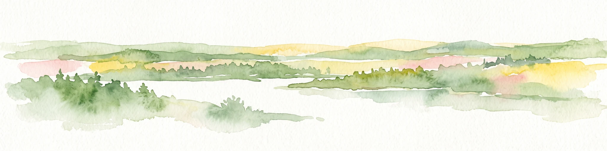
A horizontal watercolor painting depicting a soft-toned, layered landscape of rolling hills and forests in shades of green and pale yellow.
Nature reserveThuringia
About 6.7 km away#1 closest

South

Adolfsburg, Bornberg, Sülzenberg: A Protected Muschelkalk Landscape in Thuringia

Geographic map and protected-area atlas context

This nature reserve stands as a prominent geological feature in the Werrabergland region, where steep Muschelkalk hills and plateaus meet the Werra valley. The site protects a rare assembly of habitats including juniper heathland, scree slopes, and old-growth orchards, offering a dense case study for regional botanical diversity and limestone-terrain mapping in central Germany.

Nature reserveThuringia
About 7 km away#2 closest

South

Werrahänge von Frankenroda bis Falken: A Deep Dive into Thuringian Protected Landscapes

Mapping limestone river canyons and unique forest habitats in Wartburgkreis.

This protected area captures a distinct geomorphological intersection of river-cut canyons and plateau ridges in Thuringia. The site preserves an intense mosaic of juniper heath, dry grasslands, and ancient beech forests, functioning as a vital link for species conservation. Examine the mapped boundaries, karst features, and the sculptural topography formed by the Werra river as it winds through the Muschelkalk rim of the Thuringian Basin.

Area
5.69 km²
Established
1999
IUCN
IV
Relief
Upland
Nature reserveThuringia
About 7.7 km away#3 closest

South

Werra bis Treffurt mit Zuflüssen: Protected River and Floodplain Network in Thuringia

Mapping an extensive 191 kilometer Natura 2000 river corridor.

The Werra bis Treffurt mit Zuflüssen protected area serves as a vital ecological corridor in Thuringia. This site encompasses a complex mosaic of fast-flowing highland brooks, expansive floodplain meadows, inland salt sites, and rare dissolution lakes. Its geography bridges high-altitude source regions with lower river valleys, creating a distinctive landscape transect that supports essential freshwater habitats and rare aquatic species across the state.

Area
22.6 km²
Established
2008
IUCN
IV
Relief
Mixed relief
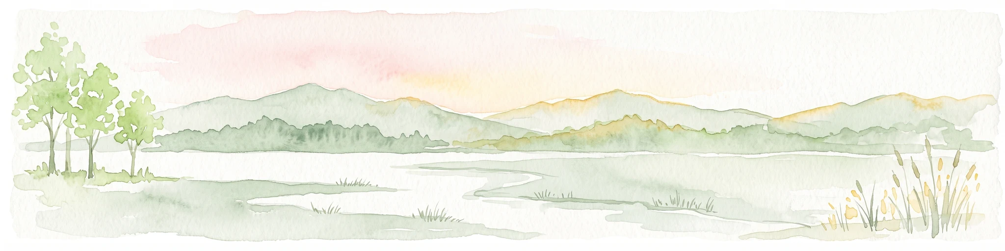
A horizontal watercolor painting showing a calm pond with distant hills, trees on the left, and reeds on the right under a soft, sunset-colored sky.
Nature reserveWerra-Meißner-Kreis
About 7.9 km away#4 closest

West

Kiesteich unter der Aue’schen Kugel: Protected Nature Reserve and Wetland Landscape

Regional geography and habitat mapping in Werra-Meißner-Kreis

Kiesteich unter der Aue’schen Kugel is a specialized nature reserve that safeguards essential wetland habitats within the Werra river corridor. This protected area features two former gravel lakes shielded by dense vegetation, serving as a critical refuge for water-dependent species. Its inclusion in the Auenverbund Werra landscape protection network underscores its role in regional ecological connectivity and river-basin conservation efforts.

Area
0.093 km²
Established
1984
IUCN
IV
Access
Highly restricted
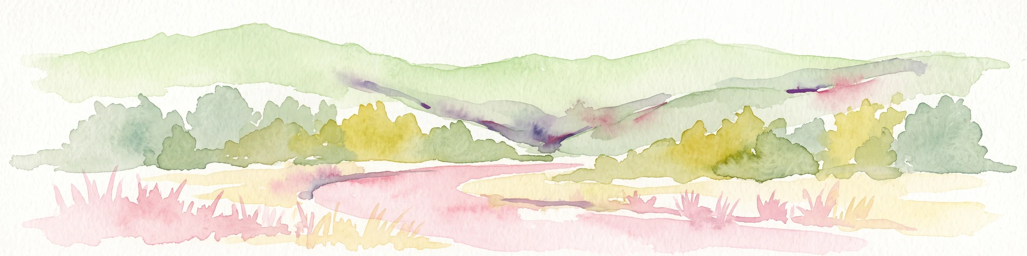
Watercolor illustration showing a wide landscape with green rolling hills in the background, a line of trees in the midground, and a pinkish meadow with grasses in the foreground
Nature reserveHesse
About 8.5 km away#5 closest

Southwest

Frankenloch bei Heldra Nature Reserve: Mapped Protected Landscapes in Hesse, Germany

A rare, near-natural Werra river oxbow and wetland floodplain sanctuary.

Discover the geographic layout of Frankenloch bei Heldra, a protected nature reserve located along the River Werra. This site offers insight into floodplain dynamics, reed-bed ecology, and the restoration of natural river channels within the Werra-Meissner-Kreis district of Hesse, Germany.

Area
0.089 km²
Established
1995
Relief
Lowland
Climate
Temperate
Nature reserveWartburgkreis
About 8.7 km away#6 closest

Southwest

Werraaue Treffurt Nature Reserve: Geographic Overview and Protected Floodplain Map

Wartburgkreis wetland refuge and Green Belt stepping stone

Werraaue Treffurt comprises a complex riverine landscape where sediment-rich floodplain soils and restored gravel-pit lakes create a diverse sanctuary. Located near the Thuringia-Hessia state border, this nature reserve integrates into the broader Green Belt, offering significant habitat continuity for species dependent on transition zones. Its position in the Werra valley floor highlights the intersection of hydrological change, historical land-use exclusion, and modern ecological protection in Germany.

Area
0.685 km²
Established
1995
IUCN
IV
Relief
Lowland
A horizontal watercolor painting depicting a calm lake with marshy grass in the foreground and rolling mountains in the distance under a soft, pale sky.
Nature reserveWerra-Meißner-Kreis
About 8.8 km away#7 closest

West

Kiesteich bei Frieda Nature Reserve: Exploring the Protected Geography of Werra-Meißner-Kreis

A detailed look at wetland habitats and landscape reclamation in the Werra valley

Kiesteich bei Frieda is a protected nature reserve nestled in the Werra valley of the Werra-Meißner-Kreis. This area, originally formed through gravel mining, now provides a dense vegetative buffer and aquatic ecosystem that serves as a vital corridor for amphibians and waterbirds. Discover the geographic features that define this essential protected sanctuary and understand its integration into the wider regional environmental network.

Area
0.066 km²
Established
1988
IUCN
IV
Relief
Lowland
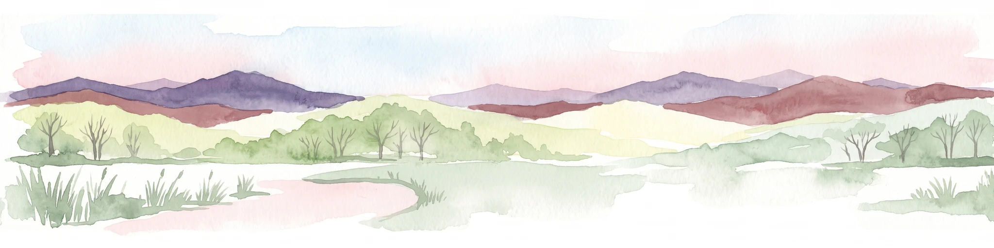
A wide watercolor painting depicting a landscape with green and purple trees and pale hills in the background.
Nature reserveGermany
About 11 km away#8 closest

South

Probsteizella Nature Reserve: A Geographical Overview of Limestone Cliffs and Forested Valleys in Germany

Mapping the Muschelkalk sequences and woodland habitats of the Werra valley.

Probsteizella is a distinctive nature reserve in Germany that showcases the dramatic geomorphology of the Werra valley. The site features the Falkener Klippen, an exposed limestone cliff face showing a full stratigraphic sequence, and the historic Bauernkanzel outcrop. This area supports a rich diversity of beech-woodland communities, providing a focused example of central German river valley protected terrain.

Area
0.269 km²
Established
1961
Relief
Upland
Climate
Temperate

Common questions about visiting, size, designation, and location context for Klosterschranne, Faulunger Stein

Klosterschranne, Faulunger Stein FAQs for park facts, access, geography, and protected area context

Find quick answers about Klosterschranne, Faulunger Stein, including protected-area facts, park geography, trail and visitor context, and how the park fits into its surrounding country and regional landscape.
MoriAtlas Explorer

Continue Your Protected Areas Search Across the Global Atlas

Deepen your exploration by continuing the structured search for national parks and protected areas worldwide. Utilize the comprehensive filtering capabilities to compare different conservation landscapes and refine your understanding of global park geography. Discover more about the distribution and characteristics of protected natural areas.

Global natural geography