Mori Atlas logo
Protected areaKokorou-Namga Complex

A critical mosaic of seasonal lakes, dune corridors, and forest-savanna in Niger

Kokorou-Namga Complex: Mapping Sahelian Wetland Landscapes and Protected Area Boundaries

The Kokorou-Namga Complex stands as a distinctive protected wetland system located within the Tillaberi Region of Niger. This area serves as a significant stopover for migratory waterbirds, characterized by an intricate geography of intermittent lakes like Mare de Kokorou and Mare de Namga separated by sandy dune corridors. Iron-rich soils and sheltered microclimates support diverse vegetation, offering a vital refuge against the surrounding arid Sahelian climate.

Sahelian wetlandRamsar siteintermittent lakesdune corridorsforest-savanna mosaicmigratory waterbirds

Kokorou-Namga Complex

Protected area

Park overview

Structured park overview, official facts, and landscape profile for Kokorou-Namga Complex

Kokorou-Namga Complex park facts, protected area profile, and essential visitor context

Review the core facts for Kokorou-Namga Complex, including designation, size, terrain, visitor scale, habitats, and operating context in one park-focused overview.

About Kokorou-Namga Complex

Spanning an area of roughly 66,829 hectares in the Department of Téra in western Niger, the Kokorou-Namga Complex is one of the country's most significant wetland conservation areas. Its formal recognition under the Ramsar Convention on 17 June 2001 placed it among an international network of wetlands of high ecological value and underscored its importance for resident and migratory waterbirds traveling along Sahelian flyways.

The Complex sits across the communes of Kokorou and Téra, with a small southwestern portion extending into the commune of Téra itself. The protected area has a broadly rectangular footprint, oriented around a sequence of lakes and ponds of which the Mare de Kokorou and Mare de Namga are the largest and most prominent. They are complemented by smaller, intermittent water bodies such as the Mare de Zoribi.

Sand dunes running in long parallel strips divide these water bodies from one another. Far from being neutral terrain, the dunes play a defining role in the ecology of the Complex: they break up the open landscape, create sheltered microclimate pockets, and concentrate moisture around the wetland edges. Groundwater in the area is unstable and lies relatively deep, typically around 30 meters below the surface, which makes the existing surface water bodies especially important to both wildlife and people.

The result is a rare Sahelian mosaic, blending open water, dune bands, and patches of forest-savanna. Where the soils are heavily iron-rich, vegetation becomes denser around the lakes and in flood-prone depressions. The landscape thins out on the elevated plateaus and within fields of millet near the water, where ana-trees and desert date palms (Balanites aegyptiaca) are common, while dry stream beds and other lowlands are characterized by seyal acacia (Acacia seyal) and Anogeissus leiocarpa.

This mosaic supports a level of biodiversity that stands out against the broader Sahelian matrix. Waterbirds of international significance winter or pass through the area in large numbers, while the woodland patches maintain localized populations of tree and plant species more typical of moister savanna environments. The Complex thus serves both as a refuge and as a stepping stone within a generally dry landscape.

At the same time, the site remains closely interwoven with the lives of local communities. Settlements such as the village of Kokorou, the hamlet of Sébangou, the village of Namga, and several others lie within or around the protected area. Human pressures, including livestock grazing, hunting, and plant harvesting, have long shaped the dynamics of the wetland. The expansion of the nearby mining town of Komabangou has also intensified the demand for timber, raising additional management challenges for an otherwise ecologically distinctive place.

Quick facts and research context for Kokorou-Namga Complex

The Kokorou-Namga Complex is a Ramsar-listed wetland in the Department of Téra in western Niger, designated under the Ramsar Convention in June 2001. Its protected zone covers roughly 66,829 hectares and forms a rectangular block in the Region of Tillabéri. The system is built around a chain of intermittent lakes and ponds, most prominently the Mare de Kokorou and Mare de Namga, that are separated by linear dune formations.

Its soils are heavily iron-rich, and vegetation is concentrated near the water bodies, where forest-savanna has developed at sufficient density to contrast sharply with the wider Sahelian landscape. The Complex is internationally recognized for its waterbird importance and sits within a region historically influenced by traditional land use, grazing, and the growth of nearby mining-related settlements.

Protection and recognition

Examine documented terrestrial protection parameters and management scope for Kokorou-Namga Complex.

Kokorou-Namga Complex Protection Status and Terrestrial Conservation Scope

Terrestrial protection status and documented management parameters define the conservation framework for Kokorou-Namga Complex. Official records outline the baseline designation metrics and international recognition scope associated with this protected landscape.

Protection details

Protection scope
Terrestrial
Transboundary protection
No
Park context

Deeper park guide and search-rich context for Kokorou-Namga Complex

Kokorou-Namga Complex history, landscape, wildlife, and travel context

Explore Kokorou-Namga Complex through its history, landscape character, ecosystems, wildlife, conservation priorities, cultural context, and seasonal travel timing in a structured park guide built for atlas discovery and search intent.

Why Kokorou-Namga Complex stands out

The Kokorou-Namga Complex is best known as a Sahelian wetland complex that supports very large concentrations of migratory and wintering waterbirds within an otherwise arid landscape. A survey in 2000 recorded nearly 50,000 individual waterbirds from 56 species, including the threatened crowned crane, water rail, and purple swamphen. Beyond the birdlife, the site is also notable for its unusual combination of seasonal lakes separated by long dune corridors, with associated woodland-savanna patches, iron-rich soils, and locally adapted vegetation such as acacia, Anogeissus leiocarpa, and stands of ana-trees around the wetter fringes. This makes it a recognized reference point for Sahel wetland conservation in Niger.

Kokorou-Namga Complex history and protected-area timeline

The Kokorou-Namga Complex was formally entered into the Ramsar Convention list of internationally significant wetlands on 17 June 2001, giving the site a recognized international status as a protected area.

Beyond that designation, the wetland system has long existed as a key part of the local landscape used by Sahelian communities for water, grazing, seasonal agriculture in adjacent millet fields, hunting, and the gathering of medicinal and wood plant resources. The site's modern conservation profile reflects the broader pattern in Niger, where wetland ecology, rural livelihoods, and growing resource demand, particularly from nearby settlements such as the mining town of Komabangou, intersect.

Academic work by researchers at the Université Abdou Moumouni de Niamey, including studies published in 2009 on inventory systems, monitoring, and priority actions for protection and sustainable management of the Complex, has helped frame its recognized status as a wetland warranting structured, long-term conservation attention.

Kokorou-Namga Complex landscape and geographic character

The physical landscape of the Kokorou-Namga Complex is shaped by the interplay between open water and dune formations. Long, roughly parallel bands of sandy dunes run through the site, separating a chain of lakes and ponds rather than encircling them. The largest of these water bodies are the Mare de Kokorou and the Mare de Namga, supplemented by smaller, intermittent ponds such as the Mare de Zoribi, which fill seasonally and shrink during the dry season.

The dune corridors are not simply sandy wastes. They create sheltered microclimates that temper the otherwise hot and dry Sahelian climate, allowing denser and more varied vegetation to develop around the water edges. Groundwater lies deep, around 30 meters below the surface, and is unstable, meaning the surface lakes and seasonal ponds are the dominant hydrological feature shaping the local environment.

Soils in the area are notably iron-rich, particularly around the wetland fringes, which influences both vegetation patterns and the visual character of the soil. Higher plateaus and areas near millet fields have thinner, drier cover, while depressions, flood-prone zones, and the margins of the lakes support forest-savanna and more moisture-loving tree species.

Kokorou-Namga Complex ecosystems, habitats, and plant life

Ecologically, the Kokorou-Namga Complex is defined by a sharp contrast between its water-rich depressions and the surrounding arid country. Around the lakes and ponds, especially on iron-rich soils, vegetation becomes comparatively dense, transitioning into forest-savanna that would be impossible to maintain in the open Sahel just beyond the site's margins.

The vegetation pattern reflects the local hydrology. Higher plateaus and areas adjacent to millet fields support ana-trees (Faidherbia albida) and desert date palms (Balanites aegyptiaca), both well adapted to dryland Sahelian conditions. In contrast, dry streambeds and other depressions are characterized by seyal acacia (Acacia seyal) and Anogeissus leiocarpa, while the wetter fringes along the lakes are dominated by denser formations of typical south-Sahelian woodland species.

This habitat mosaic turns the site into an unusually productive ecological niche within an otherwise dry matrix. The transition from open water to floodplain, to woodland-savanna, to dune, creates a layered system of microhabitats that supports a wide range of both resident and migratory species, and gives the Complex its distinctive ecological value.

Kokorou-Namga Complex wildlife and species highlights

The Kokorou-Namga Complex is internationally recognized for the scale and diversity of its waterbird populations. A single survey in the year 2000 recorded close to 50,000 individual waterbirds belonging to 56 different species, marking the site as one of the most significant Sahelian wetlands in Niger for aquatic birdlife.

Among the species present are globally threatened or ecologically important birds such as the crowned crane, the water rail, and the purple swamphen. The bulk of the recorded populations, however, included large flocks of whistling ducks, including the white-faced whistling duck, the fulvous whistling duck, and the knob-billed duck, which together account for a sizeable portion of the waterbird total.

Beyond the waterbirds, the mosaic of lakes, floodplains, dune corridors, and forest-savanna patches provides habitat for a broader community of Sahelian fauna, with the complexity of habitat types allowing a more diverse fauna than the surrounding drylands might otherwise support.

Kokorou-Namga Complex conservation status and protection priorities

The primary conservation significance of the Kokorou-Namga Complex lies in its formal recognition as a Ramsar site in 2001, placing it within an international framework for the protection of wetlands of high ecological value. Its combination of permanent and seasonal lakes, dune-mediated microclimates, iron-rich soils, and associated forest-savanna fragments makes it a key refuge for wetland-dependent and savanna-dependent species within an otherwise arid Sahelian region.

The site also plays a significant role in supporting migratory and wintering bird populations on the Sahelian flyway, making it an important node for regional waterbird conservation and for international cooperation on migratory species.

At the same time, the Complex faces multiple, intersecting pressures. Lakes and ponds are threatened by erosion and pollution linked to household water use. Overgrazing, overhunting, and excessive harvesting of plants for medicinal purposes affect broader ecosystem health. The growth of the nearby mining town of Komabangou has driven an increasing demand for wood used as building material and fuel, adding pressure on the local vegetation. Managing these pressures while sustaining the ecological function of the wetland is a continuing conservation challenge.

Kokorou-Namga Complex cultural meaning and human context

The Kokorou-Namga Complex sits within a rural landscape deeply shaped by traditional Sahelian livelihoods. Several villages and hamlets lie within or directly around the protected area, including the village of Kokorou, the hamlet of Sébangou, the village of Namga, the hamlet of Darabangou, the village of Zoribi, the hamlet of Toussoukokorou, and the village of Diblo. These communities have long depended on the lakes for water, the surrounding lands for grazing, and the vegetation for medicinal plants, fuel, and building materials.

Local land-use practices, including the cultivation of millet near the water bodies and the harvesting of wood resources, are integral to how the wetland functions today. The growth of the mining town of Komabangou in the vicinity has introduced new economic dynamics and intensified pressure on local plant resources, reshaping the relationship between communities and the Complex in recent decades.

Top sights and standout views in Kokorou-Namga Complex

The Kokorou-Namga Complex stands out for combining Ramsar-level international protection with a distinctive Sahelian wetland landscape shaped by parallel dune corridors dividing chains of intermittent lakes and ponds. It supports exceptionally large waterbird concentrations, including close to 50,000 individuals from 56 species at a single survey, with threatened species such as the crowned crane recorded within its bounds.

The site's ecological character is reinforced by iron-rich soils that allow forest-savanna to develop around the lakes, producing a remarkably dense and varied vegetation pattern for a region otherwise defined by Sahel aridity. Combined with its importance for surrounding rural communities, these qualities give the Complex a strong, multi-layered profile of conservation, hydrological, and cultural value.

Best time to visit Kokorou-Namga Complex

The character of the Kokorou-Namga Complex varies notably with the Sahelian seasonal cycle. The wet season brings higher water levels to the lakes and ponds, expanding available habitat for waterbirds and concentrating wildlife along the receding water edges, while promoting the growth of vegetation in the flood-prone depressions.

The cooler and dry season, when many migratory waterbirds arrive in the region for wintering, is generally a more comfortable period for sustained observation of waterbird concentrations, while the surrounding landscape remains defined by the contrast between dune corridors and lake margins. Short-stay visitors will find that waterbody extent, vegetation freshness, and bird visibility all shift with the rains, and the dry-season months tend to favor observations of large wintering flocks.
Monthly climate preview

Long-term representative point measurements tracking monthly temperature and precipitation rhythm

Kokorou-Namga Complex Climate Normals and Measured Annual Temperature Patterns

Kokorou-Namga Complex exhibits measured monthly temperature variations alongside a distinct annual precipitation cycle recorded from representative coordinate data. Examining the complete twelve-month climate profile reveals comprehensive long-term averages for detailed regional analysis.
Annual mean29 °C
23 °C35 °C
Jan23°
Feb26°
Mar30°
Apr34°
May35°
Jun32°
Jul30°
Aug27°
Sep28°
Oct29°
Nov26°
Dec24°
Warmest month
May

34.5 °C

Coolest month
January

22.8 °C

Wettest month
August

5.7 mm/day

Driest month
January

0 mm/day

Park location guide

Geography guide, regional context, and park location map for Kokorou-Namga Complex

Kokorou-Namga Complex park geography, regions, and map view in Niger

Understand where Kokorou-Namga Complex sits in Niger through a broader geographic reading of the surrounding landscape, nearby location context, and its mapped position within the national park landscape.

How Kokorou-Namga Complex fits into Niger

Niger is a landlocked West African country spanning approximately 1.27 million km², making it the largest landlocked country in the region and the second-largest landlocked nation in Africa. Over 80% of its territory lies in the Sahara Desert, with the population concentrated in clusters in the southern and western regions. The country gained independence from France in 1960 and has experienced multiple coups, most recently in 2023.

Wider geography shaping Kokorou-Namga Complex in Niger

Niger is located in West Africa and is landlocked, bordered by Libya (northeast), Chad (east), Nigeria (south), Benin and Burkina Faso (southwest), Mali (west), and Algeria (northwest). Over 80% of the country's land area lies in the Sahara Desert. The terrain is predominantly flat desert plains and sand dunes, with the Niger River flowing through the southwest corner near the capital Niamey.

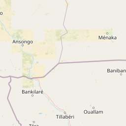
Map view of Kokorou-Namga Complex

Use this park location map to pinpoint Kokorou-Namga Complex in Niger, understand its exact geographic position, and read its mapped placement within the surrounding landscape more clearly.

Pigeon | © OpenStreetMap contributors

Location context for Kokorou-Namga Complex

Tillaberi Region
Park atlas

Compare adjacent wetland habitats, sandy dune corridors, and regional conservation areas.

Explore Other Parks Near Kokorou-Namga Complex and Regional Protected Landscapes

Browse related protected areas near Kokorou-Namga Complex to examine wider regional ecology and seasonal waterbird habitats. Comparing adjacent wetland landscapes provides deeper context on Sahelian biodiversity and regional conservation networks.
A watercolor painting showing soft, rolling hills with hints of trees in muted green, yellow, and pink tones against a white background.
Protected areaSahel Region
About 67 km away#1 closest

South

Lac Higa Protected Area: Wetland Geography and Sahel Region Landscape Mapping

A vital freshwater ecosystem in northeastern Burkina Faso.

Explore the spatial characteristics of Lac Higa, a permanent wetland and protected area in the Sahel Region of Burkina Faso. This atlas entry details the lake basin, the Yali River connection, and the surrounding shrub savanna terrain, providing essential context for this unique hydrological and biological site.

Area
15.14 km²
Relief
Lowland
Climate
Arid
Scope
Terrestrial
A soft, light watercolor painting of a valley landscape with rolling green hills, distant purplish mountains, and patches of pink, yellow, and green vegetation.
Wildlife reserveNiger
About 194 km away#2 closest

Southeast

Dallol Bosso Wildlife Reserve: Geographic Atlas and Protected Landscape Context in Niger

A 350-kilometer seasonal wetland corridor and regional hydrologic system

Dallol Bosso stands as a major seasonal drainage corridor in western Niger. This wildlife reserve spans from the Malian border to the Niger River, offering a distinct study in Sahelian hydrology. Its alluvial soils and wetland characteristics support specific agricultural patterns, making it a focal point for understanding the human and natural geography of the Boboye region.

Area
8,921.22 km²
Established
2004
Relief
Lowland
Climate
Subtropical
National parkNiger
About 199 km away#3 closest

Southeast

W National Park: Niger National Park, UNESCO World Heritage Site & Ramsar Wetland

Transborder savanna ecosystem and dramatic Niger River landscape.

W National Park in Niger offers a unique atlas view of a vast protected landscape defined by the Niger River's iconic W-shaped bend. As a UNESCO World Heritage Site and Ramsar Wetland, it protects crucial savanna plains, extensive floodplains, and rocky outcrops. This transborder conservation area is a vital habitat for West African wildlife, providing a rich context for geographic discovery and landscape exploration.

Area
10,000 km²
Established
1954
IUCN
II
Relief
Mixed relief
National parkNiger
About 264 km away#4 closest

Southeast

W of the Niger National Park: National Park Protected Landscape and Geographic Atlas

Explore the mapped boundaries and regional geography of this protected area.

W of the Niger National Park is a designated national park offering detailed atlas-level context for its protected landscape. Users can investigate its mapped boundaries, understand its regional geographic setting, and gain insight into its unique natural terrain. This entry provides a focused view of the park's identity within the broader atlas for protected-area exploration.

Area
10,000 km²
Established
1954
Relief
Mixed relief
Climate
Tropical
A watercolor painting showing a small boat floating on a calm body of water with gentle, rolling green hills in the background.
Protected areaBam Province
About 275 km away#5 closest

West

Lac Bam Protected Area: Regional Landscape Map and Geography of Bam Province

Ecological transition zone and natural freshwater reservoir

Lac Bam serves as a critical freshwater site and natural reservoir within the Sahelian-Sudanian transition zone of Burkina Faso. This protected area supports a mosaic of wooded savanna, wetland margins, and open water, defining the hydrology of the surrounding Bam Province. Analyze the landscape dynamics and broad catchment characteristics of this significant inland water system through our integrated geographic dataset.

Area
30 km²
Relief
Lowland
Scope
Terrestrial
Water
Water-dominated
National parkTapoa Province
About 295 km away#6 closest

South

Arli National Park National Park: Mapped Protected Landscape in Tapoa Province

Explore its geographic context and boundaries.

Arli National Park stands as a critical protected area, identified as a national park within Tapoa Province. This detail page serves as an atlas-focused entry point to understanding the park's unique landscape characteristics and its precise geographic location. Users can investigate its mapped boundaries and explore how it fits into the regional geography, offering a foundational understanding for protected-area discovery.

Area
760 km²
Established
1954
IUCN
IV
Relief
Upland
Protected areaDosso
About 305 km away#7 closest

Southeast

Feuchtgebiet am mittleren Niger: Protected Wetland Geography and River Floodplain Atlas

Geographic overview of floodplain terrain in Dosso, Niger

Feuchtgebiet am mittleren Niger preserves a vital mosaic of riverine channels, temporary ponds, and floodplain flats. This protected area stands as a distinctive aquatic corridor within the Sahel, characterized by diverse water-based habitats and seasonal vegetation shifts that define the regional geography of Dosso.

Area
521.8 km²
Established
2001
Relief
Lowland
Scope
Terrestrial
National parkBenin
About 306 km away#8 closest

South

Pendjari National Park: Mapping Benin's Primary Protected Savanna Ecosystem and Wilderness

Located in northwestern Benin, bordering the WAP transboundary complex.

Pendjari National Park represents a significant conservation landscape in West Africa, featuring a complex geography of river-fed riparian forests, sprawling savanna plains, and the high-elevation cliffs of the Atakora mountain range. This protected area offers a look into an intact savanna wilderness, serving as a vital sanctuary for large mammals and diverse bird species within its clearly defined boundaries.

Area
2,755 km²
IUCN
II
Relief
Highland
Climate
Subtropical

Common questions about visiting, size, designation, and location context for Kokorou-Namga Complex

Kokorou-Namga Complex FAQs for park facts, access, geography, and protected area context

Find quick answers about Kokorou-Namga Complex, including protected-area facts, park geography, trail and visitor context, and how the park fits into its surrounding country and regional landscape.
MoriAtlas Explorer

Continue Your Protected Areas Search Across the Global Atlas

Deepen your exploration by continuing the structured search for national parks and protected areas worldwide. Utilize the comprehensive filtering capabilities to compare different conservation landscapes and refine your understanding of global park geography. Discover more about the distribution and characteristics of protected natural areas.

Global natural geography